Embed Size (px)
Citation preview
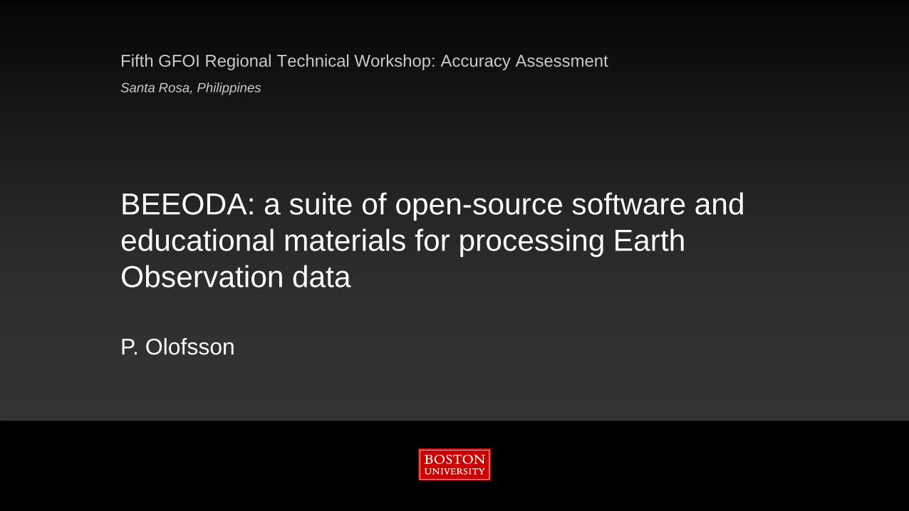
BEEODA: a suite of open-source software and educational materials for processing Earth Observation data
P. Olofsson
Fifth GFOI Regional Technical Workshop: Accuracy AssessmentSanta Rosa, Philippines
Why are we doing this?
Our own research needs!
Built in support of our own research and education, and capacity building organizations/initiatives (SilvaCarbon, GFOI, GOFC/GOLD)
Lesson learned from teaching workshops: software to take home and that are in line with new advancements needed
BEEODA
2
1/27/2016
BEEODA
3
1/27/2016
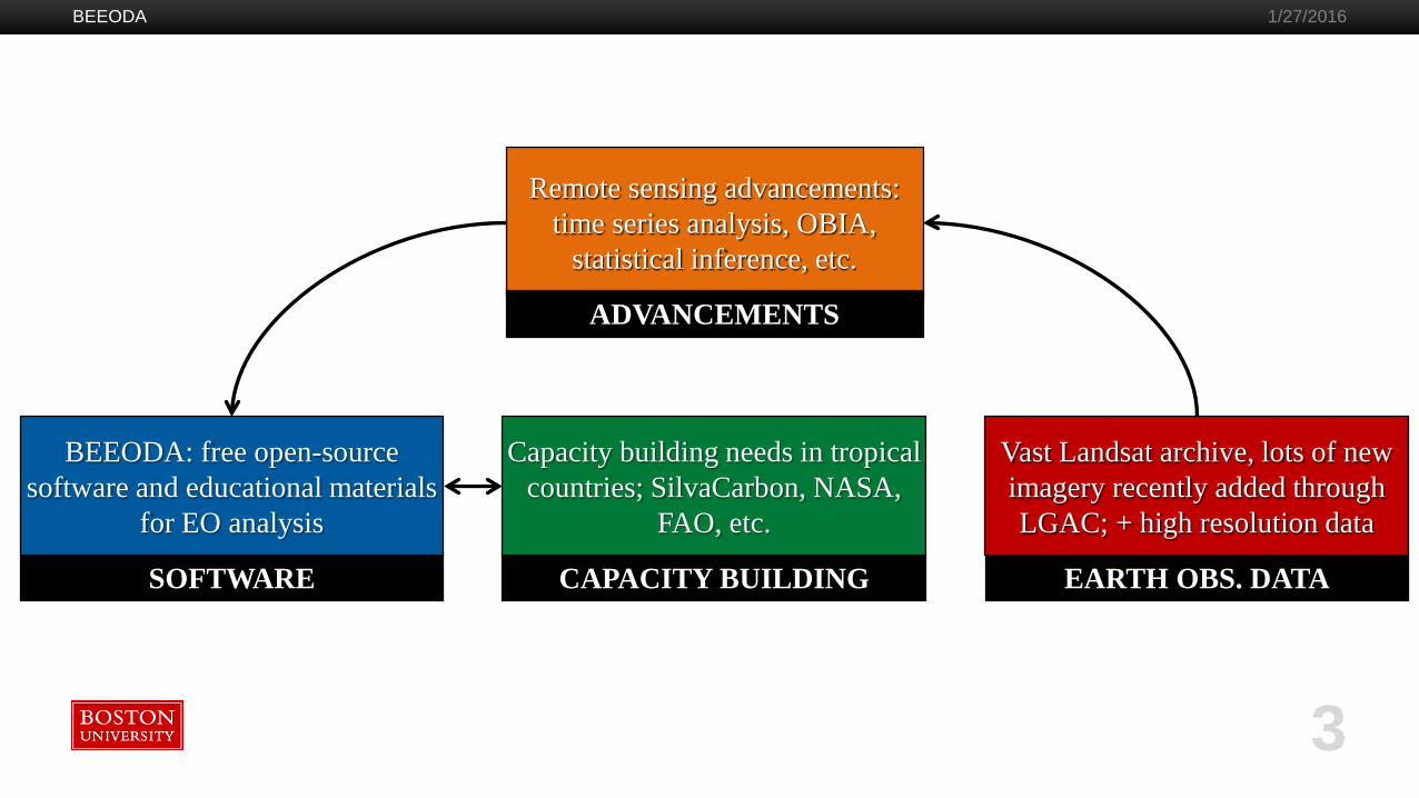
CAPACITY BUILDING
Capacity building needs in tropical countries; SilvaCarbon, NASA,
FAO, etc.
SOFTWARE
BEEODA: free open-source software and educational materials
for EO analysis
EARTH OBS. DATA
Vast Landsat archive, lots of new imagery recently added through LGAC; + high resolution data
Remote sensing advancements: time series analysis, OBIA,
statistical inference, etc.
ADVANCEMENTS

Overview
BEEODA: Boston Education in Earth Observation Analysis
Collection of: existing open-source tools + our own implementations + educational materials
Philosophy: “try to use as much existing tools as possible and only implement the missing pieces”
Educational material divided into modules in line with demand and advancements in remote sensing analyses such as time series analysis and accuracy/area estimation
BEEODA 1/27/2016
4
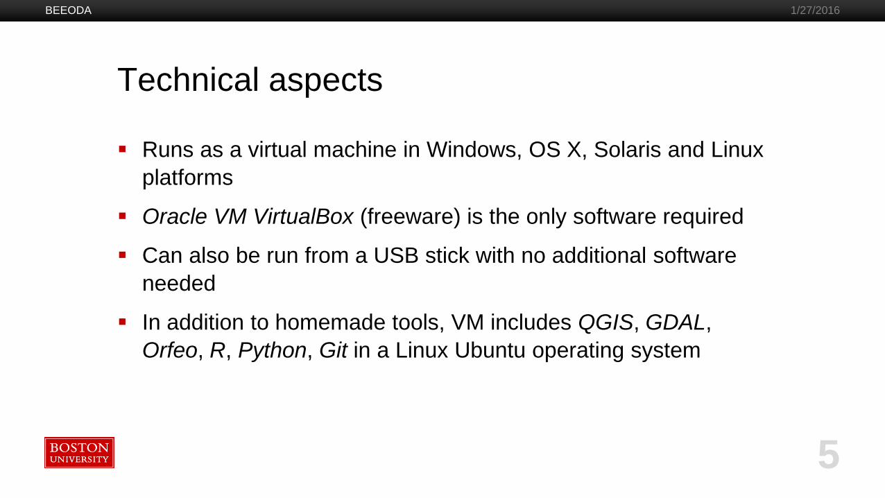
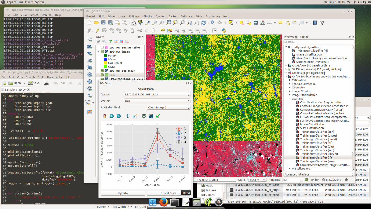
Technical aspects
Runs as a virtual machine in Windows, OS X, Solaris and Linux platforms
Oracle VM VirtualBox (freeware) is the only software required
Can also be run from a USB stick with no additional software needed
In addition to homemade tools, VM includes QGIS, GDAL, Orfeo, R, Python, Git in a Linux Ubuntu operating system
BEEODA 1/27/2016
5
BEEODA 1/27/2016
Modules
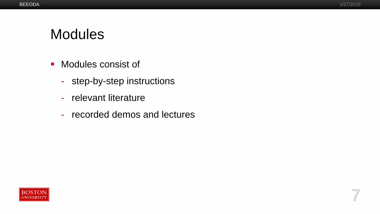
Modules consist of
- step-by-step instructions
- relevant literature
- recorded demos and lectures
BEEODA 1/27/2016
7
BEEODA 1/27/2016
8
BEEODA 1/27/2016
9

BEEODA
10
1/27/2016
BEEODA
11
1/27/2016
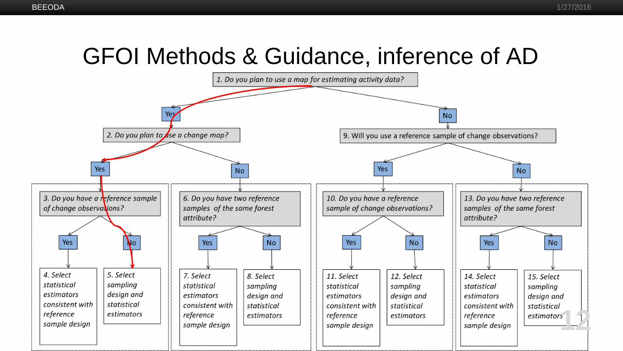
GFOI Methods & Guidance, inference of AD
BEEODA
12
1/27/2016

Workflow, decision tree “red thread”
Determine sample design
Construct stratification
(if any)
Compute strata
weightsEstimate
sample sizeAllocate
sample to strata
BEEODA
13
1/27/2016
Identify reference
data
Examine sample units
Provide reference
labels
Construct error matrix
Construct area
estimators
Compute confidence intervals
Own implementation
Existing tools (QGIS/GDAL)

BEEODA
14
1/27/2016

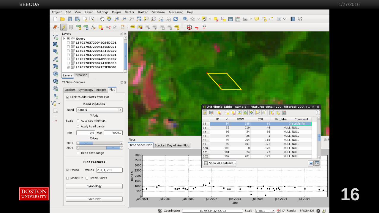
Time series analysis
CCDC implemented (on-the-fly and wall-to-wall)
Teaming up with Wageningen University (Jan Verbesselt et al.) to implement BFAST
BEEODA
15
1/27/2016
BEEODA
16
1/27/2016

BEEODA
17
1/27/2016

BEEODA
18
1/27/2016

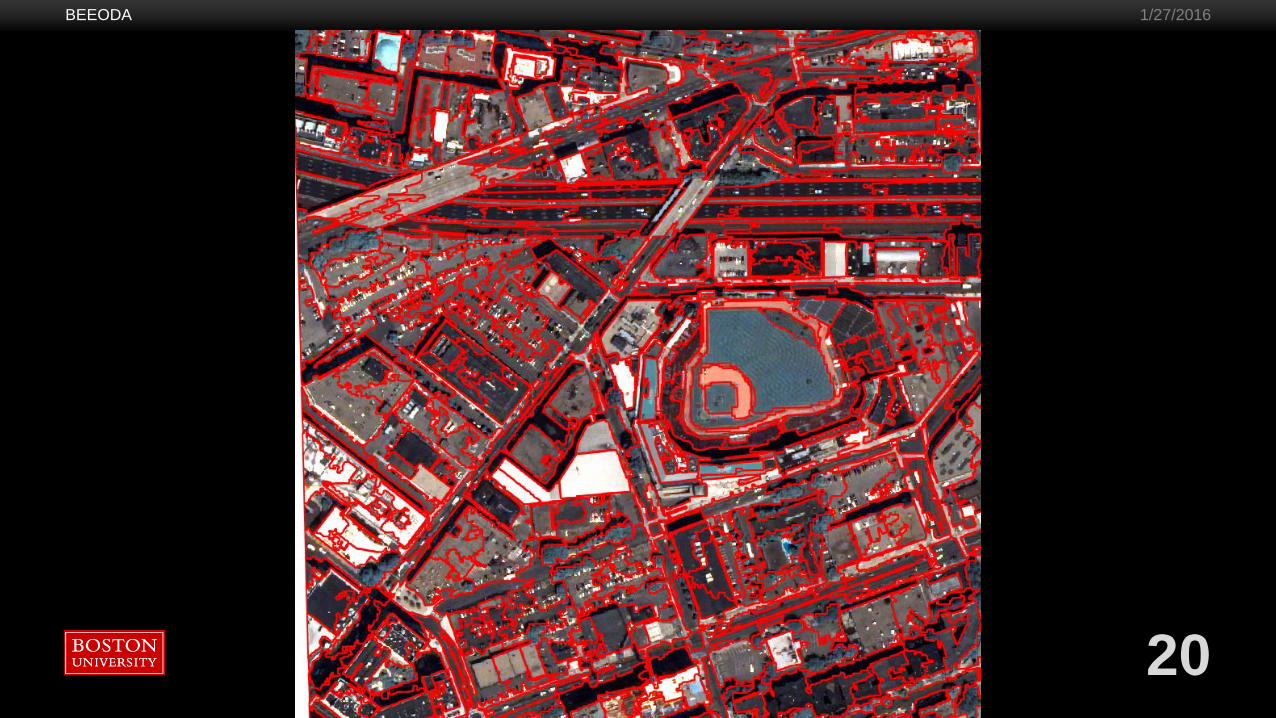
Object based image analysis
Popular mapping used methodology but proprietary software for OBIA often prohibitively expensive
BEEODA contains open source solution
Still in progress
BEEODA
19
1/27/2016
BEEODA
20
1/27/2016
Advantages
Fully open-source, available on GitHub
Developed by researchers
Integrated solution
Customizable (add your own or other open-source tools)
Dynamic (easily updated)
Dependencies solved (major issue in Windows)
One single software installation (or none if booting from USB)
Runs offline on basically any computer
BEEODA 1/27/2016
21
Current status
Working on new modules, such as OBA
Used in workshops and university courses and by researchers
Unfunded*
Unsupported
Currently maintained by BU researchers and grad students...
BEEODA 1/27/2016
22
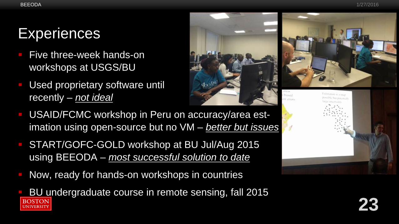
Experiences Five three-week hands-on
workshops at USGS/BU
Used proprietary software until recently – not ideal
BEEODA 1/27/2016
23
USAID/FCMC workshop in Peru on accuracy/area est-imation using open-source but no VM – better but issues
START/GOFC-GOLD workshop at BU Jul/Aug 2015 using BEEODA – most successful solution to date
Now, ready for hands-on workshops in countries
BU undergraduate course in remote sensing, fall 2015
Comments from participants (Jul/Aug 2015)
“I learnt processing of data using open source software [...] which makes it easily transferable to my networks and other developing country researchers due to the free access [...]” Mercy South Africa
“A crucial advantage of the training was that we performed all these advanced methods using open-source software [...] By this training, I not only acquired a lot of data and processing techniques and tools which will be shared at my home institutions, I can rather be considered as a candidate for any land cover change detection and estimation analysis. Furthermore, I can contribute to a good implementation of National REDD program and to the capacity building in my region.” Maleki, Togo
BEEODA 1/27/2016
24
25
Comments from participants (Jul/Aug 2015)“One important limitation […] I had experienced was that commercial software are often prohibitively expensive. Often there is a need of more than one software package for completing the analysis procedures. Further, the installation and operation of those systems are often operating system dependent and have many issues when running on even on machines with different versions of windows. Here, […] significant add-ons was the open source set of tools in the form of Virtual Machine provided to us. This has the potential to address most of the issues with conventional software systems. This can be installed as an independent operating systems and has a set of tools ranging from basic spreadsheets program to advanced image processing. Further, the tools are open source, thus we can use, adapt as per our requirement to solve diverse data analysis problems. And also all the tutorials are provided […] with free access to anybody.
[In] my work, I have been volunteering a significant amount of time trying to help students and other fellow researchers with their data analysis issues. In doing this one important limitation was the software as for example I could demonstrate the data analysis process in a machine with a licensed software but they could not try those on their own machine. This was mainly due to the lack of licensed software and often the operation system itself or component requirements within the operating systems. Now, I am confident that access to as well as skills on using this tools will be very beneficial.” Shiva, Nepal
BEEODA 1/27/2016

Comments from participants (Jul/Aug 2015)
“[The] two week data analysis exercise at Boston University is really excellent. I really liked the neat planning and execution of training in terms of objectives like data collection, classification and accuracy assessment. [...] The use of open source tools such as QGIS, Orfeo toolbox, GDAL, Python and other in house developed tools by Boston University team provided effective and ever improving solution for satellite data analysis.” Suryakant , India
We know for sure that many participants and their colleagues are currently using BEEODA and at their home institutions.
In short: very well received. This is also true for the BU students who have are excited to have the whole system for analysis on their laptops – for completing labs but also for future use.
BEEODA 1/27/2016
26

Future options
1. Continue unsupported and practitioners can use the software and materials if they want to
2. Or, if you see the benefit to build support there are option, e.g.:
support to continued development of BEEODA
support for workshops (not necessarily taught by us)
support for users (hire a designated developer)
BEEODA 1/27/2016
27
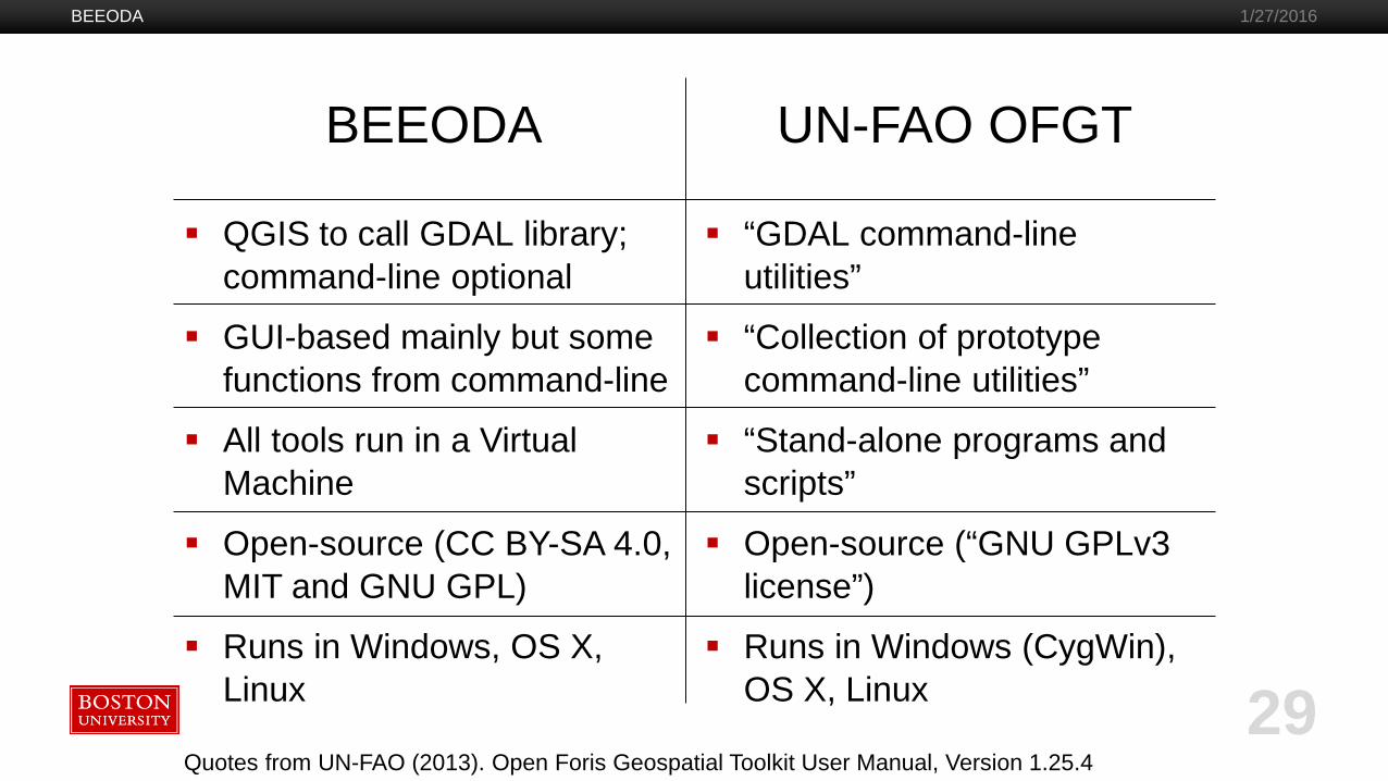
QGIS to call GDAL library; command-line optional
GUI-based mainly but some functions from command-line
All tools run in a Virtual Machine
Open-source (CC BY-SA 4.0, MIT and GNU GPL)
Runs in Windows, OS X, Linux
BEEODA
“GDAL command-line utilities”
“Collection of prototype command-line utilities”
“Stand-alone programs and scripts”
Open-source (“GNU GPLv3 license”)
Runs in Windows (CygWin), OS X, Linux
BEEODA 1/27/2016
29Quotes from UN-FAO (2013). Open Foris Geospatial Toolkit User Manual, Version 1.25.4
UN-FAO OFGT