Embed Size (px)
Citation preview
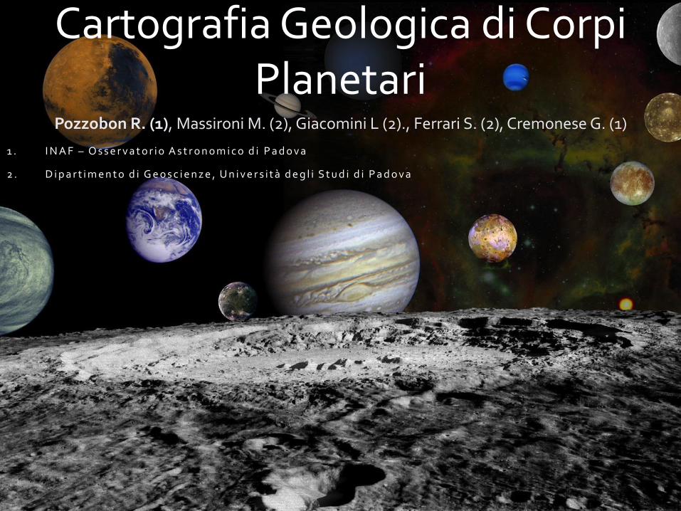
Cartografia Geologica di Corpi Planetari
Pozzobon R. (1), Massironi M. (2), Giacomini L (2)., Ferrari S. (2), Cremonese G. (1)
1 . I N A F – O s s e r v a t o r i o A s t r o n o m i c o d i P a d o v a
2 . D i p a r t i m e n t o d i G e o s c i e n z e , U n i v e r s i t à d e g l i S t u d i d i P a d o v a
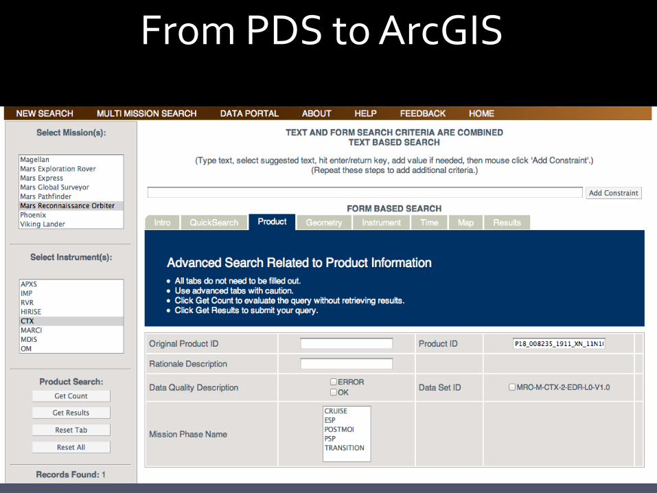
From PDS to ArcGIS
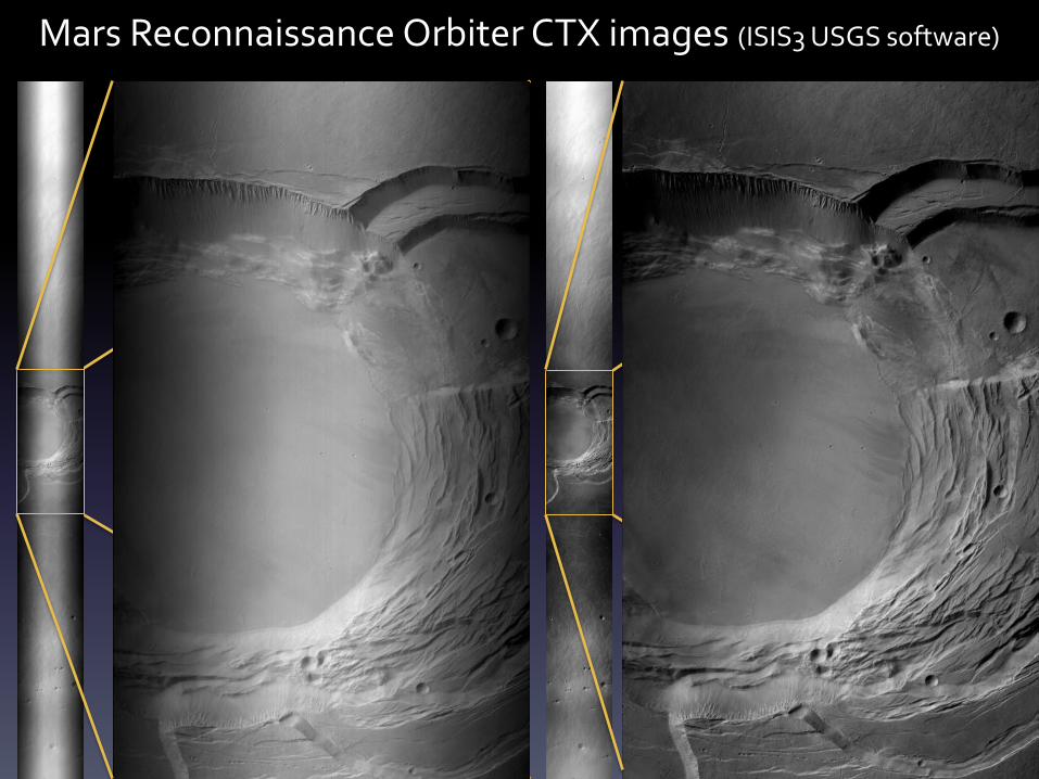
Mars Reconnaissance Orbiter CTX images (ISIS3 USGS software)
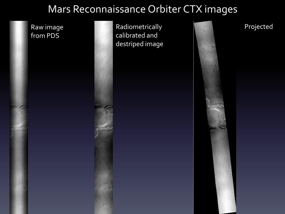
Mars Reconnaissance Orbiter CTX images
Raw image from PDS
Radiometrically calibrated and destriped image
Projected
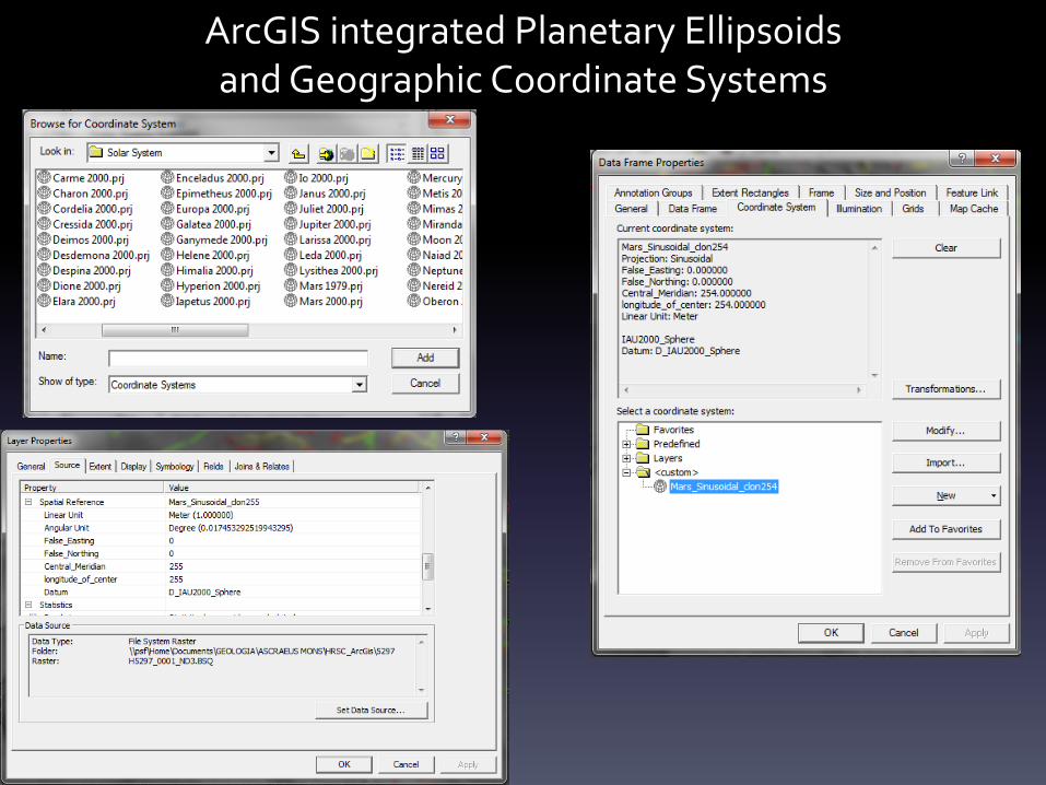
ArcGIS integrated Planetary Ellipsoids and Geographic Coordinate Systems
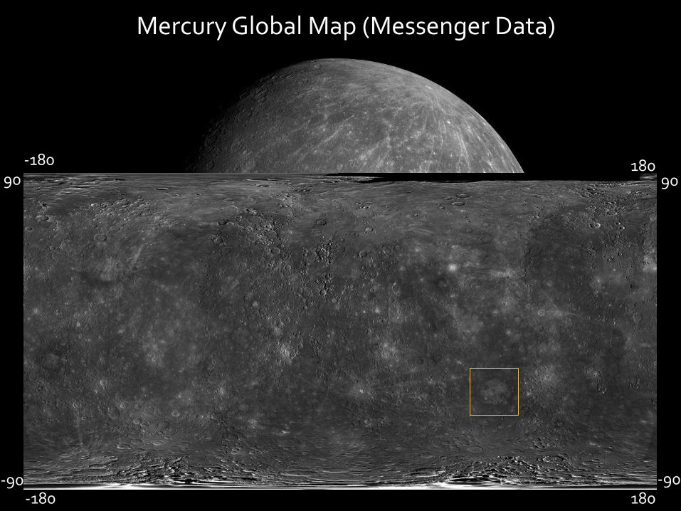
Mercury Global Map (Messenger Data)
90 -180 180
90
-90 180
-90 -180
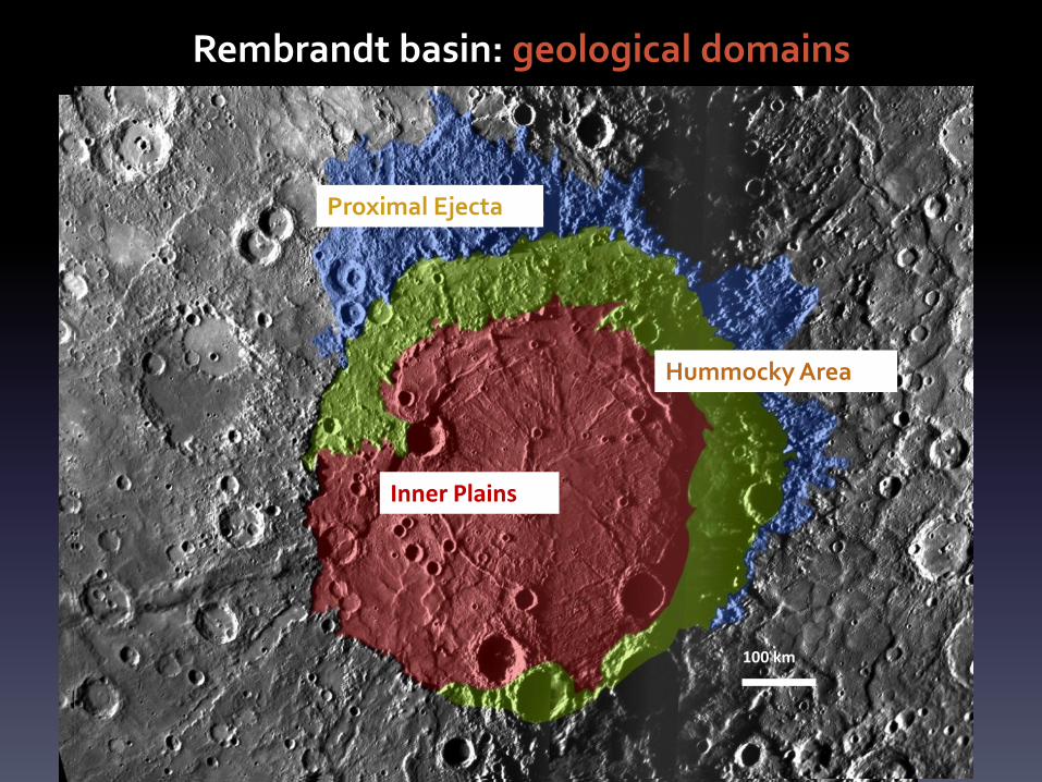
Rembrandt basin: geological domains
Inner Plains
Proximal Ejecta
Hummocky Area
100 km
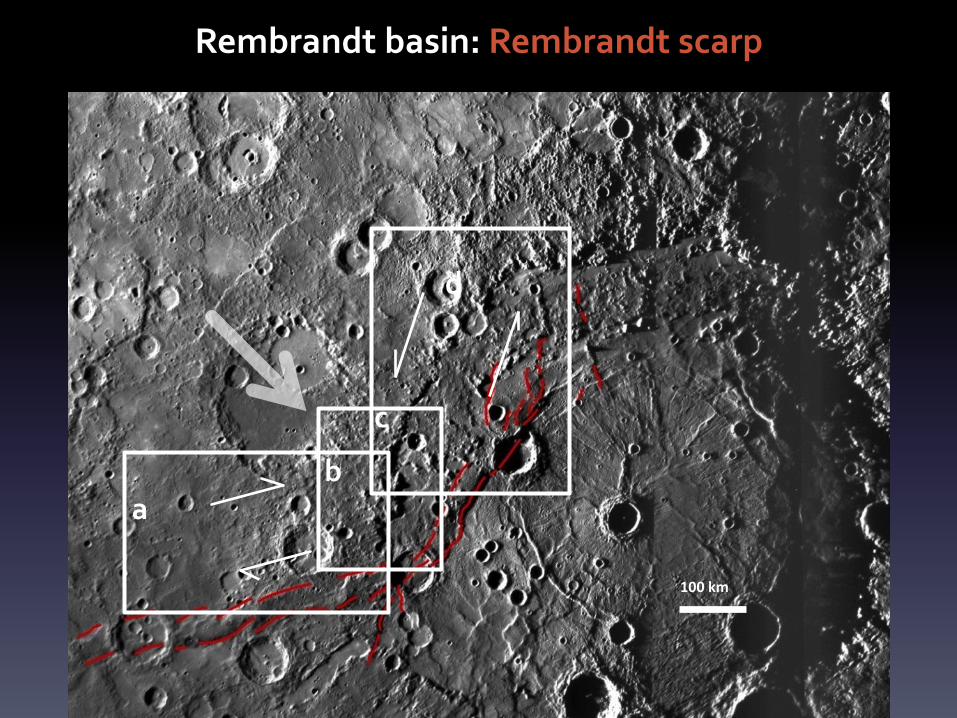
Rembrandt basin: Rembrandt scarp
100 km
a
d
c
b
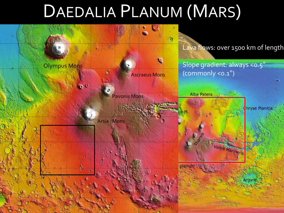
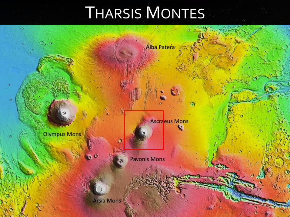
DAEDALIA PLANUM (MARS)
Arsia Mons
Pavonis Mons
Ascraeus Mons
Olympus Mons
Lava flows: over 1500 km of length Slope gradient: always <0.5° (commonly <0.1°)
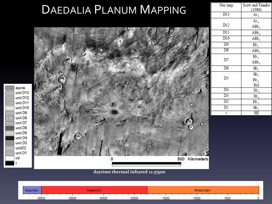
daytime thermal infrared 12.57μm
DAEDALIA PLANUM MAPPING
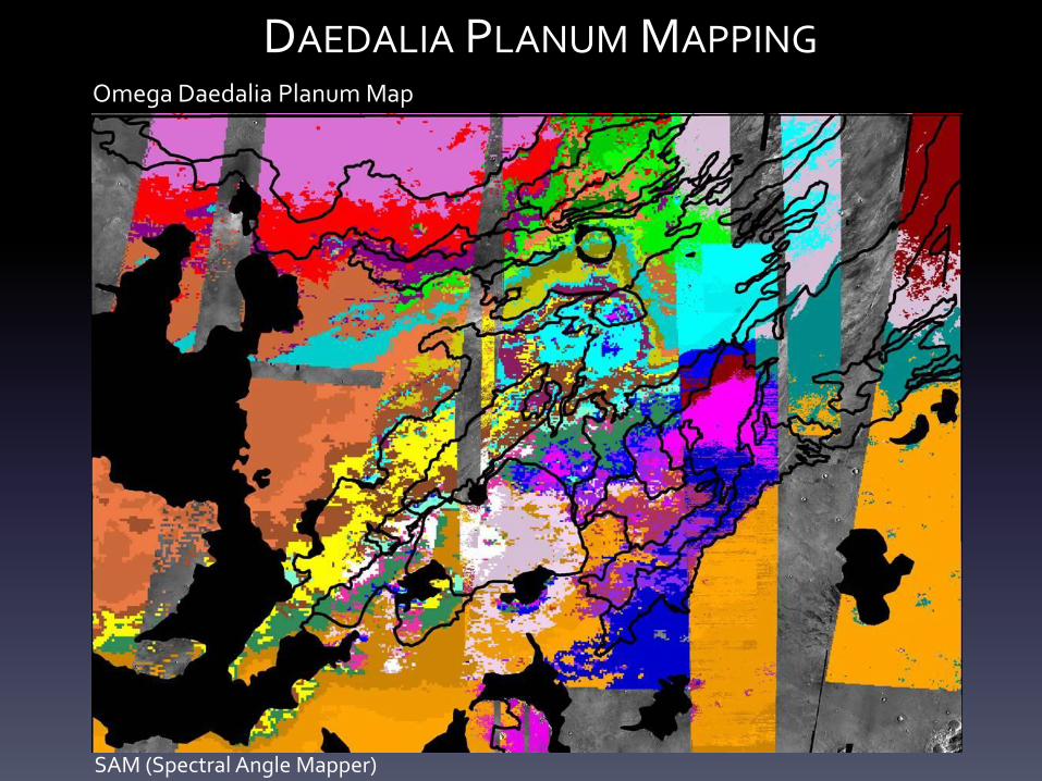
Omega Daedalia Planum Map
SAM (Spectral Angle Mapper)
DAEDALIA PLANUM MAPPING
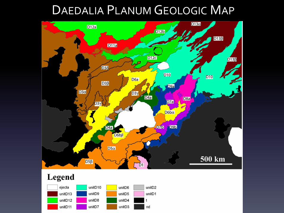
DAEDALIA PLANUM GEOLOGIC MAP
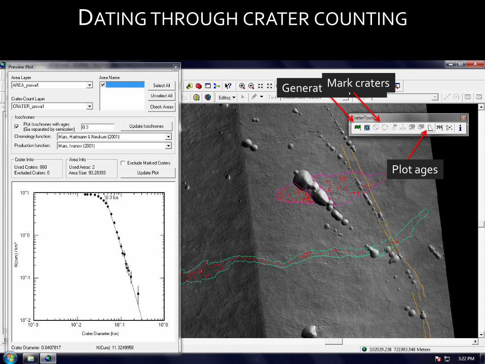
DATING THROUGH CRATER COUNTING
Generate shapefiles Mark craters
Plot ages
THARSIS MONTES
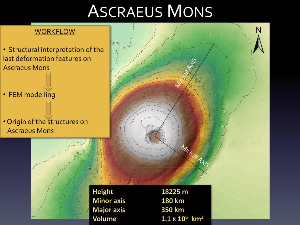
ASCRAEUS MONS WORKFLOW
• Structural interpretation of the last deformation features on Ascraeus Mons • FEM modelling • Origin of the structures on Ascraeus Mons
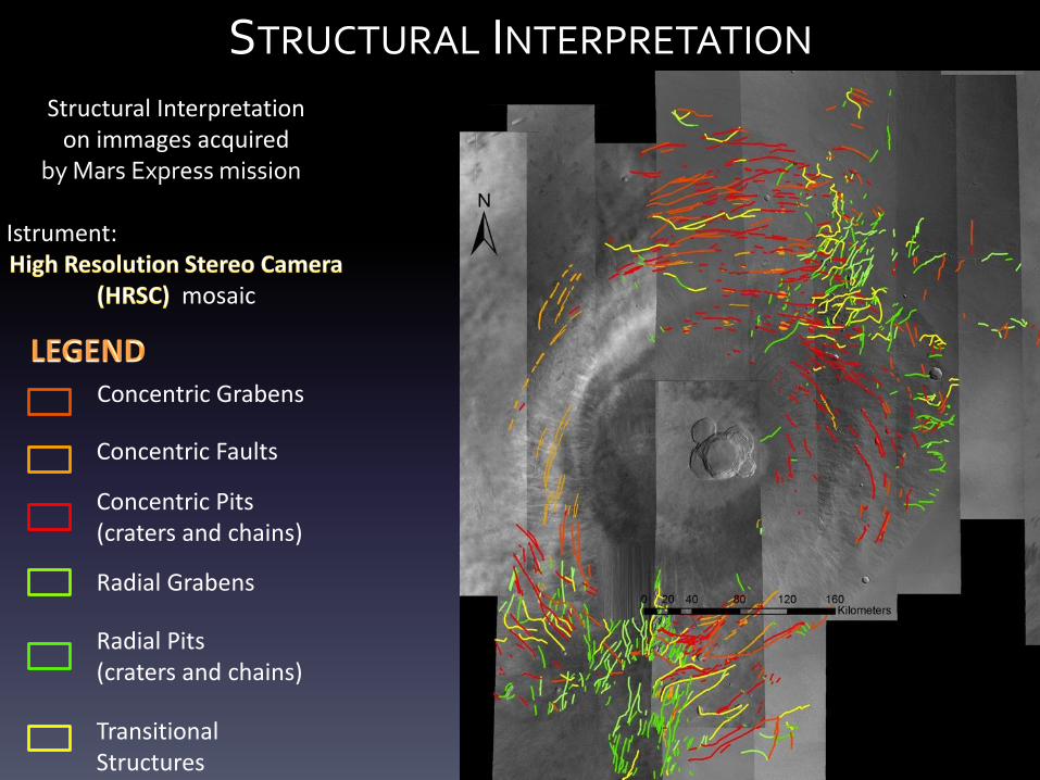
STRUCTURAL INTERPRETATION
Concentric Grabens
Concentric Pits (craters and chains)
Concentric Faults
Radial Grabens
Radial Pits (craters and chains)
Transitional Structures
Structural Interpretation on immages acquired
by Mars Express mission Istrument:
mosaic
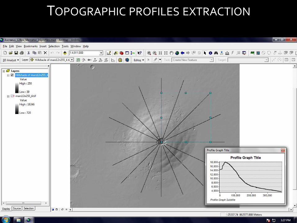
TOPOGRAPHIC PROFILES EXTRACTION
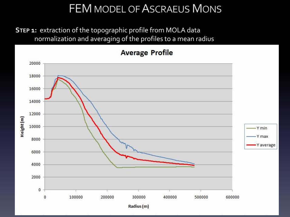
STEP 1: extraction of the topographic profile from MOLA data normalization and averaging of the profiles to a mean radius
EXAMPLE OF CYLINDRICAL AXIAL SYMMETRY
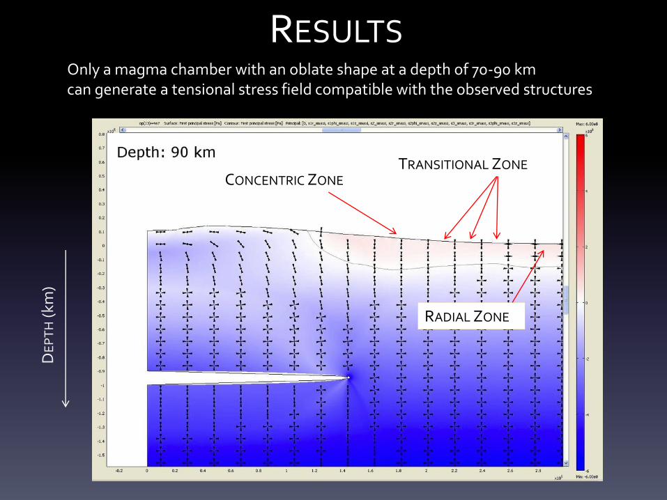
RESULTS Only a magma chamber with an oblate shape at a depth of 70-90 km can generate a tensional stress field compatible with the observed structures
DE
PT
H (
km)
RADIAL ZONE
CONCENTRIC ZONE TRANSITIONAL ZONE
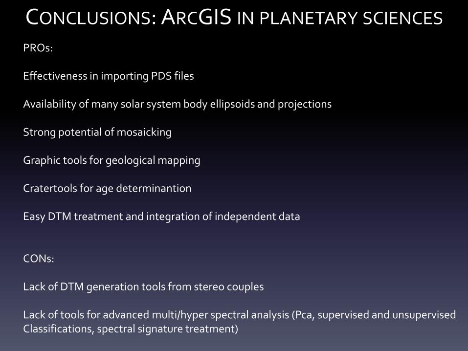
PROs: Effectiveness in importing PDS files Availability of many solar system body ellipsoids and projections Strong potential of mosaicking Graphic tools for geological mapping Cratertools for age determinantion Easy DTM treatment and integration of independent data CONs: Lack of DTM generation tools from stereo couples Lack of tools for advanced multi/hyper spectral analysis (Pca, supervised and unsupervised Classifications, spectral signature treatment)
CONCLUSIONS: ARCGIS IN PLANETARY SCIENCES

THANK YOU!