Embed Size (px)
Citation preview
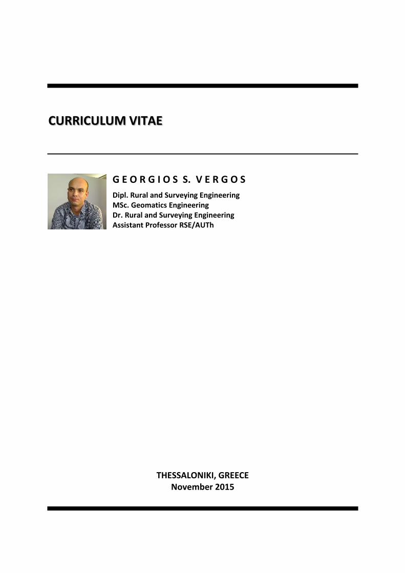
CURRICULUM VITAE
G E O R G I O S S. V E R G O S
Dipl. Rural and Surveying Engineering MSc. Geomatics Engineering Dr. Rural and Surveying Engineering Assistant Professor RSE/AUTh
THESSALONIKI, GREECE November 2015

G.S. VERGOS ii
G.S. VERGOS iii
TABLE OF CONTENTS
TABLE OF CONTENTS ................................................................................................................... iii
1. PERSONAL DATA ................................................................................................................. 1
2. ACADEMIC RECORD ............................................................................................................ 1
3. PROFESSIONAL EXPERIENCE ................................................................................................ 2
4. TEACHING EXPERIENCE ....................................................................................................... 2
5. ADMINISTRATIVE WORK ..................................................................................................... 4
6. RESEARCH ACTIVITIES ......................................................................................................... 4
7. PARTICIPATION IN RESEARCH PROJECTS AND RESEARCH EXPERIENCE .................................. 5
8. PARTICIPATION IN CONFERENCES ........................................................................................ 7
9. AWARDS-SCHOLARSHIPS-DISTINCTIONS .............................................................................. 8
10. MEMBERSHIPS .................................................................................................................... 9
11. FOREIGN LANGUAGES KNOWN & COMPUTER SKILLS ........................................................... 9
12. PUBLICATIONS AND SCIENTIFIC RECOGNITION ................................................................... 10
12.1 Refereed Papers .......................................................................................................................... 10
12.2 Conference Presentations ........................................................................................................... 16
12.3 Papers in dedicated volumes ...................................................................................................... 26
12.4 Thesis........................................................................................................................................... 27
12.5 Project Reports............................................................................................................................ 27
12.6 Course Notes ............................................................................................................................... 28
12.7 Citation to scientific work ........................................................................................................... 29

G.S. VERGOS iv
G.S. VERGOS 1
CURRICULUM VITAE
1. PERSONAL DATA
NAME: Georgios S. Vergos
PLACE AND DATE OF BIRTH: Göttingen, Low-Saxony, Germany, March 18, 1978
MARITAL STATUS: Married with Elena Tzanou, father of one child
WORK:
Department of Geodesy and Surveying Aristotle University of Thessaloniki University Box 440 54 124 Thessaloniki Greece Tel. Office: +30 231 0994225 Fax: +30 231 0995948 Mob.: +30 6947 300572 e-mail : [email protected] URL: http://olimpia.topo.auth.gr/vergos
HOME:
34, Analipseos St. Panorama, Thessaloniki 55236 Greece Tel.: ++30 231 0430316
2. ACADEMIC RECORD
o 1995: Completion of studies in High school and Lyceum. During my enrollment in the Secondary and High school I was awarded each year with praise (graduation with Excellent). Registration after exams at the School of Rural and Surveying Engineering (RSE) of the Polytechnic School of the Aristotle University of Thessaloniki (AUTH).
o September, 1995 – July 2000: Undergraduate student at the RSE of the AUTH.
o March 1999 – June 2000: Diploma thesis at the Department of Geodesy and Surveying of the School of Rural and Surveying Engineering of the Aristotle University of Thessaloniki under the title “The contribution of satellite altimetry to gravity field modeling – A case of study in the Eastern Mediterranean”.
o July 2000: Graduate student of the School of Rural and Surveying Engineering of the Aristotle University of Thessaloniki. Graduation with “Very Good” (8.49).
o July 2000: Dip. Eng. of the School of Rural and Surveying Engineering of the Faculty of Engineering of the Aristotle University of Thessaloniki.
o July 2000 – June 2002: Graduate student at the Department of Geomatics Engineering, Faculty of Engineering of the University of Calgary, Calgary, Alberta, Canada. Enrollment in an MSc program under the title “Gravity and Reference Systems”.
o March 2002: Successful defense of Master of Science theses under the title “Sea Surface Topography, Bathymetry and Marine Gravity Field Modeling”. The examining committee of my theses was Drs. M.G. Sideris, N. El Sheimy, N. Sneeuw and P. Wu.
G.S. VERGOS 2
o December 2002 – July 2006: PhD candidate at the Department of Geodesy and Surveying of the Aristotle University of Thessaloniki, Greece under the supervision of Prof. Dr. I.N. Tziavos.
o July 2006: Dr. Rural and Surveying Engineer, Department of Geodesy and Surveying, Aristotle University of Thessaloniki. PhD Thesis under the title “Study of the Earth’s Gravity Field and Sea Surface Topography in Greece by combining surface data and data from the new satellite missions of CHAMP and GRACE”.
o April 2008 – December 2012: Lecturer at the Department of Geodesy and Surveying, AUTh.
o January 2013 – today: Assistant Professor at the Department of Geodesy and Surveying, AUTh.
3. PROFESSIONAL EXPERIENCE
Professional Researched in Rural and Surveying Engineering since 06/10/2004 (ΑΜ 17538) with A’ Class Diplomas in the following Categories: (a) 16: Surveying Research and (b) 10: Research in Transport and Road Engineering.
Rich experience and related applications in:
o Marine and land geoid and gravity field determination in local and regional scales
o Use of remote sensing satellites to improve the geophysical corrections in satellite altimetry data
o Experience in field surveying
o Experience in computer aided drawing software (CAD)
o Use of the Global Positioning System (GPS) in surveying and road planning applications
o Combination of GPS with GIS for hydraulics, environmental and cadastral studies
4. TEACHING EXPERIENCE
School of Rural and Surveying Engineering - AUTh
Teaching assistant at the School of Rural and Surveying Engineering of the Aristotle University of Thessaloniki during the winter semester of 2005-2006 in the following courses:
a) Surveying Instruments and Measurement Techniques (1st Semester).
b) Signals and Spectral Methods in Geoinformatics (3rd Semester).
c) GPS (5th Semester).
Teaching assistant at the School of Rural and Surveying Engineering of the Aristotle University of Thessaloniki during the winter semester of 2007-2008 in the following courses:
a) Signals and Spectral Methods in Geoinformatics (3rd Semester).
Lecturer at the School of Rural and Surveying Engineering of the Aristotle University of Thessaloniki (April 2008 – December 2012) to the following courses:
Undergraduate courses
a) Land Surveying (2nd Semester).
G.S. VERGOS 3
b) Signals and Spectral Methods in Geoinformatics (3rd Semester).
c) Introduction to the Gravity Field of the Earth (4th Semester).
d) Field Application of Layout Plans and Surveying Practice (6th Semester).
e) Gravimetry (7th Semester).
f) Internship Program of the School of Rural and Surveying Engineering (7th Semester).
g) Entrepreneurship and Innovation in RSE Science (7th Semester).
h) Field Surveying Exercises (8th Semester).
i) Internship Program of the School of Rural and Surveying Engineering (7th Semester).
Graduate courses
a) Foundation research seminar (1st Semester).
b) Specialization research seminar in Advanced Geodetic Applications (2nd Semester).
c) Gravity field and GPS Leveling GPS (2nd Semester).
Assistant Professor at the School of Rural and Surveying Engineering of the Aristotle University of Thessaloniki (January 2013-today) to the following courses:
Undergraduate courses
a) Land Surveying (2nd Semester).
b) Signals and Spectral Methods in Geoinformatics (3rd Semester).
c) Introduction to the Gravity Field of the Earth (4th Semester).
d) Field Application of Layout Plans and Surveying Practice (6th Semester).
e) Gravimetry (7th Semester).
f) Internship Program of the School of Rural and Surveying Engineering (7th Semester).
g) Entrepreneurship and Innovation in RSE Science (7th Semester).
h) Field Surveying Exercises (8th Semester).
i) Internship Program of the School of Rural and Surveying Engineering (7th Semester).
Graduate courses
a) Foundation research seminar (1st Semester).
b) Specialization research seminar in Advanced Geodetic Applications (2nd Semester).
c) Gravity field and GPS Leveling GPS (2nd Semester).
Department of Geo-informatics and Surveying – TEI of Serres
Research assistant at the Department of Geo-informatics and Surveying of the Technological Educational Institute (TEI) of Serres since September 2002. I have taught the following courses:
a) Applications of the Global Positioning System (GPS) (5th Semester) 09/2002-09/2005.
G.S. VERGOS 4
b) Surveying ΙΙΙ (4th Semester) 09/2003 – 09/2005.
c) GPS Applications (6th Semester) 09/2004 – 09/2005.
During my employment at the Department of Geo-informatics and Surveying I supervised ten (10) Diploma Theses.
Seminars
Lecturer of a one-week seminar at the Department of Agriculture on «The Global Positioning System and its Applications» (5/12/2005-9/12/2005).
5. ADMINISTRATIVE WORK
Representative of the School of Rural and Surveying Engineering in the Social Exhibits Committee of the Faculty of Engineering of AUTh (September 2008 - today)
Member of the RSE/AUTH general assembly.
Member of the DGS general assembly.
Responsible for the Undergraduate Studies Handbook of RSE/AUTH.
Webmaster of the RSE/AUTH webpage.
Responsible for the convocation ceremonies of RSE/AUTH.
Scientific responsible of the Internship Program of RSE/AUTH.
Scientific responsible of the Entrepreneurship and Innovation Program of RSE/AUTH.
6. RESEARCH ACTIVITIES
o Gravity field modeling.
o Satellite altimetry.
o Spectral methods in geodesy.
o Physical oceanography.
o Ocean bathymetry estimation.
o Sea Surface Topography modeling.
o Wavelet methods in geoid and gravity filed estimation and solution of boundary value problems.
o Spectral techniques in cartography.
o Satellite methods in geodesy and geophysics (GPS and radar altimetry).
o GPS/GIS combination.
Regular reviewer in:
o Journal of Geodesy (J Geod 2003(77): 487-488; J Geod 2004(78): 223-224)
o Journal of Geodetic Science
o Journal of Geodynamics
o Arabian Journal for Science and Engineering
G.S. VERGOS 5
o Computer and Geosciences
o the proceedings of the International Association of Geodesy and International Union of Geodesy and Geophysics Symposia.
o Geotechnical Scientific Issues (2003(14): 1-3)
7. PARTICIPATION IN RESEARCH PROJECTS AND RESEARCH EXPERIENCE
(i) Research assistant and research associate at the Department of Geomatics Engineering of the University of Calgary under two GEOIDE Network of Centers of Excellence (NCE) projects.
ENV#13: The synergistic use of multi-sensor remote sensing for monitoring of the Earth’s surface and atmospheric parameters. Duration: 07/2000 – 05/2002. The program objectives were: to determine the weather effects on radar signals; to evaluate the weather effects on sea surface temperature retrievals; to evaluate weather effects on sea ice SAR imagery; to develop methodology for retrieval of atmospheric parameters using weather radar and satellite observations; to validate geodetic products of satellite altimetry; to assimilate the improved remotely-sensed atmospheric and surface parameters into watershed hydrological models; and to develop a marketing plan for atmospheric and surface products. Funding: 994.000 €.
ACQ#10: Precise Geoid determination for geo-referencing and oceanography. Duration: 07/2000 – 05/2002. The program objectives were to: refine the gravimetric geoid prediction methods; investigate the required data coverage, accuracy and resolution for centimetre-level geoid determination; improve the modelling of tides and SST, especially in coastal regions, by additional oceanographic, hydrographic and atmospheric data; investigate appropriate geoid, gravity and SST determination methods using satellite altimetry and shipborne gravimetry data in the oceans; solve the altimetry-gravimetry problem in coastal regions and incorporate other available data sets in precise geoid determination. Funding: 624.000 €.
(ii) Main investigator in the AirGosat project funded by the EU in the frame of the CAATER program. This project refereed to airborne gravity measurements in the area of Crete, Greece. Duration: 09/2000 – 09/2001.
(iii) Main investigator in the GAVDOS project funded by the European Union Energy, Environment and Sustainable Development Program. Duration: 04/2002 – 12/2004. The project is entitled “GAVDOS: Establishment of a European radar altimeter calibration and sea-level monitoring site for JASON, ENVISAT and Euro-GLOSS” and its objectives are: the establishment of an absolute sea level monitoring and altimeter calibration facility on the isle of Gavdos, south of the island of Crete, Greece; to monitor deformations of the earth’s surface at the tide gauges in the area as a contribution to the European Sea-level Observing System (EOSS) project; the development of a detailed regional geoid and Sea Surface Topography (SST) model. These models are required for referencing the altimeter measurements over the calibration facility and for studying the regional sea current circulation. Funding: 2.400.000 €.
(iv) Main investigator in the «Satellite Altimetry Studies in the Black Sea and the Aegean» project funded by the GSRT. The project was funded in the frame of the bilateral cooperation program between Greece and Bulgaria. Duration: 06/2003 – 06/2005. Funding: 11.740 €.
G.S. VERGOS 6
(v) Main investigator in the “Optimal Combination of Terrestrial and Altimetric Data with Data from the New Satellite Missions of CHAMP and GOCE for the Accurate Determination of the Gravity Field” project funded by the GSRT. The project was funded in the frame of the bilateral cooperation program between EU and non-EU countries. Duration: 10/2003 – 10/2005. Funding: 60.000 €
(vi) Main investigator in the “Satellite Altimetry Studies in the Mediterranean Sea and the Aegean” project. The project is conducted in the frame of the ESA call for the utilization of ERS1/2 and ENVISAT data. Duration: 10/2003 – 10/2005.
(vii) Main investigator in the “Forest and Environmental Impact of road cutting in natural ecosystems” project under the ΕΠΕΑΕΚ ΙΙ program «Nature-Archimedes»: Support to Research Teams in ΤΕΙ», Meter 2.6, funded by the Greek Ministry of Education. Duration: 01/2004 – 01/2007. Funding: 55.000 €
(viii) Main investigator in the «Professional consulting for the development of wages in administrative studies of Meter 6.3 Action A» project funded by the National Institute of Forest Research of Thessaloniki. The main focus of the project was the geocoding of information for cartographic studies and the processing and visualization of geodata. Duration: 01/12/2003 – 15/01/2004.
(ix) Main investigator in the «Modeling and interpretation of the gravity field in local and regional scale combining terrestrial and satellite data» project under the ΕΠΕΑΕΚ ΙΙ program «Pythagoras ΙΙ – Support to Research Teams in the Universities». Duration: 01/1/2005 – 31/12/2006. Funding: 90.000 €.
(x) Main investigator in the «Validation, quality assessment and interpretation of current satellite-only Earth gravity models» project funded by the GSRT. The project was funded in the frame of the bilateral cooperation program between Greece and Czech Republic. Duration: 11/2005 – 11/2007. Funding: 11.740 €
(xi) Main investigator in the «Gravity Field Modeling for the Mediterranean Sea by Combining Satellite and Marine Gravity Data» project funded by the GSRT. The project was funded in the frame of the bilateral cooperation program between Greece and Italy. Duration: 11/2005 – 11/2007. Funding: 11.740 €
(xii) Main investigator in the “Comparison of GOCE data with gradiometric observations, gravity anomalies and satellite altimetry data at various altitudes for precise geoid and gravity field approximation in Europe” project. The project is conducted in the frame of the ESA AO call for the utilization of GOCE data. Duration: 04/2007 – today.
(xiii) Scientific responsible of the «Student’s Internship School of Rural and Surveying Engineering», project of the RSE/AUTH funded by the Operation Program “Education and Lifelong Learning 2007-2013”. Duration: 10/2010 – 10/2013. Budget: 158.182,86 €. Extension for the period 10/2013 – 09/2015. Budget: 83.584,73 €.
(xiv) Scientific responsible of the «Entrepreneurship and Innovation in Rural and Surveying Engineering» project of the RSE/AUTH funded by the Operation Program “Education and Lifelong Learning 2007-2013”. Duration: 09/2010 – 09/2013. Extension for the period 10/2013 – 09/2015.
(xv) Main investigator in the «Development of an Information System for Natural Risk Management in the Mediterranean - SyNaRMa» program funded by the European Regional Development Fund and Greek National Funds. The project is in the frame of the INTEREG III Community Initiative, Strand B, program ARCHIMED, Priority Axes 3 «Integrated and sustainable management of cultural and natural resources and of landscapes and risk management», Measure 3.3.5 «Management, prevention and
G.S. VERGOS 7
reduction of natural risks: drought, desertification, fires, earthquakes etc.». Duration: 06/2006 – 12/2007. Funding: 1.752.300 €.
(xvi) Main investigator in the «Development of a common intraregional monitoring system for the environmental protection and preservation of the Black Sea – ECO-Satellite» project funded by the European Union in the frame of the European Neighborhood & Partnership Instrument – ENPI and national funds. Duration: 10/2011 – 10/2013. Budget: 650.000,00 €.
(xvii) Main investigator in the «Evaluation of the Hellenic Vertical network in the frame of the European systems and control networks interconnection - Application in the areas of Attiki and Thessaloniki» project funded by the Operation Program “Education and Lifelong Learning 2007-2013” in the frame of the Archimedes ΙΙΙ action. Duration: 11/2011 – 04/2014. Budget: 83.000,00 €.
(xviii) Main investigator in the «External calibration/validation of ESA’s GOCE mission and contribution to dynamic ocean topography and sea level change determination through stochastic combination with heterogeneous data – GOCE-SeaComb» project, funded by the European Space Agency within the ESA/PRODEX office. Duration: 07/2012 – 07/2014. Budget: 123.013,00 €.
8. PARTICIPATION IN CONFERENCES
(i) The Hellenic Cadastre in Use – Experiences, Ascertainments and Suggestions. February 10th – 11th, 2000, Thessaloniki, Greece.
(ii) IAG International Symposium on Gravity, Geoid and Geodynamics 2000 – IAG GGG2000 Conference. July 30th – August 4th 2000, Banff, Alberta, Canada.
(iii) 3rd Annual Conference of the GEOIDe Network of Centers of Excellence (NCE), June 21– 22, 2001, Fredericton, New Brunswick, Canada.
(iv) International Association of Geodesy (IAG) Scientific Assembly, September 2 – 7, 2001, Budapest, Hungary.
(v) Joint Assemblies of the International Association for the Physical Sciences of the Oceans and International Association for Biological Oceanography IAPSO/IABO Oceanographic Meeting, Mar del Plata, Argentina, October 21-28, 2002.
(vi) XXVII General Assembly of the European Geophysical Union (EGS), Nice, France, April 21 – 26, 2002.
(vii) Annual Scientific Meeting of the Canadian Geophysical Union (CGU) – A Joint Assembly with the Canadian Society of Soil Science (CSSS), Banff, Alberta, Canada, May 18 –21, 2002.
(viii) 3rd Meeting of the International Gravity and Geoid Commission (IGGC), Gravity and Geoid 2002 – GG2002, August 26-30, Thessaloniki, Greece.
(ix) 2003 General Assembly of the International Union of Geodesy and Geophysics (IUGG2003), June 30 – July 11, Sapporo, Japan.
(x) Joint CHAMP/GRACE Science Meeting, July 6-8 2004, Potsdam, Germany.
(xi) IAG International Symposium on Gravity Geoid and Space Missions 2004 (GGSM2004), August 30th – September 3rd, Porto, Portugal.
G.S. VERGOS 8
(xii) The Evolution of Instruments, Methods and Measuring Systems in Surveying Sciences in Greece, April 15-16 2005, Thessaloniki, Greece.
(xiii) XXIV General Assembly of the International Union of Geodesy and Geophysics (IUGG2007), July 2-13, 2007, Perugia, Italy.
(xiv) “Studying, Modeling and Sense Making of Planet Earth” 2008 International Conference, June 1-6, 2008, Mytilene, Greece.
(xv) Gravity, Geoid and Earth Observation 2008 (GGEO2008) International Symposium of the International Association of Geodesy (IAG), June 23-27, Chania, Greece.
(xvi) 2011 General Assembly of the European Geosciences Union (EGU), Vienna, Austria, April 3 – 8, 2011.
(xvii) 2012 General Assembly of the European Geosciences Union (EGU), Vienna, Austria, April 22 – 27, 2012.
(xviii) 32nd European Association of Remote Sensing Laboratories (EARSel) Symposium, Mykonos, Greece, May 21-25, 2012.
(xix) 20 Years of Progress in Radar Altimetry, ESA/CNES Symposium, Venice, Italy, September 24-29, 2012.
(xx) 2013 General Assembly of the European Geosciences Union (EGU), Vienna, Austria, April 07 – 12, 2013.
(xxi) 2014 General Assembly of the European Geosciences Union (EGU), Vienna, Austria, April 27 – May 2, 2014.
(xxii) The 3rd International Gravity Field Service (IGFS) General Assembly, June 30-July 6, 2014, Shanghai, China.
(xxiii) 5th International GOCE User Workshop, November 25-28, 2014, Paris, France.
(xxiv) XXVI General Assembly of the International Union of Geodesy and Geophysics (IUGG2015), June 22 – July 2, 2015, Prague, Czech Republic.
9. AWARDS-SCHOLARSHIPS-DISTINCTIONS
o Scholarship of the Greek National Scholarships Foundation for three consecutive years between 1997 to 2000.
o Awarded from the National Technical Chamber of Greece with the best student award for the 3rd year of my studies (1997-1998).
o During the Fall semester of the 1st year, 2000-2001, of my studies at the Department of Geomatics Engineering of the University of Calgary I was awarded with a Graduate Research Scholarship special award.
o During the Fall semester of the 1st year, 2000-2001, of my studies at the Department of Geomatics Engineering of the University of Calgary I was awarded with the REE – International Program award.
o During the Spring semester of the 1st year, 2000-2001, of my studies at the Department of Geomatics Engineering of the University of Calgary I was awarded with the Faculty of Graduate Studies Scholarship and a full Graduate Research Scholarship (GRS) award.
o Awarded with two awards by the International Association of Geodesy for participating to the following conferences: a) Scientific Assembly of the IAG, September 2-7, 2001, Budapest,
G.S. VERGOS 9
Hungary and b) General Assembly of the International Union of Geodesy and Geophysics, June 30 - July 11, 2003, Sapporo, Japan.
o Scholarship of Excellence, Research Committee of the Aristotle University of Thessaloniki, during the second year of my PhD Studies (2004).
o Best student paper award in the Geoid, Gravity and Space Missions 2004 conference of the International Association of Geodesy (Porto, Portugal, 31 August – 4 September 2004).
10. MEMBERSHIPS
o Member of the American Geophysical Union (AGU), the European Geophysical Society (EGS) and the Canadian Geophysical Union (CGU).
o Member of the International Association of Geodesy (IAG) Special Study Groups (SSGs) 3.167 on “Regional land and marine gravity field modeling” and 3.186 on “Altimetry data processing for gravity, geoid and sea surface topography determination” (2001 – 2003).
o Member of the IAG SSG - SG2 on “Satellite Altimetry: Data Quality Improvement and Coastal Applications (2003 – today).
o Member of the International Association of Geodesy (IAG) (2003-today).
o Member of the National Technical Chamber of Greece (TEE) (June 2002 – today).
o Member of the Panhellenic Association of Dipl. Rural and Surveying Engineers (June 2002 – today).
o Member of the Association of Dipl. Rural and Surveying Engineers of Northern Greece (June 2002 – today)
11. FOREIGN LANGUAGES KNOWN & COMPUTER SKILLS
Foreign languages
o English : Excellent. I posses the FCE (Lower) degree of the University of Cambridge as well as the PCE (Proficiency) degree of the University of Cambridge. I posses the ETS’s TOEFL degree with a 273 score in a Computer Adaptive Test (CAT) (examination date 15-12-1999).
o German : Medium. I posses the Certificat degree of the Goethe Institut.
Computer skills
o Programming in FORTRAN
o Programming in MATLAB©
o Excellent knowledge of Windows – Office software suite (WORD, EXCEL, POWERPOINT, ACCESS)
o CAD Software: AUTOCAD© (AutoCAD© 12, 14, 2000, 2004)
o GIS Software: ArcGIS© (8.1, 8.3)
o Very good knowledge of image processing tools (CorelDraw, Photoshop, Photopaint)
o Operating systems known: Windows (93, 95, 98, 2000, XP), MS-DOS, UNIX, LINUX
o Knowledge of the mapping software package Generic Mapping Tools (GMT).
o Knowledge of the GRAVSOFT software for gravity field modeling.
o GPS processing software (Ski Pro 1.0, 1.1, 2.1, Leica Geo Office Combined)
G.S. VERGOS 10
12. PUBLICATIONS AND SCIENTIFIC RECOGNITION
12.1 Refereed Papers1
2001
[1α] Andritsanos VD, Vergos GS, Tziavos IN, Pavlis EC, Mertikas SP (2001) A high resolution geoid for the establishment of the GAVDOS multi-satellite calibration site. In: Sideris (ed) Gravity Geoid and Geodynamics 2000, International Association of Geodesy Symposia Vol. 123, Springer Berlin Heidelberg New York, pp. 347-354.
2002
[2α] Grebenitcharsky RS, Vergos GS and Sideris MG (2002) Combination of gravity, altimetry and GPS/Leveling data for the numerical solution of altimetry-gravimetry boundary value problems. In: Ádám J, Schwarz K-P (eds) Vistas for Geodesy in the New Millennium, International Association of Geodesy Symposia Vol. 125, Springer Berlin Heidelberg New York, pp. 150-155.
[3α] Vergos GS, Bayoud FA, Sideris MG and Tziavos IN (2002) High-Resolution Geoid Computation by Combining Shipborne and Multi-Satellite Altimetry Data in the Eastern Mediterranean Sea. IGeS Buletin Special Issue, Vol. 13, Proceedings of the EGS 2001 - G7 Session "Regional and Local Gravity Field Approximation", I.N. Tziavos and R. Barzaghi (eds.), pp. 85-99, March 25-30, Nice, France.
[4α] Vergos GS, Grebenitcharsky RS and Sideris MG (2002) Combination of Multi-Satellite Altimetry and Shipborne Gravity Data for Geoid Determination in a Coastal Region of Eastern Canada. IGeS Buletin Special Issue, Vol. 13, Proceedings of the EGS 2001 - G7 Session "Regional and Local Gravity Field Approximation", I.N. Tziavos and R. Barzaghi (eds.), pp. 100-115, March 25-30, Nice, France.
[5α] Vergos GS, Sideris MG (2002a) Improving the Estimation of Bottom Ocean Topography with Altimetry-Derived Gravity Data Using the Integrated Inverse Method. In: Ádám J, Schwarz K-P (eds) Vistas for Geodesy in the New Millennium, International Association of Geodesy Symposia Vol. 125, Springer Berlin Heidelberg New York, pp. 529-534.
[6α] Vergos GS, Sideris MG (2002b) Evaluation of Geoid Models and Validation of Geoid and GPS/Leveling Undulations in Canada. IGeS Bulletin 12:3-17.
2003
[7α] Kotzev VM, Pashova LG, Grebenitcharsky RS, Tziavos IN, Vergos GS, Kiratzi A (2003) Satellite Altimetry Studies in the Black Sea and the Aegean. Proceedings of the 5th International Symposium “TECHNOMAT & INFOTEL”, Scien Pub vol IV, Book 1, 277-285 (στα Βουλγάρικα).
[8α] Vergos GS, Grebenitcharsky RS and Sideris MG (2003) Sea Surface Topography and Geostrophic Flow Estimation from Multi-Satellite Altimetry and Shipborne Gravity Data Using Wavelet Decomposition. In: Tziavos IN (ed) Gravity and Geoid 2002 - GG2002, 3rd Meeting of the International Gravity and Geoid Commission (IGGC), pp. 314-319.
1 All referred papers are available in PDF format through http://olimpia.topo.auth.gr/vergos/Publications.html
G.S. VERGOS 11
[9α] Vergos GS, Sideris MG (2003a) Estimation of High-Precision Marine Geoid Models Offshore Newfoundland, Eastern Canada. In: Tziavos IN (ed) Gravity and Geoid 2002 - GG2002, 3rd Meeting of the International Gravity and Geoid Commission (IGGC), pp. 126-131.
[10α] Vergos GS, Sideris MG (2003b) Altimetry-Derived Marine Gravity Field Estimation Using Single- and Multi-Satellite Data. In: Tziavos IN (ed) Gravity and Geoid 2002 - GG2002, 3rd Meeting of the International Gravity and Geoid Commission (IGGC), pp. 308-313.
2004
[11α] Mertikas S, Pavlis EC, Tziavos IN, Koutroulis E, Palamartchouk K, Papadopoulos T, Vergos GS (2004) Permanent facility for calibration/validation of satellite altimetry: GAVDOS. In: Bostater CR, Santoleri Jr R (eds), Remote Sensing of the Ocean and Sea Ice 2004, SPIE Proc vol 5569, pp 14-25.
2005
[12α] Tocho C, Vergos GS, Sideris MG (2005) Optimal Marine Geoid Determination in the Atlantic Coastal Region of Argentina. In: Sansó F (ed) International Association of Geodesy Symposia Vol. 128, A Window on the Future of Geodesy, Springer Berlin Heidelberg New York, pp. 380-385.
[13α] Tziavos IN, Vergos GS, Kotzev V, Pashova L (2005) Mean sea level and sea surface topography studies in the Black Sea and the Aegean. In: Jekeli C, Bastos L, Fernandes J (eds), Gravity Geoid and Space Missions 2004, International Association of Geodesy Symposia, Vol. 129, Springer Berlin Heidelberg New York, pp. 254-259.
[14α] Vergos GS, Sideris MG (2005) Improvement in the Determination of the Marine Geoid by Estimating the Bathymetry from Altimetry and Depth Soundings. Mar Geod 28(1): 81-102 (doi: 10.1080/01490410590884593).
[15α] Vergos GS, Tziavos IN, Andritsanos VD (2005a) On the Determination of Marine Geoid Models by Least-Squares Collocation and Spectral Methods Using Heterogeneous Data. In: Sansó F (ed) International Association of Geodesy Symposia Vol. 128, A Window on the Future of Geodesy, Springer Berlin Heidelberg New York, pp. 332-337.
[16α] Vergos GS, Tziavos IN, Andritsanos VD (2005b) Gravity Data Base Generation and Geoid Model Estimation Using Heterogeneous Data. In: Jekeli C, Bastos L, Fernandes J (eds), Gravity Geoid and Space Missions 2004, International Association of Geodesy Symposia, Vol. 129, Springer Berlin Heidelberg New York, pp. 155-160.
2006
[17α] Aretos V, Vergos GS, Vergos SG (2006) Centaurea Messenicolasiana. A local native species of the area around Lake N. Plastiras. Proceedings of the 12th Panhellenic Forestry Conference, Avtzis ND (ed), pp. 143-148.
[18α] Tocho C, Vergos GS, Sideris MG (2006) A new marine geoid model for Argentina combining altimetry, shipborne gravity data and CHAMP/GRACE-type EGMs. Geodesy and Cartography 54(4): 177-189.
[19α] Vergos GS, Tziavos IN, Sideris MG (2006) On the validation of CHAMP- and GRACE-type EGMs and the construction of a combined model. Geodesy and Cartography 55(3): 115-131.
G.S. VERGOS 12
[20α] Tzanou EA, Vergos GS, Vergos SG (2006) Hydrology of the Northern Pindos Mountains (Greece): Emphasis on erosion problems caused by land management. Proceedings of the 12th Panhellenic Forestry Conference, Avtzis ND (ed), pp. 113-120.
2007
[21α] Müller A, Bürki B, Limpach P, Kahle HG, Grigoriadis VN, Vergos GS, Tziavos IN (2007) Validation of marine geoid models in the North Aegean Sea using satellite altimetry, marine GPS data and astrogeodetic measurements. In: Forsberg R, Kiliçoğlu A (eds) 1st International Symposium of the International Gravity Field Service, Gravity Field of the Earth, General Command of Mapping, Special Issue 18, pp. 90-95.
[22α] Tocho C, Vergos GS, Sideris MG (2007a) Evaluation of the SRTM 90m DTM over Argentina and its Implications to Gravity Field and Geoid Modelling. In: Forsberg R, Kiliçoğlu A (eds) 1st International Symposium of the International Gravity Field Service, Gravity Field of the Earth, General Command of Mapping, Special Issue 18, pp. 324-329.
[23α] Tocho C, Vergos GS, Sideris MG (2007b) Estudio preliminar de geoide marino en el océano atlántico Argentine. Boletim de Ciências Geodésicas 13(1): 3-21.
[24α] Vergos GS, Grigoriadis V, Kalampoukas G, Tziavos IN (2007) Accuracy assessment of the SRTM 90m DTM over Greece and its implications to geoid modeling. In: Tregoning P, Rizos C (eds) Dynamic Planet 2005 - Monitoring and Understanding a Dynamic Planet with Geodetic and Oceanographic Tools, International Association of Geodesy Symposia, vol.130 Springer – Verlag Berlin Heidelberg, pp. 309-315.
[25α] Vergos GS, Grigoriadis V, Tziavos IN, Sideris MG (2007) Combination of multi-satellite altimetry data with CHAMP and GRACE EGMs for geoid and sea surface topography determination. In: Tregoning P, Rizos C (eds) Dynamic Planet 2005 - Monitoring and Understanding a Dynamic Planet with Geodetic and Oceanographic Tools, International Association of Geodesy Symposia, vol.130 Springer – Verlag Berlin Heidelberg, pp. 244-250.
[26α] Vergos GS, Tziavos IN (2007) Determination of the quasi-stationary sea surface topography from a common adjustment of a geodetic and an oceanographic model. In: Forsberg R, Kiliçoğlu A (eds) 1st International Symposium of the International Gravity Field Service, Gravity Field of the Earth, General Command of Mapping, Special Issue 18, pp. 235-241.
2008
[27α] Sansò F, Venuti G, Tziavos IN, Vergos GS, Grigoriadis VN (2008) Geoid and Sea Surface Topography from satellite and ground data in the Mediterranean region - A review and new proposals. Bulletin of Geodesy and Geomatics 67(3): 155-201.
[28α] Vergos GS, Tziavos IN (2008a) Monitoring System Earth with the Recent and Forthcoming Gravity-Field Dedicated Satellite Missions. Proceedings of the International conference “Studying, Modeling and Sense Making of Planet Earth – Earth 2008”, June 1-6, Mytilene, Greece.
[29α] Vergos GS, Tziavos IN (2008b) Sea Level Variability in the Aegean Sea as a Tool for Climate Change Monitoring. Proceedings of the International conference “Studying, Modeling and Sense Making of Planet Earth – Earth 2008”, June 1-6, Mytilene, Greece.
2009
G.S. VERGOS 13
[30α] Barzaghi R, Maggi A, Tselfes N, Tsoulis D, Tziavos IN, Vergos GS (2009) Combination of Gravimetry, Altimetry and GOCE Data for Geoid Determination in the Mediterranean: Evaluation and Simulation. In: Sideris MG (ed) Observing our Changing Earth, International Association of Geodesy Symposia Vol. 133, Springer Berlin Heidelberg New York, pp. 195-202.
[31α] Barzaghi R, Tselfes N, Tziavos IN, Vergos GS (2009) Geoid and High Resolution Sea Surface Topography Modelling in the Mediterranean from Gravimetry, Altimetry and GOCE Data: Evaluation by Simulation. Journal of Geodesy, 83(8):751-772. doi: 10.1007/s00190-008-0292-z.
[32α] Kotzev VM, Pashova LG, Tziavos IN, Vergos GS, Grebenitcharsky RS (2009) Multi-Satellite Marine Geoid for the Black Sea. Compt rend Acad bulg Sci 62(5): 621-630.
[33α] Mertikas SP, Ioannides RT, Frantzis X, Tripolitsiotis A, Partsinevelos P, Tziavos IN, Vergos GS, Hausleitner W (2009) Recent developments for the estimation of the altimeter bias for the Jason-1&2 satellites using the dedicated calibration site at Gavdos. Proc vol 7473 (74730C), Bostater CR, Mertikas SP, Neyt X, Velez-Reyes M (eds.), Remote Sensing of the Ocean, Sea Ice and Large Water Regions 2009, doi: 10.1117/12.830403.
2010
[34α] Fotiou A, Grigoriadis VN, Pikridas C, Rossikopoulos D, Tziavos IN, Vergos GS (2010) Combination Schemes for Local Orthometric Height Determination from GPS Measurements and Gravity Data. In: Mertikas SP (ed) Gravity, Geoid and Earth Observation 2008, International Association of Geodesy Symposia Vol. 135, Springer Berlin Heidelberg New York, pp. 309-314.
[35α] Mertikas S, Daskalakis A, Hausleitner W, Tziavos IN, Vergos GS, Zervakis V, Partsinevelos P, Frantzis X, Andrikopoulos D, Tripolitsiotis A (2010) Calibration of satellite radar altimeters at Gavdos Cal/Val facility using three different methodologies. Proceedings of the ESA Living Planet Symposium, June 28 – July 2, Bergen, Norway. ESA Special Publication SP-686.
[36α] Mertikas SP, Daskalakis A, Tserolas V, Hausleitner W, Tziavos IN, Vergos GS, Zervakis V, Frantzis X, Tripolitsiotis A, Partsinevelos P, Andrikopoulos D (2010) Absolute calibration of Jason satellite radar altimeters at Gavdos Cal/Val facility using independent techniques. Proc vol 7825 (78250C), Bostater CR, Mertikas SP, Neyt X, Velez-Reyes M (eds.), Remote Sensing of the Ocean, Sea Ice and Large Water Regions 2010, doi: 10.1117/12.865991.
[37α] Mertikas SP, Ioannides RT, Tziavos IN, Vergos GS, Hausleitner W, Frantzis X, Tripolitsiotis A, Partsinevelos P, Andrikopoulos D (2010) Statistical Models and Latest Results in the Determination of the Absolute Bias for the Radar Altimeters of Jason Satellites using the Gavdos facility. Mar Geod 33(S1): 114-149, doi: 10.1080/01490419.2010.488973.
[38α] Tocho C, Vergos GS, Sideris MG (2010) Further Improvements in the Determination of the Marine Geoid in Argentina by Employing Recent GGMs and Sea Surface Topography Models. In: Mertikas SP (ed) Gravity, Geoid and Earth Observation 2008, International Association of Geodesy Symposia Vol. 135, Springer Berlin Heidelberg New York, pp. 369-376.
[39α] Tziavos IN, Vergos GS, Grigoriadis VN (2010) Investigation of topographic reductions and aliasing effects to gravity and the geoid over Greece based on various digital terrain models. Surveys in Geophysics 31(1)23-67. doi: 10.1007/s10712-009-9085-z.
2011
[40α] Vergos GS (2011) The recent gravity-field dedicated satellite missions and applications to geosciences. CHOROgrafies, “Spatial Approaches”, 2(1)1-11. ISSN: 1792-3913.
G.S. VERGOS 14
[41α] Mertikas SP, Daskalakis A, Tziavos IN, Vergos GS, Frantzis X, Tripolitsiotis A, Partsinevelos P, Andrikopoulos D, Zervakis V (2011) Ascending and Descending Passes for the Determination of the Altimeter Bias of Jason Satellites using the Gavdos facility. Mar Geod 34(S3-S4): 1-16, doi: 10.1080/01490419.2011.584837.
2012
[42α] Savvaidis P, Tziavos IN, Grigoriadis VN, Vergos GS, Papadopoulou ID, Stergioudis A (2012) A WebGIS-based monitoring and decision support tool for the environmental protection and preservation of the Black Sea: The ECO-Satellite project. In: Proc. “Modern technologies, education and professional practice in geodesy and related fields”, 20th International Symposium, 08 - 09 November, Sofia, 2012.
[43α] Tocho C, Vergos GS, Sideris MG (2012) Investigation of topographic reductions for marine geoid determination in the presence of an ultra-high resolution reference geopotential model. In: Kenyon S, Pacino C, Marti U (eds) Geodesy for Planet Earth, International Association of Geodesy Symposia Vol. 136, Springer Berlin Heidelberg New York, pp. 419-426.
[44α] Tziavos IN, Vergos GS, Grigoriadis VN, Andritsanos VD (2012) Adjustment of collocated GPS, geoid and orthometric height observations in Greece. Geoid or orthometric height improvement? In: Kenyon S, Pacino C, Marti U (eds) Geodesy for Planet Earth, International Association of Geodesy Symposia Vol. 136, Springer Berlin Heidelberg New York, pp. 481-488.
[45α] Vergos GS, Tziavos IN, Sideris MG (2012) On the determination of sea level changes by combining altimetric, tide gauge, satellite gravity and atmospheric observations. In: Kenyon S, Pacino C, Marti U (eds) Geodesy for Planet Earth, International Association of Geodesy Symposia Vol. 136, Springer Berlin Heidelberg New York, pp. 123-130.
2013
[46α] Alexandridis TK, Alexandrov BG, Monachou S, Kalogeropoulos C, Strati S, Vorobyova L, Bogatova
Y, Grigoriadis VN, Vergos GS, Topaloglou C (2013) Monitoring water quality parameters in the marine area of Danube Delta using satellite remote sensing. Proc. SPIE 8795, First International Conference on Remote Sensing and Geoinformation of the Environment (RSCy2013), 87950P, doi:10.1117/12.2027210.
[47α] Anastasiou D, Gaifillia D, Katsdourou A, Kolyvaki E, Papanikolaou X, Gianniou M, Vergos GS, Pagounis V (2013) First validation of the Hellenic vertical datum as a prerequisite for the efficient disaster and resources management: the “Elevation” project. In: Dalyot S (ed), FIG Commission 3 “Spatial Information” conference proceedings, Athens, Greece.
[48α] Mertikas SP, Daskalakis A, Tziavos IN, Andersen OB, Vergos GS, Tripolitsiotis A, Zervakis V, Frantzis X, Partsinevelos P (2013a) Altimetry, Bathymetry and Geoid variations at the Gavdos permanent Cal/Val Facility. Adv Space Res 51(8): 1418-1437, doi: 10.1016/j.asr.2012.10.021.
[49α] Mertikas SP, Daskalakis A, Tziavos IN, Andersen OA, Vergos GS, Zervakis V (2013b) Local marine geoid variations and Jason-2 bias determination using the Gavdos permanent Cal/Val facility. European Space Agency “20 Years of progress in radar altimetry”, ESA Publications SP-710.
[50α] Tzanou EA, Vergos GS (2013) The impact of recent high-resolution global digital elevation models to the determination of basin hydrological properties. In: Perakis K and Moysiadis A (eds) Advances in Geosciences, 32nd European Association of Remote Sensing Laboratories (EARSeL) Symposia, pp. 270-283.
G.S. VERGOS 15
[51α] Tzanou EA, Vergos GS, Vergos SG (2013) Assessing forest fire risk and fire propagation in the area of Valia Calda, National Park of North Pindos, Greece. In: Perakis K and Moysiadis A (eds) Advances in Geosciences, 32nd European Association of Remote Sensing Laboratories (EARSeL) Symposia, pp. 231-243.
[52α] Tziavos IN, Vergos GS, Mertikas SP, Daskalakis A, Grigoriadis VN, Tripolitsiotis A (2013) The contribution of local gravimetric geoid models to the calibration of satellite altimetry data and an outlook of the latest GOCE GGM performance in GAVDOS. Adv Space Res 51(8): 1502-1522 doi: 10.1016/j.asr.2012.06.013.
[53α] Vergos GS, Natsiopoulos DA (2013) Ocean remote sensing altimetric satellites in support of sea level anomalies and mean sea surface modeling. In: Perakis K and Moysiadis A (eds) Advances in Geosciences, 32nd European Association of Remote Sensing Laboratories (EARSeL) Symposia, pp. 398-423.
[54α] Vergos GS, Natsiopoulos DA, Tziavos IN (2013) Sea level anomaly and dynamic ocean topography analytical covariance functions in the Mediterranean Sea from ENVISAT data. European Space Agency “20 Years of progress in radar altimetry”, ESA Publications SP-710.
2014
[55α] Grigoriadis VN, Kotsakis C, Tziavos IN, Vergos GS (2014) Estimation of the geopotential value Wo for the local vertical datum of continental Greece using EGM08 and GPS/leveling data. In: Mart U (ed) Gravity, Geoid and Height Systems (GGHS2012), International Association of Geodesy Symposia Vol. 141, Springer International Publishing Switzerland. doi: 10.1007/978-3-319-10837-7_32.
[56α] Tocho C, Vergos GS, Pacino MC (2014) Evaluation of the latest GOCE/GRACE derived Global Geopotential Models over Argentina with collocated GPS/Leveling observations. In: Mart U (ed) Gravity, Geoid and Height Systems (GGHS2012), International Association of Geodesy Symposia Vol. 141, Springer International Publishing Switzerland. doi: 10.1007/978-3-319-10837-7_10.
[57α] Vergos GS, Grigoriadis VN, Tziavos IN, Kotsakis C (2014) Evaluation of GOCE/GRACE Global Geopotential Models over Greece with collocated GPS/Levelling observations and local gravity data. In: Mart U (ed) Gravity, Geoid and Height Systems (GGHS2012), International Association of Geodesy Symposia Vol. 141, Springer International Publishing Switzerland. doi: 10.1007/978-3-319-10837-7_11.
2015
[58α] Andritsanos VA, Grigoriadis VN, Vergos GS, Pagounis V, Tziavos IN (2015) GOCE/GRACE GGM evaluation over Attica and Thessaloniki, Greece and local geoid modelling in support of height unification. South-Eastern European Journal of Earth Observation and Geomatics, 4(1):105-122.
[59α] Contadakis ME, Arabelos DA, Vergos GS, Spatalas S (2015) TEC variations over the Mediteranean before and during the strong earthquake (M=6.2) of 12th October 2013 in Crete, Greece. Physics and Chemistry of the Earth, Parts A/B/C. doi: doi:10.1016/j.pce.2015.03.010.
[60α] Carrion D, Vergos GS, Albertella A, Barzaghi R, Tziavos IN, Grigoriadis VN (2015) Assessing the GOCE models accuracy in the Mediterranean area. Newton's Bulletin 5: 63-82.
G.S. VERGOS 16
[61α] Mertikas SP, Daskalakis A, Tziavos IN, Vergos GS, Fratzis X, Tripolitsiotis A (2015) First Calibration Results for the SARAL/AltiKa Altimetric Mission using the Gavdos Permanent Facilities. Mar Geod 38(S1):249-259. doi: 10.1080/01490419.2015.1030052.
[62α] Mertikas SP, Zhou X, Qiao F, Daskalakis A, Lin M, Peng H, Tziavos IN, Vergos GS, Tripolitsiotis A, FrantzisX (2015) First preliminary results for the absolute calibration of the Chinese HY-2 altimetric mission using the CRS1 calibration facilities in West Crete, Greece. Adv Space Res (in press). doi: 10.1016/j.asr.2015.10.01.
[63α] Peidou AC and Vergos GS (2015a) GOCE GGM analysis through wavelet decomposition and reconstruction and validation with GPS/Leveling data. South-Eastern European Journal of Earth Observation and Geomatics, 4(1):13-32.
[64α] Peidou AC and Vergos GS (2015b) Wavelet multi-resolution analysis of recent GOCE/GRACE GGMs. Accepted for publication to the Proceedings of the IGFS2014 Meeting of the IGFS, International Association of Geodesy Symposia Vol. 145, Springer Berlin Heidelberg New York. doi: 10.1007/1345_2015_44.
[65α] Tocho C, Vergos GS (2015) Estimation of the geopotential value W0 for the Local Vertical Datum of Argentina using EGM2008 and GPS/Levelling data. Accepted for publication to the Proceedings of the IAG2013 Scientific Assembly, International Association of Geodesy Symposia Vol. 142, Springer Berlin Heidelberg New York. doi: 10.1007/1345_2015_32.
[66α] Tocho C, Vergos GS (2015b) Assessment of different-generation GOCE-only and GOCE/GRACE Earth Global Gravity Models over Argentina using terrestrial gravity anomalies and GPS/Levelling data. Newton's Bulletin 5: 105-126.
[67α] Tziavos IN, Vergos GS, Grigoriadis VN, Tzanou EA, Natsiopoulos DA (2015) Validation of GOCE/GRACE satellite only and combined global geopotential models over Greece, in the frame of the GOCESeaComb Project. Accepted for publication to the Proceedings of the IAG2013 Scientific Assembly, International Association of Geodesy Symposia Vol. 142, Springer Berlin Heidelberg New York.
[68α] Vergos GS, Andritsanos VD, Grigoriadis VN, Pagounis V, Tziavos IN (2015) Evaluation of GOCE/GRACE GGMs over Attika and Thessaloniki, Greece, and Wo determination for height system unification. Accepted for publication to the Proceedings of the IGFS2014 Meeting of the IGFS, International Association of Geodesy Symposia Vol. 145, Springer Berlin Heidelberg New York.
[69α] Vergos GS, Arabelos DN, Contadakis ME (2015) Evidence for tidal triggering on the earthquakes of the Hellenic Arc, Greece. Physics and Chemistry of the Earth, Parts A/B/C. doi: 10.1016/j.pce.2015.02.004.
12.2 Conference Presentations
2000
[1b] Andritsanos VD, Vergos GS, Tziavos IN, Pavlis EC (2000) Alternative Geoid Solutions in the Southern Aegean Sea: Comparisons and Results. Presented at the EGS Millennium conference, April 25th – 29th, 2000, Nice, France.
2001
[2b] Vergos GS, Grebenicharsky RS and Sideris MG (2001) Improving the Marine Geoid by Combining Satellite and Shipborne Data. Presented at the 3rd Annual Conference of the GEOIDe Network of Centers of Excellence (NCE), June 21 – 22, 2001, Fredericton, New Brunswick, Canada.
G.S. VERGOS 17
[3b] Vergos GS, Sideris MG (2001) On Improving the Determination of the Gravity Field by Estimating the Bottom Ocean Topography with Satellite Altimetry and Shipborne Gravity Data. Presented at the Joint IAPSO/IABO Oceanographic Meeting, Mar del Plata, Argentina, October 21-28.
2002
[4b] Cocard M, Vergos GS and the GAVDOS Team (2002) Airborne laser and gravity project for the altimeter calibration site Gavdos. Presented at the XXVII EGS General Assembly, April 21-26, Nice, France.
[5b] Cocard M, Kahle H-G, Geiger A, Vergos GS and the GAVDOS Team (2002) Past and Future Airborne Laser Surveys over Greece. Presented at the 3rd Meeting of the International Gravity and Geoid Commission (IGGC), Gravity and Geoid 2002 - GG2002, August 26-30, Thessaloniki, Greece.
[6b] Damianidis K, Vergos GS and the GAVDOS Team (2002) GAVDOS: An Absolute Altimeter Calibration and Sea Level-Monitoring Facility on the Isle of Gavdos, Crete, Greece. Presented at the 3rd Meeting of the International Gravity and Geoid Commission (IGGC), Gravity and Geoid 2002 - GG2002, August 26-30, Thessaloniki, Greece.
[7b] Grebenitcharsky RS, Vergos GS, Kotzev VM and Sideris MG (2002) Multi-satellite Altimetry Geoid Determination in the Black-Sea. Presented at the XXVII EGS General Assembly, April 21-26, Nice, France.
[8b] Mertikas S, Vergos GS and the GAVDOS Team (2002a) GAVDOS: A European radar altimeter calibration and sea-level monitoring site for JASON-1, ENVISAT and Euro-GLOSS. Presented at the XXVII EGS General Assembly, April 21-26, Nice, France.
[9b] Mertikas S, Vergos GS and the GAVDOS Team (2002b) Altimeter Calibration and Sea-Level Monitoring Facility in Gavdos, Crete. Presented at the Jason-1 Science Meeting, June 10-12, Biarritz, France.
[10b] Mertikas S, Vergos GS and the GAVDOS Team (2002c) Installation procedures of establishing an altimeter calibration and sea level monitoring facility on the isle of Gavdos, Crete, Greece. Presented at the WEGENER 2002 Meeting, June 12-14, Athens, Greece.
[11b] Pavlis EC, Vergos GS and the GAVDOS Team (2002) Absolute sea level monitoring and altimeter calibration at Gavdos, Crete, Greece. Presented at the XXVII EGS General Assembly, April 21-26, Nice, France.
[12b] Vergos GS, Sideris MG (2002a) Bottom Ocean Topography Estimation Improvement Using Altimetry and Depth Soundings. Presented at the XXVII EGS General Assembly, April 21-26, Nice, France.
[13b] Vergos GS, Sideris MG (2002b) Marine Geoid Estimation Using Satellite and Shipborne Data. Presented at the Annual Scientific Meeting of the Canadian Geophysical Union, May 18-21, Banff, Canada.
[14b] Vergos GS, Sideris MG (2002c) Gravity Field and Quasi-stationary Sea Surface Topography Estimation Using Heterogeneous Data. Presented at the Annual Scientific Meeting of the Canadian Geophysical Union, May 18-21, Banff, Canada.
[15b] Vergos GS, Sideris MG, Tziavos IN (2002) High-Resolution and High-Accuracy Marine Geoid Estimation in the Aegean Sea Using Satellite and Shipborne Data. Presented at the 3rd Meeting of the International Gravity and Geoid Commission (IGGC), Gravity and Geoid 2002 - GG2002, August 26-30, Thessaloniki, Greece.
G.S. VERGOS 18
[16b] Vergos GS, Tziavos IN and the GAVDOS Team (2002a) A Survey of Marine Geoid Estimation Using Satellite and Shipborne Data in Gavdos. Presented at the XXVII EGS General Assembly, April 21-26, Nice, France.
[17b] Vergos GS, Tziavos IN and the GAVDOS Team (2002b) A Survey of Marine Geoid Estimation Using Satellite and Shipborne Data in Gavdos II. Presented at the 3rd Meeting of the International Gravity and Geoid Commission (IGGC), Gravity and Geoid 2002 - GG2002, August 26-30, Thessaloniki, Greece.
2004
[18b] Mertikas S, Vergos GS and the GAVDOS Team (2004) A permanent facility for calibration/validation of satellite altimetry: GAVDOS. Presented at the 1st EGU General Assembly, April 25-30, Nice, France.
[19b] Tocho C, Vergos GS, Sideris MG (2004a) GEOIDE MARINO EN ARGENTINA. Presented at the XXII Scientific Reunion of the Argentinean Association of Geophysics and Geodesy (AAGG2004), September 6-10, Buenos Aires.
[20b] Tocho C, Vergos GS, Sideris MG (2004b) A new marine geoid model for Argentina combining altimetry, shipborne gravity data and CHAMP/GRACE-type EGMs. Presented at the Gravity Geoid and Space Missions 2004 (GGSM2004) conference, August 30 – September 3, Porto, Portugal.
[21b] Vergos GS, Tziavos IN (2004) A geodetic perspective to the estimation of the quasi-stationary sea surface topography and current velocities in a closed sea area. Presented at the Gravity Geoid and Space Missions 2004 (GGSM2004) conference, August 30 – September 3, Porto, Portugal.
[22b] Vergos GS, Tziavos IN, Sideris MG (2004a) On the validation of CHAMP- and GRACE-type EGMs and the construction of a combined model. Presented at the Joint CHAMP/GRACE Science Meeting, July 6-8, Potsdam, Germany.
[23b] Vergos GS, Tziavos IN, Sideris MG (2004b) A first validation of the new EGMs from CHAMP and GRACE and some notes on the combined adjustment of altimetric, gravimetric, QSST, TG and orthometric heights. Presented at the Gravity Geoid and Space Missions 2004 (GGSM2004) conference, August 30 – September 3, Porto, Portugal.
2005
[24b] Konstadinidis A, Ramnalis DN, Vergos GS, Kazakis P (2005) E-Learning Courses in Cartography and G.I.S. Presented at the 2005 International Cartographic Conference, July 9-16, A Coruña, Spain.
[25b] Malamatinis I, Mparas Th, Vergos GS, Konstadinidis A (2005) Creation of a digital elevation model and imprinting a part of the coastline of the lake Kerkini in Serres with the use of a G.P.S. Presented at the 2005 International Cartographic Conference, July 9-16, A Coruña, Spain.
[26b] Müller A, Bürki B, Limpach P, Tziavos IN, Vergos GS, Grigoriadis VN, Kahle HG (2005) Astrogeodätische Lotabweichungsbestinmmung in der Nordägäis (Griechenland). Presented at the 2005 Geodätische Woche, Düsseldorf, Germany, October 4-6.
2006
G.S. VERGOS 19
[27b] Tocho C, Vergos GS, Sideris MG (2006a) Efectos de aliasing en la determinación de geoide. Presented at Simposio Internacional: Gravedad y Geoide en Sud América, September 25-29, Buenos Aires, Argentina.
[28b] Tocho C, Vergos GS, Sideris MG (2006b) Validation and evaluation of the SRTM DTM over Argentina and its implications for geodesy. Presented at the XXIII Scientific Meeting of the Argentinean Association of Geophysics and Geodesy (AAGG2006), August 14-18, Bahia Blanca, Argentina.
[29b] Tziavos IN, Sideris MG, Vergos GS, Grigoriadis VN, Andritsanos VD (2006) An overview of spectral methods for the optimal processing of satellite altimetry and other data. Presented at the “15 Years of Progress in Satellite Altimetry“ Symposium, March 13-18, Venice, Italy.
[30b] Tziavos IN, Tsoulis D, Andritsanos VD, Grigoriadis VN, Tzanou EA, Vergos GS (2006) Establishment of a GPS network in Northern Greece for geodetic and geodynamic applications. Presented at the 1st International Symposium of the International Gravity Field Service “Gravity Field of the Earth”, August 28 – September 1 2006, Istanbul.
[31b] Tziavos IN, Vergos GS (2006) Validation of CHAMP and GRACE derived EGMs and some notes on the combined adjustment of heterogeneous height systems. Presented at the 2006 EGU General Assembly, Session G8 “Earth's gravity field: instruments and applications - in memoriam of Peter Schwintzer”, April 2nd-7th, Vienna, Austria.
2007
[32b] Novák P, Tsoulis D, Kadlec M, Vergos GS (2007) Numerical evaluation of terrain induced gravitational potentials and their derivatives by combination of analytical formulae and discrete integration. Presented at the EGU 2007 General Assembly, Vienna, Austria, April 15-20.
[33b] Tocho C, Vergos GS, Sideris MG (2007) Estimation of a New High-Accuracy Marine Geoid Model Offshore Argentina Using CHAMP- and GRACE-derived Geopotential Models. Presented at the XXIV General Assembly of the IUGG (IUGG2007), July 2-13, Perugia, Italy.
[34b] Tsoulis D, Novák P, Vergos GS, Kadlec M (2007) Evaluation of the terrain-generated gravitational potential and its directional derivatives by combination of analytical formulae and numerical integration. Presented at the XXIV General Assembly of the IUGG (IUGG2007), July 2-13, Perugia, Italy.
[35b] Tziavos IN, Vergos GS, Grigoriadis VN, Tsoulis D, Andritsanos VD, Tzanou EA (2007) Analysis of Repeated GPS Measurements over a geodetic network and a common adjustment of heterogeneous height data. Presented at the XXIV General Assembly of the IUGG (IUGG2007), July 2-13, Perugia, Italy.
[36b] Vergos GS, Tziavos IN (2007a) Height Datum Unification in Greece employing tide gauge, marine geoid and sea surface topography data. Presented at the XXIV General Assembly of the IUGG (IUGG2007), July 2-13, Perugia, Italy.
[37b] Vergos GS, Tziavos IN (2007b) Estimating the Time-Variable Component of the Sea Surface Topography with Geodetic Data. Presented at the XXIV General Assembly of the IUGG (IUGG2007), July 2-13, Perugia, Italy.
2008
G.S. VERGOS 20
[38b] Tziavos IN, Vergos GS, Grigoriadis VN (2008) Marine gravity field modeling using spectral methods. Presented at the 2008 EGU General Assembly, Session G1 “Marine Gravity Field Modeling”, April 13th-18th, Vienna, Austria.
[39b] Vergos GS, Tziavos IN, Papageorgiou P, Grigoriadis VN (2008) Validation of the SRTM and SRTM PLUS DTMs in Northern Greece for geoid and gravity field modeling. Presented at the Gravity, Geoid and Earth Observation 2008 (GGEO2008) of the IAG, June 23-27, Chania, Greece.
2009
[40b] Tocho C, Vergos GS, Sideris MG (2009) Investigation of topographic reductions for marine geoid determination in the presence of an ultra-high resolution reference geopotential model. Presented at the 2009 Scientific Assembly of the IAG, Geodesy for Planet Earth, August 31 – September 4, Buenos Aires, Argentina.
[41b] Tziavos IN, Vergos GS, Grigoriadis VN, Andritsanos VD (2009) Adjustment of collocated GPS, geoid and orthometric height observations in Greece. Geoid or orthometric height improvement? Presented at the 2009 Scientific Assembly of the IAG, Geodesy for Planet Earth, August 31 – September 4, Buenos Aires, Argentina.
[42b] Vergos GS, Tziavos IN (2009) Investigation of height combination schemes for sea surface topography determination in the presence of satellite gravimetry data. Presented at the 2009 EGU General Assembly, Session G11 “High resolution geoid modelling with satellite, marine, terrestrial, and airborne gravity data”, April 19th-24th, Vienna, Austria.
[43b] Vergos GS, Tziavos IN, Sideris MG (2009) On the determination of sea level changes by combining altimetric, tide gauge, satellite gravity and atmospheric observations. Presented at the 2009 Scientific Assembly of the IAG, Geodesy for Planet Earth, August 31 – September 4, Buenos Aires, Argentina.
2010
[44b] Mertikas SP, Daskalakis A, Tserolas V, Hausleitner W, Tziavos IN, Zervakis V, Frantzis X, Tripolitsiotis A, Vergos GS, Partsinevelos P, Andrikopoulos D (2010) Absolute calibration of Jason satellite radar altimeters at Gavdos Cal/Val facility using independent techniques. Presented at the SPIE's International Symposium, Remote Sensing Europe (ERS10) - "Remote Sensing of the Ocean, Sea Ice, and Large Water Regions 2010", September 20-23, Toulouse, France.
[45b] Mertikas S, Ioannides R, Hausleitner W, Tziavos IN, Zervakis V, Frantzis X, Tripolitsiotis A, Vergos GS, Partsinevelos P, Andrikopoulos D (2010) Calibration of satellite radar altimeters at Gavdos Cal/Val facility using three different methodologies. Presented at ESA Living Planet Symposium, June 28 – July 2, Bergen, Norway.
[46b] Tocho C, Vergos GS, Sideris MG (2010a) Investigation of topographic reductions and aliasing effects on gravity and the geoid over continental Argentina. Presented at the 2010 AGU Meeting of the Americas, August 8 – 13, Foz do Iguassu, Brazil.
[47b] Tocho C, Vergos GS, Sideris MG (2010b) An analysis of gravimetric reductions and their corresponding aliasing effects towards geoid determination in continental Argentina. Presented at the XXV Scientific Meeting of the Argentinean Association of Geophysics and Geodesy (AAGG2010), November 3-5, Córdoba, Argentina.
[48b] Vergos GS (2010) Modern methods of monitoring the Earth’s gravity field and applications to geodesy, surveying and oceanography. Invited speech to the conference «Satellite Geodesy:
G.S. VERGOS 21
Modern systems and applications». Surveying Department, Technical Educational Institute of Athens, May 26th 2010.
[49b] Vergos GS, Tziavos IN (2010) On the combined adjustment of tide gauge, marine geoid and sea surface topography towards the unification of the Greek vertical datum. Presented at the 2010 EGU General Assembly, Session G14 “Recent Development in Geodetic Theory”, May 2nd-4th, Vienna, Austria.
2011
[50b] Mertikas SP, Andersen OA, Daskalakis A, Tziavos IN, Vergos GS, Zervakis V (2011a) Local Reference Surface Models for Calibrating Jason-2 at Gavdos. Presented at the 5th Coastal Altimetry Workshop, October 16-18, San Diego, California.
[51b] Mertikas SP, Daskalakis A, Andersen OA, Tziavos IN, Vergos GS, Zervakis V (2011b) Recent Results for Jason-2 altimeter bias using the Gavdos Cal/Val Facility. Presented at the Ocean Surface Topography Science Team Meeting, October 19-21, San Diego, California.
[52b] Vergos GS, Tziavos IN (2011) An investigation of the common adjustment between GPS, geoid and orthometric heights in a network of BMs in northern Greece with the recent GOCE-based GGMs and local geoid models. Presented at the 2011 EGU General Assembly, Session G14 “Recent Development in Geodetic Theory”, April 3rd-8th, Vienna, Austria.
[53b] Tziavos IN, Vergos GS, V.N. Grigoriadis, D.A, Natsiopoulos (2011) Mean sea surface and geoid models in the Aegean Sea. Presented at the XXV General Assembly of the IUGG, Session U08 “Global and Regional Sea Level Change”, June 28th – July 7th, Melbourne, Australia.
2012
[54b] Anastasiou D, Gaifillia D, Katsdourou A, Kolyvaki E, Papanikolaou X, Gianniou M, Vergos GS, Pagounis V (2012) First validation of the Hellenic vertical datum as a prerequisite for the efficient disaster and resources management: the “Elevation” project. Presented at the FIG Commission 3 “Spatial Information” conference, December 10th-14th, 2012, Athens, Greece.
[55b] Contadakis M.E., Arabelos D.A., Vergos GS (2012) TEC variations over North-western Balkan Peninsula before and during the seismic activity of 24th May 2009. Presented at the 2012 EGU General Assembly, Session NH4.5 “Electro-magnetic phenomena and connections with seismo-tectonic activity”, April 22nd-27th, Vienna, Austria.
[56b] Grigoriadis VN, Kotsakis C, Tziavos IN, Vergos GS (2012) Estimation of the geopotential value Wo for the local vertical datum of continental Greece using EGM08 and GPS/leveling data. Presented at the IAG Commission 2 “Gravity, Geoid and Height Systems GGHS2012” conference, October 9th-12th, Venice, Italy.
[57b] Mertikas SP, Daskalakis A, Andersen OA, Tziavos IN, Vergos GS, Zervakis V (2012a) Steep Bathymetry Changes in the Coastal Region South of Gavdos and their Relation to the Altimeter Bias of Jason-2. Presented at the European Space Agency “20 Years of progress in radar altimetry” Conference, September 24th-29th, Venice, Italy.
[58b] Mertikas SP, Daskalakis A, Tziavos IN, Vergos GS, Andersen OA, Zervakis V (2012b) Altimetry and Bathymetry trends around the coastal zone of Gavdos permanent Cal/Val Facility. Presented at the 6th Coastal Altimetry Workshop, September 20th-21st, Riva del Garda, Italy.
[59b] Mertikas SP, Daskalakis A, Zhou X, Tziavos IN, Andersen OA, Chen Y.Q., Vergos GS, Zervakis V (2012c) Latest results for the determination of absolute bias for Jason-2 and HY-2 satellites using the Gavdos & Crete Cal/Val permanent facilities. Presented at the European Space
G.S. VERGOS 22
Agency “20 Years of progress in radar altimetry - Ocean Surface Topography Mission 2012” Conference, September 24th-29th, Venice, Italy.
[60b] Tocho C, Vergos GS, Pacino MC (2012) Evaluation of the latest GOCE/GRACE derived Global Geopotential Models over Argentina and contribution to W0 determination. Presented at the IAG Commission 2 “Gravity, Geoid and Height Systems GGHS2012” conference, October 9th-12th, Venice, Italy.
[61b] Tzanou EA, Vergos GS (2012a) Determination of the hydrological properties of a small-scale catchment area in Northern Greece from ASTER and SRTM DEMs and accuracy assessment with a local DTM. Presented at the 2012 EGU General Assembly, Session HS2.4 “Hydrology and remote sensing for monitoring, modelling and improve the management of urban and rural water systems”, April 22nd-27th, Vienna, Austria.
[62b] Tzanou EA, Vergos GS (2012b) The impact of recent high-resolution global digital elevation models to the determination of basin hydrological properties. An application to Northern Greece. Presented at the 32nd European Association of Remote Sensing Laboratories (EARSel) Symposium “Advances in Geosciences”, May 21-24, Myconos, Greece.
[63b] Tzanou EA, Vergos GS, Vergos SG (2012) Assessing forest fire risk and fire propagation in the area of Valia Calda, National Park of North Pindos, Greece. Presented at the 32nd European Association of Remote Sensing Laboratories (EARSel) Symposium “Advances in Geosciences”, May 21-24, Myconos, Greece.
[64b] Vergos GS (2012a) Student Internship program at the RSE/AUTH. Experiences and potential for the future. Invited talk at the TEI Athens “Role of the Internship Program in the RSE profession: Experiences and Prospects” conference, December 11th-12th, Athens, Greece.
[65b] Vergos GS (2012b) Student Internship program at the RSE/AUTH and student mobility. Presented at the “50 Years of RSE/AUTH” Day, KE.D.E.A. Building, AUTH, Devember 14, 2012, Thessaloniki.
[66b] Vergos GS, Arabelos D.A., Contadakis M.E. (2012) Evidence for Tidal triggering on the earthquakes of the Hellenic Arc, Greece. Presented at the 2012 EGU General Assembly, Session SM5.4/NH4.6 «Time-dependent earthquake occurrence and seismic hazard: physics and statistics”, April 22nd-27th, Vienna, Austria.
[67b] Vergos GS, Natsiopoulos DA (2012) Ocean remote sensing altimetric satellites in support of sea level anomalies and mean sea surface modeling. Presented at the 32nd European Association of Remote Sensing Laboratories (EARSel) Symposium “Advances in Geosciences”, May 21-24, Myconos, Greece.
[68b] Vergos GS, Natsiopoulos DA, Tziavos IN (2012) Sea level anomaly and dynamic ocean topography analytical covariance functions in the Mediterranean Sea from ENVISAT data. Presented at the European Space Agency “20 Years of progress in radar altimetry” Conference, September 24th-29th, Venice, Italy.
[69b] Vergos GS, Grigoriadis VN, Tziavos IN, Kotsakis C (2012) Evaluation of GOCE/GRACE Global Geopotential Models over Greece with collocated GPS/Levelling observations and local gravity data. Presented at the IAG Commission 2 “Gravity, Geoid and Height Systems GGHS2012” conference, October 9th-12th, Venice, Italy.
[70b] Vergos GS, Tziavos IN (2012a) Assessment of the recent GOCE/GRACE earth geopotential models over a network of collocated GPS/Levelling benchmarks in Greece. Presented at the 2012 EGU General Assembly, Session G4.2 “Satellite Gravimetry: GRACE, GOCE and Future Gravity Missions”, April 22nd-27th, Vienna, Austria.
G.S. VERGOS 23
[71b] Vergos GS, Tziavos IN (2012b) A first outlook of GOCE contribution to the determination of the dynamic ocean topography and ocean circulation in the Mediterranean Sea. Presented at the 2012 EGU General Assembly, Session G4.2 “Satellite Gravimetry: GRACE, GOCE and Future Gravity Missions”, April 22nd-27th, Vienna, Austria.
2013
[72b] Alexandridis TK, Alexandrov BG, Monachou S, Kalogeropoulos C, Strati S, Vorobyova L, Bogatova
Y, Grigoriadis VN, Vergos GS, Topaloglou C (2013) Monitoring water quality parameters in the marine area of Danube Delta using satellite remote sensing. Presented at the First International Conference on Remote Sensing and Geoinformation 2013, April 8-10, Paphos, Cyprus.
[73b] Contadakis M.E., Arabelos D.A., Vergos GS (2013) Testing the recent Santorini seismic activity for possible tidal triggering effect. Presented at the 2013 EGU General Assembly, Session SM3.2 “Earthquake precursors, bioanomalies prior to earthquakes and prediction”, April 7th-12th, Vienna, Austria.
[74b] Katsadourou A, Vergos GS, Tziavos IN (2013) Mean dynamic ocean topography determination from recent GOCE/GRACE geopotential models and satellite altimetry data. Presented at the 2013 EGU General Assembly, Session G4.2 “Satellite Gravimetry: GRACE, GOCE and Future Gravity Missions”, April 7th-12th, Vienna, Austria.
[75b] Kolyvaki E, Vergos GS, Tziavos IN (2013) GRACE induced mass changes over continental and marine areas and correlations with rain-gauge data and oscillation indexes. Presented at the 2013 EGU General Assembly, Session G3.2 “Determination of Mass Transport and Distribution in the Earth System”, April 7th-12th, Vienna, Austria.
[76b] Mertikas SP, Daskalakis A, Peng H, Tziavos IN, Zhou X, Vergos GS, Zervakis V, Andersen OB (2013a) Latest Results for the absolute calibration of Jason and HY-2 satellites using the Gavdos/Crete permanent calibration facility. Presented at the 2013 Ocean Surface Topography Science Team (OSTST) Meeting, October 8-11, Boulder CO, USA.
[77b] Mertikas SP, Daskalakis A, Tziavos IN, Andersen OB, Vergos GS, Zervakis V (2013b) Bathymetry changes sensed with altimetry at the Gavdos permanent Cal/Val facility. Presented at the First International Conference on Remote Sensing and Geoinformation 2013, April 8-10, Paphos, Cyprus.
[78b] Mertikas SP, Daskalakis A, Tziavos IN, Andersen OB, Vergos GS, Zervakis V (2013c) Steep bathymetry changes close to the coast as sensed with altimetry at the Gavdos permanent Cal/Val facility. Presented at the ESA Living Planet Symposium 2013, September 9-13, Edinburgh, United Kingdom.
[79b] Mertikas SP, Zervakis V, Tserolas P, Tziavos IN, Andersen OA, Daskalakis A, Vergos GS (2013d) Analysis of Sea Level Trends with Altimetry around the coastal zone of Gavdos permanent Cal/Val Facility. Presented at the ESA 7th Coastal Altimetry Workshop, October 7-8, Boulder CO, USA.
[80b] Natsiopoulos A, Vergos GS, Tziavos IN (2013) On the determination of EVISAT SLA analytical covariance functions and correlation with climate indexes. Presented at the 2013 EGU General Assembly, Session G1.1 “Recent developments in geodetic theory”, April 7th-12th, Vienna, Austria.
[81b] Tocho C, Vergos GS, Pacino MC (2013) Preliminary estimation of the geopotential value WO for value WO the Local Vertical Datum of Argentina using EGM2008 and GPS/Levelling data.
G.S. VERGOS 24
Presented at the 2013 IAG Scientific Assembly, Session 2.6 “Unification of Height Systems”, September 1st-6th, Potsdam, Germany.
[82b] Tziavos IN, Vergos GS, Grigoriadis VN, Tzanou EA, Natsiopoulos DA (2013) External calibration/validation of ESA’s GOCE mission and contribution to DOT and SLA determination using a stochastic approach - The GOCESeaComb Project. Presented at the 2013 EGU General Assembly, Session G4.2 “Satellite Gravimetry: GRACE, GOCE and Future Gravity Missions”, April 7th-12th, Vienna, Austria.
[83b] Tziavos IN, Vergos GS, Grigoriadis VN, Tzanou EA, Natsiopoulos DA (2013b) Validation of GOCE/GRACE satellite only and combined global geopotential models over Greece, in the frame of the GOCESeaComb Project. Presented at the 2013 IAG Scientific Assembly, Session 2.2 “Global Gravity Field Models”, September 1st-6th, Potsdam, Germany.
[84b] Tziavos IN, Vergos GS, and the ECO-Satellite Team (2013) Development of a WebGIS-based monitoring and environmental protection and preservation system for the Black Sea: The ECO-Satellite project. Presented at the 2013 EGU General Assembly, Session OS2.2 “Advances in understanding of the multi-disciplinary dynamics of the Southern European Seas (Mediterranean and Black Sea)”, April 7th-12th, Vienna, Austria.
2014
[85b] Andritsanos VD, Vergos GS, Grigoriadis VN, Pagounis V, Tziavos IN (2014) Spectral characteristics of the Hellenic vertical network - Validation over Central and Northern Greece using GOCE/GRACE global geopotential models. Presented at the 2014 EGU General Assembly, Session G4.2 “Satellite Gravimetry: GRACE, GOCE and Future Gravity Missions”, April 27th - May 2nd, Vienna, Austria.
[86b] Barzaghi R, Albertella A, Cazzaniga NE, Bonvalot S, Bruinsma A, Lequentrec-Lalancette MF, Tziavos IN, Vergos GS, Grigoriadis VN (2014) Estimating Geoid and Sea Surface Topography in the Mediterranean Sea. Presented at the 3rd International Gravity Field Service (IGFS) General Assembly (IGFS 2014), June 30-July 6, 2014, Shanghai, China.
[87b] Contadakis ME, Arabelos DA, Vergos GS, Spatalas S (2014a) TEC variations over Mediteranean before and during the strong earthquake (M=6.2) of 12th October 2013 in Crete, Greece. Presented at the 2014 EGU General Assembly, Session NH4.3 “Electro-magnetic phenomena and connections with seismo-tectonic activity”, April 27th - May 2nd, Vienna, Austria.
[88b] Contadakis ME, Arabelos DA, Vergos GS, Spatalas S (2014b) Variation of the Earth tide-seismicity compliance parameter during the recent seismic activity of Fthiotida, Greece. Presented at the 2014 EGU General Assembly, Session SM3.2/NH4.4 “Earthquakes Short-term Prediction and Dynamic Assessment of Seismic Hazard”, April 27th - May 2nd, Vienna, Austria.
[89b] Grebenitcharsky RS, Vergos GS, Piretzidis D, Tziavos IN (2014) GOCE gradient downward continuation for local/regional gravity field recovery. Presented at the 5th GOCE User Workshop, November 24-29, Unesco, Paris, France.
[90b] Mertikas SP, Daskalakis A, Tziavos IN, Vergos GS, Peng H, Zhou X, Qiao F, Zervakis V (2014a) Latest absolute calibration results for Jason-2 and HY-2 satellites using the Gavdos/Crete permanent calibration facilities. Presented at the 2014 Ocean Surface Topography Science Team (OSTST) Meeting, October 28-31, Lake Constance, Germany.
[91b] Mertikas SP, Daskalakis A, Tziavos IN, Vergos GS, Zervakis V (2014b) Absolute calibration of the SARAL/ALTIKA satellite altimeter using the permanent facility on Gavods, Greece. Presented at the SARAL/AltiKa workshop, October 27, Lake Constance, Germany.
G.S. VERGOS 25
[92b] Mertikas S, Daskalakis A, Tziavos IN, Vergos GS (2014c) Absolute Calibration of SARAL/Altika in Gavdos. Presented in the 2014 SARAL International Science and Applications Meeting, 22 - 24 April 2014, Ahmedabad, India.
[93b] Mertikas S, Daskalakis A, Tziavos IN, Vergos GS, Zervakis V (2014d) Deep Bathymetry Changes sensed by satellite altimeters around the coastal zone of Gavdos/Crete permanent Satellite Calibration Facility. Presented in the SPIE Remote Sensing 2014 Conference, 22 - 25 September 2014, Amsterdam, The Netherlands.
[94b] Natsiopoulos VD, Vergos GS, Tziavos IN (2014) Modeling the barotropic response of the Mediterranean sea level to atmospheric pressure forcing. Presented at the 2014 EGU General Assembly, Session OS2.2 “Advances in understanding of the multi-disciplinary dynamics of the Southern European Seas (Mediterranean and Black Sea)”, April 27th - May 2nd, Vienna, Austria.
[95b] Peidou A and Vergos GS (2014a) GOCE GGM analysis through wavelet decomposition and reconstruction and validation with GPS/Leveling data. Presented at the 2014 EGU General Assembly, Session G4.2 “Satellite Gravimetry: GRACE, GOCE and Future Gravity Missions”, April 27th - May 2nd, Vienna, Austria.
[96b] Peidou A and Vergos GS (2014b) Wavelet multi-resolution analysis of recent GOCE/GRACE GGMs. Presented at the 3rd International Gravity Field Service (IGFS) General Assembly (IGFS 2014), June 30-July 6, 2014, Shanghai, China.
[97b] Tocho CN and Vergos GS (2014a) Evaluation of GOCE/GRACE GGMs over Argentina with GPS/Leveling and gravity anomaly data. Presented at the 3rd International Gravity Field Service (IGFS) General Assembly (IGFS 2014), June 30-July 6, 2014, Shanghai, China.
[98b] Tocho C, Vergos GS (2014b) Estimation of the geopotential value Wo for the local vertical datum of Argentina using EGM08 and GPS/levelling data. Presented at the XXVII Scientific Meeting of the Argentinean Association of Geophysics and Geodesy (AAGG2014), November 10-14, San Juan, Argentina.
[99b] Vergos GS, Andritsanos VD, Grigoriadis VN, Pagounis V, Tziavos IN (2014) Evaluation of GOCE/GRACE GGMs over Attika and Thessaloniki, Greece, and Wo determination for height system unification. Presented at the 3rd International Gravity Field Service (IGFS) General Assembly (IGFS 2014), June 30-July 6, 2014, Shanghai, China.
[100b] Vergos GS, Grigoriadis VN, Tziavos IN, Natsiopoulos DA, Tzanou EA (2014) GOCE/GRACE GGM evaluation over Greece with GPS/Leveling and gravity data. Presented at the 5th GOCE User Workshop, November 24-29, Unesco, Paris, France.
[101b] Vergos GS, Natsiopoulos DA, Tziavos IN, Grigoriadis VN, Tzanou EA (2014) DOT and SLA stationary and time-varying analytical covariance functions for LSC-based heterogeneous data combination. Presented at the 2014 EGU General Assembly, Session G1.1 “Recent developments in geodetic theory”, April 27th - May 2nd, Vienna, Austria.
2015
[102b] Barzaghi R, Albertella A, Carrion D, Bruinsma A, Bonvalot S, Lequentrec-Lalancette MF, Bonnefond P, Vergos GS, Tziavos IN, Grigoriadis VN, Knudsen P, Andersen O, Simav M, Hasan Y, Basic T, Gil AJ (2015) The GEOMED 2 project: a high resolution geoid of the Mediterranean Sea. Presented at the 2015 IUGG General Assembly, Session G02 “Static Gravity Field Models and Observations”, June 22 – July 2, Prague, Czech Republic.
[103b] Contadakis ME, Arabelos DA, Vergos GS, Spatalas S (2015a) Variation of the Earth tide-seismicity compliance parameter the last 50 years for the west site of the Aegean Volcanic
G.S. VERGOS 26
Arc, Greece. Presented at the 2015 IUGG General Assembly, Session S07a “S07a Seismic Hazard and Risk: Frontiers in Seismic Hazard Assessment”, June 22 – July 2, Prague, Czech Republic.
[104b] Contadakis ME, Arabelos DA, Vergos GS, Spatalas S, Skeberis Ch (2015b) Variation of the Earth tide-seismicity compliance parameter the last 50 years for the seismic area of Evoikos, Greece. Presented at the 2015 EGU General Assembly, Session SM3.1/NH4.3 “Earthquakes Short-term Prediction and time-Dependent Assessment of Seismic Hazard (t-DASH)”, April 12th – 17th, Vienna, Austria.
[105b] Grebenitcharsky RS, Vergos GS, Piretzidis D, Tziavos IN (2015) Combination of GOCE SGG data and surface gravity anomalies for local/regional geoid determination. Presented at the 2015 IUGG General Assembly, Session G02 “Static Gravity Field Models and Observations”, June 22 – July 2, Prague, Czech Republic.
[106b] Natsiopoulos VD, Vergos GS, Tziavos IN (2014) Modeling the response of the Mediterranean sea level to global and regional climatic phenomena. Presented at the 2015 IUGG General Assembly, Session G08 “Sea-Level Observation and Modelling”, June 22 – July 2, Prague, Czech Republic.
[107b] Peidou AC and Vergos GS (2015) Spectral improvements of recent GOCE GGMs through spatial selective filtering using wavelet-based multi-resolution approximation. Presented at the 2015 IUGG General Assembly, Session G02 “Static Gravity Field Models and Observations”, June 22 – July 2, Prague, Czech Republic.
[108b] Tocho C, Vergos GS, Piñon D (2015) Wo determination for Argentinean height system unification. Presented at the 2015 IUGG General Assembly, Session G06 “Unified Height System”, June 22 – July 2, Prague, Czech Republic.
[109b] Tziavos IN, Vergos GS, Andritsanos VD, Grigoriadis VN, Pagounis V (2015) GOCE/GRACE GGM evaluation over Attika and Thessaloniki, Greece and local geoid modeling in support of height unification. Presented at the 2015 IUGG General Assembly, Session G02 “Static Gravity Field Models and Observations”, June 22 – July 2, Prague, Czech Republic.
12.3 Papers in dedicated volumes
2009
[1c] Vergos GS, Tziavos IN (2009) A geodetic perspective to the estimation of the quasi-stationary sea surface topography and current velocities in a closed sea area. Arabelos DN, Kontadakis ME, Kaltsikis Ch, Spatalas SD (eds), The Earth and Stellar Environment, Honorary Volume to Professor G. Asteriadis, Ziti Editions, pp. 199-208.
2010
[2c] Mertikas S, Ioannidis R, Frantzis X, Tripolitsiotis A, Partsinevelos P, Tziavos IN, Vergos GS, Hausleitner W (2010) Recent measurements for the bias determination of Jason1 and Jason2 altimeters at the dedicated calibration facility of the Faculty of Engineering at Gavdos. Honorary Volume to the memory of Professor G. Kavouridis, Technical University of Chania Publications, pp. 143-150.
[3c] Tziavos IN, Vergos GS (2010) Sea level variations and impact in coastal areas. International Year for Planet Earth – Water Source of Life, University Studio Press, Thessaloniki, pp. 97-99.
[4c] Vergos GS (2010) Estimation of the time-varying part of the dynamic sea surface topography from the combined adjustment of geodetic and oceanographic data. Kaltsikis Ch Kontadakis,
G.S. VERGOS 27
ME, Spatalas SD, Tziavos IN, Tokmakidis K (eds.), «The apple of knowledge», Special Issue dedicated to the Emeritus Professor Demetrius N. Arabelos, Ziti Editions, pp. 299-310.
2013
[5c] Vergos GS, Natsiopoulos DA (2013) Determination of mean sea surface and sea level anomaly models in different regional and temporal scales by altimetric data. Katsampalos KV, Rossikopoulos D, Spatalas SD, Tokamkidis K (eds.), Special Issue dedicated to the Emeritus Professor Dimitrios Vlachos, Ziti Editions, pp. 247-268.
[6c] Vergos GS, Tziavos IN (2013) Unification of the Greek vertical datum through a deterministic adjustment of tide gauge, marine geoid and sea surface topography data. Arabelos D, Kaltsikis Ch, Spatalas SD, Tziavos IN (eds.), Special Issue dedicated to the Emeritus Professor Michael Kontadakis, Ziti Editions, pp. 304-325.
2015
[7c] Natsiopoulos DA, Vergos GS, Tziavos IN, Grigoriadis VN (2015) Sea level variability in the Mediterranean Sea through satellite altimetry analytical covariance functions. Rossikopoulos D, Fotiou A, Paraschakis I (eds.), Special Issue dedicated to the Emeritus Professor Christogeorgis Kaltsikis, Ziti Editions.
[8c] Grigoriadis VN, Tziavos IN, Vergos GS, Natsiopoulos VA (2015) Evaluation of global digital bathymetry models with echosounding data in the area of the Axios-Loudias-Aliakmonas Delta. Arvanitis A, Lafazani P, Mpasmpas S, Papadopoulou M, Parschakis I, Rossikopoulos D (eds.), Special Issue dedicated to the Emeritus Professor Myron Myridis, Ziti Editions.
12.4 Thesis
[1d] Vergos GS (2000) The contribution of satellite altimetry to gravity field modeling – A case of study in the Eastern Mediterranean Sea. Diploma thesis, Department of Geodesy and Surveying, School of Rural and Surveying Engineering, Faculty of Engineering, Aristotle University of Thessaloniki, June 2000.
[2d] Vergos GS (2002) Sea Surface Topography, Bathymetry and Marine Gravity Field Modeling. MSc Theses Dissertation, Submitted to the Faculty of Graduate Studies in Partial Fulfillment for the Degree of Master of Science, Department of Geomatics Engineering, University of Calgary, UCGE Report 20157, February 2002.
[3d] Vergos GS (2006) Study of the Earth’s Gravity Field and Sea Surface Topography in Greece by combining surface data and data from the new satellite missions of CHAMP and GRACE. PhD Dissertation, Department of Geodesy and Surveying, School of Rural and Surveying Engineering, Faculty of Engineering, Aristotle University of Thessaloniki, January 2006.
12.5 Project Reports2
2002
[1e] Vergos GS, Sideris MG (2002) Sea Surface Topography and Marine Gravity Field Modeling. Final Report to the GEOIDe NCE ENV#13 (The synergistic use of multi-sensor remote sensing for
2 All published project reports are available through the GAVDOS web page (http://www.gavdos.tuc.gr).
G.S. VERGOS 28
monitoring of the Earth’s surface and atmospheric parameters) Project Leader, February 2002.
[2e] Vergos GS, Tziavos IN (2002) Marine Geoid Modeling and Topographic, Bathymetric and Gravimetric Database Generation. Mid-Term report in the frame of the EU-Sponsored GAVDOS Project.
[3e] Vergos GS, Tziavos IN and the AUTH Team (2002a) Marine Geoid and Gravity Field Modeling and Topographic, Bathymetric and Gravimetric Database Generation. 1st Semi-annual Coordination Meeting of the GAVDOS Team.
[4e] Vergos GS, Tziavos IN and the AUTH Team (2002b) Accurate Marine Geoid Determination and Gravity Database Generation. 1st Annual Coordination Meeting of the GAVDOS Team.
2003
[5e] Vergos GS, Tziavos IN and the AUTH Team (2003a) High-accuracy and high-resolution marine and land gravity database generation and data validation. 2nd Year Semi-Annual Coordination Meeting of the GAVDOS Team.
[6e] Vergos GS, Tziavos IN and the AUTH Team (2003b) High-accuracy and high-resolution marine and land gravity database generation and data validation. 2nd Annual Coordination Meeting of the GAVDOS Team.
2004
[7e] Vergos GS, Tziavos IN and the AUTH Team (2004a) Sea Surface Topography and sea circulation determination in Gavdos. 3rd Year Semi-Annual Coordination Meeting of the GAVDOS Team.
[8e] Vergos GS, Tziavos IN and the AUTH Team (2004β) Geoid modeling, Sea Surface Topography and current velocity determination in Gavdos. 3rd Annual Coordination Meeting of the GAVDOS Team.
2006
[9e] Tziavos IN, Vergos GS, Nikou N, Patrikis V (2006) Measurement of a trigonometric network and surveying of a forest road with GPS. EPEAEK ΙΙ, “ENVIRONMENT - ARCHIMIDES: Support to Scientific Teams in TEI”, Giaxoudi Publications.
2008
[10e] Tziavos IN, Vergos GS (2008) Modeling and interpretation of the Earth’s gravity field in local and regional scale through terrestrial and satellite data combination. Final Project report submitted to the Ministry of Education under the program ΕΠΕΑΕΚ ΙΙ «Pythagoras ΙΙ – Support to Research Teams in the Universities».
12.6 Course Notes
[1f] Vergos GS, Katsougiannopoulos S (2003) Application of the Global Positioning System (GPS). Lecture Notes. Department of Geo-informatics and Surveying, TEI Serron.
[2f] Vergos GS, Katsougiannopoulos S (2003) Application of the Global Positioning System (GPS). Lab Notes. Department of Geo-informatics and Surveying, TEI Serron.
G.S. VERGOS 29
12.7 Citation to scientific work
Citations to the scientific work from other scientists (does not include co-authored papers):
(i) Andritsanos VD, Vergos GS, Tziavos IN, Pavlis EC, Mertikas SP (2001) A high resolution geoid for the establishment of the GAVDOS multi-satellite calibration site. In: Sideris (ed) Gravity Geoid and Geodynamics 2000, International Association of Geodesy Symposia Vol. 123, Springer Berlin Heidelberg New York, pp. 347-354. [1 citation]
Rio M-H, Poulain PM, Pascual A, Mauri E, Larnicol G, Santoleri R (2007) A Mean Dynamic Topography of the Mediterranean Sea Estimated from the Combined use of Altimetry, In-Situ Measurements and a General Circulation Model. J of Mar Syst 65(1-4), 484-508.
(ii) Vergos GS, Sideris MG (2002a) Improving the Estimation of Bottom Ocean Topography with Altimetry-Derived Gravity Data Using the Integrated Inverse Method. In: Ádam J Schwarz KP (eds) Vistas for Geodesy in the New Millennium, International Association of Geodesy Symposia, Vol. 124. Springer, Berlin Heidelberg, pp 529-534. [5 citations]
Darbeheshti N (2009) Modification of the Least-Squares Collocation Method for Non-Stationary Gravity Field Modelling. Doctoral Thesis, Department of Spatial Sciences, Curtin University of Technology.
Jun X (2001) Geodetic Inversion Theory and Methods Progress. Journal of Wuhan University 126(6): 555-561.
Kingdon R, Hwang C, Hsiao Y-S, Santos M (2008) Gravity Anomalies from Retracked ERS and Geosat Altimetry over the Great Lakes: Accuracy Assessment and Problems. Terr Atmos Ocean Sci 19(1-2): 93-101.
Prasanna HMI and Chen W (2012) Geoid modeling using a high resolution geopotential model and terrain data: A case study in Canadian Rockies. J App Geodesy 6(2): 89-101.
Xu C (2003) Improvement of Theories and Methods in Geodetic Joint Inversion. Geospatial Information Science 6(1): 12-18.
Zhai GJ, Huang MT, Ouyang YZ, Bian SF, Liu YC, Liu CY (2004) A modified method for recovering bathymetry from Altimeter Data. In: Hwang C, Shum Ck, Li JC (eds) Satellite Altimetry for Geodesy, Geophysics and Oceanography, International Association of Geodesy Symposia, Vol 126. Springer, Berlin Heidelberg, pp 83-89.
(iii) Vergos GS, Sideris MG (2002b) Evaluation of Geoid Models and Validation of Geoid and GPS/Leveling Undulations in Canada. IGeS Bulletin, Vol. 12, pp. 3 - 17. [7 citations]
Souza DV and Sá NC (2007) Identification of distortions in altimetric networks using geoid and GPS. Brazilian Journal of Cartography (Revista Brasileira de Cartografia) 59(3): 199-212.
El-Shazly Adel H (2005) GPS Levelling Without Geoid in Egypt Applied to Borg Al-Arab City. Proceedings of the FIG Working Week 2005 “From Pharaohs to Geoinformatics” and the 8th International Conference on the Global Spatial Data Infrastructure “GSDI-8”, TS33 – Vertical Reference Frames: 14-27.
Grebenitcharsky RS, Rangelova E, Sideris MG (2005) Transformation between gravimetric and GPS/levelling-derived geoids using additional gravity information. J of Geodyn 39(5): 527-544.
Toyra J, Pietroniro A, Hopkinson C, Kalbfleisch W (2003) Assessment of airborne scanning laser altimetry (lidar) in a deltaic wetland environment. Canadian J of Remote Sens 29 (6): 718-728 DEC 2003.
G.S. VERGOS 30
McDonald AJ (2004) Which Geoid Model be used for GPS Heighting on the Toowoomba Bypass Project. Dissertation submitted towards the Degree of Bachelor of Surveying, University of Southern Queensland, Faculty of Engineering and Surveying.
You P-J (2006) Local Geoid improvement using GPS and Leveling Data: Case Study. J of Surv Eng 132(3): 101-107 (doi: 10.1061/(ACSE)0733-9453(2006)132:3 (101)).
Prasanna HMI and Wu C (2012) Geoid modeling using a high resolution geopotential model and terrain data: A case study in Canadian Rockies. J of App Geod 6(2): 89-101. doi: 10.1515/jag-2011-0002.
(iv) Vergos GS, Sideris MG (2003a) Estimation of High-Precision Marine Geoid Models Offshore Newfoundland, Eastern Canada. In: Tziavos IN (ed) Gravity and Geoid 2002 - GG2002, 3rd Meeting of the International Gravity and Geoid Commission (IGGC), pp. 126-131. [1 citation]
Catalão J, Sevilla MJ (2009) Mapping the geoid for Iberia and the Macaronesian Islands using multisensor gravity data and the GRACE geopotential model. J of Geodyn, doi: 10.1016/j.jog.2009.03.001.
(v) Tziavos IN, Vergos GS, Kotzev V, Pashova L (2005) Mean sea level and sea surface topography studies in the Black Sea and the Aegean. International Association of Geodesy Symposia, Vol. 129, Jekeli C, Bastos L, Fernandes J (eds.), Gravity Geoid and Space Missions 2004, Springer – Verlag Berlin Heidelberg, pp. 254-259. [7 citations]
Catalão J, Sevilla MJ (2009) Mapping the geoid for Iberia and the Macaronesian Islands using multisensor gravity data and the GRACE geopotential model. J of Geodyn, doi: 10.1016/j.jog.2009.03.001.
Darbeheshti N (2009) Modification of the Least-Squares Collocation Method for Non-Stationary Gravity Field Modelling. Doctoral Thesis, Department of Spatial Sciences, Curtin University of Technology.
Fernandes JM, Barbosa S, Lázaro C (2006) Impact of Altimeter Data Processing on Sea Level Studies. Sensors (6): 131-163.
Limpach P, Geiger A, Kahle H-G (2007) GNSS applications in airborne and seaborne sea surface height measurements. 20th International Technical Meeting of the Satellite Division of The Institute of Navigation 2007 ION GNSS 2007, Volume 2, pp. 2163-2168.
Limpach P, Geiger A, Kahle H-G (2007) Sea Surface Topography by Airborne Laser Altimetry and Offshore GPS Buoys in the Eastern Mediterranean: Comparison with JASON-1 Radar Altimeter Data and GRACE Gravity Field. In: Forsberg R, Kiliçoğlu A (eds) 1st International Symposium of the International Gravity Field Service, Gravity Field of the Earth, General Command of Mapping, Special Issue 18, pp. 253-258.
Somieski Anna-Eve (2008) Astrogeodetic geoid and isostatic consideration in the North Aegean Sea, Greece. Dissertation for the Degree of Doctor of Philosophy, ETHZ, Dissert ETH No 17790.
Melachroinos, S.E. (2007). Positionnement Géodésique à Haute Fréquence de Reseaux GNSS Terrestres et Marins. Doctorat en Astronomie et Astrophysique, Observatoire de Paris, École Doctorale d’ Astronomie et d’ Astrophysique Ile de France.
(vi) Vergos GS, Tziavos IN, Andritsanos VD (2005a) On the Determination of Marine Geoid Models by Least-Squares Collocation and Spectral Methods Using Heterogeneous Data. International Association of Geodesy Symposia, Vol. 128 F. Sansó (ed.), A Window on the Future of Geodesy, Springer – Verlag Berlin Heidelberg, pp. 332-337. [6 citations]
G.S. VERGOS 31
Claessens SJ (2006) Solutions to Ellipsoidal Boundary Value Problems for Gravity Field Modelling. Doctoral Thesis, Department of Spatial Sciences, Curtin University of Technology.
Darbeheshti N (2009) Modification of the Least-Squares Collocation Method for Non-Stationary Gravity Field Modelling. Doctoral Thesis, Department of Spatial Sciences, Curtin University of Technology.
Roland M (2005) Untersuchungen zur Kombination terrestrischer Schweredaten und aktueller globaler Schwerefeldmodelle. Wissenschaftliche arbeiten der Fachrichtung Vermessungswesen der Universität Hannover, Nr 254.
Pavlis EC, Mertikas SP (2004) The GAVDOS Mean Sea Level and Altimeter Calibration Facility: Results for Jason-1. Mar Geod 27: 631-655 (doi: 10.1080/01490410490902106).
Somieski Anna-Eve (2008) Astrogeodetic geoid and isostatic consideration in the North Aegean Sea, Greece. Dissertation for the Degree of Doctor of Philosophy, ETHZ, Dissert ETH No 17790.
Tselfes, N. (2008). Global an local geoid modelling with GOCE data and collocation. PhD Thesis, Politecnico di Milano.
(vii) Vergos GS, Tziavos IN, Andritsanos VD (2005b) Gravity Data Base Generation and Geoid Model Estimation Using Heterogeneous Data. In: Jekeli C, Bastos L, Fernandes J (eds), Gravity Geoid and Space Missions 2004, International Association of Geodesy Symposia, Vol. 129, Springer Berlin Heidelberg New York, pp. 155-160. [5 citations]
Catalão J, Bos MS (2008) Sensitivity analysis of the gravity geoid estimation: A case study on the Azores plateau. Phys Earth Planet In 168(1-2): 113-124, doi:10.1016/j.pepi.2008.05.010.
Catalão J, Sevilla MJ (2009) Mapping the geoid for Iberia and the Macaronesian Islands using multisensor gravity data and the GRACE geopotential model. J of Geodyn, doi: 10.1016/j.jog.2009.03.001.
Darbeheshti N (2009) Modification of the Least-Squares Collocation Method for Non-Stationary Gravity Field Modelling. Doctoral Thesis, Department of Spatial Sciences, Curtin University of Technology.
Limbach P (2009) Sea Surface Topography and Marine Geoid by Airborne Laser Altimetry and Shipborne Ultrasound Altimetry in the Aegean Sea. PhD Thesis, ETH Zurich, Diss. ETH No. 18225.
Grigoriadis VN (2009) Geodetic and geophysical approximation of the Earth's gravity field with application in the Hellenic area. PhD Dissertation, Department of Geodesy and Surveying, School of Rural and Surveying Engineering, Faculty of Engineering, Aristotle University of Thessaloniki.
(viii) Vergos GS, Tziavos IN, Sideris MG (2006) On the validation of CHAMP- and GRACE-type EGMs and the construction of a combined model. Geodesy and Cartography 55(3): 115-131. [3 citations]
Amos MJ (2007) Quasi-geoid Modelling in New Zeland to Unify Multiple Local Vertical Datums. Doctoral Thesis, Department of Spatial Sciences, Curtin University of Technology.
Tocho C (2006) A gravimetric geoid model for Argentina. Tesis de doctorado, Facultad de Ciencias Astronómicas y Geofísicas, Universidad nacional de La Plata, La Plata, Argentina.
G.S. VERGOS 32
Szucs Ε (2012) Validation of GOCE time-wise gravity field models using GPS-levelling, gravity, vertical deflections and gravity gradient measurements in Hungary. Periodica Polytecnica – Civil Engineering 56(1): 3-11. doi: 10.3311/pp.ci.2012-1.01.
(ix) Müller A, Bürki B, Limpach P, Kahle HG, Grigoriadis VN, Vergos GS, Tziavos IN (2007) Validation of marine geoid models in the North Aegean Sea using satellite altimetry, marine GPS data and astrogeodetic measurements. In: Forsberg R, Kiliçoğlu A (eds) 1st International Symposium of the International Gravity Field Service, Gravity Field of the Earth, General Command of Mapping, Special Issue 18, pp. 90-95. [4 citations]
Hirt C, Seeber G (2008) Accuracy analysis of vertical deflection data observed with the Hannover
Digital Zenith Camera System TZK2-D. J of Geod 82(6), 347-356.
Featherstone WE, Lichti DD (2008) Fitting gravimetric geoid models to vertical deflections. J of Geod, doi: 10.1007/s00190-008-0263-4.
Voigt C, Denker H, Hirt C (2009) Regional Astrogeodetic Validation of GPS/Levelling Data and Quasigeoid Models. In: Sideris MG (ed) Observing our Changing Earth, International Association of Geodesy Symposia Vol. 133, Springer Berlin Heidelberg New York, pp. 413-420.
Claessens SJ, Featherstone WE, Anjasmara IM, Filmer MS (2009) Is Australian data really validating EGM2008, or is EGM2008 just in/validating Australian data? Newton's Bulletin.
(x) Barzaghi R, Tselfes N, Tziavos IN, Vergos GS (2009) Geoid and High Resolution Sea Surface Topography Modelling in the Mediterranean from Gravimetry, Altimetry and GOCE Data: Evaluation by Simulation. Journal of Geodesy, 83(8):751-772. doi: 10.1007/s00190-008-0292-z. [6 citations]
Kamiri R and Ardalan AA (2010) An alternative direct method towards mean dynamic topography computations. Ocean Dynamics 60(3), 555-562.
Eshagh M (2011) The effect of spatial truncation error on integral inversion of satellite gravity gradiometry data. Adv Space Res 47(7), 1238-1247.
Xu H, Zhang Y, Duan H (2011) Gravity anomaly detected by GOCE in China's western region. Appl Mech Mater 90-93, 2849-2852.
Xu H, Zhang Y, Duan H (2012) Gravity anomaly computed by GOCE data in northeastern margin of Tibetan Plateau. Appl Mech Mater 117-119, 1461-1464.
Hang Y-Z, Xu H-J, Wang W-D, Duan H-R, Zhang B-P (2011) Gravity anomaly from satellite gravity gradiometry data by GOCE in Japan Ms9.0 strong earthquake region. Procedia Environmental Sciences 10 (PART A), 529-534.
Hang Y-Z, Xu H-J, Wang W-D, Duan H-R, Zhang B-P (2011) Gravity anomaly from satellite gravity gradiometry data by GOCE in Japan Ms9.0 strong earthquake region. Procedia Environmental Sciences 10 (PART A), 529-534.
Xu H, Zhang Y, Duan H, Xia CL (2012) Gravity anomaly detected by GOCE satellite in China. Progress in Geophys 27(2): 404-408. doi: 10.6038/j.issn.1004-2903.2012.02.003.
(xi) Mertikas SP, Ioannides RT, Tziavos IN, Vergos GS, Hausleitner W, Frantzis X, Tripolitsiotis A, Partsinevelos P, Andrikopoulos D (2010) Statistical Models and Latest Results in the Determination of the Absolute Bias for the Radar Altimeters of Jason Satellites using the Gavdos facility. Mar Geod 33(S1): 114-149, doi: 10.1080/01490419.2010.488973. [4 citations]
Crétaux J-F, Calmant S, Romanovski V, Perosanz F, Tashbaeva S, Bonnefond P, Moreira D, Shum CK, Nino F, Bergé-Nguyen M, Fleury S, Gegout P, Abarca Del Rio P, Maisongrande P
G.S. VERGOS 33
(2011) Absolute Calibration of Jason Radar Altimeters from GPS Kinematic Campaigns Over Lake Issykkul. Mar Geod (34):3-4: 291-318.
deCarvalho R, Haines BJ, Desai SD (2011) Sensitivity Analysis Techniques Applied to Jason-1 and Jason-2/OSTM Cross Calibration. Mar Geod (34)3-4: 364-381.
Crétaux J-F, Bergé-Nguyen M, Calmant S, Romanovski VV, Meyssignac B, Perosanz F, Tashbaeva S, Arsen A, Fund F, Martignago N, Bonnefond P, Laurain O, Morrow R, Maisongrande P (2012) Calibration of Envisat radar altimeter over Lake Issykkul. Advances in Space Research, ISSN 0273-1177. doi: 10.1016/j.asr.2012.06.039.
Crétaux J-F, Calmant S, Romanovski V, Perosanz F, Tashbaeva S, Bonnefond P, Moreira D, Shum CK, Nino F, Bergé-Nguyen M, Fleury S, Gegout P, Abarca Del Rio P, Maisongrande P (2011) Absolute Calibration of Jason Radar Altimeters from GPS Kinematic Campaigns Over Lake Issykkul. Mar Geod (34):3-4: 291-318.
Haines BJ, Desai SD, Born GH (2012) GPS monitoring of vertical seafloor motion at Platform Harvest. Adv Space Res, doi: 10.1016/j.asr.2012.11.008.
Seyler F, Calmant S, da Silva JS, Moreira DM, Mercier F, Shum CK (2012) From TOPEX/Poseidon to Jason-2/OSTM in the Amazon basin. Adv Space Res, doi: 10.1016/j.asr.2012.11.002.
(xii) Tziavos IN, Vergos GS, Grigoriadis VN (2010) Investigation of topographic reductions and aliasing effects to gravity and the geoid over Greece based on various digital terrain models. Surveys in Geophysics 31(1)23-67. doi: 10.1007/s10712-009-9085-z. [3 citations]
Bulatovic V, Susic Z, Ninkov T (2012) Estimate of the ASTER GDEM regional systematic errors and their removal. Int J Remote Sens 33(18): 5915-5926, doi: 10.1080/01431161.2012.676744.
Ferreira VG and Silvio RC (2012) Geopotential numbers from GPS satellite surveying and disturbing potential model: a case study of Parana, Brazil. J of Applied Geodesy 5(3-4): 155-162. doi: 10.1515/JAG.2011.016.
Gikas V, Mpimis A, Androulaki A (2012) Proposal for Geoid Model Evaluation from GNSS-INS/Leveling Data: Case Study along a Railway Line in Greece. J of Surv Eng, doi: 10.1061/(ASCE)SU.1943-5428.0000099.
(xiii) Mertikas SP, Daskalakis A, Tziavos IN, Vergos GS, Frantzis X, Tripolitsiotis A, Partsinevelos P, Andrikopoulos D, Zervakis V (2011) Ascending and Descending Passes for the Determination of the Altimeter Bias of Jason Satellites using the Gavdos facility. Mar Geod 34(S3-S4): 261-276, doi: 10.1080/01490419.2011.584837. [2 citations]
Cancet M, Bijac S, Chimot J, Bonnefond P, Jeansou E, Laurain O, Lyard F, Bronner E, Féménias P (2012) Regional in situ validation of satellite altimeters: Calibration and cross-calibration results at the Corsican sites. Adv Space Res, doi: 10.1016/j.asr.2012.06.017.
Seyler F, Calmant S, da Silva JS, Moreira DM, Mercier F, Shum CK (2012) From TOPEX/Poseidon to Jason-2/OSTM in the Amazon basin. Adv Space Res, doi: 10.1016/j.asr.2012.11.002.
(xiv) Vergos GS (2002) Sea Surface Topography, Bathymetry and Marine Gravity Field Modeling. MSc Theses Dissertation, Submitted to the Faculty of Graduate Studies in Partial Fulfillment for the Degree of Master of Science, Department of Geomatics Engineering, University of Calgary, UCGE Report 20157, February 2002. [12 citations]
Kern M, Allesch M (2003) GOCE DAPC Phase Ia, ASAP – Project Report, Technical University of Graz.
G.S. VERGOS 34
Abbak RA (2005) Spectral Analysis of Sea Level Observations by Least Squares Method. MSc Thesis Dissertation, Selçuk University, Graduate School of Natural and Applied Sciences.
Emadi SR, Najafi-Alamdari M, Sedighi M, Nankali HR (2006) Determination of the Earth gravity field parameters in Persian Gulf and Oman Sea with the satellite altimetry data. Presented at the “15 Years of Progress in Satellite Altimetry“ Symposium, March 13-18, Venice, Italy.
Tocho C (2006) A gravimetric geoid model for Argentina. Tesis de doctorado, Facultad de Ciencias Astronómicas y Geofísicas, Universidad nacional de La Plata, La Plata, Argentina.
Cheng Y, Hao YL, Liu FM (2006) Based on satellite/airborne/ship data constructing high accuracy marine gravity map. Proceedings of the Society of Photo-Optical Instrumentation Engineers, 6th International Symposium on Instrumentation and Control Technology, Vol. 6358(1-2), SPIE Bellingham USA, pp. Y3582.
Cheng Y, Hao YL, Liu FM (2007) The simulation for the downward continuation for airborne gravity data. 2nd IEEE Conference on Industrial Electronics and Applications, Vol. 1-4, IEEE New York, pp. 1712-1716.
Cheng Y, Liu FM, Hao YL (2007) Marine gravity map encryption simulation study. Journal of Chinese Inertial Technology 15(2): 206-208.
Cheng Y, Hao YL, Liu FM (2008) Airborne gravity data downward continuation and its influencing factors. Journal of System Simulation 20(8): 2190-2194.
Hao YL, Cheng Y, Sun FM, Liu FM (2008) Tikhonov regularization downward continuation for simulation research. Journal of Scientific Instrument 29(2): 605-609.
Cheng Y, Luo J, Xiu CB (2010) The research on Tikhonov regularization algorithm in Airborne Gravity Data Downward Continuation. International Conference on Advanced Measurement and Test (AMT 2010, “ADVANCED MEASUREMENT AND TEST, PARTS 1 AND 2” Book Series: Key Engineering Materials, vol. 439-440, pp. 674-678.
Grigoriadis VN (2009) Geodetic and geophysical approximation of the Earth's gravity field with application in the Hellenic area. PhD Dissertation, Department of Geodesy and Surveying, School of Rural and Surveying Engineering, Faculty of Engineering, Aristotle University of Thessaloniki.
Kolyvaki E (2012) GRACE contribution to monitoring mass changes over continental and marine areas. MSc Thesis, Specialization: High-accuracy Surveying Applications, Department of Geodesy and Surveying, School of Rural and Surveying Engineering, Faculty of Engineering, Aristotle University of Thessaloniki.
(xv) Vergos GS (2006) Study of the Earth’s Gravity Field and Sea Surface Topography in Greece by combining surface data and data from the new satellite missions of CHAMP and GRACE. PhD Dissertation, Department of Geodesy and Surveying, School of Rural and Surveying Engineering, Faculty of Engineering, Aristotle University of Thessaloniki. [7 citations]
Grigoriadis VN (2009) Geodetic and geophysical approximation of the Earth's gravity field with application in the Hellenic area. PhD Dissertation, Department of Geodesy and Surveying, School of Rural and Surveying Engineering, Faculty of Engineering, Aristotle University of Thessaloniki.
Papoudas I (2009) Validation of the horizontal transformation between HTRS07 and ΕΓΣΑ87 and the connection of geometric and orthometric heights through global geopotential models on trigonometric BMs. MSc Thesis, Specialization: High-accuracy Surveying Applications, Department of Geodesy and Surveying, School of Rural and Surveying Engineering, Faculty of Engineering, Aristotle University of Thessaloniki.
G.S. VERGOS 35
Karavasilis Ch. (2011) Measurement and adjustment of GPS baselines in various reference systems and comparisons of heterogeneous height data. MSc Thesis, Specialization: High-accuracy Surveying Applications, Department of Geodesy and Surveying, School of Rural and Surveying Engineering, Faculty of Engineering, Aristotle University of Thessaloniki.
Tsimerikas A (2011) Vertical network adjustment with GPS/Levelling and gravity data. MSc Thesis, Specialization: High-accuracy Surveying Applications, Department of Geodesy and Surveying, School of Rural and Surveying Engineering, Faculty of Engineering, Aristotle University of Thessaloniki.
Tziavos IN, Denker H, Grigoriadis VN (2010) Local and regional geoid modeling – Methodology and case studies. Kaltsikis Ch Kontadakis, ME, Spatalas SD, Tziavos IN, Tokmakidis K (eds.), «The apple of knowledge», Special Issue dedicated to the Emeritus Professor Demetrius N. Arabelos, Ziti Editions, pp. 260-281.
Katsadourou A (2012) Mean dynamic ocean topography determination from recent GOCE/GRACE geopotential models and satellite altimetry data. MSc Thesis, Specialization: High-accuracy Surveying Applications, Department of Geodesy and Surveying, School of Rural and Surveying Engineering, Faculty of Engineering, Aristotle University of Thessaloniki.
Kolyvaki E (2012) GRACE contribution to monitoring mass changes over continental and marine areas. MSc Thesis, Specialization: High-accuracy Surveying Applications, Department of Geodesy and Surveying, School of Rural and Surveying Engineering, Faculty of Engineering, Aristotle University of Thessaloniki.