Embed Size (px)
Citation preview

DAM SAFETY MONITORING & DAM SAFETY MONITORING &
SURVEILLANCE IN MALAYSIASURVEILLANCE IN MALAYSIA
Ir. Liew Shaw Shong | Ir. Liew Shaw Shong | En. Mohd Hizan KamaruzamanEn. Mohd Hizan Kamaruzaman | En. Othman bin Darjad| En. Othman bin Darjad
Asia Water 2010 Conference, Kuala Lumpur Convention Asia Water 2010 Conference, Kuala Lumpur Convention
Centre, 6Centre, 6thth –– 88thth April 2010April 2010
DAM BREACH:
SOME CASE HISTORIES

Teton Dam (1975 – 1976)
St Francis Dam, US
1924-1928
(Killed 600 people)
Vajont Dam, Italy
1959-1963
(Killed 2000 people)
Immediately following the disaster, Mulholland said he “envied those who were killed”and went on to say, “Don’t blame anyone else, you just fasten it on me . If there was an error in human judgment , I was the human, and I won't try to fasten it on anyone else.”
"the construction and operation of a great dam should never be left to the sole judgment of one man, no matter how eminent."

Situ Gintung Dam, Indonesia (1933 –2009)
CURRENT INVENTORY OF DAMSCURRENT INVENTORY OF DAMS
Water Supply Dam
(Sg. Selangor)
Water Supply Dam – Klang Gates (Taman Melawati)

CURRENT INVENTORY OF DAMSCURRENT INVENTORY OF DAMS
Flood Defense Dam
– Beris Dam
(Kedah)
Irrigation Dam – Pedu Dam (Alor Setar)
CURRENT INVENTORY OF DAMSCURRENT INVENTORY OF DAMS
Recreation Dam
(Putra Jaya)
Hydropower Dam - Bakun
(SESCO)

OBJECTIVE OF DAM SAFETY MONITORING & OBJECTIVE OF DAM SAFETY MONITORING &
MAINTENANCESMAINTENANCES
OBJECTIVE OF DAM SAFETY MONITORING & OBJECTIVE OF DAM SAFETY MONITORING &
MAINTENANCESMAINTENANCES
• Prevent disastrous
consequences to:
– National Security
– Public Safety
– Social Economy
– Environmental

OBJECTIVE OF DAM SAFETY MONITORING &
SURVEILLANCE
Dam Safety Monitoring & Surveillance should
include identifying :
• Factors that influence
– Safe operation of dam / appurtenant structures
– Dam’s potential to adversely affect human life, human
health, property, and the environment surrounding it.
• Adequacy of operations, maintenance &
emergency plan of the dams
ROLE & RESPONSIBILITY OF STAKEHOLDERSROLE & RESPONSIBILITY OF STAKEHOLDERS

ROLE & RESPONSIBILITY OF DAM ROLE & RESPONSIBILITY OF DAM
REGULATORREGULATOR
• Regulator – Monitor obligatory tasks
(monitoring & surveillance) by dam owner
– Review & approve competency of technical staff by the owner for monitoring & surveillance
– Organize scheduled independent inspection for compliance check
– Review & approve surveillance report
ROLE & RESPONSIBILITY OF DAM ROLE & RESPONSIBILITY OF DAM
OWNER & OPERATOROWNER & OPERATOR
• Owner – Collect and storage of up-to-
date documentations :
• Static data in Data Book -design, as-built, operating manual
• Dynamic data in Dam Safety & Surveillance Report - maintenance, monitoring, repair & incident reports of dam
– Implement Monitoring & Surveillance
– Implement Maintenance Scheme

ROLE & RESPONSIBILITY OF DAM ROLE & RESPONSIBILITY OF DAM
OWNER & OPERATOROWNER & OPERATOR
• Operator– Perform regular visual
inspection
– Perform periodical check and maintenance of control systems, discharge structures, etc
– Annual reporting
ROLE & RESPONSIBILITY OF DAM ROLE & RESPONSIBILITY OF DAM
ENGINEERENGINEER
• Engineer – Perform comprehensive
technical inspections– Plan additional monitoring &
taking measurements at scheduled interval or changes in operational conditions
– Interpret, analyze datacollected & visually present outcome in graphical form
– Highlight any slowly developing but rapid deteriorating dangerous trends or signs (anomalous behaviors)
– Prepare surveillance report

ROLE & RESPONSIBILITY OF DAM ROLE & RESPONSIBILITY OF DAM
CONTRACTORSCONTRACTORS
• Contractor – Assist the Engineer on their
tasks
– Repair damaged instrumentsor install additional instruments
– Improve precision & reliability of instruments & measurements
– Take measurements & compile data collected
– Prepare factual monitoring report
DAM SAFETY MANAGEMENT

DAM SAFETY MANAGEMENT
• Safety Inspection
– Routine Safety Inspection
– Periodic Safety Inspection
– Special Safety Inspection
• Dam Safety Management Plan
• ERP – Emergency Response Plan
– Prepared based on dam break study
– ERP during construction and operation phases
– Avoid and minimized injury/loss of life to employees
and public during emergency incidents
DAM SAFETY REGULATORY FRAMEWORKSDAM SAFETY REGULATORY FRAMEWORKS
MONITORING & SURVEILLANCE
MONITORING & SURVEILLANCEMONITORING & SURVEILLANCE
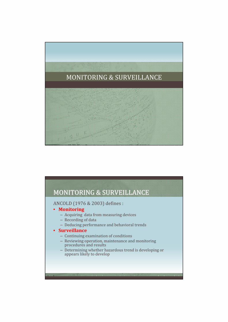
ANCOLD (1976 & 2003) defines :
• Monitoring– Acquiring data from measuring devices
– Recording of data
– Deducing performance and behavioral trends
• Surveillance– Continuing examination of conditions
– Reviewing operation, maintenance and monitoring procedures and results
– Determining whether hazardous trend is developing or appears likely to develop

MONITORING & SURVEILLANCEMONITORING & SURVEILLANCE
• Monitoring & Surveillance
shall be continued as long as
the hazards associated with
the existence of the dam
present.
• Level of Monitoring &
Surveillance depends on
consequences of failure.
MONITORINGMONITORING
• Survey on :– Deformation of dam
– Reservoir level & rainfall
• Measurements on :– Seepage & pore pressure
– Foundation pressure
– Stresses in dam & structures
• Spillway performance & condition
• Monitoring on :– Cracks
– Erosion
– Seismicity (esp. for large reservoir or at seismically active areas)

MONITORINGMONITORING
SURVEILLANCESURVEILLANCE
• Safety Inspection
– Routine Safety
Inspection
– Periodic Safety
Inspection
– Special Safety
Inspection
• Dam Safety
Management Plan

VISUAL INSPECTION OF DAM
UNCONTROLLED LEAKAGE/SEEPAGEUNCONTROLLED LEAKAGE/SEEPAGE

CRACKS ON DAM STRUCTURESCRACKS ON DAM STRUCTURES
TENSION CRACKS ON DAM CRESTTENSION CRACKS ON DAM CREST

EROSION ON EMBANKMENT SLOPESEROSION ON EMBANKMENT SLOPES
Erosion at the Downstream Face of Erosion at the Downstream Face of
DamDamErosion due to Dam OvertoppedErosion due to Dam Overtopped
INSTRUMENTATION MONITORING OF
DAM

STATESTATE--OFOF--ART & FUTURE TREND OF ART & FUTURE TREND OF
INSTRUMENTATIONINSTRUMENTATION
TYPICAL INSTRUMENTATION FOR EARTH DAMTYPICAL INSTRUMENTATION FOR EARTH DAM
Source: http://www.geokon.com/products

TYPICAL INSTRUMENTATION FOR CONCRETE DAMTYPICAL INSTRUMENTATION FOR CONCRETE DAM
Source: http://www.geokon.com/products
TYPICAL INSTRUMENTATION FOR TUNNELTYPICAL INSTRUMENTATION FOR TUNNEL
Source: http://www.geokon.com/products

DAM LEAKAGE/SEEPAGE MEASUREMENTDAM LEAKAGE/SEEPAGE MEASUREMENT
SEISMOMETERSEISMOMETER

HYDROLOGICAL INSTRUMENTATIONHYDROLOGICAL INSTRUMENTATION
Flip Bucket Rain Gauge
DISPLACEMENT SURVEY USING 3D GROUND DISPLACEMENT SURVEY USING 3D GROUND
BASED TERRESTRIAL LiDARBASED TERRESTRIAL LiDAR
3D Light Detection and Ranging Equipment
(LiDAR)

BEHAVIOURAL ANALYSISBEHAVIOURAL ANALYSIS
FEM - 0.2 lit/s to 0.4 lit/s
Head Pressure
Seepage
FlowSeepage
Flow
BEHAVIOURAL ANALYSIS
Seepage Analysis (FEM Modelling)

INSTRUMENTS LAYOUT PLANINSTRUMENTS LAYOUT PLAN
Inclinometer Location (CH250,400,550) Vibrating Wire Piezometer (CH250,400,550) Optical Prism Magnetic Probe Extensometer Standpipe Piezometer (CH100,250,400,550,650) Settlement Pin Surface Settlement Markers Seepage Measurement Chambers (CH250,400,550)
3 inclinometer stations were installed at respective chainages to measure horizontal movement in the dam embankment (e.g. A-B direction: Upstream-downstream direction).
1. Inclinometer Monitoring
RockfillRockfill
WL 21.0mRL
Dam Crest
(23.5mRL)
14mRL
0.00mRL
Inclinometer
Access Tube
Excavation Level -3.15mRL
IN3001

2. Magnectic Probe Extensometer
Magnetic Probe Extensometer is used to monitor the internal vertical displacement of embankment and foundation of the dam.
Total Settlement of Clay Core at Dam at EX 3001, 3002 and 3003
(2003-2007)
-0.06
-0.05
-0.04
-0.03
-0.02
-0.01
0
6-Oct-03
14-Jan-04
23-Apr-04
1-Aug-04
9-Nov-04
17-Feb-05
28-May-05
5-Sep-05
14-Dec-05
24-Mar-06
2-Jul-06
10-Oct-06
18-Jan-07
28-Apr-07
6-Aug-07
14-Nov-07
Time (Date)
Settlement (m)
Total Settlement EX3001 Total Settlement EX3002 Total Settlement EX3003
Maximum allowable vertical
displacement taking into long
Total settlement for all 3 stations EX 3001, EX 3002 and EX 3003 are well below the specified permissible limit of 50mm in the past (2002-2006) and during the IMP
IMP

3. Vibrating Wire Piezometer
There are 24 numbers of vibrating wire piezometer gauges installed/embedded in clay core of the dam at predetermined locations to measure the pore pressure.
5.16mRL
From this point onward, cable runs parallel to dam axis to join main Trench at Chainage 402
WL (about 21mRL)
Dam Crest23.5mRL)
Downstream Level (14mRL)
VW13
VW14
VW18
VW12VW
8VW2
VW7VW
1
5.16mRL
From this point onward, cable runs parallel to dam axis to join main Trench at Chainage 402
WL (about 21mRL)
Dam Crest(23.5mRL)
Downstream Level (14mRL)
VW23
VW20
VW19
VW15VW1
0VW9
VW4 VW3Excavation Level (-3.15mRL)
5.16mRL
From this point onward, cable runs parallel to dam axis to join main Trench at Chainage 402
WL (about 21mRL)
Dam Crest(23.5mRL)
Downstream Level (14mRL)
VW5
VW24
VW21
VW22
VW17
VW16
VW11
VW6 Excavation Level (-7.15mRL)
4. Standpipe Piezometer
Standpipe piezometers are used to monitor the Groundwater Table in the stability berm at the downstream of the dam. There are five stations installed at the dam toe.

5. Seepage Measurement Chamber
There are 3 seepage measurement chambers (v-notch weir) downstream of the dam at SC 01, SC 02 and SC 03 to measure the amount of the dam seepage water.
Rainfall Data vs Seepage
RAINFALL DATA (Seri Kembangan)
25-Sep-07, 0.8626-Sep-07, 0.84
27-Sep-07, 1.0028-Sep-07, 0.9829-Sep-07, 0.9530-Sep-07, 0.92
3-Oct-07, 1.75
5-Oct-07, 1.33
8-Oct-07, 1.18
10-Oct-07, 1.10
12-Oct-07, 0.84
16-Oct-07, 1.15
17-Oct-07, 1.86
19-Oct-07, 1.37
26-Oct-07, 2.16
29-Oct-07, 1.18
31-Oct-07, 1.11
2-Nov -07, 1.02
5-Nov -07, 1.15
7-Nov-07, 0.94
9-Nov -07, 2.15
12-Nov -07, 1.2114-Nov-07, 1.18
16-Nov -07, 0.90
19-Nov -07, 1.09
0
10
20
30
40
50
60
70
25-Sep-07
26-Sep-07
27-Sep-07
28-Sep-07
29-Sep-07
30-Sep-07
1-Oct-07
2-Oct-07
3-Oct-07
4-Oct-07
5-Oct-07
6-Oct-07
7-Oct-07
8-Oct-07
9-Oct-07
10-Oct-07
11-Oct-07
12-Oct-07
13-Oct-07
14-Oct-07
15-Oct-07
16-Oct-07
17-Oct-07
18-Oct-07
19-Oct-07
20-Oct-07
21-Oct-07
22-Oct-07
23-Oct-07
24-Oct-07
25-Oct-07
26-Oct-07
27-Oct-07
28-Oct-07
29-Oct-07
30-Oct-07
31-Oct-07
1-Nov-07
2-Nov-07
3-Nov-07
4-Nov-07
5-Nov-07
6-Nov-07
7-Nov-07
8-Nov-07
9-Nov-07
10-Nov-07
11-Nov-07
12-Nov-07
13-Nov-07
14-Nov-07
15-Nov-07
16-Nov-07
17-Nov-07
18-Nov-07
19-Nov-07
Date
Rainfall (mm)
0.00
0.50
1.00
1.50
2.00
2.50
Rainfall Total Seepage
It is evident that high seepage readings invariably were attributed to high rainfall values recorded at Seri Kembangan station located within the Putrajaya upper catchment boundary.
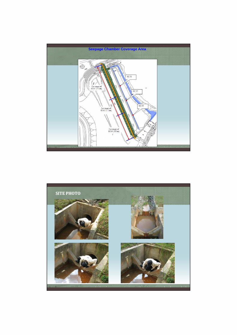
Seepage Chamber Coverage Area
SITE PHOTOSITE PHOTO

7. Total Station and Optical Prism Position, Precise Settlement Monitoring
To monitor any settlement or movement along the dam crest and its profile. Survey
work was carried out during the IMP to monitor the following instruments:
1.Existing Surface Settlement Marker (21 pts)
2.Additional Optical prism (32 pts), and
3.Additional Settlement Pin (14 pts)
SSM Survey
OP Survey

SP Survey
8. Visual Inspection of inclinometer tubing
Micro camera for inclinometer tubing inspection
The recorded video images show that there is no physical damage found in all the 3 inclinometer tubing. The inspection also confirmed that the maximum displacement recorded for the inclinometer was all at the joint locations.
It has cleared the earlier doubt that the useful life of these tubing ended when tubing curvature had forced the inclinometer probe out of the access grooves in the tube and prevented passage of the inclinometer probe.

Depth at 13.5m (Joint)
Depth at 16.5 (Joint)
Closer look at the joint.
The ramp at the access groove interface between the tubings and the telescoping coupling has introduced slight discontinuity, caused the new inclinometer probe (Bluetooth inclinometer), which is much lighter compared to the old inclinometer probe, to experience difficulty to advance into the tubing.
Finding