Embed Size (px)
Citation preview
Remote Sensing
1
Fundamentals of Remote
Sensing
Division of Spatial Information Science
Graduate School Life and Environment Sciences
University of Tsukuba
Prof. Dr. Yuji Murayama
Surantha Dassanayake
10/6/2010
Remote Sensing
2
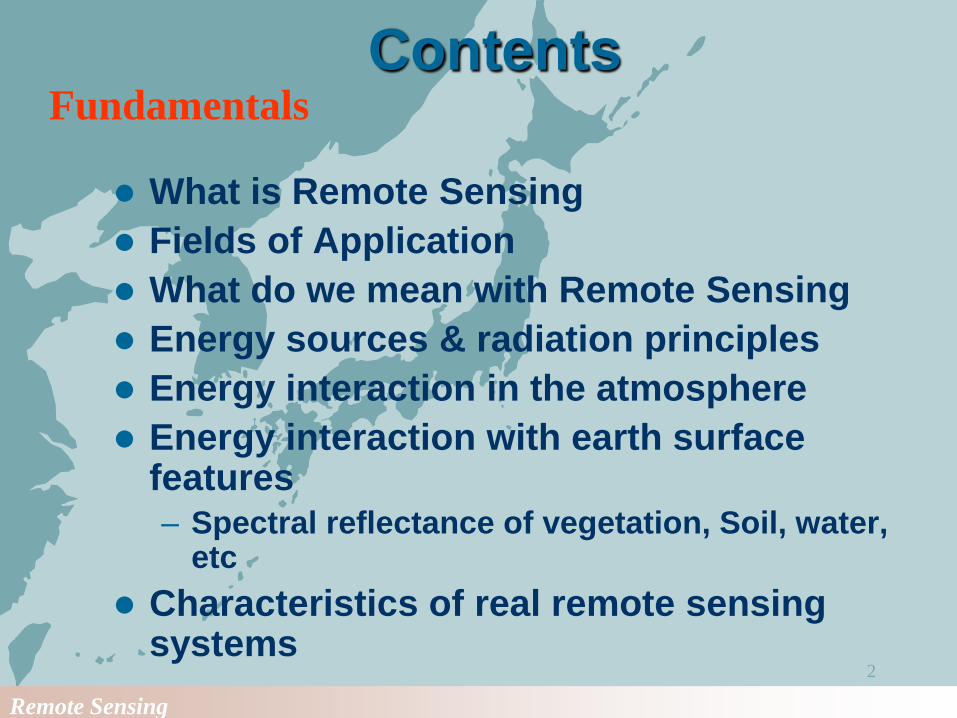
Contents
What is Remote Sensing
Fields of Application
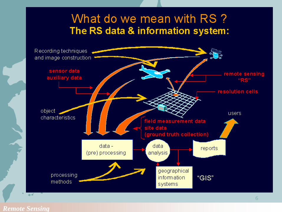
What do we mean with Remote Sensing
Energy sources & radiation principles
Energy interaction in the atmosphere
Energy interaction with earth surface features– Spectral reflectance of vegetation, Soil, water,
etc
Characteristics of real remote sensing systems
Fundamentals
Remote Sensing
3
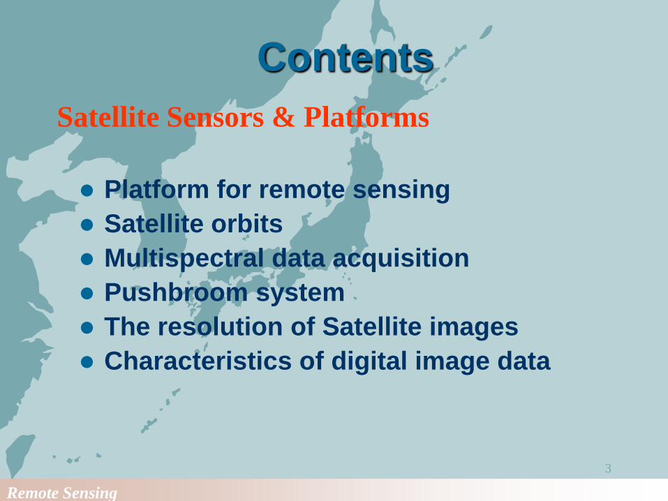
Contents
Platform for remote sensing
Satellite orbits
Multispectral data acquisition
Pushbroom system
The resolution of Satellite images
Characteristics of digital image data
Satellite Sensors & Platforms
Remote Sensing
4
Contents
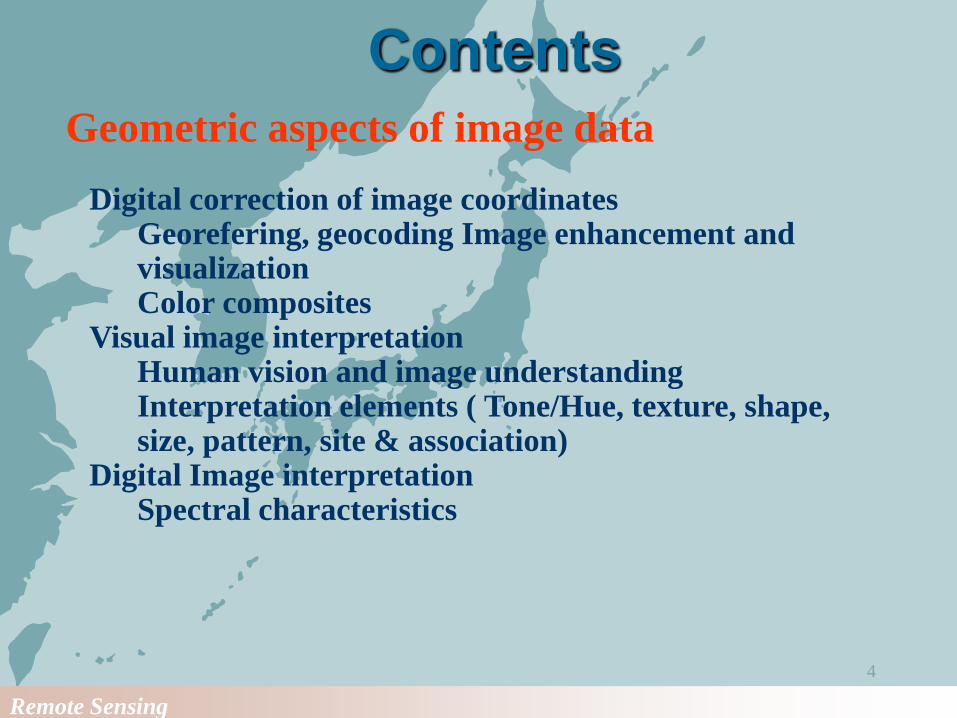
Geometric aspects of image data
Digital correction of image coordinatesGeorefering, geocoding Image enhancement and visualization Color composites
Visual image interpretationHuman vision and image understandingInterpretation elements ( Tone/Hue, texture, shape, size, pattern, site & association)
Digital Image interpretationSpectral characteristics
Remote Sensing
5
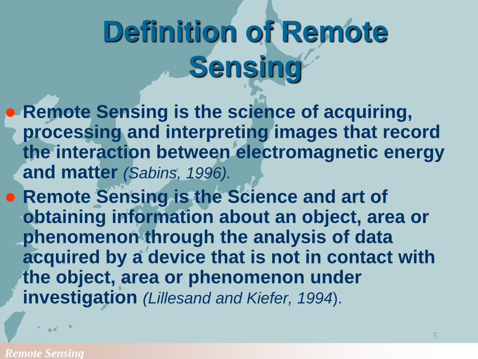
Definition of Remote
Sensing
Remote Sensing is the science of acquiring, processing and interpreting images that record the interaction between electromagnetic energy and matter (Sabins, 1996).
Remote Sensing is the Science and art of obtaining information about an object, area or phenomenon through the analysis of data acquired by a device that is not in contact with the object, area or phenomenon under investigation (Lillesand and Kiefer, 1994).
Remote Sensing
6
Remote Sensing
7
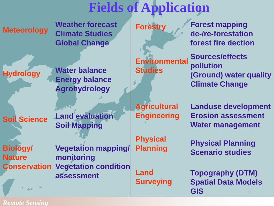
MeteorologyWeather forecast
Climate Studies
Global Change
Hydrology Water balance
Energy balance
Agrohydrology
Soil Science Land evaluation
Soil Mapping
Biology/
Nature
Conservation
Vegetation mapping/
monitoring
Vegetation condition
assessment
Forestry Forest mapping
de-/re-forestation
forest fire dection
Environmental
Studies
Sources/effects
pollution
(Ground) water quality
Climate Change
Agricultural
Engineering
Landuse development
Erosion assessment
Water management
Physical
PlanningPhysical Planning
Scenario studies
Land
SurveyingTopography (DTM)
Spatial Data Models
GIS
Fields of Application

Remote Sensing
8
Concept of Remote Sensing
Remote Sensing
9
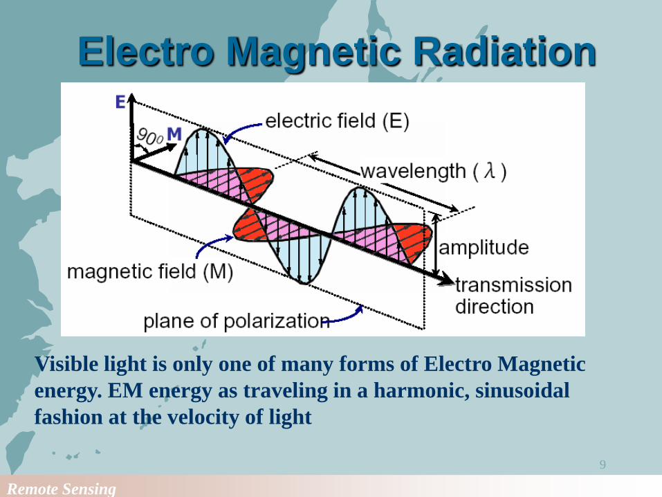
Electro Magnetic Radiation
Visible light is only one of many forms of Electro Magnetic
energy. EM energy as traveling in a harmonic, sinusoidal
fashion at the velocity of light
Remote Sensing
10
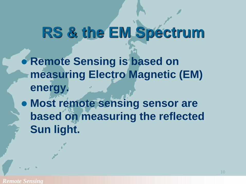
RS & the EM Spectrum
Remote Sensing is based on
measuring Electro Magnetic (EM)
energy.
Most remote sensing sensor are
based on measuring the reflected
Sun light.

Remote Sensing
11
Energy sources
The Sun is the most obvious source
of electromagnetic radiation for
Remote Sensing.
All matter at temperature above
absolute zero (0 K or -273 C)
continuously emit electromagnetic
radiation.
Remote Sensing
12
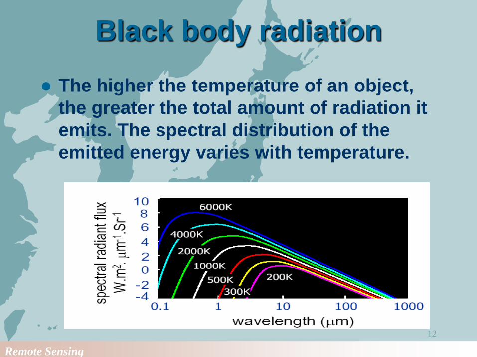
Black body radiation
The higher the temperature of an object,
the greater the total amount of radiation it
emits. The spectral distribution of the
emitted energy varies with temperature.
Remote Sensing
13
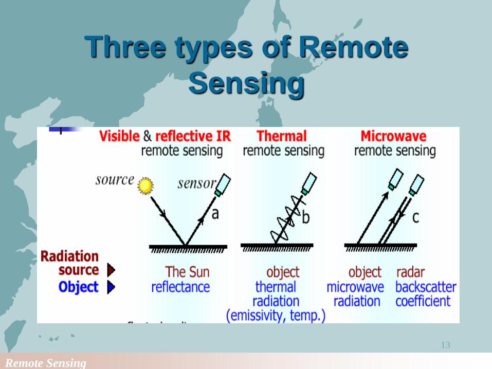
Three types of Remote
Sensing
Remote Sensing
14
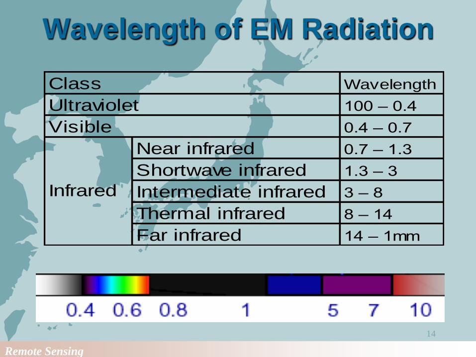
Wavelength of EM Radiation
Wavelength
100 – 0.4
0.4 – 0.7
Near infrared 0.7 – 1.3
Shortwave infrared 1.3 – 3
Intermediate infrared 3 – 8
Thermal infrared 8 – 14
Far infrared 14 – 1mm
Class
Ultraviolet
Visible
Infrared
Remote Sensing
15
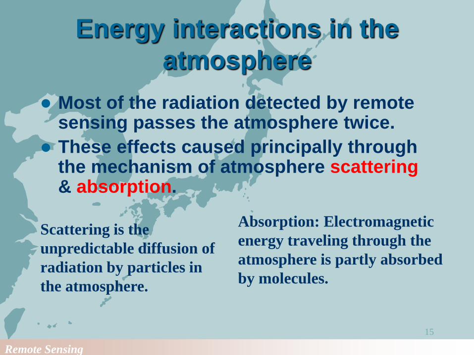
Energy interactions in the
atmosphere
Most of the radiation detected by remote sensing passes the atmosphere twice.
These effects caused principally through the mechanism of atmosphere scattering& absorption.
Scattering is the
unpredictable diffusion of
radiation by particles in
the atmosphere.
Absorption: Electromagnetic
energy traveling through the
atmosphere is partly absorbed
by molecules.
Remote Sensing
16
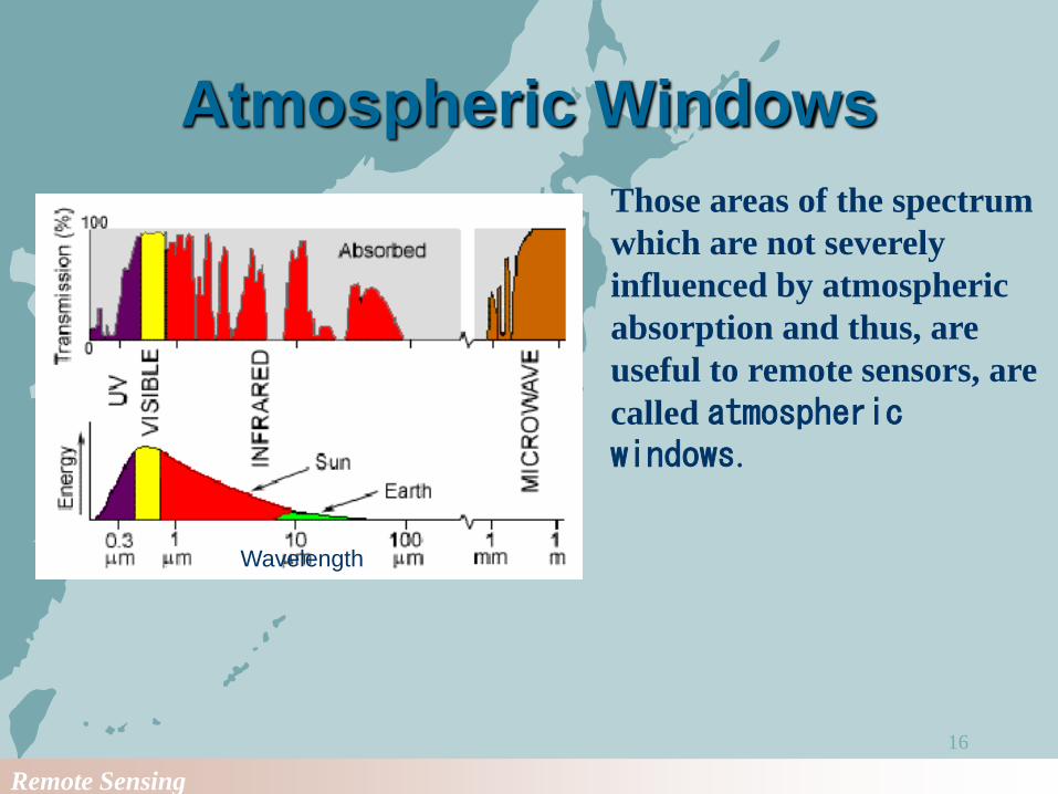
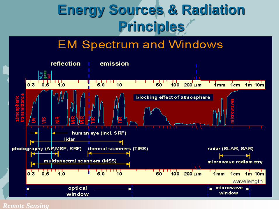
Atmospheric Windows
Wavelength
Those areas of the spectrum
which are not severely
influenced by atmospheric
absorption and thus, are
useful to remote sensors, are
called atmospheric windows.
Remote Sensing
17
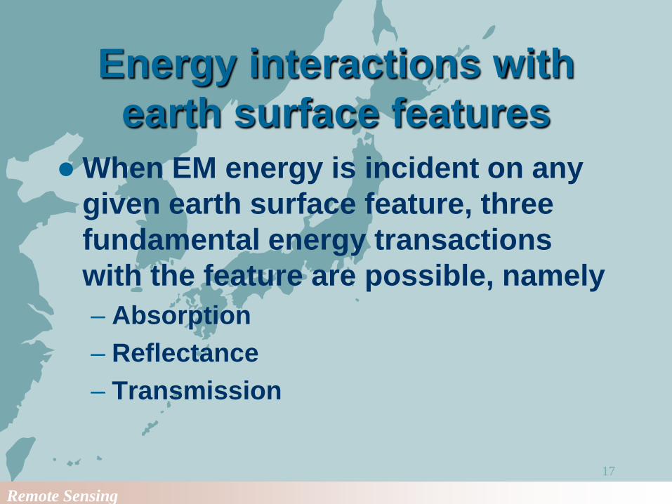
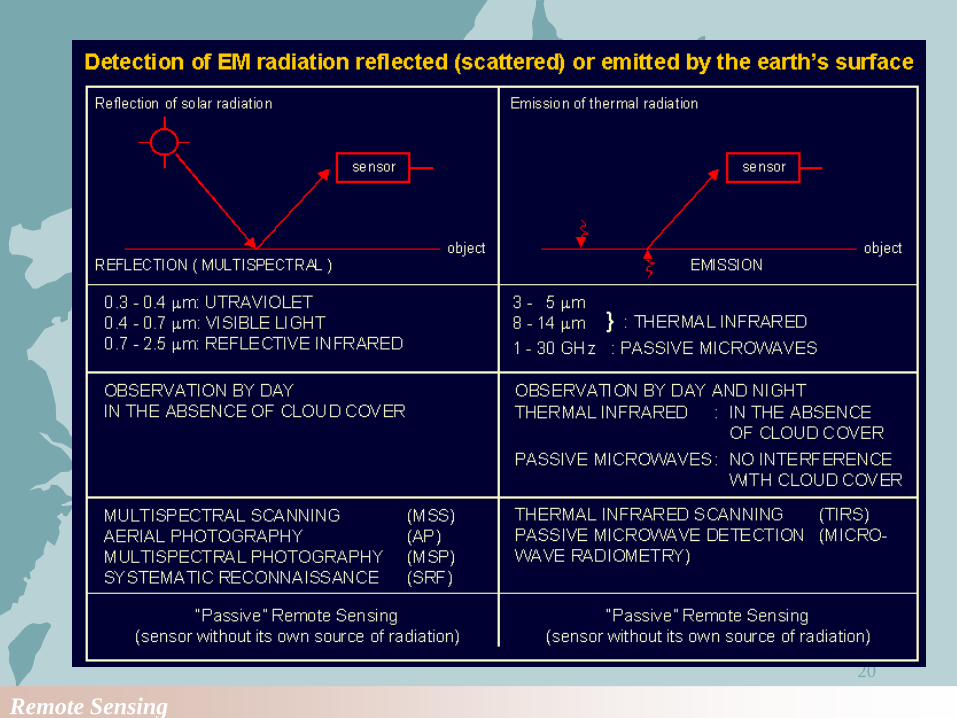
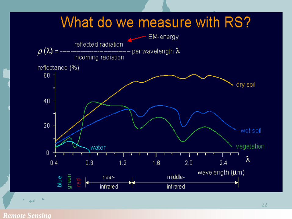
Energy interactions with
earth surface features
When EM energy is incident on any
given earth surface feature, three
fundamental energy transactions
with the feature are possible, namely
– Absorption
– Reflectance
– Transmission
Remote Sensing
18
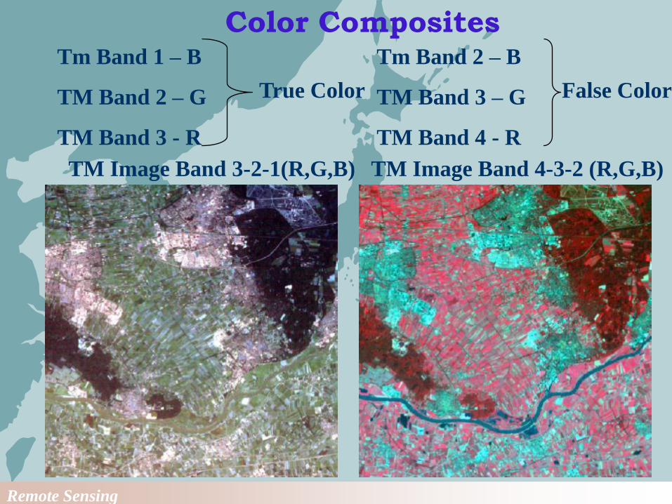
TM Image Band 4-3-2 (R,G,B)TM Image Band 3-2-1(R,G,B)
Tm Band 1 – B
TM Band 2 – G
TM Band 3 - R
True Color
Tm Band 2 – B
TM Band 3 – G
TM Band 4 - R
False Color
Color Composites
Remote Sensing
19
Energy Sources & Radiation
Principles
Remote Sensing
20
Remote Sensing
21
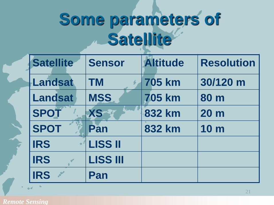
Some parameters of
Satellite
Satellite Sensor Altitude Resolution
Landsat TM 705 km 30/120 m
Landsat MSS 705 km 80 m
SPOT XS 832 km 20 m
SPOT Pan 832 km 10 m
IRS LISS II
IRS LISS III
IRS Pan
Remote Sensing
22
Remote Sensing
23
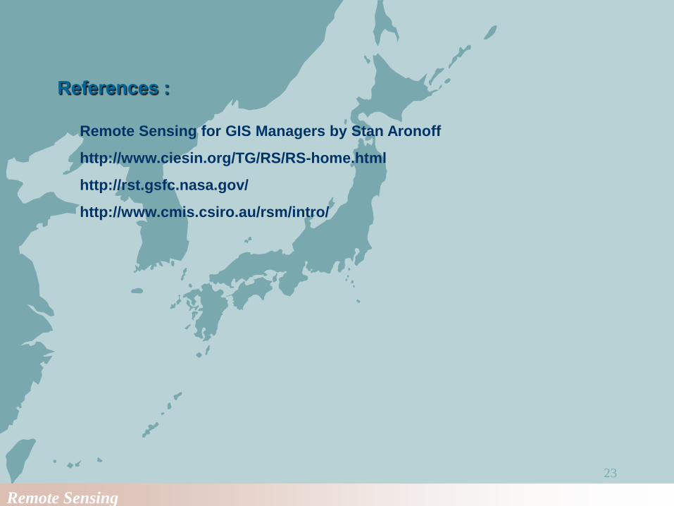
References :
Remote Sensing for GIS Managers by Stan Aronoff
http://www.ciesin.org/TG/RS/RS-home.html
http://rst.gsfc.nasa.gov/
http://www.cmis.csiro.au/rsm/intro/