Embed Size (px)
Citation preview
GEO SMART ASIA 2017 Assessing climate change impacts - Utilization of GIS, Side Scan Sonar and Video in Creating Marine Habitat Map of Kuala Linggi, Melaka, Malaysia.
Abdullah, N. A., Chiffings, T., Golingi, T., Auluck, M.
DHI Water and Environment (M) Sdn. Bhd.

Introduction
© DHI
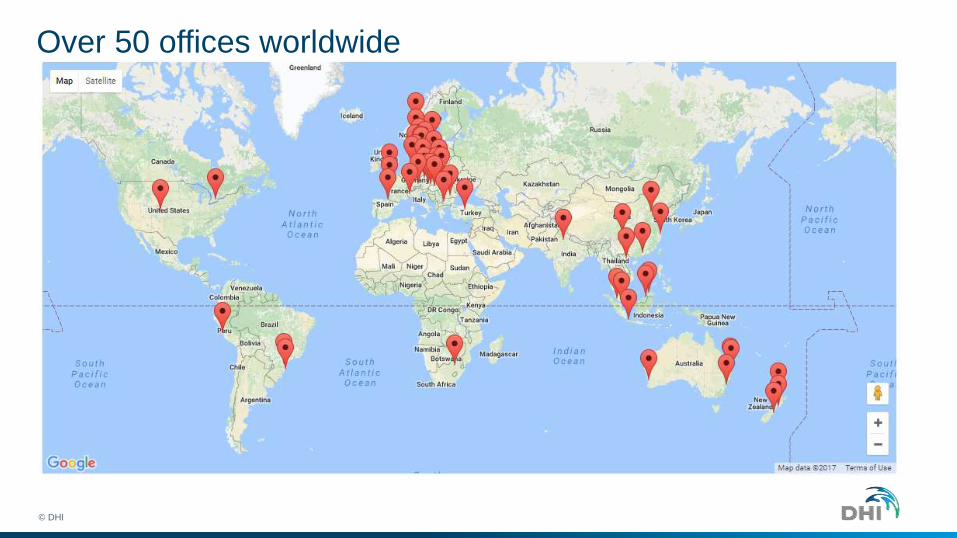
Over 50 offices worldwide
© DHI
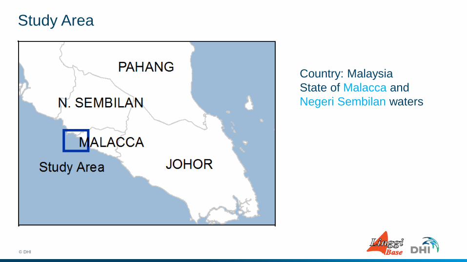
Study Area
© DHI
Country: Malaysia
State of Malacca and
Negeri Sembilan waters
Study Area
© DHI
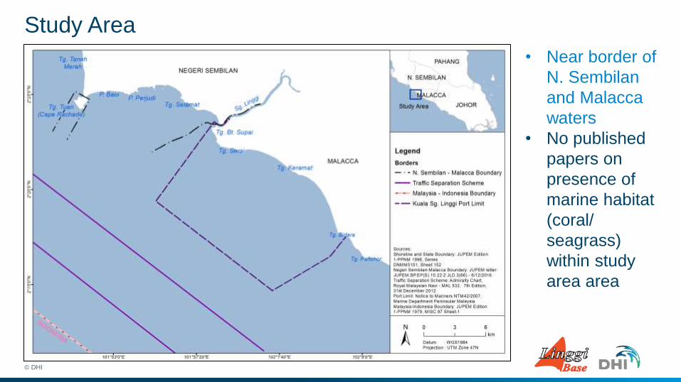
• Near border of
N. Sembilan
and Malacca
waters
• No published
papers on
presence of
marine habitat
(coral/
seagrass)
within study
area area
Statement of Problems
© DHI
Statement of Problems
1. Huge area to cover in limited amount of time
2. Turbid water
3. Strong current
© DHI
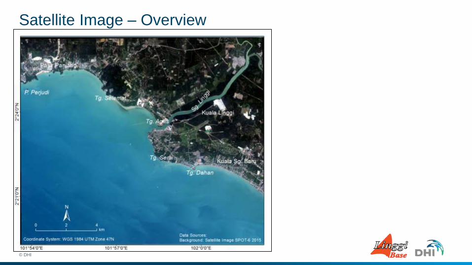
Satellite Image – Overview
© DHI

Side scan sonar and splash/tow camera
Methodology
© DHI
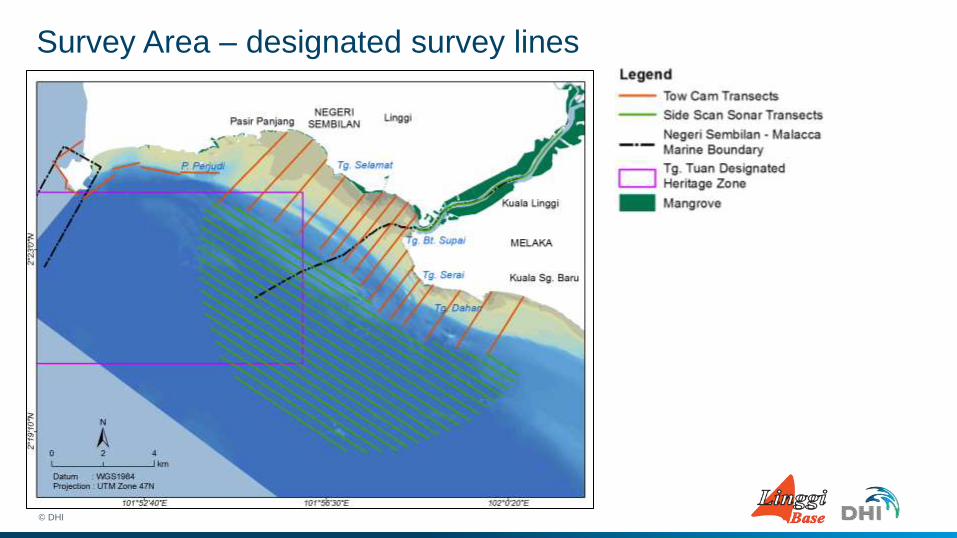
Survey Area – designated survey lines
© DHI
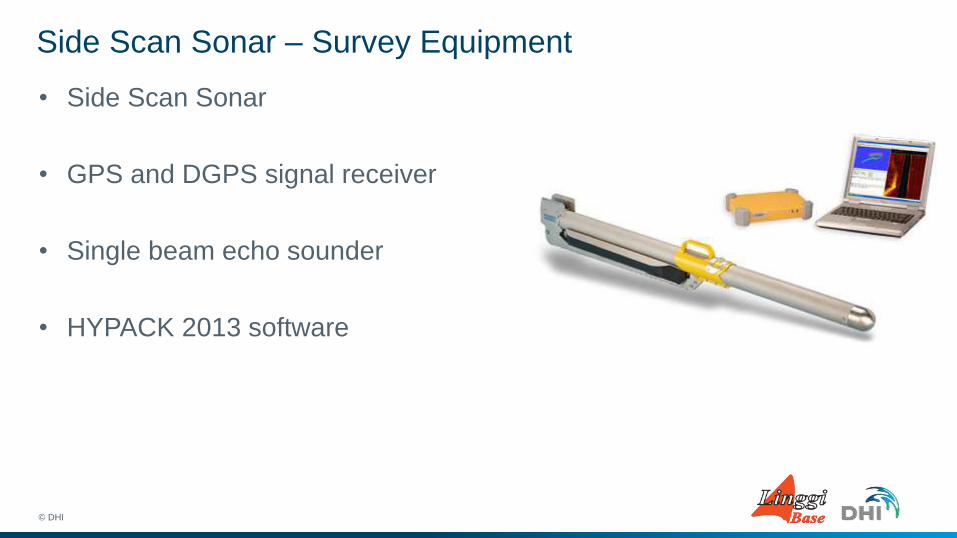
Side Scan Sonar – Survey Equipment
• Side Scan Sonar
• GPS and DGPS signal receiver
• Single beam echo sounder
• HYPACK 2013 software
© DHI
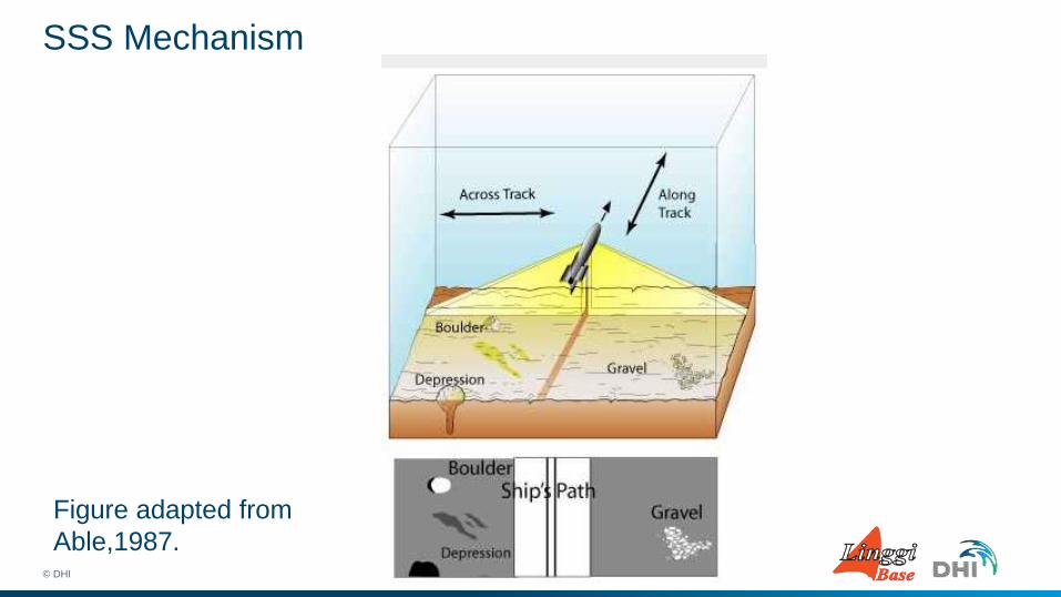
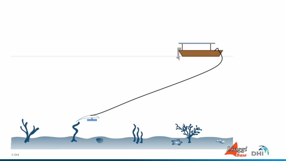
SSS Mechanism
© DHI
Figure adapted from
Able,1987.
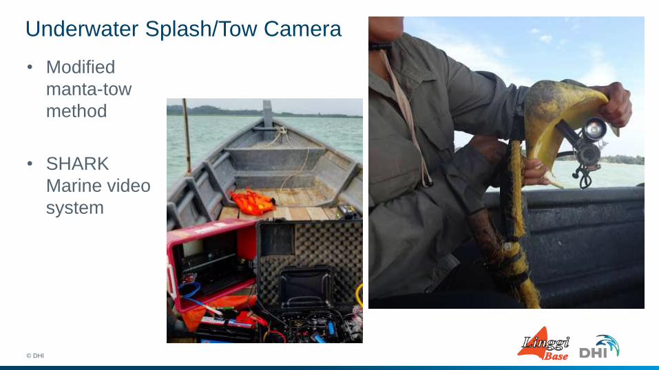
Underwater Splash/Tow Camera
• Modified
manta-tow
method
• SHARK
Marine video
system
© DHI
© DHI

Data Output
© DHI
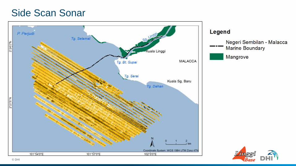
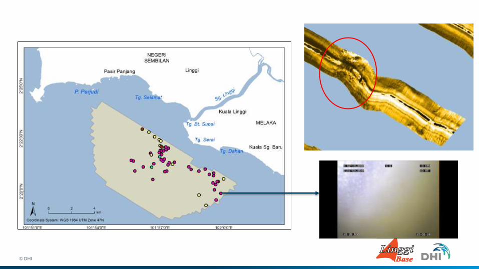
Side Scan Sonar
© DHI
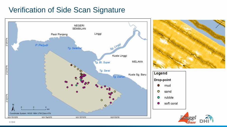
Verification of Side Scan Signature
© DHI
© DHI
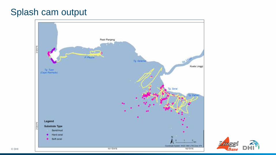
Splash cam output
© DHI
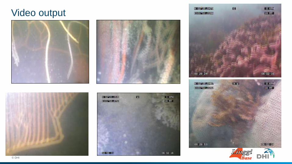
Video output
© DHI
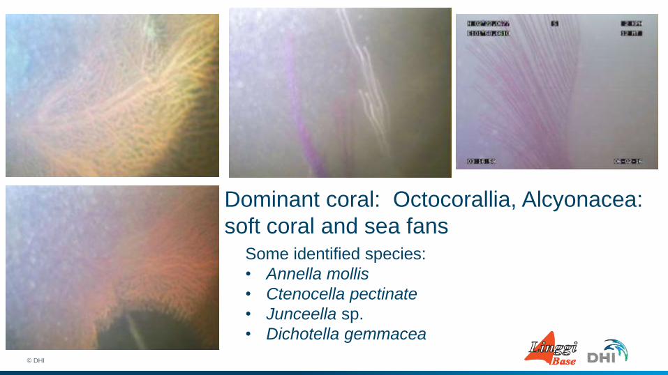
Dominant coral: Octocorallia, Alcyonacea:
soft coral and sea fans
© DHI
Some identified species:
• Annella mollis
• Ctenocella pectinate
• Junceella sp.
• Dichotella gemmacea
Habitat Map using GIS
© DHI
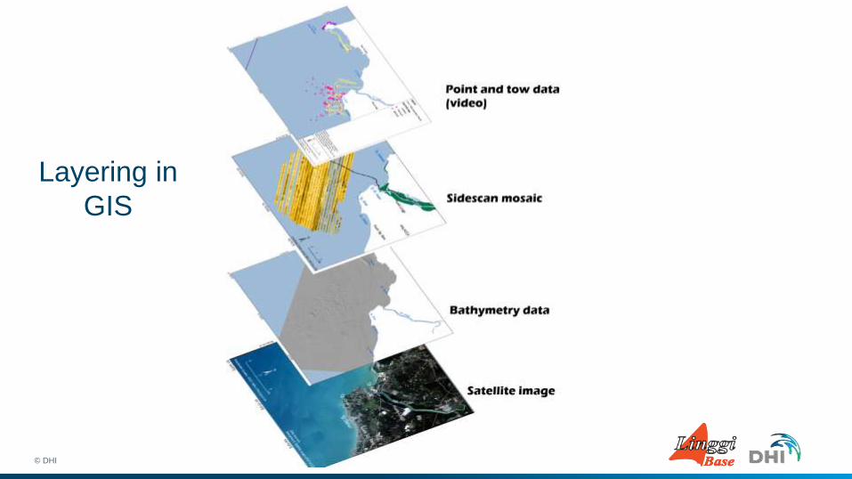
Layering in
GIS
© DHI
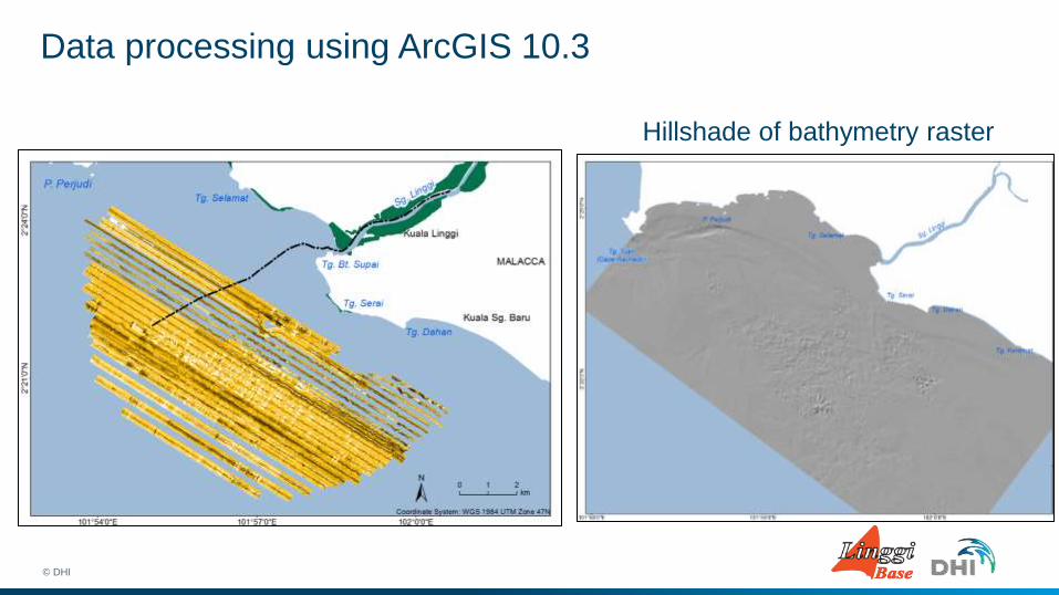
Data processing using ArcGIS 10.3
© DHI
Hillshade of bathymetry raster
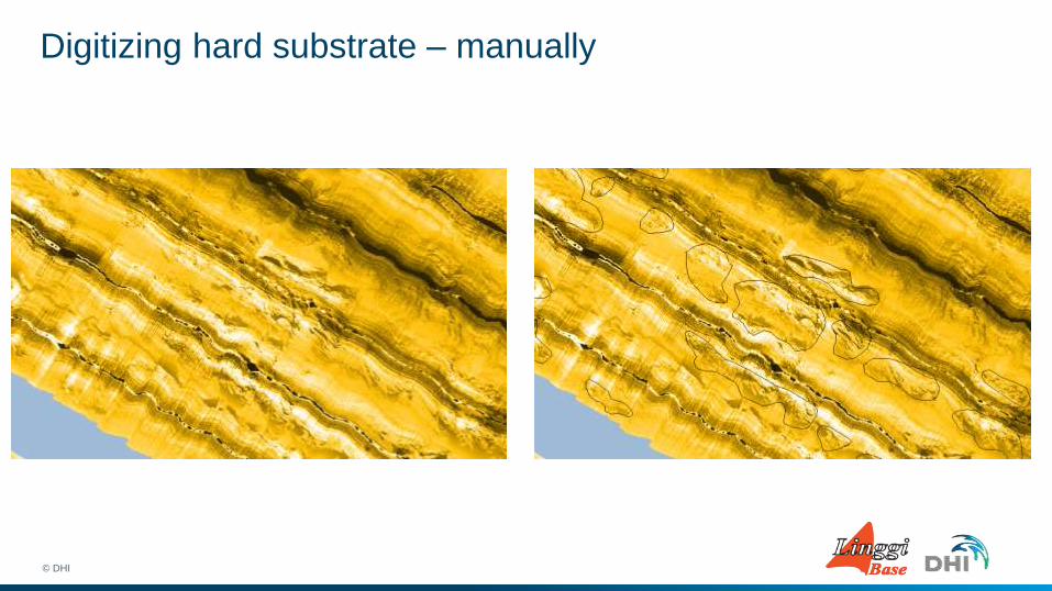
Digitizing hard substrate – manually
© DHI
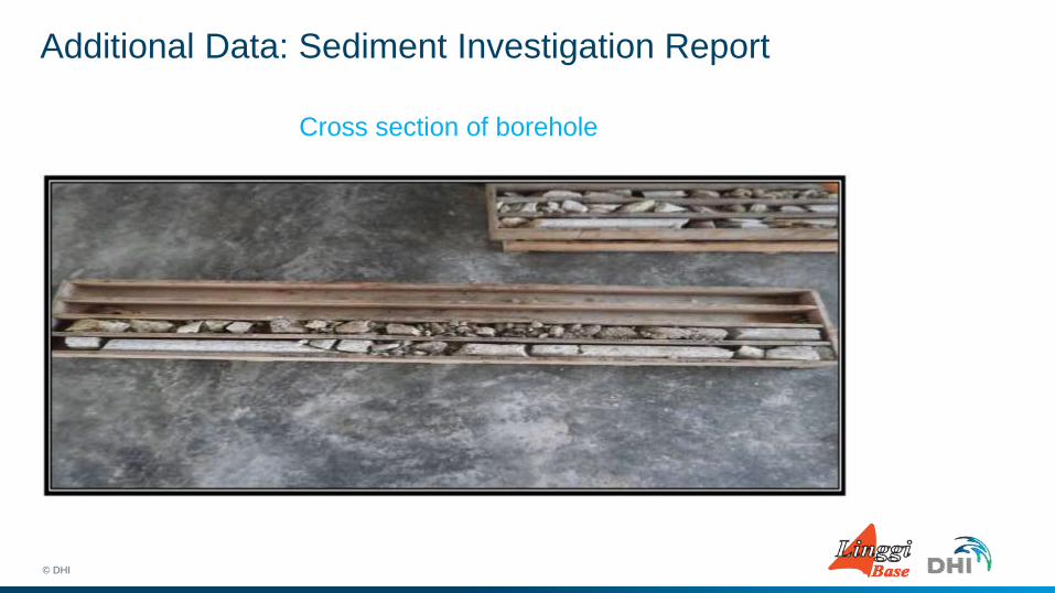
Additional Data: Sediment Investigation Report
© DHI
Cross section of borehole
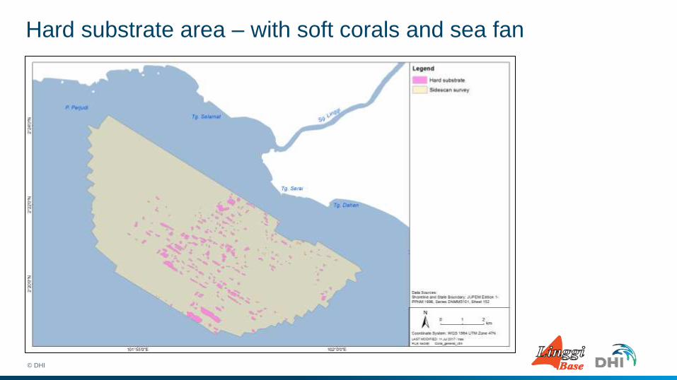
Hard substrate area – with soft corals and sea fan
© DHI
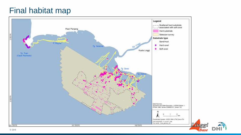
Final habitat map
© DHI

Discussion
© DHI
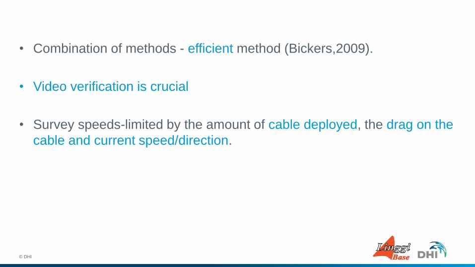
• Combination of methods - efficient method (Bickers,2009).
• Video verification is crucial
• Survey speeds-limited by the amount of cable deployed, the drag on the
cable and current speed/direction.
© DHI
• Cable drag distance - accurate map
• Higher resolution, better data, more expansive
© DHI

Conclusion
© DHI
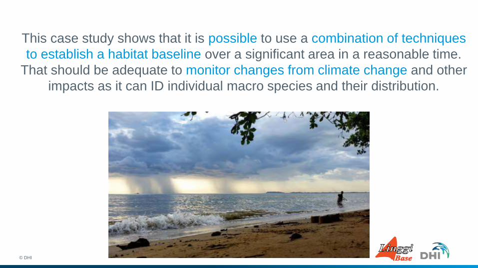
This case study shows that it is possible to use a combination of techniques
to establish a habitat baseline over a significant area in a reasonable time.
That should be adequate to monitor changes from climate change and other
impacts as it can ID individual macro species and their distribution.
© DHI
Thank you Noor Atika binti Abdullah DHI Water and Environment (M) Sdn. Bhd. [email protected] +6088260780
© DHI


![Tópicos 2] geo 2° ano geo](https://img.pdfslide.tips/doc/110x75/5572601dd8b42a761d8b4c36/topicos-2-geo-2-ano-geo.jpg)