Embed Size (px)
Citation preview
GISDECO 2002, ITC, The Netherlands, May 15-18
GIS AND DEVELOPMENT CONTROL SYSTEM FOR LOCAL AUTHORITY IN MALAYSIA
Ahris Yaakup Foziah Johar
Susilawati Sulaiman Department of Urban and Regional Planning
Universiti Teknologi Malaysia Faculty of Built Environment
81300 Skudai, Johor, Malaysia Email: [email protected]
Ruslin Hassan
Abdul Rashid Ibrahim Kuala Lumpur City Hall
Jalan Raja Laut, 50250 Kuala Lumpur, Malaysia
Abstract The process of development control involves a technique for the systematic compilation of expert quantitative analysis and qualitative assessment of project land use and property development viability, including its effect on the surrounding area, and the presentation of results in a way that enables the importance of the predicted results, and the scope of modifying or mitigating them to be properly evaluated by the relevant decision making body before a planning permission is rendered. Taking the local authorities in Malaysia as an example, this paper will discuss and demonstrate the development of GIS database and its integration and application for development and building control. The first part of the paper examines the functions of local authorities particularly in the context of development control. In this study, the procedure involved in granting a planning permission as well as enforcement becomes the main focus because it determines the bulk of the system design. The study identifies seven sub-systems namely planning permission, building control, planning enforcement, geospatial database, information kiosk, document processing and presentation sub-systems. The system is developed using a combination of office automation, CAD, GIS, multimedia and other software packages. This paper will focus on the development of the GIS for the purpose of development control. The components of the GIS database include land information, building, existing development, planning information, development plan, utilities, community facilities, transportation, environment and socio-economy database. The GIS database will be used at every stages of development control process for example in initial discussion, registration, invitation of objection, development control process, consideration by technical committee and consideration by planning committee. It is anticipated that the GIS database could be used by many parties involve in the process as reference point in evaluating a planning submission. Having access to the database will provide the flexibility in assessing a development and deciding on the overall urban growth management programme in the most cost-effective manner. The system will also provide transparency and consistency in the development control procedure. Key words: GIS, Development Control, Local Authority 1.0 INTRODUCTION Of late there have been an enormous improvement in the price and performance of computer hardware and functionality of software packages, such that a wide range of specific demands for the management, analysis and presentation of data can now be met in a cost-effective manner. A direct consequence of these new opportunities has been the rapid growth in the number of users interested in developing the urban planning and monitoring applications.

GISDECO 2002, ITC, The Netherlands, May 15-18
Given the dynamic nature of planning and management carried out at local level, it is not surprising that the local authorities become one of the largest users of GIS in advanced and developed countries. In Malaysia, only a small number of District Councils and Municipalities have already invested in GIS. However, the previous reluctance of local authorities to accept the challenge to embrace the technology due mainly to lack of support from the management level, the lack of in-house expertise to make use of the system and the high cost of GIS has been countered by the support given directly by the Federal Government in realising the concept of e-planning. This is a positive sign of moving towards a more transparent planning approach apart from building up a more efficient government as the implementation of e-planning would very much speed up the overall conventional planning process. The first part of the paper examines the functions of local authorities particularly in the context of development control. In this study, the procedure involved in granting a planning permission as well as enforcement becomes the main focus because it determines the bulk of the system design. Next, the paper will focus on the development of the GIS for the purpose of development control. The overall discussion will reflect on the Kuala Lumpur City Hall as the case study to represent the local authorities in Malaysia, in which the Development Control System is currently being developed. 2.0 FUNCTIONS OF LOCAL AUTHORITIES IN MALAYSIA The Malaysian administrative system is divided into three major levels of hierarchy: the Federal Government, State Government and Local Government, the latter being the local authority for its area. In 1976, the Local Government Act 1976 (Act 171) was promulgated providing a consolidated framework for local authorities. It also empowers the authority to undertake a wide range of functions. The planning powers of local authorities were thereof stipulated in the allied Town and Country Planning Act. The act stated that the local authority shall be the local planning authority for the area of the local authority, thus, conferring a primary physical planning responsibility at the local level and not at the state level as previously practiced. To carry out this function, the local authority shall prepare a two-tier development plan for the purpose of organizing, controlling and planning the development and use of land and buildings in their area. Strategic or policy decisions are to be incorporated in Structure Plans while detailed decisions are to be laid out in the Local Plans (Yaakup et al., 1994). Development at the local level obviously involves a lot of policies and implementation decisions which have to consider the cost and benefit to every level of urban dwellers. The interdependency between investments and their environment and the need to integrate all groups of inhabitants in urban society under decent living condition would be the prime concern of urban planners and managers at local level. Given the wide range of activities over the years, the local authorities have amassed a huge amount of information of which a substantial portion is geographical in nature such as layout of housing scheme, road and drainage system, composition and distribution of population, distribution of land use and so forth. Unfortunately, these data are often inaccessible even to the local administrators, the main reason being the database management system which is based on manual filing system, making retrieval of information difficult and time consuming. To alleviate the problem, a number of authorities employ computer database system such as Data Base IV, Filemaker, Statistical Analytical system or Statistical Package for Social Scientist. While these systems help tremendously in information retrieval and analysis, they do not handle spatial data very well. Thus, jobs assigned to the system are quite limited to routine retrieval (Yaakup et al., 1995). 2.1 Development Control - Process And Procedures The process of development control involves a technique for the systematic compilation of expert quantitative analysis and qualitative assessment of project land use and property development viability, including its effect on the surrounding area, and the presentation of results in a way that enables the importance of the predicted results, and the scope of modifying or mitigating them to be properly evaluated by the relevant decision making body before a planning permission is rendered.
GISDECO 2002, ITC, The Netherlands, May 15-18
In the context of urban planning, the present system of development control in most local authorities in Malaysia is by the granting or refusal of planning permission for development. The local authority is empowered to grant or refuse any planning application in its area. The recent amendment to the Town and Country Planning Act requires that certain planning application shall be accompanied by a development proposal report which include a written statement and a plan to (i) describe the present condition of the land to which the application relates; and (ii) describe the proposed development, in particular on how it would be likely to have a significant effect on the built environment (Ali, 1990). In most cases, a development proposal report involves a technique for the systematic compilation of expert quantitative analysis and qualitative assessment of the proposed project’s land use and development viability, including its effect on the surrounding area, and the presentation of results in a way which enables the importance of the predicted results, and the scope for modifying or mitigating them, to be properly evaluated by the relevant decision making body before a decision on an application is rendered (Yaakup, Johar and Dahlan, 1997). Information required for a development proposal report would therefore include the following major aspects:
i. Status of land and restrictions; ii. Land use analysis and intensity of development – this includes land use zoning,
population density zoning, height limit, plot ratio, plinth area, predetermined public area; iii. Analysis of issues and potential of sites – this includes site location, existing drainage
system, topography and slope, existing road system, existing land use, natural features which must be preserve and development potential;
iv. Analysis of surrounding development – this includes infrastructure, type, intensity and facilities available in the surrounding area;
v. The policies of the Structure Plan and Local Plan if available. In addition, a planning proposal report should also observe the planning standards or other policies which may be imposed from time to time. The report will then have to be verified by the local authority concerned, in particular by the Planning Division. The report together with other considerations will be used as a basis for making decision. The actual practice of development control however may differ from one local authority to another depending mainly on the size and status of the authority. 3.0 DEVELOPMENT CONTROL IN KUALA LUMPUR CITY HALL Kuala Lumpur, the capital of Malaysia has evolved as the center of economic growth activities for the Klang Valley and the country. The development of Kuala Lumpur has taken the form of a definite concentration of physical and economic activities in the center with ribbon developments taking place along the major arterials leading into the city. The City Hall of Kuala Lumpur is the largest municipal authority as far as size and functions are concerned whereby administration and management are undertaken by 20 different departments or units namely the Planning Control Division, Building Control Division, Enforcement Unit, Administration Division as well as the Secretariat, each having its own head. Together, the departments are headed by a Director General who is assisted by two Deputy Director Generals. The Mayor appointed by the Prime Minister heads the entire organization and is an administrator with vast power and authority over decision making as far as development is concerned. Planning legislation in Kuala Lumpur was traced back to 1881 (Baharom and Yusof, 2001) whereby an important and critical legislative action was taken after the big fire catastrophe. However ‘urban planning’ was only introduced in 1921, while legislation that directly regulates town planning activities was later introduced in 1930. Eventually, the sudden need for better planning was realized with the new Kuala Lumpur City Act (Planning) in 1973 (Act 107). It is the first ever legislation meant to control urban planning and development and related activities (Malaysia, 1973). When Local Government Act (Act 172) was introduced in 1976, which incorporated Structure Plan under 20 years strategic planning, it also included Local Plan meant to develop framework for social policies, urban
GISDECO 2002, ITC, The Netherlands, May 15-18
economic activities and environmental issues. Later, a dedicated Act meant only for Kuala Lumpur was passed by Parliament that incorporates major principles covered under Act 107 and 172). All applications for development in the city of Kuala Lumpur will have to be submitted to City Hall for approval. Depending on the type and scale of development, these applications will be processed and considered by either one of the following committees: (i) Town Planning Committee I; and (ii) Town Planning Committee II. The Town Planning Committee I chaired by the Mayor looks at the proposal for comprehensive and large-scale development, layout plans, change of use of land and increased density, and the application for the use of government land. This committee comprises the Director General of city Hall, Deputy Secretary to the Minister of Federal Territory, and all the directors of the technical divisions. Before an application is reviewed by this committee, it will have to go through all the technical departments for comments and recommendations, based on decision is derived whether to approve or approve with conditions or reject the proposed development, after which the Development Order will be issued by the Mayor. The Town Planning Committee II looks into the application for development of shop houses, detach houses, mosques, industrial buildings, etc. the procedure adopted by the Town Planning Committee II is similar to the former committee, except that the Development Order will be issued by the Director General. Development control is considered very important for Kuala Lumpur Metropolitan, especially in the Commercial Central Area which has the highest concentration of development compared to the rest of the city. It has a mixture of traditional shop houses, office complexes and modern hotel-cum shopping complexes. To date the area still receives numerous applications either for new development or redevelopment. The City Hall receives many applications to redevelop the traditional shop houses to be replaced by a more up-beat commercial buildings (Adom, 1992). Such small-scale development often carried out by private developers can be completed in record time but does little to contribute to the aesthetic aspect of the city since it is done in a piecemeal manner. Applications for new development include hotel or shopping complexes and mega projects (floor space of more than 1 million square feet) normally carry out based on privatization concept. Potential areas being planned for such developments include open space, government land, school and river. Presently, development of this area is based on the rather outdated development plan of 1970, which does not provide adequate guidelines to control the developments. In addition, the City Hall applied some form of planning standards and restrictions such as plot ratio, density and plinth area. However, such restrictions can still be negotiated by compensating with payment of development charges, provision of car parking and other facilities, surrendering land for road widening or providing building setback. The concern is that the development of the area if not properly and efficiently controlled, will not only adversely affect the form of the planned growth but that the image and identity of Kuala Lumpur will be eventually lost. To plan and control development in such area requires an information system that is capable of not only assisting in day-to-day routines but should also aid in formulating development strategies able to cope with the fast changing scene. 3.1 The Development Control System The Development Control System developed for Kuala Lumpur City Hall integrates several sub systems to execute specific functions. In general, the Development Control System has seven main sub systems, which are:
i. Planning Authorization Sub System ii. Building Control Sub System iii. Enforcement Sub System iv. Geospatial and Planning Information Sub System v. Information Kiosk Sub System vi. Meeting Presentation Sub System vii. Documentation Processing Sub System
GISDECO 2002, ITC, The Netherlands, May 15-18
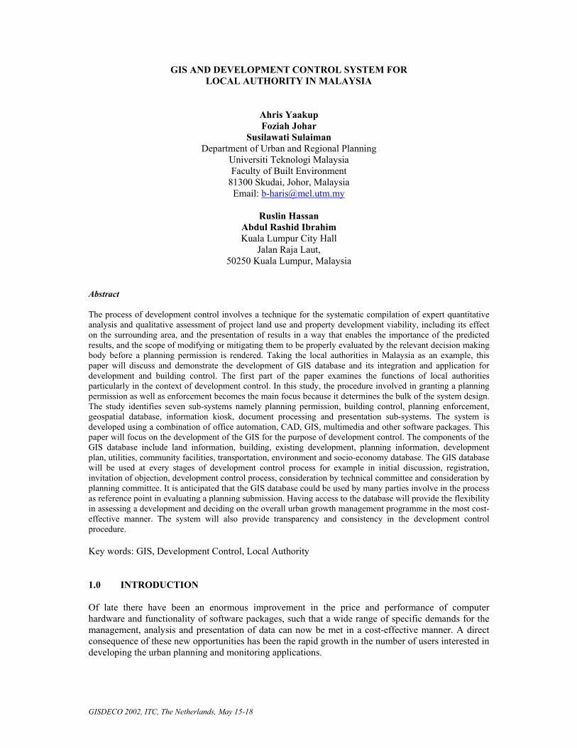
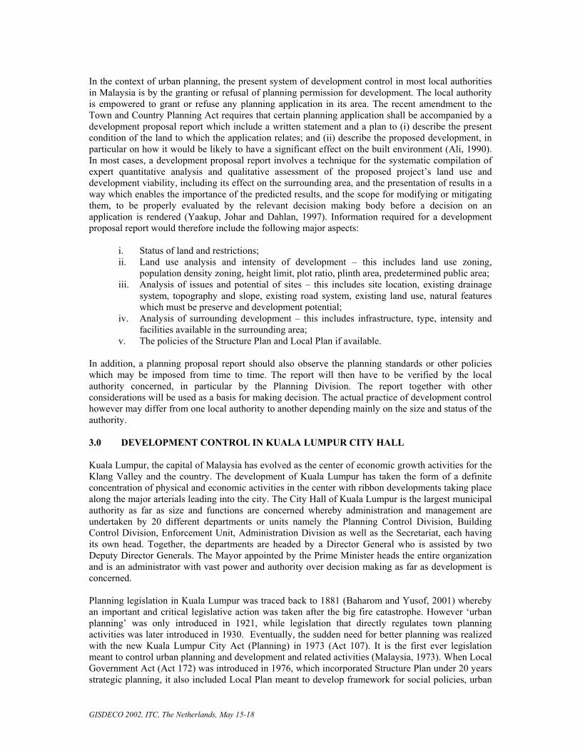
Planning Authorization Sub System The Planning Authorization Sub System operates to process planning applications, beginning from the submission of applications until the Policy Approval or Development Order Approval is issued. This sub system allows user to comply with the policies and spatial information while evaluating the planning applications and observe the planning requirements. Apart from saving time and space, it helps to minimize workload and reduce the use of paper. Besides, the data-sharing concept will minimize overlapping in the database development and thus, increase the quality and productivity of work. Building Control Sub System The Building Control Sub System is developed as a support for the building plan approval process. This sub system begins from the submission of building plan approval applications to the process of producing Certificate for Occupation. The features are similar to the Planning Authorization Sub System, which includes graphic and interactive interface and enables interaction between sub systems. This sub system will assist the Building Control Division in managing their activities. Enforcement Sub System The Enforcement Sub System is an aid for the Planning and Control Building Department in planning enforcement actions. This includes reports on site investigation, warning notices, control actions and reports on certain decision made by the Planning Control Building Department. This sub system also helps the public to file complaint and receive feedback form the local authority. Besides, it also facilitates the management in receiving investigation reports faster so as to act more effectively, systematically and immediately. Geospatial and Planning Information Sub System The Geospatial and Planning Information Sub System is developed to produce a complete spatial database along with the attribute data, which recorded the Development Order Approval, Building Order Approval, and Building Occupation Order. This sub system will aid the management to make decision more systematically and rationally. Some advantages of this system are that user can choose the type of information they want to retrieve. The query operation is based on lot, road, section and ‘mukim’. The implementation of this system involves the GIS database design, data collection, data conversion and updating of spatial and attribute data. The Development Control GIS provides support in terms of spatial data for other sub systems. Therefore, the interface program will link with the
Figure 1: Interface for Planning Authorization Sub System
Basic Information- Site PlanRegistration Counter
Planning Approval Registration Administration
GISDECO 2002, ITC, The Netherlands, May 15-18
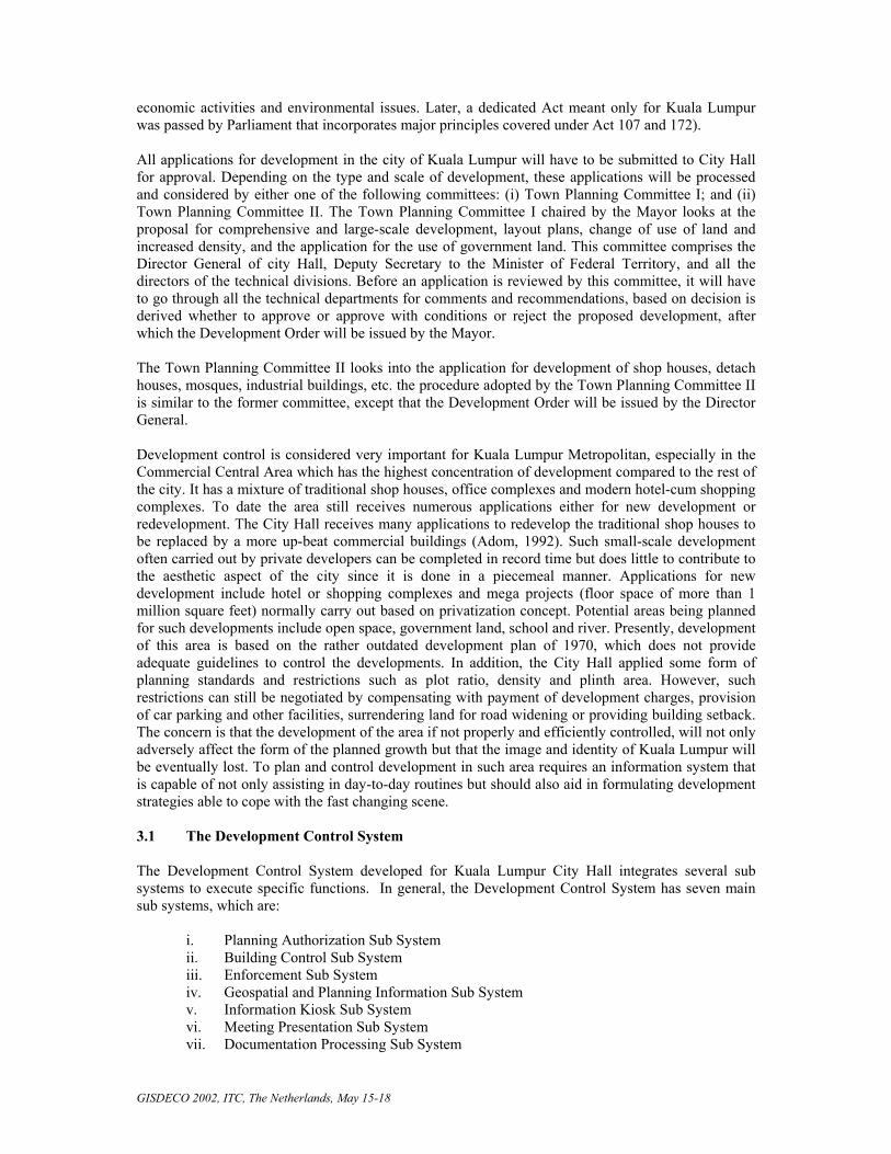
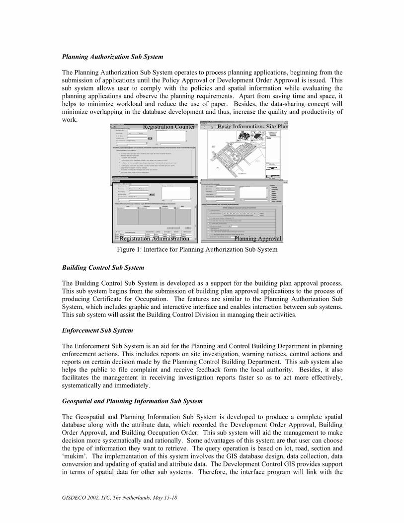
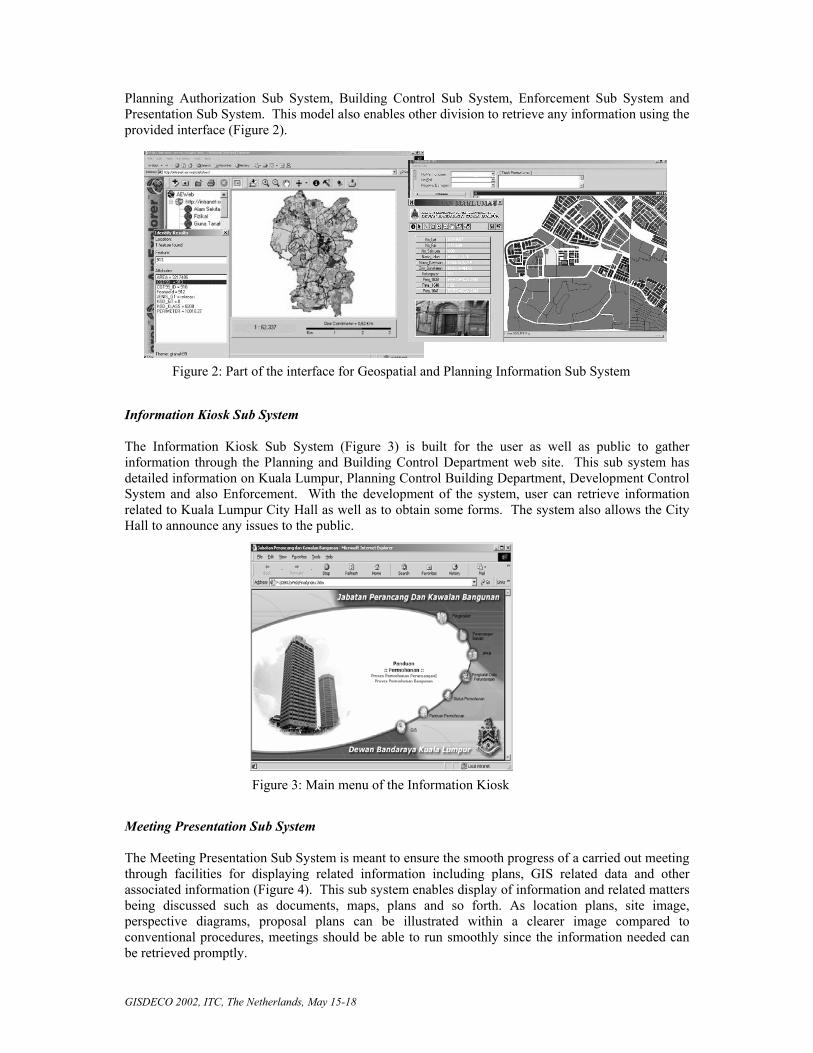
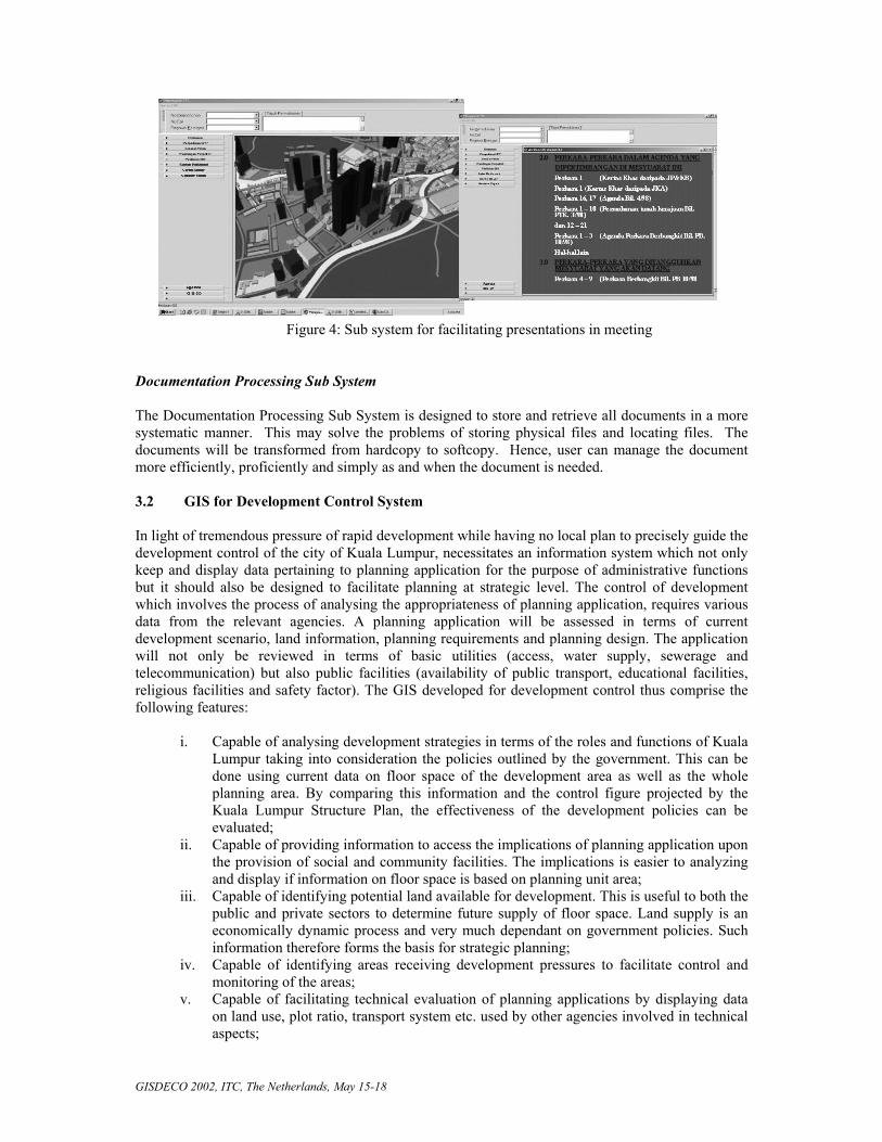
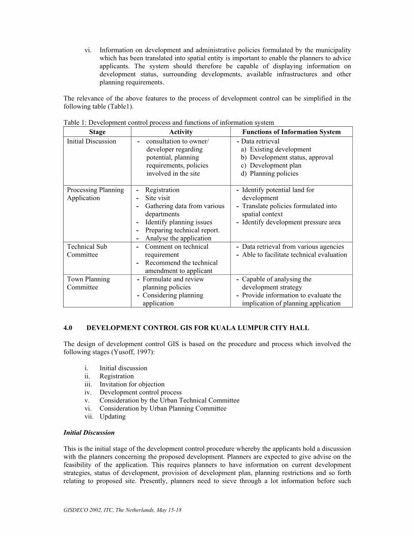
Planning Authorization Sub System, Building Control Sub System, Enforcement Sub System and Presentation Sub System. This model also enables other division to retrieve any information using the provided interface (Figure 2). Information Kiosk Sub System The Information Kiosk Sub System (Figure 3) is built for the user as well as public to gather information through the Planning and Building Control Department web site. This sub system has detailed information on Kuala Lumpur, Planning Control Building Department, Development Control System and also Enforcement. With the development of the system, user can retrieve information related to Kuala Lumpur City Hall as well as to obtain some forms. The system also allows the City Hall to announce any issues to the public. Meeting Presentation Sub System The Meeting Presentation Sub System is meant to ensure the smooth progress of a carried out meeting through facilities for displaying related information including plans, GIS related data and other associated information (Figure 4). This sub system enables display of information and related matters being discussed such as documents, maps, plans and so forth. As location plans, site image, perspective diagrams, proposal plans can be illustrated within a clearer image compared to conventional procedures, meetings should be able to run smoothly since the information needed can be retrieved promptly.
Figure 3: Main menu of the Information Kiosk
Figure 2: Part of the interface for Geospatial and Planning Information Sub System
GISDECO 2002, ITC, The Netherlands, May 15-18
Documentation Processing Sub System The Documentation Processing Sub System is designed to store and retrieve all documents in a more systematic manner. This may solve the problems of storing physical files and locating files. The documents will be transformed from hardcopy to softcopy. Hence, user can manage the document more efficiently, proficiently and simply as and when the document is needed. 3.2 GIS for Development Control System In light of tremendous pressure of rapid development while having no local plan to precisely guide the development control of the city of Kuala Lumpur, necessitates an information system which not only keep and display data pertaining to planning application for the purpose of administrative functions but it should also be designed to facilitate planning at strategic level. The control of development which involves the process of analysing the appropriateness of planning application, requires various data from the relevant agencies. A planning application will be assessed in terms of current development scenario, land information, planning requirements and planning design. The application will not only be reviewed in terms of basic utilities (access, water supply, sewerage and telecommunication) but also public facilities (availability of public transport, educational facilities, religious facilities and safety factor). The GIS developed for development control thus comprise the following features:
i. Capable of analysing development strategies in terms of the roles and functions of Kuala Lumpur taking into consideration the policies outlined by the government. This can be done using current data on floor space of the development area as well as the whole planning area. By comparing this information and the control figure projected by the Kuala Lumpur Structure Plan, the effectiveness of the development policies can be evaluated;
ii. Capable of providing information to access the implications of planning application upon the provision of social and community facilities. The implications is easier to analyzing and display if information on floor space is based on planning unit area;
iii. Capable of identifying potential land available for development. This is useful to both the public and private sectors to determine future supply of floor space. Land supply is an economically dynamic process and very much dependant on government policies. Such information therefore forms the basis for strategic planning;
iv. Capable of identifying areas receiving development pressures to facilitate control and monitoring of the areas;
v. Capable of facilitating technical evaluation of planning applications by displaying data on land use, plot ratio, transport system etc. used by other agencies involved in technical aspects;
Figure 4: Sub system for facilitating presentations in meeting
GISDECO 2002, ITC, The Netherlands, May 15-18
vi. Information on development and administrative policies formulated by the municipality which has been translated into spatial entity is important to enable the planners to advice applicants. The system should therefore be capable of displaying information on development status, surrounding developments, available infrastructures and other planning requirements.
The relevance of the above features to the process of development control can be simplified in the following table (Table1).
Table 1: Development control process and functions of information system
Stage Activity Functions of Information System Initial Discussion - consultation to owner/
developer regarding potential, planning requirements, policies involved in the site
- Data retrieval a) Existing development b) Development status, approval c) Development plan d) Planning policies
Processing Planning Application
- Registration - Site visit - Gathering data from various
departments - Identify planning issues - Preparing technical report. - Analyse the application
- Identify potential land for development
- Translate policies formulated into spatial context
- Identify development pressure area
Technical Sub Committee
- Comment on technical requirement
- Recommend the technical amendment to applicant
- Data retrieval from various agencies - Able to facilitate technical evaluation
Town Planning Committee
- Formulate and review planning policies
- Considering planning application
- Capable of analysing the development strategy
- Provide information to evaluate the implication of planning application
4.0 DEVELOPMENT CONTROL GIS FOR KUALA LUMPUR CITY HALL The design of development control GIS is based on the procedure and process which involved the following stages (Yusoff, 1997):
i. Initial discussion ii. Registration iii. Invitation for objection iv. Development control process v. Consideration by the Urban Technical Committee vi. Consideration by Urban Planning Committee vii. Updating
Initial Discussion This is the initial stage of the development control procedure whereby the applicants hold a discussion with the planners concerning the proposed development. Planners are expected to give advise on the feasibility of the application. This requires planners to have information on current development strategies, status of development, provision of development plan, planning restrictions and so forth relating to proposed site. Presently, planners need to sieve through a lot information before such
GISDECO 2002, ITC, The Netherlands, May 15-18
information can be obtained and this can be time consuming and tedious. At this stage, GIS can easily provide current development scenario and planners can anticipate the feasibility of the proposed development. Registration Every formal planning application is registered and reviewed by the Administration Section. Information from new application will be keyed in while spatial data in the application have to be consistent with the base map. Invitation for Objections Every application involving a change of use or density will have to go through the process of objection by neighboring landowners. The adjacent landowners to which the applications relates will have to be identified and notice served, inviting them to voice their objections to the proposed development, if any. At this stage, GIS should be able to list the adjacent landowners and capable of displaying the changing development scenarios of the related area to be used as a platform in considering the objections. Development Control Process Before the Technical Committee can decide on the application, planners have to inspect sites, verify the planning evaluation report submitted to them and prepare their own evaluation report. Such report can be done efficiently if the planners can get access to the relevant data, such as road systems, land status, etc. which, presently, are kept by various departments. GIS therefore have to be designed to enable easy access to those information and facilitate data analysis in determining the potential and constraints of the proposed development and enable to assist planners in generating development alternatives. Consideration by the Technical Committee At this stage, the Technical Committee which comprise of the representatives from the various departments will meet to review the proposed development. GIS should be able to display the relevant data from the various departments to facilitate those representatives to give their comments. GIS should be capable to indicate the implications of the proposed development and thus providing “early warning systems” if such development can adversely affect the city growth. For example, the proposed floor space should be able to indicate the traffic generated by the development, thus the committee can decide whether the current road system in that locality can accommodate the additional traffic. “What-if” analysis should also be part of the exercise to generate suitable development features based on different assumptions and criteria instead of rejecting the application outright. Consideration by the Town Planning Committee The Town Planning Committee plays a crucial role in the whole development control process. The Committee have to formulate development strategies and outline planning policies, taking into account the national policies and Cabinet directives which have to viewed in spatial contexts. They also reviewed development strategies contained in the Kuala Lumpur Structure Plan and policies that have been implemented. GIS should be able to give them adequate information to facilitate decision making to the proposed development. Updating GIS for development control will have to be maintained and planning information will have to be updated continuously. Once the decision is made, both the spatial and attribute database should be updated.
GISDECO 2002, ITC, The Netherlands, May 15-18
4.1 GIS Database Concept for Development Control
Information design must be based in the planning and development control process to be implemented. Based on conceptualized GIS application for development control, there will be 14 layers with the database. They are meant for analysis and conform to technical requirements for any planning applications. The main layers are:
• Base Map – coordinate, topography, map series, locational relationships and spatial
entity at land parcel level with assigned ID. • Present Development – present land use, soil slope and topography. • Building – condition, height, plinth, conservation and walkway. • Planning requirements – Local Plan, planning policy, land use, plot ratio,
development status. • Educational facilities – level of institution (kindergarten, primary, secondary,
tertiary). • Public safety – police beat, police station, fire station. • Community facilities – mosques, other religious places, civic hall, health clinic,
other community facilities • Road – present, proposed and dedicated. • Public transport – bus stop, bus station, taxi, light rail and commuter trail. • Land information – parcel no, district/village, section and status/conditions. • Utilities – overhead cable and transmission. • Telecommunication – cable line, public phone and transmitter • Water – pipe line and pump station. • Sewerage – sewage line, sewage tank and treatment plant.
4.2 GIS Applications for Planning Application Evaluation
Abiding Development Plans
Information on zonal development policies and administrative policies covering spatial matters are crucial to the planners involved. They need to be well informed before being approached by potential developer. Hence, providing these information under a planning information system helps both party. Additionally, GIS database can be incorporated to display and allow certain queries related to these policies. Hence, potential charges resulted from these policies amendments can be easily quantified and translated into dollar and cents immediately.
Identifying Development Stages and Pattern
Any given development pattern can be identifies from past data and development trend such as floor space and building height. This helps decision-makers identify development activities and potential development in any given site, making it easier to identify potential floor space on a studied area. This system is expected to provide visual display as well as describe potential alternatives to the selected planning process selected. This not only be convenient to planners and developers, but also reduce resistance among landowners involved. Visualization is definitely the main advantage in GIS applications where graphic can be manipulated to allow various alternatives evaluated on a fair ground.
Land Acquisition
Land acquisition for road expansion and special needs including schools and public safety facilities are cover under the National Land Code of 1993. GIS will help planners to project implications and
GISDECO 2002, ITC, The Netherlands, May 15-18
identify alternatives before such actions takes place. It can also help explain or inform current landowner of the scenario and overcome potential resistance to such action.
Planning Evaluation Report
GIS provides technical committees with various analyses on proposed development plan comprehensively. Critical evaluation can be easily done and time spent on various formulation and calculation can be reduced. The capability of carrying out planning analysis will help evaluation process to be completed in a quarter of the present time spent. Additionally, display of decision can be easily understood and thus better rectified by the potential developers and landowners.
Current and Vicinity Information
Present land use status has been among the top in the list of criteria considered by the Town Planning Committee. This information will assist in comparing present scenario with proposed development.
Building Design Suitability Evaluation (3-D View)
3-D analysis is now becoming a major application in GIS. It allows potential viewing on impacts not normally visible by naked eye. Thus, at any given scenario, this application definitely is a part of the development control application. It should be offered to any potential developers so as to give advanced information in the application process. 5.0 CONCLUSION Urban planning activities will continue to look for ways to hasten processing and transparency in all scope of work. In Kuala Lumpur, the need for faster and open planning approval process requires extensive and up to date data management. The City Hall may continue to integrate GIS as the core of the database system. Cooperation among various departments within City Hall can help reduce the development cost and time required to implement successful GIS. However, there is still a need to educate and change of thinking among planning staffs. In time, GIS database will soon be overwhelmed with the size of in-house data. Be it spatial or attribute, both need dedicated management approach in handling them. Data sharing must always be considered and encouraged given the interdependence of various departments within and beyond the City Hall. Without which, it will not achieve its main objective to create an efficient and transparent service to the public and GIS will remain as part of exhibition materials and tools for map production only. Acknowledgement The authors would like to thank the Kuala Lumpur City Hall and University of Technology Malaysia for allowing and granting permission to present this paper. REFERENCES Adom, R., 1992. Peraturan mengemukakan permohonan perancangan ke Unit Pengekalan dan Seni Bandar. Report of Department of Planning and Building Control. Unpublished, Kuala Lumpur City Hall. Ali, R.M., 1990. Development control guidelines – Managing the physical development of the Federal Territory. Proceedings of the National Conference on the Challenge and Opportunities in Urban Development, Kuala Lumpur.
GISDECO 2002, ITC, The Netherlands, May 15-18
Baharom, A. and Yusof, I.M., 2001. GIS applications in development control process: Local government in Malaysia. Paper presented at Middle States Division of the Association of American Geographers Annual Meeting, Brookville, New York. Malaysia, 1973. Akta (Perancangan) Bandaraya Kuala Lumpur, 1973, Akta 107. Jabatan Percetakan Negara, Kuala Lumpur. Malaysia, 1976. Akta Perancangan Bandar dan Desa, 1976, Akta 172. Jabatan Percetakan Negara, Kuala Lumpur. Scholten, H.J. and Padding, P., 1990. Working with Geographical Information System in policy environment, Environment and Planning B: Planning and Design, Vol. 17, pp. 405-416. Yaakup, A.B., Ibrahim, M. and Johar, F., 1995. Incorporating GIS into sustainable urban and regional planning: The Malaysian case. Paper presented at the GeoInformatic’95 Hong Kong: International Symposium on Remote Sensing, Geographical Information Systems and Global Positioning Systems in Sustainable Development and Environmental Monitoring, Hong Kong. Yaakup, A.B., Johar, F. and Dahlan, N.A., 1994. GIS and Decision Support Systems for local authority in Malaysia. Proceedings of the International Conference on Design and Decision Support Systems in Architecture and Urban Planning, Vaals, The Netherlands. Yaakup, A.B., Johar, F. and Yusof, I.M, 1997. Development Control System and GIS for local authority in Malaysia: A case of Kuala Lumpur City Hall. Proceedings of the 5th International Conference on Computers in Urban Planning and Urban Management, Bombay, India. Yusoff, I.M., 1997. Guna pakai GIS untuk kawalan pembangunan, Kajian kes: Kawasan Perdagangan Pusat Kuala Lumpur. Unpublished M.Sc Dissertation, Department of Urban and Regional Planning, University of Technology Malaysia.


![Dobieranie preparatów do pielęgnacji włosów 514[02].Z3 · 514[02].Z3.02 Planowanie zabiegów pielęgnacyjnych 514[02].Z3.03 Dobieranie preparatów do pielęgnacji włosów 514[02].Z3.04](https://img.pdfslide.tips/doc/110x75/5f0684097e708231d4186073/dobieranie-preparatw-do-pielgnacji-wosw-51402z3-51402z302-planowanie.jpg)