Embed Size (px)
Citation preview
Department of Civil and Environmental Engineering
Gordon E. Clark and Dr. Richard N. Palmer
Hydrologic Modeling at Road-Stream Crossings:
Challenges and approaches in estimating flood flows at ungauged locations in the Northeast region
2 Department of Civil and Environmental Engineering
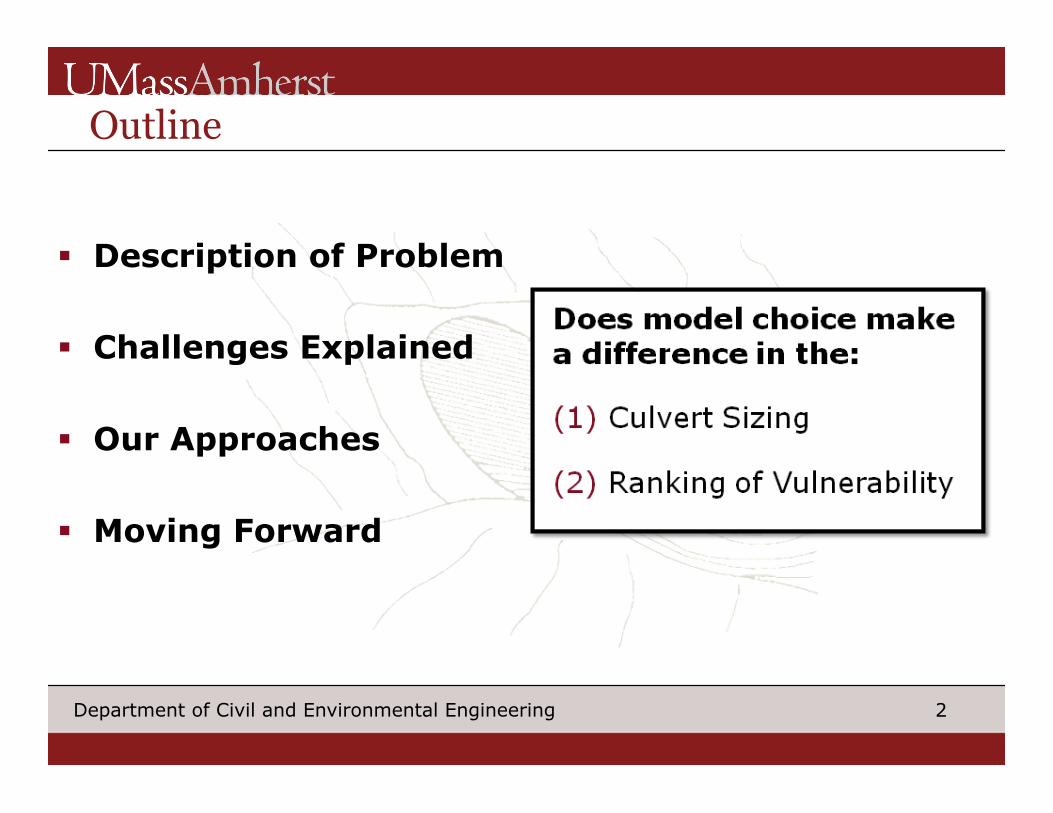
Outline
§ Description of Problem
§ Challenges Explained
§ Our Approaches
§ Moving Forward
Does model choice make a difference in the:
(1) Culvert Sizing
(2) Ranking of Vulnerability
3 Department of Civil and Environmental Engineering
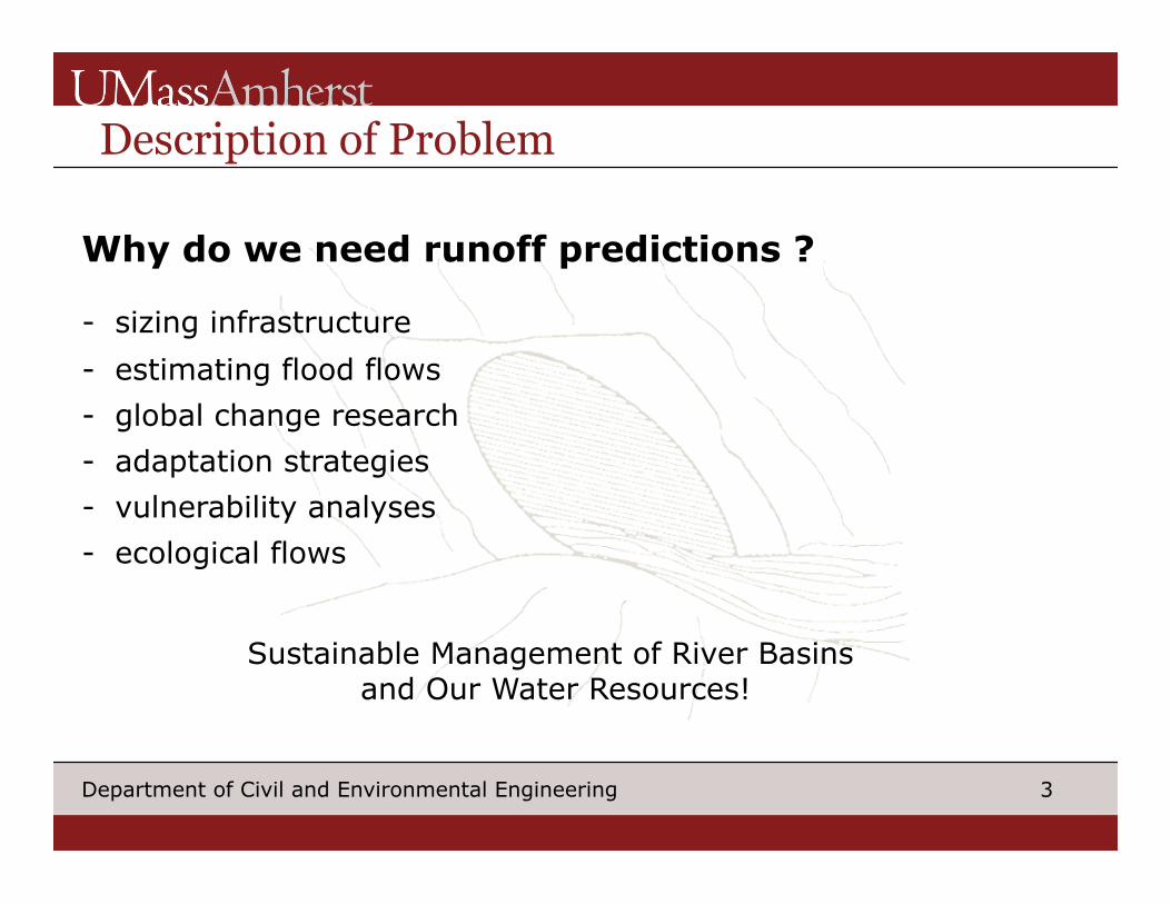
Description of Problem
Why do we need runoff predictions ?
- sizing infrastructure
- estimating flood flows
- global change research
- adaptation strategies
- vulnerability analyses
- ecological flows
Sustainable Management of River Basins and Our Water Resources!
4 Department of Civil and Environmental Engineering
Description of Problem
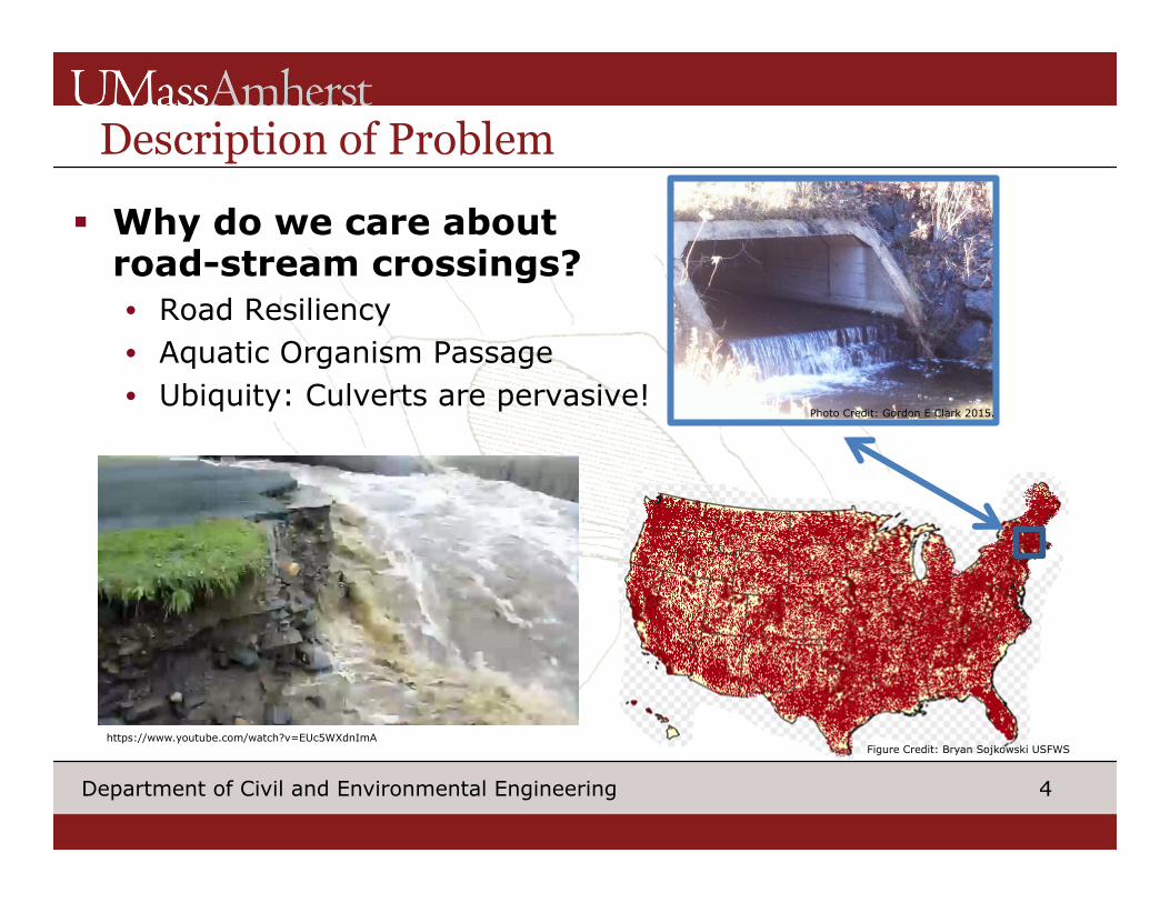
§ Why do we care about road-stream crossings? • Road Resiliency • Aquatic Organism Passage • Ubiquity: Culverts are pervasive!
Photo Credit: Gordon E Clark 2015.
https://www.youtube.com/watch?v=EUc5WXdnImA Figure Credit: Bryan Sojkowski USFWS
5 Department of Civil and Environmental Engineering
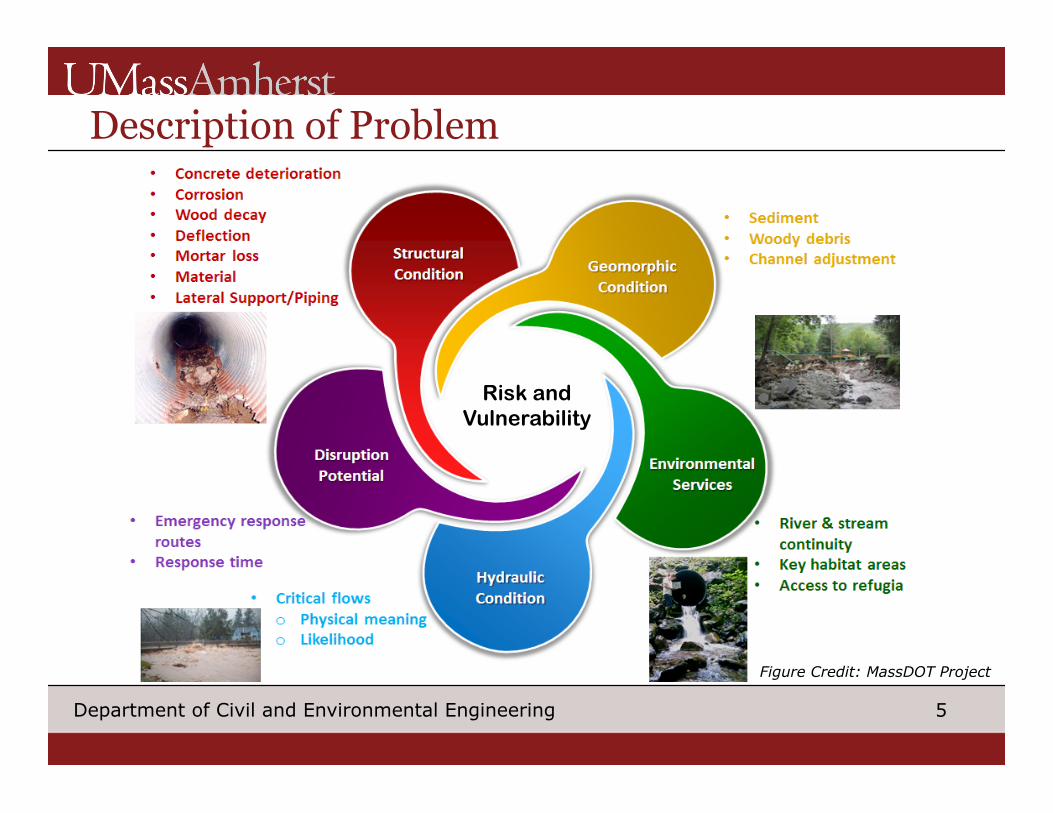
Risk and Vulnerability
Description of Problem
Figure Credit: MassDOT Project
6 Department of Civil and Environmental Engineering
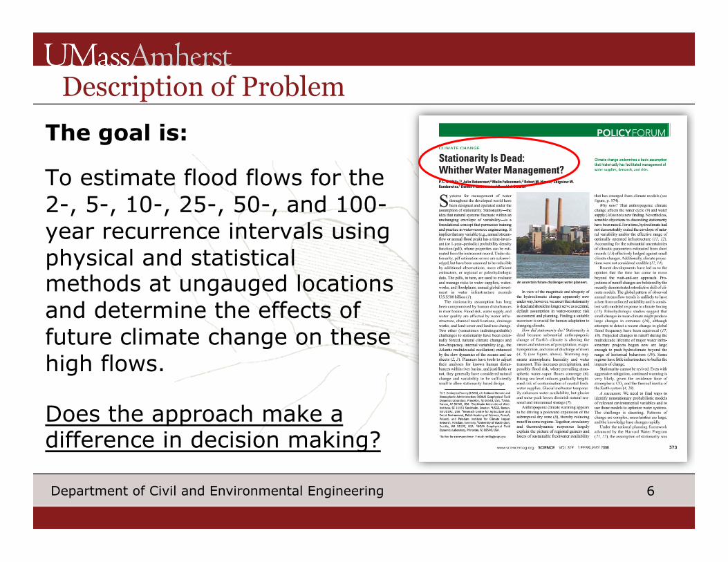
Description of Problem The goal is:
To estimate flood flows for the 2-, 5-, 10-, 25-, 50-, and 100-year recurrence intervals using physical and statistical methods at ungauged locations and determine the effects of future climate change on these high flows.
Does the approach make a difference in decision making?
7 Department of Civil and Environmental Engineering
Description of Problem
(1) Use the Deerfield River Basin as a pilot study to assess road-stream crossing hydrologic/ hydraulic vulnerability
(2) Apply methods to assess vulnerability at a broader regional scale
8 Department of Civil and Environmental Engineering
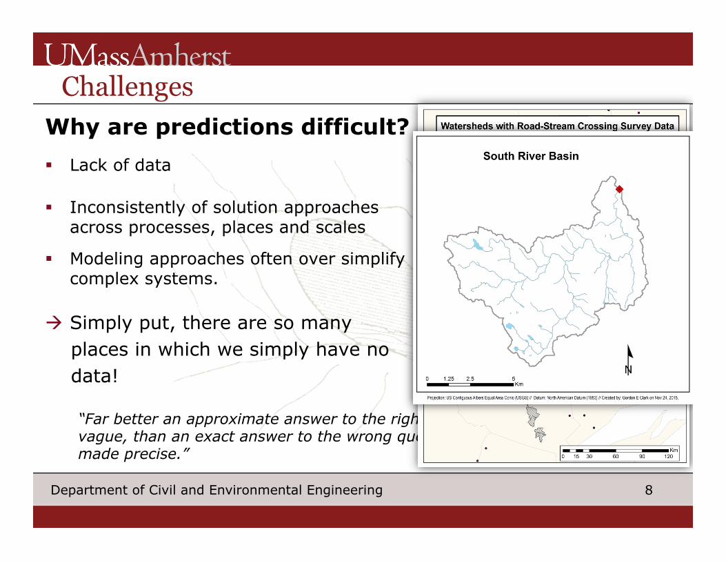
Challenges Why are predictions difficult? § Lack of data
§ Inconsistently of solution approaches across processes, places and scales
§ Modeling approaches often over simplify complex systems.
à Simply put, there are so many places in which we simply have no data!
“Far better an approximate answer to the right question , which is often vague, than an exact answer to the wrong question, which can always be made precise.” - John W. Tukey, 1962
9 Department of Civil and Environmental Engineering
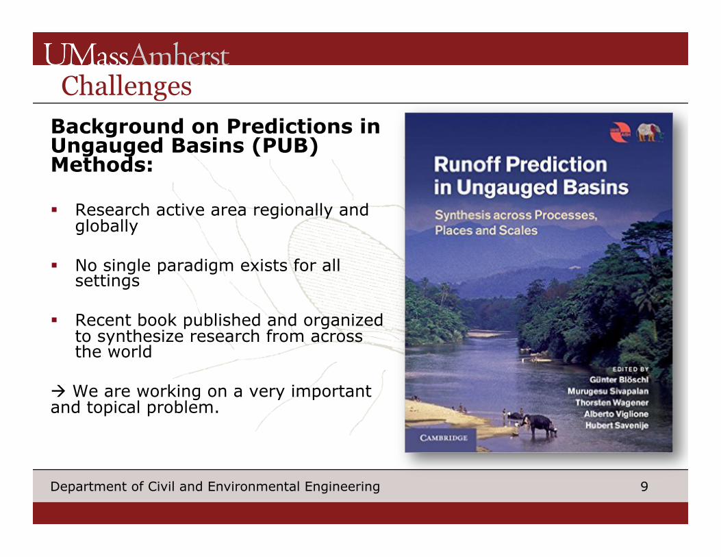
Challenges Background on Predictions in Ungauged Basins (PUB) Methods: § Research active area regionally and
globally § No single paradigm exists for all
settings
§ Recent book published and organized to synthesize research from across the world
à We are working on a very important and topical problem.
10 Department of Civil and Environmental Engineering
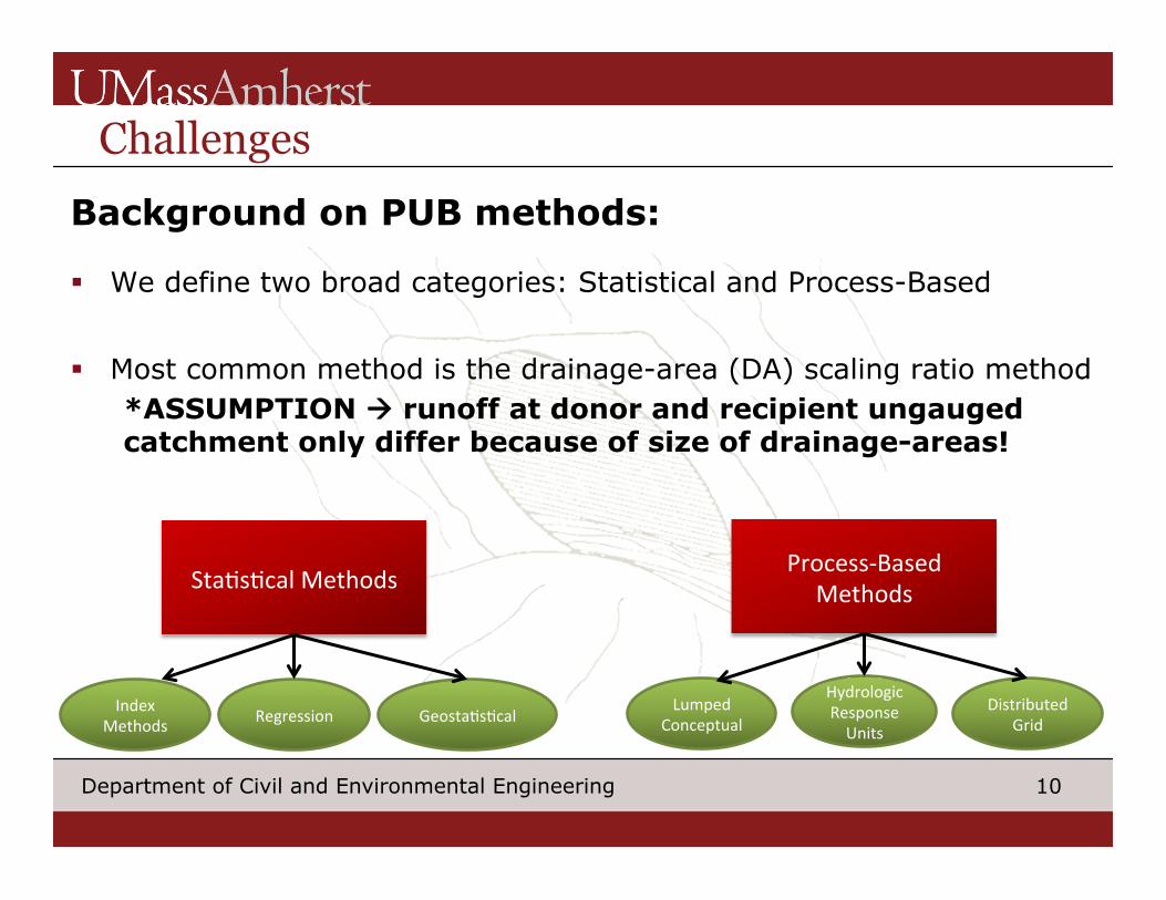
Challenges Background on PUB methods:
§ We define two broad categories: Statistical and Process-Based
§ Most common method is the drainage-area (DA) scaling ratio method *ASSUMPTION à runoff at donor and recipient ungauged catchment only differ because of size of drainage-areas!
Sta$s$calMethodsProcess-Based
Methods
IndexMethods Regression Geosta$s$cal
LumpedConceptual
HydrologicResponseUnits
DistributedGrid
11 Department of Civil and Environmental Engineering
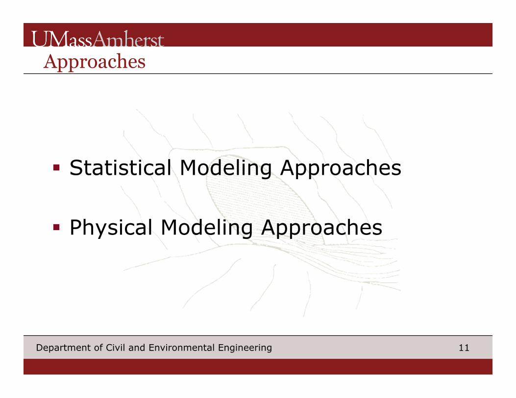
Approaches
§ Statistical Modeling Approaches § Physical Modeling Approaches
12 Department of Civil and Environmental Engineering
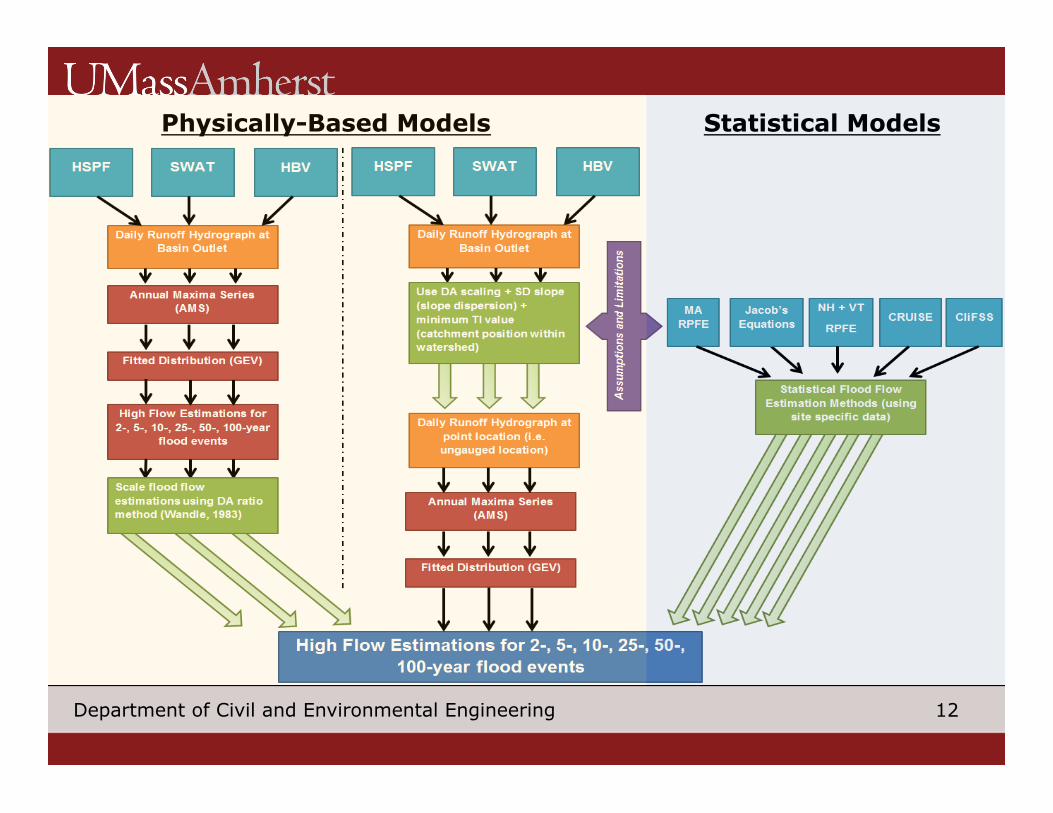
Physically-Based Models Statistical Models
13 Department of Civil and Environmental Engineering
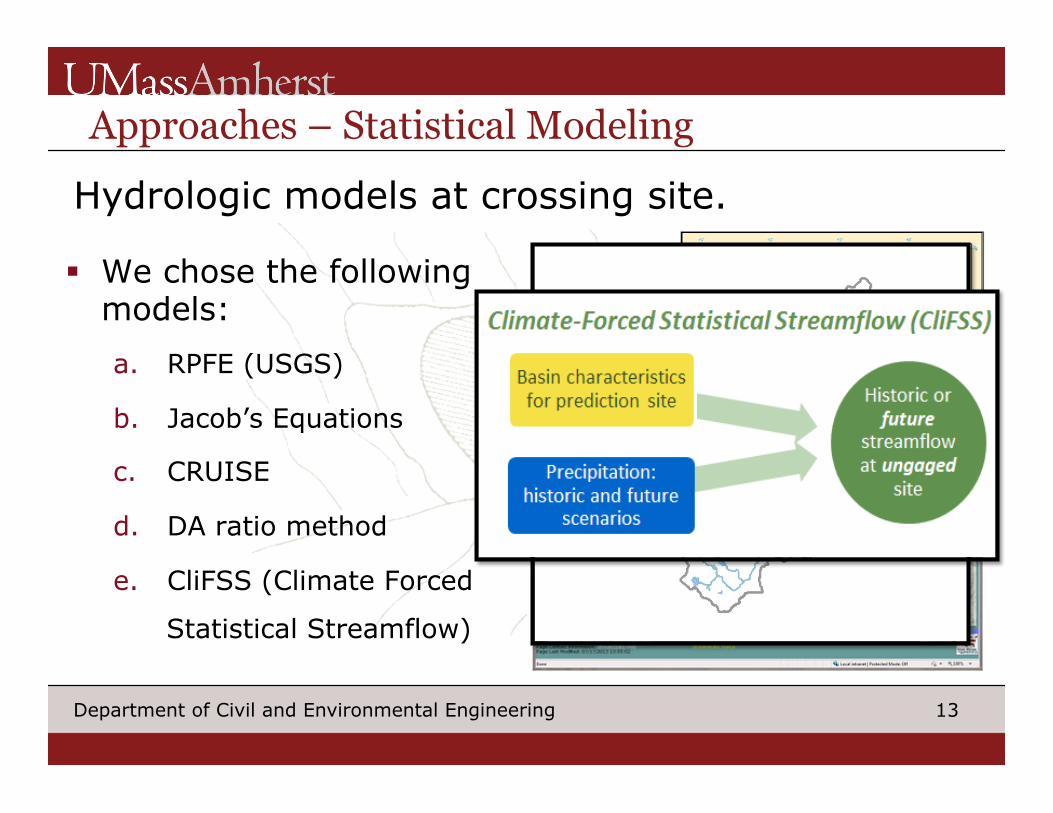
Approaches – Statistical Modeling
§ We chose the following models: a. RPFE (USGS)
b. Jacob’s Equations
c. CRUISE
d. DA ratio method
e. CliFSS (Climate Forced
Statistical Streamflow)
Hydrologic models at crossing site.
14 Department of Civil and Environmental Engineering
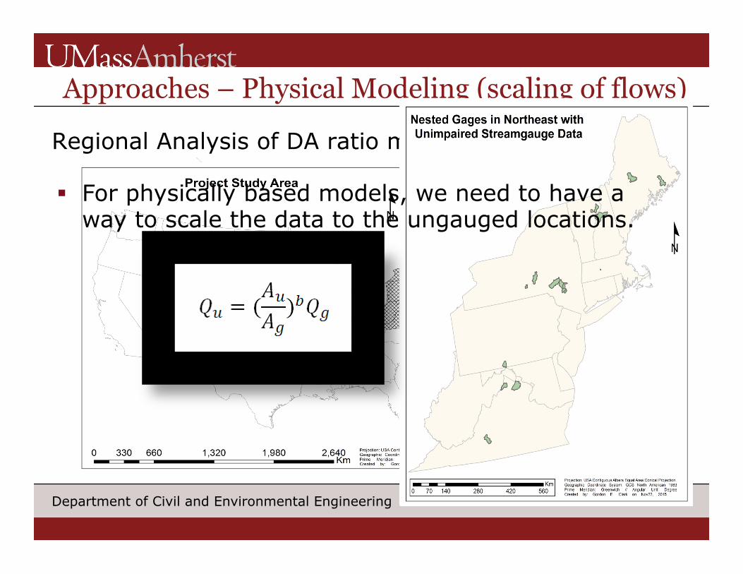
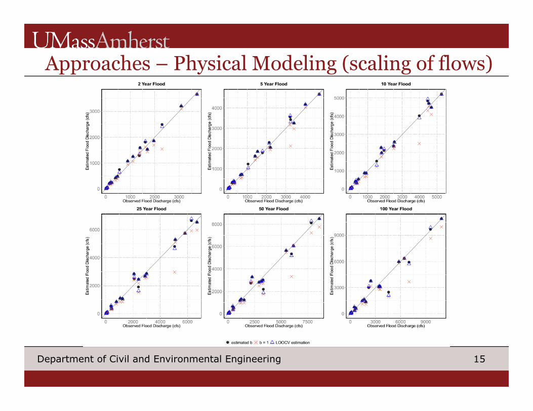
Approaches – Physical Modeling (scaling of flows)
Regional Analysis of DA ratio method
§ For physically based models, we need to have a way to scale the data to the ungauged locations.
15 Department of Civil and Environmental Engineering
Approaches – Physical Modeling (scaling of flows)
16 Department of Civil and Environmental Engineering
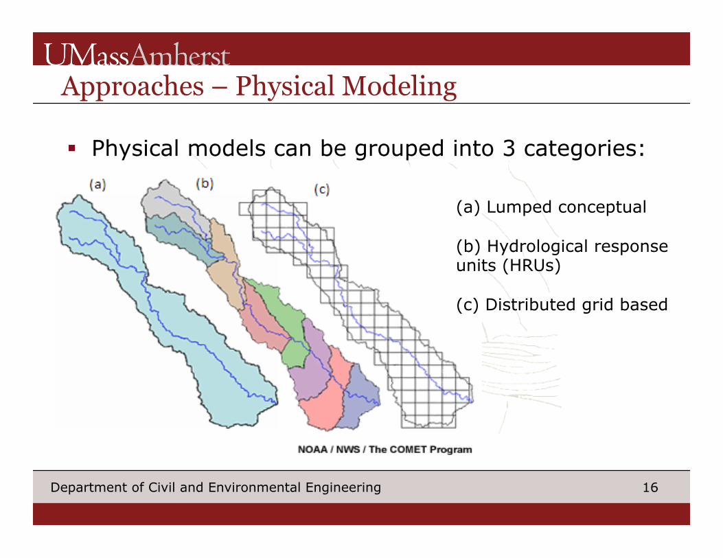
Approaches – Physical Modeling
§ Physical models can be grouped into 3 categories:
(a) Lumped conceptual (b) Hydrological response units (HRUs) (c) Distributed grid based
17 Department of Civil and Environmental Engineering
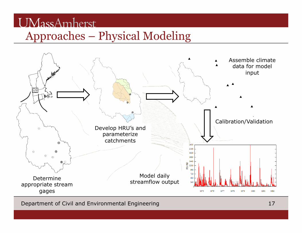
Approaches – Physical Modeling
Determine appropriate stream
gages
Develop HRU’s and parameterize catchments
Assemble climate data for model
input
Calibration/Validation
Model daily streamflow output
18 Department of Civil and Environmental Engineering
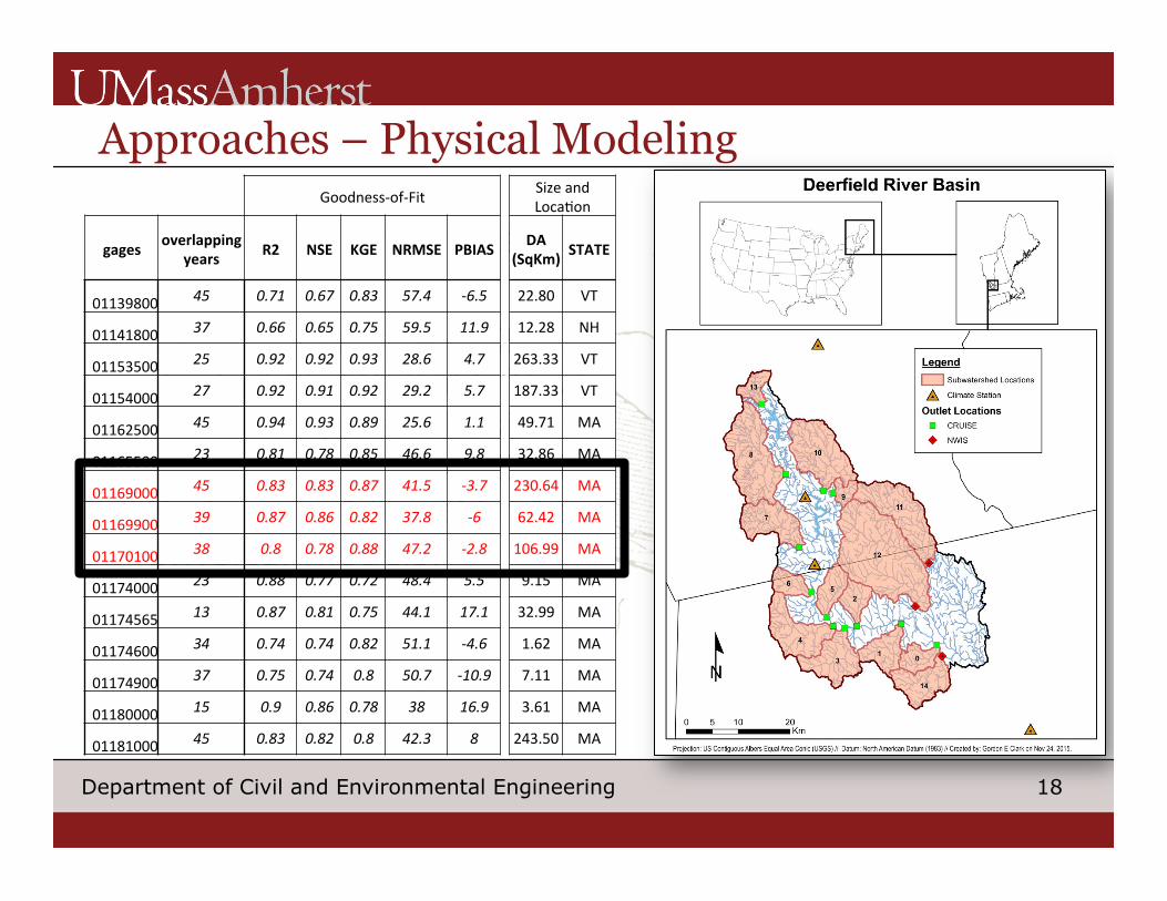
Approaches – Physical Modeling
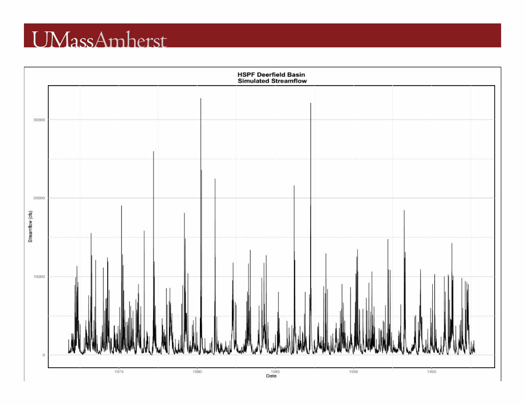
For Deerfield River Basin § CRUISE (Archfield, 2013)
is used to estimate flows in the larger subbasins in the Deerfield River Basin that is used to calibrate physical models.
Goodness-of-Fit SizeandLoca$on
gages overlappingyears R2 NSE KGE NRMSE PBIAS DA
(SqKm) STATE
01139800 45 0.71 0.67 0.83 57.4 -6.5 22.80 VT
01141800 37 0.66 0.65 0.75 59.5 11.9 12.28 NH
01153500 25 0.92 0.92 0.93 28.6 4.7 263.33 VT
01154000 27 0.92 0.91 0.92 29.2 5.7 187.33 VT
01162500 45 0.94 0.93 0.89 25.6 1.1 49.71 MA
01165500 23 0.81 0.78 0.85 46.6 9.8 32.86 MA
01169000 45 0.83 0.83 0.87 41.5 -3.7 230.64 MA
01169900 39 0.87 0.86 0.82 37.8 -6 62.42 MA
01170100 38 0.8 0.78 0.88 47.2 -2.8 106.99 MA
01174000 23 0.88 0.77 0.72 48.4 5.5 9.15 MA
01174565 13 0.87 0.81 0.75 44.1 17.1 32.99 MA
01174600 34 0.74 0.74 0.82 51.1 -4.6 1.62 MA
01174900 37 0.75 0.74 0.8 50.7 -10.9 7.11 MA
01180000 15 0.9 0.86 0.78 38 16.9 3.61 MA
01181000 45 0.83 0.82 0.8 42.3 8 243.50 MA
19 Department of Civil and Environmental Engineering
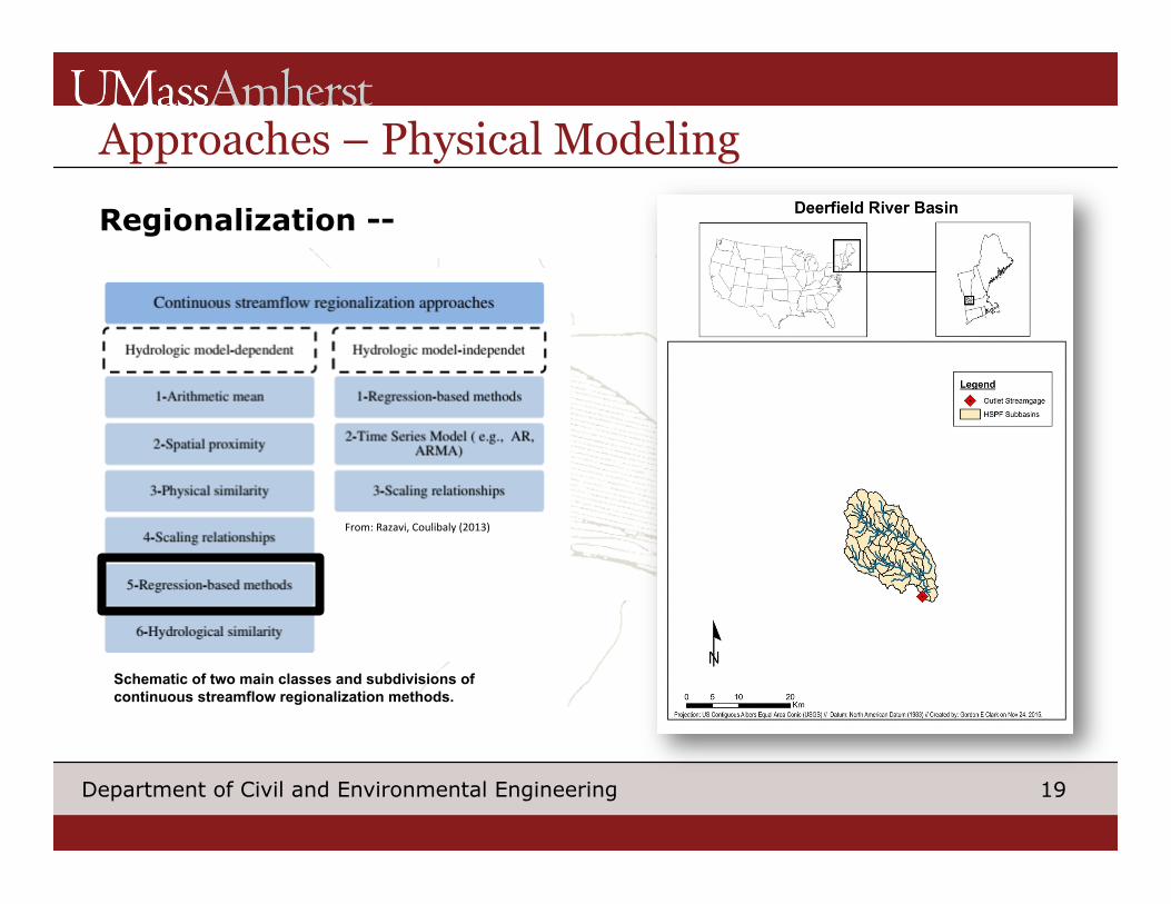
Approaches – Physical Modeling
From:Razavi,Coulibaly(2013)
Schematic of two main classes and subdivisions of continuous streamflow regionalization methods.
Regionalization --
20 Department of Civil and Environmental Engineering
Approaches – Physical Modeling
21 Department of Civil and Environmental Engineering
Moving Forward
To complete over next 3 months –
§ Finish applying methods to Deerfield and compare models
§ Take approaches that perform the best and apply to broader Northeast region
22 Department of Civil and Environmental Engineering
Moving Forward
Does model choice make a difference in the:
(1) Culvert Sizing
(2) Ranking of Vulnerability
Comparing hydrological modeling approaches where we have data.
23 Department of Civil and Environmental Engineering
Thank you.
24 Department of Civil and Environmental Engineering
25 Department of Civil and Environmental Engineering
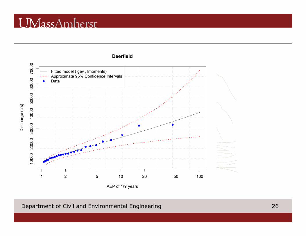
26 Department of Civil and Environmental Engineering
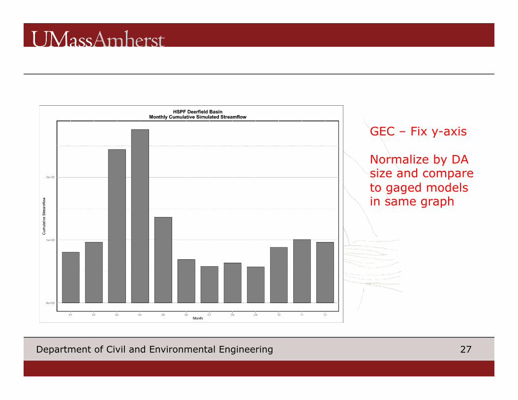
27 Department of Civil and Environmental Engineering
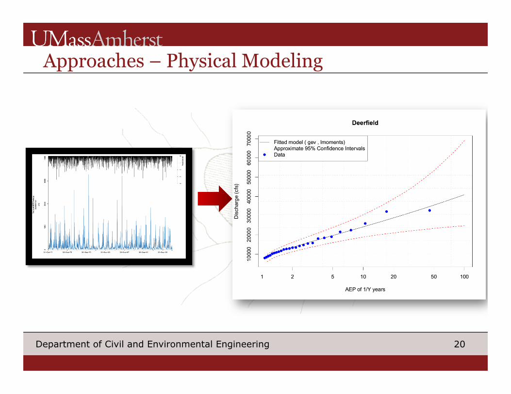
GEC – Fix y-axis Normalize by DA size and compare to gaged models in same graph
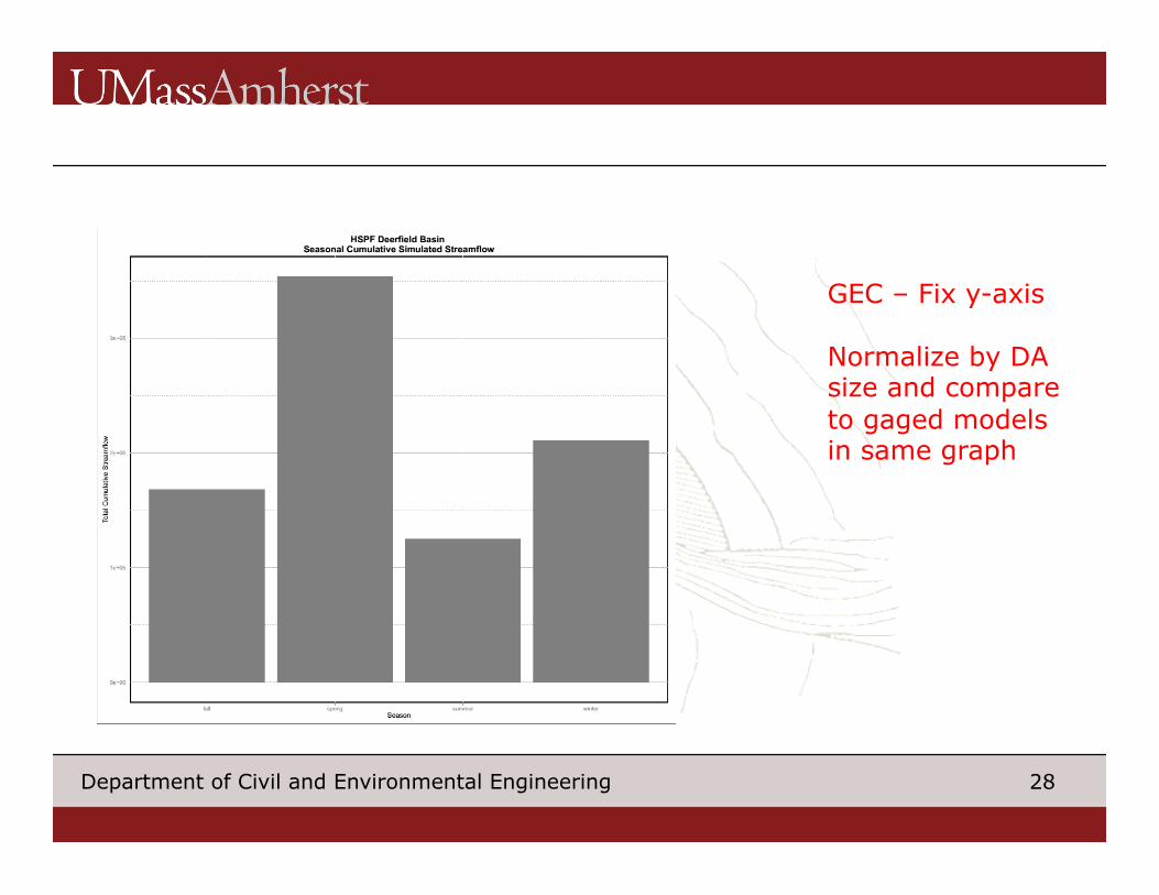
28 Department of Civil and Environmental Engineering
GEC – Fix y-axis Normalize by DA size and compare to gaged models in same graph
29 Department of Civil and Environmental Engineering
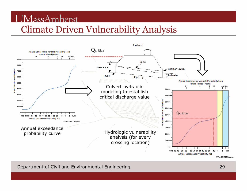
Climate Driven Vulnerability Analysis
Qcritical
Culvert hydraulic modeling to establish
critical discharge value
Qcritical
Hydrologic vulnerability analysis (for every crossing location)
Annual exceedance probability curve
30 Department of Civil and Environmental Engineering
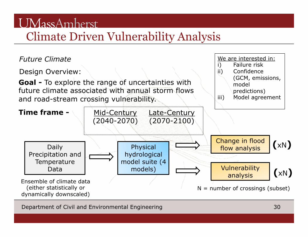
Climate Driven Vulnerability Analysis
Future Climate
Design Overview:
Mid-Century (2040-2070)
Late-Century (2070-2100)
Goal - To explore the range of uncertainties with future climate associated with annual storm flows and road-stream crossing vulnerability.
Time frame -
Daily Precipitation and
Temperature Data
Physical hydrological
model suite (4 models)
Change in flood flow analysis
Vulnerability analysis
(xN)
(xN) N = number of crossings (subset)
Ensemble of climate data (either statistically or
dynamically downscaled)
We are interested in: i) Failure risk ii) Confidence
(GCM, emissions, model predictions)
iii) Model agreement
31 Department of Civil and Environmental Engineering
Climate Driven Vulnerability Analysis
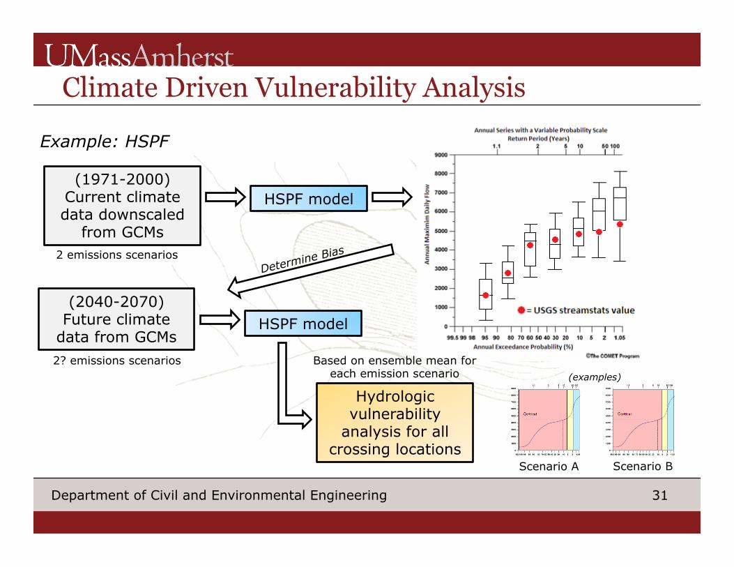
Example: HSPF
(1971-2000) Current climate data downscaled
from GCMs 2 emissions scenarios
HSPF model
(2040-2070) Future climate
data from GCMs 2? emissions scenarios
Determine Bias
HSPF model
Hydrologic vulnerability
analysis for all crossing locations
Based on ensemble mean for each emission scenario
Scenario A Scenario B
(examples)
32 Department of Civil and Environmental Engineering
Climate Driven Vulnerability Analysis
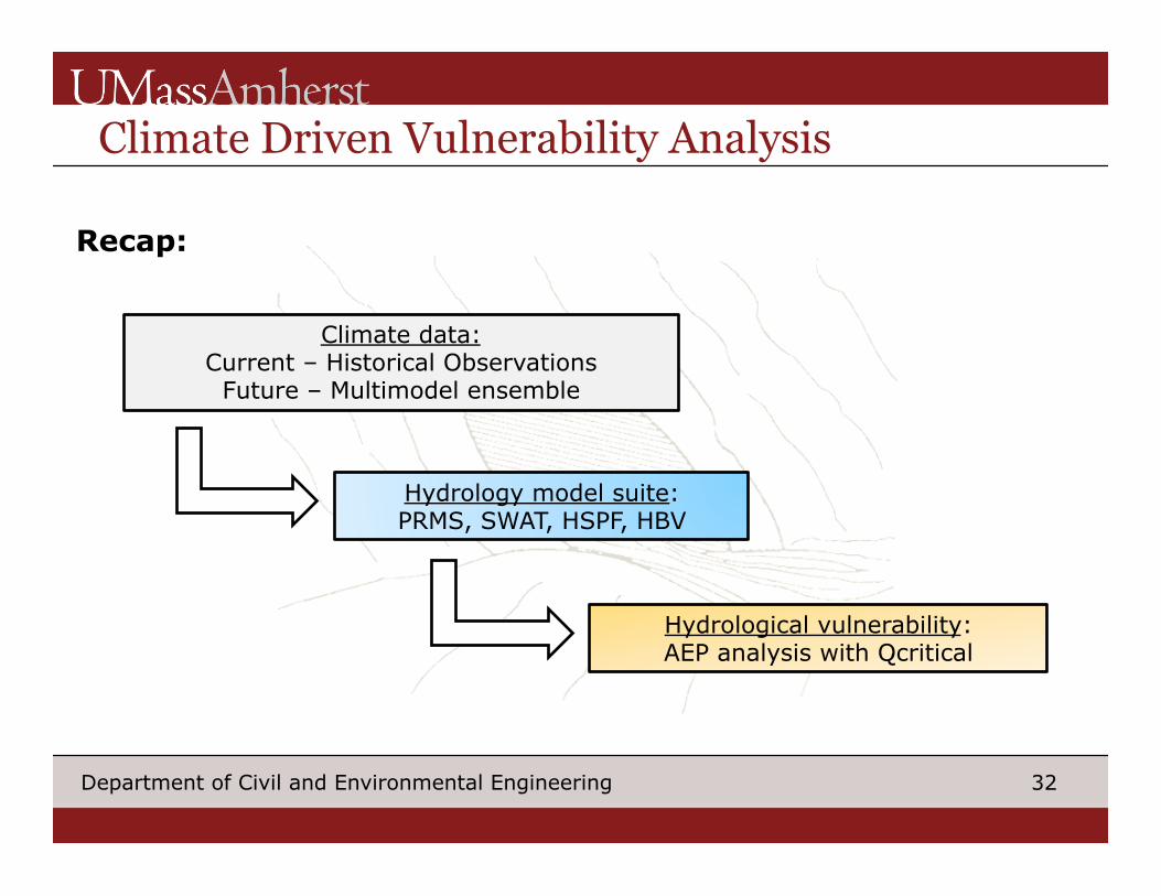
Climate data: Current – Historical Observations
Future – Multimodel ensemble
Hydrology model suite: PRMS, SWAT, HSPF, HBV
Hydrological vulnerability: AEP analysis with Qcritical
Recap: