Embed Size (px)
Citation preview
1
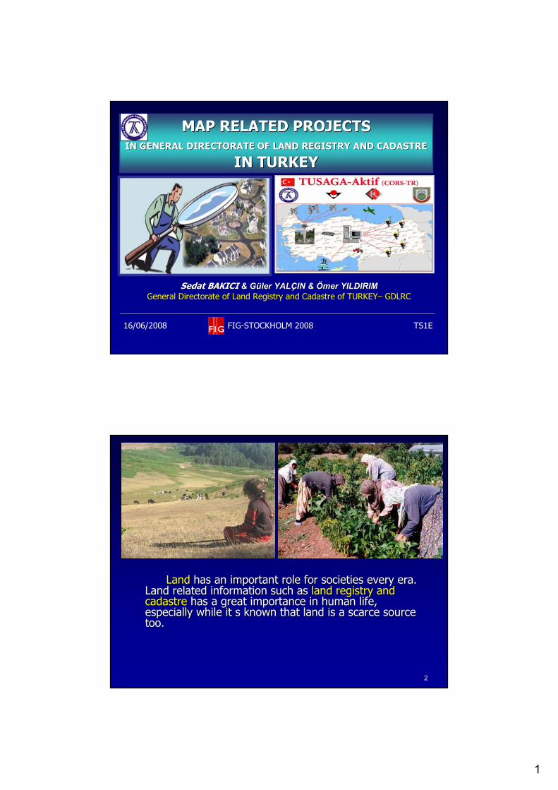
MAP RELATED PROJECTS MAP RELATED PROJECTS IN GENERAL DIRECTORATE OF LAND REGISTRY AND CADASTREIN GENERAL DIRECTORATE OF LAND REGISTRY AND CADASTRE
IN TURKEYIN TURKEY
Sedat BAKICI Sedat BAKICI && GGüüler YALler YALÇÇIN & IN & ÖÖmer YILDIRIMmer YILDIRIMGeneral Directorate of Land Registry and CadastreGeneral Directorate of Land Registry and Cadastre of TURKEYof TURKEY–– GDLRC GDLRC
16/06/2008 FIG-STOCKHOLM 2008 TS1E
22
LandLand has an important role for societies every era. has an important role for societies every era. Land related information Land related information suchsuch as as land registry and land registry and cadastrecadastre has a great importance in has a great importance in humanhuman life, life, especially while it s known that land is a scarce source especially while it s known that land is a scarce source too. too.
2
33
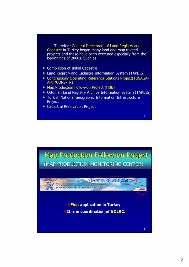
Therefore Therefore General Directorate of Land Registry and General Directorate of Land Registry and CadastreCadastre in Turkey began many land and map related in Turkey began many land and map related projects and these have been executed especially from the projects and these have been executed especially from the beginnings of 2000sbeginnings of 2000s. S. Suchuch asas; ;
•• CompletionCompletion of of InitialInitial CadastreCadastre•• Land Registry and Cadastre Information SystemLand Registry and Cadastre Information System (TAKBIS)(TAKBIS)•• Continuously Operating Reference Stations ProjectContinuously Operating Reference Stations Project(TUSAGA(TUSAGA--
Aktif/CORSAktif/CORS--TR)TR)•• MapMap ProductionProduction FollowFollow--on Projecton Project (HBB)(HBB)•• OttomanOttoman Land Land RegistryRegistry Archive Information SystemArchive Information System (TARBIS)(TARBIS)•• Turkish National Geographic Information Turkish National Geographic Information InfrastructureInfrastructure
ProjectProject•• Cadastral Renovation ProjectCadastral Renovation Project
44
MapMap ProductionProduction FollowFollow--on Projecton Project(MAP PRODUCTION MONITORING CENTER)(MAP PRODUCTION MONITORING CENTER)
First application in Turkey.
It is in coordination of GDLRC.
3
55
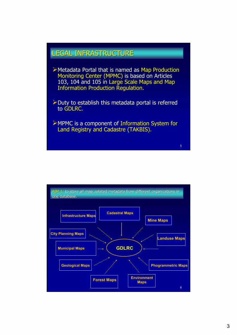
Metadata Portal Metadata Portal thatthat is is namednamed asas Map Production Map Production MonitoringMonitoring Center (MPMC)Center (MPMC) is based on Articles is based on Articles 103, 104 and103, 104 and 105 in 105 in Large Scale Maps and Map Large Scale Maps and Map InformationInformation PProductionroduction RRegulationegulation..
DDutyuty to establish this metadata portal is referred to establish this metadata portal is referred toto GDLRC.GDLRC.
MPMC is MPMC is a a componentcomponent ofof Information SystemInformation System for for Land Registry and Cadastre (TAKBIS).Land Registry and Cadastre (TAKBIS).
LEGAL INFRASTRUCTURELEGAL INFRASTRUCTURE
66
Cadastral Maps
Landuse Maps
Forest Maps
Phogrammetric MapsGeological Maps
City Planning Maps
Municipal Maps
Mine MapsInfrastructure Maps
GDLRC
EnvironmentMaps
AIM 1: AIM 1: toto storestore allall mapmap__relatedrelated metadatametadata fromfrom differentdifferent organizationsorganizations in in oneone databasedatabase..
4
77
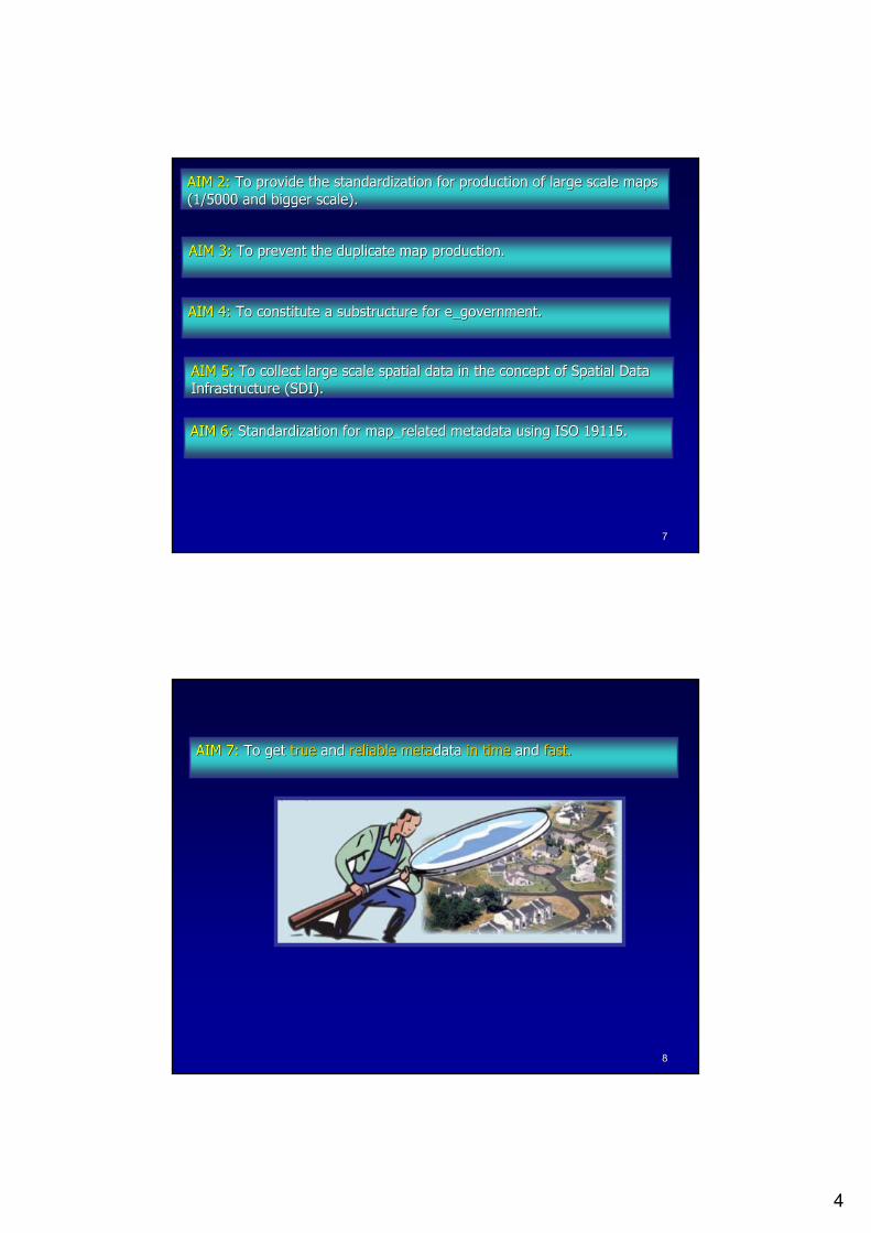
AIM 2:AIM 2: To provide the standardization To provide the standardization forfor productionproduction of of largelarge scalescale mapsmaps(1/5000 (1/5000 andand biggerbigger scalescale).).
AIM AIM 33:: ToTo preventprevent thethe duplicateduplicate mapmap productionproduction..
AIM AIM 55:: To To collectcollect largelarge scalescale spatialspatial data in data in thethe conceptconcept of of SpatialSpatial Data Data InfrastructureInfrastructure (SDI).(SDI).
AIM AIM 66:: StandardizationStandardization forfor mapmap__relatedrelated metadatametadata usingusing ISO 19115. ISO 19115.
AIM AIM 44:: To To constituteconstitute a a substructuresubstructure forfor e_e_governmentgovernment..
88
AIM AIM 77:: ToTo getget truetrue andand reliablereliable metametadatadata in timein time andand fastfast..
5
99
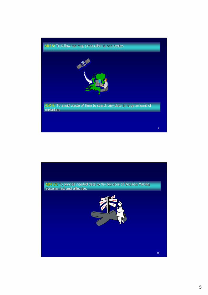
AIM AIM 88:: ToTo followfollow thethe mapmap productionproduction in in oneone centercenter..
AIM AIM 99:: ToTo avoidavoid wastewaste of time of time toto searchsearch anyany data in data in hugehuge amountamount of of metadatametadata
1010
AIM AIM 1010:: ToTo provideprovide neededneeded data data toto thethe ServicesServices of of DecisionDecision MakingMakingSystemsSystems fastfast andand effectiveeffective..
6
1111
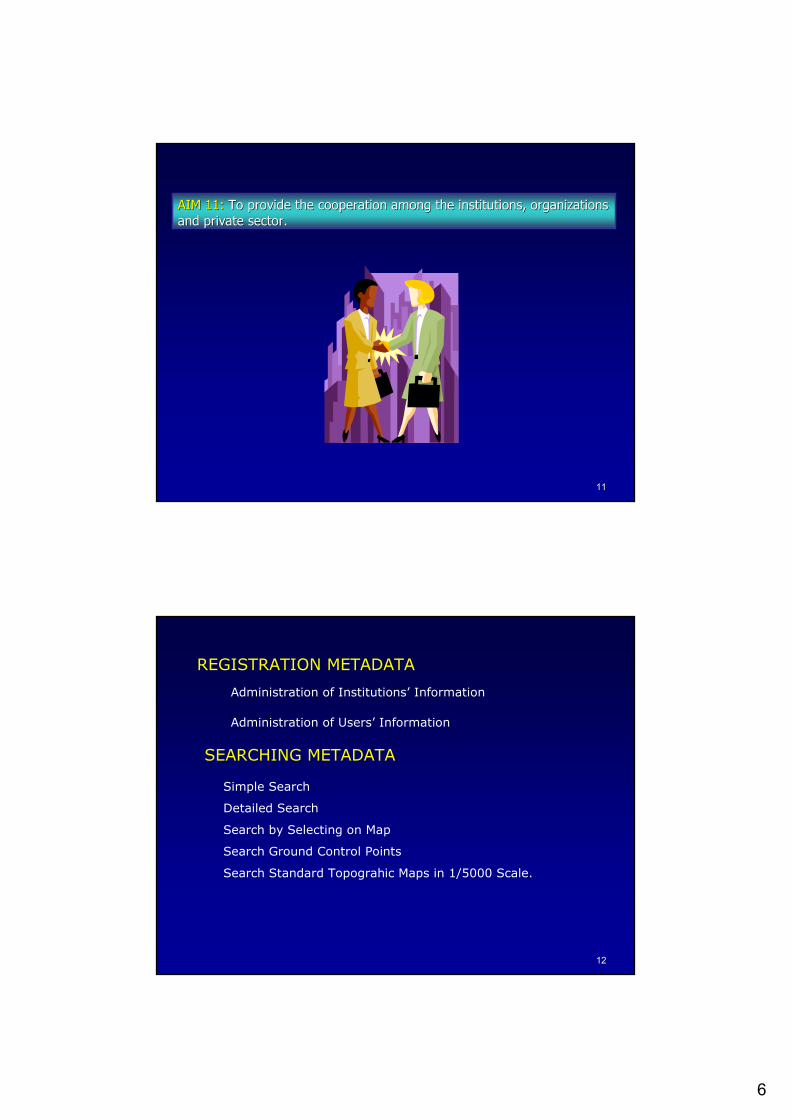
AIM AIM 1111:: To provide To provide thethe cooperationcooperation amongamong thethe institutionsinstitutions, , organizationsorganizationsandand privateprivate sectorsector..
1212
REGISTRATION METADATA
Administration of Institutions’ Information
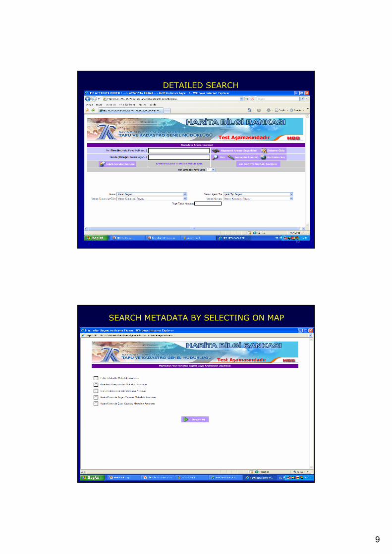
SEARCHING METADATA
Simple Search
Detailed Search
Search by Selecting on Map
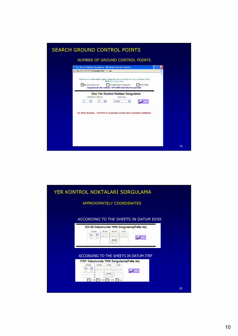
Search Ground Control Points
Search Standard Topograhic Maps in 1/5000 Scale.
Administration of Users’ Information
7
1313
1414
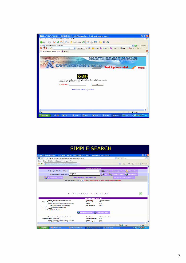
SIMPLE SEARCH
8
1515
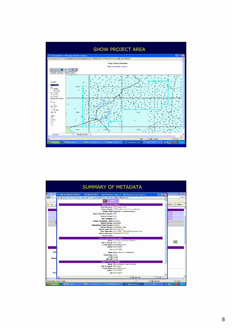
SHOW PROJECT AREA
1616
SUMMARY OF METADATA
9
1717
DETAILED SEARCH
1818
SEARCH METADATA BY SELECTING ON MAP
10
1919
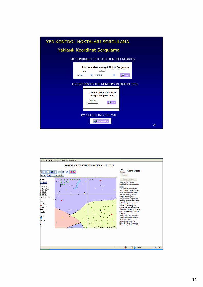
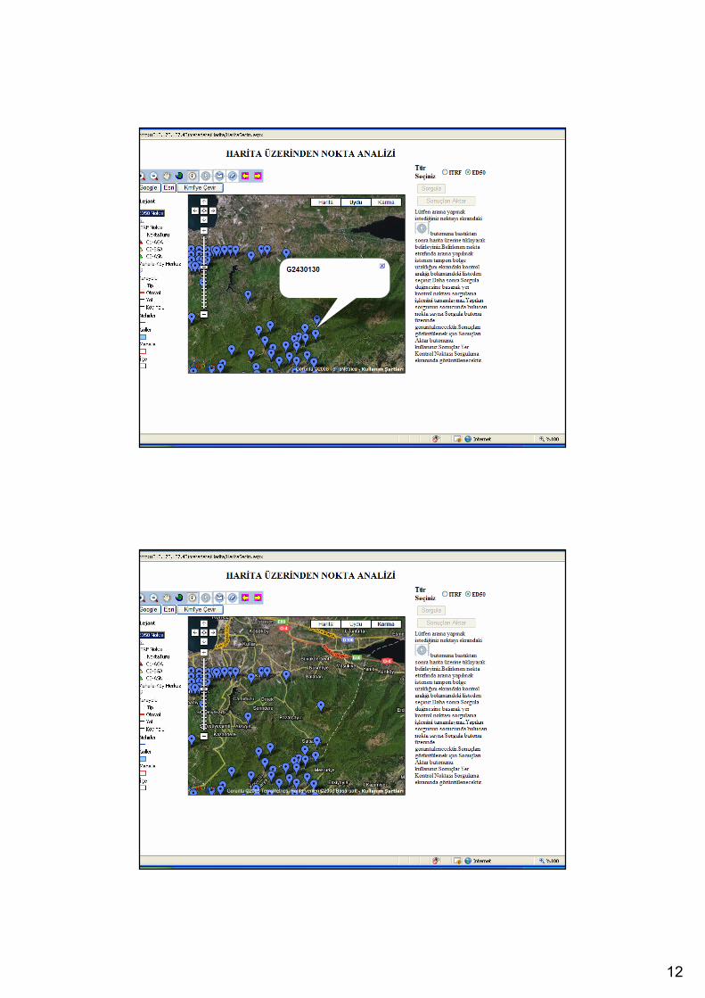
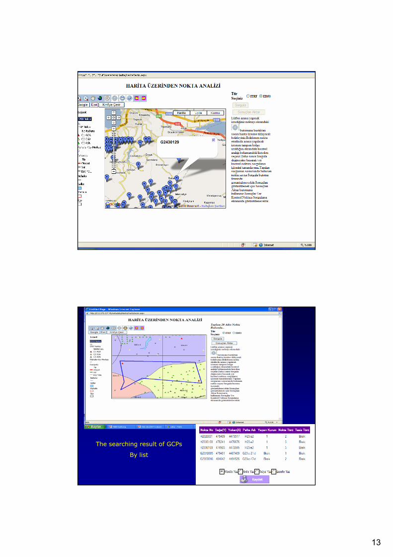
SEARCH GROUND CONTROL POINTS
NUMBER OF GROUND CONTROL POINTS
2020
YER KONTROL NOKTALARI SORGULAMA
APPROXIMATELY COORDINATES
ACCORDING TO THE SHEETS IN DATUM ED50
ACCORDING TO THE SHEETS IN DATUM ITRF
11
2121
ACCORDING TO THE POLITICAL BOUNDARIES
ACCORDING TO THE NUMBERS IN DATUM ED50
BY SELECTING ON MAP
YER KONTROL NOKTALARI SORGULAMA
Yaklaşık Koordinat Sorgulama
2222
12
2323
2424
13
2525
2626
The searching result of GCPs
By list
14
2727
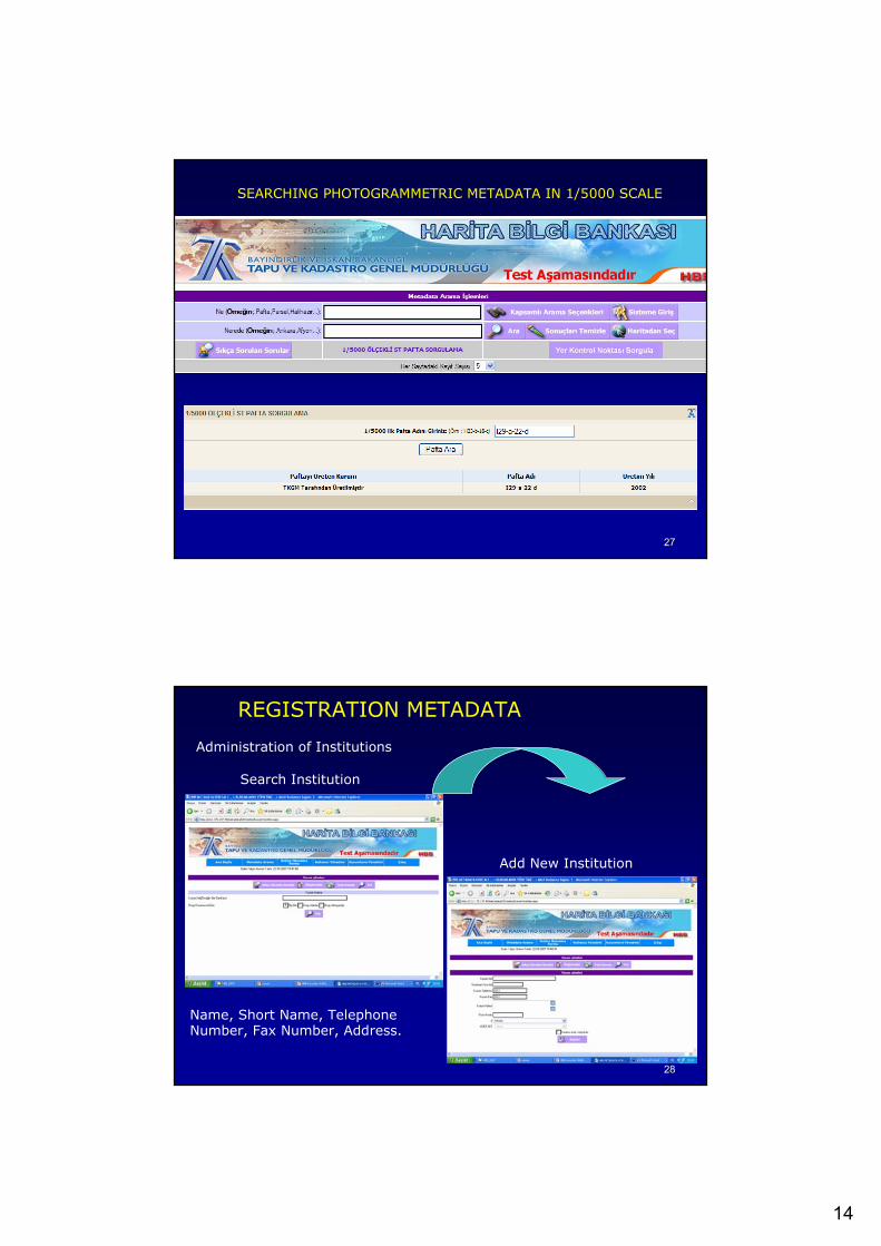
SEARCHING PHOTOGRAMMETRIC METADATA IN 1/5000 SCALE
2828
REGISTRATION METADATA
Administration of Institutions
Add New Institution
Search Institution
Name, Short Name, TelephoneNumber, Fax Number, Address.
15
2929
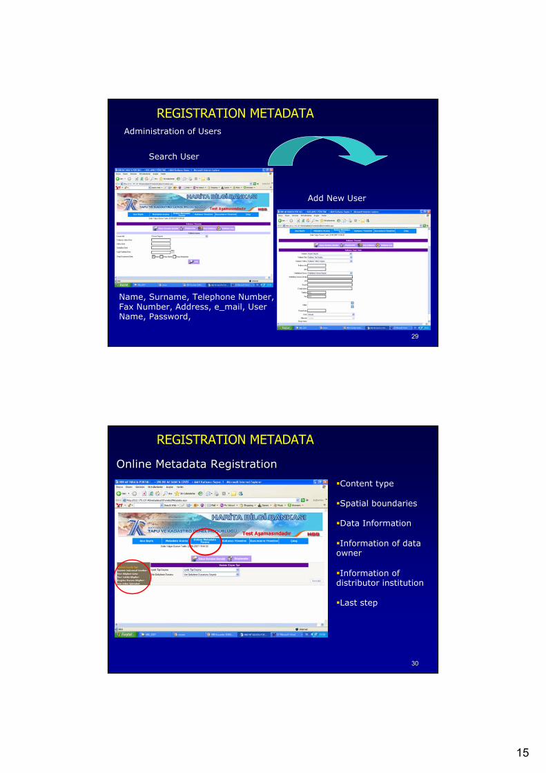
REGISTRATION METADATAAdministration of Users
Add New User
Search User
Name, Surname, Telephone Number, Fax Number, Address, e_mail, UserName, Password,
3030
REGISTRATION METADATA
Online Online MetadataMetadata RegistrationRegistration
Content type
Spatial boundaries
Data Information
Information of data owner
Information of distributor institution
Last step
16
3131
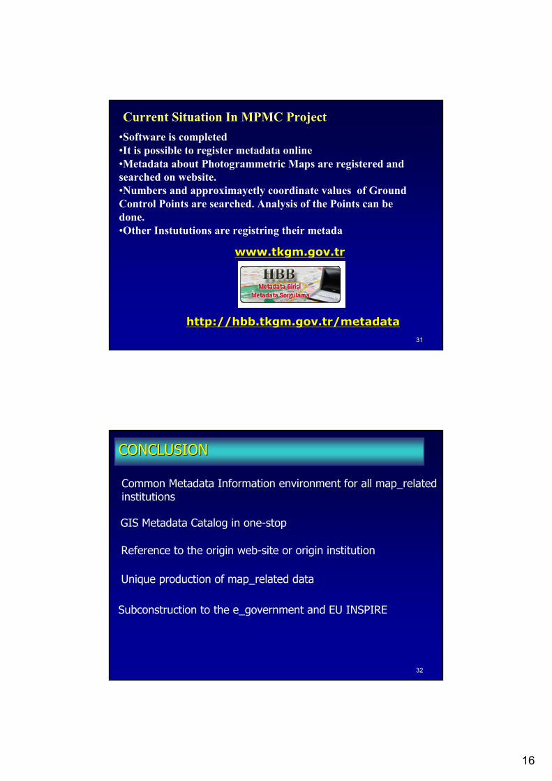
•Software is completed•It is possible to register metadata online•Metadata about Photogrammetric Maps are registered andsearched on website.•Numbers and approximayetly coordinate values of GroundControl Points are searched. Analysis of the Points can be done. •Other Instututions are registring their metada
Current Situation In MPMC Project
www.tkgm.gov.trwww.tkgm.gov.tr
http://http://hbbhbb.tkgm.gov.tr.tkgm.gov.tr//metadatametadata
3232
CONCLUSIONCONCLUSION
Common Metadata Information environment for all map_relatedinstitutions
GIS Metadata Catalog in one-stop
Reference to the origin web-site or origin institution
Unique production of map_related data
Subconstruction to the e_government and EU INSPIRE
17
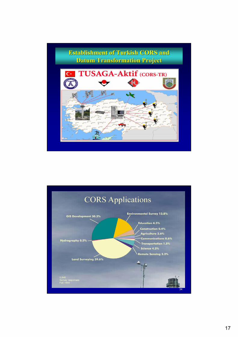
Establishment of Turkish CORS and Establishment of Turkish CORS and Datum TransformationDatum Transformation ProjectProject
3434
18
3535
TUSAGA-Aktif (CORS-TR) PROJECT
• Proposed to TÜB�TAK (Turkish Scientific andTechnolojical Research Concil) by ICU, GDLRC, GCM
• Signed on 18 April 2006• 31 Months Project with a budget of about 6.59 Million
YTL (3.3 Million Euro)
Project Implementation(ICU)
Sponsor (TÜBİTAK)
Clients(GDLRC / GCM)
3636
SCOPE OF PROJECTSCOPE OF PROJECT• Establishment of CORS-TR covering entire Turkey with 24 h.
RTK Positioning, thus meeting precise geodetic positioning requirements of Institutions without needing for any conventionalgeodetic network points (triangulation, traverse, etc.)
• Assesment / Development of Datum transformation between ED50 and ITRFyy Datum.
• Carry out research on plate tectonics, earthquake and atmosphere
19
3737
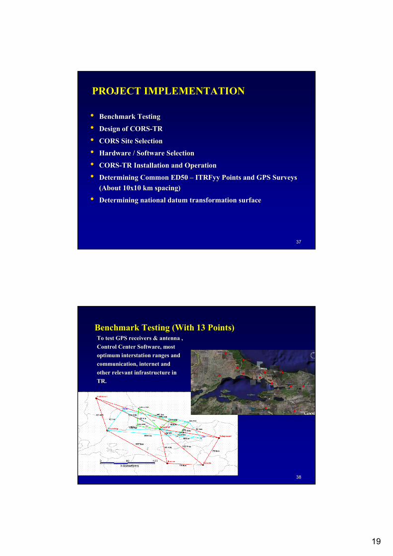
PROJECT IMPLEMENTATION
•• Benchmark TestingBenchmark Testing
•• Design of CORSDesign of CORS--TRTR
•• CORS CORS Site SelectionSite Selection
•• Hardware / Software SelectionHardware / Software Selection
•• CORSCORS--TR Installation and OperationTR Installation and Operation
•• Determining Common Determining Common ED50 ED50 –– ITRFyyITRFyy Points and GPS Surveys Points and GPS Surveys (About (About 1100x1x10 km spacing)0 km spacing)
•• Determining national datum transformation surfaceDetermining national datum transformation surface
3838
Benchmark TestingBenchmark Testing ((WithWith 13 13 PointsPoints))To test GPS receivers & antenna To test GPS receivers & antenna , , Control Center SoftwareControl Center Software,, most most optimum optimum interstationinterstation rangesranges andandcommunication, internet and communication, internet and other relevant infrastructure in other relevant infrastructure in TRTR..
20
3939
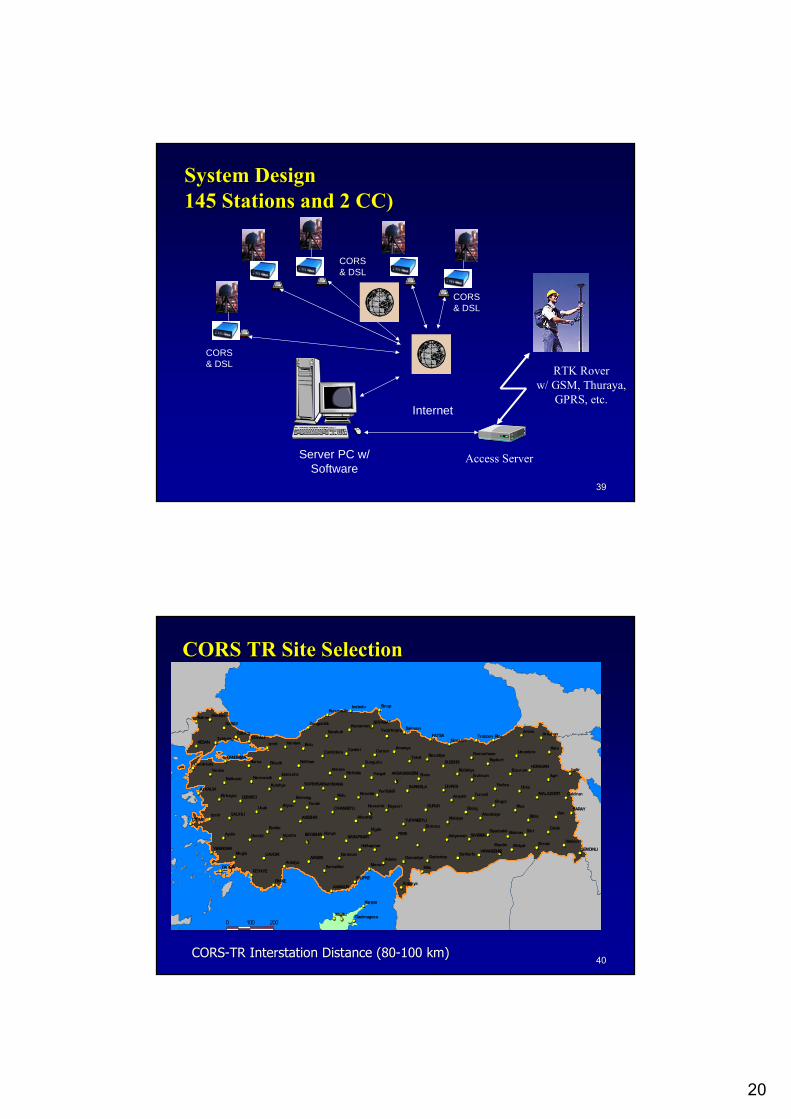
System DesignSystem Design145 145 StationsStations andand 2 CC)2 CC)
CORS& DSL
CORS& DSL
CORS& DSL
Server PC w/Software
Internet
RTK Roverw/ GSM, Thuraya,
GPRS, etc.
Access Server
4040
CORS TR Site SelectionCORS TR Site Selection
CORSCORS--TR TR InterstationInterstation DistanceDistance (80(80--100 km)100 km)
0 100 200
Midyat
ErzincanRefahiye
Vezirkopru Samsun
Mardin
Nevsehir Kayseri
AKDAGMADENI
BEYSEHIR Konya
Adana
Adiyaman
Afyon
Agri
Aksaray
Amasya
Ankara
Antakya
Antalya
ArdahanArtvin
Aydin
Balikesir
Batman
BayburtBilecik
Bingol
Bitlis
Bolu
BursaCanakkale
Cankiri Corum
DenizliDiyarbakir
Edirne
Elazig
ErzurumEskisehir
Gaziantep
Giresun
Gumushane
Hakkari
Igdir
Isparta
Istanbul
Izmir
izmit
Karabuk
Karaman
Kars
Kastamonu
Kilis
Kiriklale
Kirklareli
Kirsehir
Kutahya
Malatya
Mersin
Mugla
Mus
Nigde
Osmaniye
Rize
Sanliurfa
Siirt
Sinop
Sirnak
Sivas
Tekirdag
Tokat
Trabzon
Tunceli
UsakVan
Yozgat
Zonguldak
AKSEHIR
AKSEKI
ANAMUR
AYVALIK
BANDIRMA
BOYABAT
CAVDIR
CESME
CIHANBEYLI
DATCA
DEMIRCI
DIVRIGI
FATSA
FEKE
FETHIYE
FINIKE
GURUN
HAYMANA
HORASAN
KARAPINAR
KESAN
MALAZGIRT
SALIHLI
SARAY
SARAY
SARKISLA
SEMDINLI
SILIFKE
SIVEREK
SIVRIHISAR
SUSEHRI
TUFANBEYLI
VIRANSEHIRYENIHISAR
Hendek
IneboluKurucasile
YeniceHarmancik
Kirkagac
Camlidere
Evciler
Nallihan
KuluEmirdagYunak
Halkapinar
Sariveliler
Resadiye
YenifakiliArapkir
Ekinozu
Alacakaya
Uzundere
Yedisu HinisCaldiran
Catak
Catalca
Sungurlu
Morfu Gazimagosa
Karpas
21
4141
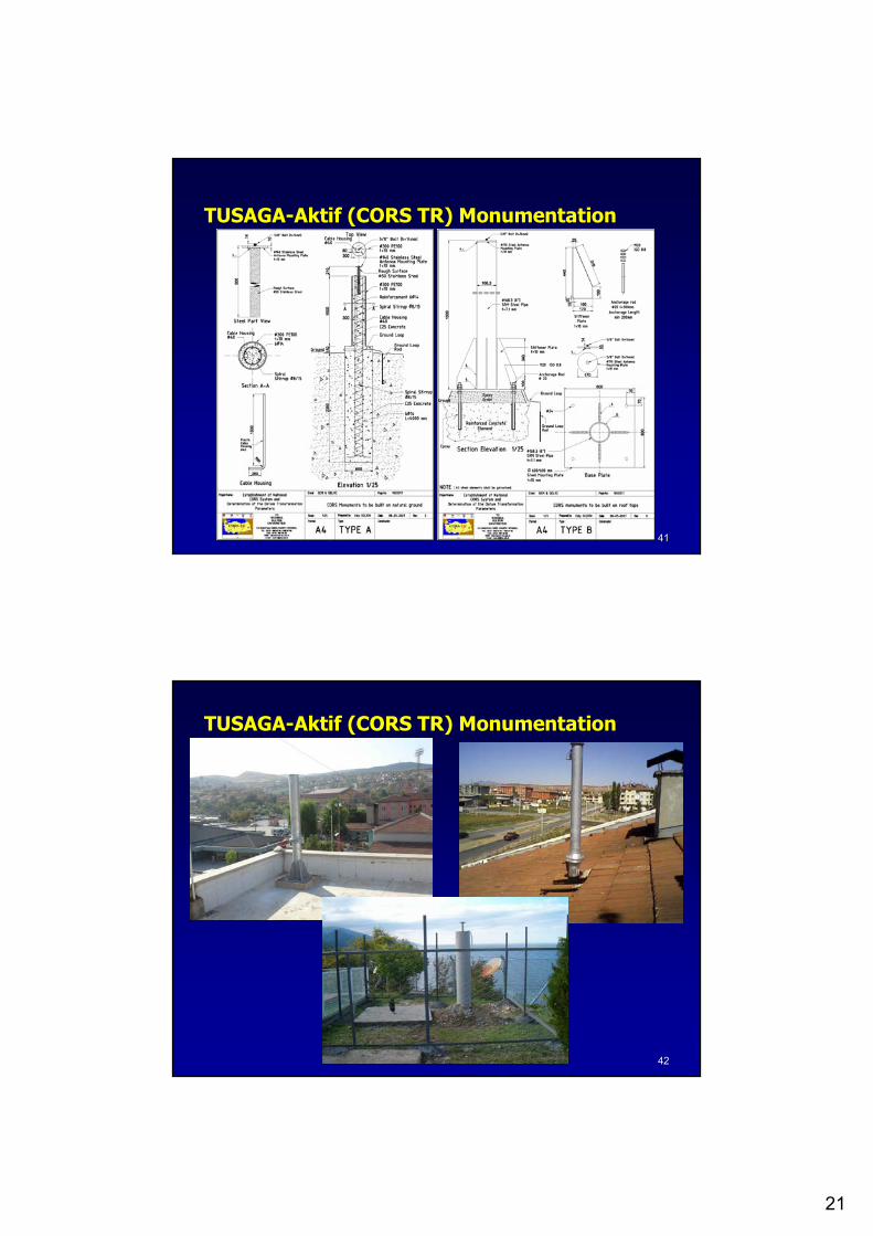
TUSAGATUSAGA--Aktif (Aktif (CORS TRCORS TR)) MonumentationMonumentation
4242
TUSAGATUSAGA--Aktif (Aktif (CORS TRCORS TR)) MonumentationMonumentation
22
4343
Determining National Transformation Determining National Transformation ParametersParameters
•• AboutAbout 75007500--10000 10000 common points of ED50 & common points of ED50 & ITRFyyITRFyy will will be GPS surveyedbe GPS surveyed ((approximatelyapproximately 3000 3000 commoncommon pointspoints areareavailableavailable) )
•• Analytical surface will be fitted for the entire countryAnalytical surface will be fitted for the entire country-- LiLineneaar r regressionregression-- Minimum Minimum curvaturecurvature surfacesurface-- Thin plate Thin plate splinessplines-- StochaticStochatic modelsmodels-- OthersOthers
•• Thus, about 50000 map Thus, about 50000 map ssheetheet will be transferred from will be transferred from ED50 datum to ED50 datum to ITRFyyITRFyy datumdatum
4444
PROJECT OUTPUTEngineering Applications• All spatial IT (geoinformation) Projects• Geodetic engineering surveys• Mapping and cadastral surveys, GIS activities, etc.• Planning and environmental activities• Monitoring engineering structures (displacement, deformation ..)• Utility surveys• E-government, e-municipality, e-commerce activities• Other spatial projects
Scientific Applications• Earthquake engineering and seismic activities• Modeling troposphere and ionosphere • Meteorological predictions• Deformation, monitorine tectonic plate movements• Transportation, navigation, vehicle tracking, etc.
23
4545GGüüler YALler YALÇÇIN IN & & ÖÖmer Ymer Yııldldıırrıım & Sedat BAKICIm & Sedat BAKICI
[email protected]@tkgm.gov.tr & & [email protected]@tkgm.gov.tr & & [email protected]@tkgm.gov.tr