Embed Size (px)
Citation preview
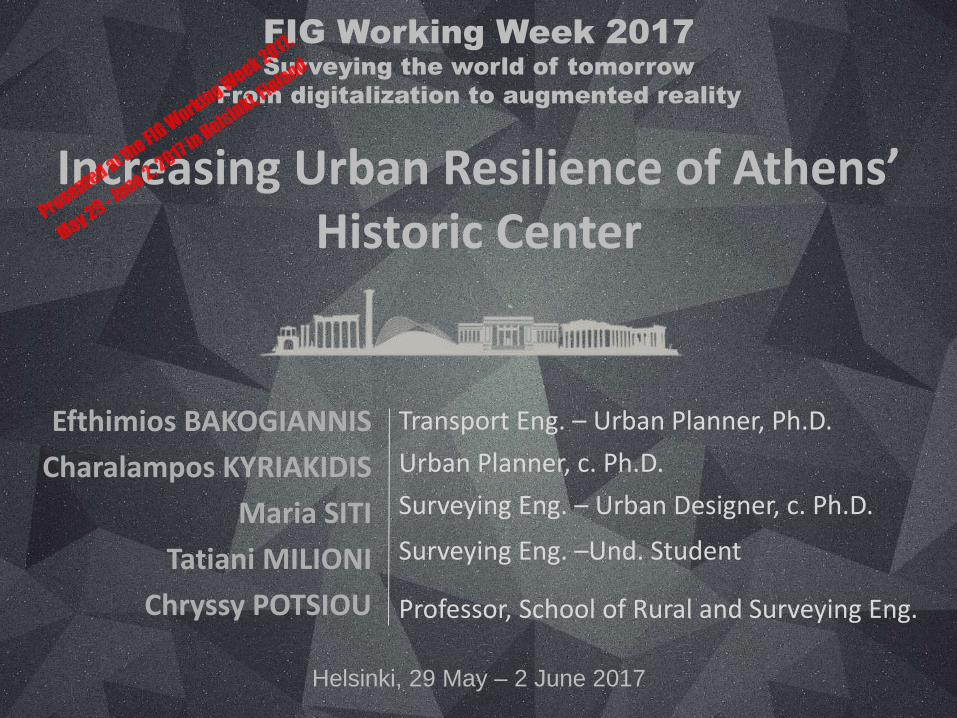
Increasing Urban Resilience of Athens’ Historic Center
Efthimios BAKOGIANNIS
Charalampos KYRIAKIDIS
Maria SITI
Tatiani MILIΟΝΙ
Chryssy POTSIOU
Transport Eng. – Urban Planner, Ph.D.
Urban Planner, c. Ph.D.
Surveying Eng. – Urban Designer, c. Ph.D.
Surveying Eng. –Und. Student
Professor, School of Rural and Surveying Eng.
FIG Working Week 2017
Surveying the world of tomorrow
From digitalization to augmented reality
Helsinki, 29 May – 2 June 2017
Presented at th
e FIG W
orking Week 2017,
May 29 - June 2, 2
017 in Helsinki, F
inland
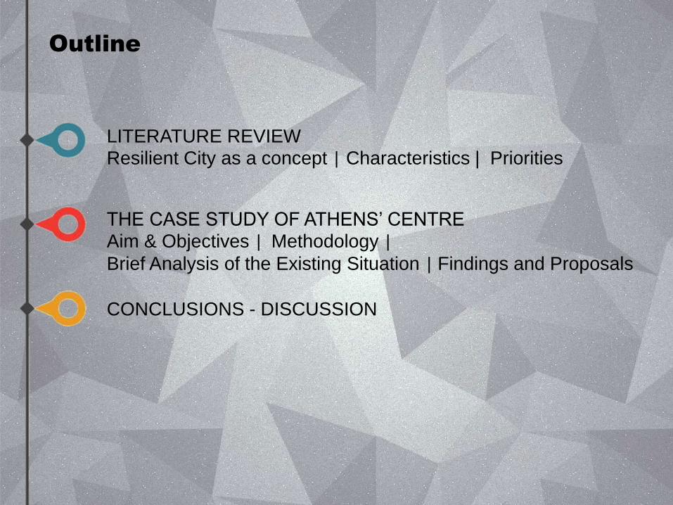
Outline
LITERATURE REVIEW Resilient City as a concept | Characteristics | Priorities
THE CASE STUDY OF ATHENS’ CENTRE Aim & Objectives | Methodology | Brief Analysis of the Existing Situation | Findings and Proposals
CONCLUSIONS - DISCUSSION
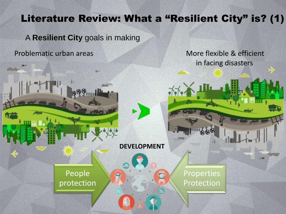
Literature Review: What a “Resilient City” is? (1)
A Resilient City goals in making
Problematic urban areas More flexible & efficient in facing disasters
People protection
Properties Protection
DEVELOPMENT
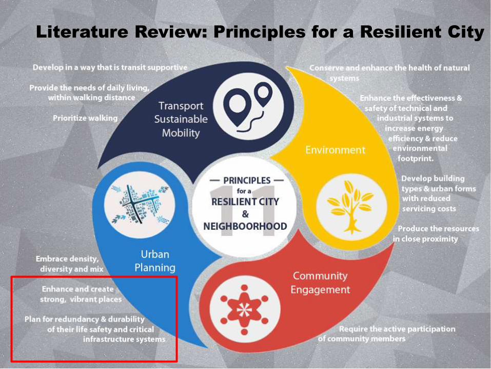
Literature Review: Principles for a Resilient City
Aim and Objectives
Preparation for protection against negative impacts of a possible disaster in this area. For this particular scope, the following spatial parameters are investigated: Which are the free spaces in the center of Athens and what locations may be utilized as
potential and temporary gathering spaces in case of emergency? Which is the zone of influence that may be efficiently served by each of these selected
potential gathering spaces? Which are the shortest routes that may best serve specific types of vehicles in case of
emergency?
Increase awareness
Disaster risks
Need for enhancing
Disaster preparedness
Improving responsiveness
Ath
en
s’ H
isto
ric
Ce
nte
r (A
HC
)
Aim
Objectives
Natural disasters
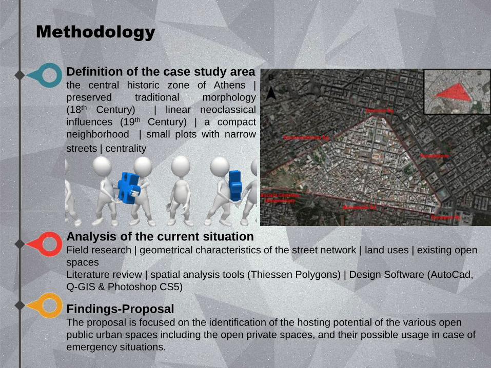
Methodology
Definition of the case study area the central historic zone of Athens |
preserved traditional morphology
(18th Century) | linear neoclassical
influences (19th Century) | a compact
neighborhood | small plots with narrow
streets | centrality
Analysis of the current situation Field research | geometrical characteristics of the street network | land uses | existing open
spaces
Literature review | spatial analysis tools (Thiessen Polygons) | Design Software (AutoCad,
Q-GIS & Photoshop CS5)
Findings-Proposal The proposal is focused on the identification of the hosting potential of the various open
public urban spaces including the open private spaces, and their possible usage in case of
emergency situations.
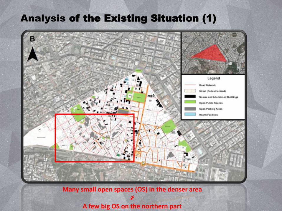
Analysis of the Existing Situation (1)
Many small open spaces (OS) in the denser area ҂
A few big OS on the northern part
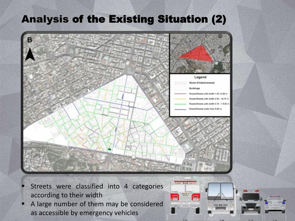
Analysis of the Existing Situation (2)
Streets were classified into 4 categories according to their width
A large number of them may be considered as accessible by emergency vehicles
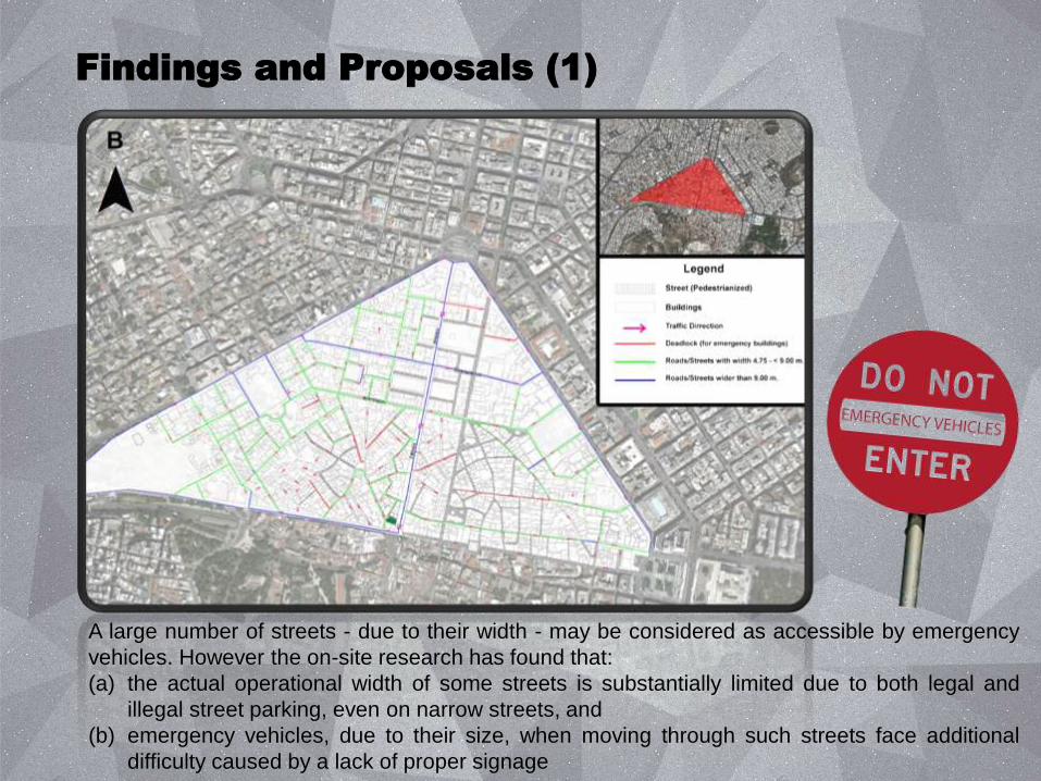
Findings and Proposals (1)
A large number of streets - due to their width - may be considered as accessible by emergency
vehicles. However the on-site research has found that:
(a) the actual operational width of some streets is substantially limited due to both legal and
illegal street parking, even on narrow streets, and
(b) emergency vehicles, due to their size, when moving through such streets face additional
difficulty caused by a lack of proper signage
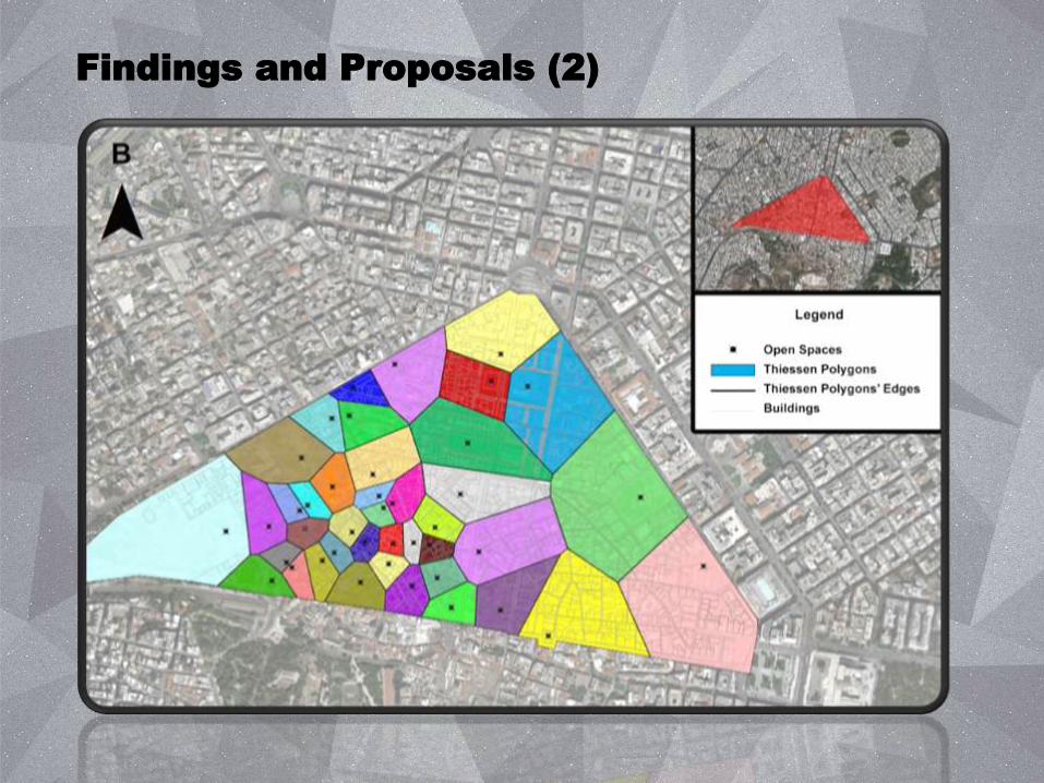
Findings and Proposals (2)
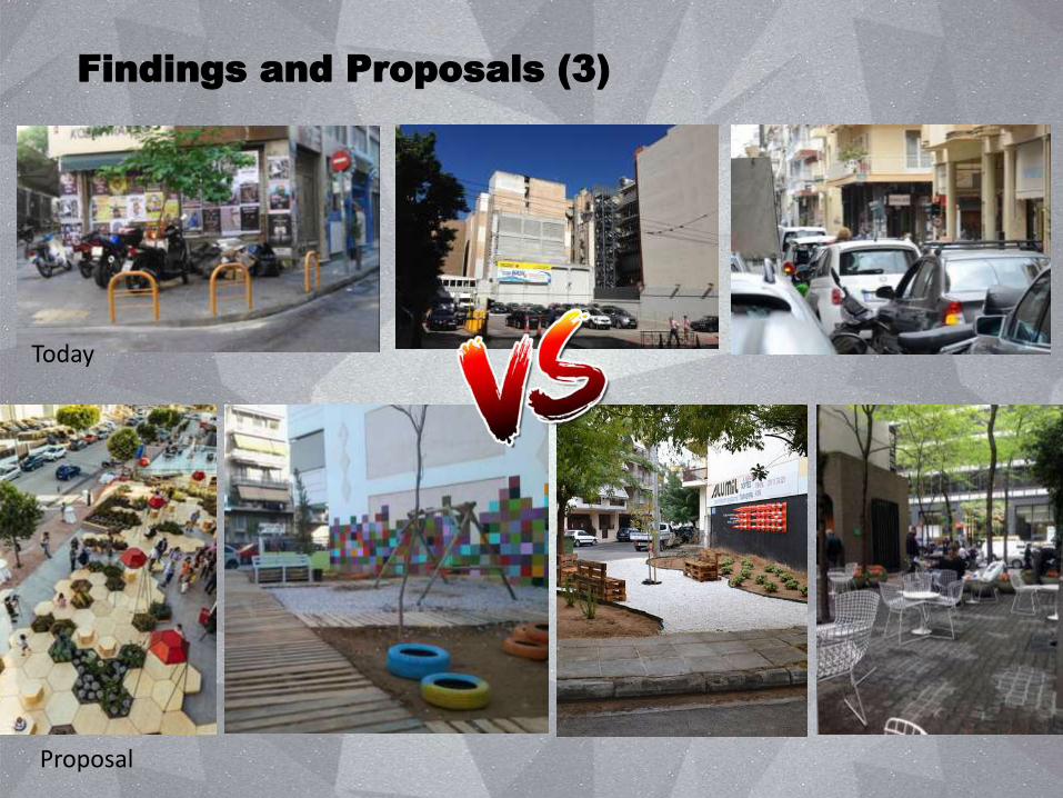
Findings and Proposals (3)
Today
Proposal
Findings and Proposals (4)
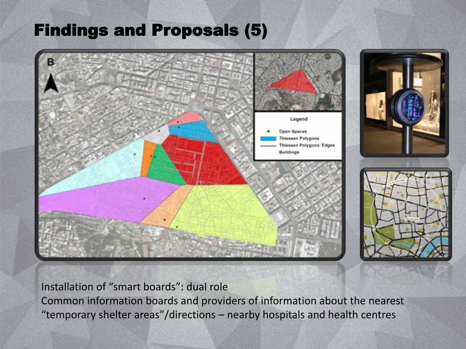
Findings and Proposals (5)
Installation of “smart boards”: dual role Common information boards and providers of information about the nearest “temporary shelter areas”/directions – nearby hospitals and health centres
Conclusions
Natural disasters are matters on which modern cities must focus and require specific spatial data infrastructure to be prepared.
A resilient city is a model which is combined with models of sustainable, economic and social models of city .
Athens cannot function as a “resilient city” (narrow roads, extensive vehicular traffic, roadside parking and the absence of signage) – Opportunities (i.e. many open spaces).
Our proposals focus on: (a) making Athens more flexible in dealing with natural disasters, (b) improving pedestrian conditions and promoting sustainable mobility and (c) social interaction.
Research should be continued to provide the necessary spatial data infrastructure and identify the most appropriate measures that would function well in the various types of disasters.
Thank you!
Bakogiannis E., Kyriakidis C., Siti M., Milioni T. & Potsiou C. National Technical University of Athens- 9 Iroon Polytechniou – Zografou Campus- Athens.