Embed Size (px)
Citation preview
Introduction to Geographic Information
Systems (GIS)January 10, 2011
Introduction to Geographic Information Systems
Review of last class
ToursBlogging
Questions?
Introduction to Geographic Information Systems
Goals and ObjectivesTo create a knowledge base in each student that embodies a sound GIS skill set complimented by the development of a broader “geographic perspective.”
I order to attain this goal I must keep the students interested, active and challenged.
This will be achieved through class lecture and labs, multimedia presentations, guest lectures and a promotion of open discourse throughout the class
Introduction to Geographic Information Systems
Introduction to Geographic Information Systems
Geographic Information Systems2 parts:
Geographic (Geography)
Information Systems
What is GIS
Introduction to Geographic Information Systems
Geography – Definitionge·og·ra·phy (jē äg′rə fē)noun1. the science that studies and describes the surface of the earth and its
physical, biological, political, economic, and demographic characteristics and the complex interrelations among them.
2. the topographical features of a specific area.
3. a book on this subject. —geographer, n. —geographic, geographical, adj.
“The Study of the Earth”
What is GIS
Introduction to Geographic Information Systems
Information System (Definition)
The organised collections of hardware, software, equipment, policies, procedures and people that store, process, control and provide access to information.
What is GIS

Introduction to Geographic Information Systems
Geographic Information System (Definition)
•A geographic information system (GIS) integrates hardware, software, and data for capturing, managing, analyzing, and displaying all forms of geographically referenced information.•GIS allows us to view, understand, question, interpret, and visualize data in many ways that reveal relationships, patterns, and trends in the form of maps, globes, reports, and charts.•A GIS helps you answer questions and solve problems by looking at your data in a way that is quickly understood and easily shared.•GIS technology can be integrated into any enterprise information system framework.
What is GIS
Source - www.GIS.com
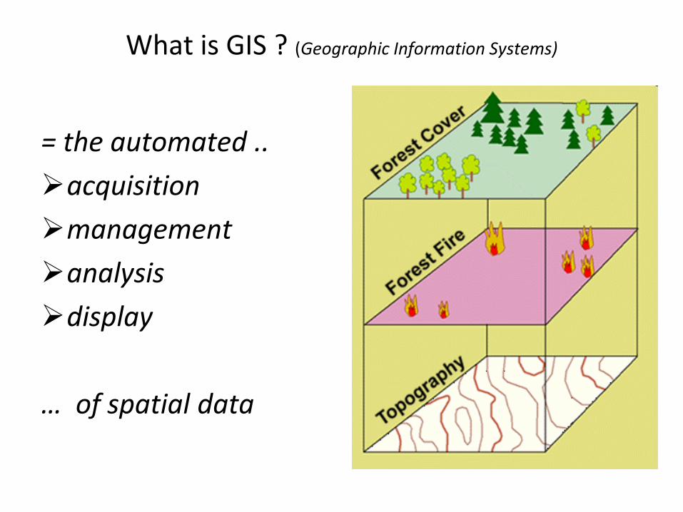
What is GIS ? (Geographic Information Systems)
= the automated ..
acquisition
management
analysis
display
… of spatial data
Introduction to Geographic Information Systems
GIS – The Big Picture
http://training.esri.com/Courses/StartGIS/index.cfm
•Pandemic Past Video
•Pandemic Present Video
What is GIS
Introduction to Geographic Information Systems
Assignment 1.
1. Search the internet for a definition of GIS.2. Post it on your blog.3. Read another users definition and comment on it.
What is GIS
Introduction to Geographic Information Systems
Stop for a second and think about how you would rate your understanding of what GIS is.
Don’t hesitate to ask questions.
What is GIS
Introduction to Geographic Information Systems
Geography and Geomatics
Introduction to Geographic Information Systems
The Geographic Approach/Perspective“Geographic perspective – the perspective used by geographerswhen they use all available data and tools to first assess spatialdistributions, then investigate the underlying spatial processesresponsible for the observable spatial distributions, and finally
make spatial predictions and decisions about how best to preserveor change the distributions”
http://training.esri.com/Courses/StartGIS/M1/what_is_the_geographic_approach_88471.cfm
Introduction to Geographic Information Systems
The First Law of GeographyWaldo Tobler’s definition
"Everything is related to everything else, but near things are more related than distant things."
Introduction to Geographic Information Systems
The Six Essential Elements of GeographyGeography educators have created a set of eighteen learning standards called Geography for Life. Each of these eighteen
standards is organized into six essential elements.
1. The World in Spatial Terms2. Places and Regions3. Physical Systems 4. Human Systems 5. Environment and Society 6. The Uses of Geography
Billy's .pdf
Geography
http://www.maps-gps-info.com/ygphy.html
Introduction to Geographic Information Systems
Excercise –
Break off into groups of 2 and discuss one of the previous elements
From your understanding of what a GIS is, how could it be used as a toll within the element.
Think Geographically with relationships and analysis in mind
Geography
http://www.maps-gps-info.com/ygphy.html

Introduction to Geographic Information Systems
The Six Essential Elements of GeographyGIS fits best in this category
The World in Spatial Terms
1. How to use maps and other geographic representations, tools, and technologies to acquire, process, and report information from a spatial perspective2. How to use mental maps to organize information about people, places, and environments in a spatial context3. How to analyze the spatial organization of people, places, and environments on earth's surface
Geography
http://www.maps-gps-info.com/ygphy.html
Introduction to Geographic Information Systems
Class discussion
How does Geography affect you?
Geography
Introduction to Geographic Information Systems
Geomatics is – a category of GeographyGIS generally falls within the realm of Geomatics
Geomatics.pdf
Geomatics
Introduction to Geographic Information Systems
Define Geomatics
http://en.wikipedia.org/wiki/Geomatics
Geomatics
Introduction to GIS • Review yesterday
– Congratulations everyone scored 100% on the quiz – Definition of GIS
• Automated acquisition, management, analysis and display of spatial data
• GIS the Big picture
– Definition of Geography• Class discussion re. how geography impacts their life.• Looked at where GIS fits into Geomatics
– Blog content was good. I think it is a good starting point for developing project ideas.
Introduction to Geographic Information Systems
• If some countries have too much history, we have too much geography. Mackenzie King
• Sometimes I think war is God's way of teaching us geography. Paul Rodriguez
• "I get to go to overseas places, like Canada." Britney Spears
• "No matter where you go, there you are“ Buckeroo Banzai• "It is wonderful to be here in the great state of Chicago"
Dan C. Quayle
•
www.GIS.com
Geography quotes
Introduction to Geographic Information Systems
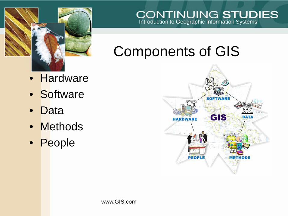
• Hardware• Software• Data• Methods• People
www.GIS.com
Components of GIS
Introduction to Geographic Information Systems
HardwarePrintersComputerPlottersPDA’sCell Phones
www.GIS.com
Components of GIS
Introduction to Geographic Information Systems
SoftwareGIS Software
ArcGIS, Manifold, Google Earth
Word ProcessingDatabase3rd party translation toolsGPS
www.GIS.com
Components of GIS
Introduction to Geographic Information Systems
DataSpatial Data
Government or private data
Tabular dataGPS data and attributes
www.GIS.com
Components of GIS
Introduction to Geographic Information Systems
MethodsAutomated scriptsGeo-processing tools
www.GIS.com
Components of GIS
Introduction to Geographic Information Systems
PeopleGIS Technicians/AnalystsGIS ManagersEnd usersData collectors
www.GIS.com
Components of GIS
Introduction to Geographic Information Systems
Break
www.GIS.com
Components of a GIS
Introduction to Geographic Information Systems
History of GIS
5 components of GIS
GIS AssignmentGIS and Natural disasters
www.GIS.com
Review
Introduction to Geographic Information Systems
Components of GIS– Spatial vs Non-spatial data– Geo-entities (features)
Lecture with Roger Wheate
GIS Assignment Presentations
Today
Introduction to Geographic Information Systems
Stop for a second and think about how you would rate your understanding of what GIS is.
What are some of the key points we have discussed?
What is GIS
Introduction to Geographic Information Systems
Spatial vs non-spatial data
Take a look at your definition of GIS from you blog. Does it contain the terms “spatial” and “non-spatial”. If not what similar terms does it contain?
Components of GIS
Introduction to Geographic Information Systems
SpatialSpatial data contains 2 broad groups of properties
Geometric (Geometry)• Relates to the measurement of points, lines, polygons and
surfaces• Geometric properties include position, length, direction,
area, perimeter etc.
Components of GIS
Introduction to Geographic Information Systems
TopologicalTopology describes the spatial relationships between
adjacent features, and uses x, y coordinates to identify the location of a particular point, line, or polygon.
• Relational characteristics that do not change even if the geometric properties change
• Connectivity, inclusion, adjacency
Components of GIS
Introduction to Geographic Information Systems
In GIS we make rules to ensure topology is “correct”
– Parcels cannot overlap. Adjacent parcels have shared boundaries. – Stream lines cannot overlap and must connect to one another at their
endpoints. – Adjacent counties have shared edges. Counties must completely
cover and nest within states. – Adjacent census blocks have shared edges. Census blocks must not
overlap, and census blocks must completely cover and nest within block groups.
– Road centerlines must connect at their endpoints. – Road centerlines and census blocks share coincident geometry
(edges and nodes).
Components of GIS
Introduction to Geographic Information Systems
Non – Spatial (Tabular data)
• Has the properties of ‘Value’ and ‘time’
• Has a unique ID that relates to the spatial data
• Data can be linked to Spatial to enhance the detail of it
Components of GIS
Introduction to Geographic Information Systems
*All GIS software store information regarding geometric properties and non-spatial properties of data. Only some software packages (e.g. ArcGIS Workstation, Manifold) store information (rules) regarding the topological properties of data
Components of GIS
Introduction to Geographic Information Systems
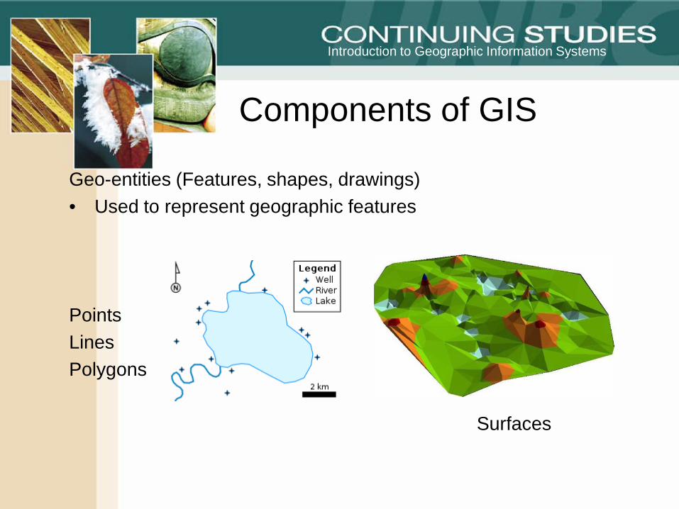
Geo-entities (Features, shapes, drawings)• Used to represent geographic features
PointsLinesPolygons
Surfaces
Components of GIS
Introduction to Geographic Information Systems
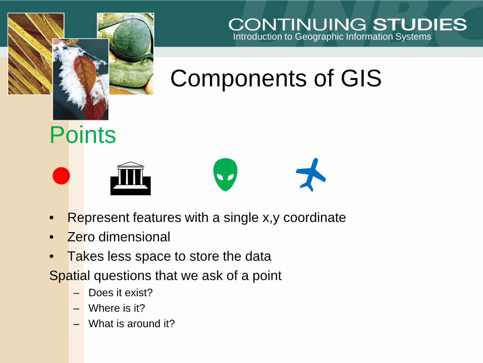
Points
● • Represent features with a single x,y coordinate• Zero dimensional • Takes less space to store the dataSpatial questions that we ask of a point
– Does it exist?– Where is it?– What is around it?
Components of GIS
Introduction to Geographic Information Systems
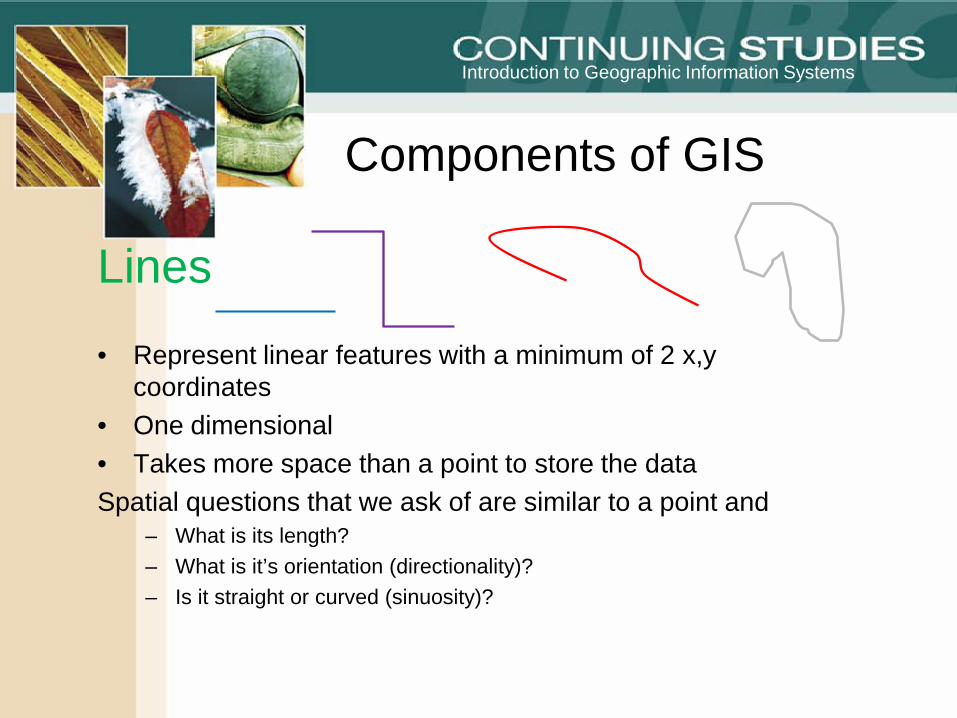
Lines
• Represent linear features with a minimum of 2 x,ycoordinates
• One dimensional • Takes more space than a point to store the dataSpatial questions that we ask of are similar to a point and
– What is its length?– What is it’s orientation (directionality)?– Is it straight or curved (sinuosity)?
Components of GIS
Introduction to Geographic Information Systems
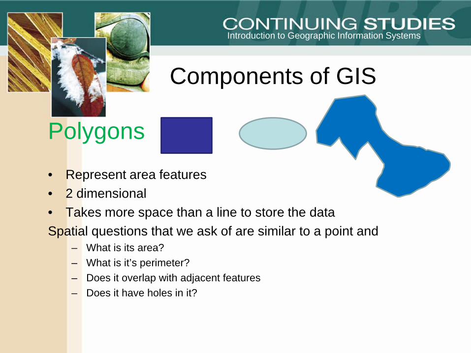
Polygons
• Represent area features• 2 dimensional• Takes more space than a line to store the dataSpatial questions that we ask of are similar to a point and
– What is its area?– What is it’s perimeter?– Does it overlap with adjacent features– Does it have holes in it?
Components of GIS
Assignment
• List 5 examples of features that each geo-entity could represent in;– Urban Areas– Environment– Health
• No duplications allowed
QuestionFeatures can be
represented by more than one Geo-entity.
What determines this?
(1 word answer)
SCALE
Introduction to Geographic Information Systems
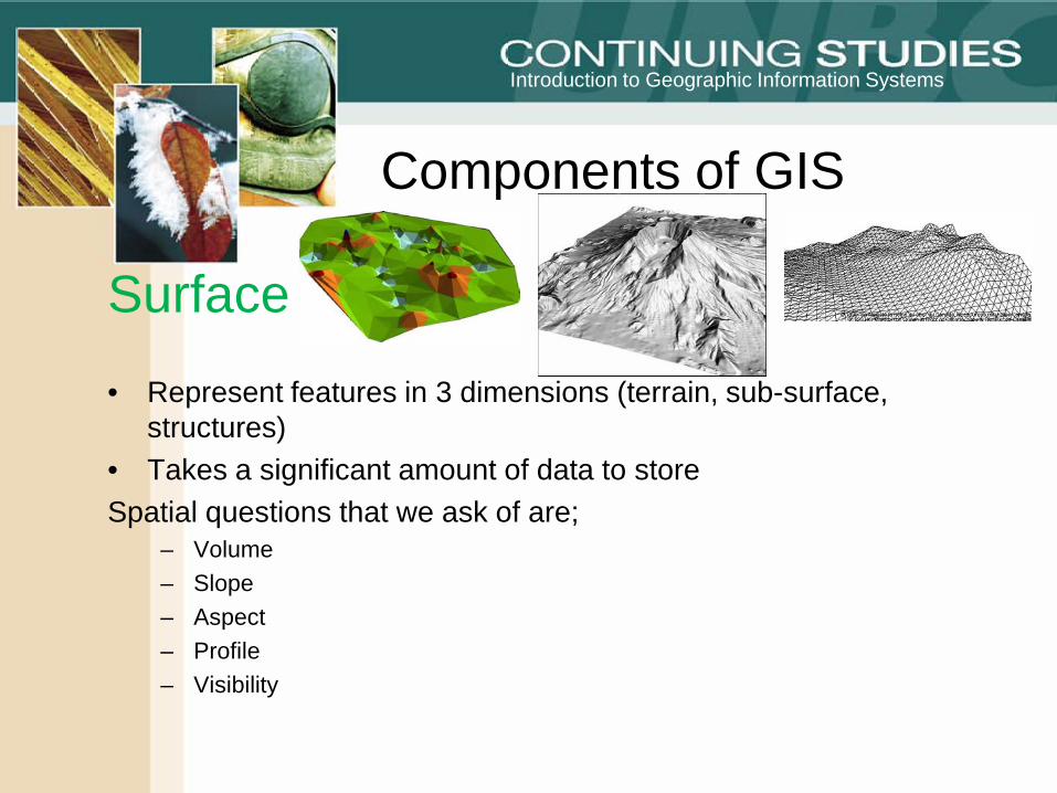
Surface
• Represent features in 3 dimensions (terrain, sub-surface, structures)
• Takes a significant amount of data to storeSpatial questions that we ask of are;
– Volume– Slope– Aspect– Profile– Visibility
Components of GIS
Introduction to Geographic Information Systems
NoteA group of geo-entities can be represented by a single record.The will be referred to as multi-point, Multi-line and Multi-
polygon
Components of GIS
Introduction to Geographic Information Systems
Geo-entities and layersWhen we add spatial data in a GIS we refer to it as a layer. A
layer can only have on geo-entity in it.
For instance you would not be able to have stop signs (point) and roads (lines) in the same layer.
You can have geo-entities representing different features in a layer (e.g. Streams and roads)
Components of GIS
Introduction to Geographic Information Systems
A small ArcGIS demo
Components of GIS
Introduction to Geographic Information Systems
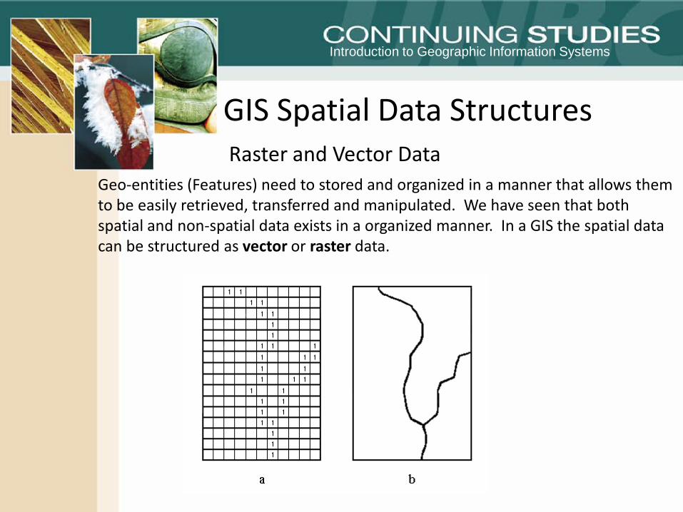
GIS Spatial Data StructuresRaster and Vector Data
Geo-entities (Features) need to stored and organized in a manner that allows them to be easily retrieved, transferred and manipulated. We have seen that both spatial and non-spatial data exists in a organized manner. In a GIS the spatial data can be structured as vector or raster data.
Introduction to Geographic Information Systems
GIS Spatial Data StructuresRaster and Vector Data
Vector data
Vector data represents the location of point, line and polygon data at a high precision (See yesterdays lecture)
•A point is represented by a simple pair of coordinates. •The line is represented by an ordered list of pairs of coordinates. •The area is represented as a polygon with ordered pairs of coordinates that close the polygon (the first and last pair being the same).
Introduction to Geographic Information Systems
GIS Spatial Data StructuresRaster and Vector Data
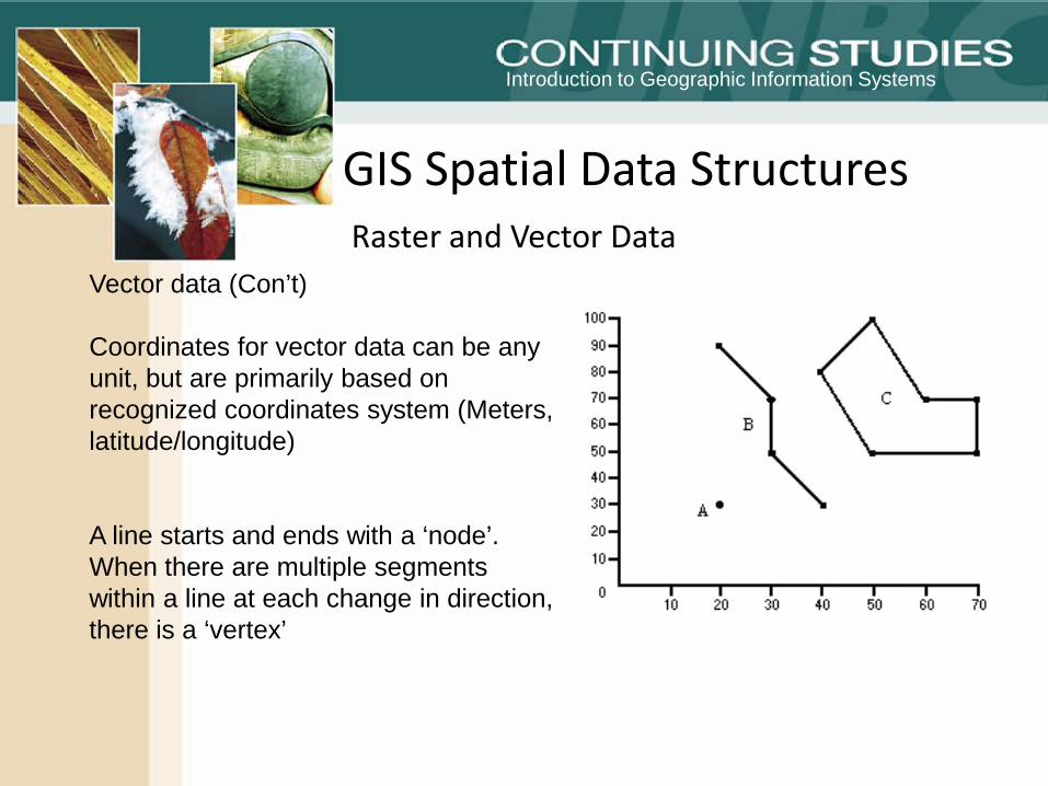
Vector data (Con’t)
Coordinates for vector data can be any unit, but are primarily based on recognized coordinates system (Meters, latitude/longitude)
A line starts and ends with a ‘node’. When there are multiple segments within a line at each change in direction, there is a ‘vertex’
Introduction to Geographic Information Systems
GIS Spatial Data Structures
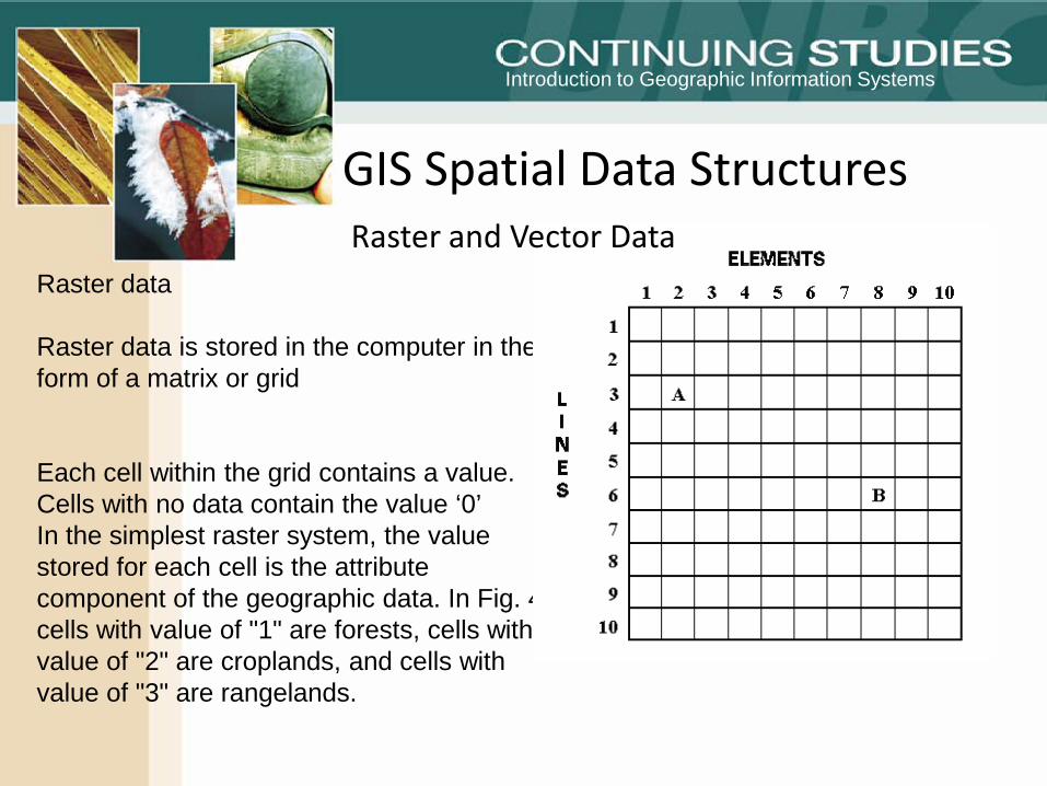
Raster data
Raster data is stored in the computer in the form of a matrix or grid
Each cell within the grid contains a value. Cells with no data contain the value ‘0’In the simplest raster system, the value stored for each cell is the attribute component of the geographic data. In Fig. 4, cells with value of "1" are forests, cells with value of "2" are croplands, and cells with value of "3" are rangelands.
Raster and Vector Data
Introduction to Geographic Information Systems
GIS Spatial Data StructuresRaster and Vector Data
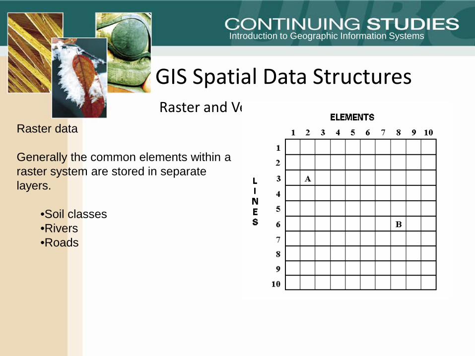
Raster data
Generally the common elements within a raster system are stored in separate layers.
•Soil classes•Rivers•Roads
Introduction to Geographic Information Systems
• http://geogratis.cgdi.gc.ca/geogratis/en/geo101.html;jsessionid=F3D12C2C445B82C40D6D6D3FA02FFD3D
• Raster Vector graphing exercise
• Search for the advantages and disadvantages of the raster and vector data format.
• John demo the • Raster data
GIS Spatial Data StructuresRaster and Vector Data
Introduction to Geographic Information Systems
GIS Spatial Data StructuresRaster and Vector Data
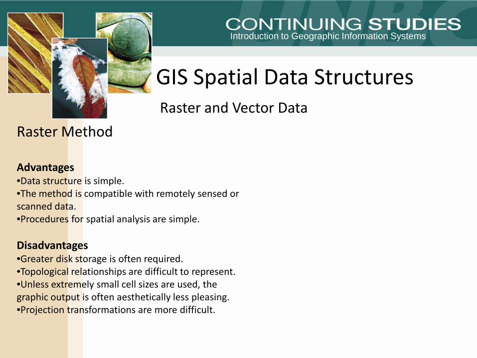
Raster Method
Advantages •Data structure is simple. •The method is compatible with remotely sensed or scanned data. •Procedures for spatial analysis are simple.
Disadvantages•Greater disk storage is often required. •Topological relationships are difficult to represent. •Unless extremely small cell sizes are used, the graphic output is often aesthetically less pleasing. •Projection transformations are more difficult.
Introduction to Geographic Information Systems
GIS Spatial Data StructuresRaster and Vector Data
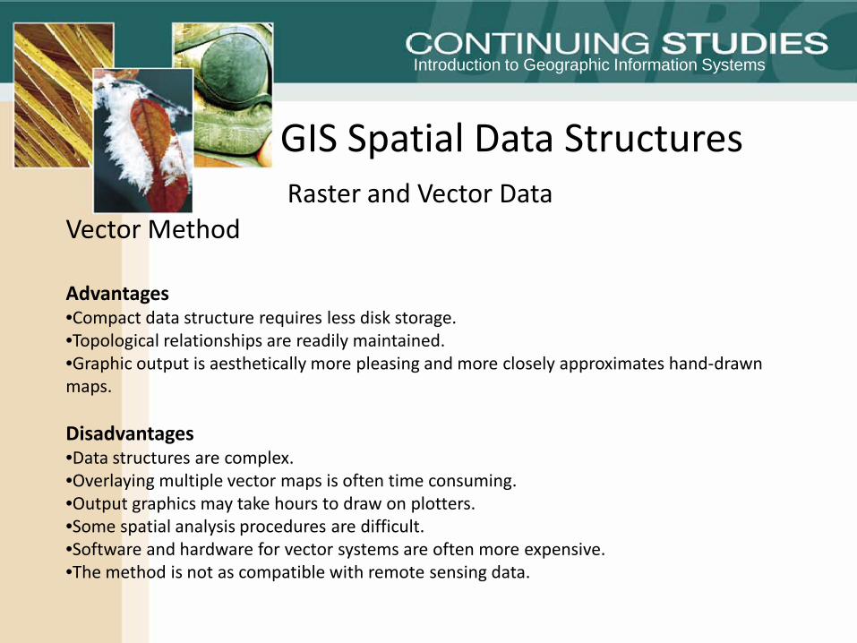
Vector Method
Advantages •Compact data structure requires less disk storage. •Topological relationships are readily maintained. •Graphic output is aesthetically more pleasing and more closely approximates hand-drawn maps.
Disadvantages•Data structures are complex. •Overlaying multiple vector maps is often time consuming. •Output graphics may take hours to draw on plotters. •Some spatial analysis procedures are difficult. •Software and hardware for vector systems are often more expensive. •The method is not as compatible with remote sensing data.
Introduction to Geographic Information Systems
GIS Spatial Data StructuresRaster and Vector Data
Week reviewGeographic perspectiveWhy Geography is importantIntroduction to GIS5 Components of GISHistory of GIS
Introduction to Geographic Information Systems
http://training.esri.com/Courses/StartGIS/index.cfm
Map gallery 2010
http://www.esricanada.com/en_company/924.asp
www.GIS.com
What is GIS