Embed Size (px)
Citation preview
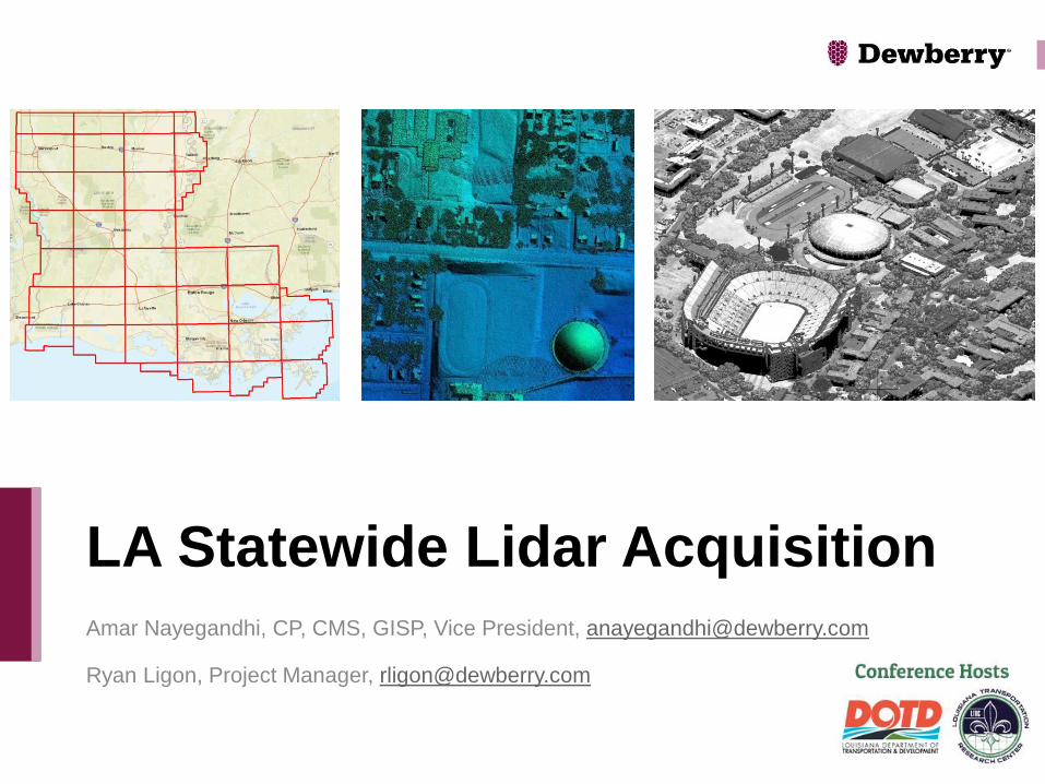
Amar Nayegandhi, CP, CMS, GISP, Vice President, [email protected]
Ryan Ligon, Project Manager, [email protected]
LA Statewide Lidar Acquisition

Introduction to Lidar
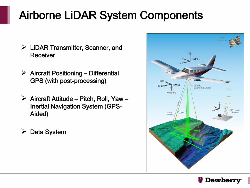
Airborne LiDAR System Components
LiDAR Transmitter, Scanner, and
Receiver
Aircraft Positioning – Differential
GPS (with post-processing)
Aircraft Attitude – Pitch, Roll, Yaw –
Inertial Navigation System (GPS-
Aided)
Data System
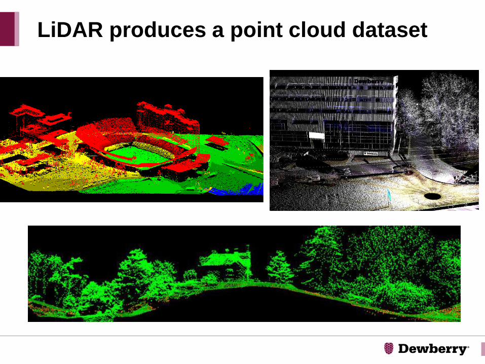
LiDAR produces a point cloud dataset
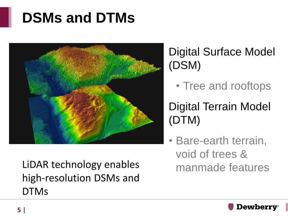
Digital Surface Model
(DSM)
• Tree and rooftops
Digital Terrain Model
(DTM)
• Bare-earth terrain,
void of trees &
manmade features
DSMs and DTMs
LiDAR technology enables high-resolution DSMs and DTMs
5 |
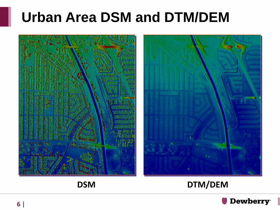
Urban Area DSM and DTM/DEM
DSM DTM/DEM
6 |

• Shows the intensity of
LiDAR reflectance for
each laser pulse, normally
1st return pulse intensities
• Similar to a B/W photo
image
LiDAR Intensity Images
7 |
Downtown Baltimore, MD
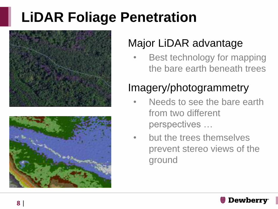
Major LiDAR advantage
• Best technology for mapping
the bare earth beneath trees
Imagery/photogrammetry
• Needs to see the bare earth
from two different
perspectives …
• but the trees themselves
prevent stereo views of the
ground
LiDAR Foliage Penetration
8 |
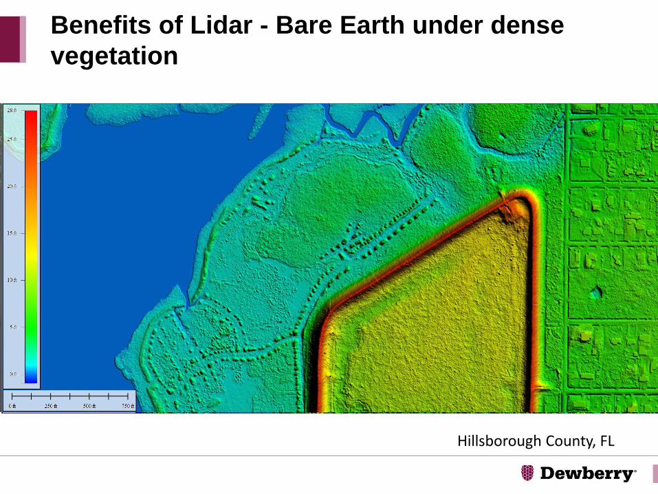
Benefits of Lidar - Bare Earth under dense
vegetation
Hillsborough County, FL
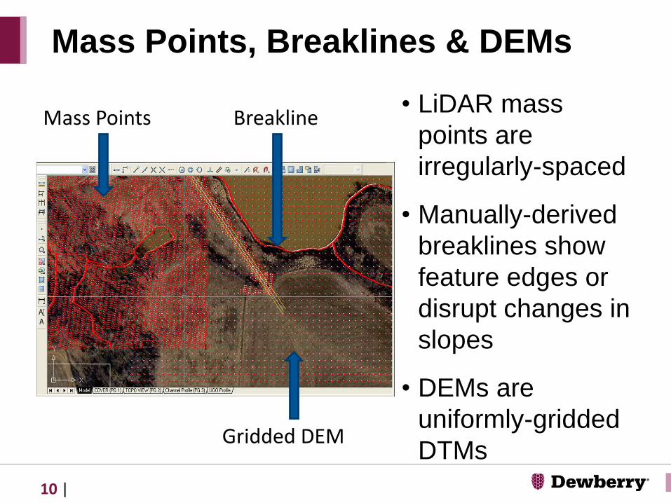
• LiDAR mass
points are
irregularly-spaced
• Manually-derived
breaklines show
feature edges or
disrupt changes in
slopes
• DEMs are
uniformly-gridded
DTMs
Mass Points, Breaklines & DEMs
Mass Points
Gridded DEM
Breakline
10 |
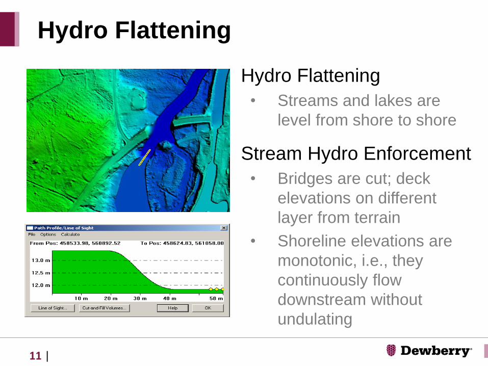
Hydro Flattening
• Streams and lakes are
level from shore to shore
Stream Hydro Enforcement
• Bridges are cut; deck
elevations on different
layer from terrain
• Shoreline elevations are
monotonic, i.e., they
continuously flow
downstream without
undulating
Hydro Flattening
11 |
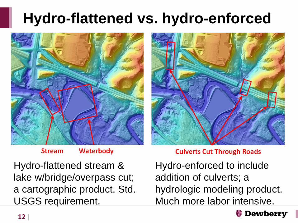
Hydro-flattened stream &
lake w/bridge/overpass cut;
a cartographic product. Std.
USGS requirement.
Hydro-flattened vs. hydro-enforced
Hydro-enforced to include
addition of culverts; a
hydrologic modeling product.
Much more labor intensive.
12 |

Semi-automated but still requires breaklines• Single-line stream
centerlines
• Dual-line stream centerlines
• Road casings/edge of pavement
For human interpretation of the 3D terrain only
Many people now prefer hillshades for 3D visualization
Contours
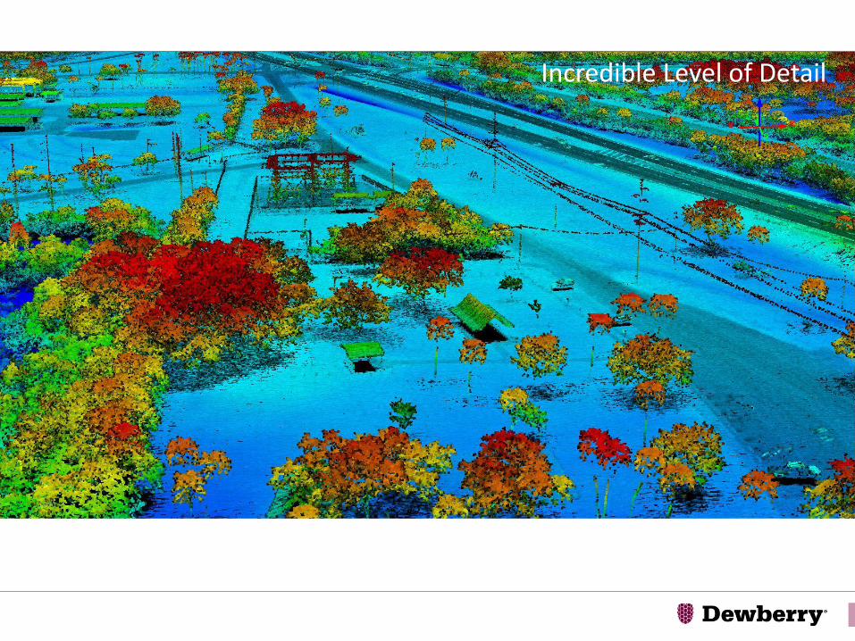
Incredible Level of Detail
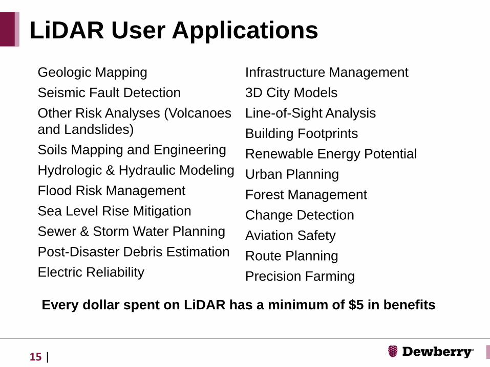
LiDAR User Applications
Geologic Mapping
Seismic Fault Detection
Other Risk Analyses (Volcanoes
and Landslides)
Soils Mapping and Engineering
Hydrologic & Hydraulic Modeling
Flood Risk Management
Sea Level Rise Mitigation
Sewer & Storm Water Planning
Post-Disaster Debris Estimation
Electric Reliability
Infrastructure Management
3D City Models
Line-of-Sight Analysis
Building Footprints
Renewable Energy Potential
Urban Planning
Forest Management
Change Detection
Aviation Safety
Route Planning
Precision Farming
Every dollar spent on LiDAR has a minimum of $5 in benefits
15 |

NEEA Report for 3DEP QL1/QL2 LiDAR
Blueprint for the 3D Elevation Program (3DEP)
16 | LiDAR and Common Applications
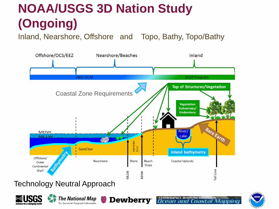
NOAA/USGS 3D Nation Study
(Ongoing)Inland, Nearshore, Offshore and Topo, Bathy, Topo/Bathy
Coastal Zone Requirements
Technology Neutral Approach
Supporting LADOTD
• Dewberry Engineers Inc is contracted to provide guidance
and assist in the creation of GIS data as outlined by the
DOTD.
• Dewberry will develop with DOTD an updated Master
Program Management Plan
• To provide guidance on planning lidar acquisition, sensor
operation, data qc, and lidar processing.
• Training the DOTD staff is a critical part of Dewberry’s
task. Develop training documents.
• Data acquisition to be conducted by DOTD’s staff under
the supervision of Dewberry staff in place at the DOTD
headquarters.
• Training of DOTD staff for processing lidar data
conducted by Dewberry staff that are both permanently
placed in Baton Rouge as well as traveling from Tampa,
FL.
• Standard Operating Procedures are co-developed with
input from DOTD and Dewberry specifically for use with
the statewide acquisition program.
Supporting LA DOTD
• Quality Level 1 (QL1) lidar containing at least 8 points
per square meter.
• Produces highly accurate elevation data that can be
used to create contours, DEMs, more accurate
orthophotography…
• Rigorous QA/QC process testing data against surveyed
accuracy checkpoints to ensure meeting ASPRS and
USGS/3DEP specifications.
• Data and products shall be reviewed and accepted by
the USGS for use in the 3DEP program
Desired Lidar Specifications
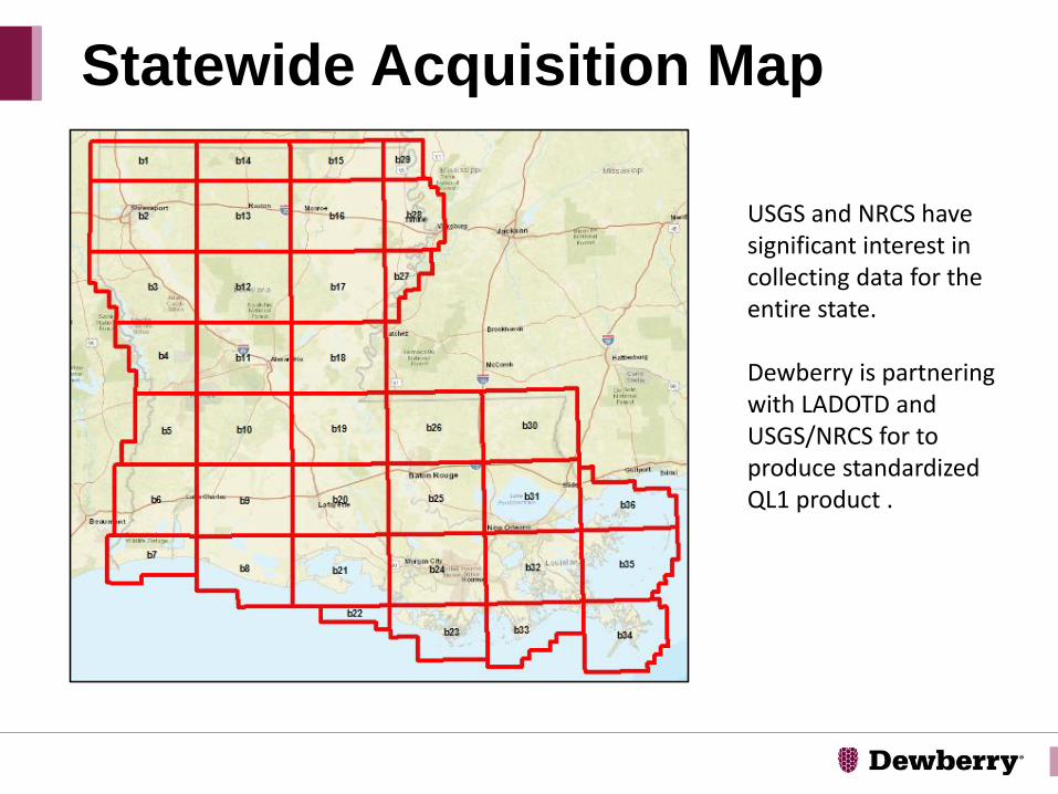
Statewide Acquisition Map
USGS and NRCS have significant interest in collecting data for the entire state.
Dewberry is partnering with LADOTD and USGS/NRCS for to produce standardized QL1 product .
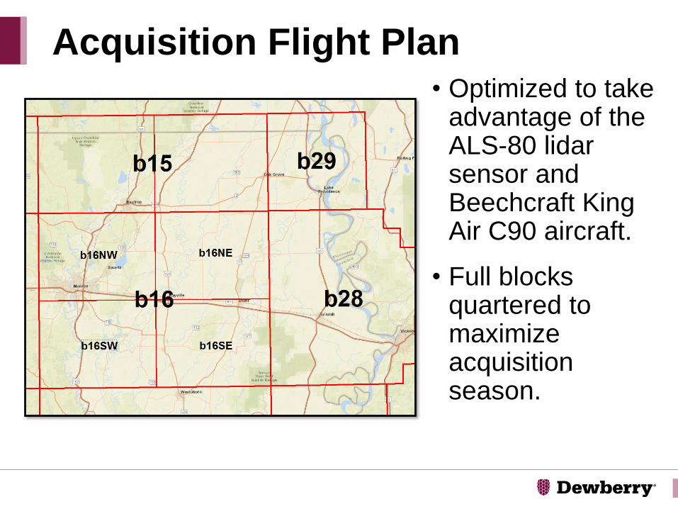
• Optimized to take advantage of the ALS-80 lidarsensor and Beechcraft King Air C90 aircraft.
• Full blocks quartered to maximize acquisition season.
Acquisition Flight Plan
West Chesapeake Bay Watershed TO
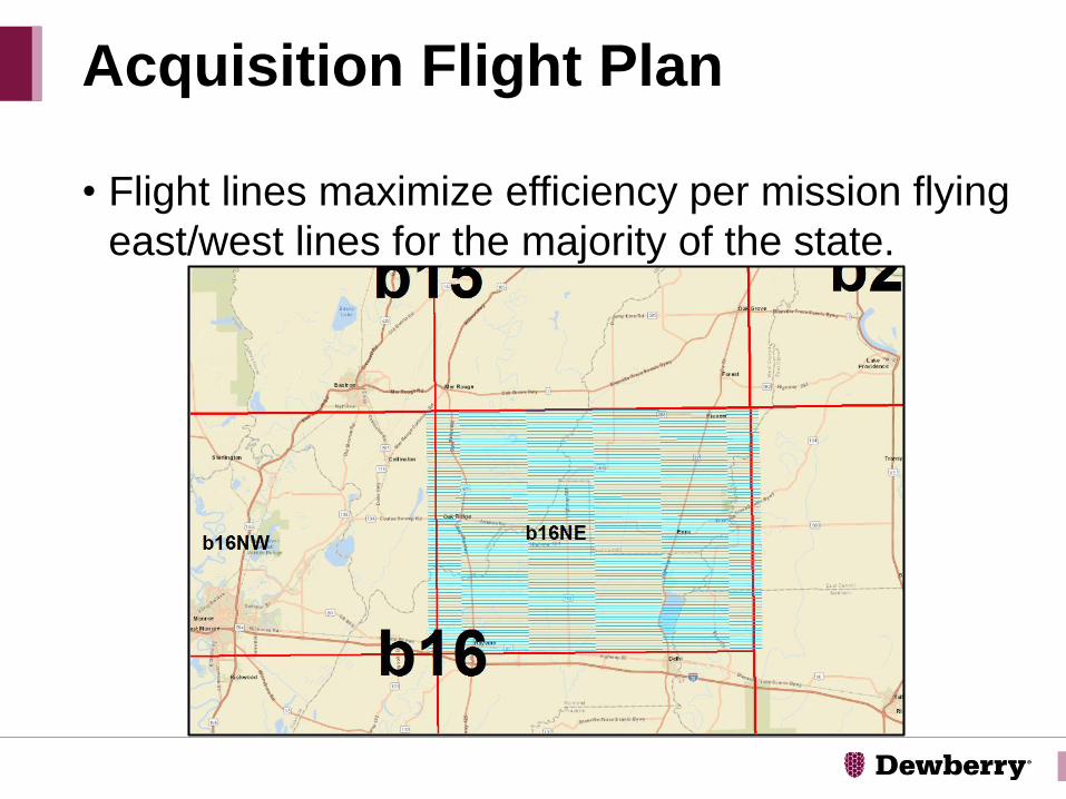
• Flight lines maximize efficiency per mission flying
east/west lines for the majority of the state.
Acquisition Flight Plan

• Proof of concept data collected to test the sensor
and initially train DOTD staff
• Area of interest approximately 298 square miles
• 37 flight lines acquired in July 2017
• 6 tiles processed and submitted to USGS for
acceptance as a QL1 deliverable
• USGS acceptance on January 18, 2018
Baton Rouge Pilot Acquisition

• The pilot acquisition area was chosen to contain an example cross section of many feature types: urban, industrial, commercial, residential, agricultural, forested, wetland, and containing hydrographic features.
Baton Rouge Pilot Acquisition
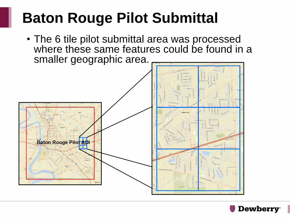
• The 6 tile pilot submittal area was processed where these same features could be found in a smaller geographic area.
Baton Rouge Pilot Submittal
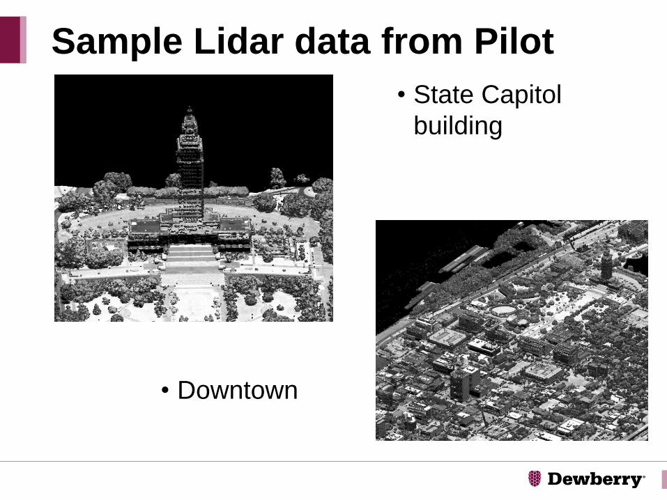
• State Capitol
building
Sample Lidar data from Pilot
• Downtown

• LSU Tiger
Stadium!
Sample Lidar data from Pilot
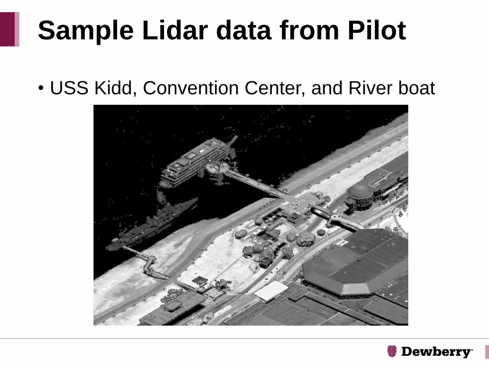
• USS Kidd, Convention Center, and River boat
Sample Lidar data from Pilot

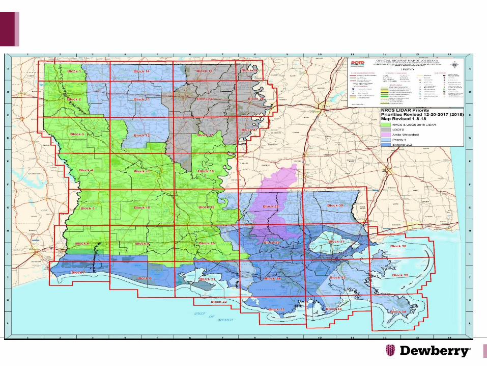
• Approximately 5930 square miles of land area
• 10 parishes in all
DOTD Priority area 2017/2018
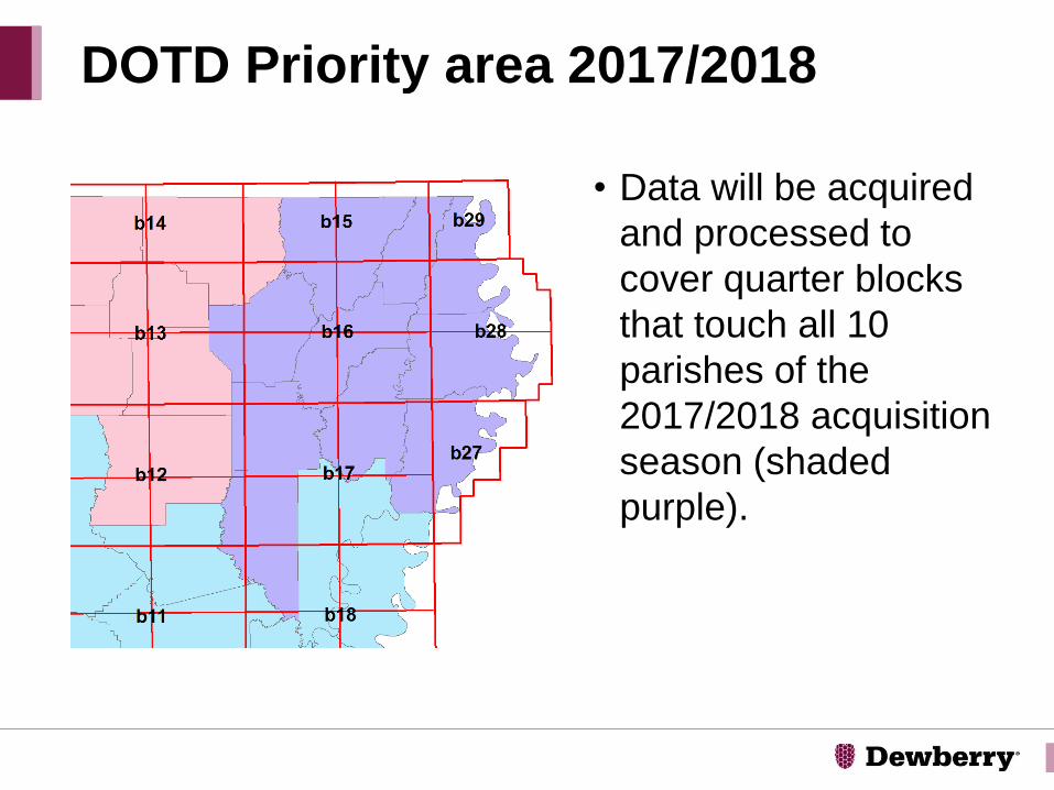
• Data will be acquired
and processed to
cover quarter blocks
that touch all 10
parishes of the
2017/2018 acquisition
season (shaded
purple).
DOTD Priority area 2017/2018
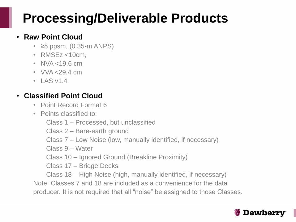
Processing/Deliverable Products
• Raw Point Cloud
• ≥8 ppsm, (0.35-m ANPS)
• RMSEz <10cm,
• NVA <19.6 cm
• VVA <29.4 cm
• LAS v1.4
• Classified Point Cloud
• Point Record Format 6
• Points classified to:
Class 1 – Processed, but unclassified
Class 2 – Bare-earth ground
Class 7 – Low Noise (low, manually identified, if necessary)
Class 9 – Water
Class 10 – Ignored Ground (Breakline Proximity)
Class 17 – Bridge Decks
Class 18 – High Noise (high, manually identified, if necessary)
Note: Classes 7 and 18 are included as a convenience for the data
producer. It is not required that all “noise” be assigned to those Classes.
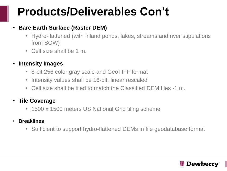
• Bare Earth Surface (Raster DEM)
• Hydro-flattened (with inland ponds, lakes, streams and river stipulations
from SOW)
• Cell size shall be 1 m.
• Intensity Images
• 8-bit 256 color gray scale and GeoTIFF format
• Intensity values shall be 16-bit, linear rescaled
• Cell size shall be tiled to match the Classified DEM files -1 m.
• Tile Coverage
• 1500 x 1500 meters US National Grid tiling scheme
• Breaklines
• Sufficient to support hydro-flattened DEMs in file geodatabase format
Products/Deliverables Con’t
• QA/QC Checkpoints
• Check points shall be collected according to ASPRS Positional
Accuracy Standards for Digital Geospatial Data, Version 1.0
(November 2014).
• Metadata
• Compliant to USGS Lidar Base Specification Version 1.2; one per
project, lift and tiled deliverable product group
• Collection Report detailing mission planning and flight logs
• Survey Report
• Processing Report
• QA/QC Report
• Control and Check Points
Products/Deliverables Con’t
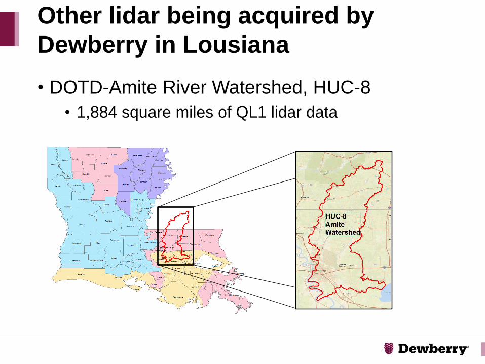
• DOTD-Amite River Watershed, HUC-8
• 1,884 square miles of QL1 lidar data
Other lidar being acquired by
Dewberry in Lousiana
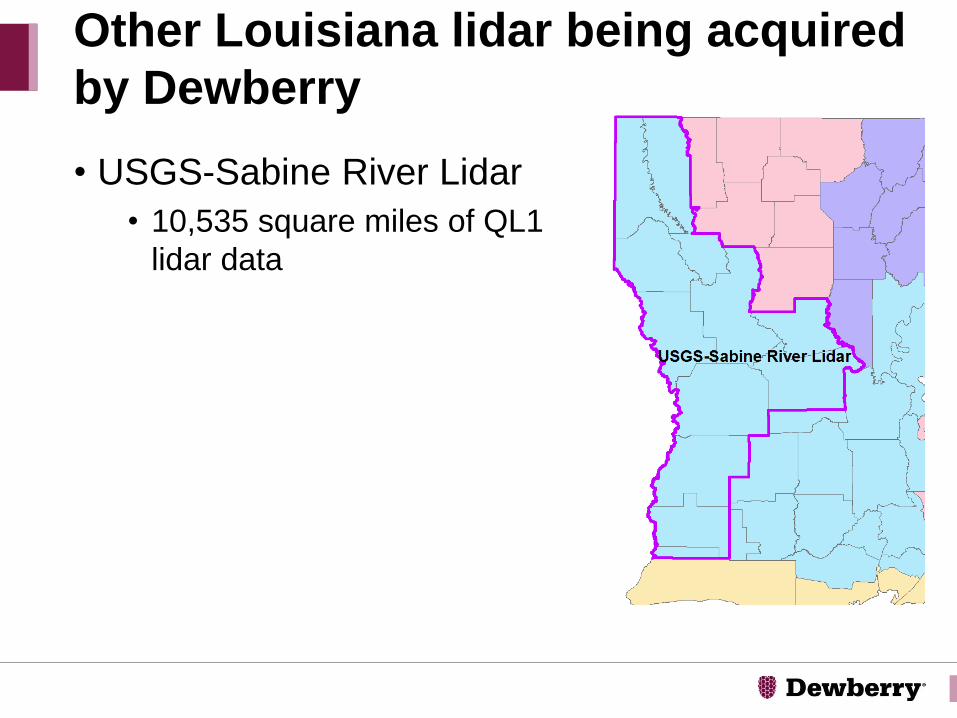
• USGS-Sabine River Lidar
• 10,535 square miles of QL1
lidar data
Other Louisiana lidar being acquired
by Dewberry

Questions/Open Forum
Discussion Topics
Amar Nayegandhi, CP, CMS, GISPVice [email protected]
Ryan LigonProject [email protected]