Embed Size (px)
Citation preview
Erdbeobachtung für die Maritime Sicherheit
Nationales Forum für Fernerkundung und Copernicus 2015 "Copernicus erfolgreich nutzen"
Egbert Schwarz German Remote Sensing Data Center Maritime Security Lab Neustrelitz
German Remote Sensing Data Center
Presentation Outline Background
− Maritime Security Lab Neustrelitz − Component of Service Chain
Application Status and Future Development − Ship Detection − Oil Detection − Wind and Wave − Iceberg Detection and Classification
German Remote Sensing Data Center
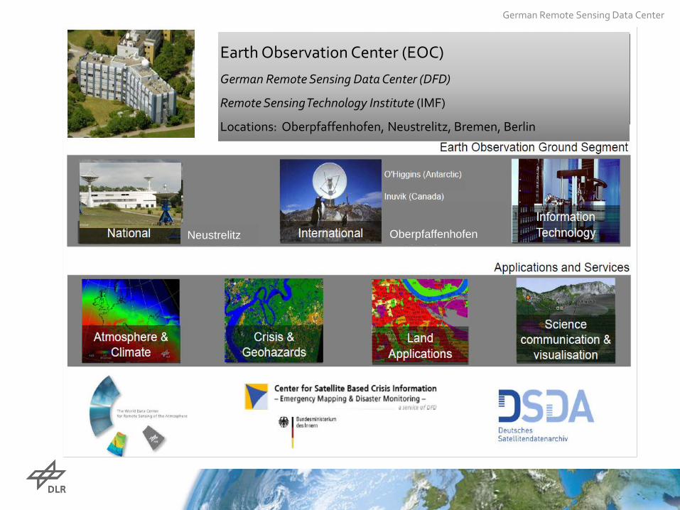
Earth Observation Center (EOC)
German Remote Sensing Data Center (DFD)
Remote Sensing Technology Institute (IMF)
Locations: Oberpfaffenhofen, Neustrelitz, Bremen, Berlin
Oberpfaffenhofen Neustrelitz
German Remote Sensing Data Center
NEUSTRELITZ
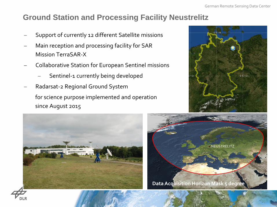
Ground Station and Processing Facility Neustrelitz
Data Acquisition Horizon Mask 5 degree
− Support of currently 12 different Satellite missions
− Main reception and processing facility for SAR Mission TerraSAR-X
− Collaborative Station for European Sentinel missions
− Sentinel-1 currently being developed
− Radarsat-2 Regional Ground System
for science purpose implemented and operation since August 2015
German Remote Sensing Data Center
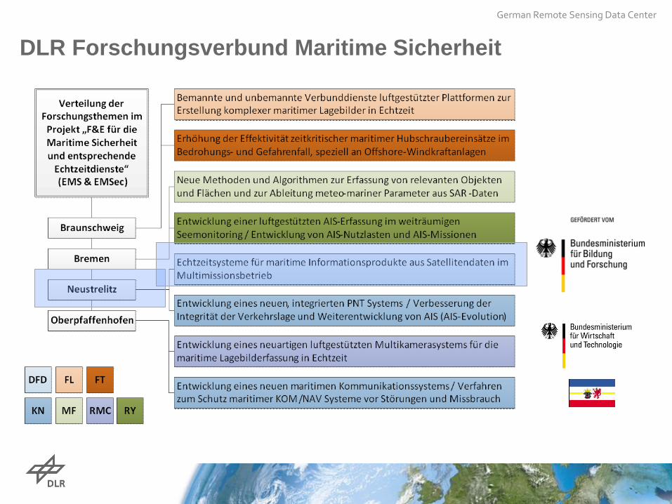
DLR Forschungsverbund Maritime Sicherheit
German Remote Sensing Data Center
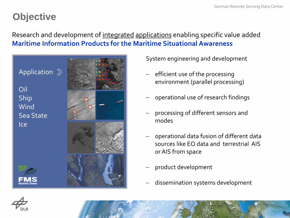
Objective
Research and development of integrated applications enabling specific value added Maritime Information Products for the Maritime Situational Awareness
Application Oil Ship Wind Sea State Ice
System engineering and development − efficient use of the processing
environment (parallel processing)
− operational use of research findings − processing of different sensors and
modes − operational data fusion of different data
sources like EO data and terrestrial AIS or AIS from space
− product development − dissemination systems development
German Remote Sensing Data Center
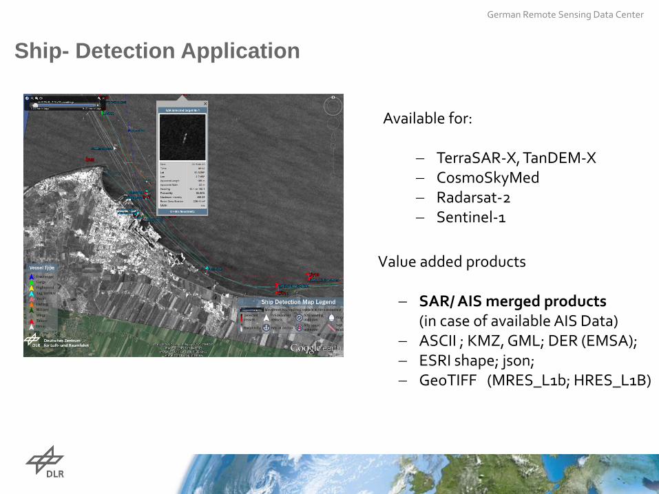
Ship- Detection Application
Available for:
− TerraSAR-X, TanDEM-X − CosmoSkyMed − Radarsat-2 − Sentinel-1
Value added products
− SAR/ AIS merged products (in case of available AIS Data)
− ASCII ; KMZ, GML; DER (EMSA); − ESRI shape; json; − GeoTIFF (MRES_L1b; HRES_L1B)
German Remote Sensing Data Center
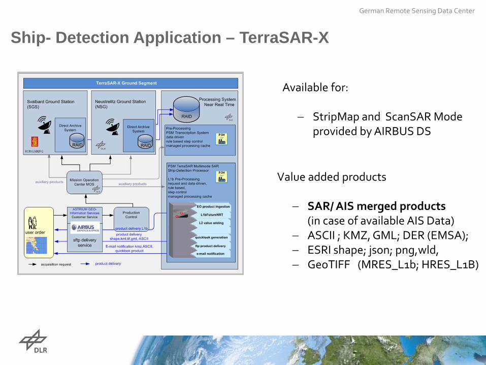
Ship- Detection Application – TerraSAR-X
Available for:
− StripMap and ScanSAR Mode
provided by AIRBUS DS
Value added products
− SAR/ AIS merged products (in case of available AIS Data)
− ASCII ; KMZ, GML; DER (EMSA); − ESRI shape; json; png,wld, − GeoTIFF (MRES_L1b; HRES_L1B)
German Remote Sensing Data Center
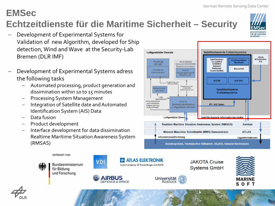
EMSec Echtzeitdienste für die Maritime Sicherheit – Security − Development of Experimental Systems for
Validation of new Algorithm, developed for Ship detection, Wind and Wave at the Security-Lab Bremen (DLR IMF)
− Development of Experimental Systems adress
the following tasks − Automated processing, product generation and
dissimination within 10 to 15 minutes − Processing System Management − Integration of Satellite date and Automated
Identification System (AIS) Data − Data fusion − Product development − Interface development for data dissimination
Realtime Maritime Situation Awareness System (RMSAS)
German Remote Sensing Data Center
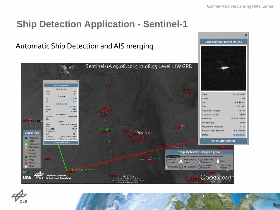
Automatic Ship Detection and AIS merging
Sentinel-1A 09.08.2015 17:08:55 Level 1 IW GRD
Ship Detection Application - Sentinel-1
German Remote Sensing Data Center
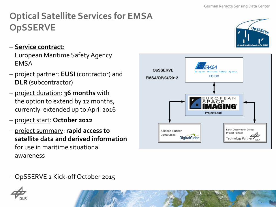
Optical Satellite Services for EMSA OpSSERVE
− Service contract: European Maritime Safety Agency EMSA
− project partner: EUSI (contractor) and DLR (subcontractor)
− project duration: 36 months with the option to extend by 12 months, currently extended up to April 2016
− project start: October 2012
− project summary: rapid access to satellite data and derived information for use in maritime situational awareness
− OpSSERVE 2 Kick-off October 2015
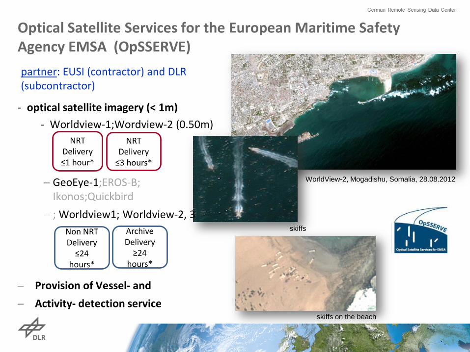
Optical Satellite Services for the European Maritime Safety Agency EMSA (OpSSERVE)
- optical satellite imagery (< 1m) - Worldview-1;Wordview-2 (0.50m)
− Provision of Vessel- and − Activity- detection service
WorldView-2, Mogadishu, Somalia, 28.08.2012
skiffs on the beach
skiffs
NRT Delivery ≤1 hour*
NRT Delivery
≤3 hours*
− GeoEye-1;EROS-B; Ikonos;Quickbird
− ; Worldview1; Worldview-2, 3 Non NRT
Delivery ≤24
hours*
Archive Delivery
≥24 hours*
partner: EUSI (contractor) and DLR (subcontractor)
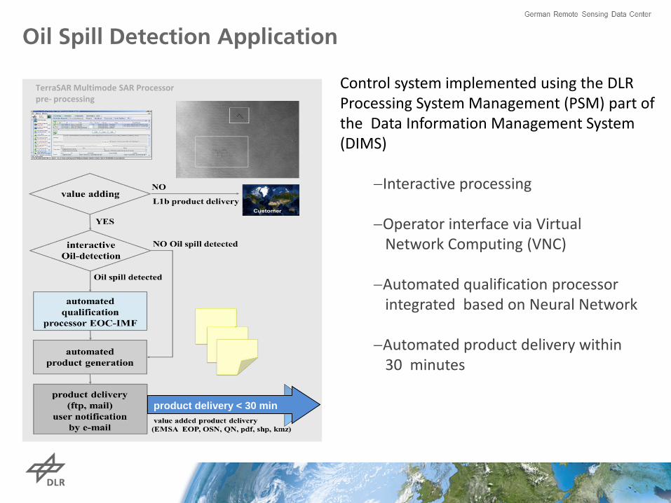
TerraSAR Multimode SAR Processor pre- processing
product delivery < 30 min
Control system implemented using the DLR Processing System Management (PSM) part of the Data Information Management System (DIMS)
−Interactive processing −Operator interface via Virtual Network Computing (VNC) −Automated qualification processor integrated based on Neural Network
−Automated product delivery within 30 minutes
Oil Spill Detection Application
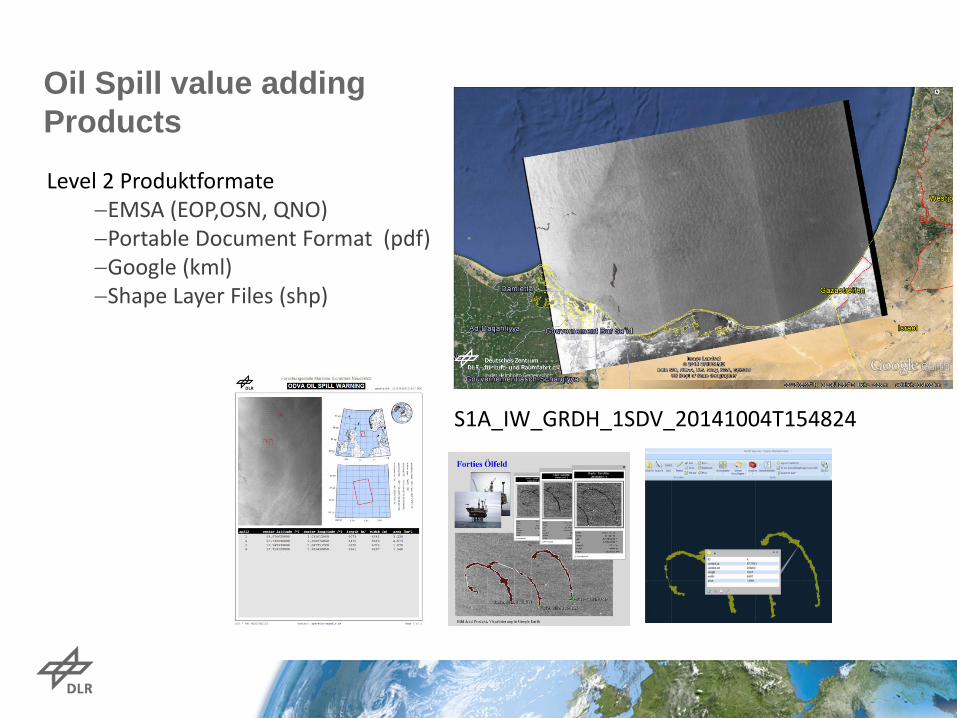
Oil Spill value adding Products
Level 2 Produktformate −EMSA (EOP,OSN, QNO) −Portable Document Format (pdf) −Google (kml) −Shape Layer Files (shp)
S1A_IW_GRDH_1SDV_20141004T154824
German Remote Sensing Data Center
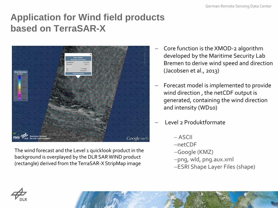
Application for Wind field products based on TerraSAR-X
− Core function is the XMOD-2 algorithm developed by the Maritime Security Lab Bremen to derive wind speed and direction (Jacobsen et al., 2013)
− Forecast model is implemented to provide
wind direction , the netCDF output is generated, containing the wind direction and intensity (WD10)
− Level 2 Produktformate
− ASCII −netCDF −Google (KMZ) −png, wld, png.aux.xml −ESRI Shape Layer Files (shape)
The wind forecast and the Level 1 quicklook product in the background is overplayed by the DLR SAR WIND product (rectangle) derived from the TerraSAR-X StripMap image
German Remote Sensing Data Center
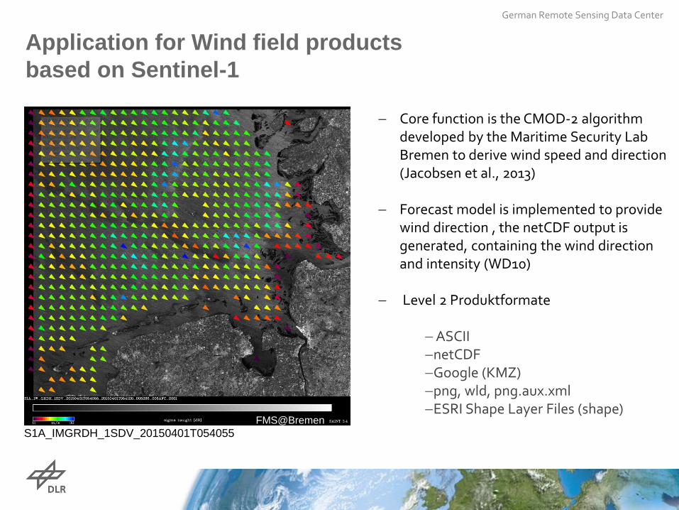
Application for Wind field products based on Sentinel-1
− Core function is the CMOD-2 algorithm developed by the Maritime Security Lab Bremen to derive wind speed and direction (Jacobsen et al., 2013)
− Forecast model is implemented to provide
wind direction , the netCDF output is generated, containing the wind direction and intensity (WD10)
− Level 2 Produktformate
− ASCII −netCDF −Google (KMZ) −png, wld, png.aux.xml −ESRI Shape Layer Files (shape)
The wind forecast and the Level 1 quicklook product in the background is overplayed by the DLR SAR WIND product (rectangle) derived from the TerraSAR-X StripMap image
S1A_IMGRDH_1SDV_20150401T054055 FMS@Bremen
German Remote Sensing Data Center
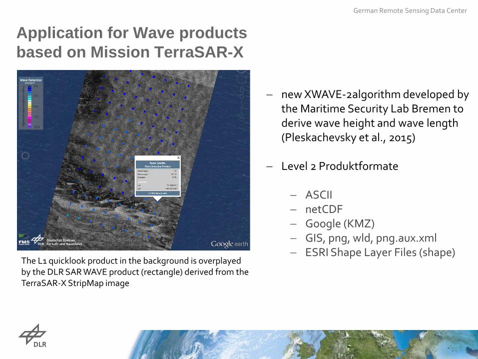
Application for Wave products based on Mission TerraSAR-X
− new XWAVE-2algorithm developed by
the Maritime Security Lab Bremen to derive wave height and wave length (Pleskachevsky et al., 2015)
− Level 2 Produktformate
− ASCII − netCDF − Google (KMZ) − GIS, png, wld, png.aux.xml − ESRI Shape Layer Files (shape)
The L1 quicklook product in the background is overplayed by the DLR SAR WAVE product (rectangle) derived from the TerraSAR-X StripMap image
18 / 25
German Remote Data Center
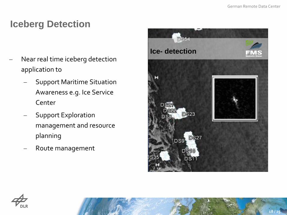
Iceberg Detection
− Near real time iceberg detection application to
− Support Maritime Situation Awareness e.g. Ice Service Center
− Support Exploration management and resource planning
− Route management
Ice- detection
German Remote Sensing Data Center
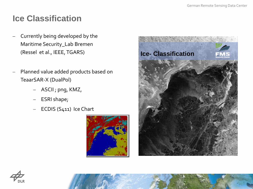
Ice Classification
− Currently being developed by the Maritime Security_Lab Bremen (Ressel et al., IEEE, TGARS)
− Planned value added products based on TeaarSAR-X (DualPol)
− ASCII ; png, KMZ,
− ESRI shape;
− ECDIS (S411) Ice Chart
Ice- Classification
German Remote Sensing Data Center
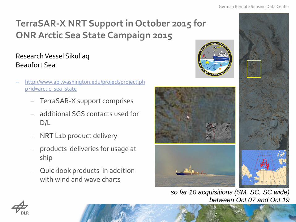
TerraSAR-X NRT Support in October 2015 for ONR Arctic Sea State Campaign 2015 Research Vessel Sikuliaq Beaufort Sea
− http://www.apl.washington.edu/project/project.php?id=arctic_sea_state
− TerraSAR-X support comprises
− additional SGS contacts used for D/L
− NRT L1b product delivery
− products deliveries for usage at ship
− Quicklook products in addition with wind and wave charts
so far 10 acquisitions (SM, SC, SC wide)
between Oct 07 and Oct 19
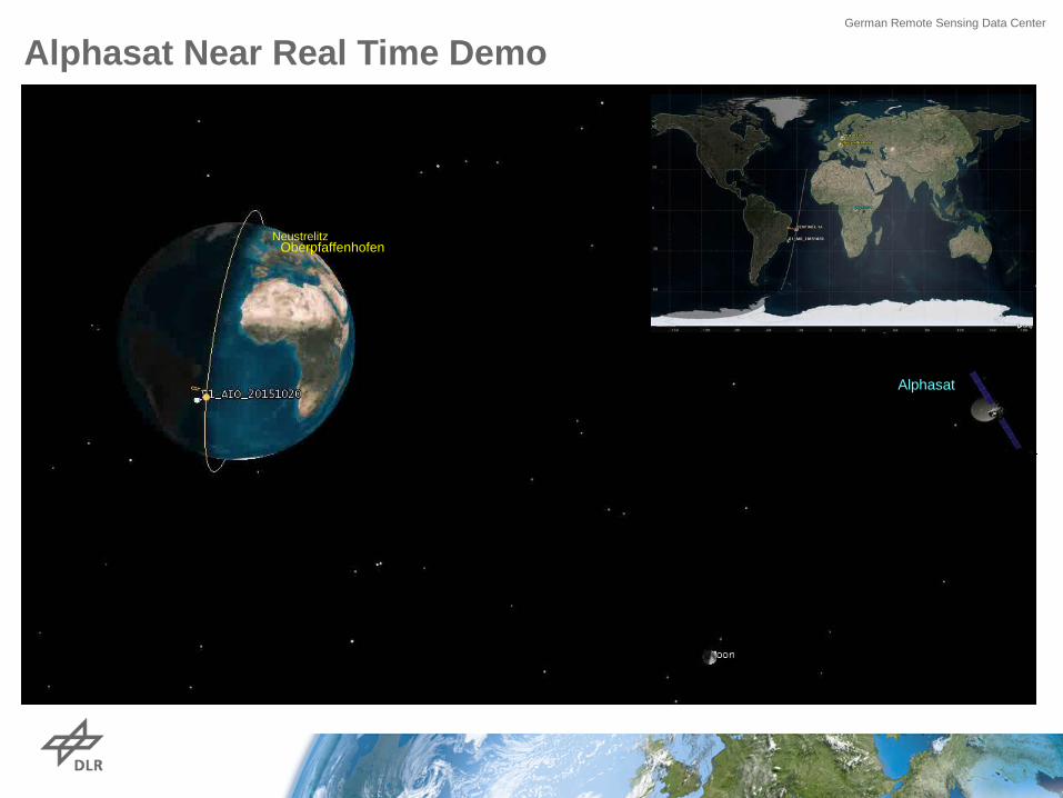
Alphasat Near Real Time Demo German Remote Sensing Data Center
Alphasat
Oberpfaffenhofen Neustrelitz
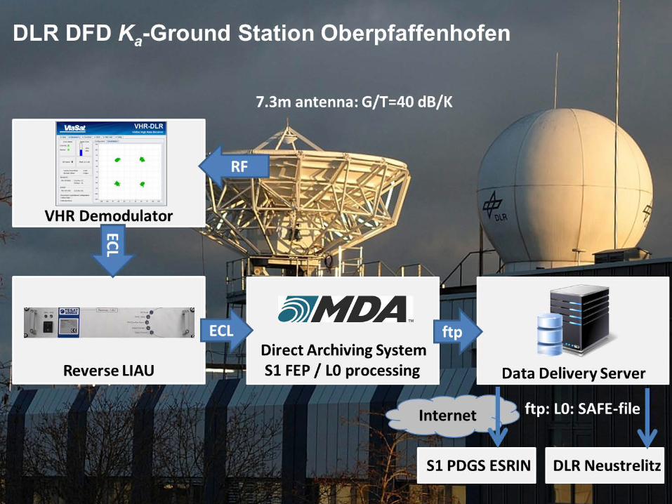
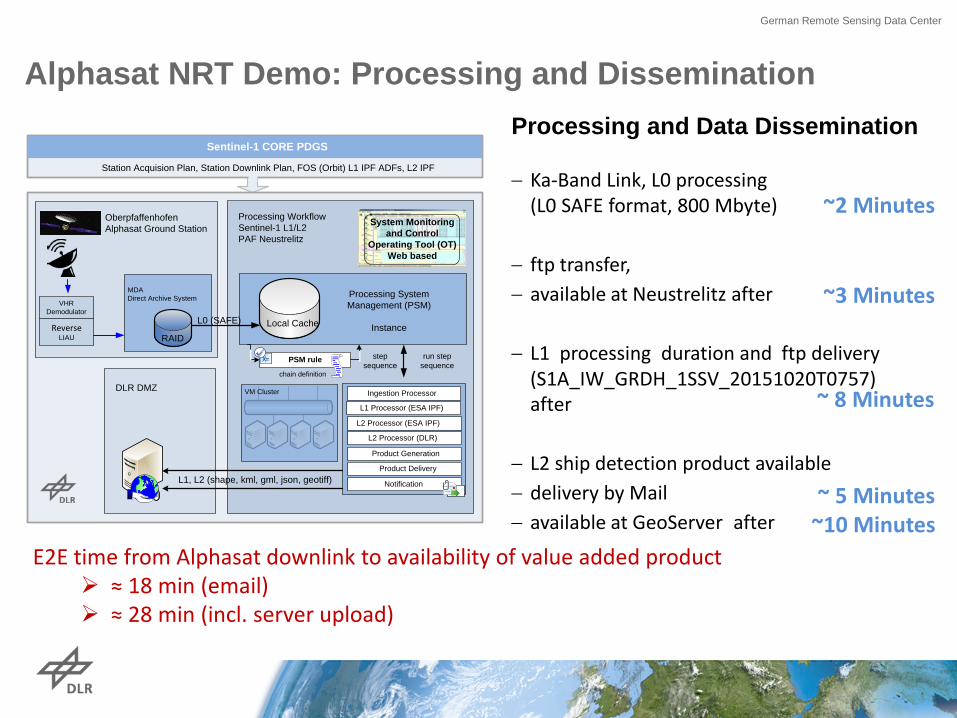
Processing and Data Dissemination − Ka-Band Link, L0 processing
(L0 SAFE format, 800 Mbyte) − ftp transfer, − available at Neustrelitz after − L1 processing duration and ftp delivery
(S1A_IW_GRDH_1SSV_20151020T0757) after
− L2 ship detection product available − delivery by Mail − available at GeoServer after
Alphasat NRT Demo: Processing and Dissemination
E2E time from Alphasat downlink to availability of value added product ≈ 18 min (email) ≈ 28 min (incl. server upload)
German Remote Sensing Data Center
Processing Workflow Sentinel-1 L1/L2 PAF Neustrelitz
Oberpfaffenhofen Alphasat Ground Station
MDADirect Archive System
X= PSM rule step sequence
Local Cache
L1 Processor (ESA IPF)
L2 Processor (ESA IPF)
Ingestion Processor
Product Generation
System Monitoring and Control
Operating Tool (OT)Web based
run step sequence
Product Delivery
Notification
chain definition
Processing System Management (PSM)
Instance
Sentinel-1 CORE PDGS
Reverse LIAU
VHR Demodulator
RAID
L0 (SAFE)
DLR DMZ
L2 Processor (DLR)
VM Cluster
L1, L2 (shape, kml, gml, json, geotiff)
Station Acquision Plan, Station Downlink Plan, FOS (Orbit) L1 IPF ADFs, L2 IPF
~3 Minutes
~ 8 Minutes
~ 5 Minutes ~10 Minutes
~2 Minutes
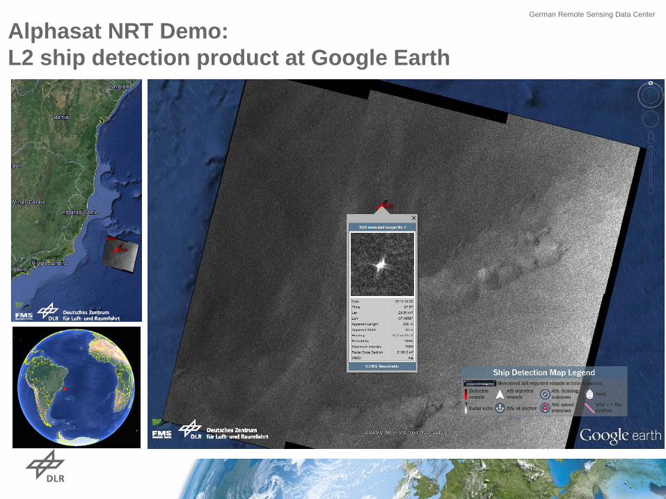
Alphasat NRT Demo: L2 ship detection product at Google Earth
German Remote Sensing Data Center
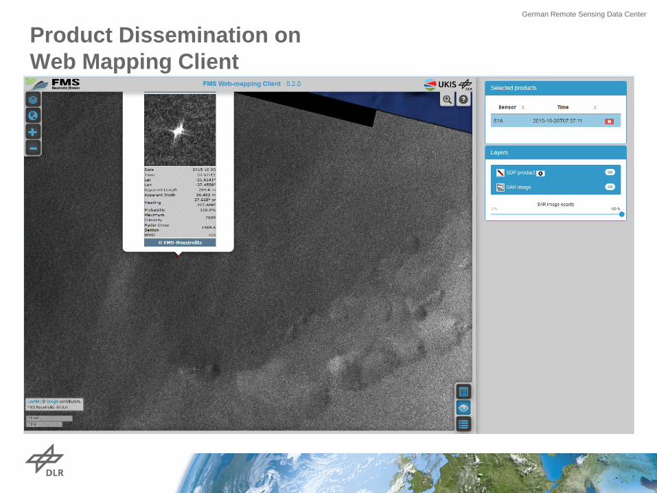
Product Dissemination on Web Mapping Client
German Remote Sensing Data Center
German Remote Sensing Data Center
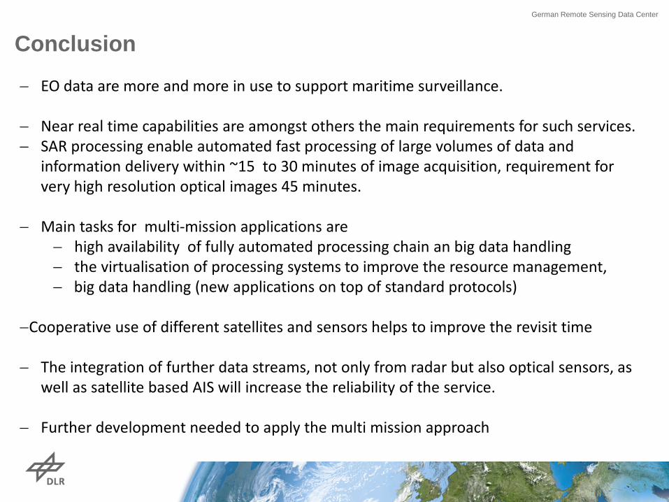
− EO data are more and more in use to support maritime surveillance.
− Near real time capabilities are amongst others the main requirements for such services. − SAR processing enable automated fast processing of large volumes of data and
information delivery within ~15 to 30 minutes of image acquisition, requirement for very high resolution optical images 45 minutes.
− Main tasks for multi-mission applications are − high availability of fully automated processing chain an big data handling − the virtualisation of processing systems to improve the resource management, − big data handling (new applications on top of standard protocols)
−Cooperative use of different satellites and sensors helps to improve the revisit time − The integration of further data streams, not only from radar but also optical sensors, as
well as satellite based AIS will increase the reliability of the service. − Further development needed to apply the multi mission approach
Conclusion
German Remote Sensing Data Center
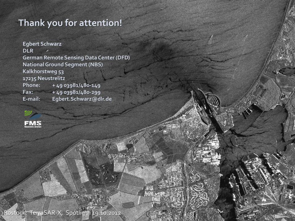
Egbert Schwarz DLR German Remote Sensing Data Center (DFD) National Ground Segment (NBS) Kalkhorstweg 53 17235 Neustrelitz Phone: + 49 03981/480-149 Fax: + 49 03981/480-299 E-mail: [email protected]
Rostock: TerraSAR-X, Spotligth 19.10.2012
Thank you for attention!