Embed Size (px)
Citation preview

Nestlé South Development Brief
Nestlé South Development Brief
May 2007 City Development Directorate of City Strategy
Nestlé South Development Brief
C O N T E N T S Chapter Page 1. Introduction ……………………………………………………………….. 1 Site History …………………………………………………………………….. 1 Why a Development Brief now? ……………………………………………. 1 Purpose of Brief ……………………………………………………………… 2 Vision ………………………………………………………………………….. 3 Key Objectives ……………………………………………………………….. 3 2. Site and Surroundings ………………………………………………….. 5 3. Policy Context ……………………………………………………………. 9 National Planning Policy ……………………………………………………. 9 Regional Planning Policy ……………………………………………………. 9 Local Planning Policy ………………………………………………………… 11 4. Sustainable Development ……………………………………………… 14 5. Development Opportunities ……………………………………………. 17 6. Design and Landscape Principles ……………………………………. 21 Understanding the Site ………………………………………………………. 21 Heritage ……………………………………………………………………… . 21 Links and Spaces ……………………………………………………………. 23 Scale, Height, Massing and Character ……………………………………. 25 Landscape Treatment ……………………………………………………….. 27 Trees ………………………………………………………………………… . 27 7. Open Space, Recreation and Public Art …………………………….. 29 8. Safety and Security ……………………………………………………... 32 9. Archaeology ………………………………………………………………. 33 10. Sustainable Transport …………………………………………………… 35 11. Highways and Parking ………………………………………………….. 39
Nestlé South Development Brief
Chapter Page 12. Accessibility ……………………………………………………………… 43 13. Environmental Issues …………………………………………………... 44
Air Quality ……………………………………………………………………… 44 Contaminated Land …………………………………………………………… 46
Noise and Other Amenity Issues ……………………………………………. 47 Ecology …………………………………………………………………………. 48 Flood Risk ………………………………………………………………………. 49 14. Services / Public Utilities ………………………………………………. 50 15. Developing Proposals ………………………………………………….. 51
Public Consultation on the Draft Development Brief ……………………… 51 Public Consultation on Development Proposals …………………………… 51 Masterplanning ………………………………………………………………… 52 Planning Applications and Conditions ………………………………………. 52
Planning Obligations ………………………………………………………….. 53
Environmental Impact Assessment …………………………………………. 55 Appendices 1. Summary of the History of Nestlé Rowntree ……………………………. 56
2. List of Documents …………………………………………………………… 58
3. City of York Council Contacts ……………………………………………… 59 Plans Plan 1 – Site Location Plan 2 – The Site Plan 3 – Development Control Local Plan Proposals Plan Extract Plan 4 – Existing Buildings Plan 5a – Existing Cycle Paths and Footpaths Plan 5b – Existing Bus Routes and Stops Plan 5c – Potential Areas of Traffic Improvement
Plan 6 – Buildings of Special Character Plan 7 – Local Service Provision
Chapter 1: Introduction
Nestlé South Development Brief
1
1. INTRODUCTION History 1.1 The site is historically associated with the manufacture of confectionary and cocoa, being the main production site for Nestlé Rowntree (and its previous companies in York) since 1890 when it was first developed by Joseph Rowntree as the “Cocoa Works”. 1.2 The works have progressively expanded from the south to the north over the last century, and this can be seen through the various building styles and materials. Appendix 1 summarises the history of Nestlé Rowntree from the 18th century. 1.3 The most intensive period of development at the site was between 1890 and 1940. This was characterised by the erection of large, multi storey blocks constructed in reinforced concrete or built in steel frames clad in brick and ashlar York stone dressings. 1.4 Between 1940 and 1970 development on the site slowed considerably, as Rowntrees sought to establish a global network of manufacturing bases. The company acquired UK and international companies and invested in new build factories around the UK, which were more ideally suited to automation and modern manufacturing techniques. 1.5 The next phase of major development occurred in the 1980’s, particularly after the acquisition of Rowntree PLC by Nestlé in 1988. This period included the construction of new, large single storey production and warehousing buildings. 1.6 The area that is subject of this Development Brief contains the core of the original factory, built between 1890 and 1940, at the southern margin of the Nestlé Rowntree site. Why a Development Brief now ? 1.7 As part of the plans announced by Nestlé Rowntree in September 2006, there was a clear commitment to stay in York, to safeguard the long-term employment of the 1,800 remaining employees. 1.8 A massive capital investment is needed in order to upgrade and improve facilities on the more modern northern part of the site, leaving redevelopment opportunities on the older, southern part of the site closest to the city centre. 1.9 This southern area (referred to as Nestlé South in the rest of this Brief) represents around 40% (7.9 hectares/ 19.5 acres) of the overall site
Chapter 1: Introduction
Nestlé South Development Brief
2
plant and largely comprises outdated general offices, some older Kit-Kat production and other buildings / extensions. Together they absorb a substantial part (up to 80%) of the factory’s maintenance budget and do not form the main part of Nestlé production. 1.10 A capital realisation of redevelopment in this area would allow re-investment in new facilities on the rest of the site, which would help to safeguard the future of employment on the remaining Nestlé site. It would also provide opportunities for new employment uses, as well as housing, new amenity and open spaces and better, safer links to surrounding areas as part of a mixed use development. 1.11 In order to progress a masterplan for the redevelopment of this part of the site it is essential that planning and highways requirements be addressed at an early stage, and overall objectives agreed through consideration by the local authority and through full consultation with the local community and other key stakeholders. 1.12 By setting out the policy requirements and wider aspirations for the site in this comprehensive Development Brief document, public representations can be received and responded to in a clear and accountable manner, well in advance of any planning application submission. What is the purpose of the Development Brief ? 1.13 The Brief aims to provide clear guidance on how the site should be developed, adding to the more general policies of the City of York Council Development Control Local Plan (April 2005) as well as regional and national policy and best practice guidance (see Chapter 3). The Brief is based on a comprehensive analysis of the site’s planning context, site constraints and opportunities to improve the area through conservation and redevelopment. 1.15 The Brief puts forward the Council’s vision, objectives, requirements and aspirations, introduces developers and urban designers to what the site has to offer, and is intended to inspire them to design and plan for the highest possible standards. It reinforces the call in the Government’s Urban Task Force report ‘Towards an Urban Renaissance’ (1990), for earlier, greater and better-informed attention to urban design. 1.16 The Brief has been subject to comprehensive consultation with the public and key organisations (statutory consultees) and prospective developers should, in progressing design solutions in this area, show how they have responded to the objectives and requirements set out in the Brief.
Chapter 1: Introduction
Nestlé South Development Brief
3
What is the Council’s vision for the site ? 1.17 The Council’s overall vision for the redevelopment of this area is: To create a new, inclusive, live / work community and cultural hub well integrated with surrounding areas. It should accommodate a mix of uses and follow best practice guidance in order to achieve high standards of design, public space and sustainability. High quality urban design which recognises the distinctive character of this part of the City, and safe and attractive pedestrian / cycle routes through and around the area will help to create a sense of place, and low car use principles must be embraced. Key Objectives 1.18 To deliver this overall vision a number of specific objectives need to be met. Redevelopment of the site will be successful if it :- KO1 Retains factory buildings of agreed distinction and considers
conversion to employment / residential, with some new build. KO2 Respects the character and fabric of factory buildings fronting
Haxby Road, together with the library, theatre and Nuffield Hospital and safeguards the wider character of the area and the setting of the historic City.
KO3 Creates its own identity and sense of place, whilst respecting the
history of the site. KO4 Provides new employment opportunities, particularly for the
creative industries. KO5 Creates a hub in the network of knowledge based industries,
potentially through existing Science City links with Nestlé. KO6 Provides smaller workshops, artisan studios and business
premises. KO7 Provides live / work units. KO8 Takes full account of the Council’s 2007 Housing Market
Assessment in putting forward any housing proposals on site, especially in terms of providing 2/3 bedroom family houses.
Chapter 1: Introduction
Nestlé South Development Brief
4
KO9 Provides new affordable homes for local people as part of an inclusive development.
KO10 Develops an overall character and appearance through adoption
of a low energy, community-focused approach. KO11 Considers contemporary design options and ensures layout,
design and build is exemplar in terms of sustainability and overall energy efficiency.
KO12 Incorporates on-site water management and recycling, and
provides at least 10% of its energy from on-site sources. KO13 Maximises connectivity and linkages between the site, the local
area and wider services and facilities, including links to open spaces at Fossway and other recreation spaces such as the Nestlé-owned sports facilities and open space to the north.
KO14 Provides safe, secure and good quality provision for children’s
play, amenity open space and youth and adult sports facilities. KO15 Makes the site easy to access by pedestrians, cyclists and public
transport users. KO16 Is highly accessible from the city centre, but with low car use. KO17 Improves the attractiveness and safety of the existing cycle path
between the site and Hambleton Terrace. KO18 Creates a greener environment than is there currently. KO19 Protects and encourages wildlife. 1.19 These nineteen key objectives are referred to throughout this Brief, and prospective developers of the site will be expected to demonstrate how each of these objectives have been addressed through a consultative masterplan and any subsequent planning applications for development of the site.
Chapter 2: Site & Surroundings
Nestlé South Development Brief
5
2. SITE AND SURROUNDINGS Nestlé Rowntree factory complex 2.1 The Nestlé Rowntree factory complex lies 2km to the north of the city centre on the urban / rural fringe (Plan 1). The site has 48 buildings, together with facilities for car and lorry parking. 2.2 The site is bounded to the south by the Sustrans Foss Island cycle route (which connects to the National Cycle Network Route 66), the B1363 Wigginton Road to the west, and Haxby Road to the east. To the north of the Nestlé Rowntree Factory complex the company sports fields open out into Green Belt countryside. Access to the site is from both the B1363 Wigginton Road and Haxby Road. 2.3 There is a mixture of building types on the site, which reflect the long evolution of the factory. They are set in a distinct rectilinear pattern and are generally utilitarian, designed for production purposes. The earliest buildings are to the south of the site and the most recent development to the north, away from the city centre. Nestlé South 2.4 This part of the factory site occupies 7.9 hectares (19.5 acres), around 40% of the total site area (Plan 2). It comprises the older, prominent buildings fronting Haxby Road and Hambleton Terrace together with car parking areas, landscaping and other factory buildings from a range of periods. 2.5 The native and ornamental planting around the site boundary links the site to the surrounding areas. It creates a backdrop to the site and enhances the local area, in part through reducing the impact of the large factory buildings. 2.6 Mature trees immediately within the factory boundary give the impression of the factory in a landscaped setting. However, there is very little landscape or trees within the inner site and no trees are the subject of Tree Preservation Orders to protect them. 2.7 This neighbourhood of York would be completely dominated, visually, by the factory works if it were not as well screened by mature trees and hedgerows. The planting is well defined and provides a strong framework for any future development. 2.8 Travelling along Haxby Road (the eastern site boundary) the landscape is essentially mature ornamental planting. Behind the boundary fence there are areas of dense shrub planting with both deciduous and evergreen mature trees. The planting, being of a similar age and style and set
Chapter 2: Site & Surroundings
Nestlé South Development Brief
6
behind a fence, mirrors the landscape of the former Rowntrees amenity buildings on the opposite side of Haxby Road – the former Dining Block (now Nuffield Hospital), Joseph Rowntree Theatre, Yearsley swimming baths and sports fields. 2.9 The main visitor entrance is off Haxby Road, and this leads to the office block. Other entrances allow access to individual buildings, and are given a formal setting with ornamental planting. There are boundary railings and access points, which have a variety of structures, associated with them such as clocks and security points. 2.10 To the north of the Nestlé Rowntree factory complex there are playing fields and allotment gardens, which provide a transition between the urban environment and the open countryside. 2.11 Along the southern boundary of the site is a disused railway line, which now forms part of the Sustrans cycleway route. Trees and steep embankments on either side of the route separate the cycleway from the houses on Hambleton Terrace and from the site. There is currently no access to the site from the south. 2.12 The western boundary is marked by the B1363 Wigginton Road, an arterial route running from the city centre to the north. There are two access points to the site from this road (see Plan 2). The southernmost entrance provides general access and the northernmost access allows for lorries. 2.13 A link has been created to the cycleway from Wigginton Road, and trees planted formally on either side. On this boundary only the entrances to the site are formalised, with a clock and low shrubs backed by an evergreen hedge. Travelling along the length of the site boundary, planting becomes less formal and the plant species native – intermittent blackthorn hedge follows the perimeter of the site and mature deciduous trees surrounded by a chestnut pale fence act as a buffer between the road and the site. Views from surrounding areas 2.14 There are distinctive views of the Nestlé Rowntree works from the outer ring road, Haxby Road and Wigginton Road, and other surrounding streets. There is an iconic and historic attachment to the works, which is familiar and reminds people of York. The buildings and views of them need to be fully taken into account in developing a masterplan for the area. Through redevelopment, however, the opportunity does exist to bring some new and interesting views to this area, which would compliment rather than compromise the present setting.
Chapter 2: Site & Surroundings
Nestlé South Development Brief
7
Visual Impact 2.15 As the site is well screened by the buffer of mature trees, many of the factory buildings remain unseen by residents and pedestrians in the immediate area. 2.16 To the south east of the site the 1900-1930’s multi storey buildings are visible from Haxby Road. On the southern boundary the dense buffer of trees allows only occasional views of the Almond Blocks and Cream Blocks (Blocks 1 and 2 as shown on Plan 4). More general views of the factory are glimpsed through breaks in the trees and entrance points. 2.17 In the south west the Office Block (Block 30 on Plan 4) and the former Gum Department (Block 34 on Plan 4) are significantly higher than the tops of the trees and, again, views are glimpsed through breaks in the planting and at the entrance points into the complex. Local Context Bootham Stray 2.18 The western margin of the site falls within Bootham Stray which lies on both sides of Wigginton Road between the factory and the Bumper Castle pub. The stray includes narrow strips of land bordering Wigginton Road down to and including Clarence Gardens at the junction with Haxby Road and Clarence Street. Much of this has either been built over or is used as the front gardens of houses in this area.
Farming and Woodland 2.19 Bootham Stray links into farmland to the north of the site. Although it is private land, it is accessible to the public in areas where public footpaths and the recently built cycle link to New Earswick occur. The farmland landscape contains a variety of habitats such as ponds, hedgerows and shelterbelts. Public Open Space 2.20 There are several areas of public open space within the vicinity of the site. The most immediate is Clarence Gardens, which lies to the south, at the junction of Haxby Road and Wigginton Road. These well used gardens contain three bowling greens, a main amenity area, a small but well-equipped children’s play area and parking. These amenities already serve a large population based in Clarence Street, the Groves and Haxby Road areas. It is managed through a partnership between Clarence Gardens Bowls Association and the City of York Council.
Chapter 2: Site & Surroundings
Nestlé South Development Brief
8
2.21 The open space areas are well linked. Clifton Ings, adjacent to the River Ouse, is the nearest, most significant Open Access Land and this area links to the National Cycle Network Route 65. Clifton Backies, a local nature reserve is within 1km of the Nestlé South site (see Plan 7). Private Open Space 2.22 Nestlé Rowntree manage and maintain the sports grounds and playing fields adjacent to the north of the factory site for the use of groups associated with the company. There are six football pitches, one rugby pitch, one hockey pitch, athletics facilities, a bowling green and four tennis courts. There is also a pavilion with four changing rooms for winter and summer sports. The Allotments 2.23 There are three Council-run allotments within the local area – Bootham Stray, Wigginton Road, and Wigginton Terrace. Bootham Stray is a particularly significant local amenity area, surrounded by stray land and open fields. Wigginton Road allotments are divided into three areas, situated either side of Crichton Avenue Bridge and Wigginton Terrace is located at the junction with Wigginton Road and Hambleton Terrace. A fourth allotment site, managed and maintained by Nestlé, is located adjacent to Mille Crux. Housing 2.24 To the south of the site are uniform rows of Victorian and Edwardian terraced housing with small, well maintained front gardens. To the west of Wigginton Road is a row of three storey Victorian / Edwardian terraced housing set back from the road; over Crichton Bridge is an estate of post-war semi detached Council housing; and to the east of Haxby Road is a mix of modern infill housing and larger, more established semi detached housing backing onto the River Foss. Transport Routes 2.25 In addition to the primary road corridors of Haxby Road and Wigginton Road there are a number of other important transport corridors in the vicinity of the site. To the west of Wigginton Road is the York to Scarborough railway line. 2.26 The Foss Islands Route – National Cycle Network, follows the site boundary on two sides. It links New Earswick (and beyond) in the north, the city centre, Tang Hall and Osbaldwick in the east. The primary cycleway is supplemented with other designated routes, taking cyclists both into and out of the city centre (see Plan 5b).
Chapter 3: Policy Context
Nestlé South Development Brief
9
3. POLICY CONTEXT 3.1 The vision set out in the introduction to this document, and the potential development uses set out in Chapter 5, are based on national, regional and local planning policy. This chapter highlights some of the key policies and guidance that informs the approach taken in the brief in terms of development principles, sustainability and transport. The lists of policies are in no way exhaustive and any proposals must demonstrate a comprehensive recognition of statutory and other relevant guidance. National Planning Policy 3.2 National guidance exists in the form of Planning Policy Guidance (replaced by Planning Policy Statements). They explain statutory provisions and provide guidance on planning policy and the operation of the planning system. The development of the area should have particular regard to the following documents: PPS 1 – Delivering sustainable development PPS 3 – Housing PPG4 – Industrial, commercial development and small firms PPS 6 – Planning for town centres PPS 9 – Biodiversity and geological conservation PPG 13 – Transport PPG 15 – Planning and the historic environment PPG 16 – Archaeology and planning PPG 17 – Planning for open space, sport and recreation PPG 24 – Planning and noise
PPS 23 – Planning and pollution control PPS 25 – Flood Risk Regional Planning Policy Regional Spatial Strategy for Yorkshire and Humber (Selective Review of RPG 12) Dec 2004 3.3 This document provides a spatial framework to inform the preparation of local development documents, regional and sub-regional strategies and programmes that have a bearing on land use activities. It forms part of the statutory Development Plan for York and covers the period to 2016. Relevant policies include:
S1: Applying sustainable development principles S3: Urban and rural renaissance S4: Urban and rural design S6: Sustainable use of physical resources
Chapter 3: Policy Context
Nestlé South Development Brief
10
P1: Strategic patterns of development E3: Planning the overall provision of employment land H2: Sequential approach to allocation of housing land H3: Managing the release of housing land
H4: Housing size, type and affordability T1: Land use and transport integration T2: Public transport accessibility T3: Personal transport SOC4: Open space, sport and recreation N2: Historic and cultural resources N3: Landscape character R3: Water resources and drainage Yorkshire and Humber Plan Regional Spatial Strategy (2005) 3.4 The Selective Review of RPG12 will be replaced by a new Regional Spatial Strategy. The emerging Yorkshire and Humber Plan Regional Spatial Strategy 2005 was subject to Examination in Public in Autumn 2006 and is due to be adopted in Autumn 2007. It will cover the period to 2021. This Strategy has ‘weight’ as a planning document and will be given material consideration in planning decisions. Policies of relevance include: YH1: Overall approach YH2: Climate change and resource use YH3: Key spatial priorities YH5: Urban focus YH8: Location of development Y1: York sub area policy H1: Provision of distribution of housing H3: The provision of affordable housing H4: Housing Mix E1: Creating a successful and competitive regional economy E2: Town centres and major facilities E3: The supply of land and premises for economic development E4: Support of regional priority sectors and clusters E5: Safeguarding employment land
ENV5: Energy ENV6: Forestry, trees and woodland ENV8: Biodiversity ENV9: Cultural heritage ENV10: Landscape T1: Personal travel and modal shift T2: Parking policy T3: Public transport
Chapter 3: Policy Context
Nestlé South Development Brief
11
North Yorkshire County Structure Plan (Oct 1995) 3.5 The adopted North Yorkshire County Structure Plan is the statutory policy document for the North Yorkshire. It covers the period 1991 to 2006. Relevant policies include:
I5: Employment land I6: Industrial and commercial development I12: Provision for business use H4: Housing H8: Residential density T9: Car parking T10: Cycling T11: Transport for industry, commerce and other major development E4: Historic environment E5: Archaeology
Local Planning Policy City of York Draft Local Plan incorporating Fourth Set of Changes (April 2005) 3.6 The City of York draft Local Plan (referred to as the Development Control Local Plan) was approved by Members for development control purposes in April 2005. It represents the most advanced stage of Local Plan production, comprising the 1998 deposit draft amended up to and including the fourth set of changes. Although it is, in statutory terms, unadopted, the Development Control Local Plan represents the current planning position in York and reflects the approach advocated in up-to-date national and regional policy guidance. It will be used to determine any planning applications on this site. 3.7 Relevant Development Control Local Plan policies include: Chapter 1 – Strategic Policies SP1: Key Sustainable Themes SP3: Safeguarding the Historic Character and Setting of York SP6: Location Strategy SP8: Reducing Dependence on the Car SP10: Strategic Windfalls Chapter 2 – General Policies GP1: Design GP3: Planning against crime GP4a: Sustainability GP4b: Air quality GP5: Renewable energy GP6: Contaminated land

Chapter 3: Policy Context
Nestlé South Development Brief
12
GP7: Open space GP9: Landscaping GP11: Accessibility GP13: Planning obligations GP21: Advertisements Chapter 3 – Nature Conservation NE1: Trees, woodland and hedgerows NE3: Water protection NE7: Habitat protection and creation NE8: Green corridors Chapter 4 – Historic Environment HE1: Designation of Conservation Areas HE2: Development in Historic Locations HE10: Archaeology HE11: Trees and landscape Chapter 6 - Transport T2a: Existing pedestrian /cycle networks T2b: Proposed pedestrian /cycle networks T4: Cycle parking standards T5: Traffic and pedestrian safety T7b: Making public transport more effective T7c: Access to public transport T13a: Travel plans and contributions T16: Private non-residential parking T17: Residents’ parking schemes T18: Highways T20: Planning agreements Chapter 7 – Housing H2a: Affordable housing H3c: Mix of dwellings on housing sites H4a: Housing windfalls H5a: Residential density Chapter 8 – Employment E3b: Existing and proposed employment sites Chapter 9 – Educational Establishments ED4: Developer contributions towards educational facilities Chapter 10 – Shopping S8: Provision of shops in non-retail developments Chapter 11 – Leisure and Recreation L1a: Leisure development L1c: Provision of new open space in development
Chapter 3: Policy Context
Nestlé South Development Brief
13
Chapter 13 – Community Facilities C1: Community facilities C6: Developer contributions towards community facilities Chapter 14 – Minerals and Waste MW7: Temporary storage for recyclable material City of York Local Development Framework 3.8 Work on the Local Development Framework (LDF) for York has commenced and it is anticipated that the core strategy, allocations and Development Control Development Plan Documents (DPDs) will achieve statutory adoption by late 2009 / early 2010. The weight to be given to the emerging LDF Development Plan Documents (DPDs) will depend on the stage they have reached when a planning application is considered for the site, with the weight increasing as the DPD progresses through each stage and the nature and extent of any objections received. 3.9 Initial consultation on Issues and Options on the Core Strategy was undertaken during the summer of 2006. The Sustainability Appraisal Scoping Report has also been produced. This has been used to inform preparation of Issues and Options, and its methodology will be applied in appraising further stages of the Core Strategy and subsequent DPDs. 3.10 The Statement of Community Involvement was submitted to Government Office in February 2007 for the final stage of formal public consultation.
Chapter 4: Sustainable Development
Nestlé South Development Brief
14
4. SUSTAINABLE DEVELOPMENT Key Objectives being met : KO10, KO11, KO12, KO13, KO15, KO16, KO18, KO19 4.1 The redevelopment of this site offers an outstanding opportunity to redevelop previously used land in accordance with sustainable development principles. A development that embodies the principles of sustainable development will reduce running costs for future users, and therefore improve marketability, improve the attractiveness of the area and provide additional public open space. It can be referenced as a good example of sustainable development in the city. 4.2 Sustainable development is development that meets the needs of the present without compromising the ability of future generations to meet their own needs. It must enable people to enjoy a better quality of life now and in the future, through balancing social, economic and environmental needs and the prudent use of natural resources. It embraces not only local issues but also national and global matters, such as climate change. 4.3 These principles are underpinned by government policies such as PPS1 - Delivering Sustainable Development. At regional level, policy S1 - Applying Sustainable Development Principles of the adopted Regional Spatial Strategy for Yorkshire and Humber 2004 and policies YH2 Climate Change and ENV5 Energy of the emerging replacement Regional Spatial Strategy (2005) are relevant. 4.4 The York City Vision and Community strategy 2004-2024 outlines six themes for the development of the city. Sustainability is one of these themes with the objective that York should be a model sustainable city with a quality built and natural environment and modern, integrated transport network. 4.5 The main objective of the strategy is to reduce the Ecological Footprint of the city. This is a tool, which works out the amount of land needed to provide a population with all their resources and to absorb all their waste. This can be compared with the capacity of the earth to provide natural resources and to deal with the waste and pollution created. More information can be found at www.york.gov.uk. 4.6 It is clear that any new development will increase the Ecological Footprint of the city. However, in doing so it will also have social and economic benefits. The purpose of using the Ecological Footprint as a success measure is to ensure that any new development reduces the negative impact on the environment – which will help to balance the social and economic benefits against reduced environmental impacts. 4.7 At a local policy level the promotion of sustainable development is a key objective of the Council and underpins the vision of the Development Control Local Plan. This is outlined in the Local Plan Strategy and in
Chapter 4: Sustainable Development
Nestlé South Development Brief
15
Development Control Local Plan Policy GP4a – Sustainability. The policy requires the submission of a Sustainability Statement for all development proposals. It covers a wide number of issues, including the protection of irreplaceable environmental assets, promoting economic growth, sustainable design and layout of development, transport policy, re-use of previously developed land and materials, reduction in energy use and protection/ promotion of public open space. 4.8 The above policy is supported by the Draft Supplementary Planning Guidance (SPG) on Sustainable Design and Construction. It has been approved by Planning Committee (November 2006), and consultation began in January 2007. This document provides minimum standards that should be met by new development and advises how this should be demonstrated in the Sustainability Statement. Development proposals on the Nestlé South site will be required to meet the standards within the SPG. 4.9 Sustainable design and construction techniques are required to be incorporated at the earliest stage of development design (e.g. incorporating methods to use waste heat from the adjacent operating Nestlé factory). Initiatives will apply to both public and private open space and amenity areas, including recycling and drying areas. As a starting point, consideration should be given to how the buildings onsite can be re-used or adapted. Only where this is not practicable, or would prove a less sustainable option, should demolition occur (see also paragraph 4.10, bullet i). The minimum standards within the SPG mentioned above will be expected to be met. For a development of this size it will mean the achievement of a BREEAM (BRE Environmental Assessment Method) standard of at least ‘very good’. This is in addition to other minimum standards relating to demolition, considerate constructors etc, and the draft SPG should be consulted for detail. Consideration is required to be given to the environmental impact of the proposals in all phases from construction, use and ultimately demolition. 4.9 The sustainability statement to accompany any subsequent proposals should address the following issues :
a) Whole-life costs of any proposals and life cycle analysis of materials and identify its effect on York’s Ecological Footprint;
b) Bio-climatic design, including the orientation of building elements to maximise solar gain and the use of solar based energy generation and heating;
c) High thermal mass for new buildings and the use of energy systems which are efficient and above that required by building control regulations, in order to provide enhanced thermal and cooling qualities;
d) Retro-fitting of existing buildings to improve thermal efficiency and general environmental performance;
e) Renewable energy generation such as ground source heat pumps, wind, biomass and combined heat and power;
f) The efficient management of water on-site in order to reduce run off through building design and sustainable urban drainage systems;
g) Building design that provides space for wildlife;
Chapter 4: Sustainable Development
Nestlé South Development Brief
16
h) Use of indigenous species and planting that has wildlife value; i) The re-use of demolition materials on-site as aggregate and, if this is
not available, the use of aggregate from recycled materials, ideally from a local supplier;
j) Different construction techniques and materials, such as timber frame and prefabricated building units
k) The use of materials that are healthy, naturally occurring from renewable sources or recycled;
l) Reduce waste generation on-site during construction and use. Design in space for waste separation;
m) The use of local labour, contractors, products and suppliers; n) Training opportunities for local people during construction; o) Opportunities to improve public transport and links between different
transport modes. 4.11 The above list is not intended to be exhaustive and prospective developers are advised to liaise with the Council’s Sustainability Officer at an early stage in the formulation of their proposals. Further advice on sustainability issues is set out in the Council’s 2006 Supplementary Planning Guidance – Sustainable Design and Construction, as referred to in paragraph 4.8 above.
Chapter 5: Development Opportunities
Nestlé South Development Brief
17
5. DEVELOPMENT OPPORTUNITIES Key Objectives being met : KO1, KO2, KO4, KO5, KO6, KO7, KO8, KO9 Mix of Uses 5.1 The Nestlé Rowntree site has played a key role in providing employment in York for over a century. 625 jobs across a variety of skills have recently been lost from the 2,445 working on the site, and any new development proposals should aim to replace these with new employment opportunities. A mixed-use development, which, in employment terms, aims to replace what is currently being lost and seeks to redress this with new employment uses, would be acceptable. 5.2 The imperative in redeveloping this site will be to create a sustainable development with a strong sense of community and identity which, in true Rowntree tradition, can be referred to in future as an exemplar of its genre. There are opportunities in terms of community heating, innovative approaches to transport/ car parking, building design, and cycle/ pedestrian links to and from the site. The very name 'Rowntree' will potentially attract a lot of interest in any scheme to redevelop this area. Employment 5.3 The site is designated in the Development Control Local Plan for employment use. Sites currently or previously in employment use should be retained as such unless it can be demonstrated that there is a sufficient supply of employment land in the city and provided that either (a) unacceptable environmental benefits exist, (b) development of the site for other appropriate uses would lead to significant benefits to the local economy, or (c) the proposed use would be ancillary to an employment use. 5.4 Redevelopment of the Nestlé South site will be considered within the context of Nestlé’s stated commitment to a long-term presence in York, with the capital receipt from disposal of this part of the site providing a re-investment opportunity for a major city employer. 5.5 In quantitative terms it is considered that the recent job losses announced by Nestlé could be replaced on site through a mixed-use development. 5.6 Early feasibility studies should explore the possibility and implications of retrofitting the older buildings which currently occupy the Nestlé South site, in order to improve thermal performance, accessibility, integration of communications and other IT equipment and services.

Chapter 5: Development Opportunities
Nestlé South Development Brief
18
5.7 Redevelopment of the site provides a great opportunity to provide modern industry, either in an office context or as a manufacturing base. Opportunities for the creative and technology-based industries, including uses which compliment York’s aspirations to develop and expand Science City, will be especially encouraged. Liaison with the Council’s Economic Development Unit prior to developing proposals is essential in order to identify the potential to meet either Science City and/ or wider economic aims of the city. 5.8 A range of B1 Business uses which, in the Town and Country Planning Act Use Classes Order 2005, includes offices, research and development of products or processes, and light industry, should be catered for in order to encourage and achieve jobs back on this site. Particular consideration will be given to:-
• small / medium enterprises (SME’s) in the food and drink sector; • technology / modern economy; • creative workshop space; • quality studio space; • artisan / manufacturing.
5.9 The uses above could be accommodated in offices, workshops and live / work units. The opportunity exists to create a true community feel with a range of jobs for local people in a range of possible career paths, including smaller workshops and business premises. 5.10 The term ‘live / work’ effectively describes accommodation that is specifically designed to enable both residential and business use. Whilst many people work from home, the work use of their property is small scale and usually secondary to the domestic. Live / work accommodation is designed to have a higher intensity of business use, either through the amount of space devoted to the work use or that the work element is designed to accommodate more workers than just the resident and may be designed in a flexible form to encourage business expansion. 5.11 Live / work units can create sustainable communities and reduce the need to travel by car. They can also aid the development of small start up businesses and provide local investment. Further information on live / work units and sustainable communities can be found on the Department of Communities and Local Government website (www.communities.gov.uk). Regional examples of flexible office / studio space include the Konflux Theatre in York (4 spaces for artists with kitchen facilities and internet access), Patrick Studios in Leeds (34 quality studio spaces) and Colburn Park in Richmondshire, North Yorkshire (16 offices for digital / media / creative business), all of which can be found on the Yorkshire Forward website (www.digitalyorkshire.org.uk/business_accommodation/index.aspx). 5.12 Nestlé may be interested in developing new products out of its Research and Development labs on site and giving opportunities for staff to create their own businesses. The integration of hot desking business support/ mentoring into the facilities would be sensible and could, should they wish to
Chapter 5: Development Opportunities
Nestlé South Development Brief
19
be involved and enter into discussions, involve Business Link as the deliverer with Science City York Business Promoters in their technology business development role. 5.13 A portion of the existing employment blocks could be re-used to provide modern employment, embracing a number of segregated uses such as technology, light industry and accommodation for the creative industries. 5.14 Craft/ art studios/ workspace will be considered very positively, given the lack of this type of facility in York. This type of use is particularly suited to the re-use of historic buildings of character. Early contact with City of York Council Officers is encouraged in order to progress this for the benefit of York residents and artists. Housing 5.15 The Nestlé South site has been identified for mixed use development, including residential use. The site is considered suitable for residential uses subject to sufficient new employment provision, amenity issues and with appropriate local facilities, affordable housing and open space provision. Housing redevelopment will help contribute to the vitality and viability of the mix of uses on the site, make good use of existing buildings of distinction, and help create a “sustainable community”. 5.16 Any proposed residential development of 15 or more dwellings or on a site of 0.3ha or more in size, will be required to include an appropriate element of affordable housing dispersed inclusively within any agreed housing area. This includes potential conversion of existing buildings to part or full residential use as well as new build. If the Policy H2a of the Development Control Local Plan applies, 50% of the total number of homes are required to be provided in partnership with a Registered Social Landlord, subject to overall viability. If the Discount for Sale element of the affordable housing provision is unable to be purchased, then it will revert to affordable rent in the ownership of a Registered Social Landlord. 5.17 Early discussion with Council Officers is encouraged in order to agree a plan for the inclusion of affordable housing. Chapter 16 of this Brief - Developing Proposals - refers to policy details on tenure mix, inclusiveness in terms of layout and design, and assessments of viability. 5.18 Any residential element must include an appropriate mix of house types and sizes in accordance with Development Control Local Plan Policy H3c – Mix of Dwellings on Housing Sites, the 2006 Draft York Housing Market Assessment and the emerging 2007 Housing Market Assessment (expected in Summer 2007). 5.19 The 2006 draft HMA concludes that there is a requirement for a range of house types and sizes in the city, but with a particular demand for houses (rather than flats). Recent completions have been dominated by one and two bed flatted schemes meaning that the demand for two and three bedroom
Chapter 5: Development Opportunities
Nestlé South Development Brief
20
family homes has not been met. It is accepted that the site lends itself to a relatively high density houses, and every effort should be made to accommodate the housing needs of families as well as those of single people and childless and older couples. 5.20 Housing design and layout should be sympathetic to and inspired by existing site characteristics, include strong green landscape components and follow the principles of sustainable design and construction. An example of a sustainable mixed-use development is the Beddington Zero Energy Development (BedZED), the UK's largest carbon-neutral eco-community and the first of its kind in this country. Development Control Local Plan policy GP4(a) and draft SPG on Sustainable Design and Construction provide detailed explanation of what is required in terms of sustainable development and sustainability statements to accompany planning applications (see Chapter 4 – Sustainable Development). Other Uses 5.21 As part of the development and in conjunction with the creation of new live / work community on the site, ancillary uses such as leisure facilities, entertainment, restaurant / bar, health and medical facilities and other community uses will be encouraged. As well as attention to design details, careful thought will also need to be put into how these uses integrate into the wider site development and community. 5.22 In order to provide new, or to improve existing, community facilities an assessment will need to be made of local facilities and the scale of new housing development proposed. If appropriate, a developer contribution may be requested which should be reasonably related in scale and kind to the proposed development.
Chapter 6: Design & Landscape Principles
Nestlé South Development Brief
21
6. DESIGN AND LANDSCAPE PRINCIPLES Key Objectives being met : KO1, KO2, KO3, KO10, KO11, KO13, KO15, KO18 “Good urban design is rarely brought about by a local authority prescribing physical solutions, or by setting rigid or empirical standards but by approaches which emphasise design objectives or principles.”
(‘By Design’, DETR, CABE 2000). Understanding the Site 6.1 It is important to understand the unique potential of the site prior to formulating and advancing design proposals. To this end an Urban Design Analysis will be required which appraises the site in terms of geographical context and historical development. The analysis should take into account:
1) the location of the site on the sub-urban fringe of York and its proximity to countryside and the city centre;
2) the nature of the site and its surroundings in physical and functional
terms;
3) connections and desire lines between the site and its surroundings, identifying possibilities for improving movement across the site for pedestrians and making functional connections;
4) site topography, hard and soft landscape and ecology; and
5) existing patterns of built form on the site and surrounding it,
including heritage issues. The "Historic Buildings Assessment" is available as a supporting document.
6.2 At present the area is a production site, with physical barriers and security controls separating it off from the surrounding community. Although the north side of the site will continue in production, there is a proposal to integrate the area to the south with the surrounding area through a mixed-use development. Key to producing a successful scheme will be in ensuring that the inherent positive characteristics of the existing site are not lost during the course of transformation. Heritage 6.3 The site has developed over a hundred years and the earlier buildings have a strong physical presence in the surrounding area. They also figure in skyline views of York. The factory buildings themselves signify the importance of the Rowntree family (and their successors). The family were enlightened

Chapter 6: Design & Landscape Principles
Nestlé South Development Brief
22
entrepreneurs and pioneers of social reform with influence beyond York itself. The York factory complex was not only developed as an economic enterprise but as a social and philanthropic one, providing improved working conditions and amenities for employees including facilities for refreshment, health, leisure, entertainment and improved living conditions. The buildings themselves are a reminder of people, events and processes. They were designed to take advantage of sunlight, outlook, fresh air and natural ventilation. Their fabric also contains evidence of innovative construction techniques in concrete and steel. 6.4 The Rowntree family expressed their creativity and conscience on this site and their achievements should provide inspiration for the site's future development in the following ways:
• the most significant buildings and groupings of buildings and landscape along Haxby Road should, subject to further assessment, be retained. They reinforce the positive identity of York and their loss would seriously diminish the sense of place;
• the retained buildings should be given appropriate status within the
overall design; and • any new development should adopt high standards - using principles of
bioclimatic design in massing and layout, adopting environmentally friendly materials and construction techniques from local sources where possible, with buildings and spaces designed to support full and healthy lifestyles.
6.5 The site and buildings have recognised historic value although currently they have no statutory protection under the Planning (Listed Buildings and Conservation Areas) Act 1990 (see paragraph 6.8). It is recognised that historic buildings can form the basis of successful regeneration projects. 6.6 A Historic Buildings Assessment report was prepared by Hall Grey Architects on behalf of Nestlé in August 2006. The report was commissioned to establish an understanding of the whole factory site, the buildings on it, adjacent buildings bounding the site, buildings owned or previously owned by Nestlé Rowntree, and external landscape. The report traces the development of the site as an integrated complex and shows how that context has changed. It identifies key buildings which have been altered, demolished or remain. These buildings are assessed in terms of their architectural and historic significance. In assessing significance of the fabric and location, buildings have been identified which should have a bearing on the future development of the complex. Judgements about options for future development, alteration or demolition should be informed by the contents of the report. 6.7 English Heritage are carrying out a further assessment for statutory listing with a view to protecting significant buildings identified as having
Chapter 6: Design & Landscape Principles
Nestlé South Development Brief
23
retained their integrity. These include (refer to Plan 4): the office and production unit (Block 67 on Plan 4); the Joseph Rowntree Memorial Library by Fred Rowntree (the first architect for the site); and post office. Times have changed since the notable architectural academic Patrick Nuttgens stated, “the cocoa works site possesses no buildings of quality unlike the Terry’s Factory to the south of the city”. 6.8 The Council will be looking to designate the buildings and spaces either side of Haxby Road (between the bridge and the roundabout and extending part way along the former Foss branch line cutting) as a Conservation Area. Conservation Areas are “areas of special architectural or historic interest the character or appearance of which it is desirable to preserve or enhance” (PPG 15). Land to the east side of Haxby Road was acquired to provide improved amenities for the workers. The theatre is a listed building and the former catering block is now in use as a private hospital. Also on the east of Haxby Road is White Cross Villa, a 19th Century house. The west side of the road contains some of the striking multi-storey factory buildings with their landscaped forecourts, clock and other structures. This area has retained the cohesive quality of its buildings and spaces and, being the most visually accessible part of the factory, is a well known landmark building. 6.9 Areas can only be designated as Conservation Areas when they are of “special interest” in the local context, based on consistent criteria. Should Conservation Area designation be considered appropriate, the Council will carry out a full Character Appraisal, accompanied by a Conservation Area Management Plan. The Appraisal will recommend a boundary for the Conservation Area; assess the historical context and character of the site and surrounding area, and identify positive, neutral and negative factors. The process of designating a Conservation Area will involve public consultation and will be subject to Members' approval. The future development of the Nestlé South site would be informed by the Character Appraisal. Designation means that extra planning controls would apply to assist in the preservation or enhancement of the character and appearance of the Area. Links and Spaces 6.10 The site boundaries are well defined with mature trees and shrubbery giving the impression of a landscape setting for the factory complex. Within the site the earlier landscape has been eroded – the rose beds and bowling green have given way to further building and hard standing for lorries and car parking. This harder industrial setting is most visible from the west where the complex is not screened by taller buildings. Here Bootham Stray maintains a softer edge to the site. 6.11 Transforming the site for mixed use will require a new framework for infrastructure and connectivity. The factory to the north will remain a barrier but the introduction of new links (for pedestrians and cyclists) should enable the site to become a natural extension of the wider environment. New access
Chapter 6: Design & Landscape Principles
Nestlé South Development Brief
24
points should be carefully considered in relation to existing movement patterns and the location of surrounding facilities (bus stops, schools, shops, swimming baths, River Foss etc). They should be designed to human scale, allowing landscape or buildings to provide enclosure at either side. Occupied buildings should overlook access points. 6.12 A new walking/ cycling spine should be introduced to facilitate east-west movement across the site connecting Wigginton and Haxby Road (see Plan 5c). This route should be reasonably direct and allow for diagonal connections of recognized desire lines, including a link to the cycleway in the cutting to the south. This route should be given prominence in the overall network by a variety of means which might include: associating open space activity with it, having buildings address it (gable ends with windows or frontages), developing its landscape quality, use of public art. The route must be convenient whilst being varied and interesting. 6.13 Please refer to Chapter 11 - Highways for details of the proposed link road between Haxby Road and Wigginton Road. Extensive areas of surface level car parking should be avoided. Pedestrians should have priority in the public realm. The creation of Home Zones will be required (see Chapter 11: Highways) and their design should negate the need for speed humps and straight runs. Instead suitable paving materials, pinch points and shared surfaces should be used. Highways design and landscape design should be integrated. 6.14 Retained structures to the east of the site may present a barrier to movement. Selective opening up at ground level could increase permeability. Some of the ancillary structures in this location could be used to mark points of entrance and the few remaining runs of early railings should be retained on site. Routes into the site should be co-ordinated with safe crossing points. 6.15 Trees alongside the Sustrans cycle route and along the top of the embankment forming the site’s southern boundary enhance the route in a natural way and screen existing factory activities. A negative counterpart to this is that the tree density and shrubbery create quite a dark, confined corridor, and one could feel vulnerable in this space. The opportunity to manage the existing woodland vegetation should be taken; for example the multi-stemmed growth and saplings should be thinned out. Management of trees should create a lighter, more open aspect with views created through to the new development, whilst presenting an opportunity to increase the bio-diversity value of this “natural” feature. 6.16 The steep bank between the cycle route and the southern boundary of the site varies in height from being level to approx 2m high. Therefore the terrain itself currently acts as a barrier between the route and the site. It is envisaged that the security fence running along the top of the embankment would be removed. In addition to visually opening up the track there may be advantage in physically reducing the embankment in places to make better visual and physical relationships with the site. This can only occur where it would not cause detrimental impact on higher value trees. Where natural
Chapter 6: Design & Landscape Principles
Nestlé South Development Brief
25
breaks occur, connectivity is desirable and site security would not be diminished. 6.17 It would be appropriate to concentrate areas of public open space adjacent to main pedestrian and cycle routes, thereby encouraging fluidity between the development and its environs. Every effort should be made to integrate new routes on and across the site with recreational routes including the Foss walkway, the Sustrans cycle route and routes into the City. The opportunity to enhance these routes as green corridors must be taken. There is advantage and increased value in amalgamating open space as it capable of being used in different ways, and increased access provides natural surveillance and stimulates co-operation and community building. All children’s play space and informal amenity space should be provided on site, and strategic options for the integration of public amenity space should be evaluated. Scale, Height, Massing and Character 6.18 The site originally developed on greenfield land to the north of the city. The larger Victorian houses over Wigginton Road to the west would have been in existence as would the two storey terrace houses to the South, separated by the former Foss branch line cutting. 6.19 The earliest buildings were one and two storey production sheds and offices. They were soon dramatically surpassed in stature by the multi-storey factory buildings located both within the site and on the fringes of the site. The height and massing of buildings on the southern boundary and eastern edge now screen the lower buildings and hide the clutter of the site that has built up over the last century. Trees around the site edges have a vital role in moderating the scale and softening the edge between the residential development and major roads. 6.20 Buildings were utilitarian for their time and laid out in a rectilinear grid pattern. Predominant materials were brick with sandstone or concrete dressings. Their large bulk was articulated by expressing the brick cladding as strong vertical piers and the horizontal window banding introduced a quicker rhythm through the window mullions. There is some modelling of parapets to produce a more interesting skyline. 6.21 The massing and scale of new buildings should recognise the sub-urban context of the site. The historic factory buildings should remain the dominant structure in any development proposals, notwithstanding the requirement to work with bioclimatic design principles as set out in paragraph 6.4. The layout and massing should provide a comfortable enclosing framework for an area, which will become occupied internally and externally throughout the day and night by a mixed community of people. Within the site it is envisaged that a variety of heights will be used – including workshops, 2-4 storey houses, and higher mixed use and commercial buildings, with no building higher than the existing factory.
Chapter 6: Design & Landscape Principles
Nestlé South Development Brief
26
6.22 It should be demonstrated that any new development would not adversely affect the character or setting of the historic city. 6.23 Generally it is expected that massing will rise to the north of the site to allow the rest of the site, including open areas, to benefit from the sun’s orientation and to acknowledge the location of the city centre in aspect and prospect. Massing buildings towards the north boundary will shield the remaining site from the remaining factory complex. Additionally some of the daytime and non-residential uses might be placed in this location. 6.24 Bootham Stray to the west must be protected and enhanced. This edge suffers from lack of definition, and there is an opportunity to introduce an enclosing line of development behind the stray, which would address this. The nature of the road and the presence of the stray would suggest a stronger response in terms of massing and stature of buildings. The area is not urban though. 6.25 The eastern edge of the site would retain its existing characteristics. Part of its character and quality is derived from the landscape and from other structures associated with the factory such as the clock and some distinctive railings. It is anticipated that some of these structures would house public functions at ground level in order to form a community hub with buildings across the road. To facilitate access permeability at ground level should be increased. 6.26 Existing factory buildings to the south form an abrupt contrast with the two storey Victorian housing on Hambledon Terrace and contribute to the vulnerable feeling along the cycle route in this area. The height and mass of the multi-storey buildings makes them highly visible from further afield, and they make a distinctive contribution to the historic skyline of York. The extent to which this positive contribution is outweighed by the negative effect of their overshadowing the rest of the site must be further assessed through the use of sun path diagrams or programmes showing the effect of the buildings, dawn to dusk, at different times of year. These studies should inform proposals for further opening up the southern edge and would provide guidelines for new development. 6.27 Where architectural expression is developed in new development it should have meaning i.e. in celebrating entrance, community or individuality, shelter, enterprise etc. Dwellings should be capable of personalisation. The provision of balconies on new buildings, particularly on any flatted development, will provide outdoor amenity space for residents. Use of brick as a predominant material will offer continuity with the existing environment, although it is envisaged that other materials will be incorporated where textures and tones provide subtle contrast and where they can provide bio-climatic design benefits (e.g. glass). Roofs should be modelled to give further clarity to the layout and interest on the skyline. Single monopitch flat roofs should be avoided over large areas.
Chapter 6: Design & Landscape Principles
Nestlé South Development Brief
27
6.28 New development is likely to be more varied, which will introduce a greater variety of form without losing the overall sense of belonging to this particular site. A controlling grid would be a useful starting point to help with the integration of existing buildings. The grid should be flexible, responding to significant uses, hierarchy of routes and spaces etc. A grid can be developed in different ways to suit different parts of the site and to accommodate different plot types. It is anticipated that most built development would define the outer edges to provide enclosure to the streets and spaces, and to protect private or semi-private areas in the centre. Defensible space along frontages should be allowed for where appropriate, and public spaces should have surveillance. A clear development framework will aid legibility. Landscape Treatment 6.29 Living boundaries between properties e.g. hedges, are preferred. They present a softer, attractive environment, exhibit seasonal variation, are potentially carbon neutral, and increase bio-diversity. 6.30 Tree planting should be utilised in order to reduce visual impact, noise pollution, and perceived proximity from the neighbouring factory. 6.31 The scheme should create a suitable landscape setting for the retained buildings; the scale, boldness, strength and simplicity of which should compliment the buildings and incorporate them into the new environment. 6.32 The landscape should aim to assist the relationship and presentation of the retained buildings to Haxby Road and convey its new image and use accordingly. 6.33 There should be a consistent approach to hard landscape in public areas/ routes, using a limited range of materials and street furniture. Materials should be fit for purpose and designed in scale with surroundings. Adjacent to buildings materials should compliment each other. Lighting should be integrated where possible, and consideration should be given to enriching the public realm with an integrated public art approach (refer also to paragraphs 7.11 to 7.15). Sustainable lighting should be incorporated where possible, for example solar generation or ‘Dark Sky’ standard lighting. Trees 6.34 Any proposed new development will need to integrate the existing belts of trees into the overall scheme as valuable, mature, attractive landscape features. They should remain predominantly in the public domain to ensure their full potential public amenity value and longevity is realised. When considering new planting native species and future climate changes must be taken into account.
Chapter 6: Design & Landscape Principles
Nestlé South Development Brief
28
6.35 In accordance with British Standard 5837 a Tree Survey will need to be carried out, of all the trees within the site and along the southern boundary. The result of this Survey will inform any proposed development layout, such that the best of the trees are retained and adequately protected. 6.36 Existing trees are predominantly located on the site’s southern boundary. Therefore the shading effects on any adjacent properties must be considered, such that there shall be no conflict between dwelling and/or garden use. Other factors to be taken into account include heavy seasonal fall, honeydew, sooty mould, perceived safety concerns – whole trees blowing over, and potential subsidence claims. Such conflicts can be overcome by designing generous and suitable distances between properties and trees.
Chapter 7: Public Open Space, Recreation & Public Art
Nestlé South Development Brief
29
7. OPEN SPACE, RECREATION AND PUBLIC ART Key Objectives being met : KO3, KO13, KO14 History 7.1 The Nestlé Rowntree factory has a significant history of providing facilities for sport, recreation, health and leisure activity. The existing sports pitches and facilities were designed as part of the original factory, as was Yearsley pool, which is still heated by steam from the factory. Also parts of the original factory were female and male gyms, which were in the canteen block. This provision was part of Joseph Rowntree’s efforts to improve the quality of civil life for all through the provision of affordable, decent housing, recreational facilities and opportunities for self-improvement. Provision for children’s play, amenity open space and youth and adult sports facilities on this site should reflect this history and develop modern but compatible ways to enhance this provision. Open Space Requirements 7.2 In accordance with Development Control Local Plan policy L1c – Provision of New Open Space in Developments – developments for all housing sites or commercial proposals over 2,500m2 gross floor space are required to make provision of the open space needs of future occupiers. This should be provided in addition to any area required for landscaping. 7.3 Discussions with the Council are required at an early stage in the planning process to ensure that the open space provision is fully integrated into design proposals, and that it is well designed and safe to use. 7.4 Employment, retail and leisure development schemes of 2,500m2 and above are required to provide informal amenity open space, principally for the use of staff. The level of open space provision will be dependant on the number of employees and will be required to be provided on-site and in addition to the required landscaping. 7.5 Residential developments are required to provide children’s equipped play space, informal amenity open space and outdoor sports facilities. The level of provision required is dependant on the number of dwellings proposed in any new development and the number of bedrooms in each dwelling. 7.6 Developers will be expected to enter into a Section 106 Agreement towards ensuring the provision and future maintenance (whether by means of a commuted sum payment or by some other means) of the open space facility for a period of ten years.
Chapter 7: Public Open Space, Recreation & Public Art
Nestlé South Development Brief
30
Children’s Play Areas 7.7 Within residential development, provision for young children’s equipped play areas must be on site and located appropriately to serve both new residents generated through any new development proposals and those from the nearby housing areas, which currently have limited access to play facilities. Provision for older children must be considered on site as a first priority. Amenity Space 7.8 For all residential schemes and commercial schemes of 2,500m² and above, amenity open space could be provided in a variety of forms on site. It may include formal gardens, green corridors, open or wooded areas. On-site open space should be designed to provide a network of green spaces and link to pedestrian and cycle routes. Whilst the majority of provision should be on-site, some off-site provision may be included - but should be used to address local need and improve access to amenity space. This may include broader community access to Nestlé’s sports pitches or North Fields, allotment sites, new uses of the allotments, and improvements to the River Foss corridor. Careful consideration should be given to the design and layout of amenity space to identify the most appropriate methods of catering for the different users. Detailed discussions should be held with the Council’s Parks and Open Spaces team prior to any planning application submission. Youth and Adult Sports Provision 7.9 Within residential proposals, youth and adult sports provision may be accepted off site as an exception and reference should be made to the City Council’s Sport & Active Leisure Partnership’s North Zone Plan which sets out community sporting priorities in this area. Provision should build on the quality facilities made available by Nestlé and should specifically focus on increasing community participation in sport. 7.10 Discussions to gain public access to the current Nestlé pitches to the north of the factory site will be progressed, and detailed proposals for youth and adult sports provision should be discussed with the Council’s Parks and Open Spaces and Sport and Active Leisure Teams prior to any planning application submission. Public Art 7.11 The site and surrounding area includes some buildings of significant historical and architectural quality. In assessing new proposals for the redevelopment of this area the Council will seek the highest quality of design
Chapter 7: Public Open Space, Recreation & Public Art
Nestlé South Development Brief
31
in public art, which will enhance the distinctive character of this area and reflect the long history of chocolate manufacture on this site. 7.12 It is likely that the provision of public art will be sought as part of a Section 106 agreement and the Council should be consulted on the design and implementation of the works proposed. 7.13 The Council has a Public Arts Strategy (1998) which seeks to promote the use of public art provision within the city. People see public art as an important element in reinforcing a particular identity in an area and promoting its attractiveness and use. 7.14 The Council is looking for public art to be provided by prospective developers. It may be art that is integral to the design of the development e.g. the re-interpretation of the public realm/ landscape framework in relation to the preserved factory buildings, a designed entrance or as a separate work of art. There is also an opportunity here for works derived from the unique history of the area and its chocolate-making industrial heritage to be explored. 7.15 The artwork should be developed at an early stage in the formulation of proposals and be integral to the overall design concept. The artist/s should be appointed at the outset to work with architects, engineers and landscape designers. The Council will work with developers to produce the Public Art brief/s and ensure that the local community are involved in the development of public art proposals.

Chapter 8: Safety & Security
Nestlé South Development Brief
32
8. SAFETY AND SECURITY Key Objectives being met KO14, KO17 8.1 PPS1 states that “developments should create safe and accessible environments where crime and disorder or fear of crime does not undermine quality of life or community cohesion.” Discussions on potential crime prevention aspects of development will need to be initiated at the outset of the design process in order to create places that are both well connected and secure. 8.2 In accordance with Development Control Local Plan policy GP3, development will be required to incorporate crime prevention measures to achieve natural surveillance of public spaces and paths from existing or proposed development, secure locations for any associated car and cycle parking and satisfactory lighting. Prospective developers will also need to enter into discussions at an early stage with Council Officers, the Safer York Partnership and North Yorkshire Police, with regards to the potential need to incorporate public and/or private CCTV coverage of the scheme and it’s environs.
Chapter 9: Archaeology
Nestlé South Development Brief
33
9. ARCHAEOLOGY Key Objectives being met : KO3 9.1 The Nestlé Rowntree factory site does not lie within an Area of Archaeological Importance (AAI) under the Ancient Monuments and Archaeological Areas Act 1979, but there remains a strong and clear policy background for assessing applications for development which would involve disturbance of existing ground levels within York. 9.2 Planning Policy Guidance (PPG) Note 16: Archaeology provides the national guidance, and this should be followed alongside City of York Council Development Control Local Plan Policy HE10: Archaeology. 9.3 There has been relatively little archaeological work in the vicinity of, or in the area occupied by, the Nestlé factory. Therefore, it will be necessary to carry out an Archaeological Desk-based Assessment of the factory site. 9.4 The Desk-based Assessment will need to address the following items:
a) current land use (from a site walkover survey); b) historical land uses (including assessment of historic Plans of the
site); geology, hydrology and hydrogeology of the site (in particular the extent to which the site may contain waterlogged deposits);
c) assessment of how the topography of the site has changed and developed from prehistory to the present day;
d) the locations and nature of listed buildings and scheduled ancient monuments within 500m of the site plus gazetteer;
e) the locations and nature of archaeological interventions (excavations, evaluations, watching briefs etc) on the site and within 500m of the site plus gazetteer;
f) a review of published documentary evidence and previous interpretations of the history and archaeology of the site;
g) a review of any existing ground investigation data, borehole records etc;
h) a deposit model for the site; and i) plans showing the site location and the proposed site layout;
j) a photographic history will be made of the sites and made available for display in the areas community provision.
9.5 This information should be drawn together to produce a Report and Deposit Model, which should describe and assess the evidence and potential impact that any proposed development might have on the site. 9.6 If necessary, the Report should suggest a programme for intrusive investigations (a Field Evaluation) on the site in order to answer specific questions on the character, date and importance of archaeological deposits, which might survive on the site. If a Field Evaluation is required this will need
Chapter 9: Archaeology
Nestlé South Development Brief
34
to be carried out in accordance with a written Scheme of Investigation prepared by or agreed with the City of York Council. 9.7 A Buildings Survey has been carried out of the main buildings. It may also be necessary to carry out a full recording exercise to a Scheme of Investigation agreed with the City of York Council on all the buildings and machinery prior to any demolitions or alterations taking place. This building record can be covered by an appropriate condition should consent be granted for development on this site. 9.8 The development of the Nestlé South site may provide opportunities for community heritage work. Discussions with the Council’s Archaeologist are encouraged. 9.9 Any proposed planning application for this site must include the following items:
• a Report on the Desk-based Assessment and the full Archaeological Evaluation;
• a copy of the Buildings Survey; • an assessment of the impact new development will have on
archaeological deposits; and • a strategy for mitigating that impact.
Chapter 10: Sustainable Transport
Nestlé South Development Brief
35
10. SUSTAINABLE TRANSPORT Key Objectives being met : KO13, KO15, KO16, KO17 10.1 At the heart of York’s Local Transport Plan 2006-2011 (LTP2) lies the commitment to achieving the Government’s Policies (Shared Priorities) for meeting transport needs more effectively and sustainably. The priorities set out to reduce congestion and improve accessibility, safety, air quality and quality of life. The Councils own ‘hierarchy of transport users’ underpins this. This is a priority listing applicable when making land-use and transport related decisions and implementing transport measures. The order of priority is as follows:
1) Pedestrians 2) People with mobility problems 3) Cyclists 4) Public transport users (includes rail, bus, coach & water) 5) Powered two wheelers 6) Commercial/business users (including deliveries & HGV) 7) Car borne shoppers and visitors 8) Car borne commuters
Pedestrians and Cyclists 10.2 The scale and significance of potential development on this site demands that careful consideration is given to the provision of facilities for pedestrians, cyclists and public transport users. The site is ideally positioned to take advantage of the surrounding highway infrastructure, which allows for realistic travel to the city centre, and indeed many other parts of the authority area, without a high degree of dependence upon the private car. Proposals will need to take account of the needs of disabled people and pay particular attention to the Disability Discrimination Act 2005 (DDA) requirements (see Chapter 12: Accessibility). 10.3 A network of safe routes should be provided throughout the site for both pedestrians and cyclists. Pedestrian / cycle routes should be designed to make them convenient, comfortable, safe, direct and attractive. Careful consideration must be given to lighting, and pedestrian routes must be designed to be open in aspect to provide a feeling of safety. When designing road crossings, it should be noted that priority should be afforded to pedestrians and cyclists. In busy locations where there is potential for conflict between pedestrians and cyclists, consideration will need to be given to the provision of segregated facilities. Where it is appropriate and safe to do so, priority at junctions should be given to cyclists on cycle tracks. 10.4 A detailed and thorough Transport Assessment should evaluate all travel implications. The Transport Assessment must include a detailed review
Chapter 10: Sustainable Transport
Nestlé South Development Brief
36
of the likely routes to key facilities (such as schools, medical facilities, local shops, etc) either within the development or in the surrounding neighbourhoods wards, which the new community will use. The focus should be on the potential need to improve such routes or provide new routes, as a result of the additional demands created. 10.5 In addition to routes to local facilities, it is important to strengthen links with the city centre. Any new development in this area should aim to enhance access in the direction of the city centre, as it is envisaged that a substantial proportion of travel to and from this site would take place between the two. In particular focus should be directed to the strategic cycle links from the site to the city centre. 10.6 The Development Control Local Plan Proposals Map identifies a proposed cycle/ pedestrian route in the vicinity of the Nestlé site, running from the south west corner of the site, behind York District Hospital, towards the city centre. Prospective developers will be expected to either make a financial contribution towards the provision of this route, or to incorporate it into their development. (Development Control Local Plan policies T2a and T2b). 10.7 Prospective developers will be expected to provide the highest quality secure, covered cycle parking facilities. The level of provision will be guided by the Council’s parking standards in conjunction with the anticipated modal split targets for the site. It will be necessary to incorporate some means of promoting a cycle hire initiative on the site and also potentially provide new residents with vouchers to redeem for purchasing / hiring bicycles. Public Transport 10.8 As with walking and cycling, development of this site will provide a good opportunity to encourage journeys by bus. Convenient, regular, frequent and high quality bus services and infrastructure are essential for the advancement of this development as a scheme for reducing car dependency. The principle of seeking to maximise trips to and from the site by bus must be integral to the scheme and discussion with Council Officers and public transport operators, must take place from the earliest stages. 10.9 Negotiation should be entered into with public transport operators in order to ensure that any proposed development is adequately serviced by public transport from the outset. An evaluation of current bus services, running within 400m of the site, needs to be considered in terms of whether they provide the optimum level and standard of service to services such as grocery stores, doctors and employment, which will be necessary to ensure that catching a bus is viewed as an attractive option by the community and also visitors. 10.10 Existing bus services are accommodated along Haxby Road and Wigginton Road (see Plan 5a), and it is envisaged that this provision will be enhanced, as appropriate. Any new development should provide an
Chapter 10: Sustainable Transport
Nestlé South Development Brief
37
opportunity for bus services serving it to have better links to the wider public transport network (e.g. York Railway Station). The opportunity to create a bus link between Haxby Road and Wigginton Road should be investigated. 10.11 Direct pedestrian links should be provided from the site to the existing public transport services on Haxby Road and Wigginton Road. Good quality seating, waiting and shelter facilities and proprietary bus-boarding kerbs should be provided at all bus stops around the site, together with up-to-date information facilities. The Council is continuing to develop real-time information and bus priority through BLISS (Bus Location Information Sub System). Bus stop and shelter facilities provided as part of the development of this site must accommodate real time information facilities. This should be coordinated through early dialogue between the prospective developer, the City of York Council, and bus operators. Reducing Private Car Dependency 10.12 In recognition of the present demands on the highway network and the planned additional development in this part of the city, together with the wider environmental reasons for controlling traffic growth in York, the Council will promote a low car ownership development. Opportunities exist within the development of this site to restrict car parking within identified areas, and prospective developers are advised to discuss options for car free areas and Home Zones with officers at the earliest opportunity. Areas identified within the development for low-car ownership should be located with easy access to alternative travel options. 10.13 Maximum car parking standards (including a percentage of designated spaces for people with mobility problems) and minimum cycle parking standards, as set out in Development Control Local Plan policy (Appendix E), apply to this site. These standards coupled with the provision of car clubs/ pool cars, community mini-buses and their associated infrastructure, as well as other effective travel planning measures delivered through a detailed site travel plan, will be sought as an effective way of reducing car dependency whilst maintaining residents’ travel options. 10.14 A comprehensive approach to the car club should be taken to enable a reduced need for private car parking, and thus free-up space for other uses. The provision of parking bays and appropriate funding to pump-prime club provision will be sought by the Council. Car club parking areas will need to be conveniently located, as club cars will be utilised by a mixture of users, including people from the wider area, both throughout the daytime and evenings. Early contact with the City’s car club operator and City of York Council Highway Officers is required.
Chapter 10: Sustainable Transport
Nestlé South Development Brief
38
Travel Plans 10.15 Any proposed commercial development with more than 30 employees, or residential development of more than 20 units, is required to submit a Travel Plan in accordance with Development Control Local Plan policy GP13a. The plan must include an analysis of the transportation impacts of the development, modal split targets, timescales monitoring methods, and full details of the proposed measures and outcomes. In addition it will need to include details of penalties/sanctions, which would apply in the event that targets are not achieved. 10.16 Any development of the Nestlé South site will require an ‘umbrella plan’1 which focuses on both residential and non-residential elements. The provision of, for example an incentives package for public transport, could form part of the overall Travel Plan. Where a particular occupier is not identified at the planning stage, a condition will be imposed (or possibly an obligation through a Section 106 agreement) on any consent requiring any subsequent occupiers to submit and agree their Travel Plan within a specified time-frame (e.g. 3 months before occupation). 10.17 In order to monitor the effectiveness of this initiative, planning conditions will be considered and enforced where necessary. Prospective developers will be encouraged to seek advice and other support from the Council for the production of the Travel Plan.
1 An ‘umbrella plan’ is a Travel Plan which overarches and draws together all the travel outcomes and targets that result from development. On a site such as Nestlé South, it will be necessary to employ an umbrella plan to ensure than the mix of uses on site contribute to the coherent management of traffic generated by the development.
Chapter 11: Highways & Car Parking
Nestlé South Development Brief
39
11. HIGHWAYS AND CAR PARKING Key Objectives being met : KO13, KO15, KO16, KO17 Highways 11.1 There are several major development sites to the south/east of the Nestlé South site, known collectively as the Foss Basin area. This includes the Hungate mixed use city centre scheme and the former Transco site on Heworth Green. The travel implications have been assessed and a series of measures are proposed in order to mitigate the effects over the next 5-10 years. Whilst Nestlé South falls just beyond the area previously considered, the transport demands created by redevelopment will have some influence on parts of the network already assessed. Consideration of committed proposals by York Hospital will also need to be taken into account. 11.2 When preparing the Transport Assessment for Nestlé South, it will be necessary for the consultants to utilise both data / findings from the Foss basin plan, together with the latest traffic models (Saturn / Microsimulation) held by the Council’s Transport Planning Unit. This approach will ensure a robust analysis of the implications arising from Nestlé South. Early discussions with the Council’s Transport Planning and Network Management units will be required in order to agree any mitigation strategy. For any traffic modelling undertaken, the cumulative effect of all potential large scale developments, and this particular development’s impact in relation to this, should be assessed. 11.3 Traffic will access Nestlé South via both Haxby Road and Wigginton Road. Both routes are part of the primary highway network, providing a key connection between the outer and inner ring roads. Presently, both routes carry significant volumes of traffic, particularly during the twice daily peak hours of 0800-0900 and 1700-1800. The physical design of both routes is restricted and towards the city centre they regularly operate at capacity. Queuing at and on the approaches to inter-connecting junctions is commonplace. 11.4 In order to achieve a satisfactory form of access from Haxby Road, it is considered likely that the existing junction will require re-profiling. This will need to be sympathetic to the historic character of this part of the site. Access from Wigginton Road will require careful consideration and some form of management (traffic signals) is a probable option. All junction proposals should give due consideration to the ease and safety of movement of pedestrians and cyclists. 11.5 It will be necessary to ensure that traffic generation associated with any redevelopment of the site does not exceed capacity on the surrounding highway network, and a strong emphasis on low levels of private car use must be promoted. A full Transport Assessment will be undertaken and, in doing
Chapter 11: Highways & Car Parking
Nestlé South Development Brief
40
so, it is essential that the analysis presents the current (and committed development) scenario in an objective way. This will require the presentation of observational traffic patterns, in addition to software modelling. It is crucial that the scope of the assessment is agreed beforehand, and guidance should be sought from the Council’s Network Management and Transport Planning units at the earliest opportunity. Layout and Design 11.6 Changes to the internal site layout are likely to necessitate alteration to the existing highway and creation of new highways. New highways should be designed and constructed to an adoptable standard. Developers should refer to City of York Council’s Highway Design Guide, the Department for Transport’s Manual for Streets and make early contact with the Council’s Network Management section for further details. 11.7 In terms of the internal layout of the Nestlé South site, it is proposed that a link between Wigginton Road and Haxby Road is incorporated. The Council’s Local Transport Plan places particular emphasis on pedestrians, cyclists and public transport in its Hierarchy of Road Users (see paragraph 10.1), and the priority of the proposed route should be for these users. Traffic modelling should be carried out to investigate the impact of a through route for all road users (including the private car) on traffic volumes both within the development and on the surrounding network, in particular at the junction of Haxby Road and Wigginton Road. Should there be a resulting increase in traffic such that the Ratio of Flow to Capacity (RFC) in the development or on the local network exceeds 0.90, or there is a diminishing in the quality of the local environment, then the proposed through route will be restricted to a highway for pedestrians, cyclists and public transport. 11.8 The use of Home Zone principles in the design and layout of the residential element of a mixed use scheme will be required. Home Zones provide improvements for local residential environments through a mixture of traffic calming measures, speed restrictions and other highway changes. The prioritisation of the social and environmental functions of the street, above its function as a highway, will reinforce sustainable travel choices and create safer play environments. Further guidance on Home Zones can be found in paragraph 6.191 of the York Local Transport Plan 2 and in the Council’s Highway Design Guide (www.york.gov.uk). 11.9 As mentioned in Chapter 8: Safety & Security, it will be necessary to consider appropriate levels of CCTV coverage for the site. In terms of managing the highway network, it is probable that new cameras will be required on both the Wigginton Road and Haxby Road frontages.
Chapter 11: Highways & Car Parking
Nestlé South Development Brief
41
Car Parking Provision 11.10 A key means of achieving a more sustainable approach to development, as set out above, is to control the amount of new car parking and to encourage and facilitate, largely through appropriate developer contributions, better access to this site by walking, cycling and use of public transport. 11.11 The negotiation of very low car parking provision (in the region of 60%) has been achieved in new housing schemes across the city (e.g. Hungate, Heworth Croft, Lawrence Street, Hull Road), and house builders and agents have reported back positively in terms of marketing and sales. The opportunity exists here to again demonstrate in York that low car ownership can be achieved without detriment to the commercial viability of developments. 11.12 The key principles the Council will adopt in considering car parking provision within the Nestlé South redevelopment area are :-
a) overall car parking provision to be agreed on the basis of a detailed
transport impact analysis (including modelling the effects of development generated traffic and subsequent mitigation measures on the city’s transport network).
b) this will apply to both residential and commercial/ business uses. The objective to be achieved is that the adjacent highway network2 in the peak hours does not exceed a ratio of flow to capacity (RFC) of 0.9 at any point or junction as a consequence of the net development traffic (i.e. after making allowances for existing movements removed from the network as a consequence of new development);
c) encouragement to schemes with low car parking provision allied with better public transport and improved cycling and walking facilities;
d) large areas of surface car parking within the scheme will not be acceptable;
e) for office development, the focus must be to provide only operational parking. The Council expects walking, cycling, and the use of public transport to play a key role in the travel requirements of future employees/ visitors;
f) for residential development, parking must reflect the nature of dwelling unit, proximity to the city centre and availability of other forms of transport; and
g) York has an operational car club and integration of an appropriate level of club cars will be necessary. Any developer of the Nestlé South site will be expected to provide the necessary finance and areas of land to support this initiative. The latest research indicates that one car club car replaces up to 7 private cars, which
2 The area of the city which extends from the junction of Lord Mayors Walk/ Gillygate to the junctions of the A1237 with Haxby Road, Wigginton Road and Shipton Road.
Chapter 11: Highways & Car Parking
Nestlé South Development Brief
42
dramatically reduces the space/ land take required for traditional parking – aside from the reduced congestion and environmental benefits that car clubs achieve.
11.13 Early discussion with Council Officers will be required in order to agree measures to prevent displacement of car parking elsewhere within the site and to the surrounding areas.
Chapter 12: Accessibility
Nestlé South Development Brief
43
12. ACCESSIBILITY Key Objectives being met : KO8, KO9, KO10 12.1 The inclusive design of access for all, including provision for disabled people and older people, must be carefully considered at an early stage and discussions with the Council are encouraged. Development proposals should consider internal spaces and facilities, the spaces between and around buildings, links to other areas and routes within, through and surrounding the area. A Disability Audit or Impact Assessment should form part of the design proposals as they are developed, and be clearly expressed in the Design and Access Statement. 12.2 All public spaces and buildings should be fully accessible for all, including disabled people. Further requirements should be obtained from the Disability Discrimination Act (2005) and Part M of the Building Regulations 2004. These requirements represent the minimum standards acceptable for development. There will be a requirement to achieve imaginative and flexible solutions to create higher levels of accessibility. The Gateshead Access Panels’ “Designing to Enable’ Guide is recommended to be followed, as is “Designing for Accessibility”, a joint publication by CABE and RIBA Enterprises.
Chapter 13: Environmental Issues
Nestlé South Development Brief
44
13. ENVIRONMENTAL ISSUES Key Objectives being met : KO11, KO12, KO18, KO19 Air Quality 13.1 The site is located approximately 250m north of the current Air Quality Management Area (AQMA). 13.2 Results from the nearest nitrogen dioxide diffusion tube monitoring sites show that only one exceedence of the 40ug/m3 annual average nitrogen dioxide objective has been observed in this area in the last 6 years (although data for 2000 and 2001 is limited). There is also some evidence of a general reduction in concentrations over the six-year period, although there are some exceptions to this. 13.3 The Council has not undertaken any monitoring outside the proposed redevelopment area, as it does not currently constitute a ‘relevant location’ for the purpose of local air quality management. A ‘relevant location’ will be created if housing is developed on the site. 13.4 There are a number of measures that could be adopted in relation to this scheme to reduce its traffic impact on local air quality.
i) Keep car parking to an absolute minimum – the possibility of a car free development or a ‘low emission’ development should be given due consideration;
ii) A car club should be incorporated; iii) Good walking and cycling access should be created and ample
cycle parking provided; iv) The site must have good access to public transport links – the
creation of a bus route through the site would aid this v) Consideration must be given to providing incentives to encourage
sustainable travel to and from the site. Ideas might include provision of cycles, provision of bus passes, journey-planning service etc.
vi) Buildings should be as energy efficient as possible to reduce domestic emissions - opportunities to use waste heat from the factory site should be looked at as a means of heating homes and businesses. Is it however recognised that this may not be available for the lifetime of the new development and other sustainable onsite production of energy.
13.5 To protect the health of new residents the following design features should be considered:
a) Setting back of residential properties from roads by distance of 10m or more.
b) Avoiding the creation of courtyard car parks between buildings
Chapter 13: Environmental Issues
Nestlé South Development Brief
45
c) Placing non-habitable e.g. bathrooms, kitchens etc on roadside facing facades
d) Discouraging the use of balconies etc on facades located close to major roads
13.6 To ensure that the air quality implications of development on this site are fully understood in terms of traffic generation, details of the likely traffic generation to and from the site should be made available to the Council before any formal planning decisions are taken on the future of the site:
13.7 This should include information about the predicted change in annual average daily traffic (AADT) flows as well as peak hour flows. It should also provide an indication of the types of vehicle movements that will be generated in terms of vehicle class e.g. bus, lorry, car etc. The latter is particularly important if a public transport route is to be provided through the site. The geographical extent of the Transport Assessment should be great enough to ensure that information about changes to traffic flows within the nearby AQMA are provided. Particular attention should be paid to Gillygate and Lord Mayor’s Walk which both currently show exceedences of the annual average nitrogen dioxide air quality objective. 13.8 If the Traffic Assessment suggests that any of the following situations are likely to occur then a full air quality impact assessment relating to traffic emissions will be required.
• There is likely to be an increase in current AADT flows of greater then 5% on any road in the vicinity of the site where there are ‘relevant’ locations.
• There is likely to be any road where flows of HGVs and/or buses are
likely to exceed more than 20% of the total flow and the number of HGVs / buses will exceed 2000 per day. Although this is considered unlikely it should be checked in relation to any proposed public transport route through the site.
13.9 The detail of air quality modelling required for any Air Quality Impact Assessment will be dependant on the magnitude of the predicted changes in traffic flow. It is recommended that the Council air quality staff be consulted on the scope and methodology for any Air Quality Assessment prior to commencement. Where modelling work is undertaken it will need to be verified as far as possible against local monitoring data. Emissions of both NOx and PM10 should be considered. 13.10 Other pollutant sources, which will need to be considered in relation to this development, include the Nestlé boiler plant (and possibly other large boiler plant in surrounding area e.g. York Hospital and Yearsley swimming pool) and construction sources. 13.11 Particular attention should be paid to the dispersion of pollutants from the existing Nestlé boiler plant to ensure that occupants of any dwellings in
Chapter 13: Environmental Issues
Nestlé South Development Brief
46
elevated locations on the site (for example in the existing buildings) are not adversely affected. It is likely that to provide adequate information detailed dispersion modelling of the stack will be required for a number of different meteorological conditions. Where modelling work is undertaken it must be verified as far as possible against local monitoring data. Emissions of both NOx and PM10 should be considered. It is recommended that any proposals for modelling stack emissions be discussed with air quality staff at the City Council prior to commencement. 13.12 If initial studies indicate that both stack and traffic emissions are likely to be significant in relation to the development then a cumulative Air Quality Study considering the impact form both sources will be required using an advanced air pollution dispersion modelling tool such as ADMS-urban. It may be considered more cost effective to undertake this approach from the outset rather than undertaking separate scoping studies for traffic and stack emissions. 13.13 To minimise the air quality impacts from construction on the site the preparation of a Construction Management Brief should be encouraged. As a minimum this should include measures for controlling dust from the site and minimising tail pipe emissions from construction vehicles. 13.14 The possibility of a financial contribution towards ongoing air quality monitoring or air quality action planning initiatives in the area should be explored. Full details of the current Air Quality Action Plan are available in Annex U of the second Local Transport Plan (LTP2). Contaminated Land 13.15 The Nestlé site has a long commercial history. Land contamination could have resulted from a number of sources, such as fuel and chemical spillages, underground storage tanks, leaking underground supply pipes and areas of made ground. 13.16 As a result, the full extent of any land contamination will need to be established. Desk study and site investigation work will be required, in order to assess the impacts on all receptors, as detailed in Part IIA of the Environmental Protection Act 1990 and in accordance with PPS23. The development area and any associated play space, open space etc. will need to be shown to be safe or made safe for the proposed use and future occupants, and any impacts on controlled waters and the wider environment will need to be appropriately mitigated. Details will be required as to how any contamination can be successfully remediated and this should be included within the EIA. Developers should contact the council’s Contaminated Land Officer and also the Environment Agency to discuss a suitable strategy for site assessments and remediation; if this is not conducted and agreed in advance, this work will be conditioned through any planning permission.

Chapter 13: Environmental Issues
Nestlé South Development Brief
47
Noise and other amenity issues 13.17 As this is the redevelopment of part of the working factory site and is likely to involve a phased approach to the development, there are a number of issues to be considered including:
• the impact of the remaining Nestlé activity on future occupants; • the impact of the ongoing development on occupiers of the first phases
of development; • the impact on the proposed mixed use of the site on the future
occupiers; and • the impact of the redevelopment as a whole on the surrounding existing
residential areas. 13.18 The existing noise climate should be established for the proposed redevelopment area. PPG24 states that wherever practicable noise-sensitive developments are to be separated from major sources of noise, such as road, rail, and certain industrial sites and that such sources are sited away from noise sensitive premises. To determine the best position for noise sensitive development on the site, a Noise Assessment should be included in the Environmental Impact Assessment determining the levels from the existing noise sources, both during the day and at night. 13.19 The remaining factory use of the northern part of the site could impact on the development site. There is a potential for impact from noise, odour, fumes and other emissions, dust and intrusive lighting from the factory activities, which are currently shielded from the nearby residential units by the existing buildings on the southern boundary of the site. 13.20 As development progresses it is likely that the first phases will be occupied whilst the remainder of the site is under development. This development of the site has the potential to result in noise and dust issues for example noise and dust from construction and demolition activities as the proposed developed takes shape or construction traffic noise from the development impacting upon existing residents. 13.21 There are potential conflicts between employment uses and residential areas. These may include:
i) Existing traffic noise from the Haxby Road and Wigginton Road upon future occupants of the development;
ii) Noise from commercial activities upon future occupants and existing residents;
iii) Noise from deliveries and waste removal to and from the employment use;
iv) Noise from any fixed plant and machinery that forms part of the main factory site upon future residents;
v) Cooking smells and other impacts of ventilation and extraction systems from any Use Class Order A3 (restaurants and cafes), A4 (drinking establishments) and A5 (hot food take-aways) uses;
Chapter 13: Environmental Issues
Nestlé South Development Brief
48
vi) Noise and odour from the occupiers of small workshops/work units on nearby residential units where the occupier of the unit is not the resident of the nearby property.
vii) The employment uses proposed on the site may impact on the existing residential premises on Haxby Road, Wigginton Road and Hambleton Terrace in the same way as raised in point 3 above.
13.22 The above issues must be addressed as part of the design process and be included within the Environmental Impact Assessment and any submitted application. The following are key to ensuring these issues are successfully designed out:
a) Use of appropriate demolition and construction techniques throughout (e.g. piling methods and dust suppression) and sensitive phasing of the development to take advantage of screening of buildings;
b) Careful consideration of site layout and orientation of buildings (e.g. delivery yards);
c) Careful consideration of neighbouring uses to avoid conflicts of interest between commercial and residential units;
d) Internal layouts of residential and commercial premises, to minimise conflict;
e) Noise insulation between uses through agreed construction methods and materials;
f) Careful specification and positioning of fixed plant and machinery; and;
g) The correct specification and positioning of extraction units from commercial use units (low level discharge units are not recommended).
Ecology 13.23 Whilst the present extent of interest is likely to be limited, an Evaluation of the overall wildlife value and potential of the site will need to be provided in order to see how development can best enhance the biodiversity of the area. 13.24 Any new development proposals will be required to retain important natural habitats and, where possible, include measures to enhance or supplement these and promote public awareness and enjoyment of them. 13.25 The value of existing buildings and trees as habitats must be evaluated, and appropriate measures provided for protection and enhancement of the habitat agreed in consultation with the Council, including a Bat Survey. 13.26 Any prospective developers are advised to have existing buildings that are proposed for conversion to be surveyed for bats and endangered birds by a properly licensed and qualified person. Any trees to be felled should also be checked for bats and endangered birds.
Chapter 13: Environmental Issues
Nestlé South Development Brief
49
13.27 The provision of landscaping and open space in and around the site provides an excellent opportunity to support the principles of the York Biodiversity Action Plan. Further guidance is also given in Section 6 of this Brief - Design and Landscape Principles. 13.28 To ensure protection of existing habitats, wildlife survey work should be carried out in consultation with the Council’s Countryside Officer. Flood Risk 13.29 The Nestlé South site lies within Flood Zone 1 as defined by the Environment Agency. This zone comprises land assessed as having a less than 1 in 1000 annual probability of river or sea flooding in any year (<0.1%). All uses are appropriate in this zone, although as the site is larger than 1 hectare, a Flood Risk Assessment will be required to investigate the vulnerability to flooding from other sources as well as from river and sea flooding, and the potential to increase flood risk elsewhere through the addition of hard surfaces and the effect of the new development on surface water run-off (PPS 25, 2006). 13.30 Sustainable Urban Drainage Systems (SUDS) should be considered as a solution to the surface water drainage requirements of any redevelopment, providing ground conditions are suitable.
Chapter 14: Services / Public Utilities
Nestlé South Development Brief
50
14. SERVICES / PUBLIC UTILITIES Key Objectives being met : KO10, KO11, KO12, KO13 14.1 The site is serviced by electricity, gas, telecommunications and water utilities along its periphery. Up-to-date confirmation of appropriate levels of service with regard to gas, electricity, telecommunications and water supply, will need to be agreed with the relevant statutory undertakers prior to planning application submission. 14.2 Through liaison with telecommunication companies, opportunities should be maximised for the early provision of high quality information technology infrastructure to the businesses, live/work units and homes on the site. Appropriate agreement should also be entered into for the phasing and safety considerations in the carrying out of works, which may affect existing or proposed service infrastructure. 14.3 In developing the site every opportunity should be taken to co-ordinate and share trenches and other conduits with undertakers of highways and landscaping works. Therefore, all these issues should be resolved prior to the commencement of any construction as part of the planning process. 14.4 Service infrastructure should be provided to the commercial, business, housing and community areas as the development proceeds, and standard conditions (e.g. wheel wash facility) will be applied to ensure the minimum of disturbance to existing residents when services are being laid.
Chapter 15: Developing Proposals
Nestlé South Development Brief
51
15. DEVELOPING PROPOSALS Key Objectives being met : KO1 - 19 Public Consultation on the Draft Brief 15.1 The Nestlé South Draft Development Brief has been prepared by the City of York Council, through contributions from a cross-directorate group of Officers. Guidance from relevant organisations such as English Heritage and CABE has been researched in order to prompt best practice. 15.2 A Draft Brief was approved by elected Members of the Council’s Planning Committee in January 2007 as a basis for consultation with the public, statutory organisations and other interested groups. It was put on deposit for 8 weeks between February and April 2007. 15.3 Presentations were made by the CYC Project Team to the Clifton Ward Committee, the Conservation Area Action Panel and the Environment Forum in order to highlight the contents and main issues of the Brief. 15.4 Representations received were considered by relevant Officers and departments within the Council. All comments were summarised and, together with Officer comments and final recommendations, were presented to Planning Committee on 31st May 2007. 15.5 This Brief has been adopted as non-statutory Draft Supplementary Planning Guidance. Development proposals will be required to comply with the adopted Brief. Public Consultation on Development Proposals 15.6 Consultants for Nestlé will be expected to work with the CYC Project Team in order to progress development proposals in line with the requirements, vision and objectives of the approved Development Brief. 15.7 When bringing forward proposals prospective developers will be expected to refer closely to this Development Brief and work with the local planning authority in order to :
• carry out a clear appraisal to determine the nature and extent of community consultation;
• carry out a community consultation exercise; and • clearly demonstrate that the local community have been extensively
involved with any planning application and have taken their views into account.
• Ensure that proposals meet the requirements of the Statement of Community Involvement
Chapter 15: Developing Proposals
Nestlé South Development Brief
52
Masterplanning 15.8 Due to the size of the site, the importance of its history and the need to integrate proposals into the wider city strategies, a developer masterplan will be required prior to any formal planning application for development. 15.9 Detailed studies which should be carried out in order to inform the
masterplan will need to be agreed with the Council and will include: • a survey of existing trees and hedgerows; • an ecological appraisal; • an urban design analysis; and • an analysis of key views into and out of the site. 15.10 In then advancing options and solutions to design and layout, developer proposals should be presented in the form of a Design and Access Statement with accompanying masterplan and supporting assessments as detailed in this Brief. This will help to ensure coordination and comprehensive delivery of the Council’s vision and objectives. 15.11 The masterplan should follow the good practice guidelines set out in the 2004 CABE document ‘Creating Successful Masterplans’ and, in particular, should:
i) show how the streets, squares and open spaces of a neighbourhood are to be connected;
ii) define the heights, massing and bulk of buildings; iii) set out suggested relationships between buildings and public spaces; iv) determine the distribution of activities/ uses that will be allowed; v) identify the network of movement patterns for people moving by foot,
cycle, car or public transport, service and refuse vehicles; vi) set out the basis for provision of other infrastructure elements such as
public utilities; vii) relate physical form to the socio-economic and cultural context and
stakeholder interests; viii) allow an understanding of how well a new, urban neighbourhood will
integrate with the surrounding urban context and natural environment; ix) identify as a far as possible individual development sites and potential
phasing. Planning Applications and Conditions 15.12 An outline application for the redevelopment of this site will be acceptable to the Council as Local Planning Authority provided it meets the objectives of this Brief and is accompanied by a detailed Design and Access Statement and Design Code. It will be checked by the Council to ensure all the required information has been submitted before going out for public consultation.
Chapter 15: Developing Proposals
Nestlé South Development Brief
53
15.13 Consultation with the public will include letters sent out to local residents and business uses, together with a list of statutory consultees. Individuals and organisations will be given a minimum of 3 weeks to respond to the application, and all comments received will be brought to the attention of elected Council Members through the Officers’ report to Planning Committee. This will be a public meeting, and objectors / supporters can register to speak at the meeting in order to reinforce their representations. 15.14 Applicants will need to demonstrate how their proposals accord with the vision and objectives of this Development Brief, as well as other material considerations such as the Development Control Local Plan (2005), national and regional policy guidance. 15.15 Conditions may be legitimately attached to any planning approval in order to ensure that schemes are built out to the satisfaction of the local authority, having regard to local, regional and national planning policy. 15.16 Subsequent details with respect to highways and detailed building design, elevation treatment, landscaping etc will be subject to Reserved Matters applications. These submissions will go through the same consultation process as the outline application, and will need to accord with the provisions of the Development Control Local Plan (2005), as well as this Development Brief and other material considerations such as national and regional planning guidance. Planning Obligations 15.17 Policy GP13 of the Development Control Local Plan states that, where appropriate, the Council will enter into Section 106 legal agreements with developers. On this site the themes set out below will need to be considered in terms of developer financial contributions. The list is not meant to be exhaustive, and there may be other issues, which arise through the consideration of detailed proposals.
a) Amenity, open space, public realm improvements and landscaping; b) Maintenance of amenity areas, open space, public realm and
landscaping; c) Sustainable travel measures and infrastructure improvements (e.g.
Travel Plan, Car Club, Bicycle Club, resident Bus Pass vouchers, resident cycle hire/purchase vouchers, new/ improved bus services and stops);
d) Improvements to cycle / pedestrian route between southern edge of site and Hambleton Terrace;
e) Public safety and security measures, including CCTV; f) Lighting schemes in accordance with York Lighting Strategy g) Public art; h) Recycling facilities; i) Renewable energy initiatives; j) Air quality improvement measures;
Chapter 15: Developing Proposals
Nestlé South Development Brief
54
k) Measures for the protection of wildlife; l) Archaeology investigation, research, interpretation, and display of
material found during investigation; m) Skills training for local people/ use of local labour in construction; n) Education provision; o) Affordable housing.
Affordable Housing 15.18 The Council will expect affordable housing to be provided on site, in accordance with Development Control Local Plan policy H2a and the Affordable Housing Advice Note (July 2005). 15.19 The required tenure split is 45% affordable rent and 5% discount sale of the total number of homes. This 5% will revert to affordable rent if they are beyond the purchase limits of local residents. Built homes will be transferred to a Registered Social Landlord (RSL) in accordance with planning policy. Affordable rents will refer to Housing Corporation benchmarks and appropriate discounts agreed with the Council having regard to the City of York Housing Needs Study 2002-2007, York draft Housing Market Assessment 2006, and emerging York Housing Market Assessment 2007. 15.20 Affordable homes are required to:
1. match pro-rata the size of the privately owned homes; 2. match pro-rata the car parking provision of the privately owned
homes; 3. match the quality of the privately owned homes; 4. be visually indistinguishable from the privately owned homes; 5. achieve eco excellent / very good status, as with other homes on
site; and 6. be satisfactorily ‘pepper-potted’ within the scheme.
15.21 For further information please refer to Development Control Local Plan policy H2a and the Council’s Affordable Housing Advice Note. Early discussions with the Council are encouraged. Education Provision 15.22 Financial contributions towards local education provision will be evaluated and agreed with reference to the Council’s adopted supplementary guidance ‘Developer Contributions to Educational Facilities, May 2002’ in order to ensure that appropriate facilities are created or improved in the local area in order to accommodate the requirements of newly forming school age children.
Chapter 15: Developing Proposals
Nestlé South Development Brief
55
Open Space Provision 15.23 Local Plan policy L1c requires children’s play areas, informal amenity space and youth and adult sports provision to be provided on all housing sites and all commercial development above 2,500m2 floor area. Further advice is given in Chapter 7. Environmental Impact Assessment 15.24 The Nestlé South site is not in a sensitive area as defined by the 1999 EIA Regulations. However, there is a potential need to remediate contaminated ground and the site is located within landscapes of historical, cultural and archaeological significance. It also lies within areas of heavy concentrations of population and in close relation to areas of poor air quality. 15.25 It is further considered that a development of a site of this size for the uses promoted by this brief is likely to have effects of more than local importance. 15.26 Given the size and location of the site, and in accordance with the Town and Country Planning (Environmental Impact Assessment) Regulations, 1999, comprehensive development (or cumulative phased or incremental development) of this land is likely to warrant the submission of an assessment of the likely significant environmental effects of development, known as an Environmental Statement. It is likely to be required to consider the following issues :
i) Sustainability; ii) Traffic and transport impact; iii) Historic and cultural heritage; iv) Ecology and wildlife; v) Archaeology; vi) Visual impact; vii) Hydrology; viii) Noise and vibration; ix) Air quality; x) Contaminated land.
15.27 Council Officers are available to give advice on the expected scope, content and detail of the Environmental Statement, and early contact is encouraged.
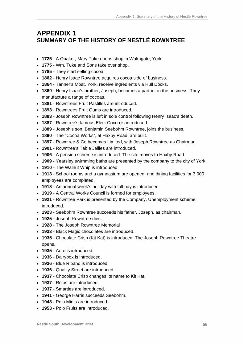
Appendix 1: Summary of the History of Nestlé Rowntree
Nestlé South Development Brief
56
APPENDIX 1 SUMMARY OF THE HISTORY OF NESTLÉ ROWNTREE
• 1725 - A Quaker, Mary Tuke opens shop in Walmgate, York. • 1775 - Wm. Tuke and Sons take over shop. • 1785 - They start selling cocoa. • 1862 - Henry Isaac Rowntree acquires cocoa side of business. • 1864 - Tanner’s Moat, York, receive ingredients via Hull Docks. • 1869 - Henry Isaac’s brother, Joseph, becomes a partner in the business. They
manufacture a range of cocoas. • 1881 - Rowntrees Fruit Pastilles are introduced. • 1893 - Rowntrees Fruit Gums are introduced. • 1883 - Joseph Rowntree is left in sole control following Henry Isaac’s death. • 1887 - Rowntree’s famous Elect Cocoa is introduced. • 1889 - Joseph’s son, Benjamin Seebohm Rowntree, joins the business. • 1890 - The “Cocoa Works”, at Haxby Road, are built. • 1897 - Rowntree & Co becomes Limited, with Joseph Rowntree as Chairman. • 1901 - Rowntree’s Table Jellies are introduced. • 1906 - A pension scheme is introduced. The site moves to Haxby Road. • 1909 - Yearsley swimming baths are presented by the company to the city of York. • 1910 - The Walnut Whip is introduced. • 1913 - School rooms and a gymnasium are opened, and dining facilities for 3,000
employees are completed. • 1918 - An annual week’s holiday with full pay is introduced. • 1919 - A Central Works Council is formed for employees. • 1921 - Rowntree Park is presented by the Company. Unemployment scheme
introduced. • 1923 - Seebohm Rowntree succeeds his father, Joseph, as chairman. • 1925 - Joseph Rowntree dies. • 1928 - The Joseph Rowntree Memorial • 1933 - Black Magic chocolates are introduced. • 1935 - Chocolate Crisp (Kit Kat) is introduced. The Joseph Rowntree Theatre
opens. • 1935 - Aero is introduced. • 1936 - Dairybox is introduced. • 1936 - Blue Riband is introduced. • 1936 - Quality Street are introduced. • 1937 - Chocolate Crisp changes its name to Kit Kat. • 1937 - Rolos are introduced. • 1937 - Smarties are introduced. • 1941 - George Harris succeeds Seebohm. • 1948 - Polo Mints are introduced. • 1953 - Polo Fruits are introduced.
Appendix 1: Summary of the History of Nestlé Rowntree
Nestlé South Development Brief
57
• 1954 - Seebohm Rowntree dies. • 1957 - Munchies are introduced. • 1958 - Fawdon factory, Newcastle, opens. • 1959 - Caramac is introduced. • 1962 - After Eight is introduced. • 1963 - Toffee Crisp is introduced. • 1963 - Tooty Frooties are introduced. • 1965 - Jellytots are introduced. • 1967 - Golden Cup is introduced. • 1968 - Matchmakers are introduced. • 1969 - Rowntree & Co Ltd and John Mackintosh & Sons Ltd become Rowntree
Mackintosh Ltd. • 1970 - Breakaway is introduced. • 1972 - Wins Queen’s Award for Export. • 1976 - Yorkie is introduced. • 1976 - Lion Bar is introduced. • 1980 - Drifter is introduced. • 1982 - Aero Countline is introduced. • 1985 - Automated Warehouse is opened in York. • 1986 - A £16 million Kit Kat 4 factory plant is opened in York. • 1987 - The company name is changed to Rowntree plc. • 1988 - Nestlé SA buys Rowntree plc. • 1989 - Rowntree Mackintosh receives its fourth Queen's Award for Export
Achievement. Nestlé shares are quoted on the London Stock Exchange. • 1991 - The Lord Mayor of York opens the £14million Cocoa Processing Plant.
Helmut Maucher, Nestlé SA Chairman and Managing Director, opens the £6 million Yorkreco Pilot Plant. Vice Versas are introduced.
• 1992 - Ramon Masip, Executive Vice President of Nestlé SA, opens the £15.5 million Polo Mint plant in York.
• 1993 – The Lord Mayor of York opens the £18 million chocolate making plant in York. The new plant can produce four tonnes of milk chocolate an hour.
• 1997 - Maverick is launched. • 1999 - Kit Kat Chunky is launched. • 2000 - Rolo biscuit is launched • 2002 - Double Cream chocolate bar is launched. • 2003 - Kit Kat Kubes are launched. • 2004 - Fruity Smarties, Kit Kat Editions and Baci are introduced. • 2006 – Nestlé Rowntree announce their intention to upgrade and improve facilities
on the northern part of the Haxby Road site and create redevelopment opportunities on the older, southern part of the site
Sourced from www.Nestlé.co.uk
Appendix 2: List of Documents
Nestlé South Development Brief
58
APPENDIX 2 LIST OF DOCUMENTS
• City of York Council Economic Development Annual Reports • City of York Draft Local Plan Incorporating the 4th Set of Changes (April
2005) • City of York Council Affordable Housing Advice Note (July 2005) • City of York Council Draft SPG on Sustainable Design and
Construction • City of York Council 2002 Housing Needs Study (2002-07) • York Housing Market Assessment - Draft (July 2006) • City of York Council Corporate Strategy (2006-2009) • City of York Council ‘Developer Contributions to Educational Facilities’
(May 2002) • ‘By Design. Urban Design in the planning system: towards better
practice’ DETR & CABE (2000) • City of York Local Transport Plan 2 (2006-2011) • City of York Council Highway Design Guide • ‘Safer Places: The Planning System and Crime Prevention’ ODPM
(2004) • ‘Designing for Accessibility’ Commission for Accessible Environments 7
RIBA Enterprises (2004) • ‘Designing to Enable’ Gateshead Access Panel
Appendix 3: City of York Council Contacts
Nestlé South Development Brief
59
APPENDIX 3 CITY OF YORK COUNCIL CONTACTS As at May 2006 01904 55 + Extension Please contact Derek Gauld in the first instance Derek Gauld, Principal City Development Officer 1470 Roger Armistead, Development Area team Leader 1320 Martin Grainger, Principal Development Officer (Planning Policy) 1667 John Oxley, Archaeologist 1346 Janine Riley, Conservation Architect 1305 Esther Priestley, Landscape Architect 1341 Bob Missin, Countryside Officer 1662 Kristina Peat, Sustainability Officer 1666 Richard Bogg, Divisional Head, Network Management 1332 Ian Stokes, Principal Transport Planner 1429 Bryn Jones, Head of Economic Development 4418 Helen Howlett, Senior Environmental Protection Officer 1567 Graham Tissiman, Housing Development Coordinator 4153 Jake Wood, Policy Officer, Learning, Culture & Children’s Services 4673 Vicky Japes, Senior Active Leisure Officer 3382 Gill Cooper, Head of Arts and Culture 4671 Leo Devlin, Equality Officer, Chief Executives 1704