Embed Size (px)
Citation preview
New features of
IDRISI Taiga 2009
Duong Dang Khoi
(September 3, 2009)
Outline:
• Why IDRISI is useful ?
• Segmentation classifier
• Earth trend modeling tools
• Land change modeling tools

1. Why IDRISI Taiga is useful?
• IDRISI (1100-1166), a cartographer, who led the mission of mapping the
world over 15 years, was used over 500 years.
• Become a commercial software product since 1987
• A industry leader in raster analytical functionality
• With 300 program modules for environmental monitoring and natural
resource management
• Being used in 175 countries worldwide
• Pioneering in decision support, classifier development, uncertainty
management, change and time series analysis, and dynamic modeling
• Partnering with conservation international, United State Department of
Agriculture and other environmental agencies
• Be familiar with IDRISI, you should read Tutorial and Guide to GIS and
Image Processing.
• If you are interested, see the details at www.idrisi.com
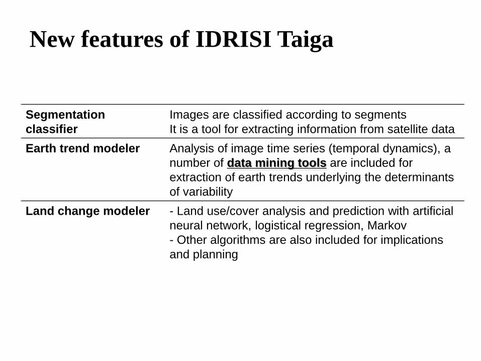
New features of IDRISI Taiga
Tools Description
Segmentation
classifier
Images are classified according to segments
It is a tool for extracting information from satellite data
Earth trend modeler Analysis of image time series (temporal dynamics), a
number of data mining tools are included for
extraction of earth trends underlying the determinants
of variability
Land change modeler - Land use/cover analysis and prediction with artificial
neural network, logistical regression, Markov
- Other algorithms are also included for implications
and planning
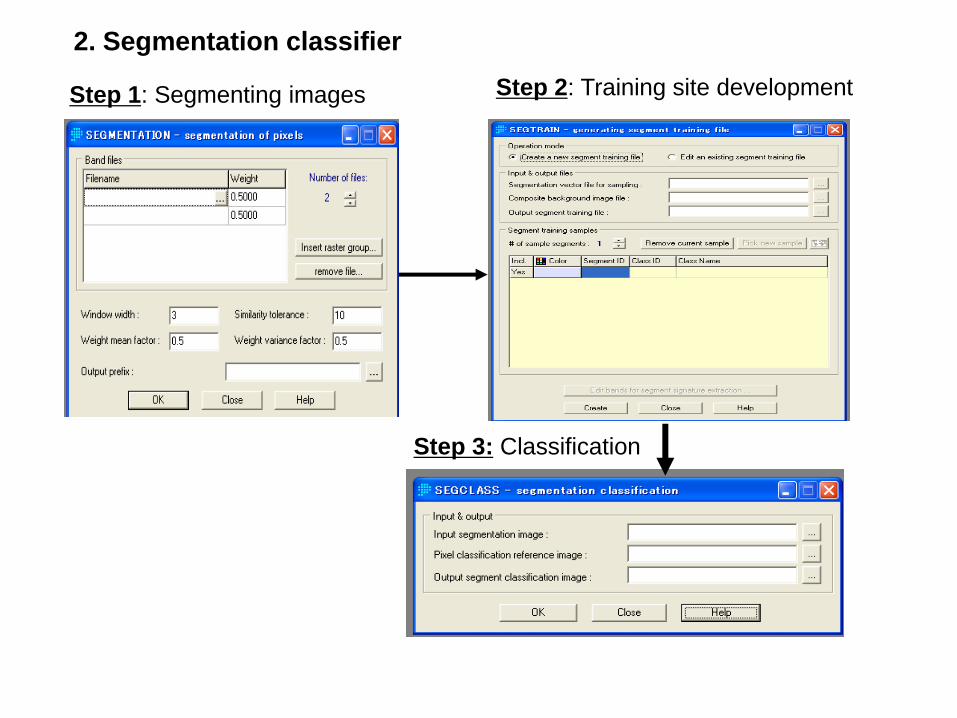
Step 1: Segmenting images Step 2: Training site development
Step 3: Classification
2. Segmentation classifier
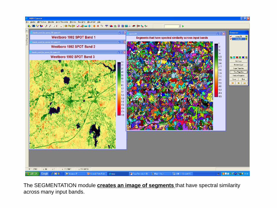
The SEGMENTATION module creates an image of segments that have spectral similarity
across many input bands.
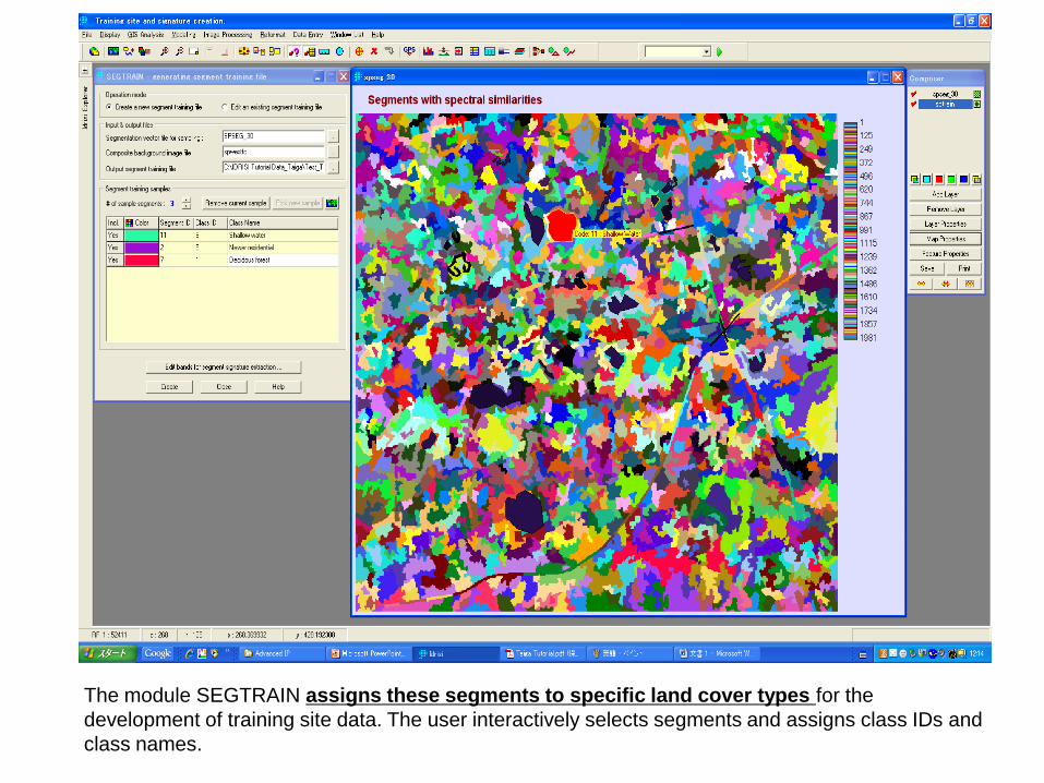
The module SEGTRAIN assigns these segments to specific land cover types for the
development of training site data. The user interactively selects segments and assigns class IDs and
class names.
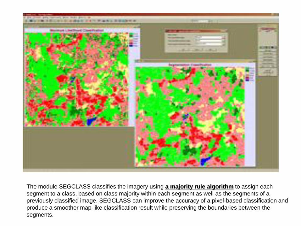
The module SEGCLASS classifies the imagery using a majority rule algorithm to assign each
segment to a class, based on class majority within each segment as well as the segments of a
previously classified image. SEGCLASS can improve the accuracy of a pixel-based classification and
produce a smoother map-like classification result while preserving the boundaries between the
segments.
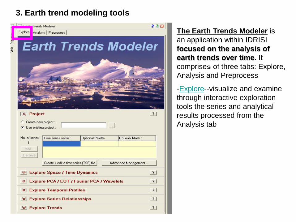
The Earth Trends Modeler is
an application within IDRISI
focused on the analysis of
earth trends over time. It
comprises of three tabs: Explore,
Analysis and Preprocess
-Explore--visualize and examine
through interactive exploration
tools the series and analytical
results processed from the
Analysis tab
3. Earth trend modeling tools

- Analysis--analyze through a
variety of processes the
series over time
- Preprocess--preprocess
and edit the series for input
to the Explore and Analysis
tabs
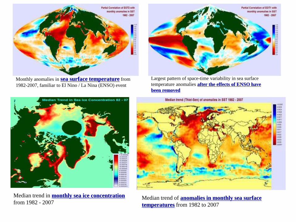
Monthly anomalies in sea surface temperature from
1982-2007, familiar to El Nino / La Nina (ENSO) event
Largest pattern of space-time variability in sea surface
temperature anomalies after the effects of ENSO have
been removed
Median trend of anomalies in monthly sea surface
temperatures from 1982 to 2007
Median trend in monthly sea ice concentration
from 1982 - 2007
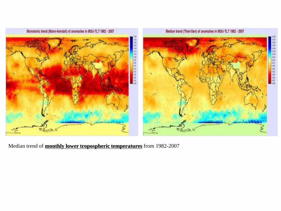
Median trend of monthly lower tropospheric temperatures from 1982-2007
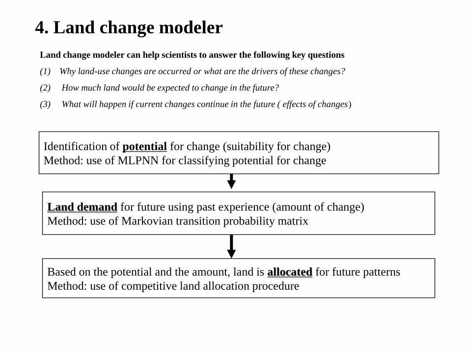
Land change modeler can help scientists to answer the following key questions
(1) Why land-use changes are occurred or what are the drivers of these changes?
(2) How much land would be expected to change in the future?
(3) What will happen if current changes continue in the future ( effects of changes)
Land demand for future using past experience (amount of change)
Method: use of Markovian transition probability matrix
Based on the potential and the amount, land is allocated for future patterns
Method: use of competitive land allocation procedure
Identification of potential for change (suitability for change)
Method: use of MLPNN for classifying potential for change
4. Land change modeler
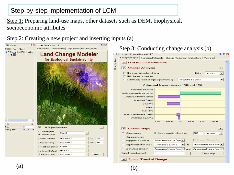
Step 1: Preparing land-use maps, other datasets such as DEM, biophysical,
socioeconomic attributes
Step 2: Creating a new project and inserting inputs (a)
Step 3: Conducting change analysis (b)
(a) (b)
Step-by-step implementation of LCM
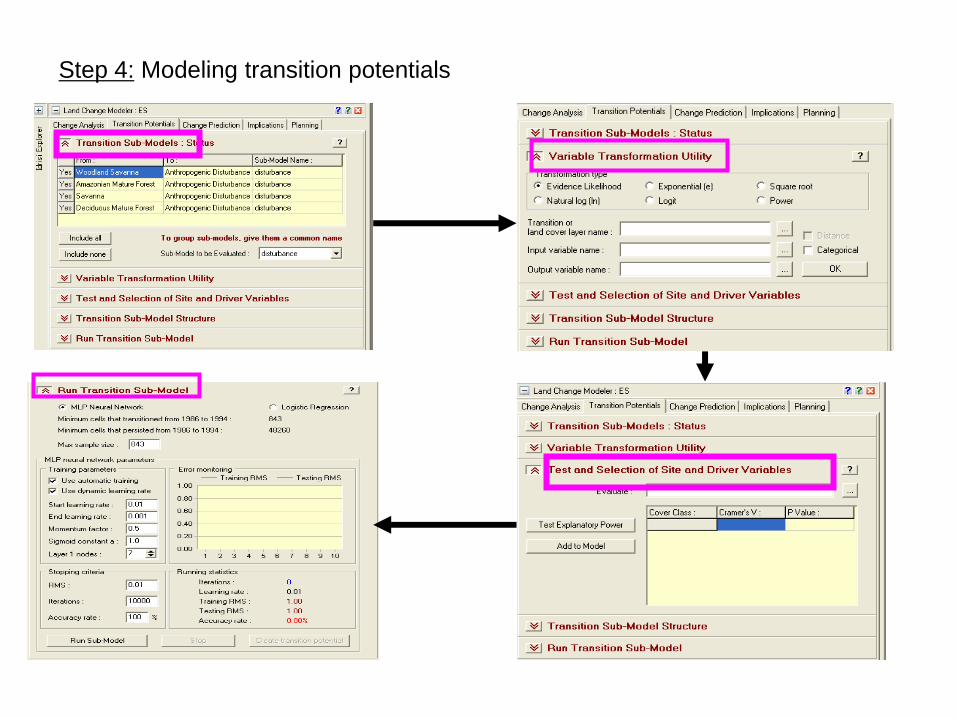
Step 4: Modeling transition potentials
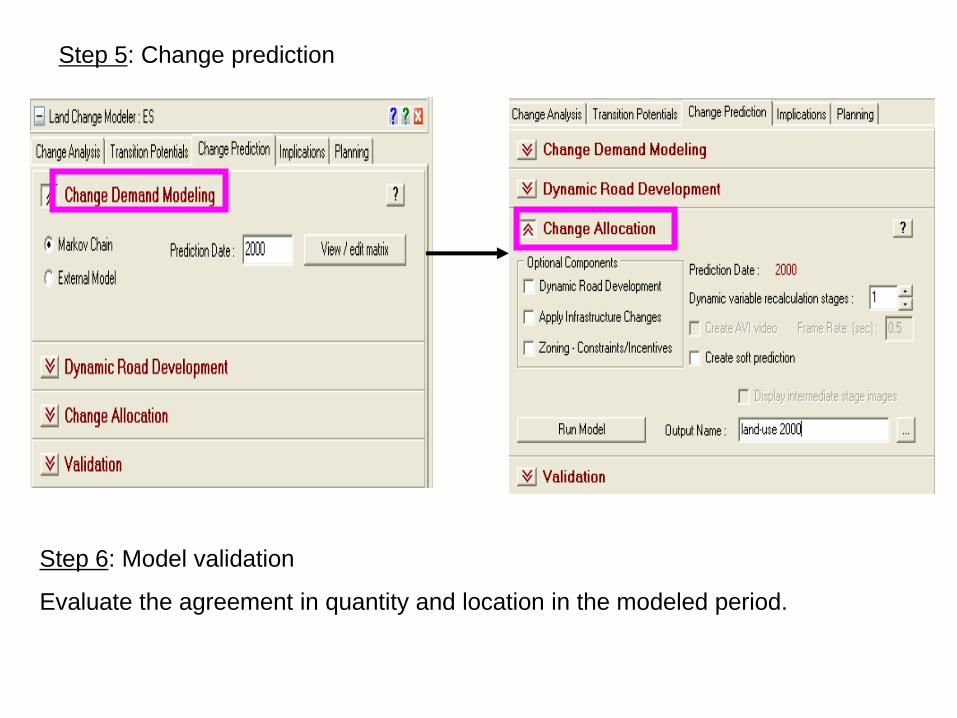
Step 5: Change prediction
Step 6: Model validation
Evaluate the agreement in quantity and location in the modeled period.

Thank you
for your attention!