Embed Size (px)
Citation preview
Edward Mac Gillavry
PROJ4 MET OSGEO-SOFTWAREPROJ4 MET OSGEO-SOFTWARE20 oktober 2016 – Hilversum20 oktober 2016 – Hilversum
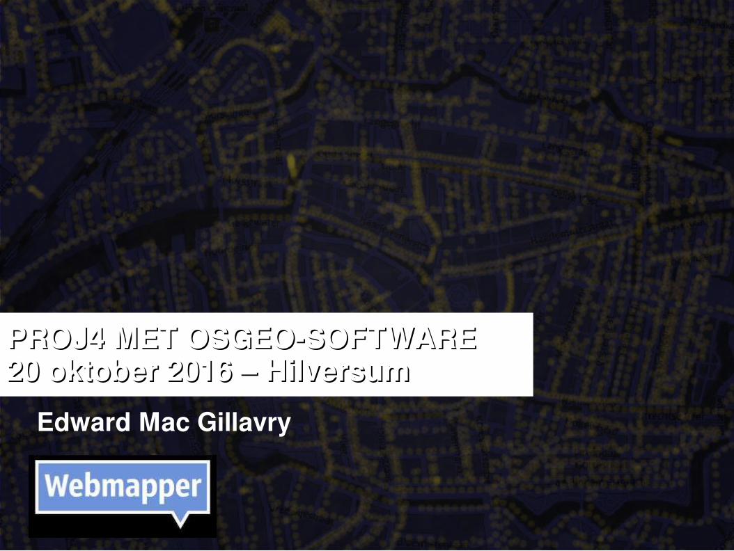
Sociale Geografie en Cartografie – Universiteit Utrecht Geo-informatics – ITC in Enschede
Multimap, Zorgatlas (RIVM), TomTom
Webmapper Geo Academie: kwaliteit in geo-webservices, cartografie en GIS HAS Den Bosch: Geo Media Design
Lid van Geo-Informatie Nederland Lid van British Cartographic Society
EDWARD MAC GILLAVRY

WEBMAPPER: what the map can be
Edward Mac Gillavry
@emacgillavry
Baukje Rienks
@sabeare
Hans Fast
@hpfast
Niene Boeijen
@bniene
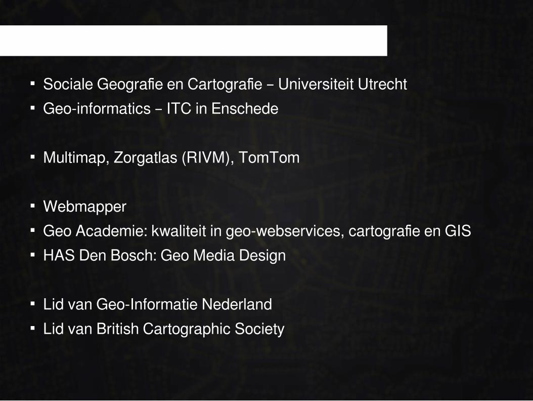
Utrecht Geografische web applicaties Web cartografie
Open geo data: OpenStreetMap, Top10NL, BAG Open source geo software: Leaflet, PostGIS Open geo standards: OGC specifications
WEBMAPPER: what the map can be

PROJ.4

PROJ ontwikkelaar: Gerald Evenden
https://twitter.com/howardbutler/status/771742649577373697

PROJ.4: VANDAAG
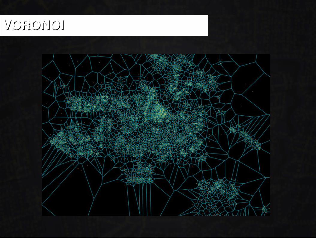
VORONOIVORONOI
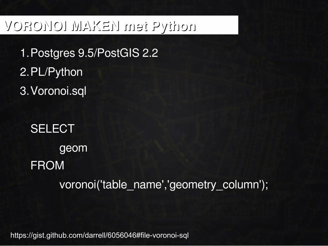
1.Postgres 9.5/PostGIS 2.2
2.PL/Python
3.Voronoi.sql
SELECT
geom
FROM
voronoi('table_name','geometry_column');
VORONOI MAKEN met PythonVORONOI MAKEN met Python
https://gist.github.com/darrell/6056046#file-voronoi-sql
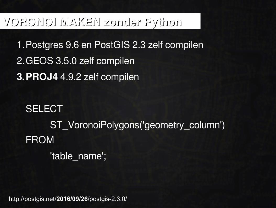
1.Postgres 9.6 en PostGIS 2.3 zelf compilen
2.GEOS 3.5.0 zelf compilen
3.PROJ4 4.9.2 zelf compilen
SELECT
ST_VoronoiPolygons('geometry_column')
FROM
'table_name';
VORONOI MAKEN zonder PythonVORONOI MAKEN zonder Python
http://postgis.net/2016/09/26/postgis-2.3.0/

PROJ.4 VAN DAG TOT DAG
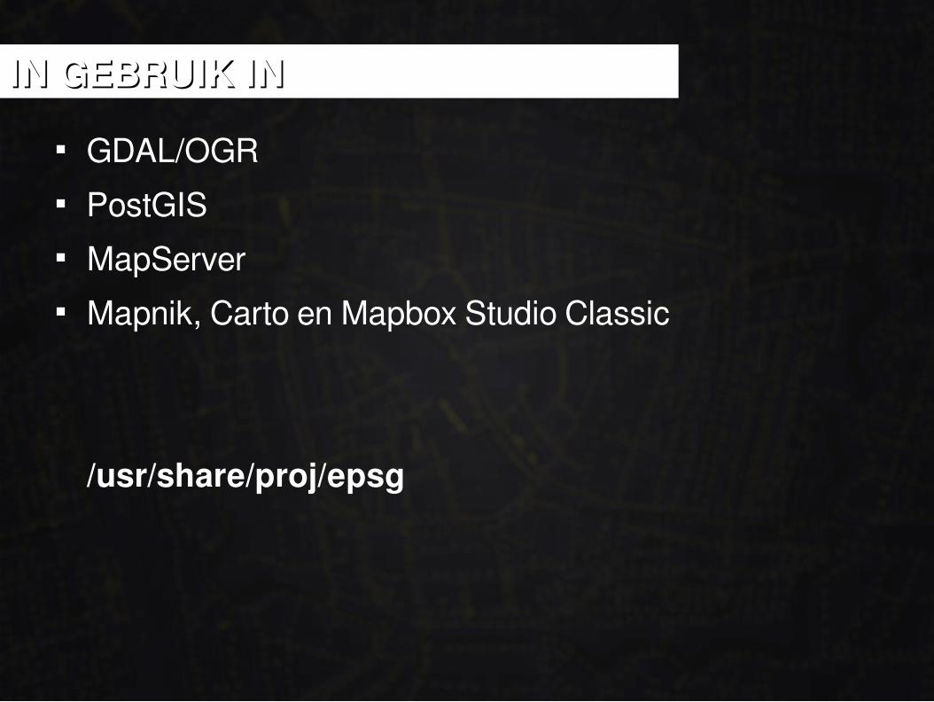
GDAL/OGR PostGIS MapServer Mapnik, Carto en Mapbox Studio Classic
/usr/share/proj/epsg
IN GEBRUIK ININ GEBRUIK IN
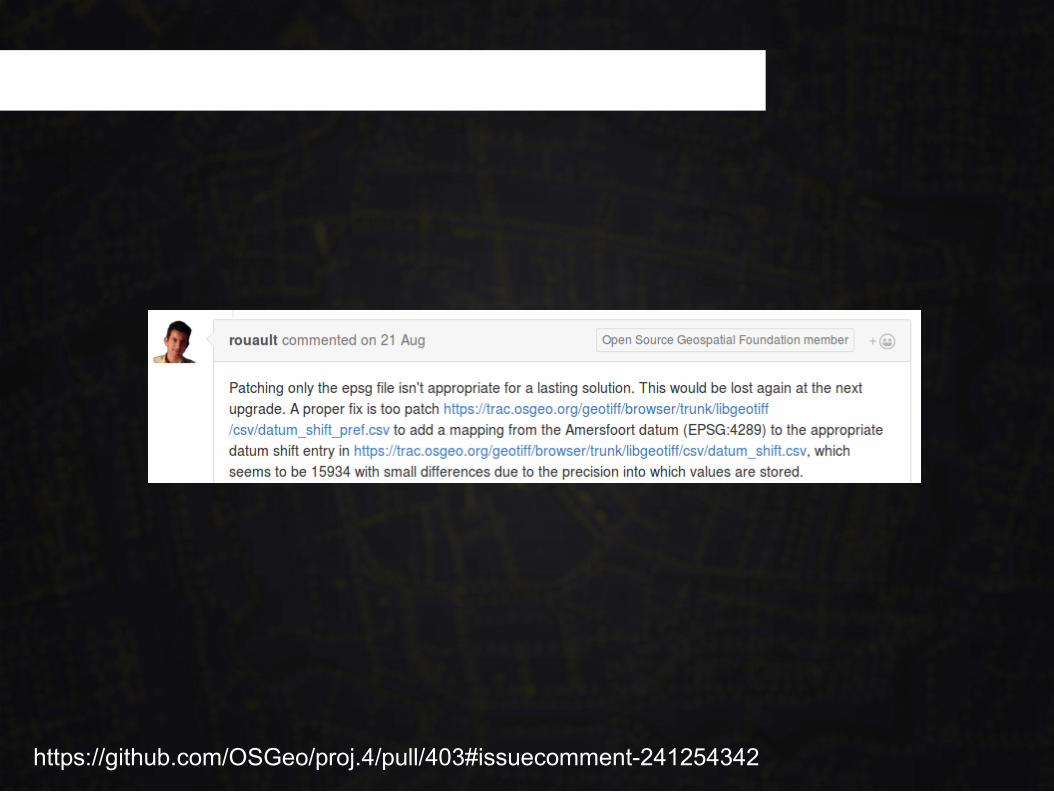
LibGeoTIFF > PROJ > EPSG
https://github.com/OSGeo/proj.4/pull/403#issuecomment-241254342
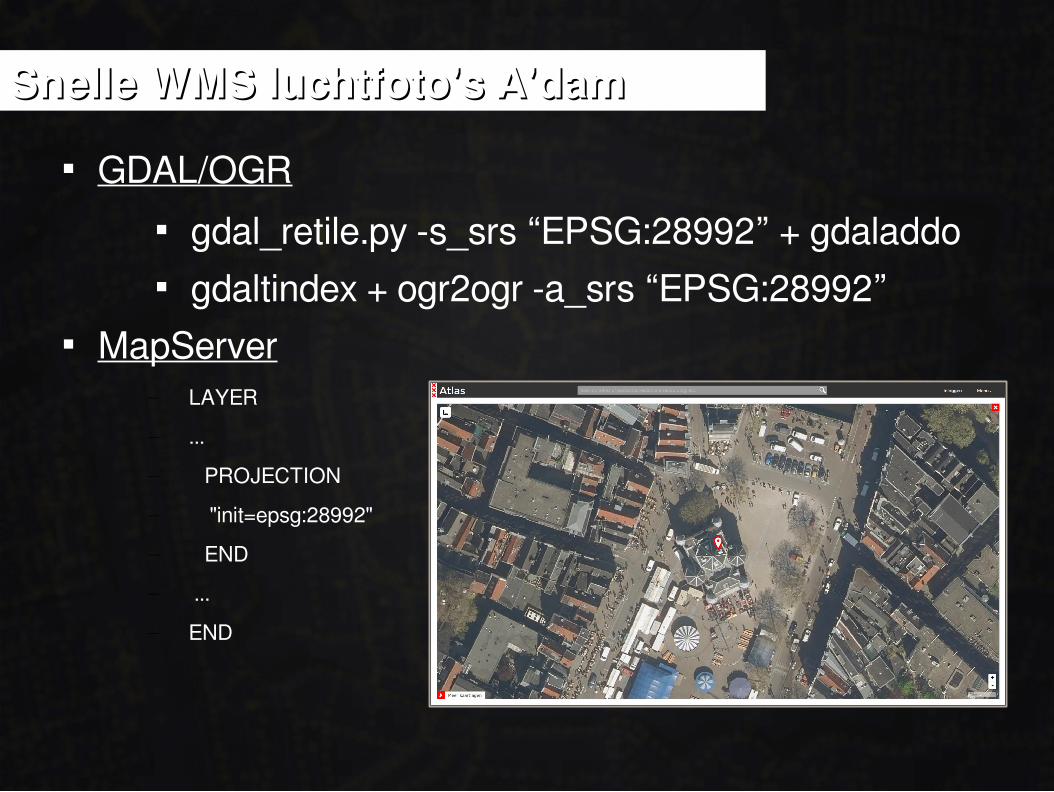
Snelle WMS luchtfoto's A'damSnelle WMS luchtfoto's A'dam
GDAL/OGR gdal_retile.py -s_srs “EPSG:28992” + gdaladdo gdaltindex + ogr2ogr -a_srs “EPSG:28992”
MapServer– LAYER
– ...
– PROJECTION
– "init=epsg:28992"
– END
– ...
– END
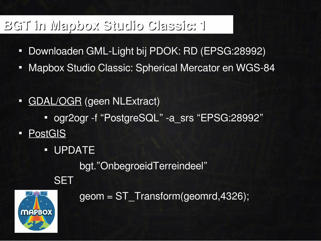
BGT in Mapbox Studio Classic: 1BGT in Mapbox Studio Classic: 1
Downloaden GML-Light bij PDOK: RD (EPSG:28992) Mapbox Studio Classic: Spherical Mercator en WGS-84
GDAL/OGR (geen NLExtract) ogr2ogr -f “PostgreSQL” -a_srs “EPSG:28992”
PostGIS UPDATE
bgt.”OnbegroeidTerreindeel”SET
geom = ST_Transform(geomrd,4326);
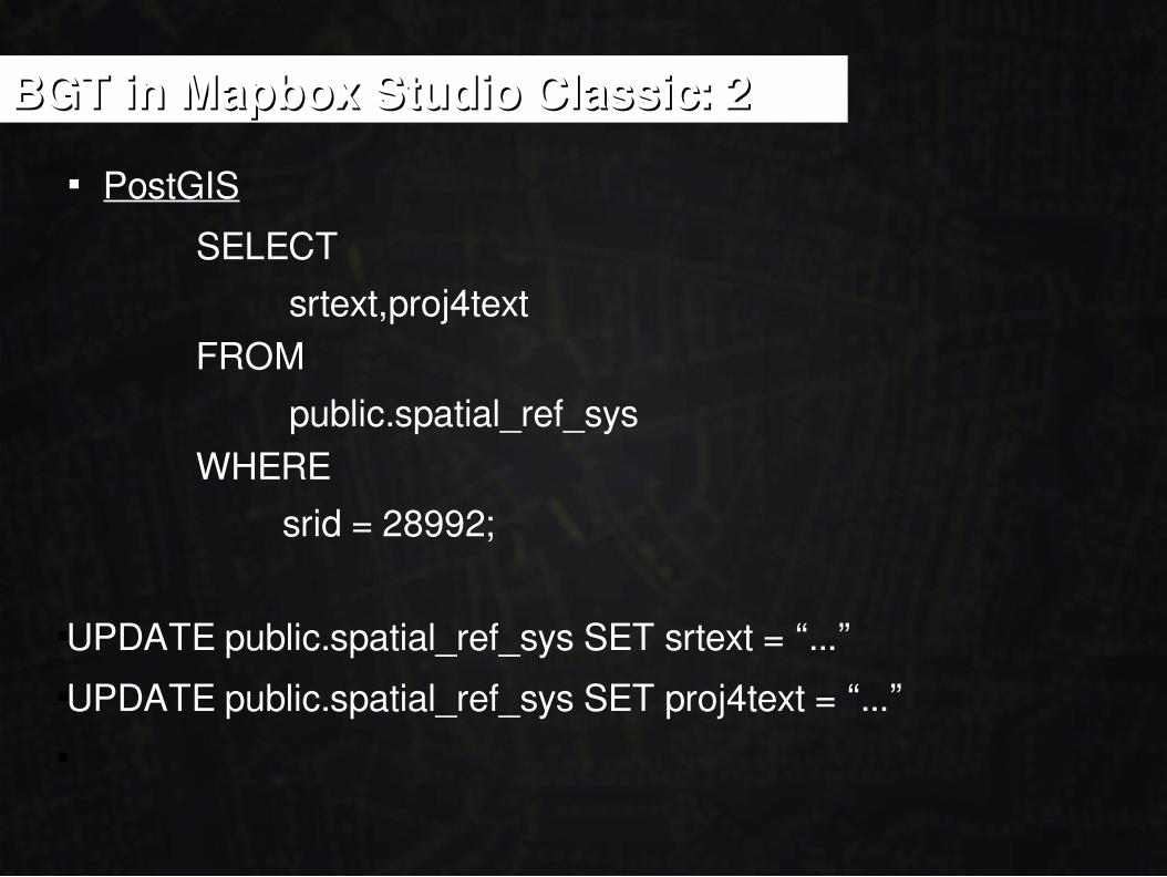
BGT in Mapbox Studio Classic: 2BGT in Mapbox Studio Classic: 2
PostGIS
SELECT
srtext,proj4textFROM
public.spatial_ref_sysWHERE
srid = 28992;
UPDATE public.spatial_ref_sys SET srtext = “...”UPDATE public.spatial_ref_sys SET proj4text = “...”
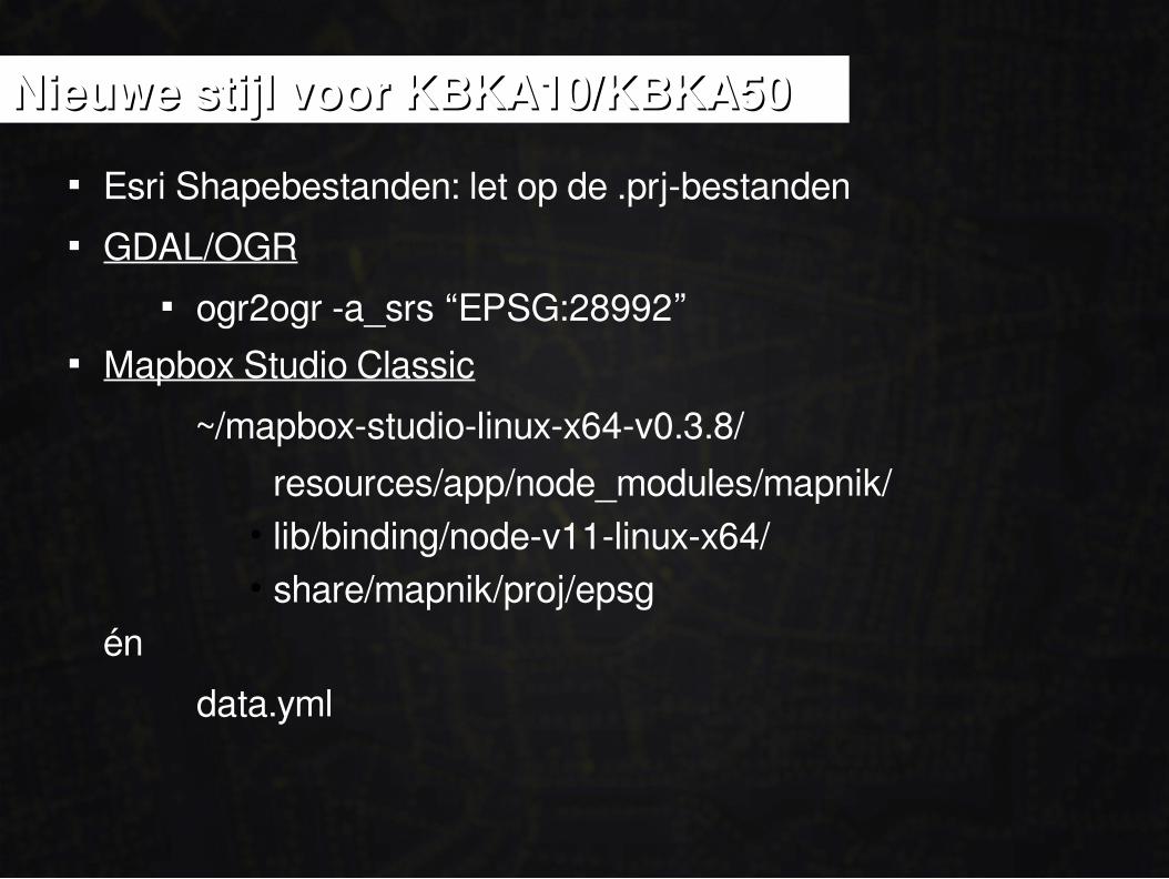
Nieuwe stijl voor KBKA10/KBKA50Nieuwe stijl voor KBKA10/KBKA50
Esri Shapebestanden: let op de .prj-bestanden GDAL/OGR
ogr2ogr -a_srs “EPSG:28992” Mapbox Studio Classic
~/mapbox-studio-linux-x64-v0.3.8/
resources/app/node_modules/mapnik/• lib/binding/node-v11-linux-x64/• share/mapnik/proj/epsg
én
data.yml

CARTOCARTO
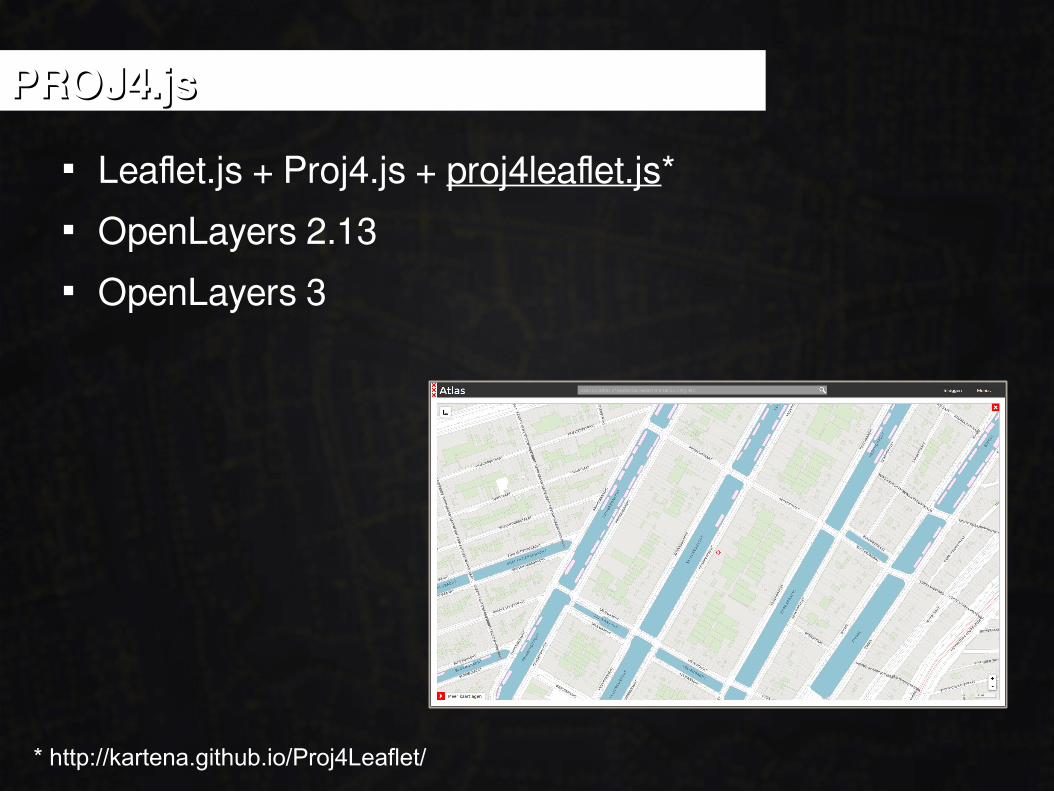
PROJ4.jsPROJ4.js
Leaflet.js + Proj4.js + proj4leaflet.js* OpenLayers 2.13 OpenLayers 3
* http://kartena.github.io/Proj4Leaflet/

MEA CULPA, MEA CULPA?
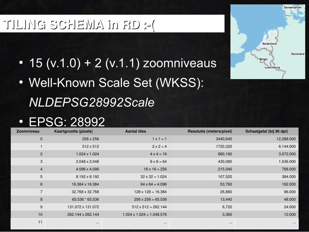
● 15 (v.1.0) + 2 (v.1.1) zoomniveaus● Well-Known Scale Set (WKSS):
NLDEPSG28992Scale● EPSG: 28992
Zoomniveau Kaartgrootte (pixels) Aantal tiles Resolutie (meters/pixel) Schaalgetal (bij 96 dpi)
0 256 x 256 1 x 1 = 1 3440,640 12.288.000
1 512 x 512 2 x 2 = 4 1720,320 6.144.000
2 1.024 x 1.024 4 x 4 = 16 860,160 3.072.000
3 2.048 x 2.048 8 x 8 = 64 430,080 1.536.000
4 4.096 x 4.096 16 x 16 = 256 215,040 768.000
5 8.192 x 8.192 32 x 32 = 1.024 107,520 384.000
6 16.384 x 16.384 64 x 64 = 4.096 53,760 192.000
7 32.768 x 32.768 128 x 128 = 16.384 26,880 96.000
8 65.536 * 65.536 256 x 256 = 65.536 13,440 48.000
9 131.072 x 131.072 512 x 512 = 262.144 6,720 24.000
10 262.144 x 262.144 1.024 x 1.024 = 1.048.576 3,360 12.000
11 ... ... ... ...
TILING SCHEMA in RD :-(TILING SCHEMA in RD :-(
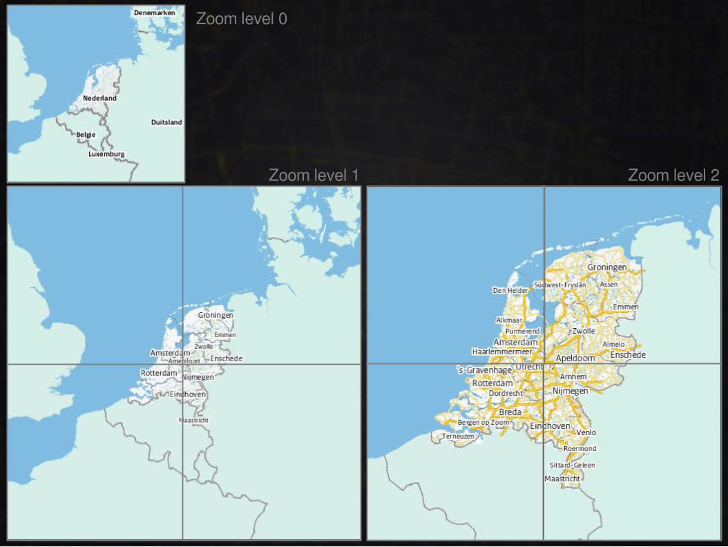
Zoom level 0
Zoom level 1 Zoom level 2

NOG EEN DING...

Geo-OntbijtGeo-Ontbijt
27 oktober 2016 8.30 – 10.00 Niasstraat 1, Utrecht
Open data Open source Open standaarden
Edward Mac Gillavry
www.webmapper.net
Dankjewel!Dankjewel!