Embed Size (px)
Citation preview
Relief Portrayal
January 23, 2006
Geog 258: Maps and GIS
Hwang, Sungsoon
황성순
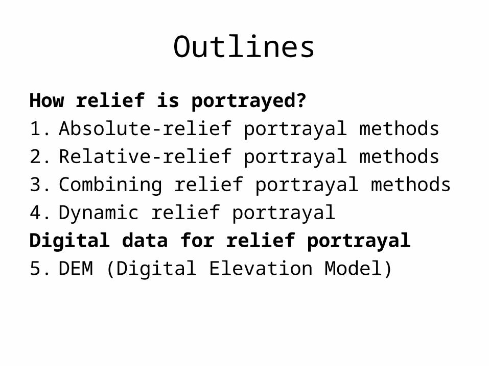
Outlines
How relief is portrayed?
1. Absolute-relief portrayal methods
2. Relative-relief portrayal methods
3. Combining relief portrayal methods
4. Dynamic relief portrayal
Digital data for relief portrayal
5. DEM (Digital Elevation Model)
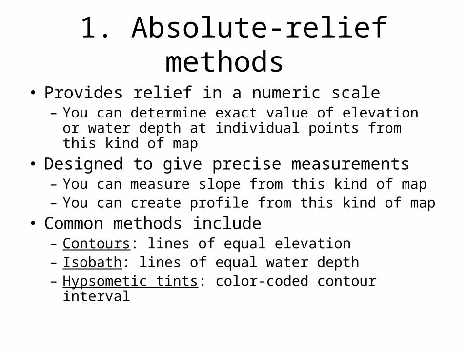
1. Absolute-relief methods
• Provides relief in a numeric scale– You can determine exact value of elevation or water
depth at individual points from this kind of map
• Designed to give precise measurements– You can measure slope from this kind of map– You can create profile from this kind of map
• Common methods include– Contours: lines of equal elevation– Isobath: lines of equal water depth– Hypsometic tints: color-coded contour interval
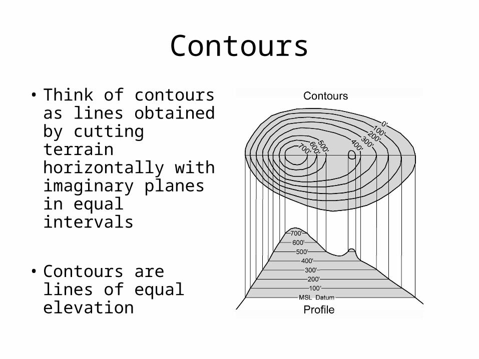
Contours
• Think of contours as lines obtained by cutting terrain horizontally with imaginary planes in equal intervals
• Contours are lines of equal elevation
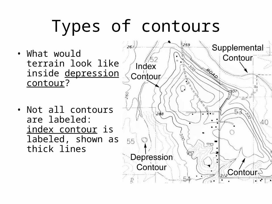
Types of contours
• What would terrain look like inside depression contour?
• Not all contours are labeled: index contour is labeled, shown as thick lines
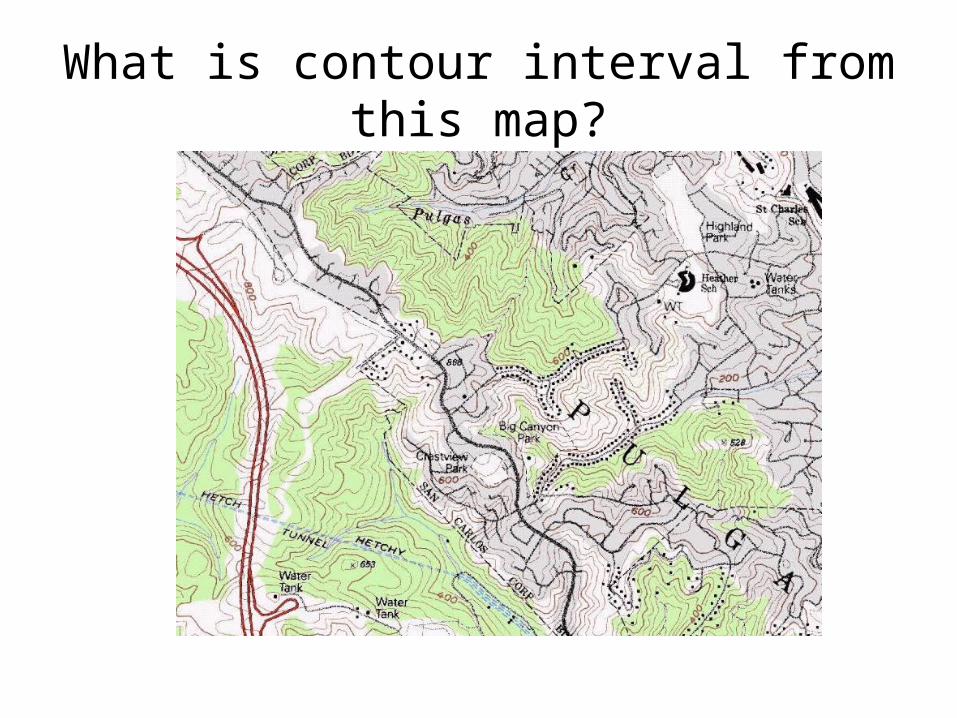
What is contour interval from this map?
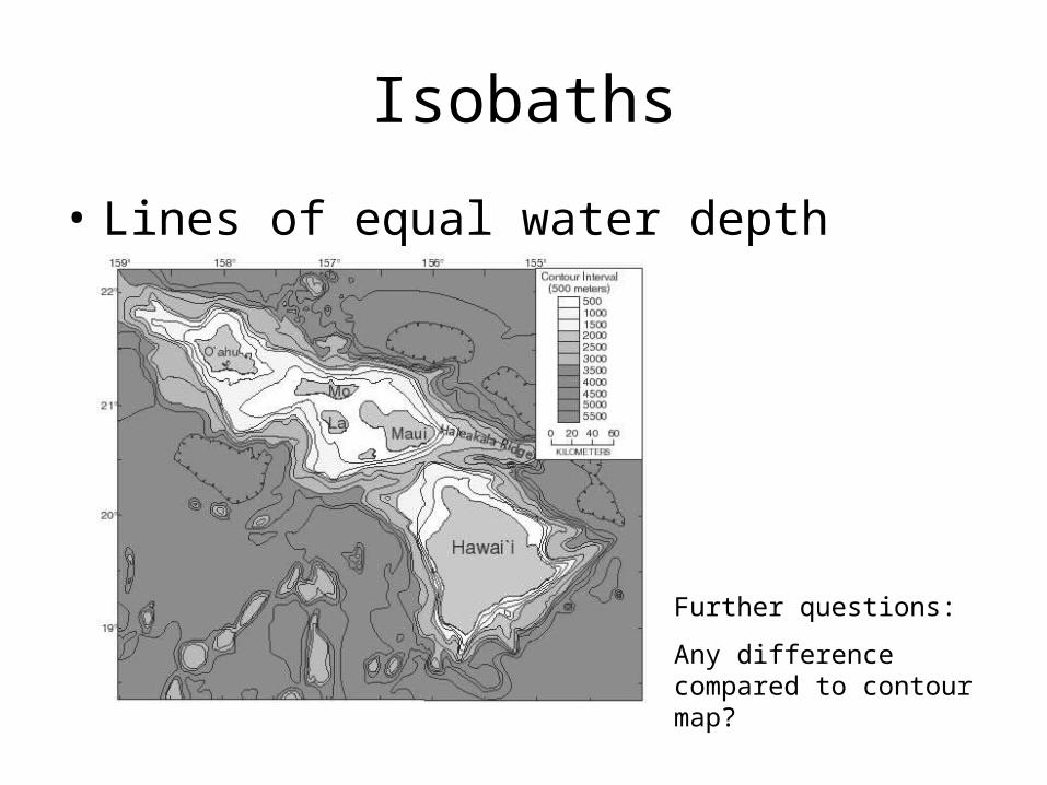
Isobaths
• Lines of equal water depth
Further questions:
Any difference compared to contour map?
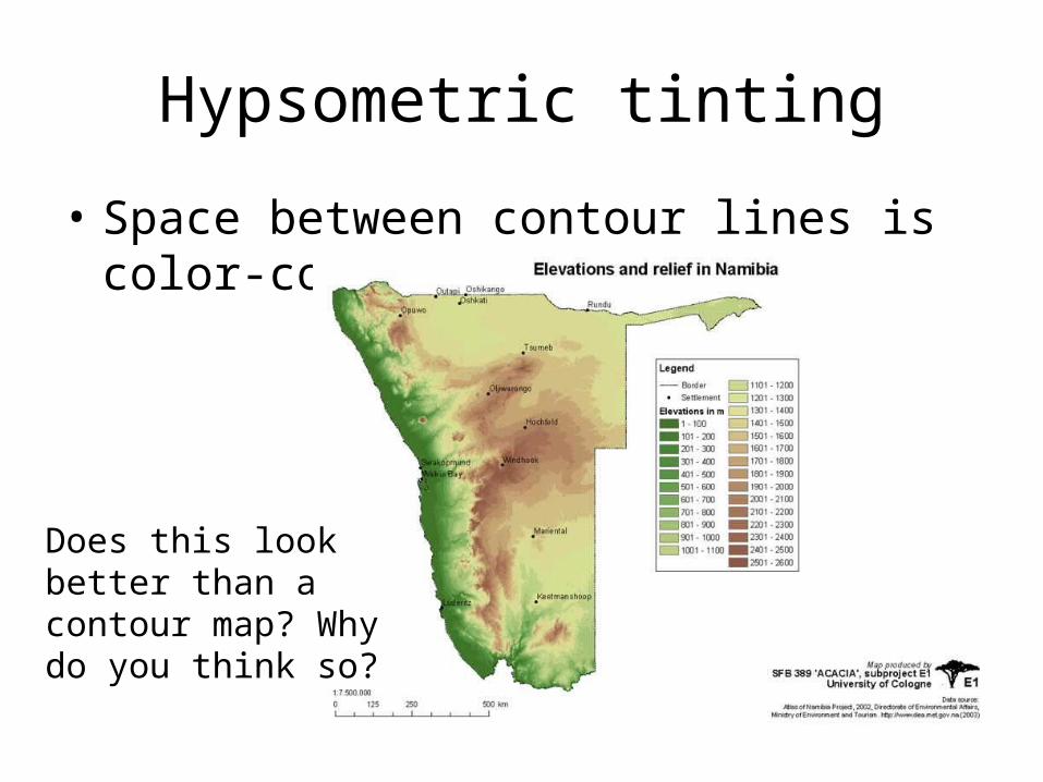
Hypsometric tinting
• Space between contour lines is color-coded
Does this look better than a contour map? Why do you think so?
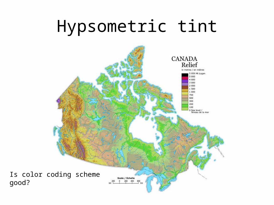
Hypsometric tint
Is color coding scheme good?
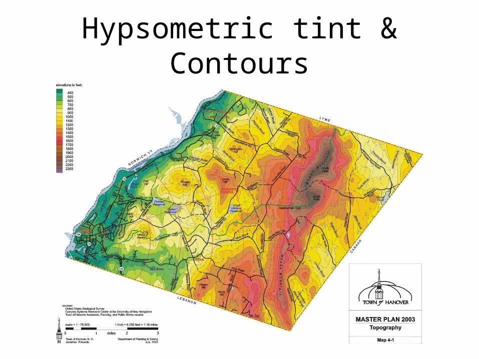
Hypsometric tint & Contours
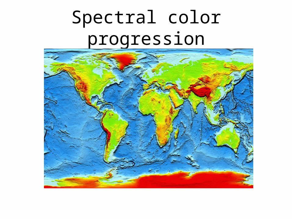
Spectral color progression
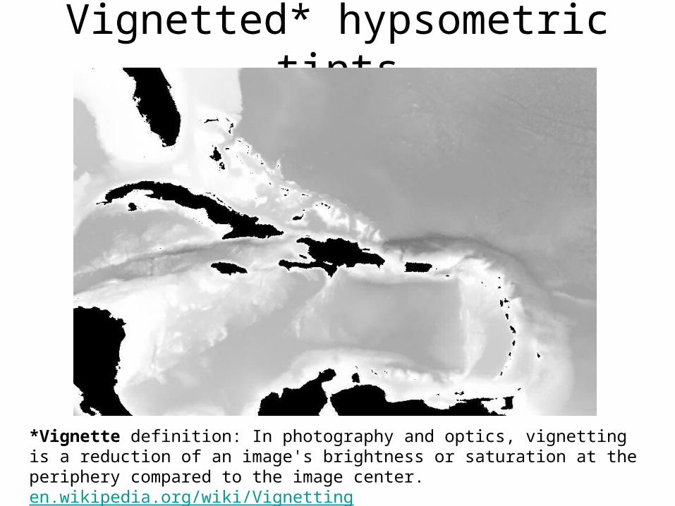
Vignetted* hypsometric tints
*Vignette definition: In photography and optics, vignetting is a reduction of an image's brightness or saturation at the periphery compared to the image center. en.wikipedia.org/wiki/Vignetting
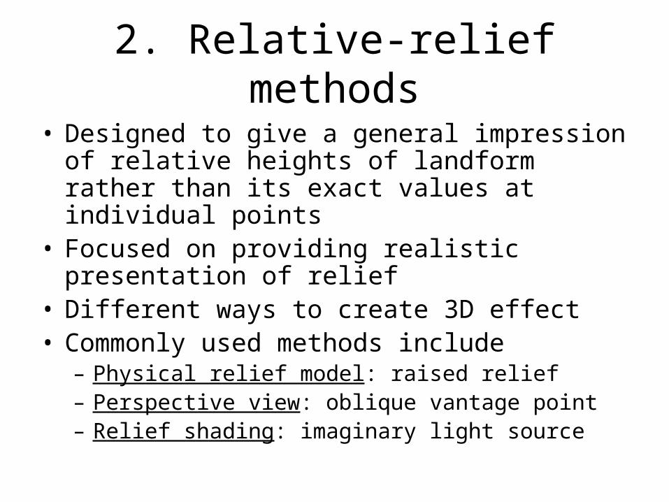
2. Relative-relief methods
• Designed to give a general impression of relative heights of landform rather than its exact values at individual points
• Focused on providing realistic presentation of relief
• Different ways to create 3D effect• Commonly used methods include
– Physical relief model: raised relief– Perspective view: oblique vantage point– Relief shading: imaginary light source
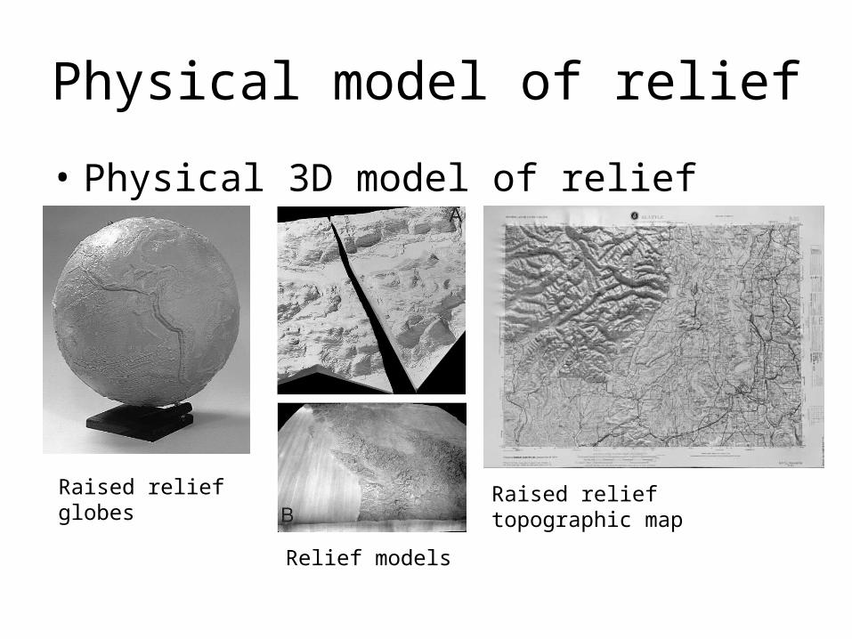
Physical model of relief
• Physical 3D model of relief
Raised relief globes
Relief models
Raised relief topographic map
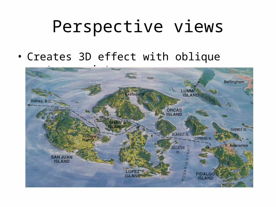
Perspective views
• Creates 3D effect with oblique vantage points
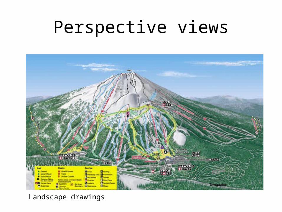
Perspective views
Landscape drawings
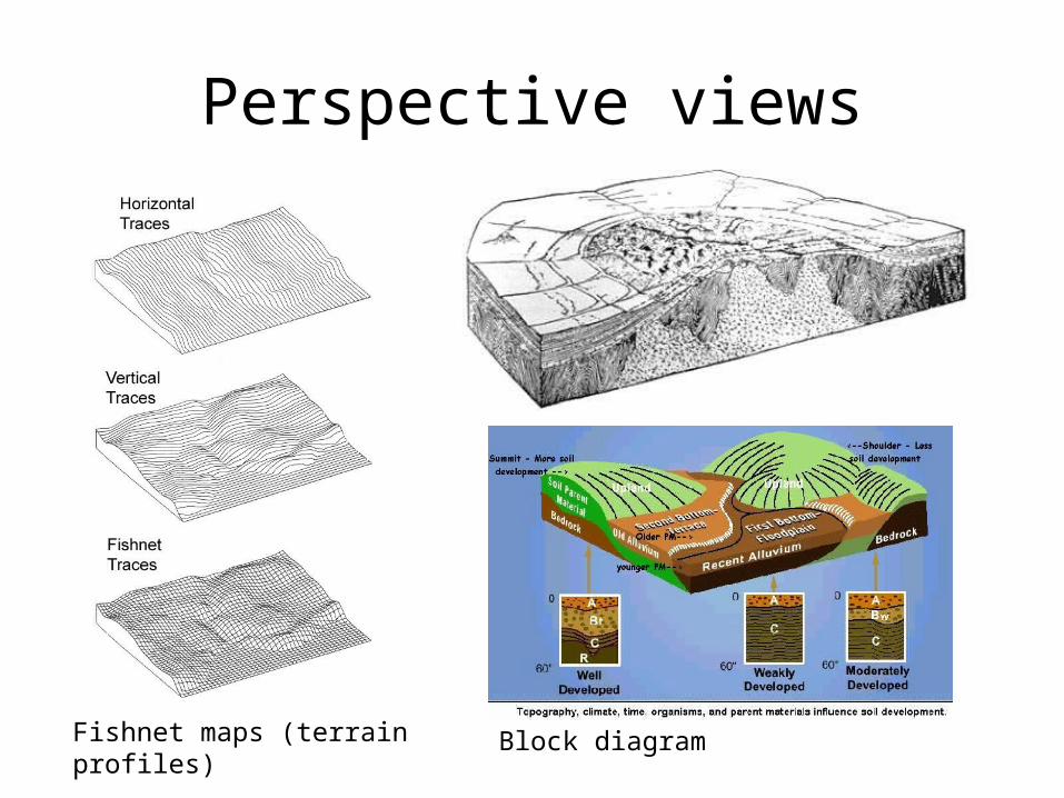
Perspective views
Fishnet maps (terrain profiles) Block diagram
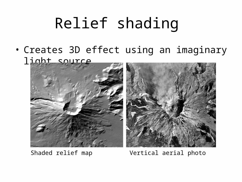
Relief shading
• Creates 3D effect using an imaginary light source
Shaded relief map Vertical aerial photo
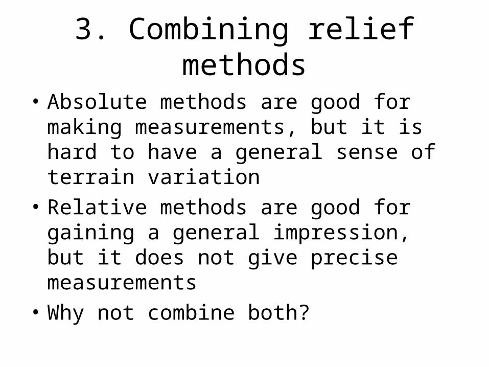
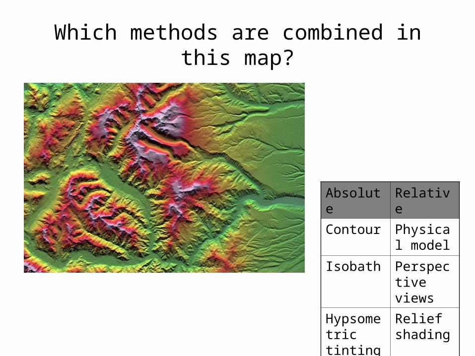
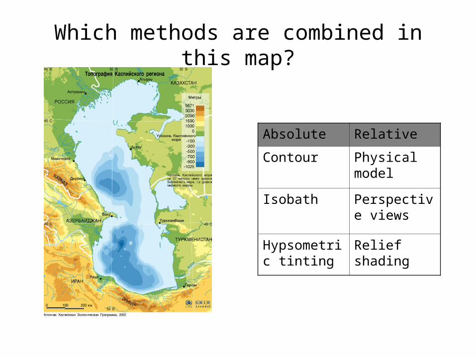
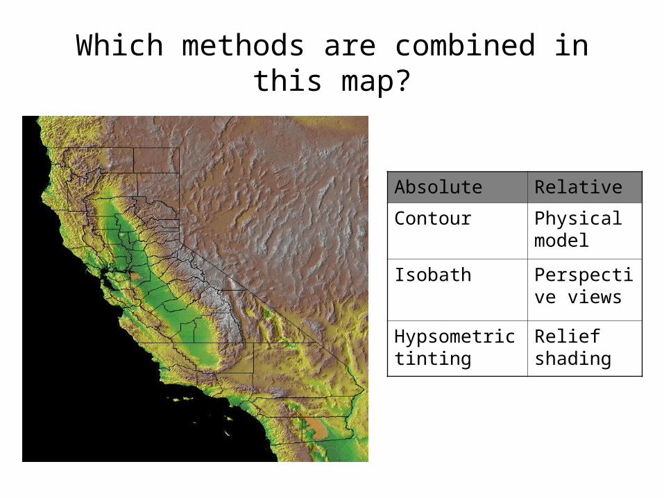
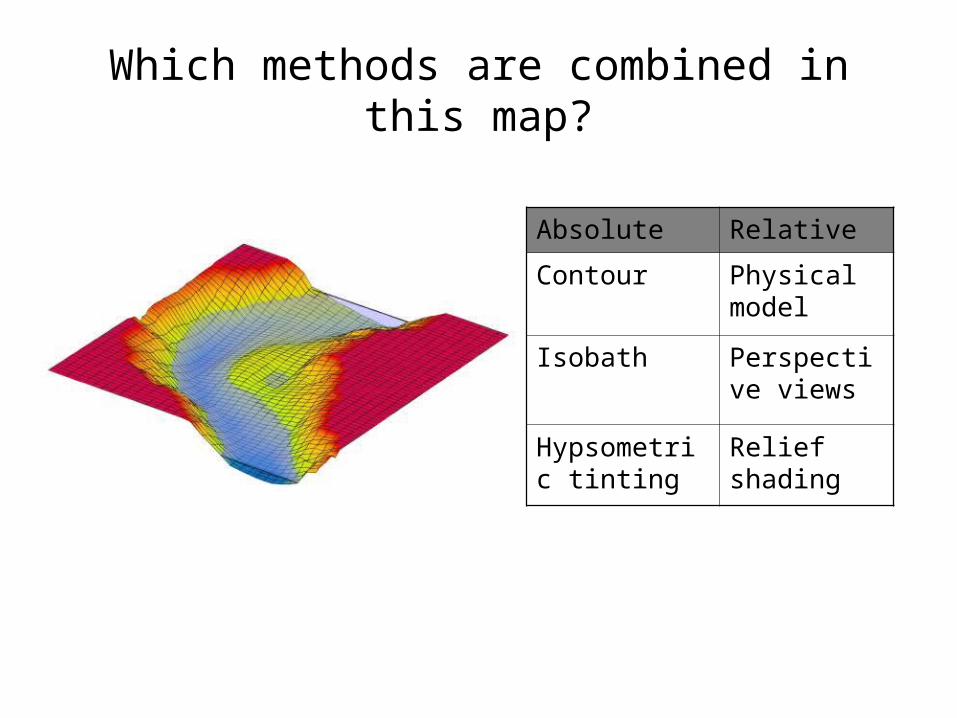
3. Combining relief methods
• Absolute methods are good for making measurements, but it is hard to have a general sense of terrain variation
• Relative methods are good for gaining a general impression, but it does not give precise measurements
• Why not combine both?
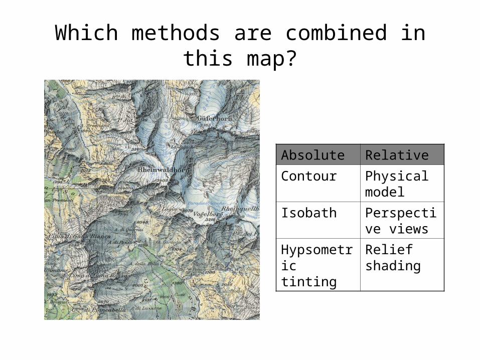
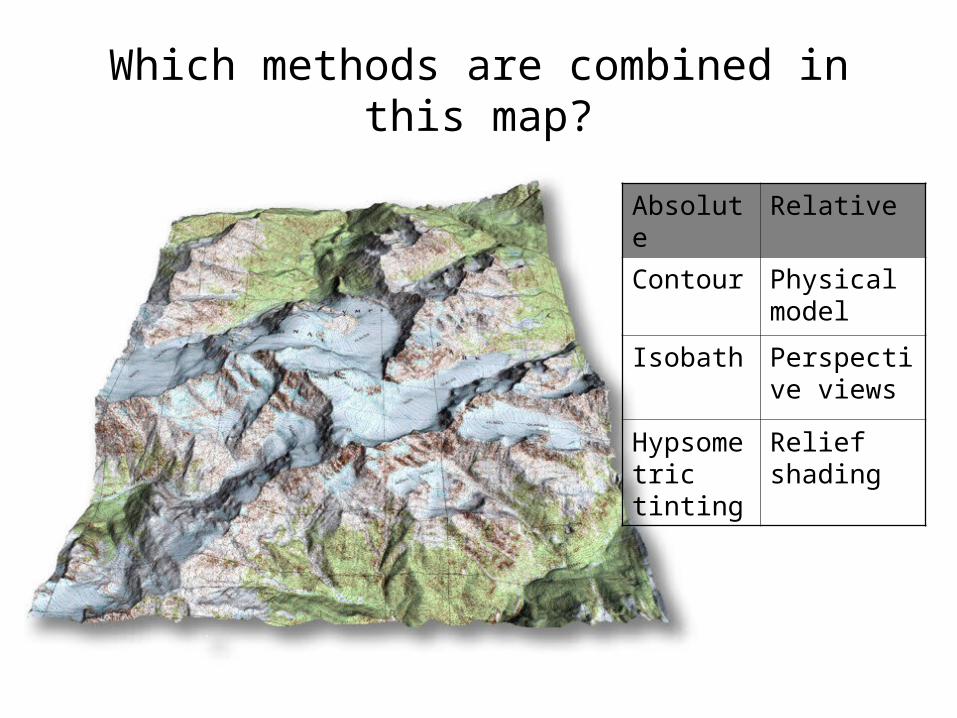
Which methods are combined in this map?
Absolute Relative
Contour Physical model
Isobath Perspective views
Hypsometric tinting
Relief shading
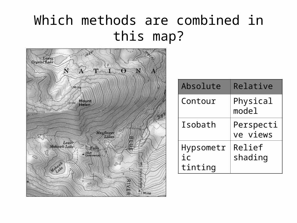
Which methods are combined in this map?
Absolute Relative
Contour Physical model
Isobath Perspective views
Hypsometric tinting
Relief shading
Which methods are combined in this map?
Absolute Relative
Contour Physical model
Isobath Perspective views
Hypsometric tinting
Relief shading
Which methods are combined in this map?
Absolute Relative
Contour Physical model
Isobath Perspective views
Hypsometric tinting
Relief shading
Which methods are combined in this map?
Absolute Relative
Contour Physical model
Isobath Perspective views
Hypsometric tinting
Relief shading
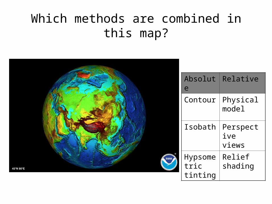
Which methods are combined in this map?
Absolute Relative
Contour Physical model
Isobath Perspective views
Hypsometric tinting
Relief shading
Which methods are combined in this map?
Absolute Relative
Contour Physical model
Isobath Perspective views
Hypsometric tinting
Relief shading
Which methods are combined in this map?
Absolute Relative
Contour Physical model
Isobath Perspective views
Hypsometric tinting
Relief shading
4. Dynamic relief portrayal
• Putting relief portrayal into motion• Can gain dynamic impression of landform• Animated methods
– A sequence of maps is animated detect changes– A series of images taken from different vantage points are
combined to create animation fly-over
• Interactive methods– You can choose the location, vantage points, and so on
• Demo– http://www2.jpl.nasa.gov/srtm/– http://geology.asu.edu/~reynolds/topo_gallery/topo_gallery.htm– http://www.truflite.com/
5. Digital Elevation Model
• Some maps can be made by hand– Relief globe, hachures, block diagram
• These days maps are increasingly generated by computers– Shaded relief map, profile map, fly-over– Combining methods are easily manipulated
• Basis of computer-generated terrain mapping is Digital Elevation Model (DEM)
• DEM stores elevation or water depth in regularly sampled points
• DEM can be thought of as varying elevation values stored in matrices