Embed Size (px)
Citation preview
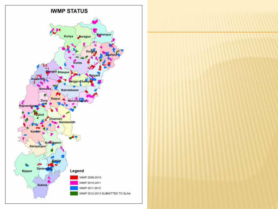
Role of GIS in Watershed
Management
Space based support for Decentralized Planning (SIS-
DP)
P. Kawishwar
Chhattisgarh Council of Science and Technology
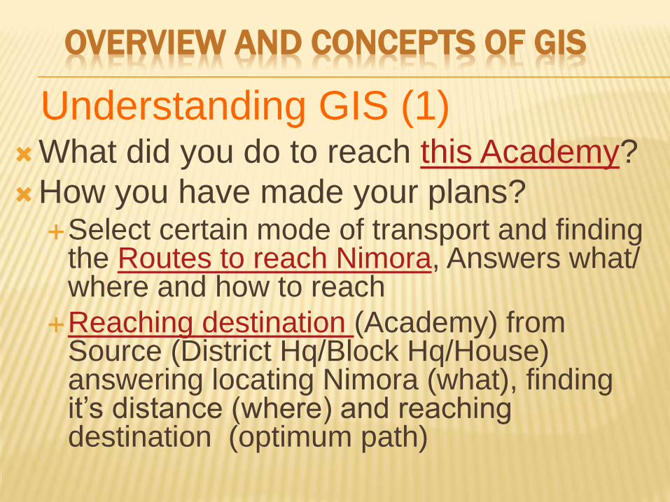
OVERVIEW AND CONCEPTS OF GIS
What did you do to reach this Academy?
How you have made your plans? Select certain mode of transport and finding
the Routes to reach Nimora, Answers what/ where and how to reach
Reaching destination (Academy) from Source (District Hq/Block Hq/House) answering locating Nimora (what), finding it’s distance (where) and reaching destination (optimum path)
Understanding GIS (1)
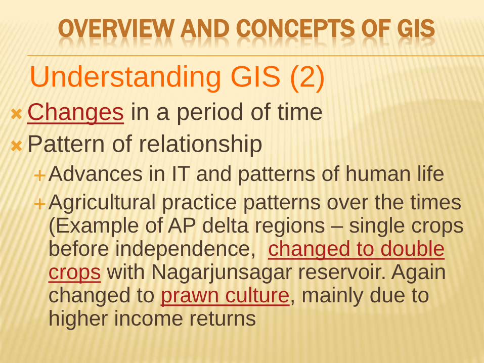
Changes in a period of time
Pattern of relationship
Advances in IT and patterns of human life
Agricultural practice patterns over the times (Example of AP delta regions – single crops before independence, changed to double crops with Nagarjunsagar reservoir. Again changed to prawn culture, mainly due to higher income returns
Understanding GIS (2)
OVERVIEW AND CONCEPTS OF GIS
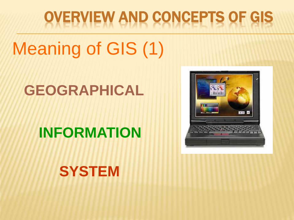
Meaning of GIS (1)
GEOGRAPHICAL
INFORMATION
SYSTEM
OVERVIEW AND CONCEPTS OF GIS
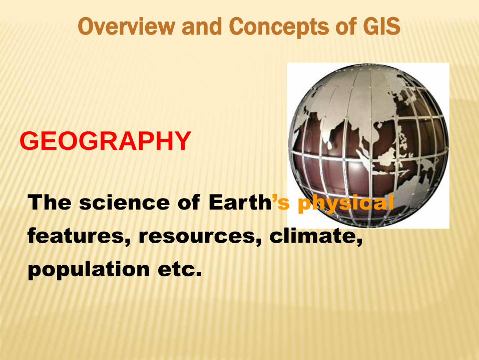
GEOGRAPHY
The science of Earth’s physical
features, resources, climate,
population etc.
Overview and Concepts of GIS
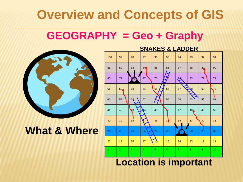
GEOGRAPHY = Geo + Graphy
100 99 98 97 96 95 94 93 92 91
81 82 83 84 85 86 87 88 89 90
80 79 78 77 76 75 74 73 72 71
61 62 63 64 65 66 67 68 69 70
60 59 58 57 56 55 54 53 52 51
41 42 43 44 45 46 47 48 49 50
40 39 38 37 36 35 34 33 32 31
21 22 23 24 25 26 27 28 29 30
20 19 18 17 16 15 14 13 12 11
1 2 3 4 5 6 7 8 9 10
SNAKES & LADDER
Location is important
What & Where
Overview and Concepts of GIS
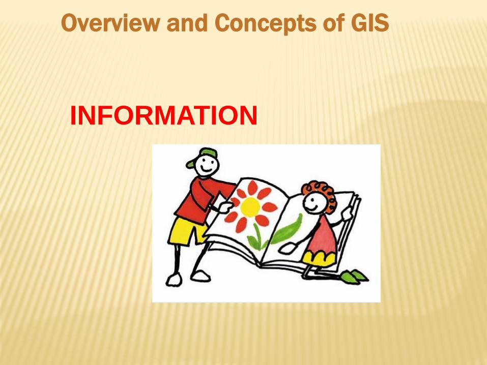
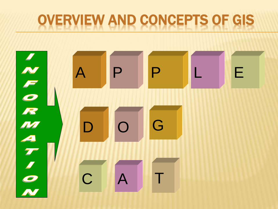
INFORMATION
Overview and Concepts of GIS
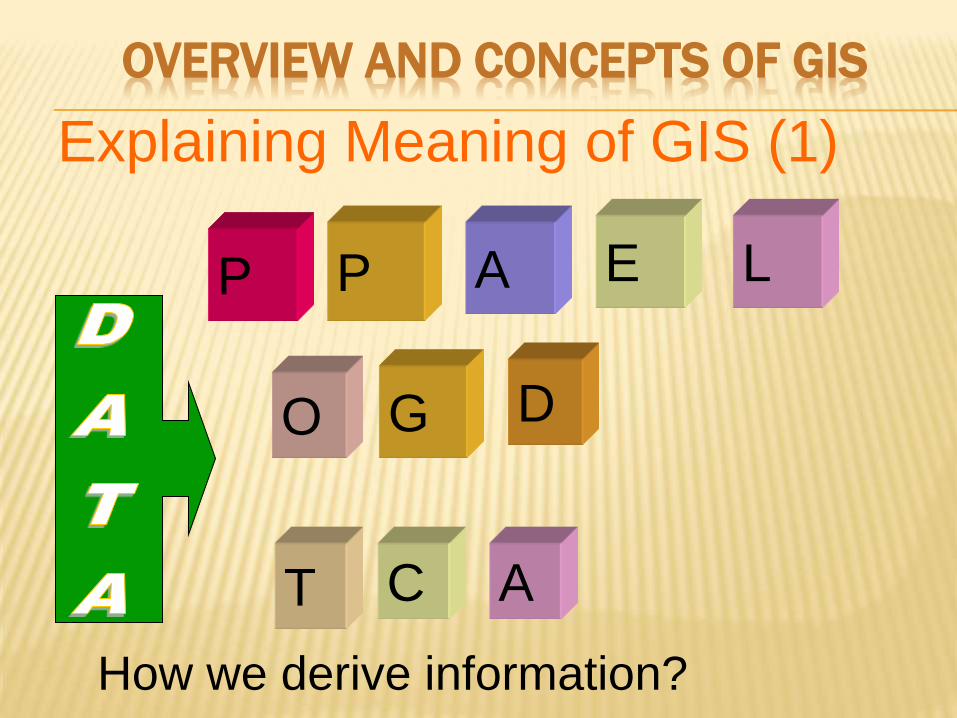
E L P P A
O G D
C A T
Explaining Meaning of GIS (1)
How we derive information?
OVERVIEW AND CONCEPTS OF GIS
E L P P A
O G D
C A T
OVERVIEW AND CONCEPTS OF GIS
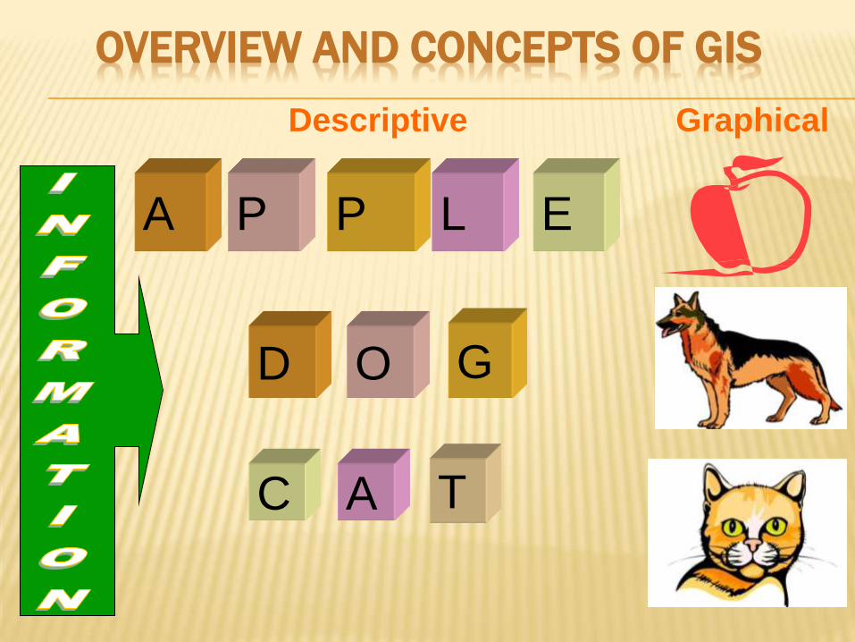
E L P P A
O G D
C A T
Descriptive Graphical
OVERVIEW AND CONCEPTS OF GIS
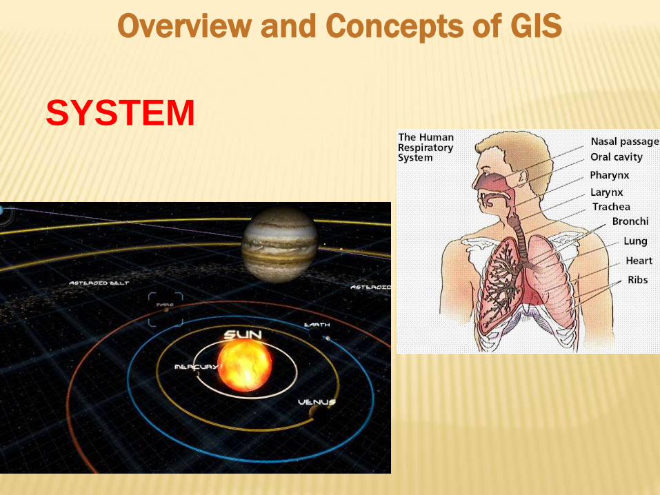
SYSTEM
Overview and Concepts of GIS
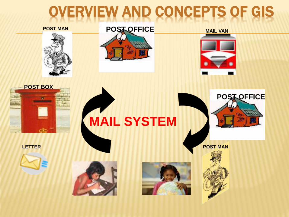
LETTER
MAIL VAN
POST OFFICE
POST MAN
POST OFFICE
POST BOX
POST MAN
MAIL SYSTEM
OVERVIEW AND CONCEPTS OF GIS
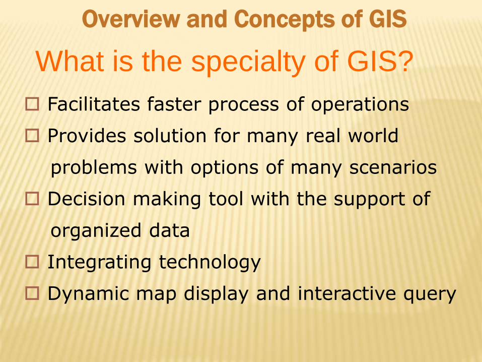
Facilitates faster process of operations
Provides solution for many real world
problems with options of many scenarios
Decision making tool with the support of
organized data
Integrating technology
Dynamic map display and interactive query
What is the specialty of GIS?
Overview and Concepts of GIS
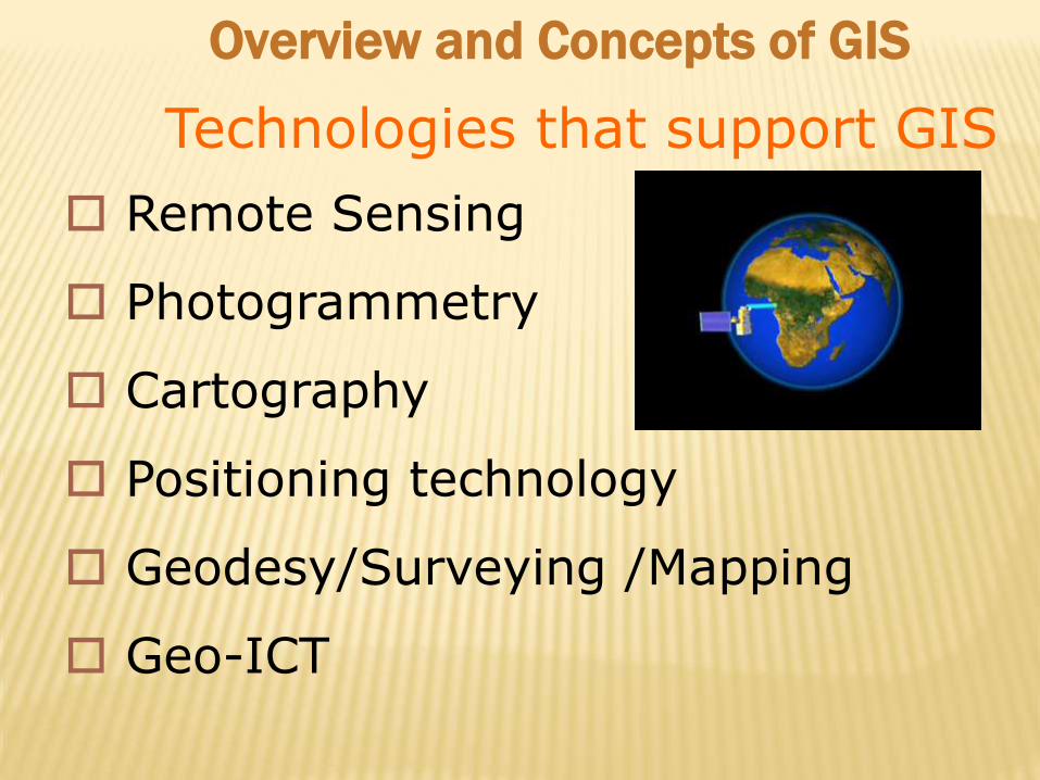
Remote Sensing
Photogrammetry
Cartography
Positioning technology
Geodesy/Surveying /Mapping
Geo-ICT
Technologies that support GIS
Overview and Concepts of GIS
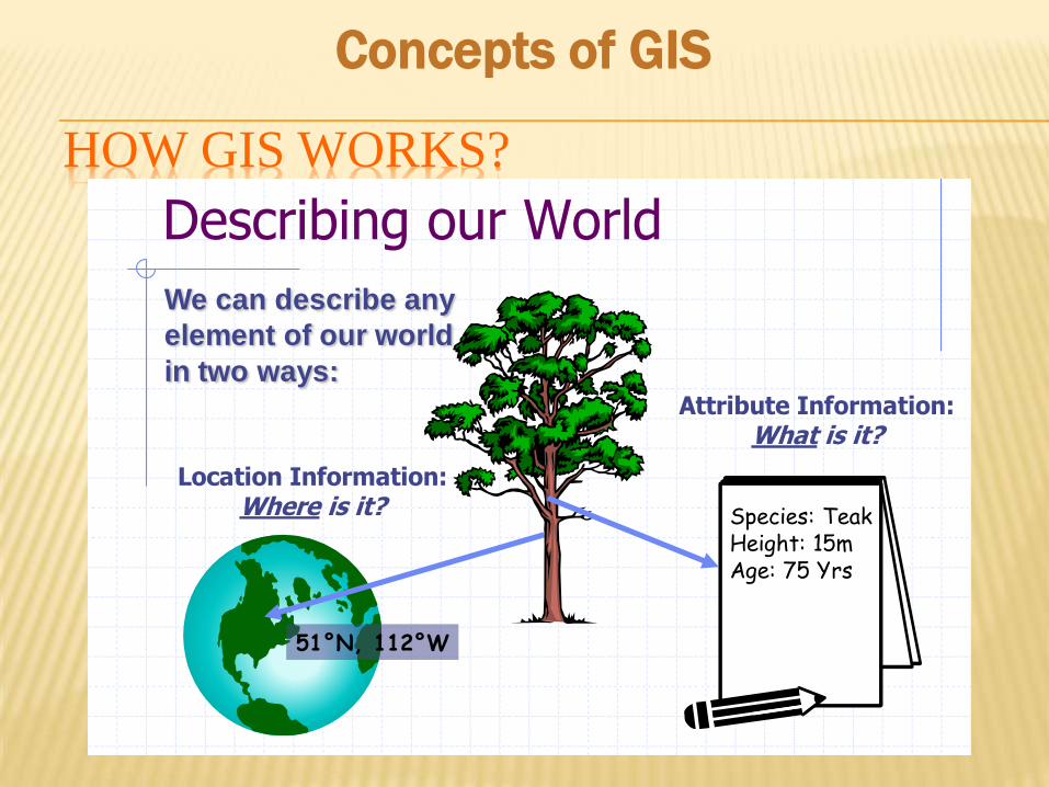
HOW GIS WORKS?
Describing our World
Location Information: Where is it?
51°N, 112°W
We can describe any
element of our world
in two ways:Attribute Information:
What is it?
Species: TeakHeight: 15mAge: 75 Yrs
Concepts of GIS
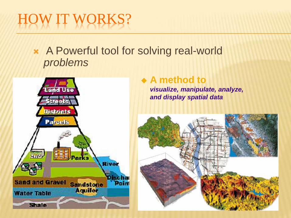
HOW IT WORKS?
A Powerful tool for solving real-world problems
A method to visualize, manipulate, analyze,
and display spatial data
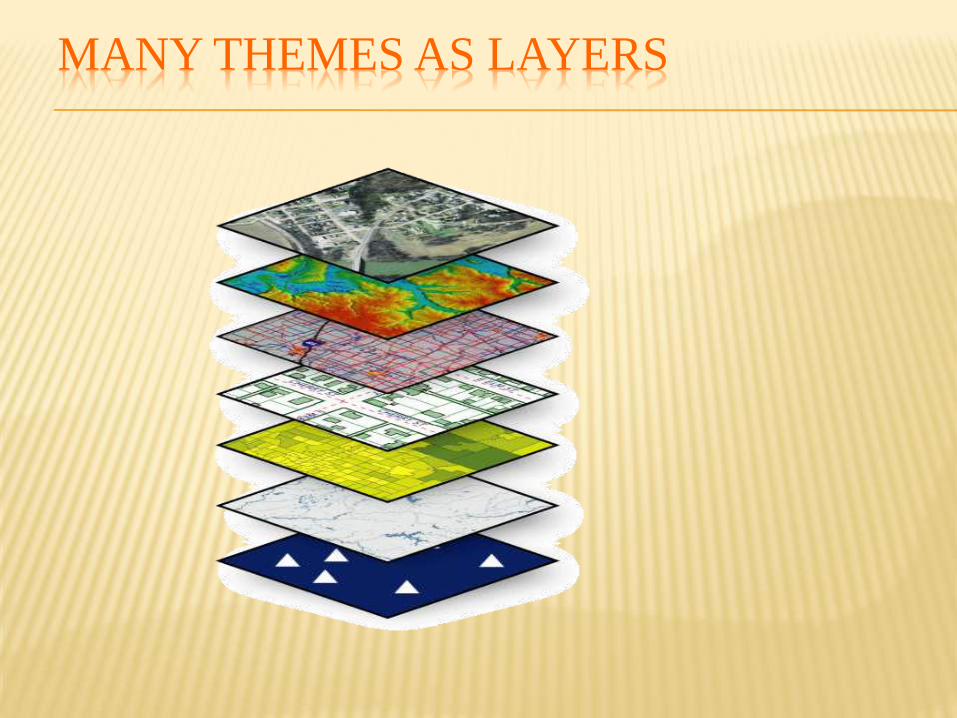
MANY THEMES AS LAYERS
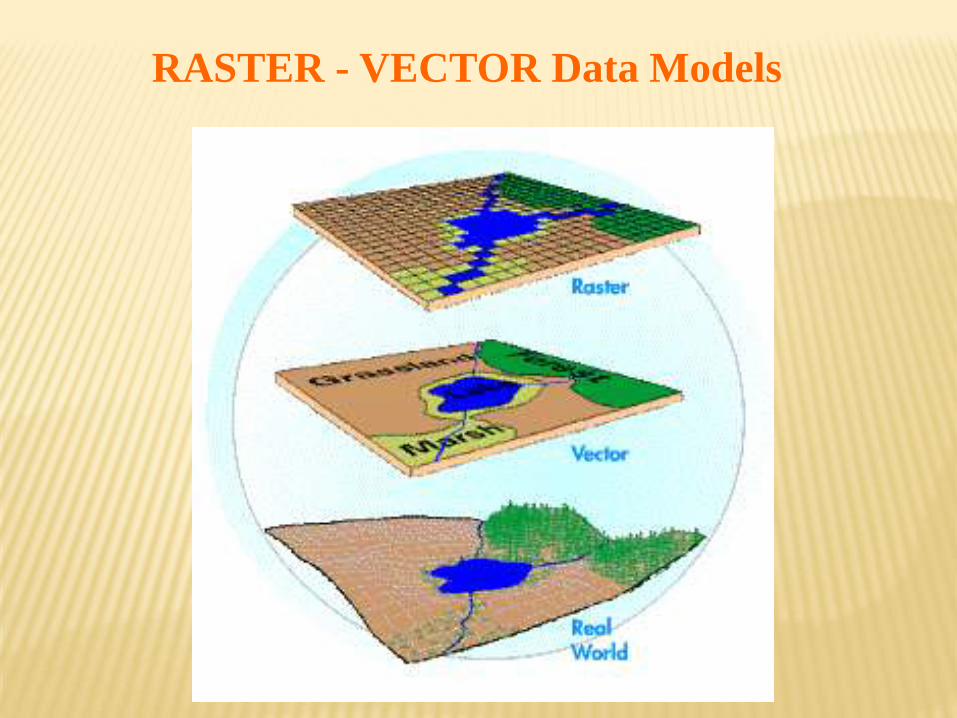
RASTER - VECTOR Data Models
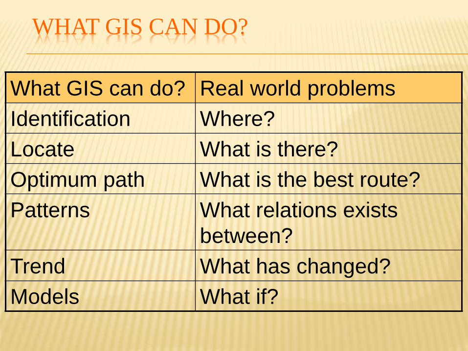
What GIS can do? Real world problems
Identification Where?
Locate What is there?
Optimum path What is the best route?
Patterns What relations exists
between?
Trend What has changed?
Models What if?
WHAT GIS CAN DO?
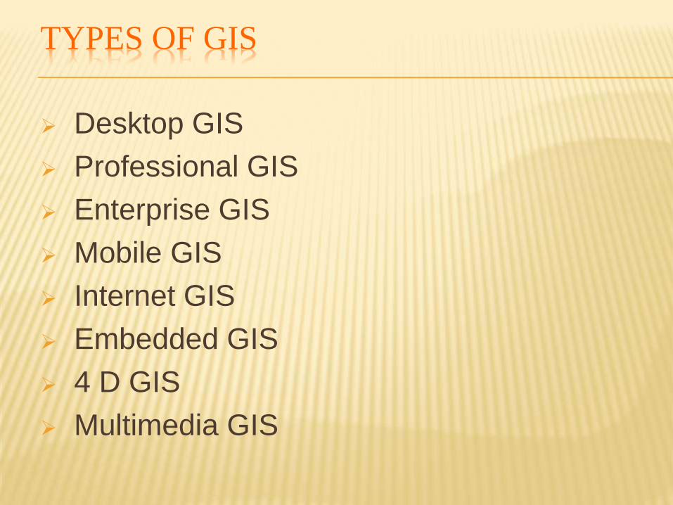
TYPES OF GIS
Desktop GIS
Professional GIS
Enterprise GIS
Mobile GIS
Internet GIS
Embedded GIS
4 D GIS
Multimedia GIS
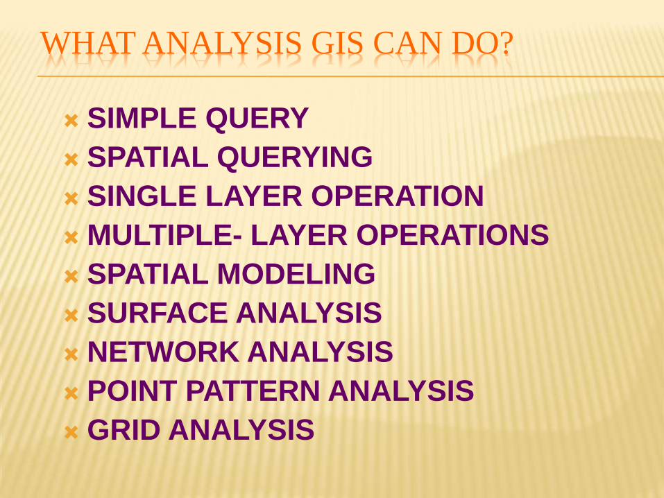
WHAT ANALYSIS GIS CAN DO?
SIMPLE QUERY
SPATIAL QUERYING
SINGLE LAYER OPERATION
MULTIPLE- LAYER OPERATIONS
SPATIAL MODELING
SURFACE ANALYSIS
NETWORK ANALYSIS
POINT PATTERN ANALYSIS
GRID ANALYSIS
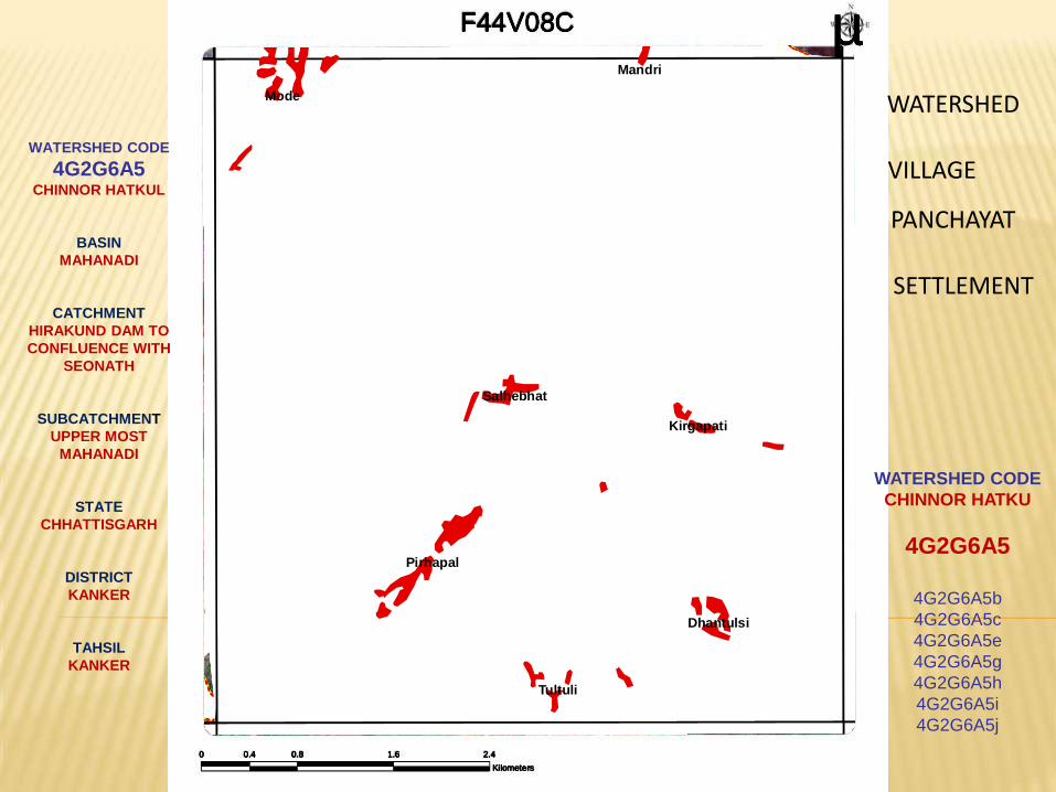
4G2G6A5e
4G2G6A5c
4G2G6A5g
4G2G6A5f
4G2G6A5b
4G2G6A2h
4G2G6A5h
4G2G6A5j
4G2G6B2a
4G2G6A5i
4G2G6A2g
4G2G6A5i
F44V08C µ
0 0.8 1.6 2.40.4
Kilometers
F44V08C µ
0 0.8 1.6 2.40.4
Kilometers
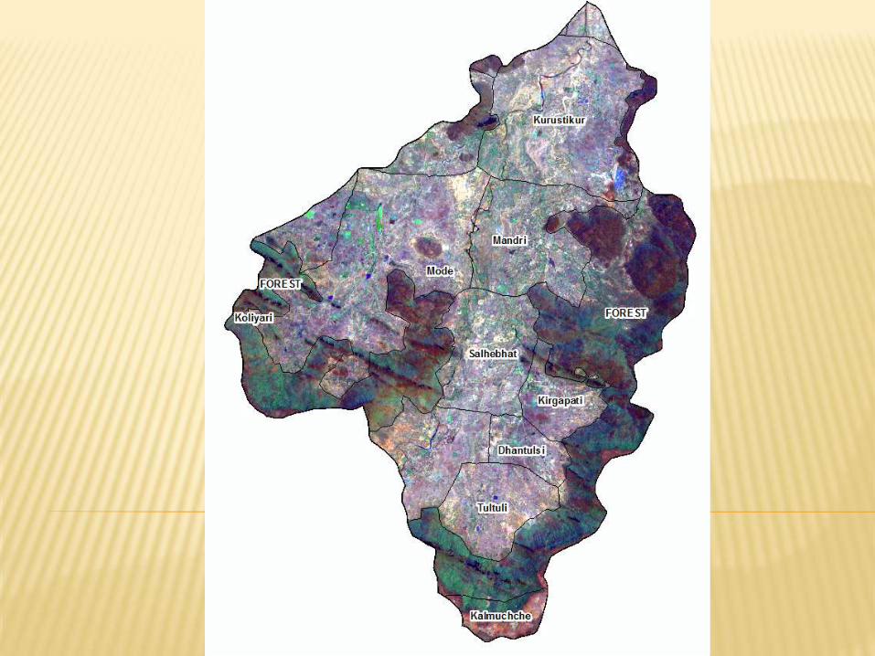
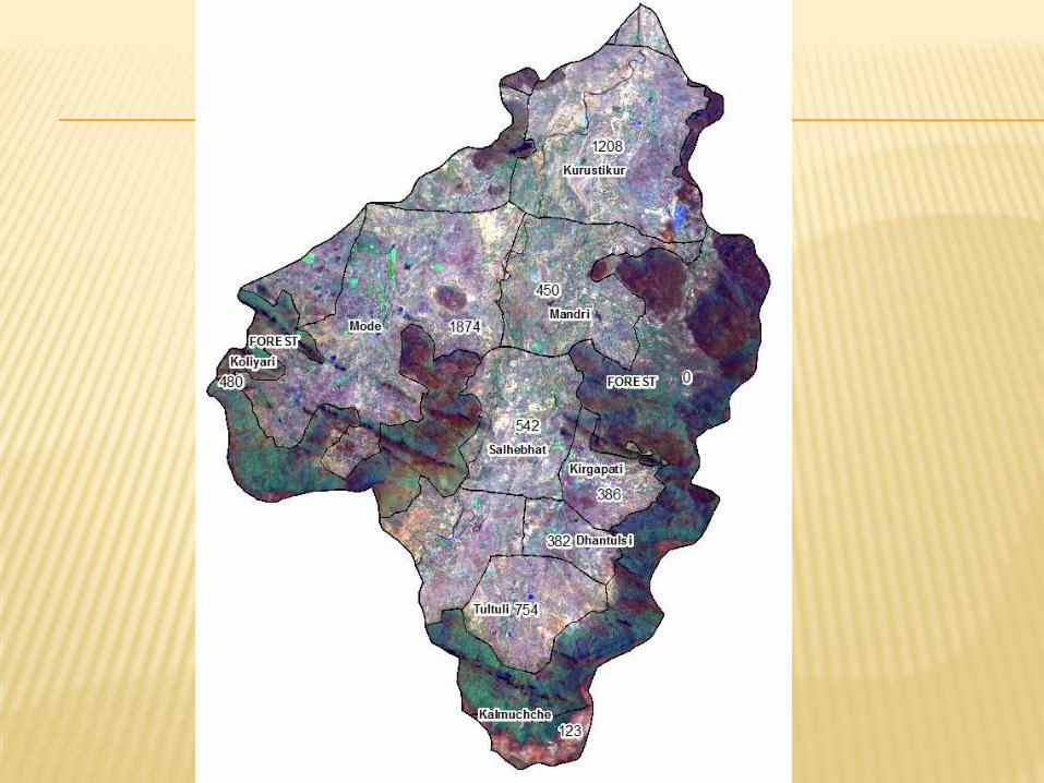
Mode
Pidhapal
FOREST
Salhebhat
Tultuli
Mandri
FOREST
FOREST
Kirgapati
Dhantulsi
Kanagaon Marrapi
F44V08C µ
0 0.8 1.6 2.40.4
Kilometers
Mode
Tultuli
Dhantulsi
Pirhapal
Mandri
Kirgapati
Salhebhat
F44V08C µ
0 0.8 1.6 2.40.4
Kilometers
VILLAGE
WATERSHED
PANCHAYAT
SETTLEMENT
WATERSHED CODE
CHINNOR HATKU
4G2G6A5
4G2G6A5b
4G2G6A5c
4G2G6A5e
4G2G6A5g
4G2G6A5h
4G2G6A5i
4G2G6A5j
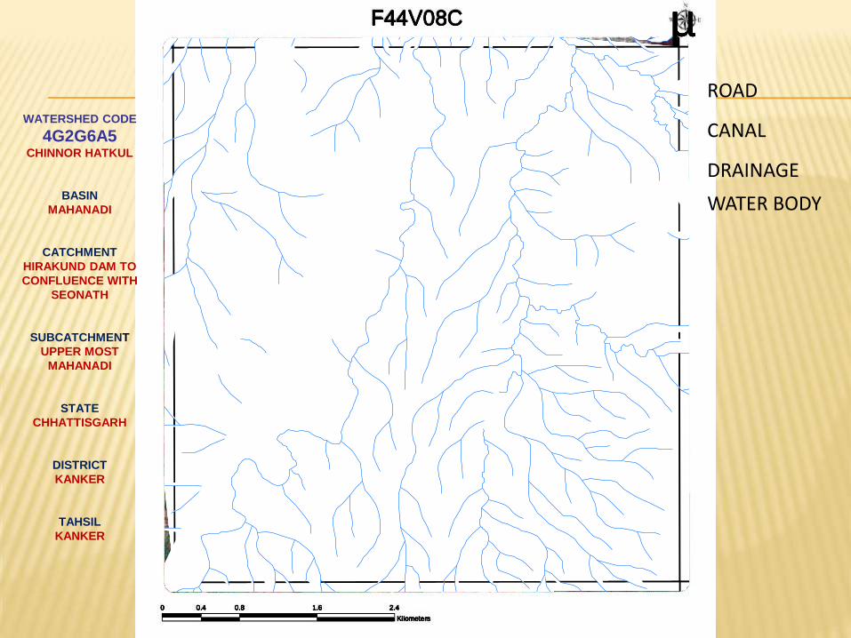
WATERSHED CODE
4G2G6A5 CHINNOR HATKUL
BASIN
MAHANADI
CATCHMENT
HIRAKUND DAM TO
CONFLUENCE WITH
SEONATH
SUBCATCHMENT
UPPER MOST
MAHANADI
STATE
CHHATTISGARH
DISTRICT
KANKER
TAHSIL
KANKER
Mode
Tultuli
Dhantulsi
Pirhapal
Mandri
Kirgapati
Salhebhat
F44V08C µ
0 0.8 1.6 2.40.4
Kilometers
F44V08C µ
0 0.8 1.6 2.40.4
Kilometers
ROAD
CANAL
DRAINAGE
WATER BODY
F44V08C µ
0 0.8 1.6 2.40.4
Kilometers
F44V08C µ
0 0.8 1.6 2.40.4
Kilometers
F44V08C µ
0 0.8 1.6 2.40.4
Kilometers
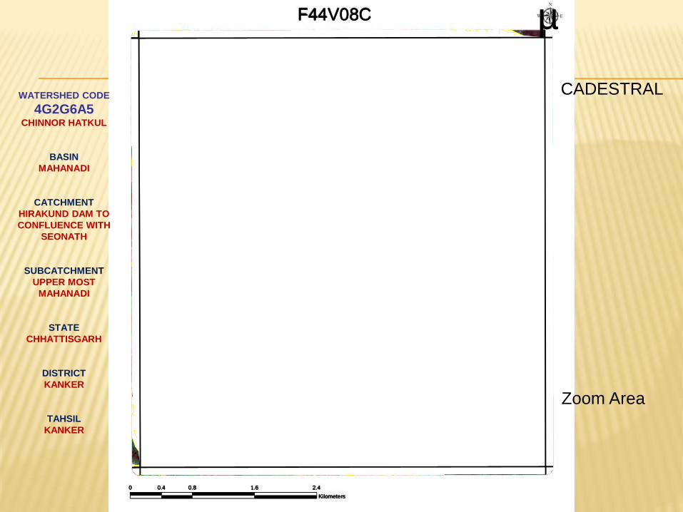
WATERSHED CODE
4G2G6A5 CHINNOR HATKUL
BASIN
MAHANADI
CATCHMENT
HIRAKUND DAM TO
CONFLUENCE WITH
SEONATH
SUBCATCHMENT
UPPER MOST
MAHANADI
STATE
CHHATTISGARH
DISTRICT
KANKER
TAHSIL
KANKER
F44V08C µ
0 0.8 1.6 2.40.4
Kilometers
CADESTRAL
F44V08C µ
0 0.8 1.6 2.40.4
Kilometers
Zoom Area
WATERSHED CODE
4G2G6A5 CHINNOR HATKUL
BASIN
MAHANADI
CATCHMENT
HIRAKUND DAM TO
CONFLUENCE WITH
SEONATH
SUBCATCHMENT
UPPER MOST
MAHANADI
STATE
CHHATTISGARH
DISTRICT
KANKER
TAHSIL
KANKER
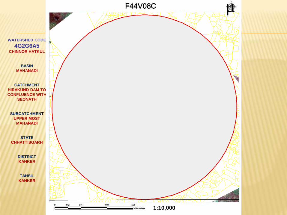
F44V08C µ
0 0.4 0.8 1.20.2
Kilometers 1:10,000
WATERSHED CODE
4G2G6A5 CHINNOR HATKUL
BASIN
MAHANADI
CATCHMENT
HIRAKUND DAM TO
CONFLUENCE WITH
SEONATH
SUBCATCHMENT
UPPER MOST
MAHANADI
STATE
CHHATTISGARH
DISTRICT
KANKER
TAHSIL
KANKER
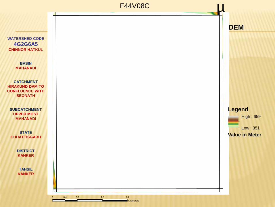
DEM
F44V08C µ
0 0.8 1.6 2.40.4
Kilometers
Legend
Value in Meter
High : 659
Low : 351
WATERSHED CODE
4G2G6A5 CHINNOR HATKUL
BASIN
MAHANADI
CATCHMENT
HIRAKUND DAM TO
CONFLUENCE WITH
SEONATH
SUBCATCHMENT
UPPER MOST
MAHANADI
STATE
CHHATTISGARH
DISTRICT
KANKER
TAHSIL
KANKER
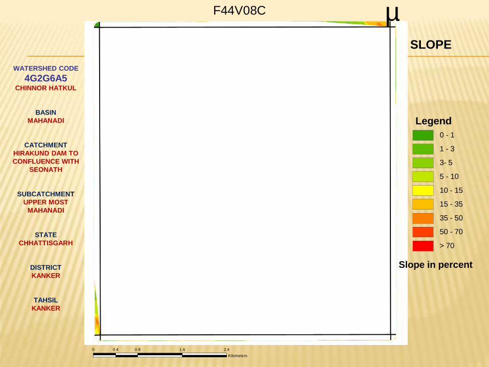
Legend
0 - 1
1 - 3
3- 5
5 - 10
10 - 15
15 - 35
35 - 50
50 - 70
> 70
SLOPE
F44V08C µ
0 0.8 1.6 2.40.4
Kilometers
Slope in percent
WATERSHED CODE
4G2G6A5 CHINNOR HATKUL
BASIN
MAHANADI
CATCHMENT
HIRAKUND DAM TO
CONFLUENCE WITH
SEONATH
SUBCATCHMENT
UPPER MOST
MAHANADI
STATE
CHHATTISGARH
DISTRICT
KANKER
TAHSIL
KANKER
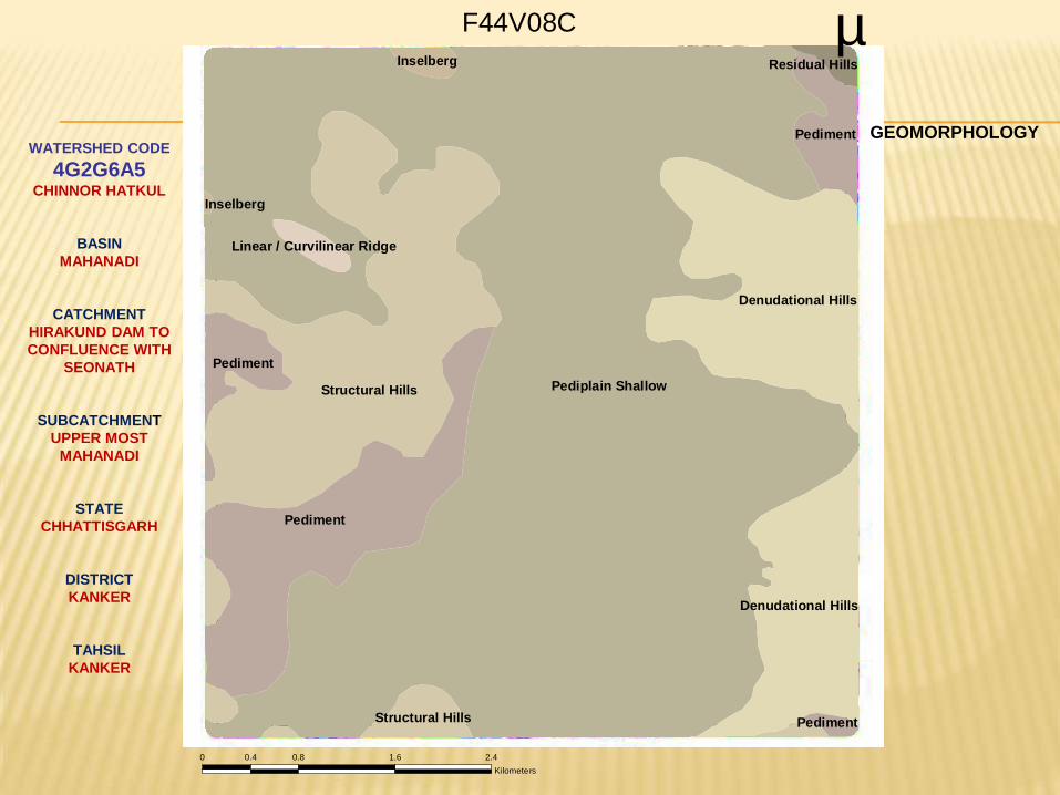
Pediplain ShallowStructural Hills
Pediment
Denudational Hills
Pediment
Pediment
Denudational Hills
Structural Hills
Inselberg Residual Hills
Pediment
Linear / Curvilinear Ridge
Inselberg
F44V08C µ
0 0.8 1.6 2.40.4
Kilometers
GEOMORPHOLOGY
WATERSHED CODE
4G2G6A5 CHINNOR HATKUL
BASIN
MAHANADI
CATCHMENT
HIRAKUND DAM TO
CONFLUENCE WITH
SEONATH
SUBCATCHMENT
UPPER MOST
MAHANADI
STATE
CHHATTISGARH
DISTRICT
KANKER
TAHSIL
KANKER
AG-Crop-Land
FR-Forest_Land
FR-Forest_Land
AG-Crop-Land
AG-Crop-Land
AG-Crop-Land
AG-Crop-Land
AG-Crop-Land
FR-Forest_Land
WL-Scrub-Land-Open
WL-Scrub-Land-Open
WL-Scrub-Land-Dense
WL-Scrub-Land-Dense
AG-Crop-Land
WL-Scrub-Land-Open
AG-Crop-Land
AG-Crop-Land
AG-Crop-Land
WB-River/Stream/Drain
FR-Forest_Land
FR-Forest_Land
WL-Scrub-Land-Open
WL-Scrub-Land-Dense
WB-River/Stream/Drain
FR-Forest_Land
WL-Scrub-Land-Open
WL-Scrub-Land-Dense
AG-Crop-Land
WL-Scrub-Land-Open
AG-Crop-Land
WL-Scrub-Land-Open
AG-Crop-Land
WL-Scrub-Land-Open
AG-Crop-Land
BU-Hamlets and Dispersed Household
BU-Hamlets and Dispersed Household
FR-Forest_Land
WB-River/Stream/Drain
WL-Scrub-Land-Dense
BU-Hamlets and Dispersed Household
BU-Hamlets and Dispersed Household
WB-Reservoir/Tanks
BU-Hamlets and Dispersed Household
WB-Lakes/Ponds
WB-Lakes/Ponds
WB-Lakes/Ponds
WB-Lakes/Ponds
WB-Reservoir/Tanks
BU-Hamlets and Dispersed Household
WB-Water-Bodies
BU-Hamlets and Dispersed Household
WB-Lakes/Ponds
BU-Hamlets and Dispersed Household
BU-Hamlets and Dispersed Household
BU-Hamlets and Dispersed Household
BU-Hamlets and Dispersed Household
BU-Hamlets and Dispersed Household
BU-Hamlets and Dispersed Household
BU-Hamlets and Dispersed Household
BU-Hamlets and Dispersed Household
BU-Hamlets and Dispersed Household
BU-Hamlets and Dispersed Household
WB-Reservoir/Tanks
WB-Lakes/Ponds
WB-Lakes/Ponds
BU-Hamlets and Dispersed Household
WB-Lakes/Ponds
AG-Crop-Land
F44V08C µ
0 0.8 1.6 2.40.4
Kilometers
LANDUSE
Legend
WL-Scrub-Land-Open
WL-Scrub-Land-Dense
WB-Water-Bodies
FR-Forest
BU-Built-Up
AG-Crop-Land
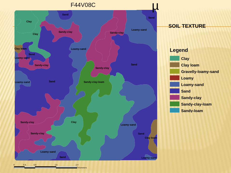
SOIL TEXTURE
Clay
Clay loam
Gravelly-loamy-sand
Loamy
Loamy-sand
Sand
Sandy-clay
Sandy-clay-loam
Sandy-loam
Legend
Clay
Sand
Sand
Sand
Loamy-sand
Clay
Loamy-sand
Clay
Sandy-clay-loam
Sandy-clay
Sandy-clay
Loamy-sand
Loamy-sand
Sandy-clay
Sandy-clay
Sand
Sandy-clay
Sand
Sandy-clay
Sand
Sand
Loamy-sand
Clay loam
Clay loam
Loamy-sand
Loamy-sand
F44V08C µ
0 0.8 1.6 2.40.4
Kilometers
35
75
43
35
43
50
35
43
56
56
43
56
75 5656
75
56
43
35
35
35
35
35
35
43
43
F44V08C µ
0 0.8 1.6 2.40.4
Kilometers
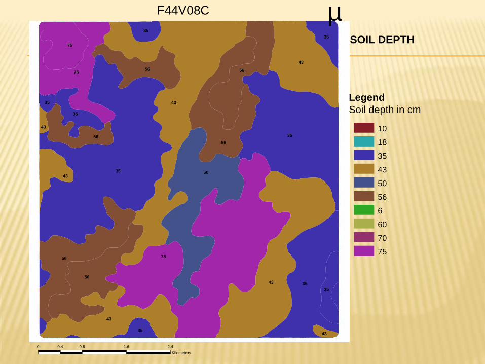
SOIL DEPTH
Legend
Soil depth in cm
10
18
35
43
50
56
6
60
70
75
F44V08C µ
0 0.8 1.6 2.40.4
Kilometers
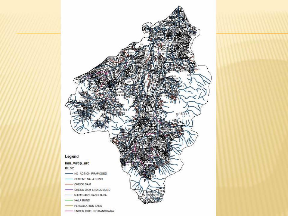
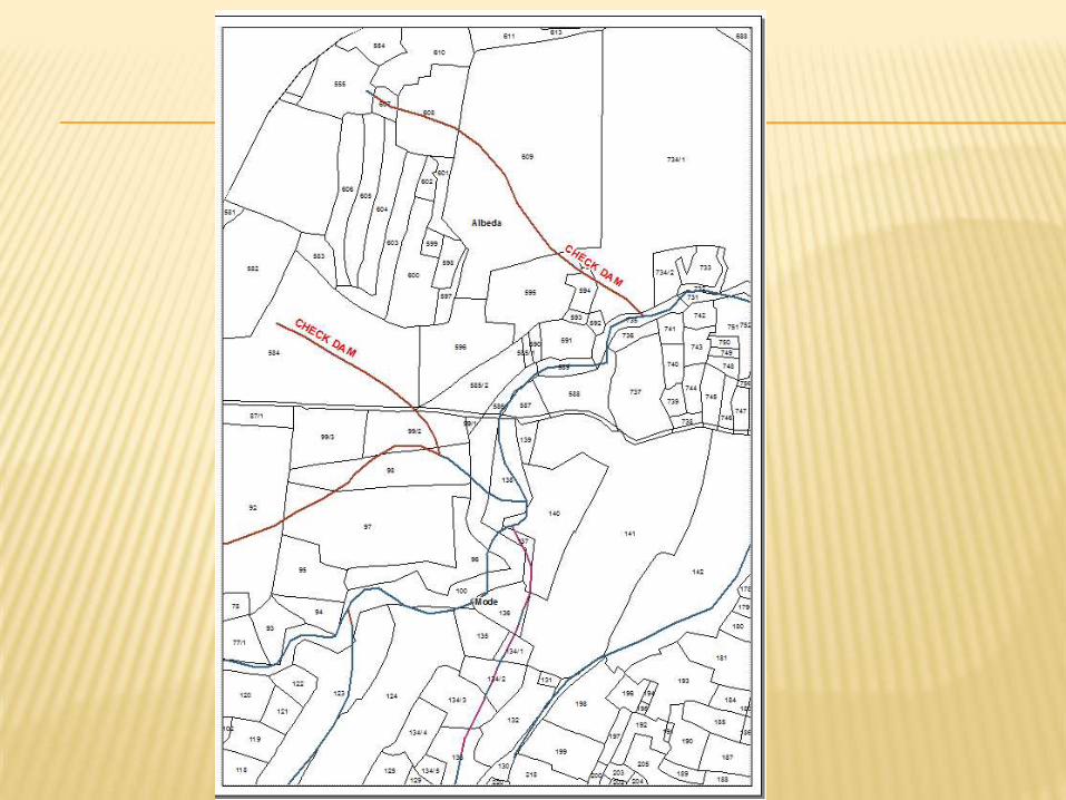
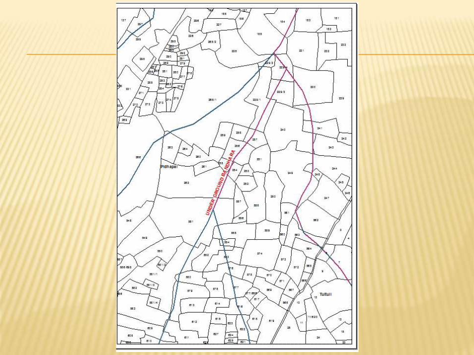
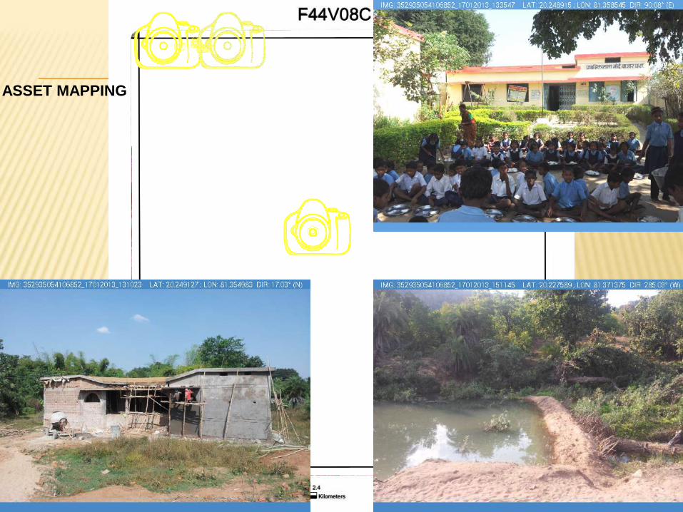
ASSET MAPPING
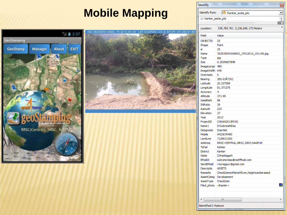
Mobile Mapping
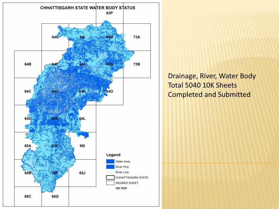
Drainage, River, Water Body Total 5040 10K Sheets Completed and Submitted
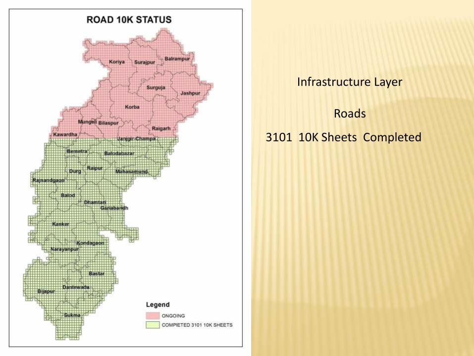
Infrastructure Layer
Roads
3101 10K Sheets Completed
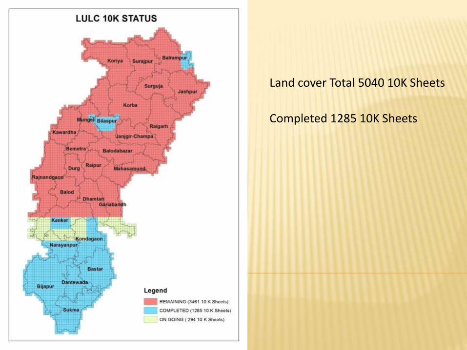
Land cover Total 5040 10K Sheets
Completed 1285 10K Sheets