Embed Size (px)
Citation preview
Soil Data WarehouseSoil Data Warehouse
Western Regional NCSS ConferenceWestern Regional NCSS Conference Telluride, ColoradoTelluride, Colorado
July 9, 2002July 9, 2002
Ken Harward, Project ManagerKen Harward, Project Manager NRCS Information Technology CenterNRCS Information Technology Center
Fort Collins, ColoradoFort Collins, Colorado
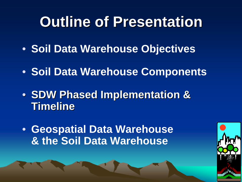
Outline of PresentationOutline of Presentation• Soil Data Warehouse Objectives
• Soil Data Warehouse Components
•• SDW Phased Implementation & SDW Phased Implementation & TimelineTimeline
• Geospatial Data Warehouse & the Soil Data Warehouse
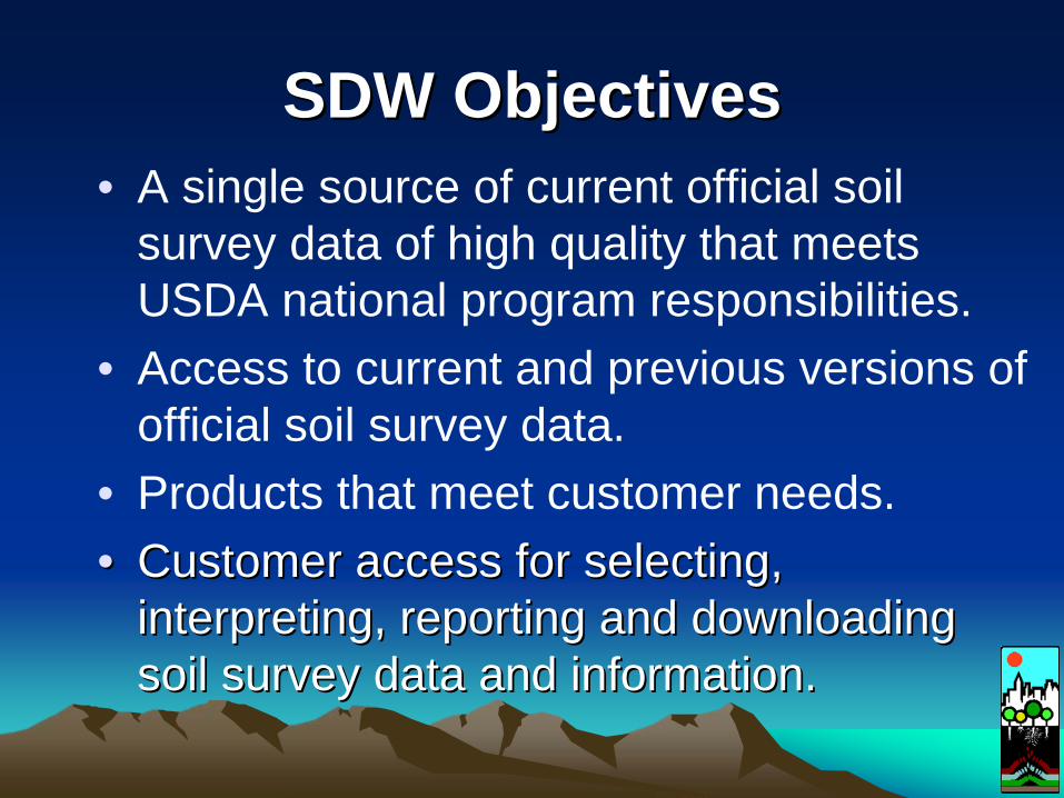
SDW ObjectivesSDW Objectives• A single source of current official soil
survey data of high quality that meets USDA national program responsibilities.
• Access to current and previous versions of official soil survey data.
• Products that meet customer needs.•• Customer access for selecting, Customer access for selecting,
interpreting, reporting and downloading interpreting, reporting and downloading soil survey data and information.soil survey data and information.
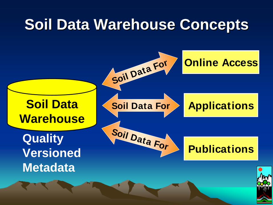
Soil Data Warehouse ConceptsSoil Data Warehouse Concepts
Publications
Applications
Online Access
Soil Data For
Soil Data For
Soil Data For
Soil DataWarehouseQualityVersionedMetadata
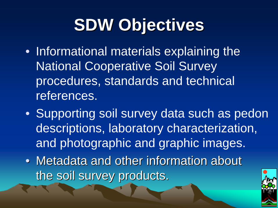
SDW ObjectivesSDW Objectives• Informational materials explaining the
National Cooperative Soil Survey procedures, standards and technical references.
• Supporting soil survey data such as pedon descriptions, laboratory characterization, and photographic and graphic images.
•• Metadata and other information about Metadata and other information about the soil survey products.the soil survey products.
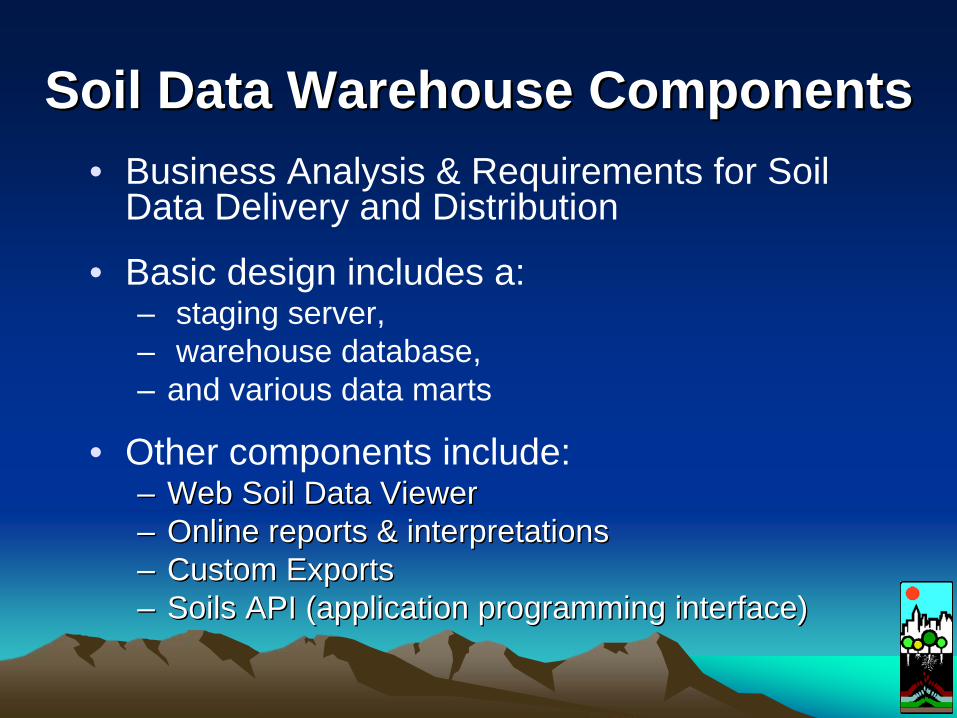
Soil Data Warehouse ComponentsSoil Data Warehouse Components• Business Analysis & Requirements for Soil
Data Delivery and Distribution
• Basic design includes a:– staging server, – warehouse database, – and various data marts
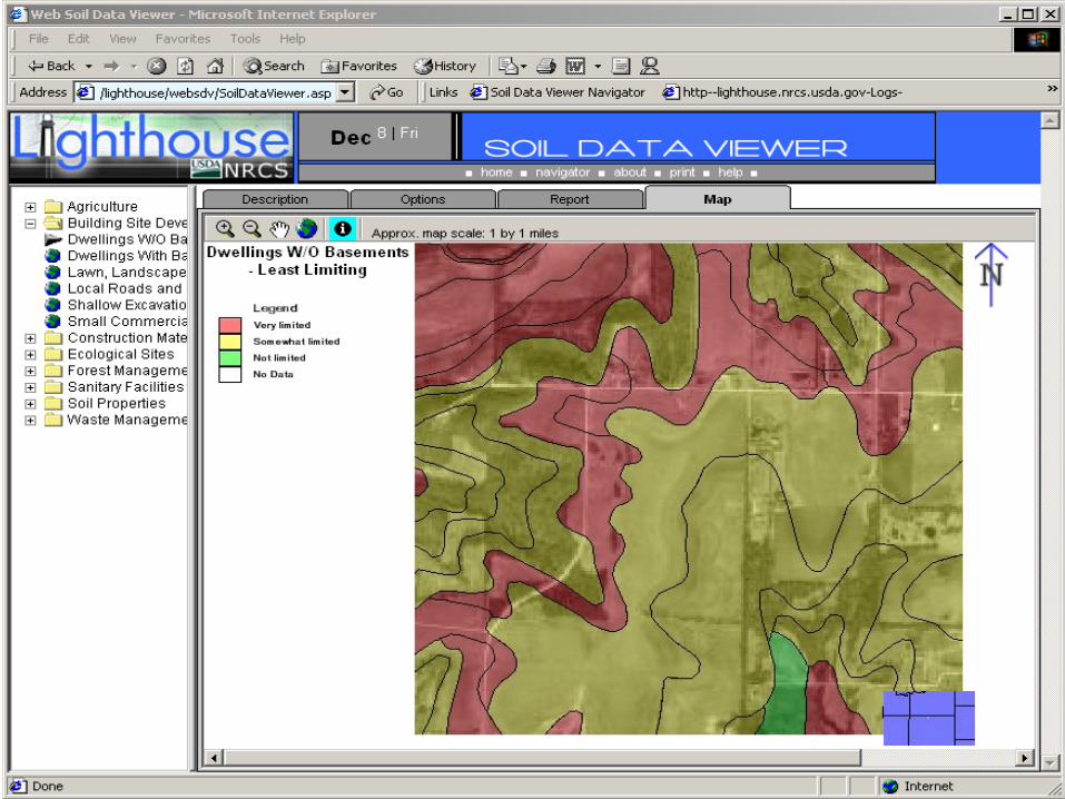
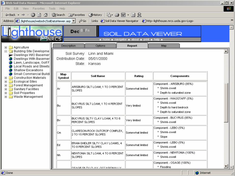
• Other components include:–– Web Soil Data ViewerWeb Soil Data Viewer–– Online reports & interpretationsOnline reports & interpretations–– Custom ExportsCustom Exports–– Soils API (application programming interface)Soils API (application programming interface)
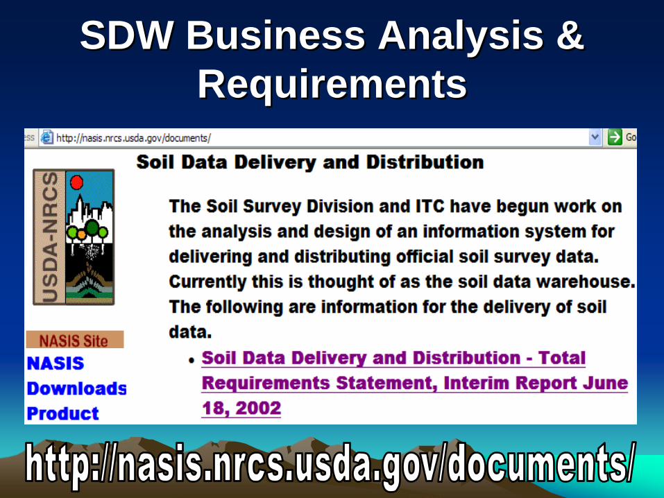
SDW Business Analysis & SDW Business Analysis & RequirementsRequirements
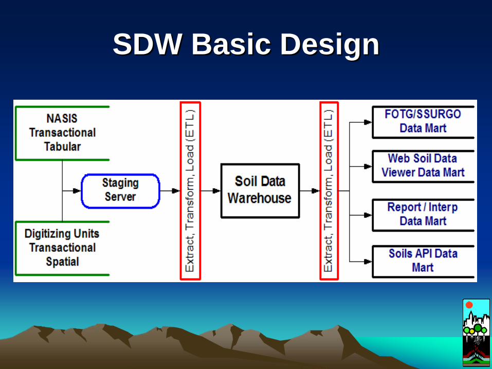
SDW Basic DesignSDW Basic Design
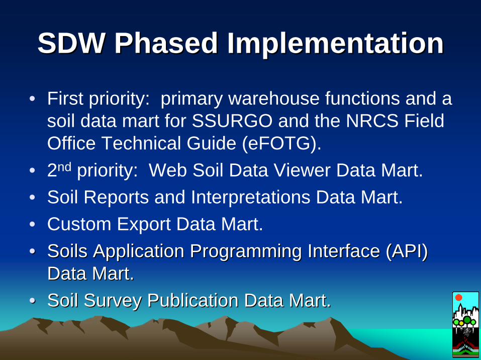
SDW Phased ImplementationSDW Phased Implementation
• First priority: primary warehouse functions and a soil data mart for SSURGO and the NRCS Field Office Technical Guide (eFOTG).
• 2nd priority: Web Soil Data Viewer Data Mart.• Soil Reports and Interpretations Data Mart.• Custom Export Data Mart.•• Soils Application Programming Interface (API) Soils Application Programming Interface (API)
Data Mart.Data Mart.•• Soil Survey Publication Data Mart.Soil Survey Publication Data Mart.
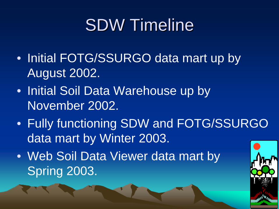
SDW TimelineSDW Timeline
• Initial FOTG/SSURGO data mart up by August 2002.
• Initial Soil Data Warehouse up by November 2002.
• Fully functioning SDW and FOTG/SSURGO data mart by Winter 2003.
• Web Soil Data Viewer data mart by Spring 2003.
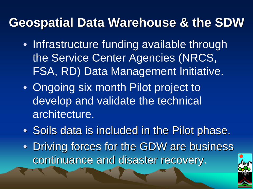
Geospatial Data Warehouse & the SDWGeospatial Data Warehouse & the SDW• Infrastructure funding available through
the Service Center Agencies (NRCS, FSA, RD) Data Management Initiative.
• Ongoing six month Pilot project to develop and validate the technical architecture.
•• Soils data is included in the Pilot phase.Soils data is included in the Pilot phase.•• Driving forces for the GDW are business Driving forces for the GDW are business
continuance and disaster recovery.continuance and disaster recovery.
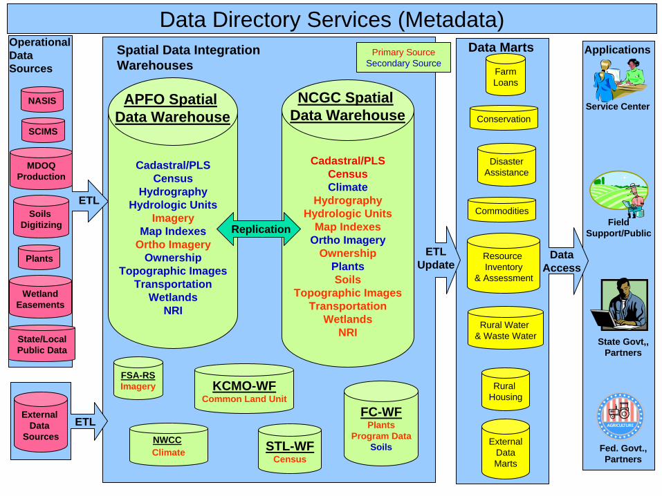
STL-WFCensus
FC-WFPlants
Program DataSoils
FSA-RSImagery KCMO-WF
Common Land Unit
Cadastral/PLSCensusClimate
HydrographyHydrologic Units
Map IndexesOrtho Imagery
OwnershipPlantsSoils
Topographic ImagesTransportation
WetlandsNRI
NCGC Spatial Data Warehouse
Cadastral/PLSCensus
HydrographyHydrologic Units
ImageryMap Indexes
Ortho ImageryOwnership
Topographic ImagesTransportation
WetlandsNRI
APFO Spatial Data Warehouse
ClimateNWCC
NASIS
ExternalDataMarts
Data Directory Services (Metadata)
FarmLoans
DisasterAssistance
Commodities
Conservation
Resource Inventory
& Assessment
Rural Water & Waste Water
Rural Housing
SCIMS
MDOQProduction
Soils Digitizing
Plants
WetlandEasements
Primary SourceSecondary Source
Spatial Data Integration Warehouses
Operational Data Sources
Data Marts
ETL
ETLUpdate
Data Access
Applications
Service Center
Field Support/Public
State Govt,, Partners
Fed. Govt.,Partners
State/Local Public Data
Replication
External Data
SourcesETL
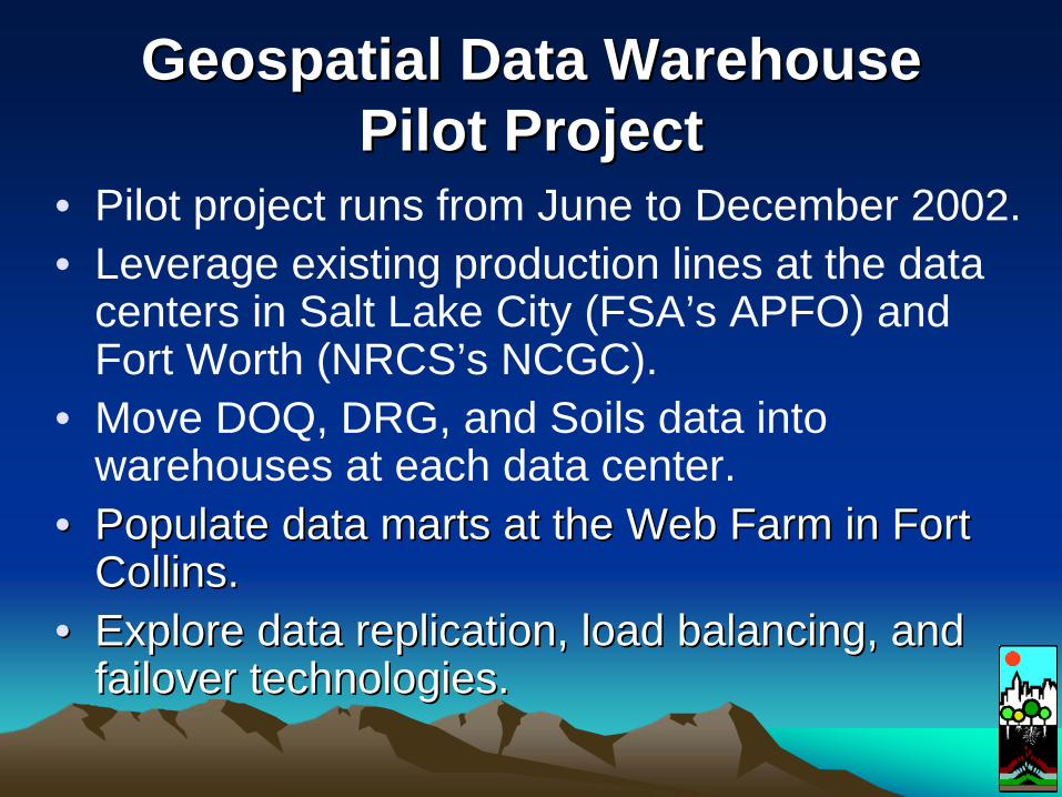
Geospatial Data WarehouseGeospatial Data Warehouse Pilot ProjectPilot Project
• Pilot project runs from June to December 2002.• Leverage existing production lines at the data
centers in Salt Lake City (FSA’s APFO) and Fort Worth (NRCS’s NCGC).
• Move DOQ, DRG, and Soils data into warehouses at each data center.
•• Populate data marts at the Web Farm in Fort Populate data marts at the Web Farm in Fort Collins.Collins.
•• Explore data replication, load balancing, and Explore data replication, load balancing, and failover technologies.failover technologies.
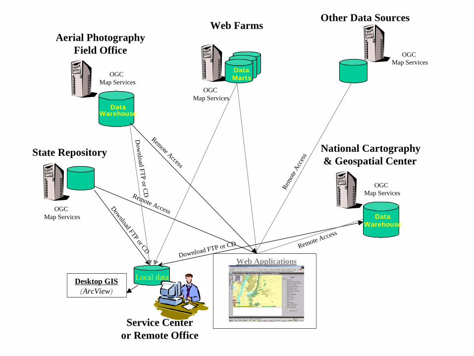
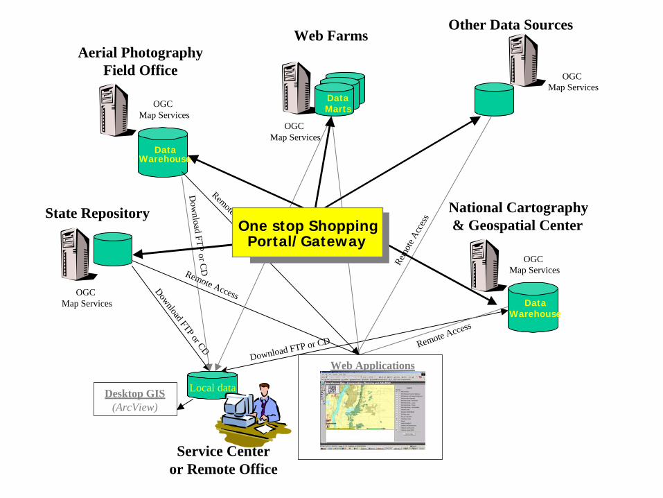
Other Data Sources
Local data
State Repository
Web Farms
Desktop GIS(ArcView)
Service Centeror Remote Office
Download FTP or CD
Download FTP or CD
OGC Map Services
National Cartography& Geospatial Center
OGC Map Services
OGC Map Services
OGC Map Services
Remote Access
Remote Access
Rem
ote A
cces
s
Aerial Photography Field Office
OGC Map Services
Remote Access
Dow
nload FTP or CD
Web Applications
DataWarehouse
DataWarehouse
DataMarts
One stop ShoppingPortal/Gateway
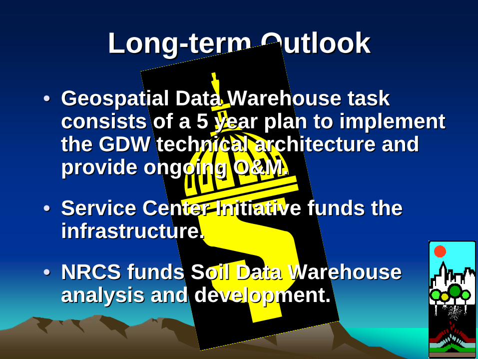
LongLong--term Outlookterm Outlook
•• Geospatial Data Warehouse task Geospatial Data Warehouse task consists of a 5 year plan to implement consists of a 5 year plan to implement the GDW technical architecture and the GDW technical architecture and provide ongoing O&M.provide ongoing O&M.
•• Service Center Initiative funds the Service Center Initiative funds the infrastructure. infrastructure.
•• NRCS funds Soil Data Warehouse NRCS funds Soil Data Warehouse analysis and development.analysis and development.