Embed Size (px)
Citation preview

Ecoroute GuideSUMACO
Title:Sumaco Ecoroute Guide
ISBN: 978-9942-02-551-7
Publisher:Corporación Andina de Fomento (CAF).
Authors:Theofilos Toulkeridis: Geology and VulcanologyVlastimil Zak: FloraFlorencio Delgado: History and cultural aspectsAndrés León-Reyes: Birds, mammals, reptiles, amphibiansXavier Silva: ButterfliesFabián Burbano: HidrologyArnaldo Rodriguez-Green Consulting: Tourism
Photographs:Theofilos Toulkeridis (photos pp.11-26), Florencio Delgado (photos pp. 26-34), Andrés León-Reyes (photos pp. 37-68), Juan Pablo Reyes (photo pp. 65), Vlastimil Zak (photos pp. 44-67), Xavier Silva (photos pp. 10, 41-67), Fundación Cofán (photo pp. 68), J. Delia y DF Cisneros-Heredia (photo pp. 53), Fernando Ayala-V (photo pp. 53), Andrew Bertram (photo pp. 30), United States National Parks Service (photo pp. 40) y Mitternacht90 - Wikipedia User (photo pp. 50), Francisco Porras (photos pp. 11).
Cover and back cover:Theofilos Toulkeridis (river photo), Ramiro Porras (Cover and back cover Sumaco photos), Xavier Silva (butterfly photos), Andrés León-Reyes (frog, eggs, native photos), Florencio Del-gado (old indean rock photo)
Inside covers:Geology: Ramiro Porras (Sumaco volcano), Rivers and waterfalls: Florencio Delgado (Ecoroute guide river), Cultural Aspects: Florencio Delgado (Sumaco´s native house), Life zones at the ecoroute: Andrés León-Reyes (Owl), Trail and life zones in the climb to Sumaco: Vlastimil Zak (Sumaco ecoroute trail).
Graphics:CGVG-USFQ
Graphic design, designs and illustrations:David Cabrera R.Patricia Salvador
Printed by:Smart Marketing
Digital version of this guide:www.caf.com/publicaciones
© 2009. All rights reserved.Corporación Andina de Fomento (CAF)
IndexPrologue 6
Introduction 7
Sumaco Napo Galeras National Park and the Sumaco Biosphere Reserve 10
GEOLOGY 11Geological aspects of the Ecoroute 13Important geological aspects along the Ecoroute 15
RIVERS AND WATERFALLS 21Hydrological background on the Ecoroute 23The Ecoroute´s most important hydrological aspects 25
CULTURAL ASPECTS 27 Cultural aspects of the Ecoroute 29The quest for “El Dorado” 30The present day indigenous cultures of the region 31Rubber, colonization, oil and wood: the footprints of development 33Significant cultural aspects along the Ecoroute 35
LIFE ZONES AT THE ECOROUTE 37The Ecoroute’s most important animal groups 39Mammals 39Birds 39Reptiles 40Amphibians 41Butterflies 41Life zones along the Sumaco Ecoroute 44A1 Dry montane scrubland 44A2 Humid montane scrubland and high montane evergreen forest 45A3 Herbaceous high wetland and mossy high wetland 45A4 High montane evergreen forest 48A5 Eastern Andes montane cloud forest 49A6 Foothill montane evergreen forest 52
TRAIL AND LIFE ZONES ALONG THE CLIMB TO SUMACO 55The SNGNP Trail 57The climb to Sumaco 58What to bring to Sumaco 59Life zones along the climb to Sumaco 60B1 Low montane evergreen forest 60B2 Montane cloud forest 64B3 High montane evergreen forest 67B4 Herbaceous High wetland 68Exploring the ecoroute 69Where to eat and sleep 69Papallacta 69Baeza, Cosanga and surrounding areas 70Sumaco Napo Galeras National Park 71Other accommodation options in Sumaco and surrounding areas 71Recommended reading 72
The Sumaco Guide is the result of efforts made by the Andean Development Corporation (CAF) as part of its institutional mission to promote sustainable development by supporting conservation and the sustainable use of biodiversity.
Within the framework of its Environmental Strategy, CAF has defined a set of fundamental principles that guide its environmental management. For the Institution one of the main contributions of the environmental dimension to susteinable development is the recognition that conservation and sustainable use of nature and the environment in the region are fundamental in promoting an improvement in the quality of life of societies, overcoming poverty, and promoting economic development and the well being of others in the long term.
Through the Institution’s Environmental Strategy, CAF is reaffirming and strengthening its commitment to the environment by supporting shareholder countries in the conservation and sustainable use of their natural resources, including ecosystems and the generation and improvement of frameworks and processes for socially responsible and environmental management procedures.
Located in one of the most biodiverse regions in the world, the Sumaco Napo Galeras National Park and the Sumaco Biosphere Reserve present natural and cultural attractions of exceptional value, with regards to the destination itself as well as along the course of its access route from Quito. Nevertheless, both the Park and the Reserve are under threat from internal and external pressures, which include oil exploitation, expansion of agriculture and cattle farming, deforestation, hunting and trafficking of species.
As part of these objectives, CAF has commissioned the Center of Geology, Volcanology and Geodynamics of the University of San Francisco of Quito, in association with Green Consulting, to develop this guide aimed at both Ecuadorian and foreign travelers. It has been designed in order for the Sumaco Napo Galeras National Park and Sumaco Biosphere Reserve to generate recreational and educational opportunities for visitors. In turn, this translates in economic benefits for businessmen, local communities and governments by using the material wealth generated from such biological diversity at the destination and converting this into incentives and opportunities for conservation.
Prologue
José CarreraVice President Social and
Environmental Development
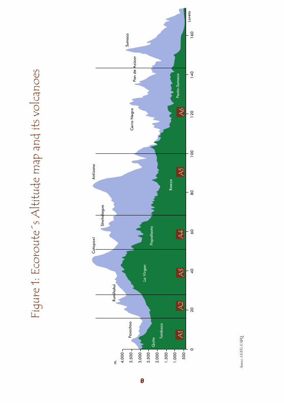
IntroductionThe Sumaco Ecoroute is named after the Sumaco Biosphere Reserve (SBR) and the Sumaco Napo Galeras National Park (SNGNP), which is located inside the SBR. Together both areas cover a total extension of 996.436 hectares, representing 8% of the northern Ecuadorian Amazon. The ecoroute starts in the city of Quito, continues through the populations of Baeza, Consanga, Hollin, Guagua Sumaco Pacto, Sumaco and ends at the SNGNP trail. The route covers approximately 220 km crossing numerous climatic zones and different types of vegetation from high wetlands to evergreen forests in the foothills. This ecological variability has contributed to the route’s high biodiversity, given that each climatic zone is characterized by its typical selection of species. More specifically the ecoroute passes through eight life zones including:
1. Humid montane scrubland 5. High montane evergreen forest2. Herbaceous high wetland 6. Montane cloud forest3. Mossy high wetland 7. Low montane evergreen forest4. High montane lake grassland 8. Montane evergreen forest
This route covers heights of 4.100 meters above sea level (masl) in the La Virgen high wetlands to 1.300 masl at the town of Guagua Sumaco.
The ecoroute encompasses Quito, Papallacta, Baeza, Hollin, Guagua Sumaco and Pacto Sumaco and also includes the SNGNP trail which leads to the summit of the Sumaco Volcano. The principal axis of the route from the city of Quito (2.800 masl) is the Interoceanic Highway (E20, Quito-Papallacta-Baeza Road). Along this route you are able to appreciate areas of spectacular biodiversity. Towards the north and south of this highway (between the towns of Pifo and Papallacta) there are further natural protected areas (the Cayambe Coca Ecological Reserve and Antisana Ecological Reserve respectively).
From the town of Baeza (1.900 masl) the route continues along the E45 Highway towards Narupa. From Narupa (at an altitude of approximately 1.400 masl) it continues along the road bordering the Sumaco-Galeras National Park to the south. Upon arriving at the town of Guagua Sumaco (1.347 masl) one can take the side road to Pacto Sumaco (1.538 masl) and enter to the SNGNP.
This guide also includes information on the trail located in the SNGNP from the park to the summit of Volcano Sumaco (at an altitude of 3.827 masl).
This ecoroute guide has been developed by the BioCAF Program with the support of the Investments and Exports Promotion Corporation’s (CORPEI) National Biotrade Program. BioCAF’s general aim is to promote the conservation and sustainable use of ecosystems, genetic and natural resources and biodiversity through sustainable environmental practices.
Two graphics of the ecoroute are presented below which specify the sections where distinctive life zones are encountered, as well as geomorphology (volcanoes) of the ecoroute.
Paso
choa
m. 4.00
0
3.50
0
3.00
0
2.50
0
2.00
0
1.50
0
1.00
0
500
020
4060
8010
012
014
016
0
Rum
iñah
ui
Cot
opax
i
Sinc
hola
gua
Ant
izan
a
Cer
ro N
egro
Pan
de A
zúca
r
Sum
aco
Lore
to
Baez
a
Pact
o-Su
mac
o
Qui
to Tum
baco
La V
irgen
Papa
llact
a
Figu
re 1:
Eco
rout
e´s A
ltitu
de m
ap a
nd it
s vol
cano
es
Sour
ce: C
GVG
-USF
Q.
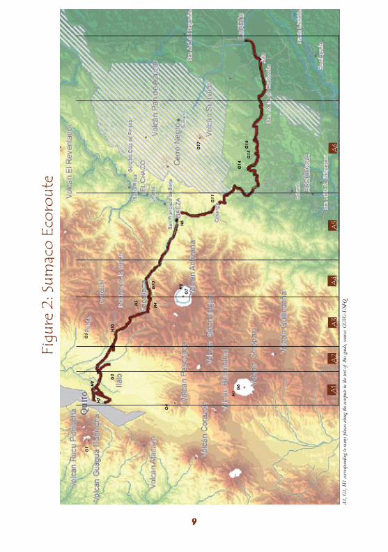
Figu
re 2
: Sum
aco
Ecor
oute
A1, G
1, H
1 co
rres
pond
ing
to m
any
plac
es a
long
the e
corp
ute i
n th
e tex
t of
this
guid
e, so
urce
: CG
VG-U
SFQ
.
G1
G3
H7
H8
H10
H4
H1
H3
H5
H6
G4
G6
G7G
10
G11
G14
G17
G15
G16
G5
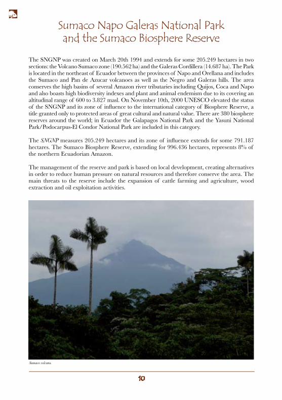
The SNGNP was created on March 20th 1994 and extends for some 205.249 hectares in two sections: the Volcano Sumaco zone (190.562 ha) and the Galeras Cordillera (14.687 ha). The Park is located in the northeast of Ecuador between the provinces of Napo and Orellana and includes the Sumaco and Pan de Azucar volcanoes as well as the Negro and Galeras hills. The area conserves the high basins of several Amazon river tributaries including Quijos, Coca and Napo and also boasts high biodiversity indexes and plant and animal endemism due to its covering an altitudinal range of 600 to 3.827 masl. On November 10th, 2000 UNESCO elevated the status of the SNGNP and its zone of influence to the international category of Biosphere Reserve, a title granted only to protected areas of great cultural and natural value. There are 380 biosphere reserves around the world; in Ecuador the Galapagos National Park and the Yasuni National Park/Podocarpus-El Condor National Park are included in this category.
The SNGNP measures 205.249 hectares and its zone of influence extends for some 791.187 hectares. The Sumaco Biosphere Reserve, extending for 996.436 hectares, represents 8% of the northern Ecuadorian Amazon.
The management of the reserve and park is based on local development, creating alternatives in order to reduce human pressure on natural resources and therefore conserve the area. The main threats to the reserve include the expansion of cattle farming and agriculture, wood extraction and oil exploitation activities.
Sumaco Napo Galeras National Park and the Sumaco Biosphere Reserve
Sumaco volcano.
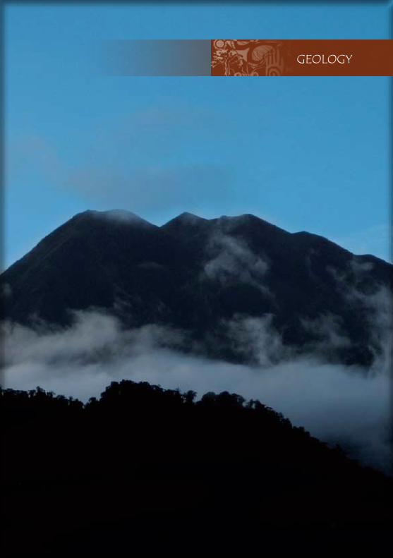
GEOLOGY

PacificPlate
CocosPlate
Galapagos islands
CarnegieRidge
CaribbeanPlate
South American
PlateNazcaPlate
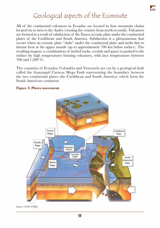
All of the continental volcanoes in Ecuador are located in four mountain chains located on or next to the Andes (crossing the country from north to south). Volcanoes are formed as a result of subduction of the Nazca oceanic plate under the continental plates of the Caribbean and South America. Subduction is a phenomenon that occurs when an oceanic plate “sinks” under the continental plate and melts due to intense heat at the upper mantle (up to approximately 700 km below surface). The resulting magma (a combination of melted rocks, crystals and gases) is pushed to the surface by high temperatures forming volcanoes, with lava temperatures between 700 and 1.200º C.
The countries of Ecuador, Colombia and Venezuela are cut by a geological fault called the Guayaquil Caracas Mega Fault representing the boundary between the two continental plates (the Caribbean and South America) which form the South American continent.
Geological aspects of the Ecoroute
Figure 3: Plates movement
Source: CGVG-USFQ.
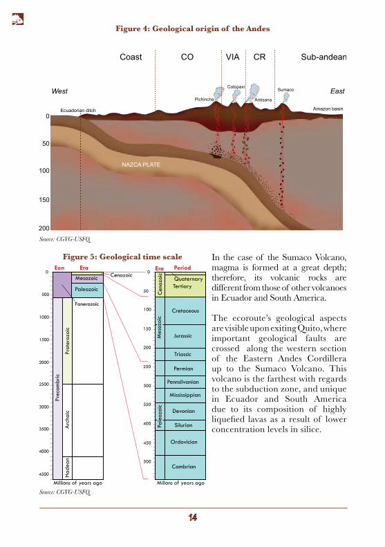
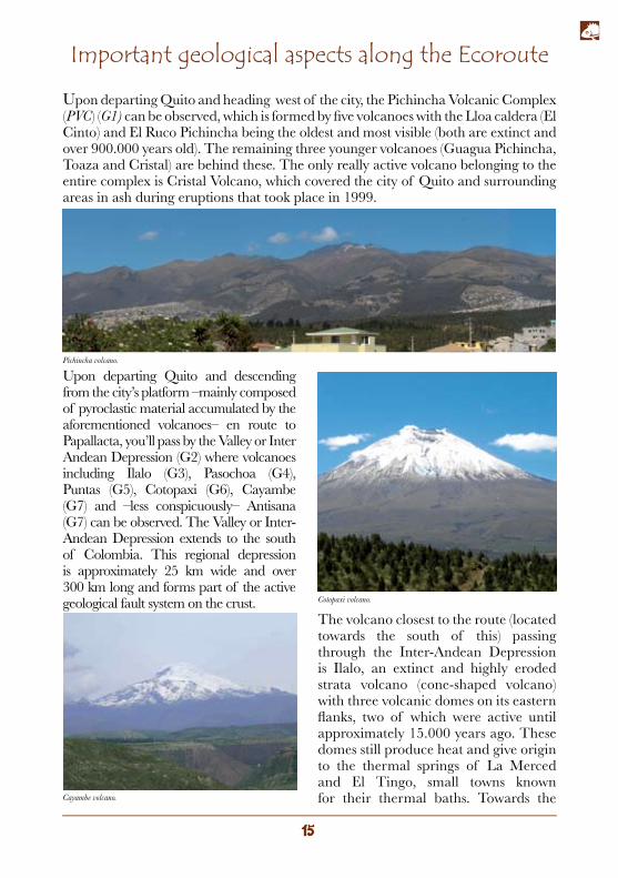
In the case of the Sumaco Volcano, magma is formed at a great depth; therefore, its volcanic rocks are different from those of other volcanoes in Ecuador and South America.
The ecoroute’s geological aspects are visible upon exiting Quito, where important geological faults are crossed along the western section of the Eastern Andes Cordillera up to the Sumaco Volcano. This volcano is the farthest with regards to the subduction zone, and unique in Ecuador and South America due to its composition of highly liquefied lavas as a result of lower concentration levels in silice.
Ecuadorian ditch
NAZCA PLATE
Cotopaxi
Antisana
Sumaco
Amazon basin
Coast
West East
Sub-andean
0
50
100
150
200
Pichincha
CO CRVIA
4500
4000
3500
3000
2500
2000
1500
1000
500
0Eon Era
CenozoicMesozoic
Paleozoic
Prot
eroz
oic
Prec
ambr
ic
Cambrian
Ordovician
Silurian
Devonian
Mississippian
Pennsilvanian
Permian
Triassic
Jurassic
Cretaceous
TertiaryQuaternary
Cen
ozoi
c
Arc
haic
Had
ean
Millions of years ago Millons of years ago
Era Period
450
500
400
350
300
250
200
150
100
50
0
Fanerozoic
Pale
ozoi
cM
esoz
oic
Figure 5: Geological time scale
Figure 4: Geological origin of the Andes
Source: CGVG-USFQ.
Source: CGVG-USFQ.
Important geological aspects along the Ecoroute
Upon departing Quito and heading west of the city, the Pichincha Volcanic Complex (PVC) (G1) can be observed, which is formed by five volcanoes with the Lloa caldera (El Cinto) and El Ruco Pichincha being the oldest and most visible (both are extinct and over 900.000 years old). The remaining three younger volcanoes (Guagua Pichincha, Toaza and Cristal) are behind these. The only really active volcano belonging to the entire complex is Cristal Volcano, which covered the city of Quito and surrounding areas in ash during eruptions that took place in 1999.
Upon departing Quito and descending from the city’s platform –mainly composed of pyroclastic material accumulated by the aforementioned volcanoes– en route to Papallacta, you’ll pass by the Valley or Inter Andean Depression (G2) where volcanoes including Ilalo (G3), Pasochoa (G4), Puntas (G5), Cotopaxi (G6), Cayambe (G7) and –less conspicuously– Antisana (G7) can be observed. The Valley or Inter-Andean Depression extends to the south of Colombia. This regional depression is approximately 25 km wide and over 300 km long and forms part of the active geological fault system on the crust.
The volcano closest to the route (located towards the south of this) passing through the Inter-Andean Depression is Ilalo, an extinct and highly eroded strata volcano (cone-shaped volcano) with three volcanic domes on its eastern flanks, two of which were active until approximately 15.000 years ago. These domes still produce heat and give origin to the thermal springs of La Merced and El Tingo, small towns known for their thermal baths. Towards the Cayambe volcano.
Pichincha volcano.
Cotopaxi volcano.
northeast of Ilalo Volcano are the eroded remains of the volcanoes Puntas (G5), Pambamarca (G8) and Izambi (G9).
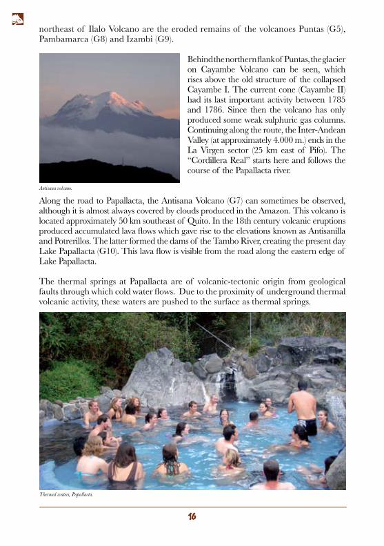
Behind the northern flank of Puntas, the glacier on Cayambe Volcano can be seen, which rises above the old structure of the collapsed Cayambe I. The current cone (Cayambe II) had its last important activity between 1785 and 1786. Since then the volcano has only produced some weak sulphuric gas columns. Continuing along the route, the Inter-Andean Valley (at approximately 4.000 m.) ends in the La Virgen sector (25 km east of Pifo). The “Cordillera Real” starts here and follows the course of the Papallacta river.
Along the road to Papallacta, the Antisana Volcano (G7) can sometimes be observed, although it is almost always covered by clouds produced in the Amazon. This volcano is located approximately 50 km southeast of Quito. In the 18th century volcanic eruptions produced accumulated lava flows which gave rise to the elevations known as Antisanilla and Potrerillos. The latter formed the dams of the Tambo River, creating the present day Lake Papallacta (G10). This lava flow is visible from the road along the eastern edge of Lake Papallacta.
The thermal springs at Papallacta are of volcanic-tectonic origin from geological faults through which cold water flows. Due to the proximity of underground thermal volcanic activity, these waters are pushed to the surface as thermal springs.
Thermal waters, Papallacta.
Antisana volcano.
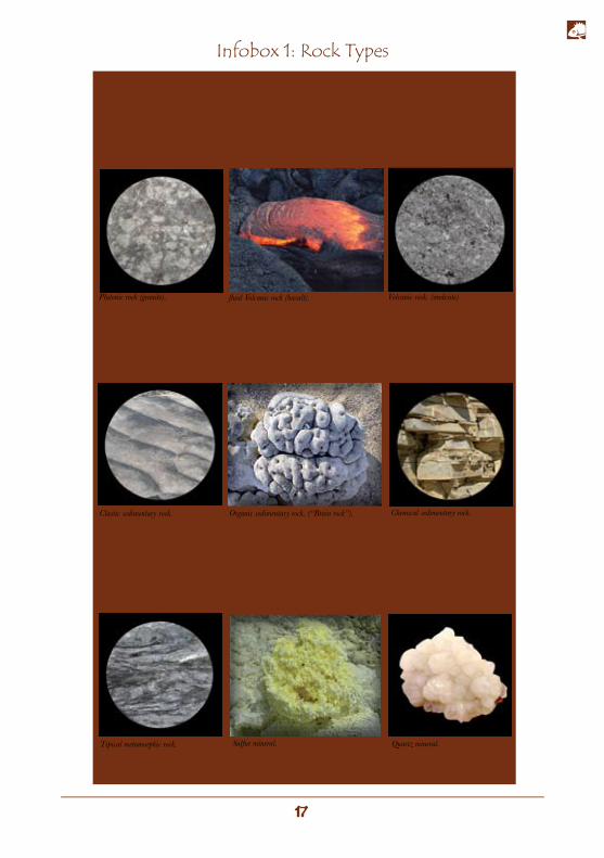
Igneous rock Igneous rocks are formed from the cooling and solidification of magma. Igneous or magmatic rocks are cateogrized as follows: volcanic rocks, when they reach the surface, and plutonic rocks (such as granite), when they crystallize beneath the earth’s surface. Around 95% of the earth’s crust is formed of igneous rocks, but their abundance is hidden by a relatively thin but extensive layer of sedimentary rocks.
Sedimentary rocksSedimentary rocks are the most common type of rock on the earth’s surface. These are formed by the accumulation of sediments which come from particles of existing rocks and are therefore also known as clastic or secondary rocks. In addition, there are also clastic, organic and chemical sedimentary rocks such as reefs and fossils.
Metamorphic rocksThese take their name from the words “meta” (change) and “morfo” (form). Any rock can be transformed into a metamorphic rock, needing only environmental changes to make the minerals of which the rock is composed unstable. In the majority of cases, metamorphic rocks are formed upon being buried and subjected to high pressure and high temperatures.
All rocks consist of minerals which are simple, single- crystal aggregates being composed of more than one element (quartz - SiO2).
Infobox 1: Rock Types
Clastic sedimentary rock. Organic sedimentary rock. (“Brain rock”). Chemical sedimentary rock.
Tipical metamorphic rock. Sulfur mineral. Quartz mineral.
Plutonic rock (granite). fluid Volcanic rock (basalt). Volcanic rock. (andesite)
Following the route and before arriving at the town of Baeza, you’ll cross the eastern border of the Cordillera Real. From this point the route changes its course towards the south (see map p. 9). The first town after the course change is the village of Cosanga (G11). At this stage along the route sedimentary rock formations (such as many clastic sedimentary rocks) can be appreciated (Infobox 1 p. 17). The route also crosses a fault zone –an area of great geotectonic disturbance with a high accumulation of geological faults– the most notable of which is the Cosanga fault (G12). Faults in the zone are generated between terrains from different geological eras.
At approximately 3 km south of the site known as Las Antenas, there is a quarry where plutonic rock can be observed (G13). This rock is magma which crystallized in the depths of the earth’s crust some 144 million years ago.
Upon crossing the Hollin river (G14), in its namesake town, you’ll arrive at the Napo elevation, which is a zone of sediments from the Cretaceous period, having an age between 144 and 65 million years.
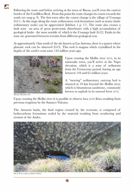
A “moving” sedimentary outcrop bed is situated at 10 km beyond the Hollin river, which is bituminous sandstone, commonly known as asphalt in its natural form (G15).
Upon crossing the Hollin river it is possible to observe lava (G16) flows resulting from previous eruptions by the Sumaco Volcano.
The Amazon basin, the final region crossed by the ecoroute, is composed of hydrocarbons formations sealed by the material resulting from weathering and erosion of the Andes.
Moving sedimentary rocks
One of the two craters of Sumaco Volcano.
Sum
aco
volc
anic
act
ivit
y
The
vo
lcan
o pe
rfor
ated
pr
e-ex
istin
g ge
olog
ical
for
mat
ions
suc
h as
tho
se o
f th
e M
isah
uallí
, Hol
lin, N
apo,
Ten
a an
d T
iyuy
ocu
form
atio
ns i
nclu
ding
gra
nite
roc
ks f
rom
the
G
uaca
may
os.
Sum
aco
volc
ano
(G17
) w
ere
form
ed i
n tw
o st
ages
. T
he fi
rst
phas
e, t
he
Pale
o Su
mac
o (1
a an
d 1b
), on
ce m
easu
red
an
altit
ude
of 3
.750
met
res;
how
ever
, fol
low
ing
a vi
olen
t eru
ptio
n, th
is c
olla
psed
and
its a
ltitu
de
(toge
ther
with
a p
aras
itic
cone
nam
ed G
uagu
a Su
mac
o) w
as r
educ
ed t
o al
mos
t ha
lf. T
he
colla
pse
prod
uced
an
aval
anch
e of
mat
eria
ls de
posi
ted
on t
he e
aste
rn s
ide
of t
he v
olca
no.
The
eve
nt le
ft a
nota
ble
scar
at a
n al
titud
e of
2.
400
mas
l w
hilst
the
mat
eria
ls th
row
n fr
om
the
volc
ano
cove
red
a ra
dius
of
120
km²
arou
nd th
e vo
lcan
o. A
shes
eje
cted
dur
ing
this
er
uptio
n co
vere
d th
e vo
lcan
o’s
surr
ound
ings
w
ith a
lay
er u
p to
10
m t
hick
in
som
e pa
rts,
appr
oxim
atel
y 20
km
fro
m t
he c
rate
r. T
he
seco
nd p
hase
(the
cur
rent
vol
cano
IIa
and
IIb)
fo
rmed
ove
r th
e ve
stig
es o
f th
e Pa
leo
Sum
aco
reac
hing
an
altit
ude
of 3
.732
m. A
lthou
gh th
e vo
lcan
o’s
hist
oric
al e
rupt
ions
hav
e no
t be
en
obse
rved
(it
is e
stim
ated
tha
t th
e m
ost
rece
nt
erup
tions
occ
urre
d be
twee
n 18
65 a
nd 1
925)
th
e vo
lcan
o re
pres
ents
a p
oten
tial h
azar
d fo
r in
habi
tant
s of
Lor
eto
and
Avi
la V
iejo
as
wel
l as
to th
e tr
ans-
Ecu
ador
ian
(SO
TE
) and
Hea
vy
Cru
de P
ipel
ines
(OC
P).
Geo
logi
cal f
ault
Lim
it of
the
colla
pse
Cur
rent
cra
ter
Form
er c
rate
r
Obs
erve
d an
d in
ferr
ed c
onta
ct
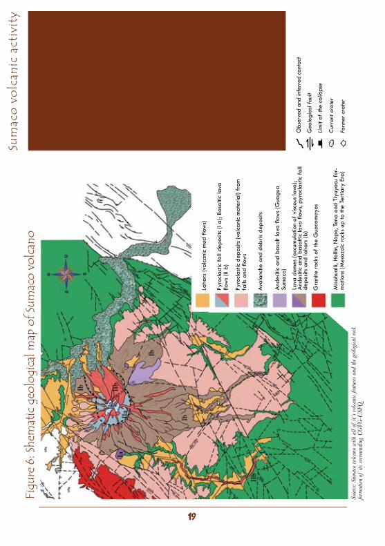
Figu
re 6
: She
mat
ic g
eolo
gica
l map
of S
umac
o vo
lcan
o
Sour
ce: S
umac
o vo
lcano
with
all
of it
´s v
olca
nic f
eatu
res a
nd th
e geo
logi
cal r
ock
form
atio
n of
its s
orro
undi
ng. C
GVG
-USF
Q.
Laha
rs (v
olca
nic
mud
flow
s)
Pyro
clas
tic f
all d
epos
its (I
a);
Basa
ltic
lava
flo
ws
(II b
)
Pyro
clas
tic d
epos
its (v
olca
nic
mat
eria
l) fr
om
falls
and
flow
s
Aval
anch
e an
d de
bris
depo
sits
And
esiti
c an
d ba
salt
lava
flow
s (G
uagu
a Su
mac
o)
Gra
nite
rock
s of
the
Gua
cam
ayos
Misa
hual
li, H
ollin
, Nap
o, T
ena
and
Tiyu
yacu
for-
mat
ions
(Mes
ozoi
c ro
cks
up to
the
Tert
iary
Era
)
Lava
dom
es (a
ccum
ulat
ion
of v
iscou
s la
va);
And
esiti
c an
d ba
salti
c la
va fl
ows,
pyro
clas
tic f
all
depo
sits
and
laha
rs (b
)

RIVERS AND WATERFALLS

Hydrological background on the Ecoroute
Numerous drainages with affluents that gradually increase as they descend the Andes towards the Amazon can be observed along the route.
Rivers belonging to the eastern region originate in the Central Cordillera and Eastern Cordillera of the Ecuadorian Andes. All rivers originate from thaws and condensation from humidity clouds concentrated around the high wetland zone which offload as they condense between the swamps and scrublands, a process which permits permanent, slow precipitation towards drainages, maintaining a constant flow year round. Thaws are another important factor,which mainly originate from the glaciers of the volcanoes Cotopaxi (H1), Cayambe (H2) and Antisana (H3).
The high wetland zone is particularly important in maintaining water resources, behaving like a sponge which slowly squeezes out water towards the rivers.
There are three large river basins along the ecoroute. A river basin is the area that pours its runoff water into a river; the basin takes its name from the main river where it drains its waters. The rivers (giving their names to the respective basins) along the ecoroute are:
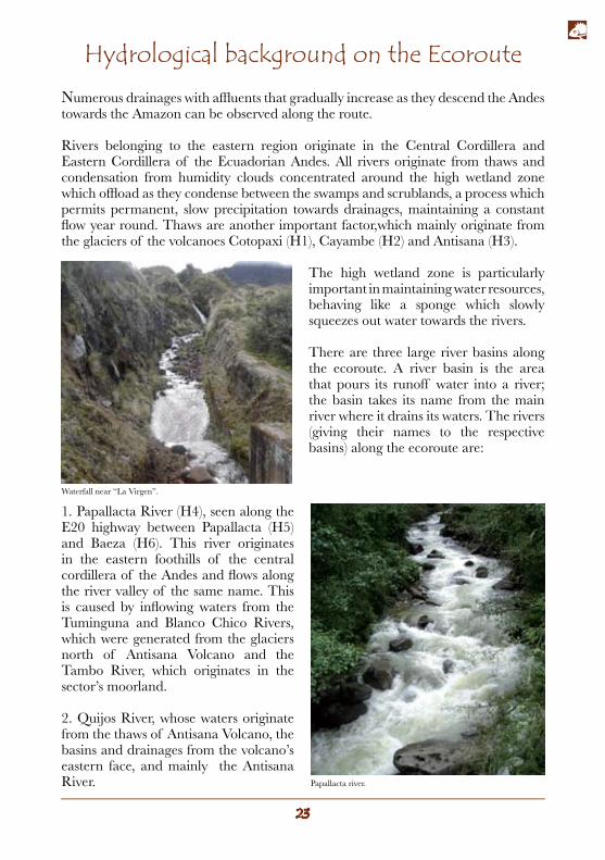
1. Papallacta River (H4), seen along the E20 highway between Papallacta (H5) and Baeza (H6). This river originates in the eastern foothills of the central cordillera of the Andes and flows along the river valley of the same name. This is caused by inflowing waters from the Tuminguna and Blanco Chico Rivers, which were generated from the glaciers north of Antisana Volcano and the Tambo River, which originates in the sector’s moorland.
2. Quijos River, whose waters originate from the thaws of Antisana Volcano, the basins and drainages from the volcano’s eastern face, and mainly the Antisana River.
Waterfall near “La Virgen”.
Papallacta river.
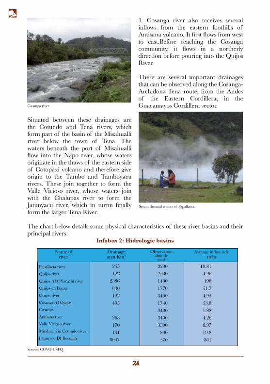
3. Cosanga river also receives several inflows from the eastern foothills of Antisana volcano. It first flows from west to east.Before reaching the Cosanga community, it flows in a northerly direction before pouring into the Quijos River.
There are several important drainages that can be observed along the Cosanga-Archidona-Tena route, from the Andes of the Eastern Cordillera, in the Guacamayos Cordillera sector.
Situated between these drainages are the Cotundo and Tena rivers, which form part of the basin of the Misahualli river below the town of Tena. The waters beneath the port of Misahualli flow into the Napo river, whose waters originate in the thaws of the eastern side of Cotopaxi volcano and therefore give origin to the Tambo and Tamboyacu rivers. These join together to form the Valle Vicioso river, whose waters join with the Chalupas river to form the Jatunyacu river, which in turnn finally form the larger Tena River.
The chart below details some physical characteristics of these river basins and their principal rivers:
Name ofriver
Drainagearea Km2
Observationaltitude
masl
Average inflow tide m3/s
Papallacta river
Quijos river
Quijos AJ OYacachi river
Quijos en Baeza
Quijos river
Cosanga AJ Quijos
Cosanga
Antisana river
Valle Vicioso river
Misahuallí in Cotundo river
Jatunyacu DJ Ilocullin
255
122
2386
840
122
495
-
263
170
141
3047
2200
2500
1490
1770
3400
1740
3400
3400
3300
800
570
10.81
4.96
198
51.7
4.95
53.8
1.88
4.26
6.97
19.8
361
Cosanga river.
Steam thermal waters of Papallacta.
Source: CGVG-USFQ.
Infobox 2: Hidrologic basins
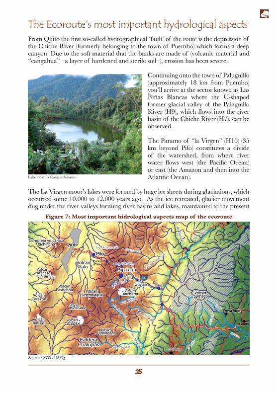
The Ecoroute’s most important hydrological aspectsFrom Quito the first so-called hydrographical ‘fault’ of the route is the depression of the Chiche River (formerly belonging to the town of Puembo) which forms a deep canyon. Due to the soft material that the banks are made of (volcanic material and “cangahua” –a layer of hardened and sterile soil–), erosion has been severe.
Continuing onto the town of Paluguillo (approximately 18 km from Puembo) you’ll arrive at the sector known as Las Peñas Blancas where the U-shaped former glacial valley of the Palaguillo River (H9), which flows into the river basin of the Chiche River (H7), can be observed. The Paramo of “la Virgen” (H10) (35 km beyond Pifo) constitutes a divide of the watershed, from where river water flows west (the Pacific Ocean) or east (the Amazon and then into the Atlantic Ocean).
The La Virgen moor’s lakes were formed by huge ice sheets during glaciations, which occurred some 10.000 to 12.000 years ago. As the ice retreated, glacier movement dug under the river valleys forming river basins and lakes, maintained to the present
Páramode la Virgen
Río Jatunyacu
VolcánIlalo
VolcánPasochoa
Complejo volcánicoPichincha
VolcánAtacasoNiñahuilca
VolcánCorazón
VolcánIlinisas
CalderaChalupas
Loreto
Avila Viejo
Source: CGVG-USFQ.
Figure 7: Most important hidrological aspects map of the ecoroute
Lake close to Guagua Sumaco
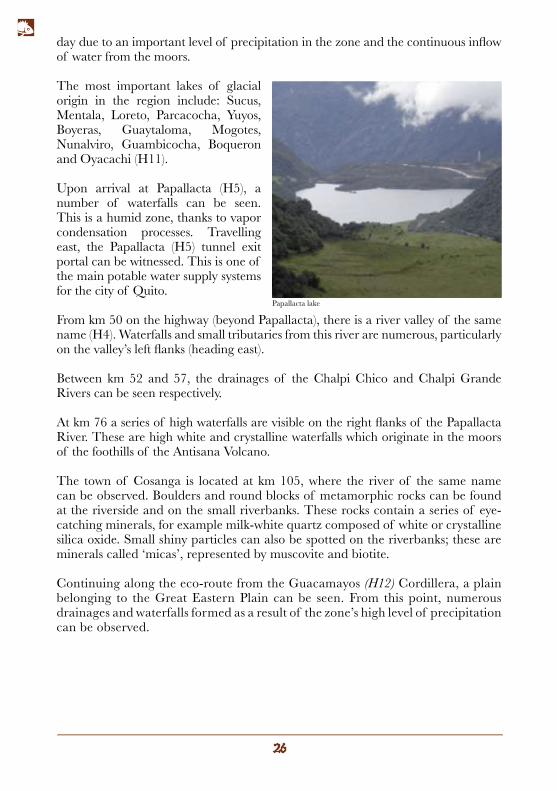
day due to an important level of precipitation in the zone and the continuous inflow of water from the moors.
The most important lakes of glacial origin in the region include: Sucus, Mentala, Loreto, Parcacocha, Yuyos, Boyeras, Guaytaloma, Mogotes, Nunalviro, Guambicocha, Boqueron and Oyacachi (H11).
Upon arrival at Papallacta (H5), a number of waterfalls can be seen. This is a humid zone, thanks to vapor condensation processes. Travelling east, the Papallacta (H5) tunnel exit portal can be witnessed. This is one of the main potable water supply systems for the city of Quito.
From km 50 on the highway (beyond Papallacta), there is a river valley of the same name (H4). Waterfalls and small tributaries from this river are numerous, particularly on the valley’s left flanks (heading east).
Between km 52 and 57, the drainages of the Chalpi Chico and Chalpi Grande Rivers can be seen respectively.
At km 76 a series of high waterfalls are visible on the right flanks of the Papallacta River. These are high white and crystalline waterfalls which originate in the moors of the foothills of the Antisana Volcano.
The town of Cosanga is located at km 105, where the river of the same name can be observed. Boulders and round blocks of metamorphic rocks can be found at the riverside and on the small riverbanks. These rocks contain a series of eye-catching minerals, for example milk-white quartz composed of white or crystalline silica oxide. Small shiny particles can also be spotted on the riverbanks; these are minerals called ‘micas’, represented by muscovite and biotite.
Continuing along the eco-route from the Guacamayos (H12) Cordillera, a plain belonging to the Great Eastern Plain can be seen. From this point, numerous drainages and waterfalls formed as a result of the zone’s high level of precipitation can be observed.
Papallacta lake
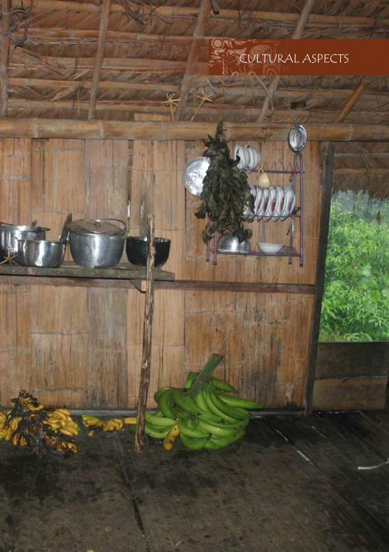
CULTURAL ASPECTS

Cultural aspects of the EcorouteThis route has historically been used by several human civilizations. It was initially the route of interaction between the populations known today as Pifo, Baeza, Cosanga, Misahualli, Sarayacu and Jondachi (the first three of which are encompassed in the route, with the remainder located towards the south of Cosanga). Subsequently, during the conquest, the route was used by the Spanish during their military or commercial incursions towards the Amazon. Afterwards, the route was used by the first religious missionaries who departed from Quito to the populations located in the eastern part of Ecuador. Unfortunately, only a few sections of the original route have been preserved to the present day. The route takes the name from the cacique (political chief) Jumandy, who during the Spanish colonial period led an uprising attempt by forming an alliance between the three most important towns of that period: Baeza de los Quijos, Archidona (south of Cosanga), and Avila (east of Guagua Sumaco), as all in the province of Hatuquixos. The uprising failed, and the indigenous people fled to the River Napo, consequently becoming an obstacle for future incursions by the Spanish in the east and thereby halting the expansion of the conquest into the Amazon. The original course of the Jumandy route continued, for the most part, along the current Interoceanica route (E20). The Jumandy route started in Pifo, crossing Guamani until reaching Papallacta. From there it started its descent through the Cuyujua passage (where the population of the same name is currently settled), joining with the passage belonging to Quijos River, a site on which several dock rope bridges were constructed in order to cross the rivers. The trail then continued through the present towns of Baeza and Cosanga, crossed the Guacamayos Cordillera and ended in the lower zone, the current locations of Archidona, Sarayacu and Jondachi.
The timeline of the Sumaco Ecoroute
The following is a summary of the most important historical events of the region:
11.000-9.000 b.C. Jondachi PhaseHunter-gatherer groups existed in the zone during the Archaic period. These groups were dedicated to hunting mega-fauna (large mammals that are now extinct). At the end of the Pleistocene era the upper Amazon and Andes climate was considerably colder and the glaciers reached an altitude of 2.000 m. in comparison to current levels.
9.000-2.000 b.C. Transition to the Cotundo PhaseWith the climatic change due to warmer weather and human pressure, mega-fauna became extinct. The region’s inhabitants adopted dual hunting and settlement systems with semi-permanent crops using the slash and burn technique.
The Quest for “El Dorado”
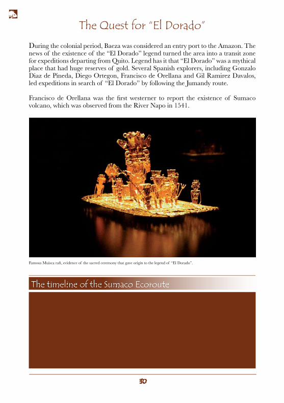
During the colonial period, Baeza was considered an entry port to the Amazon. The news of the existence of the “El Dorado” legend turned the area into a transit zone for expeditions departing from Quito. Legend has it that “El Dorado” was a mythical place that had huge reserves of gold. Several Spanish explorers, including Gonzalo Diaz de Pineda, Diego Ortegon, Francisco de Orellana and Gil Ramirez Davalos, led expeditions in search of “El Dorado” by following the Jumandy route.
Francisco de Orellana was the first westerner to report the existence of Sumaco volcano, which was observed from the River Napo in 1541.
2.000 - 1.200 b.C. - Cotundo PhaseInhabitants in the Cotundo Phase settled in Archidona, expanding along the rivers. This is the region’s oldest pottery making society.
1.200 b.C. to 800 a.D. - Cosanga PhaseInhabitants from this society settled in the valleys of the rivers Quijos, Cosanga, Jondachi, Misahualli and Suno. This phase was characterized by its high quality ceramics industry. Pottery pieces, known as “eggshell” ceramics due to their fragility and fineness, have been discovered from Chimborazo to Carchi. Remains have also been found around Quito in the valleys of Cumbaya and on the outskirts of Pichincha volcano.
The timeline of the Sumaco Ecoroute
Famous Muisca raft, evidence of the sacred ceremony that gave origin to the legend of “El Dorado”.
The timeline of the Sumaco Ecoroute
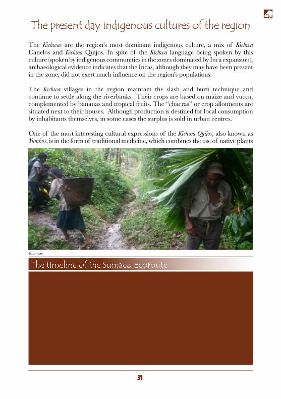
The present day indigenous cultures of the regionThe Kichwas are the region’s most dominant indigenous culture, a mix of Kichwa Canelos and Kichwa Quijos. In spite of the Kichwa language being spoken by this culture (spoken by indigenous communities in the zones dominated by Inca expansion), archaeological evidence indicates that the Incas, although they may have been present in the zone, did not exert much influence on the region’s populations.
The Kichwa villages in the region maintain the slash and burn technique and continue to settle along the riverbanks. Their crops are based on maize and yucca, complemented by bananas and tropical fruits. The “chacras” or crop allotments are situated next to their houses. Although production is destined for local consumption by inhabitants themselves, in some cases the surplus is sold in urban centres.
One of the most interesting cultural expressions of the Kichwa Quijos, also known as Yumbos, is in the form of traditional medicine, which combines the use of native plants
The timeline of the Sumaco Ecoroute800 a.D. - 1.200 a.D. Suno PhaseInhabitants during this phase were settled between the River Napo and River Coca. The characteristic practice of this culture was to bury the dead face-down in ceramic vessels (funerary urns).
850 - 1.465 a.D. Ahuano PhaseInhabitants from this phase settled along the River Napo close to the present day town of Puerto Napo,east of the city of Tena. Characteristic of this civilization were anthropomorphic funerary urns with lids.
1.100 - 1.500 d.C. Napo PhaseInhabitants from this phase settled along the River Napo, aligned in a parallel fashion to the course of the rivers. They used the land to cultivate their crops.
Kichwas.
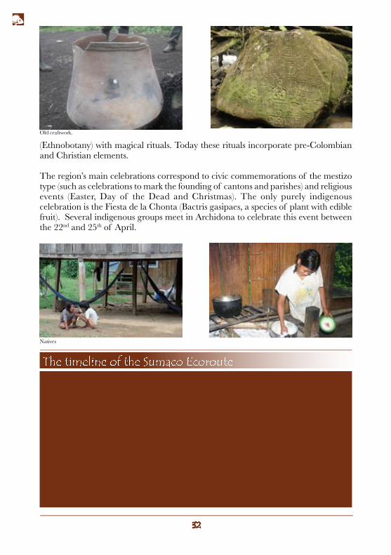
(Ethnobotany) with magical rituals. Today these rituals incorporate pre-Colombian and Christian elements. The region’s main celebrations correspond to civic commemorations of the mestizo type (such as celebrations to mark the founding of cantons and parishes) and religious events (Easter, Day of the Dead and Christmas). The only purely indigenous celebration is the Fiesta de la Chonta (Bactris gasipaes, a species of plant with edible fruit). Several indigenous groups meet in Archidona to celebrate this event between the 22nd and 25th of April.
The timeline of the Sumaco Ecoroute1600 Origins of the present-day culturesSemi-nomadic groups from the Ecuadorian Amazon settled between the rivers Napo, Pasta-za, Tigre and Curaray. Territorial conflicts were common between these groups and ethnic-cultural transformations were generated, giving rise to the Kichwas of Upper Napo. The Huaorani civilization also appeared around this time (isolated, purebred and “marginalized” in territories which were less frequently disputed by other ethnic groups).
1541Francisco de Orellana reports the existence of the Sumaco volcano from the River Napo.
1559The Spanish founded the town of Baeza on the site of Baeza de los Quijos, a large pre-Colom-bian settlement which was the centre of Caciquism (political chieftainship) of the Quijos.
Old craftwork.
Natives
The timeline of the Sumaco Ecoroute
Rubber, colonization, oil and wood: the footprints of development
Naturalists have always been fascinated by the Amazon. This region was explored by Alexander von Humboldt at the end of the 18th century, who collected and classified several plant species. In 1743 La Condamine took rubber samples back to France. With the invention of rubber tires in 1888 the rubber industry flourished. The impact of the rubber industry on the indigenous population was catastrophic. The indigenous people and their villages were displaced and they were forced to work as slaves or murderers. Ecuador was no exception, although the impact was less significant than in Brazil and Peru. However, the rubber boom did not last long. Once taken to Malaysia, rubber plants prospered and these plantations displaced crops in the Amazon forest. In the 30´s, rubber had ceased to be an important business in the Amazon region. Oil was the next natural resource that had a huge impact on the Amazon. In the 1960s Texaco Oil Company discovered and started to exploit oil in the Northeast of Ecuador. With little or no governmental control, oil activity caused a spillage of hundreds of thousands of liters of oil, displaced indigenous villages and opened paths for settlers, who rapidly invaded eastern water resources and the Amazon. Deforestation can be seen along the eco-route, in particular in the section between Papallacta and Baeza, and forests were significantly reduced during this period.
In 1964 the construction of the SOTE (Trans-Ecuadorian Pipeline System) started, and was inaugurated in 1972. This can be seen along the route at the Papallacta - Baeza section. With the capacity to transport some 150.000 barrels of crude per day, and a diameter of 66 cm, the pipeline covers a distance of 429,4 km from Lago Agrio (Nueva Loja) in the Amazon to the Baleo port at the Ecuadorian coast. In addition to the pipeline, you can also see the Baeza and Papallacta pumping stations at altitudes of 2.002 m. and 3.009 m. respectively.
The timeline of the Sumaco Ecoroute1799Humboldt started his exploration in the Amazon from the Cumana port in Venezuela, crossing the territories of Venezuela, Cuba, Colombia, Ecuador, Peru and Mexico and ending in the United States in 1804.This expedition was summarized in the text: “Personal Narrative of the Journey to the Equatorial Regions of the New Continent”.
1743The French Scientist and Explorer, La Condamine, revealed how to extract the sap from rubber and its uses. This report was sent together with plant and seed samples to Paris.
The Heavy Crudes Pipeline is the second trans-Ecuadorian pipeline. Its construction began on June 26th, 2001 and it began operating on November 14th, 2003. The pipeline has the capacity to transport between 41.000 and 45.000 barrels of crude per day via pipes with a diameter of 91 cm extending over a distance of approximately 500 km. The OCP runs parallel to the SOTE up to Papallacta where it then veers north.
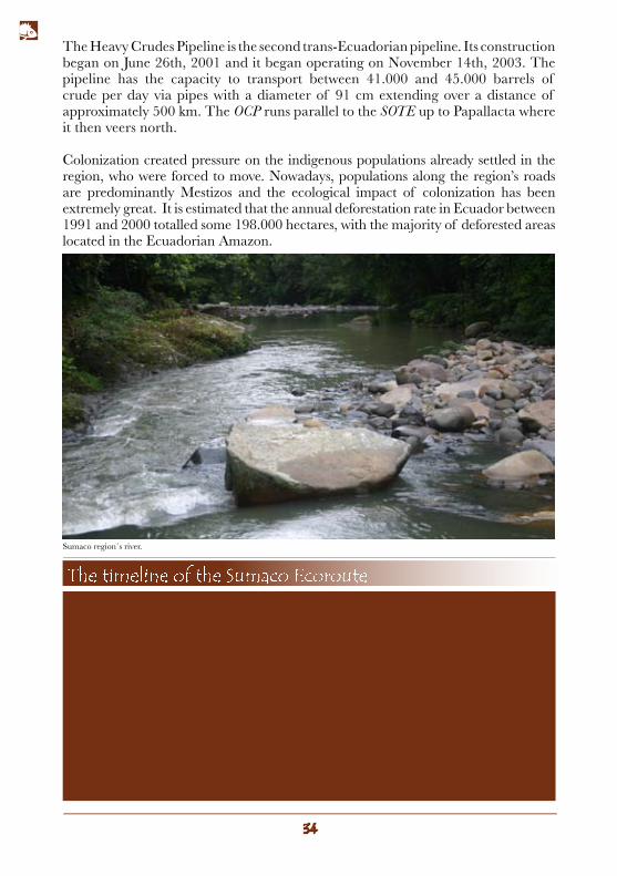
Colonization created pressure on the indigenous populations already settled in the region, who were forced to move. Nowadays, populations along the region’s roads are predominantly Mestizos and the ecological impact of colonization has been extremely great. It is estimated that the annual deforestation rate in Ecuador between 1991 and 2000 totalled some 198.000 hectares, with the majority of deforested areas located in the Ecuadorian Amazon.
The timeline of the Sumaco Ecoroute1888The first rubber tires with pneumatic chambers were created, giving rise to the rubber era.
1890Rubber exploitation started in the Amazon (marginally in Ecuador).
1865-1925It is thought that Sumaco erupted for the first time at some point during this period.
1930Rubber ceased to be an important business and the exploitation of this plant reduced con-siderably in Ecuador.
Sumaco region´s river.
The timeline of the Sumaco Ecoroute
Significant cultural aspects along the ecoroute
Following the ecoroute, leaving the town of Pifo, a great plain next to the Ilalo volcano, known as El Inga, can be observed. Archaeological remains of the first human settlers in Ecuador were found at this site 40 years ago. These remains date back to 7800 b.C.
Continuing along at 18 km from Quito the entrance to the obsidian (volcanic glass) mines can be found. This is one of the sources where the majority of obsidian used by pre-Colombian societies of present-day Ecuador came from.
Passing by the town of Cuyuja, formations similar to crop terrain constructed by the Kichwa Quijos can be observed at the roadside.
The present-day population of Baeza stands over old Baeza de los Quijos, a large pre-Colombian settlement which was the centre for the great Caciquism of the Quijos. Around the population the remains of crop terrains and platforms, where the community previously settled, can be seen.
The town of Baeza was also one of the main Spanish settlements, considered as a port of entry to the Amazon. Buildings from the historical town, founded in 1559, can also be witnessed in the present-day city.
At the ravine of the Jondachi river, a part of the Jumandy Route can be observed, upon exiting the Guacamayos Cordillera. This trail still connects Baeza to Archidona.
The timeline of the Sumaco Ecoroute1960The Texaco Oil Company discovered and began to exploit oil in the Ecuadorian Amazon.
1964Construction of the Trans-Ecuadorian Pipeline System (SOTE) started.
1972SOTE operations got underway.
1994The Sumaco Napo Galeras National Park was created.
The timeline of the Sumaco Ecoroute2000The Sumaco Napo Galeras National Park and its buffer zone were declared a Biosphere Reserve (the third in Ecuador).
2001The authorization to construct the Heavy Crudes Pipeline (OCP) was signed. The pipeline allows 450.000 barrels per day to be transported, in comparison to the 150.000 carried by the SOTE.
2003OCP operations get started.
The timeline of the Sumaco Ecoroute
LIFE ZONES ALONG THE ECOROUTE

The Ecoroute’s most important animal groups
Mammals
Birds
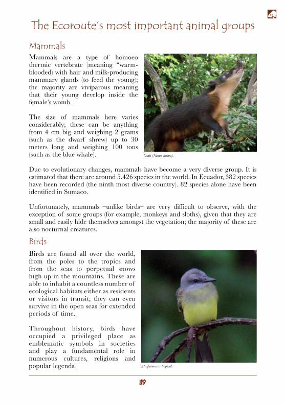
Mammals are a type of homoeo thermic vertebrate (meaning “warm-blooded) with hair and milk-producing mammary glands (to feed the young); the majority are viviparous meaning that their young develop inside the female’s womb.
The size of mammals here varies considerably; these can be anything from 4 cm big and weighing 2 grams (such as the dwarf shrew) up to 30 meters long and weighing 100 tons (such as the blue whale).
Due to evolutionary changes, mammals have become a very diverse group. It is estimated that there are around 5.426 species in the world. In Ecuador, 382 species have been recorded (the ninth most diverse country). 82 species alone have been identified in Sumaco.
Unfortunately, mammals –unlike birds– are very difficult to observe, with the exception of some groups (for example, monkeys and sloths), given that they are small and easily hide themselves amongst the vegetation; the majority of these are also nocturnal creatures.
Birds are found all over the world, from the poles to the tropics and from the seas to perpetual snows high up in the mountains. These are able to inhabit a countless number of ecological habitats either as residents or visitors in transit; they can even survive in the open seas for extended periods of time.
Throughout history, birds have occupied a privileged place as emblematic symbols in societies and play a fundamental role in numerous cultures, religions and popular legends. Atrapamoscas tropical.
Coati (Nasua nasua).
Infobox 3: IBA: Important Bird AreaThe IBA program is a program led by Birdlife International, whose aim is to establish a key and critical area network to be managed and protected in order to guarantee the diversity of birds on a global scale.International criteria used for designating an IBA include: 1. Presence of birds under world-wide threat, 2. Birds of restricted distribution, 3. Birds restricted to one biome, 4. Birds congregating in large numbers to reproduce during migration. If an area satisfies any of these above-mentioned criteria, it can be declared an IBA.Along the route you can find several IBAs including: the Cayambe Coca Ecological Reserve, the Guacamayos Cordillera – San Isidro – Sierra Azul and the Sumaco Napo Galeras National Park. Source: National Strategy for Bird-tourism, Mindo Cloud Forest Foundation, 2006
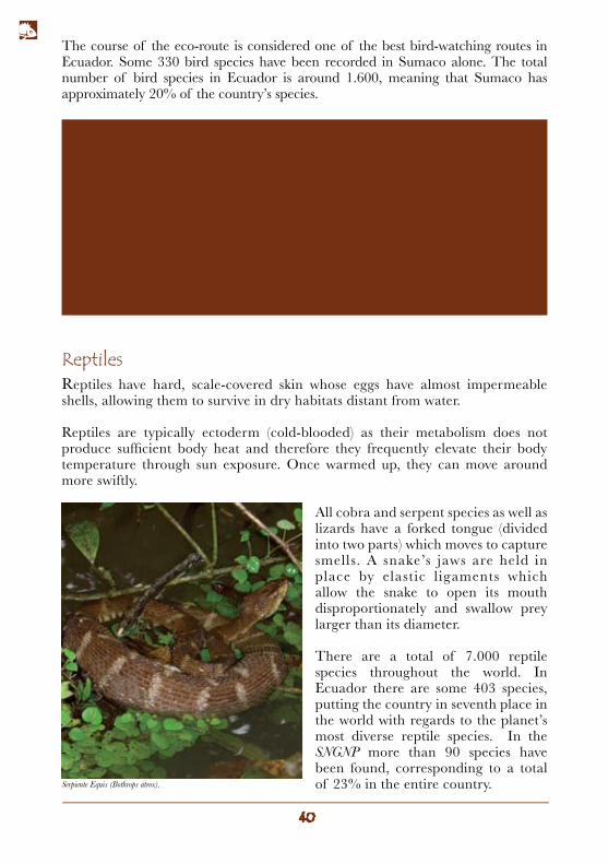
ReptilesReptiles have hard, scale-covered skin whose eggs have almost impermeable shells, allowing them to survive in dry habitats distant from water.
Reptiles are typically ectoderm (cold-blooded) as their metabolism does not produce sufficient body heat and therefore they frequently elevate their body temperature through sun exposure. Once warmed up, they can move around more swiftly.
All cobra and serpent species as well as lizards have a forked tongue (divided into two parts) which moves to capture smells. A snake’s jaws are held in place by elastic l igaments which allow the snake to open its mouth disproportionately and swallow prey larger than its diameter.
There are a total of 7.000 reptile species throughout the world. In Ecuador there are some 403 species, putting the country in seventh place in the world with regards to the planet’s most diverse reptile species. In the SNGNP more than 90 species have been found, corresponding to a total of 23% in the entire country.
The course of the eco-route is considered one of the best bird-watching routes in Ecuador. Some 330 bird species have been recorded in Sumaco alone. The total number of bird species in Ecuador is around 1.600, meaning that Sumaco has approximately 20% of the country’s species.
Serpiente Equis (Bothrops atrox).
Amphibians
Butterflies
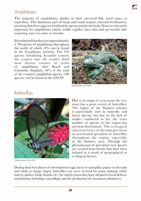
The majority of amphibians, similar to their ancestral fish, need water to reproduce. The dominant part of frogs and toads require external fertilization, meaning that their eggs are fertilized by sperm outside the body. Water is extremely important for amphibians which, unlike reptiles, have thin and permeable skin requiring water in order to breathe.
It is estimated that there are approximately 4.700 species of amphibians throughout the world, of which 10% can be found in the Ecuadorian territory. The 470 species inhabiting Ecuador convert the country into the world’s third most diverse country in terms of amphibians, after Brazil and Colombia. Similarly, 38% of the total of the country’s amphibian species (180 species) can be found in the SNGNP.
Due to its range of ecosystems the eco-route has a great variety of butterflies. The region of the Sumaco volcano is particularly rich in butterfly and insect species, but due to the lack of studies conducted so far, the exact number of species in the region has not been determined. The ecological characteristics of the route give rise to an accelerated speciation of butterflies throughout the region, especially in the Sumaco area. Through the phenomenon of speciation new species are created from breeds that have been isolated as a result of geographical or ecological factors.
During their four phases of development (eggs, larva or caterpillar, pupae or chrysalis and adult or imago stages) butterflies can serve as food for many animals (other insects, spiders, birds, lizards, etc.) for which reason they have adopted several defence mechanisms including camouflage and the production of venomous substances.
Cithaereas pireta, Xavier Silva.
Dendropsophus marmoratus.
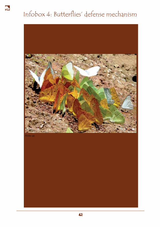
Camouflage is one of the main defense mechanisms for butterflies that is present in all life stages. For example, some butterfly eggs are transparent and imitate raindrops; others are green and can be confused with leaves. In the larva and pupa stages these can develop colors and shapes that can cause confusion with plants. The camouflage mechanism is less useful in the adult phase due to the fact that they can already fly and escape their predators; however, some species use this defense mechanism well in their adult phase, especially when they land and close their brownish-grey wings, which themselves have designs distinctly resembling dried leaves.
Another defense mechanism is the accumulation of toxins in the body, which converts them into toxic prey for their predators, especially for birds. These toxins are taken from the plant that the larva or caterpillar feeds on which then accumulate in the body until the adult stage. In these cases, larvae and butterflies do not need to camouflage themselves: on the contrary, they exhibit eye-catching colors and designs which serve as a warning for predators (a phenomenon called aposematism). Commonly displayed colors include yellow, orange and red combined with black and white – colors which are also used by humans as warning signals.
Mimicry is another defense mechanism used, through which a non-toxic butterfly imitates the colours and designs of a species which is toxic in order to confuse the predator; it therefore avoids being eaten. Butterflies not only imitate colors, but also the way in which the model species flies.
Infobox 4: Butterflies’ defense mechanism
Pieridae spp.
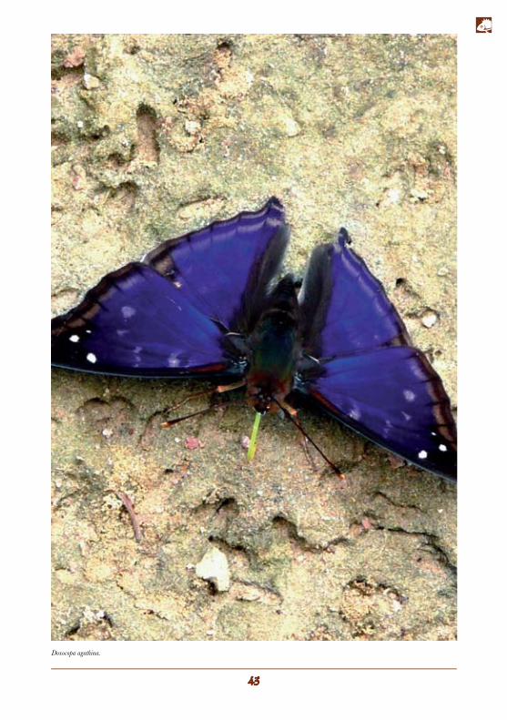
Doxocopa agathina.
Ecoroute section: includes Tumbaco, Puembo and Pifo. This zone is located at an altitude of between 1.400 and 2.500 masl.
Birds
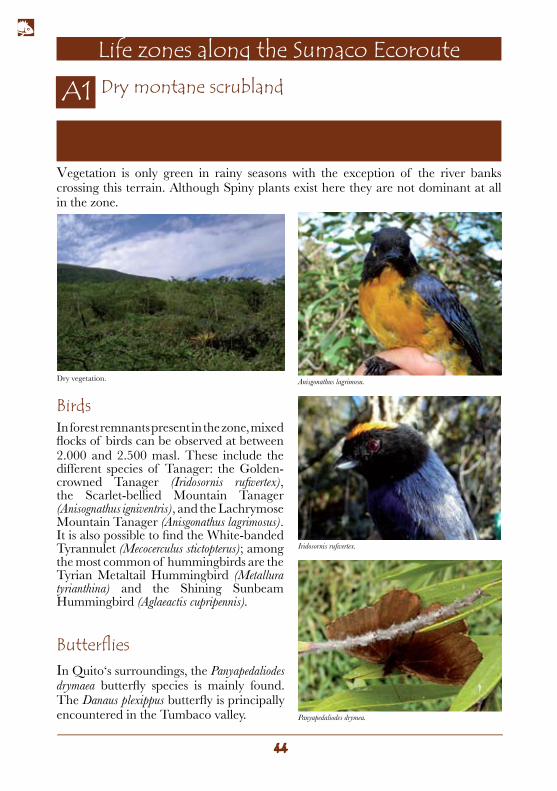
Dry montane scrubland
Life zones along the Sumaco Ecoroute
Butterflies
In forest remnants present in the zone, mixed flocks of birds can be observed at between 2.000 and 2.500 masl. These include the different species of Tanager: the Golden-crowned Tanager (Iridosornis rufivertex), the Scarlet-bellied Mountain Tanager (Anisognathus igniventris), and the Lachrymose Mountain Tanager (Anisgonathus lagrimosus). It is also possible to find the White-banded Tyrannulet (Mecocerculus stictopterus); among the most common of hummingbirds are the Tyrian Metaltail Hummingbird (Metallura tyrianthina) and the Shining Sunbeam Hummingbird (Aglaeactis cupripennis).
In Quito‘s surroundings, the Panyapedaliodes drymaea butterfly species is mainly found. The Danaus plexippus butterfly is principally encountered in the Tumbaco valley.
Vegetation is only green in rainy seasons with the exception of the river banks crossing this terrain. Although Spiny plants exist here they are not dominant at all in the zone.
Anisgonathus lagrimosu.
Panyapedaliodes drymea.
Iridosornis rufivertex.
Dry vegetation.
Ecoroute section: between Pifo and the Paluguillo sector. The humid montane scrubland zone is situated at an altitude of between 2.000 and 3.000 m.
Ecoroute section: from the La Virgen moor to the moors of Papallacta.
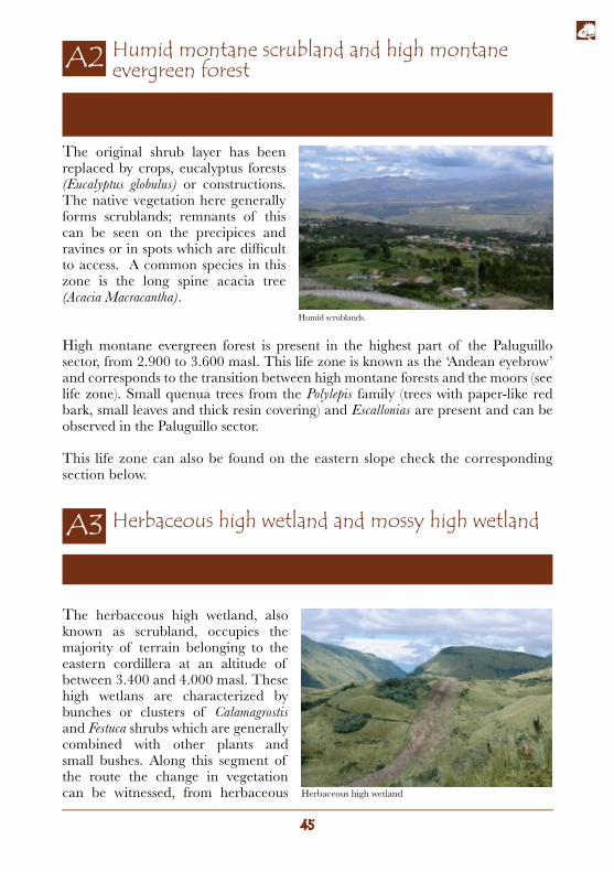
Humid montane scrubland and high montane evergreen forest
Herbaceous high wetland and mossy high wetland
The original shrub layer has been replaced by crops, eucalyptus forests (Eucalyptus globulus) or constructions. The native vegetation here generally forms scrublands; remnants of this can be seen on the precipices and ravines or in spots which are difficult to access. A common species in this zone is the long spine acacia tree (Acacia Macracantha).
High montane evergreen forest is present in the highest part of the Paluguillo sector, from 2.900 to 3.600 masl. This life zone is known as the ‘Andean eyebrow’ and corresponds to the transition between high montane forests and the moors (see life zone). Small quenua trees from the Polylepis family (trees with paper-like red bark, small leaves and thick resin covering) and Escallonias are present and can be observed in the Paluguillo sector.
This life zone can also be found on the eastern slope check the corresponding section below.
The herbaceous high wetland, also known as scrubland, occupies the majority of terrain belonging to the eastern cordillera at an altitude of between 3.400 and 4.000 masl. These high wetlans are characterized by bunches or clusters of Calamagrostis and Festuca shrubs which are generally combined with other plants and small bushes. Along this segment of the route the change in vegetation can be witnessed, from herbaceous
Humid scrublands.
Herbaceous high wetland
high wetland (drier) to mossy high wetland (wetter). The mossy high wetland are situated between 4.000 and 4.500 masl. The foliage here is composed of bushes, several species of shrubs, rosette plants (leaves in circular form all at the same height) and particularly moss plants (plants which are so tightly woven together that they look like a type of ‘cushion’). These can be formed by just one plant or several plants of the same or different species. To the west of La Virgen, Loricaria thyoides is a common plant species, whilst on the eastern side the Achupallas (Puya spp.), a type of bromeliad, is more commonly encountered.
MammalsThe first segment of the route ideal for observing mammals is the section between the La Virgen moor and the Papallacta sector. It is relatively easy to spot the Tapeti or forest rabbit (Silvilagus brasiliensis), particularly at dusk, among the scrublands.
There are also three species of deer in the area including the common Andean White-tailed Deer (Odocoileus peruvianus). This robust mammal avoids zones with dense vegetation due to the size of its antlers. The Little Red Brocket Deer (Mazama rufina) has also been seen in the area, although this is difficult to spot due to it being the smallest deer species in Ecuador. Unlike the moorland deer, this has stronger physique which allows it to penetrate dense vegetation in the search
of plants, leaves and tender branches. The final species inhabiting the zone, and just as difficult to spot, is the Northern Pudu Deer (Pudu mephistophiles) which is also a small, brownish-red colored mammal with small antlers resembling 9 cm long spikes.
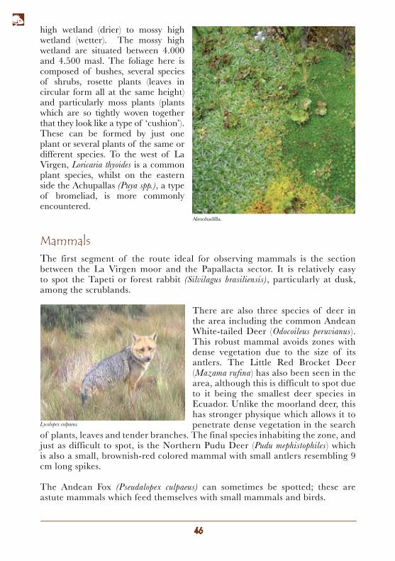
The Andean Fox (Pseudalopex culpaeus) can sometimes be spotted; these are astute mammals which feed themselves with small mammals and birds.
Almohadilla.
Lycalopex culpaeus.
Birds
Butterflies
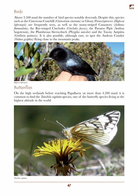
Above 3.500 masl the number of bird species notably descends. Despite this, species such as the Cinereous Conebill (Cinirostrum cinereum) or Glossy Flowerpiercer (Diglossa lafresnayii) are frequently seen, as well as the many-striped Canastero (Asthenes flammulata), the Bar-winged Cinclodes (Cinclodes fuscus), the Paramo Pipit (Anthus bogotensis), the Plumbeous Sierra-finch (Phrygilus unicolor) and the Tawny Antpitta (Grallaria quitensis). It is also possible, although rare, to spot the Andean Condor (Vulture gryphus) flying close to the mountain peaks.
On the high wetlands before reaching Papallacta (at more than 4.200 masl) it is common to find the Tatochila sagittata species, one of the butterfly species living at the highest altitude in the world.
Tatochila sagittata.
Diglossa lafresnayii.
Mammals
Birds
Ecoroute section: Papallacta sector. This zone coincides with the highest moorlands in the Paluguillo sector. Located at an altitude of between 3.600 and 2.900 masl, it includes the Andean Eyebrow or transition between the high montane forests and moors. This life zone is similar to the cloud forest (the next zone below) in relation to its physiognomy and the quantity of mosses and epiphyte plants.
High montane evergreen forest
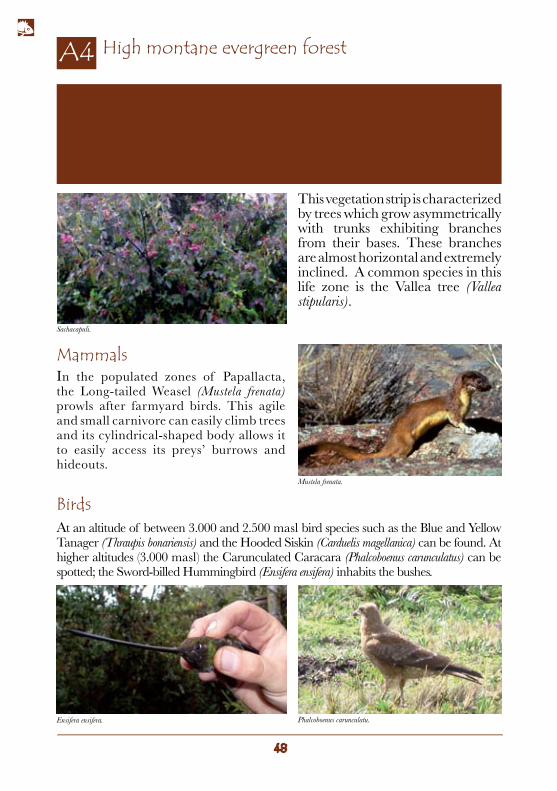
In the populated zones of Papallacta, the Long-tailed Weasel (Mustela frenata) prowls after farmyard birds. This agile and small carnivore can easily climb trees and its cylindrical-shaped body allows it to easily access its preys’ burrows and hideouts.
At an altitude of between 3.000 and 2.500 masl bird species such as the Blue and Yellow Tanager (Thraupis bonariensis) and the Hooded Siskin (Carduelis magellanica) can be found. At higher altitudes (3.000 masl) the Carunculated Caracara (Phalcoboenus carunculatus) can be spotted; the Sword-billed Hummingbird (Ensifera ensifera) inhabits the bushes.
This vegetation strip is characterized by trees which grow asymmetrically with trunks exhibiting branches from their bases. These branches are almost horizontal and extremely inclined. A common species in this life zone is the Vallea tree (Vallea stipularis).
Ensifera ensifera. Phalcoboenus carunculatu.
Mustela frenata.
Sachacapuli.
Ecoroute section: from the Cuyuja sector to the population of Sarayacu. This life zone is situated at an altitude of between 2.900 and 2.000 masl.
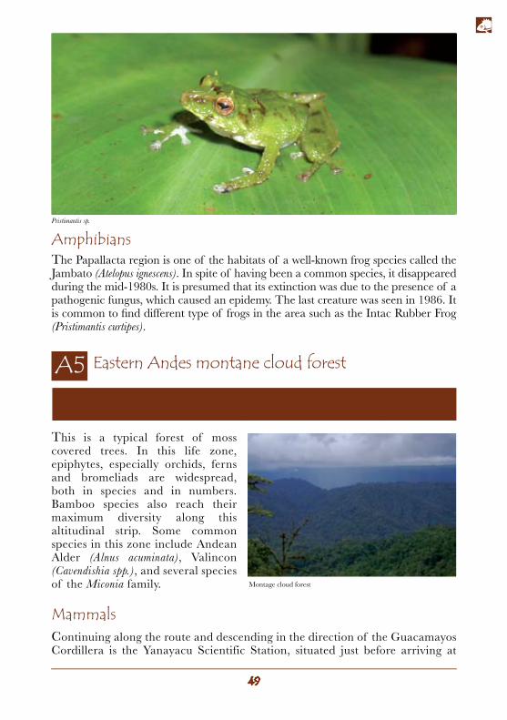
AmphibiansThe Papallacta region is one of the habitats of a well-known frog species called the Jambato (Atelopus ignescens). In spite of having been a common species, it disappeared during the mid-1980s. It is presumed that its extinction was due to the presence of a pathogenic fungus, which caused an epidemy. The last creature was seen in 1986. It is common to find different type of frogs in the area such as the Intac Rubber Frog (Pristimantis curtipes).
Eastern Andes montane cloud forest
MammalsContinuing along the route and descending in the direction of the Guacamayos Cordillera is the Yanayacu Scientific Station, situated just before arriving at
This is a typical forest of moss covered trees. In this life zone, epiphytes, especially orchids, ferns and bromeliads are widespread, both in species and in numbers. Bamboo species also reach their maximum diversity along this altitudinal strip. Some common species in this zone include Andean Alder (Alnus acuminata), Valincon (Cavendishia spp.), and several species of the Miconia family.
Pristimantis sp.
Montage cloud forest
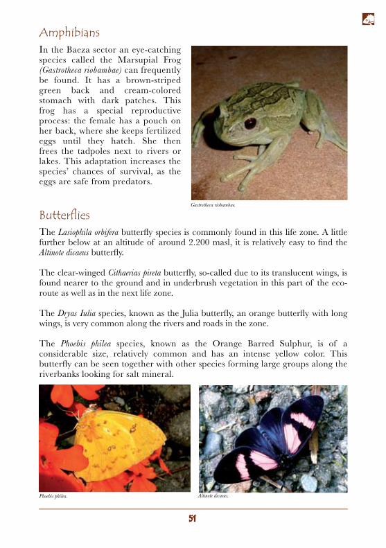
BirdsThere is an abundance of fruit trees along the route which attract diverse bird species. At 18 km from Baeza, 200 mts before reaching Cosanga, is the San Isidro lodge, known as a strategic point for bird-watching. The most common species at the site include the Slate-crowned Antpitta (Grallaricula nana) and the Barred Antthrush (Chamaeza mollissima) which can also be spotted along the road leading to the lodge. Other species easy to catch sight of include the Emerald Toucanet (Aulacorgynchus prasinus), the Scarlet-rumped Cacique (Cacicus uropygialis), the Rufous-headed Pigmy Tyrant (Pseudotricys ruficeps), and the White-capped Tanager (Sericossypha albochrystata), a rare species which travels in groups of five or six.
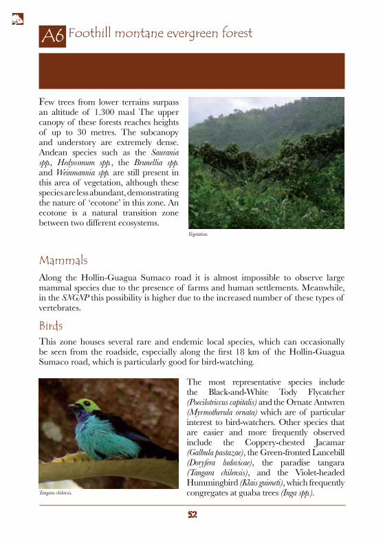
The Baeza sector is an important zone for the identification of reptiles along the ecoroute. There have been several sightings of the brown Atracus occipitals snake, which can be spotted along the road, resting under decomposing tree trunks.
At night-time it is possible to observe the Liophis epinephelus snake hunting small vertebrates along the Guacamayos Cordillera.
During the day a species of Mussurana snake (Clelia clelia) can be seen, beneficial to humans given that this feeds on other snakes, many of them poisonous (it is immune to their venom), swallowing them whole and headfirst.
Reptiles
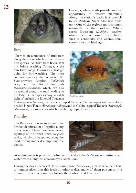
Cosanga, whose trails provide an ideal opportunity to observe mammals. Along the station’s paths it is possible to see Andean Night Monkeys (Aotus spp.). One of the region’s most common mammals is the Andean White-eared Opossum (Didelphis pernigra) which feeds on small invertebrates such as centipedes and worms, small vertebrates and bird eggs.
Pseudotriccus ruficeps.
Aotus vociferans.
Clelia clelia.
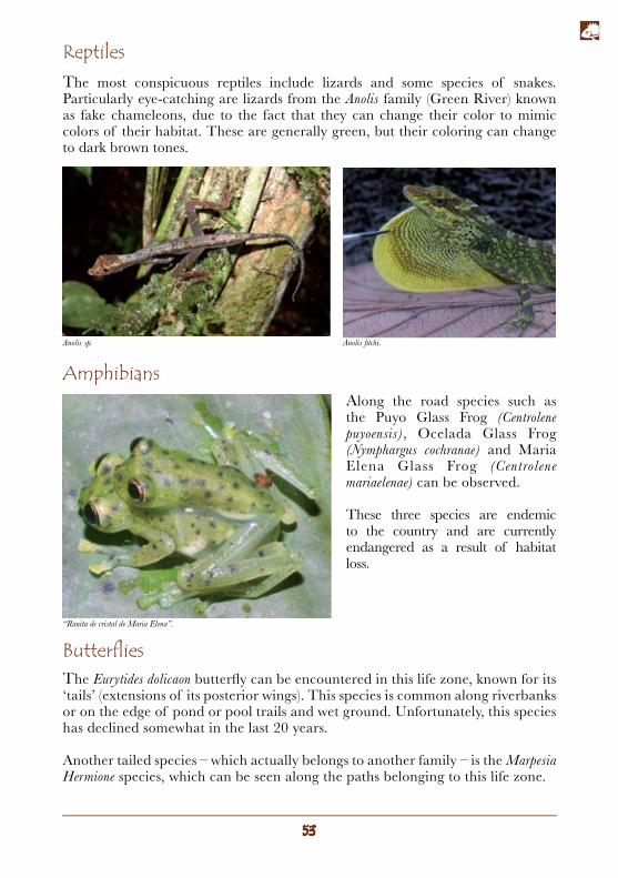
In the Baeza sector an eye-catching species called the Marsupial Frog (Gastrotheca riobambae) can frequently be found. It has a brown-striped green back and cream-colored stomach with dark patches. This frog has a special reproductive process: the female has a pouch on her back, where she keeps fertilized eggs until they hatch. She then frees the tadpoles next to rivers or lakes. This adaptation increases the species’ chances of survival, as the eggs are safe from predators.
Amphibians
ButterfliesThe Lasiophila orbifera butterfly species is commonly found in this life zone. A little further below at an altitude of around 2.200 masl, it is relatively easy to find the Altinote dicaeus butterfly.
The clear-winged Cithaerias pireta butterfly, so-called due to its translucent wings, is found nearer to the ground and in underbrush vegetation in this part of the eco-route as well as in the next life zone.
The Dryas Iulia species, known as the Julia butterfly, an orange butterfly with long wings, is very common along the rivers and roads in the zone.
The Phoebis philea species, known as the Orange Barred Sulphur, is of a considerable size, relatively common and has an intense yellow color. This butterfly can be seen together with other species forming large groups along the riverbanks looking for salt mineral.
Altinote dicaeus.Phoebis philea.
Gastrotheca riobambae.
Ecoroute section: from Sarayacu to Pacto Sumaco. This zone (with the lowest altitude of any section along the route) is situated at under 1.300 masl and demostrates how Andean species overlap with Amazon species.
Foothill montane evergreen forest
Mammals
Birds
Along the Hollin-Guagua Sumaco road it is almost impossible to observe large mammal species due to the presence of farms and human settlements. Meanwhile, in the SNGNP this possibility is higher due to the increased number of these types of vertebrates.
This zone houses several rare and endemic local species, which can occasionally be seen from the roadside, especially along the first 18 km of the Hollin-Guagua Sumaco road, which is particularly good for bird-watching.
The most representative species include the Black-and-White Tody Flycatcher (Poecilotriccus capitalis) and the Ornate Antwren (Myrmotherula ornata) which are of particular interest to bird-watchers. Other species that are easier and more frequently observed include the Coppery-chested Jacamar (Galbula pastazae), the Green-fronted Lancebill (Doryfera ludovicae), the paradise tangara (Tangara chilensis), and the Violet-headed Hummingbird (Klais guimeti), which frequently congregates at guaba trees (Inga spp.).
Few trees from lower terrains surpass an altitude of 1.300 masl The upper canopy of these forests reaches heights of up to 30 metres. The subcanopy and understory are extremely dense. Andean species such as the Saurania spp., Hedyosmum spp., the Brunellia spp. and Weinmannia spp. are still present in this area of vegetation, although these species are less abundant, demonstrating the nature of ‘ecotone’ in this zone. An ecotone is a natural transition zone between two different ecosystems.
Vegetation.
Tangara chilensis.
ReptilesThe most conspicuous reptiles include lizards and some species of snakes. Particularly eye-catching are lizards from the Anolis family (Green River) known as fake chameleons, due to the fact that they can change their color to mimic colors of their habitat. These are generally green, but their coloring can change to dark brown tones.
AmphibiansAlong the road species such as the Puyo Glass Frog (Centrolene puyoensis), Ocelada Glass Frog (Nymphargus cochranae) and Maria Elena Glass Frog (Centrolene mariaelenae) can be observed.
These three species are endemic to the country and are currently endangered as a result of habitat loss.
ButterfliesThe Eurytides dolicaon butterfly can be encountered in this life zone, known for its ‘tails’ (extensions of its posterior wings). This species is common along riverbanks or on the edge of pond or pool trails and wet ground. Unfortunately, this species has declined somewhat in the last 20 years.
Another tailed species – which actually belongs to another family – is the Marpesia Hermione species, which can be seen along the paths belonging to this life zone.
Anolis sp.
“Ranita de cristal de Maria Elena”.
Anolis fitchi.
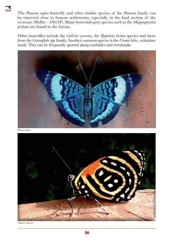
The Panacea regina butterfly and other similar species of the Panacea family can be observed close to human settlements, especially in the final section of the ecoroute (Hollin – SNGNP). Many brownish-grey species such as the Magneuptychia probata are found in the forests.
Other butterflies include the Callicire cynosura, the Hypoleria lavinia species and those from the Catonephele spp. family. Another common species is the Urania leilus, a daytime moth. This can be frequently spotted along roadsides and riverbanks.
Callicore cynosura.
Panacea regina.
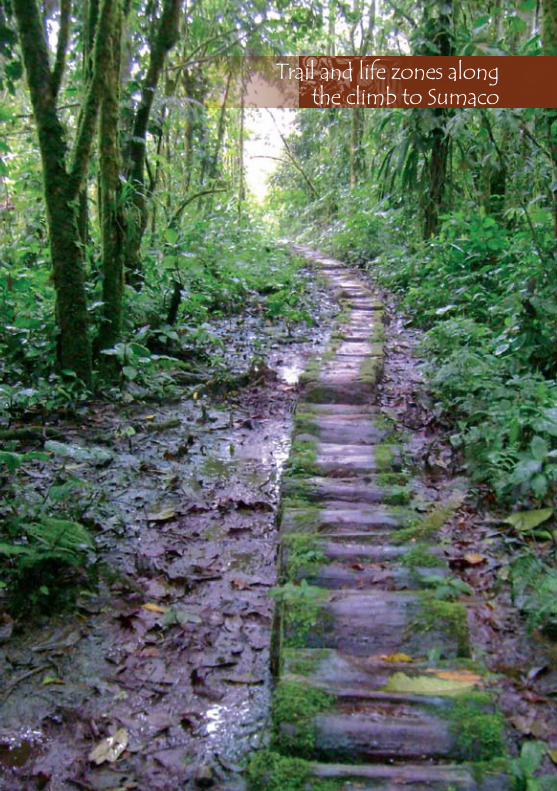
Trail and life zones alongthe climb to Sumaco

Outlook (El Mirador)
Clud forest
Paramo
The lagoon
CampPava Yacu
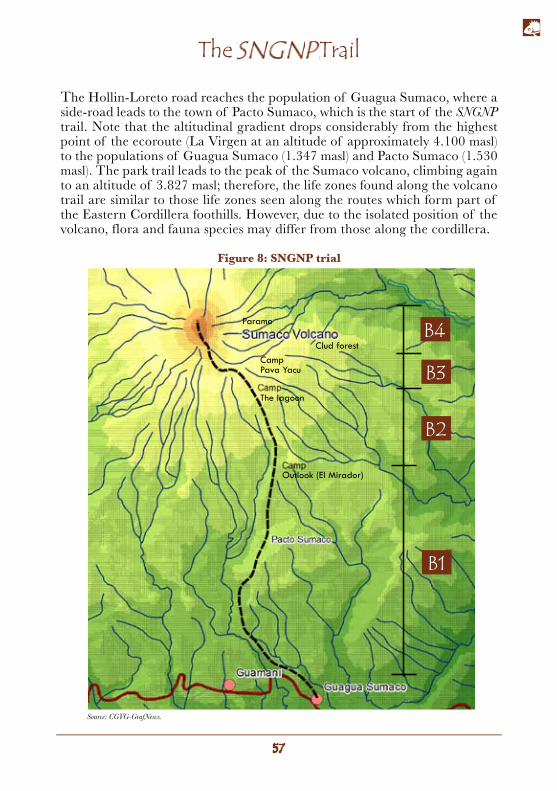
The Hollin-Loreto road reaches the population of Guagua Sumaco, where a side-road leads to the town of Pacto Sumaco, which is the start of the SNGNP trail. Note that the altitudinal gradient drops considerably from the highest point of the ecoroute (La Virgen at an altitude of approximately 4.100 masl) to the populations of Guagua Sumaco (1.347 masl) and Pacto Sumaco (1.530 masl). The park trail leads to the peak of the Sumaco volcano, climbing again to an altitude of 3.827 masl; therefore, the life zones found along the volcano trail are similar to those life zones seen along the routes which form part of the Eastern Cordillera foothills. However, due to the isolated position of the volcano, flora and fauna species may differ from those along the cordillera.
The SNGNP Trail
Source: CGVG-GrafNews.
Figure 8: SNGNP trial
The park’s main attraction is the Sumaco volcano; however, the ascent is not completely straightforward and requires climbers to be in good physical form. Rain and humidity, along with coldness and strong winds at the peak, are part of the climb. It usually takes three days to ascend and two days to descend. There are three refuges along the route, which have basic facilities for staying overnight (bunks, beds and blankets), although it is recommended to bring a sleeping bag along with you. The refuges have toilets, gas cookers – except for the Pava Yacu refuge – and water (collected rainwater).
The best months to climb are those which are the driest: from the beginning of October to the end of December.
The first person to climb the Sumaco volcano was Marcos Jimenez de la Espada, a Spanish zoologist, explorer and writer, who reached the summit in 1865 under extreme conditions. This feat was not repeated until 1925 when the British explorer George Dyott ascended a second time.
The climb up to the volcano starts at the Pacto Sumaco population along a path which cuts through pastureland and disturbed forests and takes around two hours to complete. The first camp (El Mirador) is located at 7,37 km from Pacto Sumaco. Two paths can be taken from this camp: one which continues to the ascent to the volcano and another which leads down to a clearing where you can camp out. Following the route towards to summit, you’ll reach the Guagua Sumaco lagoon, highly recommended for camping and the site of the second refuge (at 6,58 km from El Mirador). From the lagoon the path continues towards the volcano’s summit. Although the summit seems quite close to the lagoon, the climb can take more than 6 hours, 5 for the descent. It is recommended that the ascent and descent be undertaken in the same day: departing the lagoon no later than 6 am. The third refuge, Pava Yacu, is situated between the lagoon and the summit (at 3,22 km from the second camp and 3,38 km to the top of the peak).
Hiring a guide for the ascent is indispensible (USD 25 per person per day); taking food along with you and sharing it with the guide is also necessary.
The climb to Sumaco
What to bring to Sumaco
The key to climb Sumaco successfully is to travel light and keep a dry change of clothes for the night.
Backpacks and sleeping equipment
• A medium-sized backpack (waterproof if possible). All clothing and sleeping bags should be in plastic bags.
• Inflatable sleeping pad/mat
• Sleeping bag
Clothing
• Two pairs of quick-drying trousers
• One pair of warm trousers
• One pair of waterproof trousers
• One water-resistant anorak
• Hat or cap
• Woolly hat
• Gloves and glove-covers
• Two fleece jumpers
• Swimming shorts or bathing suit
• Two quick-drying tops
• Three t-shirts
• Underwear
Footwear
• A pair of comfortable walking shoes
• A pair of wellington boots
Equipment
• Sunglasses
• Water bottle
• Sun cream (at least SPF 30)
• Insect repellent
• Toiletries
• First aid kit
• Plastic bags for clothes and electronic devices
• Headlamp
• Alkaline batteries
• Plastic bags with seals (zip lock)
• Swiss army knife
• Trekking poles
• Camera
• Binoculars
• Plates, cups and cutlery
• Food for five days (including portions for the guide).
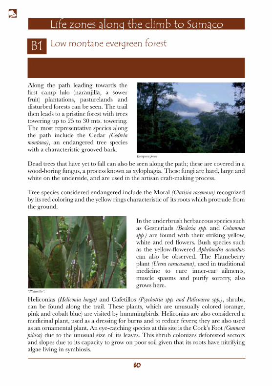
Along the path leading towards the first camp lulo (naranjilla, a sower fruit) plantations, pasturelands and disturbed forests can be seen. The trail then leads to a pristine forest with trees towering up to 25 to 30 mts. towering. The most representative species along the path include the Cedar (Cedrela montana), an endangered tree species with a characteristic grooved bark.
Dead trees that have yet to fall can also be seen along the path; these are covered in a wood-boring fungus, a process known as xylophagia. These fungi are hard, large and white on the underside, and are used in the artisan craft-making process.
Tree species considered endangered include the Moral (Clarisia racemosa) recognized by its red coloring and the yellow rings characteristic of its roots which protrude from the ground.
In the underbrush herbaceous species such as Gesneriads (Besleria spp. and Columnea spp.) are found with their striking yellow, white and red flowers. Bush species such as the yellow-flowered Aphelandra acanthus can also be observed. The Flameberry plant (Urera caracasana), used in traditional medicine to cure inner-ear ailments, muscle spasms and purify sorcery, also grows here.
Heliconias (Heliconia longa) and Cafetillos (Psychotria spp. and Palicourea spp.), shrubs, can be found along the trail. These plants, which are unusually colored (orange, pink and cobalt blue) are visited by hummingbirds. Heliconias are also considered a medicinal plant, used as a dressing for burns and to reduce fevers; they are also used as an ornamental plant. An eye-catching species at this site is the Cock’s Foot (Gunnera pilosa) due to the unusual size of its leaves. This shrub colonizes deforested sectors and slopes due to its capacity to grow on poor soil given that its roots have nitrifying algae living in symbiosis.
Trail section: from the entry to the SNGNP to the first camp, “El Mirador” (at an altitude of 1.700 masl).
Low montane evergreen forest
Life zones along the climb to Sumaco
Evergreen forest
“Platanillo”.
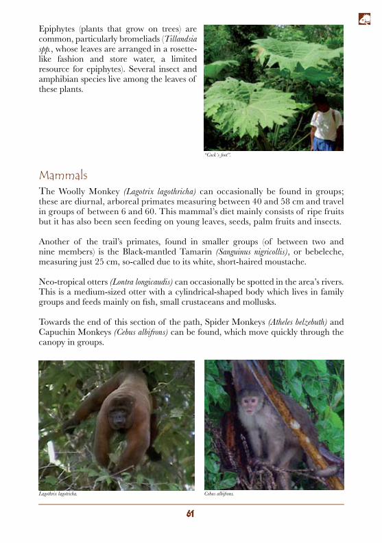
Epiphytes (plants that grow on trees) are common, particularly bromeliads (Tillandsia spp., whose leaves are arranged in a rosette-like fashion and store water, a limited resource for epiphytes). Several insect and amphibian species live among the leaves of these plants.
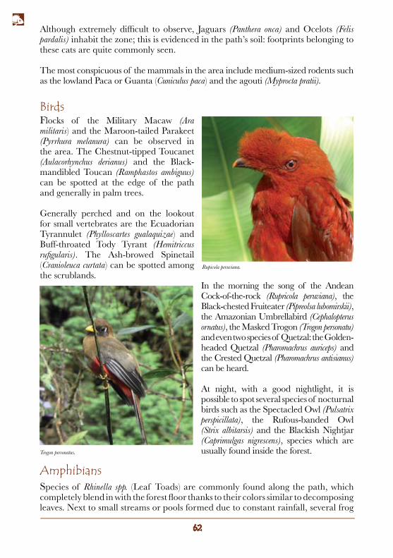
MammalsThe Woolly Monkey (Lagotrix lagothricha) can occasionally be found in groups; these are diurnal, arboreal primates measuring between 40 and 58 cm and travel in groups of between 6 and 60. This mammal’s diet mainly consists of ripe fruits but it has also been seen feeding on young leaves, seeds, palm fruits and insects.
Another of the trail’s primates, found in smaller groups (of between two and nine members) is the Black-mantled Tamarin (Sanguinus nigricollis), or bebeleche, measuring just 25 cm, so-called due to its white, short-haired moustache.
Neo-tropical otters (Lontra longicaudis) can occasionally be spotted in the area’s rivers. This is a medium-sized otter with a cylindrical-shaped body which lives in family groups and feeds mainly on fish, small crustaceans and mollusks.
Towards the end of this section of the path, Spider Monkeys (Atheles belzebuth) and Capuchin Monkeys (Cebus albifrons) can be found, which move quickly through the canopy in groups.
Cebus albifrons.Lagothrix lagotricha.
“Cock´s foot”.
BirdsFlocks of the Military Macaw (Ara militaris) and the Maroon-tailed Parakeet (Pyrrhura melanura) can be observed in the area. The Chestnut-tipped Toucanet (Aulacorhynchus derianus) and the Black-mandibled Toucan (Ramphastos ambiguus) can be spotted at the edge of the path and generally in palm trees.
Generally perched and on the lookout for small vertebrates are the Ecuadorian Tyrannulet (Phylloscartes gualaquizae) and Buff-throated Tody Tyrant (Hemitriccus rufigularis). The Ash-browed Spinetail (Cranioleuca curtata) can be spotted among the scrublands.
In the morning the song of the Andean Cock-of-the-rock (Rupricola peruviana), the Black-chested Fruiteater (Pipreolsa lubomirskii), the Amazonian Umbrellabird (Cephalopterus ornatus), the Masked Trogon (Trogon personatu) and even two species of Quetzal: the Golden-headed Quetzal (Pharomachrus auriceps) and the Crested Quetzal (Pharomachrus antisianus) can be heard.
At night, with a good nightlight, it is possible to spot several species of nocturnal birds such as the Spectacled Owl (Pulsatrix perspicillata), the Rufous-banded Owl (Strix albitarsis) and the Blackish Nightjar (Caprimulgas nigrescens), species which are usually found inside the forest.
Although extremely difficult to observe, Jaguars (Panthera onca) and Ocelots (Felis pardalis) inhabit the zone; this is evidenced in the path’s soil: footprints belonging to these cats are quite commonly seen.
The most conspicuous of the mammals in the area include medium-sized rodents such as the lowland Paca or Guanta (Cuniculus paca) and the agouti (Myprocta pratii).
Species of Rhinella spp. (Leaf Toads) are commonly found along the path, which completely blend in with the forest floor thanks to their colors similar to decomposing leaves. Next to small streams or pools formed due to constant rainfall, several frog
Amphibians
Rupicola peruviana.
Trogon personatus.
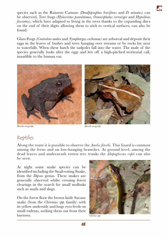
species such as the Rainette Camuse (Dendfopsophus brevifrons and D. minutus) can be observed. Tree frogs (Hyloscirtus psarolaimus, Osteocephalus verruciger and Hypsiboas fasciatus), which have adapted to living in the trees thanks to the expanding discs on the end of their digits allowing them to stick to vertical surfaces, can also be found.
Glass Frogs (Centrolene audax and Nymphargus cochranae) are arboreal and deposit their eggs in the leaves of bushes and trees hanging over streams or by rocks lay next to waterfalls. When these hatch the tadpoles fall into the water. The male of the species generally looks after the eggs and lets off a high-pitched territorial call, inaudible to the human ear.
ReptilesAlong the route it is possible to observe the Anolis fitschi. This lizard is common among the ferns and on low-hanging branches. At ground level, among the dead leaves and underneath rotten tree trunks the Alopoglossus copii can also be seen.
At night some snake species can be identified including the Snail-eating Snake, from the Dipsas genus. These snakes are generally observed whilst crossing forest clearings in the search for small mollusks such as snails and slugs.
On the forest floor the brown knife Savane snake (from the Chironius spp. family) with its yellow underside and huge eyes feeds on small rodents, seeking them out from their burrows.
Rhinella margaritífe. Rhinella margaritífe.
Chironius spp.
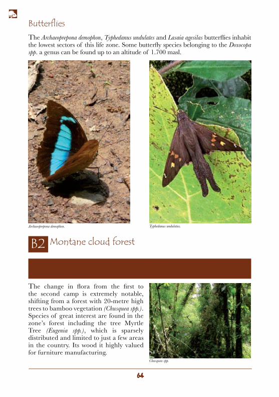
ButterfliesThe Archaeoprepona demophon, Typhedanus undulates and Lasaia agesilas butterflies inhabit the lowest sectors of this life zone. Some butterfly species belonging to the Doxocopa spp. a genus can be found up to an altitude of 1.700 masl.
Trail section: from the first camp (El Mirador) to the second camp (de la Laguna) located at 2.499 masl.
Montane cloud forest
The change in flora from the first to the second camp is extremely notable, shifting from a forest with 20-metre high trees to bamboo vegetation (Chusquea spp.). Species of great interest are found in the zone’s forest including the tree Myrtle Tree (Eugenia spp.), which is sparsely distributed and limited to just a few areas in the country. Its wood it highly valued for furniture manufacturing.
Typhedanus undulatus.Archaeoprepona demophon.
Chusquea spp.
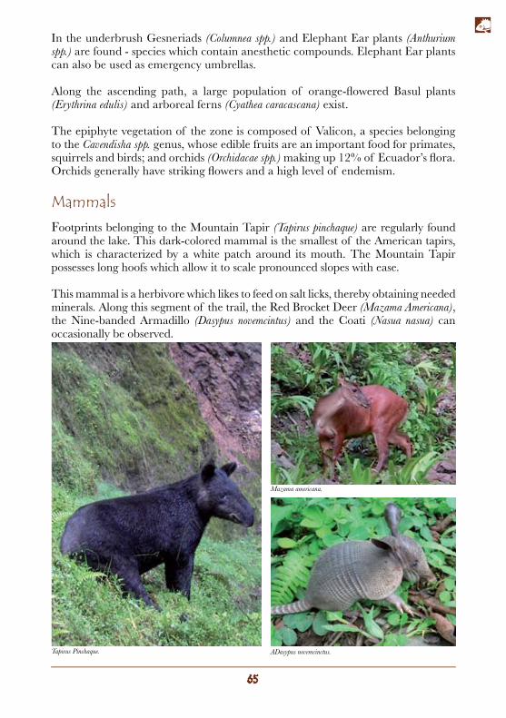
MammalsFootprints belonging to the Mountain Tapir (Tapirus pinchaque) are regularly found around the lake. This dark-colored mammal is the smallest of the American tapirs, which is characterized by a white patch around its mouth. The Mountain Tapir possesses long hoofs which allow it to scale pronounced slopes with ease.
This mammal is a herbivore which likes to feed on salt licks, thereby obtaining needed minerals. Along this segment of the trail, the Red Brocket Deer (Mazama Americana), the Nine-banded Armadillo (Dasypus novemcintus) and the Coati (Nasua nasua) can occasionally be observed.
In the underbrush Gesneriads (Columnea spp.) and Elephant Ear plants (Anthurium spp.) are found - species which contain anesthetic compounds. Elephant Ear plants can also be used as emergency umbrellas.
Along the ascending path, a large population of orange-flowered Basul plants (Erythrina edulis) and arboreal ferns (Cyathea caracascana) exist.
The epiphyte vegetation of the zone is composed of Valicon, a species belonging to the Cavendisha spp. genus, whose edible fruits are an important food for primates, squirrels and birds; and orchids (Orchidacae spp.) making up 12% of Ecuador’s flora. Orchids generally have striking flowers and a high level of endemism.
Tapirus Pinchaque. ADasypus novemcinctus.
Mazama americana.
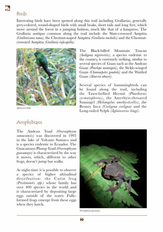
BirdsInteresting birds have been spotted along this trail including Grallarias, generally grey-colored, round-shaped birds with small beaks, short tails and long feet, which move around the forest in a jumping fashion, much like that of a kangaroo. The Grallaria anttipas common along the trail include the Slate-crowned Antpitta (Grallaricuna nana), the Chestnut-naped Antpitta (Grallaria nuchalis) and the Chestnut-crowned Antpitta (Grallaria ruficapilla).
The Black-billed Mountain Toucan (Andigena nigrirostris), a species endemic to the country, is extremely striking, similar to several species of Guan such as the Andean Guan (Penelope montagnii), the Sickle-winged Guan (Chamaepetes goudotii) and the Wattled Guan (Aburria aburri).
Several species of hummingbirds can be found along the trail, including the Tawn-bellied Hermit (Phaethornis syrmatophorus), the Amethyst-throated Sunangel (Heliangelus amethysticollis), the Bronzy Inca (Coeligena coeligna) and the Long-tailed Sylph (Aglaiocercus kingi).
Amphibians
The Andean Toad (Osornophryne sumacoensis) was discovered in 1995 in the lake of Volcano Sumaco and is a species endemic to Ecuador. The Guacamayo Plump Toad (Osornophryne guacamayo) is characterized by the way it moves, which, different to other frogs, doesn’t jump but walks.
At night-time it is possible to observe a species of higher altitudinal d i s t r ibu t ion : the Cut in f rog (Pristimantis spp.) whose family has over 400 species in the world and is characterized by depositing large eggs outside of the water. Fully-formed frogs emerge from these eggs when they hatch.
Osornophryne guacamayo.
Aglaiocercus kingi.
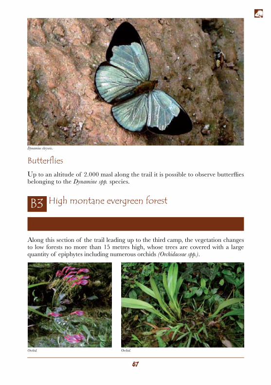
ButterfliesUp to an altitude of 2.000 masl along the trail it is possible to observe butterflies belonging to the Dynamine spp. species.
Trail section: from the second camp to the third camp: Pava Yacu (2.767 masl.)
High montane evergreen forest
Along this section of the trail leading up to the third camp, the vegetation changes to low forests no more than 15 metres high, whose trees are covered with a large quantity of epiphytes including numerous orchids (Orchidaceae spp.).
Orchid. Orchid.
Dynamine chryseis.
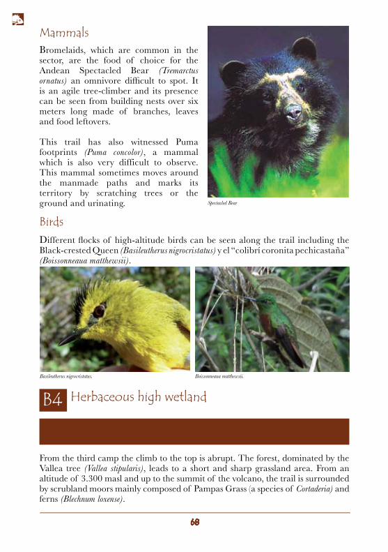
Mammals
Birds
Herbaceous high wetland
Bromelaids, which are common in the sector, are the food of choice for the Andean Spectacled Bear (Tremarctus ornatus) an omnivore difficult to spot. It is an agile tree-climber and its presence can be seen from building nests over six meters long made of branches, leaves and food leftovers.
This trail has also witnessed Puma footprints (Puma concolor), a mammal which is also very difficult to observe. This mammal sometimes moves around the manmade paths and marks its territory by scratching trees or the ground and urinating.
Different flocks of high-altitude birds can be seen along the trail including the Black-crested Queen (Basileutherus nigrocristatus) y el “colibrí coronita pechicastaña” (Boissonneaua matthewsii).
Trail section: from the third camp to the summit of the volcano (3.827 masl).
From the third camp the climb to the top is abrupt. The forest, dominated by the Vallea tree (Vallea stipularis), leads to a short and sharp grassland area. From an altitude of 3.300 masl and up to the summit of the volcano, the trail is surrounded by scrubland moors mainly composed of Pampas Grass (a species of Cortaderia) and ferns (Blechnum loxense).
Spectacled Bear
Basileutherus nigrocristatus. Boissonneaua matthewsii.
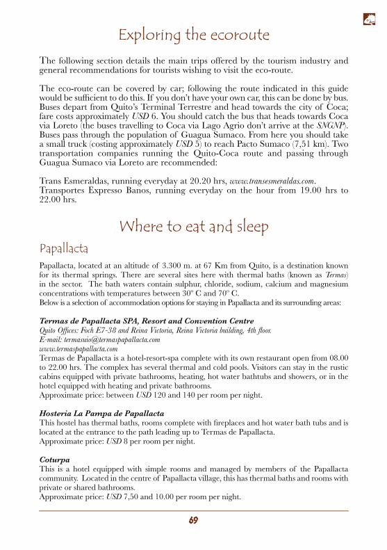
Exploring the ecorouteThe following section details the main trips offered by the tourism industry and general recommendations for tourists wishing to visit the eco-route.
The eco-route can be covered by car; following the route indicated in this guide would be sufficient to do this. If you don’t have your own car, this can be done by bus. Buses depart from Quito’s Terminal Terrestre and head towards the city of Coca; fare costs approximately USD 6. You should catch the bus that heads towards Coca via Loreto (the buses travelling to Coca via Lago Agrio don’t arrive at the SNGNP). Buses pass through the population of Guagua Sumaco. From here you should take a small truck (costing approximately USD 5) to reach Pacto Sumaco (7,51 km). Two transportation companies running the Quito-Coca route and passing through Guagua Sumaco via Loreto are recommended:
Trans Esmeraldas, running everyday at 20.20 hrs, www.transesmeraldas.com.Transportes Expresso Banos, running everyday on the hour from 19.00 hrs to 22.00 hrs.
Where to eat and sleepPapallactaPapallacta, located at an altitude of 3.300 m. at 67 Km from Quito, is a destination known for its thermal springs. There are several sites here with thermal baths (known as Termas) in the sector. The bath waters contain sulphur, chloride, sodium, calcium and magnesium concentrations with temperatures between 30º C and 70º C.Below is a selection of accommodation options for staying in Papallacta and its surrounding areas:
Termas de Papallacta SPA, Resort and Convention CentreQuito Offices: Foch E7-38 and Reina Victoria, Reina Victoria building, 4th floor.E-mail: [email protected] de Papallacta is a hotel-resort-spa complete with its own restaurant open from 08.00 to 22.00 hrs. The complex has several thermal and cold pools. Visitors can stay in the rustic cabins equipped with private bathrooms, heating, hot water bathtubs and showers, or in the hotel equipped with heating and private bathrooms. Approximate price: between USD 120 and 140 per room per night.
Hosteria La Pampa de PapallactaThis hostel has thermal baths, rooms complete with fireplaces and hot water bath tubs and is located at the entrance to the path leading up to Termas de Papallacta.Approximate price: USD 8 per room per night.
CoturpaThis is a hotel equipped with simple rooms and managed by members of the Papallacta community. Located in the centre of Papallacta village, this has thermal baths and rooms with private or shared bathrooms.Approximate price: USD 7,50 and 10.00 per room per night.
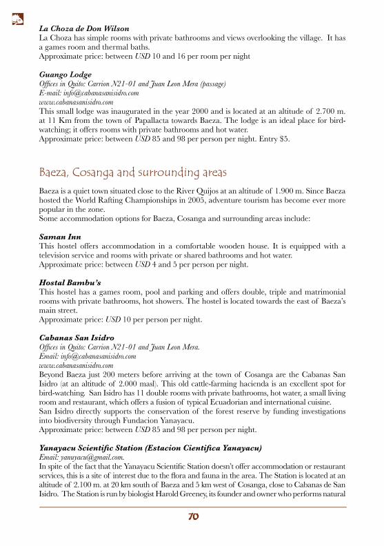
Baeza, Cosanga and surrounding areas
La Choza de Don WilsonLa Choza has simple rooms with private bathrooms and views overlooking the village. It has a games room and thermal baths.Approximate price: between USD 10 and 16 per room per night
Guango LodgeOffices in Quito: Carrion N21-01 and Juan Leon Mera (passage)E-mail: [email protected] small lodge was inaugurated in the year 2000 and is located at an altitude of 2.700 m. at 11 Km from the town of Papallacta towards Baeza. The lodge is an ideal place for bird-watching; it offers rooms with private bathrooms and hot water.Approximate price: between USD 85 and 98 per person per night. Entry $5.
Baeza is a quiet town situated close to the River Quijos at an altitude of 1.900 m. Since Baeza hosted the World Rafting Championships in 2005, adventure tourism has become ever more popular in the zone.Some accommodation options for Baeza, Cosanga and surrounding areas include:
Saman InnThis hostel offers accommodation in a comfortable wooden house. It is equipped with a television service and rooms with private or shared bathrooms and hot water. Approximate price: between USD 4 and 5 per person per night.
Hostal Bambu’sThis hostel has a games room, pool and parking and offers double, triple and matrimonial rooms with private bathrooms, hot showers. The hostel is located towards the east of Baeza’s main street.Approximate price: USD 10 per person per night.
Cabanas San IsidroOffices in Quito: Carrion N21-01 and Juan Leon Mera.Email: [email protected] Baeza just 200 meters before arriving at the town of Cosanga are the Cabanas San Isidro (at an altitude of 2.000 masl). This old cattle-farming hacienda is an excellent spot for bird-watching. San Isidro has 11 double rooms with private bathrooms, hot water, a small living room and restaurant, which offers a fusion of typical Ecuadorian and international cuisine.San Isidro directly supports the conservation of the forest reserve by funding investigations into biodiversity through Fundacion Yanayacu.Approximate price: between USD 85 and 98 per person per night. Yanayacu Scientific Station (Estacion Cientifica Yanayacu)Email: [email protected] spite of the fact that the Yanayacu Scientific Station doesn’t offer accommodation or restaurant services, this is a site of interest due to the flora and fauna in the area. The Station is located at an altitude of 2.100 m. at 20 km south of Baeza and 5 km west of Cosanga, close to Cabanas de San Isidro. The Station is run by biologist Harold Greeney, its founder and owner who performs natural
history investigations on flora and fauna from the zone thereby contributing to its conservation. The Scientific Station works closely with Cabanas de San Isidro.
SierrAzulOffices in Quito: Veintimilla E3-15 and Juan Leon Mera (operated by Runayacu).www.sierrazulecuador.comThis is a private lodge/reserve dedicated to assisting scientific investigations and promoting ecotourism for the conservation of flora and fauna in the zone.SierrAzul is located on the eastern foothills of the Andes Cordillera in Ecuador at an altitude of between 2.200 and 2.600 m., extending for over 2.000 hectares. The lodge is rustic and has a reading room, games room and dining area. Nearby is the town of Cosanga at 14 km from the Las Caucheras sector.The site also has a car park, a short walk from the reserve (a 1/2 km walk).Walks, horse-riding, bike rides or rafting are activities which visitors can enjoy in SierrAzul. Climatic and altitudinal conditions and the forest’s excellent state of conservation make this an ideal site for bird-watching.The lodge only accepts visitors with advance reservations.Approximate price: USD 73 per person per night.
Sumaco Napo Galeras National ParkAccess to the park is from Pacto Sumaco. A ticket must be bought here in order to enter and it is also possible to hire a park guide here (an indispensible requisite for admission).
Several organizations are currently working on developing tourism projects in collaboration with communities settled in the Sumaco Napo Galeras National Park in order to conserve the park’s natural capital and improve the quality of life for its inhabitants.
For more information please visit www.sumaco.orgPark entry fee: Ecuadorians USD 2 / foreigners USD 5.Certified guide: USD 25 per day.Use of refuges within the park: USD 3 per person per night.
Other accommodation options in Sumaco and its surrounding areas
Wild Sumaco LodgeEmail: [email protected] Wildsumaco Lodge (at an altitude of 1.400 m.) is a new, small and comfortable lodge with accommodation and restaurant services. Rooms are simple with private bathrooms and hot water. Professional guiding services are available for bird-watching and these services can be hired to the lodge itself. The surrounding paths and gardens can be visited throughout the day upon payment of an admission fee.Approximate price: between USD 135 and 155 per person per night. Entry fee: USD 5.
Emmons, L., y Feer, F. Neotropical Rainforest Mammals: A field guide, The University of Chicago Press, Chicago y Londres, 1990.
Gentry, H., A Field Guide to the Families and Genera of Woody Plants of North West South America, Conservation International, The University of Chicago Press, Chicago, 1996.)
Kricher, J., A neotropical companion: an introduction to the animals, plants, and ecosystems of the New World tropics. Princeton University Press, New Jersey. 1997.
Moreno, M., Silva, X. Estévez G. y Margraff, P., Mariposas del Ecuador, San Francisco de Quito University Press, Quito, 1997. Palmerlee, D., Grosberg, M. & McCarthy, C. Ecuador y las islas Galapagos, GeoPlaneta, Lonely Planet, Barcelona, 2006.
Pearson, D., y Beletsky, L., Ecuador and the Galapagos Islands: the Ecotravellers’ Wildlife Guide, Academic Press, Londres, 2000.
Ridgely, R. y Greenfield, P. Aves del Ecuador, Volumen 2: Guía de campo, Fundación Jocotoco, Quito, 2007.
Tirira, D. Guía de campo de los mamíferos del Ecuador. Ediciones Murciélago Blanco, Quito, 2007. Von Humboldt A. Personal Narrative of a Journey to the Equinoctial Regions of the New Continent, Penguin Books Ltd., New York, 1995 (only available in English).
Recommended Reading:
This book was printedin September 2009
Quito, Ecuador.The present edition consists of
1.500 books.