Embed Size (px)
Citation preview
Tile-based information systems
Nguyễn Hải Châu
Bộ môn Các hệ thống thông tin
Khoa CNTT - ĐHCN
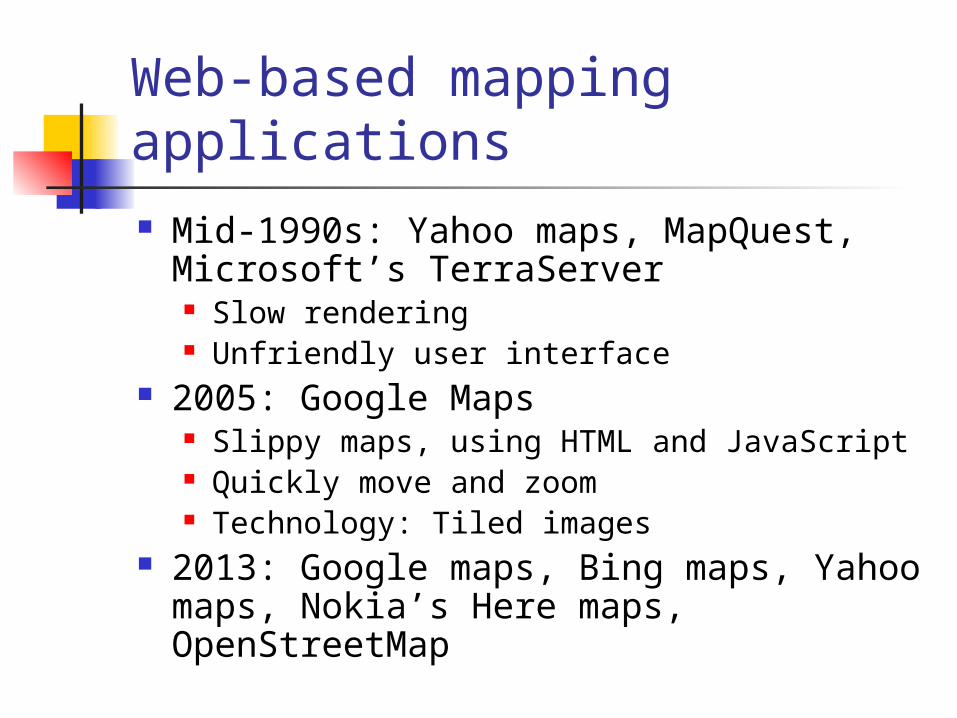
Web-based mapping applications
Mid-1990s: Yahoo maps, MapQuest, Microsoft’s TerraServer Slow rendering Unfriendly user interface
2005: Google Maps Slippy maps, using HTML and JavaScript Quickly move and zoom Technology: Tiled images
2013: Google maps, Bing maps, Yahoo maps, Nokia’s Here maps, OpenStreetMap
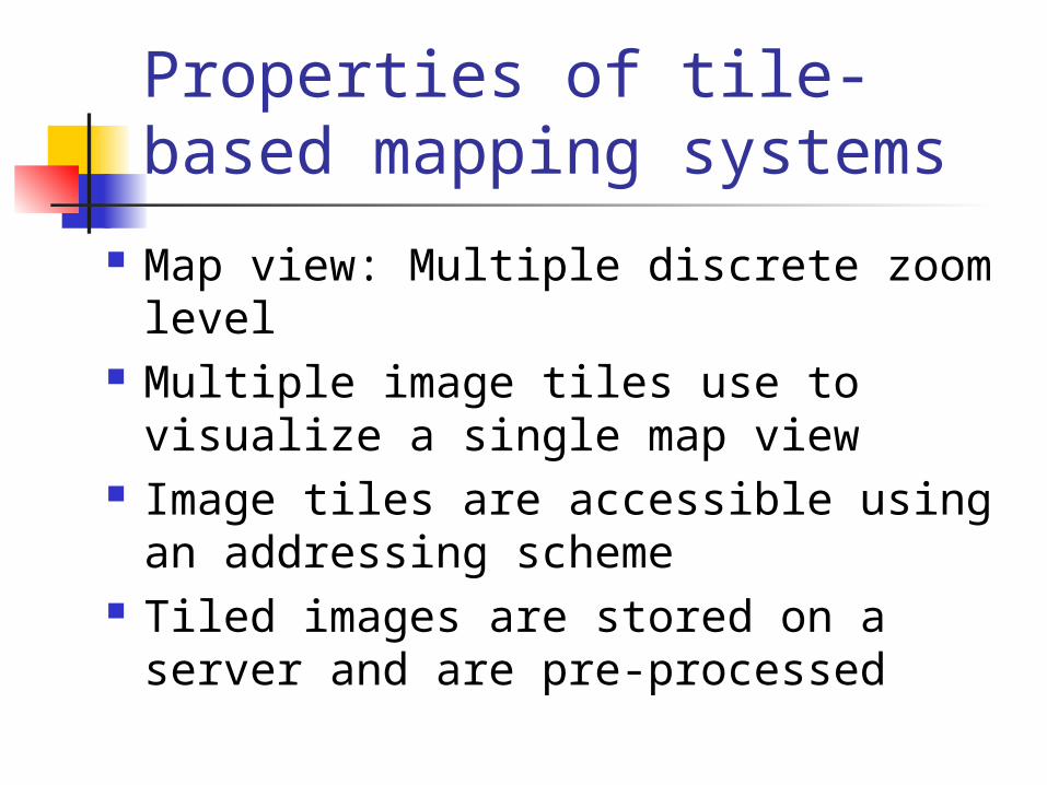
Properties of tile-based mapping systems
Map view: Multiple discrete zoom level Multiple image tiles use to visualize a
single map view Image tiles are accessible using an
addressing scheme Tiled images are stored on a server and
are pre-processed
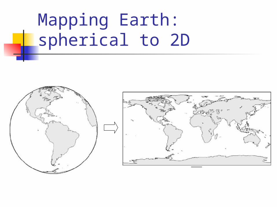
Mapping Earth: spherical to 2D
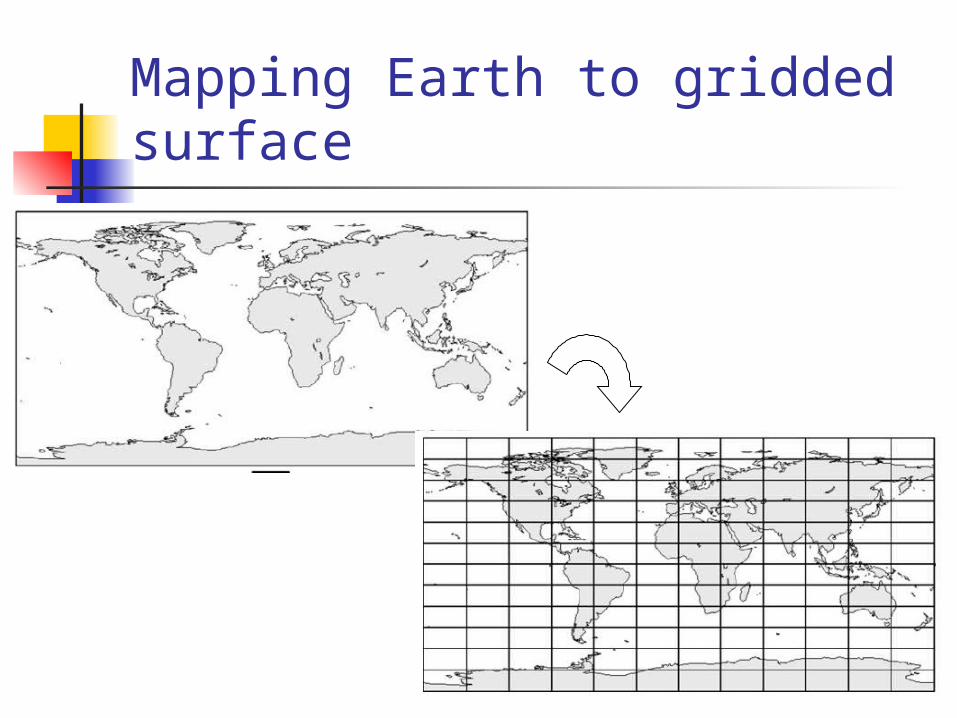
Mapping Earth to gridded surface
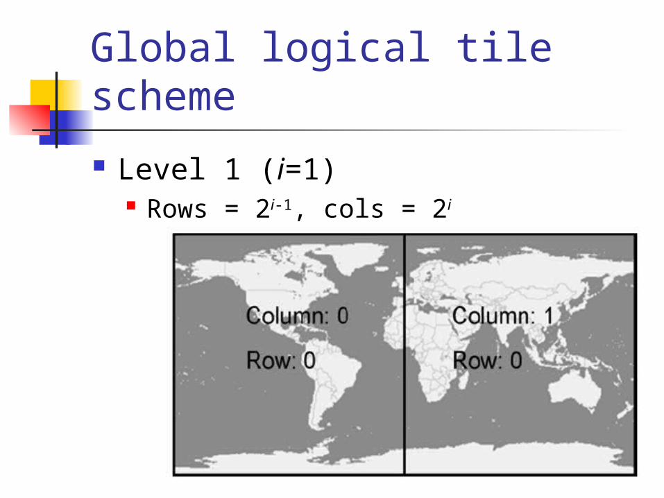
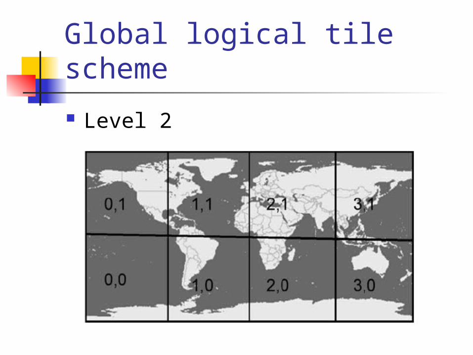
Global logical tile scheme
Level 1 (i=1) Rows = 2i-1, cols = 2i
Global logical tile scheme
Level 2
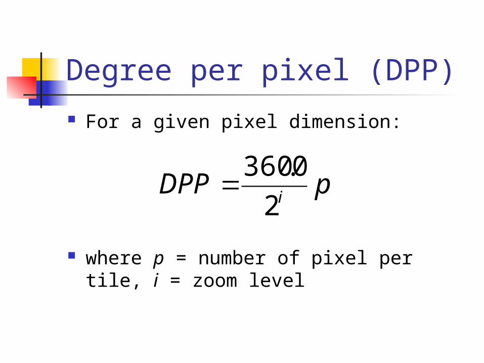
Degree per pixel (DPP) For a given pixel dimension:
where p = number of pixel per tile, i = zoom level
pDPPi2
0.360
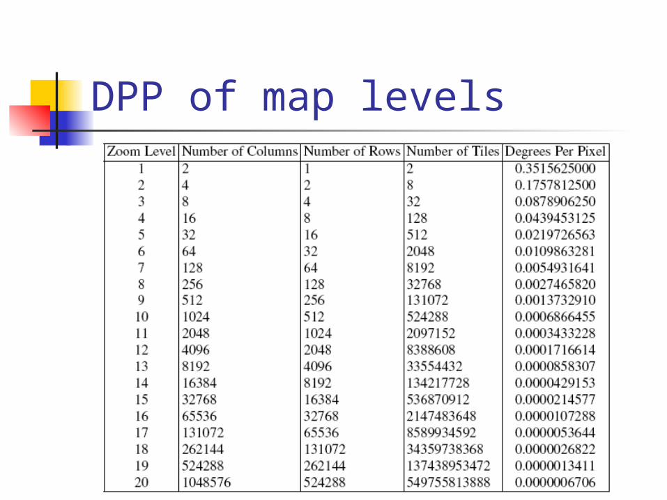
DPP of map levels
Open source mapping solutions
Server-side: MapServer Client-side: OpenLayers Server+Client solutions: GeoMajas,
GeoMoose, MapBender, MapFish, MapGuide
Reference: http://www.osgeo.org
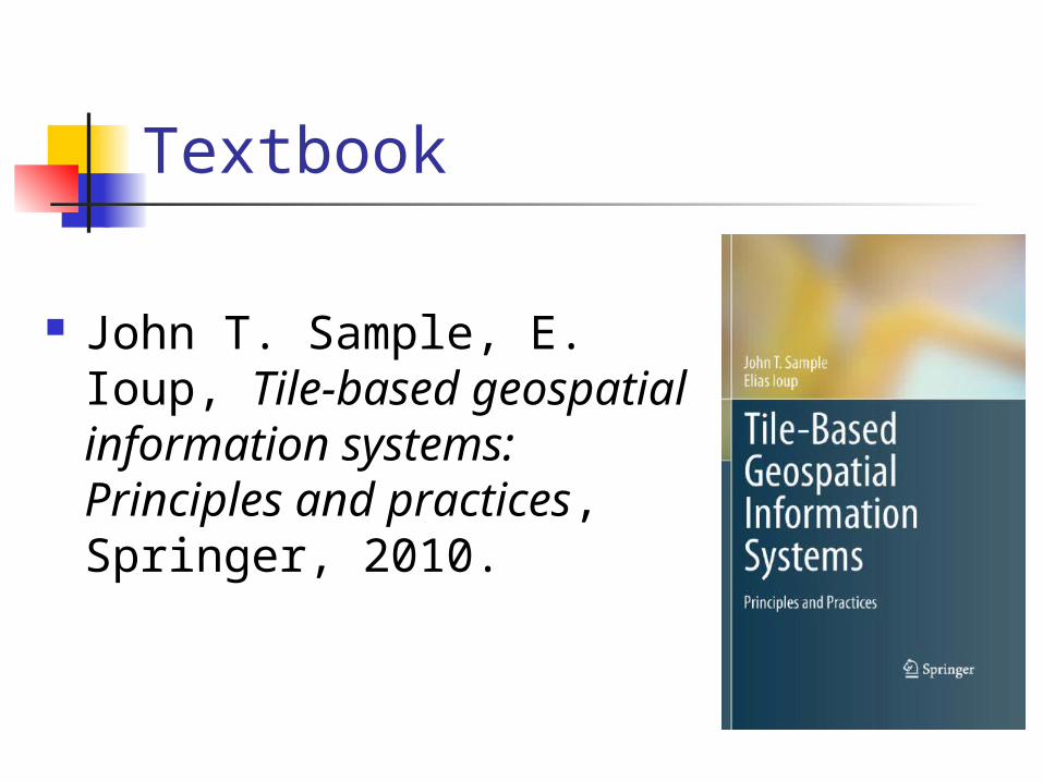
Textbook
John T. Sample, E. Ioup, Tile-based geospatial information systems: Principles and practices, Springer, 2010.
Chapters to read Chapter 3: Tiled mapping clients (W3) Chapter 5: Image tile creation (W5) Chapter 6: Optimization of tile creation
(W5) Chapter 7: Tile storage (W7) Chapter 8: Practical tile storage (W7) Chapter 9: Tile serving (W9) Chapter 11: Tile creation using vector
data (W11) Reference: Chapter 10 – Map projection
Requests
Read the listed chapters Investigate one of the following
package: GeoMajas, GeoMoose, MapBender, MapFish, MapGuide and mapping their real solution to the chapters you have read
Requests
Reorganize what you read, investigated and write as a technical report less than 20 A4 pages
Use vector data downloaded from OpenStreetMap as input for your tile-based map solutions to run your own demonstration
Grading
Report Solution demonstration Presentation
Software demonstration
OSGeo Live: http://live.osgeo.org More information:
http://www.osgeo.org