An Introduction to
OpenStreetMap
Mele Sax-Barnett State of the Map US 2014

OpenStreetWhat? � http://www.osm.org � OpenStreetMap or OSM � Not “Open Street Maps” � Founded in 2004 � Worldwide and seamless � “Wikipedia of Maps”
� Editable by anyone with an account
OpenStreetMap Basics

So, what is it really?
OpenStreetMap Basics
� It’s a very large database of XML data � Each feature is of a certain basic type, and
is defined by tags (key value pairs) � Basic types:
� Nodes (points) � Ways (lines) � Areas (polygons) � Relations (groups)
� Example tags: � highway = primary, bridge = yes

What is it not?
OpenStreetMap Basics
� A rendered map that uses particular cartography, whether for web or paper.
� Proprietary—anyone can use it for free as long as they provide proper credit
� Something static—it changes and grows all the time
� Controlled by an authority—it is driven and maintained by a large community of contributors and data consumers

Who uses OpenStreetMap? � http://switch2osm.org
OpenStreetMap Basics

What kind of things can you find in OpenStreetMap?
OpenStreetMap Basics
� Roads, highways, bridges, and tunnels � Bus stops, bus routes, bike routes, and railways � Businesses: shops, restaurants, bars � Buildings: schools, churches, houses � Parks, lakes, mountains, and even trees � Airports, power networks, and mailboxes � Administrative boundaries � Almost anything that stays the same for a while,
see http://wiki.osm.org for more

How did all this data get there?
� In the United States: 2007 TIGER data import http://wiki.openstreetmap.org/wiki/TIGER
� Other imports of open data � Around the world: lots of people uploading and
tidying up GPS tracks � More recently, tracing aerial imagery (Bing gave
special permission for contributors to use its aerials) � Local knowledge � A real person put it there, and other people have
looked at it and confirmed that it is correct � Challenge: data maintenance
OpenStreetMap Basics

What does it look like? OSM.org default
MapBox (terrain)
Stamen Design
MapQuest
OpenStreetMap Basics

What does it look like?
OpenStreetMap Basics
openstreetmap.org data view

What does it look like?
OpenStreetMap Basics
iD editor

What does it look like?
OpenStreetMap Basics
JOSM editor

OSM data
OpenStreetMap Basics
JOSM iD

Taking the next step: Editing OpenStreetMap
Editing Basics
http://www.openstreetmap.org/user/tyr_asd/diary/19549

How do you edit OSM?
1. Sign up for an account
2. Choose one of several free and open source editors
� iD and JOSM are popular
� Examples here will use iD, a new in-browser editor
iD JOSM
Editing Basics

Step 1: Sign up for an account
� Go to http://osm.org � Click the “Sign Up” link
in the top right corner
� Set up your account!
Editing Basics

Step 2: Where and what
� Congratulations! You are now the owner of one of > 1.5 million OSM editing accounts!
� Go back to http://osm.org � Find a neighborhood that you
know well � Think about the places that
you know about there - local knowledge
� Notice anything missing?
Editing Basics

Step 3: Getting started with iD
� Start familiarizing yourself with iD: � Select Edit -> Edit with iD � Go through the walkthrough
Editing Basics

Step 3: Getting started with iD
� After the walkthrough: � Click things to see how
they’re classified � Don’t worry, you can’t
break anything until you click “Save”
� Click the magnifying glass to search for a city or place
� Or, click the arrow to find your current location
Editing Basics

Step 3: Getting started with iD
� Changing the background imagery � Adjust brightness � Lots of imagery
choices � TIGER data overlay � Custom/local files and
imagery � Adjust alignment
Editing Basics

Step 4: Change something
� But first, what’s your source? � Don’t copy from other maps � Local knowledge is best, but a dataset with the
correct license and permissions can be a source � You even need permission for aerial imagery
(imagery included in OSM editors is OK) � More info about the OpenStreetMap license
(OdBL) can be found at http://www.openstreetmap.org/copyright
Editing Basics

Step 4: Change something � Let’s say a road will be closed for construction for
a long period of time � Select it, click the triangle to show all tags
Editing Basics
Change from
highway=secondary to
highway=construction and
construction=secondary

Step 5: Save your edits
Editing Basics
� Save early, save often � This creates a
“changeset” that is sent to the database
� Give an informative changeset comment that includes what you were working on and your sources
� What imagery are you using?

Step 6: View your edits
Editing Basics
� Click “View on OSM” (or go to http://osm.org)
� Hold down Ctrl while clicking refresh to clear your browser’s cache of map tiles (shift-refresh with Firefox)
� Should be updated within a few minutes
Ctrl +

More about editing
Editing Basics
� JOSM (Java OpenStreetMap Editor) is another very good editor � Powerful and not too hard to learn, especially if
you’re familiar with GIS software � Allows you to toggle multiple layers of data and
imagery on and off � http://josm.openstreetmap.de/ � http://learnosm.org
� Visit http://wiki.osm.org for tagging help, or ask on the newbies listserv http://lists.openstreetmap.org/listinfo/newbies
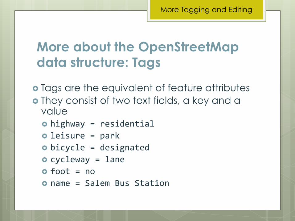
More about the OpenStreetMap data structure: Tags
� Tags are the equivalent of feature attributes � They consist of two text fields, a key and a
value � highway = residential � leisure = park � bicycle = designated � cycleway = lane � foot = no � name = Salem Bus Station
More Tagging and Editing

More about the OpenStreetMap data structure: Nodes
� Nodes: � A node/point can
be used to mark a particular place on the map
� For example, a bus stop may be marked using a node tagged with highway = bus_stop
More Tagging and Editing

More about the OpenStreetMap data structure: Ways
� Ways: � A way is a line
feature, made up of two or more connected nodes
� For example, a freeway would be a way tagged with highway = motorway
More Tagging and Editing

More about the OpenStreetMap data structure: Areas
� Areas: � An area is a
closed way � For example, a
plaza would be an area tagged with highway = pedestrian and area = yes Tags that can apply to ways or areas, like highway
= pedestrian, may also require an area = yes tag
More Tagging and Editing

More about the OpenStreetMap data structure: Relations
� Relations: � Groups of nodes, ways, or areas � Types:
� Route: includes interstate routes, cycling routes, and bus routes
� Multipolygon: areas with multiple parts or holes � Boundary: for administrative boundaries � Restriction: to describe turn restrictions
More Tagging and Editing

OSM peculiarities to keep in mind
� Most keys and values should not be capitalized (the only exceptions are values for the “name” key)
� Avoid using abbreviations of any kind � If a key must have two values, separate
them with a semicolon
More Tagging and Editing

More OSM peculiarities
� Street names should be what you see on the street sign, but expand the abbreviation
� Highways may also have ref codes, which are not the same as the name � For example, I5 is known by many names
(Robert Hugh Baldock Freeway, etc.) but it is always ref = I 5
� On and off ramps and service roads are generally unnamed
� Separated roadways should be mapped as separate ways in OpenStreetMap
More Tagging and Editing

� Does this street actually go through and connect to this other street?
� Adding new streets and paths that are missing
� Keeping up to date on prolonged closures due to construction projects is important for routing
� Directionality (one_way = yes)
Topology/Connectivity
More Tagging and Editing

Topology/Connectivity
� Bridges and tunnels � Only connect them to other features according to
reality (ok if they overlap other features)
� bridge = yes � tunnel = yes � Associated layer tags:
� layer = 0 is implied, ground level
� layer = 1 is the next layer up
� layer = -‐1 is the next layer down
� Continue incrementing up/down as needed
More Tagging and Editing

Highway classification
� highway = � motorway: freeway
� trunk: not an official freeway, but bicycles and pedestrians not usually allowed
� primary: major arterial
� secondary: secondary arterial
� tertiary: yellow centerline
� residential: no centerline
� service: often unnamed driveway or alley
� http://wiki.openstreetmap.org/wiki/Highway
More Tagging and Editing

Highway classification
� _links, for instance, motorway_link: � Defined by the highest-classification roadway it connects to
� Unnamed links between named roadways
� Highways are for pedestrians and bicycles too � footway: primarily for foot traffic
� cycleway: primarily for bicycle traffic
� path: for both foot and bike traffic
� pedestrian: wider way for pedestrian and bicycle traffic, occasional service vehicles
� http://wiki.openstreetmap.org/wiki/Highway
More Tagging and Editing

Access tags
� access = no : nobody can go there (unless you also add exceptions)
� access = private : only allowed if you are ending or beginning the trip there
� bicycle = yes : for places they’re not usually allowed, like motorways and trunks
� bicycle = designated � foot = no � psv = designated, bus = yes � http://wiki.openstreetmap.org/wiki/Access
More Tagging and Editing

Turn restrictions
� Relations that say you can or cannot go from one way to another via a particular node
� A “type”: no_right_turn, no_left_turn, no_u_turn, no_straight_on, only_right_turn, only_left_turn, only_straight_on
� A “from” way, a “via” node, and a “to” way
� Can except or apply to only certain kinds of vehicles or bicycles
� http://wiki.openstreetmap.org/wiki/Turn_restrictions
More Tagging and Editing

Bicycle facilities
� cycleway = lane : bike lane
� cycleway = opposite_lane : bike lane going against traffic (for one way streets)
� cycleway = shared_lane : sharrows
� cycleway = share_busway : shared bike/bus lane
� cycleway:right = lane, cycleway:left = shared_lane : for when different sides of the street have different facilities
� http://wiki.openstreetmap.org/wiki/Cycleway
More Tagging and Editing

Resources
� http://www.openstreetmap.org/help � http://wiki.osm.org � http://help.osm.org � Ask on the newbies listserv:
http://lists.openstreetmap.org/listinfo/newbies
More Tagging and Editing

More resources � QA tools:
� http://wiki.openstreetmap.org/wiki/Quality_assurance � Keep right: http://keepright.ipax.at/ � Notes: http://wiki.openstreetmap.org/wiki/Notes
More Tagging and Editing

Practice time!
1. Try adding a new walkway or road, and make sure you
connect it to the surrounding features correctly
2. Try changing a road classification or adding a bike lane tag
3. See if you can figure out how to split or orthagonalize a
feature, or change the direction of a way
� You can always re-run the iD walkthrough or look at the
manual (behind the book icon) if you forget how to do
something
� http://wiki.openstreetmap.org/wiki/ID
� http://wiki.openstreetmap.org/wiki/ID/Shortcuts
Try it!

Getting Data Back Out of OpenStreetMap
Getting the Data Back Out

Nodes
OpenStreetMap Data

OpenStreetMap Data
Ways: groups of nodes

OpenStreetMap Data
� They contain the same node twice, once at the start and once at the end
Areas: closed ways

OpenStreetMap Data
� Various types, for example, a route:
Relations: groups of nodes and ways

Before you begin: Think about what you want to do
� Let’s assume we want to use OSM data for cartography � What are you making? A web map? A print map? � What software do you want to use to make it? � What formats can that software use? Do you prefer to work
with certain data formats? � What is your geographic extent? � Which features do you want to show? Everything? Only the
highways? Only the coffee shops? Only a few select features?
� How often do you want to update your map?
Using OSM Data

Step 1: Get the raw data
� http://wiki.osm.org/wiki/Downloading_data
� Small areas and individual features from the OSM website � http://www.osm.org � “Export” button
Using OSM Data

Step 1: Get the raw data
� From a standalone OSM editor: � JOSM
� Just download and save, or use “Download from OSM mirror” or “Download from Overpass API” for large areas
� QGIS 2.0+ � Plugin for earlier
versions
Using OSM Data

Step 1: Get the raw data � Download large areas from various places, free or at cost:
� “The planet”, countries, cities, etc. � APIs: http://wiki.openstreetmap.org/wiki/Xapi ,
http://wiki.openstreetmap.org/wiki/Overpass_API � http://download.geofabrik.de/ � http://osmdata.thinkgeo.com/ � http://metro.teczno.com/ � http://download.bbbike.org/osm/ � http://market.weogeo.com/ � Some of it is already in shapefile format, but it might not
have exactly what you’re looking for � Remember to check the date
Using OSM Data

Step 2: Process the data � There are an ever-increasing number of tools and
scripts that you can use � Many of them involve using the command line � I will go over some popular options, and two use
cases in detail � Full list at https://github.com/pdxmele/gwyw-osm
Using OSM Data

Using OSM Data
Product Local Storage
Tool selection Source
OSM
Lots of data Database Web map
Print map
Limited data Flat file Web map
Print map .shp .geojson …
PostgreSQL/ PostGIS SQLite/SpatiaLite …
Osmium osm2pgsql Imposm ogr2ogr ...
QGIS osm-and-geojson …
Planet Country/city extracts BBOX queries ...
More at https://github.com/pdxmele/gwyw-osm

Use case 1: Web map with TileMill
� Can use both flat files and databases � Shapefile, GeoJSON � PostGIS, SQLite
� This means it can work for both creating a complete basemap from scratch, or for layering a number of features on another basemap
� This use case: make a custom bike map of a city
Using OSM Data

Use case 1: Web map with TileMill
1. Download the metro area with JOSM’s mirrored download plugin and save as a .osm file
2. Use osm2pgsql to import the data into a PostGIS database, customizing the style file to include specialized tags
3. In TileMill, add the layer by connecting to the “planet_osm_line” table
4. Style with CartoCSS 5. Upload to MapBox or host on your own 6. Update easily by downloading the same bounding
box, running the same osm2pgsql command, and dropping it into TileMill with the same styling
Using OSM Data

Use case 2: Leaflet POI web map
� Leaflet works nicely with GeoJSON � Let’s say we want to show all of the coffee shops and
bars in an area � Download the data with your preferred method � Open it in QGIS and select only the features you want
Using OSM Data

Use case 2: Leaflet POI web map
� Save the selected features out as a .geojson file � Include the GeoJSON in your Leaflet map by your
preferred method
Using OSM Data

So, you say you want to process the planet
� Pack your patience – it can easily take months to find the method that works for you, fiddle with settings, and get all of the resources you will need ready
� Ask for help from the mailing lists and OSM/GIS help sites when you need it � http://help.osm.org � https://lists.openstreetmap.org/listinfo � https://lists.openstreetmap.org/listinfo/newbies � https://lists.openstreetmap.org/listinfo/dev � http://gis.stackexchange.com/
Using OSM Data

Go for it—the data is yours!
� Your main resource for OSM tags (how to filter the data) is http://wiki.osm.org
� I’ve also made a list of common tag keys for you at https://github.com/pdxmele/gwyw-osm
� Please remember to credit the OSM contributors:
http://www.openstreetmap.org/copyright
� Questions? Twitter @pdxmele / saxbarm at gmail.com
Go For It!

The Future: Vector tiles
� TileMill 2 � “Slim enough to fit the entire world on a single USB stick” � http://www.mapbox.com/blog/vector-tiles/ � https://github.com/mapbox/tm2
� OSM vector tiles � Mapnik vector tiles:
http://openstreetmap.us/~migurski/vector-datasource/
The Future
Recommended


![[Schaum barnett rich] geometría](https://img.pdfslide.tips/doc/110x75/55c0d8a9bb61eb565e8b468f/schaum-barnett-rich-geometria.jpg)

![[barnett-rich]geometria(schaum) - CIMAT](https://img.pdfslide.tips/doc/110x75/62c3e30401e7b468403c323a/barnett-richgeometriaschaum-cimat.jpg)