Embed Size (px)
Citation preview
Spatial planning and monitoring of landscape interventionsUsing maps to link people to their landscapes
Chris Planicka, EcoAgriculutre PartnersRegional Knowledge ExchangeAICAD, KenyaJune 3, 2015
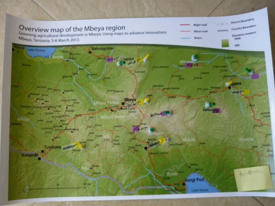
Steps in the process
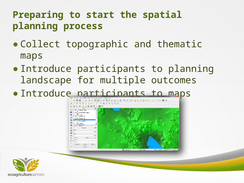
Preparing to start the spatial planning process
●Collect topographic and thematic maps●Introduce participants to planning
landscape for multiple outcomes ●Introduce participants to maps
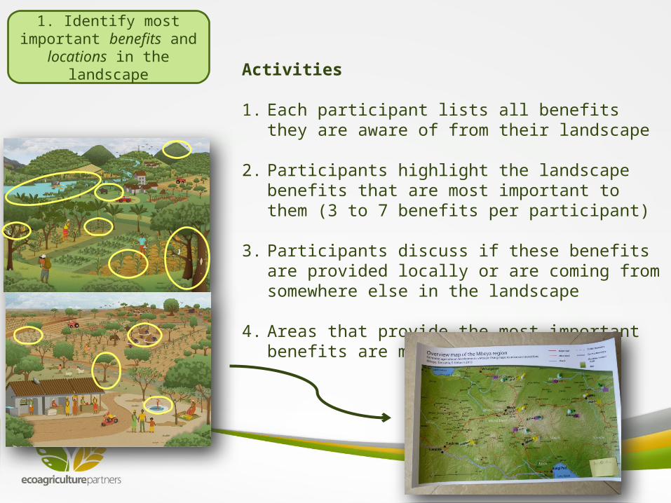
1. Identify most important benefits and locations in the
landscape Activities
1. Each participant lists all benefits they are aware of from their landscape
2. Participants highlight the landscape benefits that are most important to them (3 to 7 benefits per participant)
3. Participants discuss if these benefits are provided locally or are coming from somewhere else in the landscape
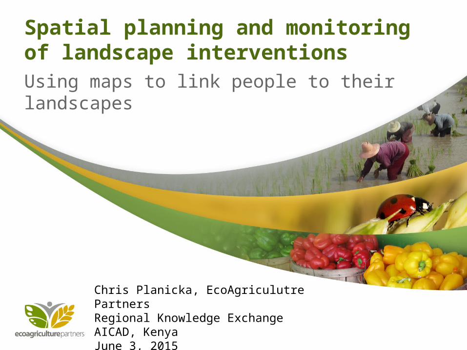
4. Areas that provide the most important benefits are marked on a map
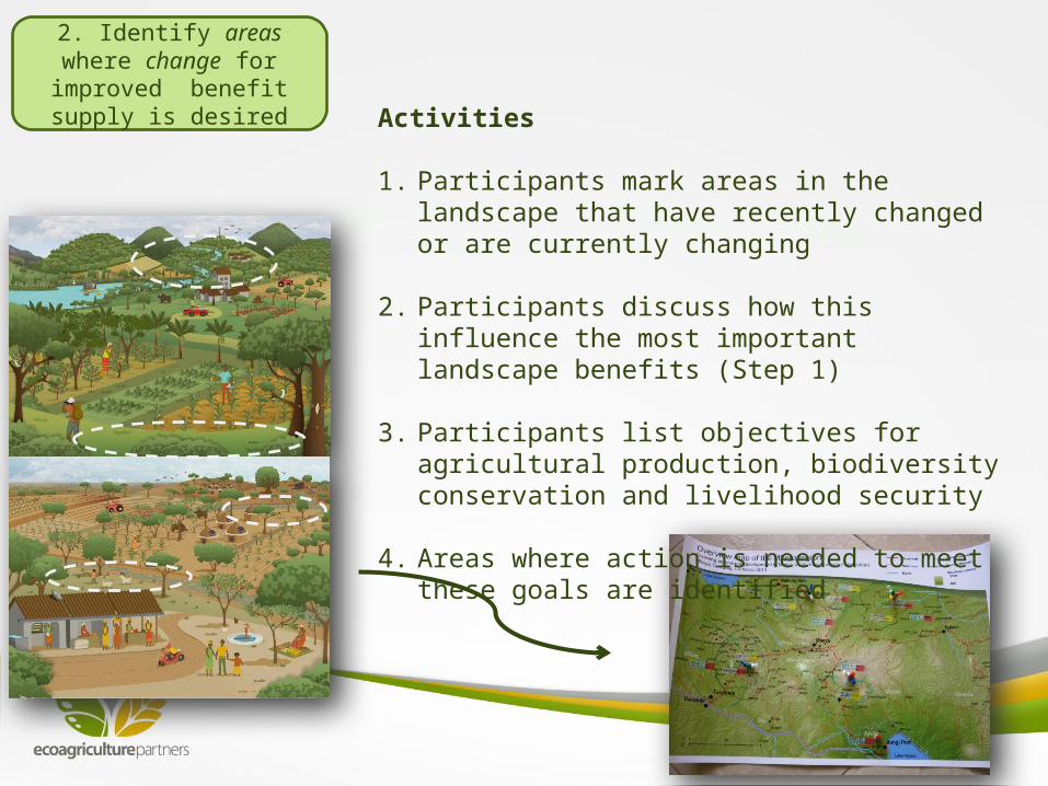
2. Identify areas where change for improved benefit
supply is desiredActivities
1. Participants mark areas in the landscape that have recently changed or are currently changing
2. Participants discuss how this influence the most important landscape benefits (Step 1)
3. Participants list objectives for agricultural production, biodiversity conservation and livelihood security
4. Areas where action is needed to meet these goals are identified
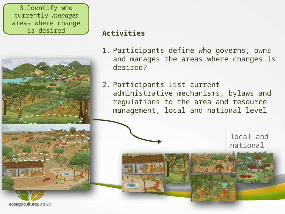
3.Identify who currently manages areas where change
is desiredActivities
1. Participants define who governs, owns and manages the areas where changes is desired?
2. Participants list current administrative mechanisms, bylaws and regulations to the area and resource management, local and national level
local and national Laws and
Regulations
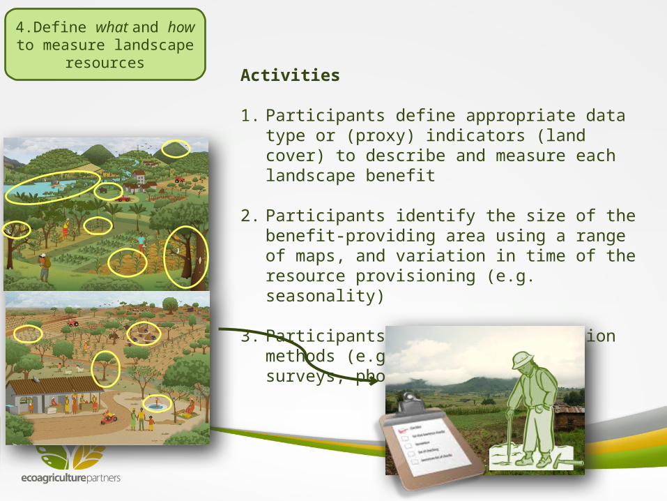
4.Define what and how to measure landscape resources
Activities
1. Participants define appropriate data type or (proxy) indicators (land cover) to describe and measure each landscape benefit
2. Participants identify the size of the benefit-providing area using a range of maps, and variation in time of the resource provisioning (e.g. seasonality)
3. Participants define data collection methods (e.g. field measures, surveys, photography)
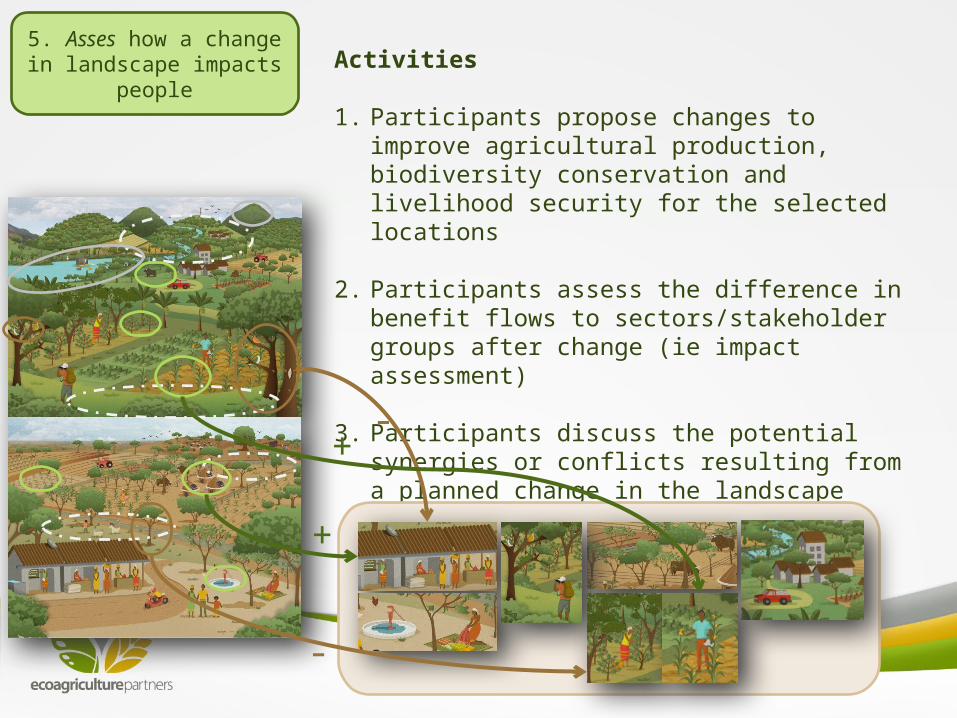
5. Asses how a change in landscape impacts people
Activities
1. Participants propose changes to improve agricultural production, biodiversity conservation and livelihood security for the selected locations
2. Participants assess the difference in benefit flows to sectors/stakeholder groups after change (ie impact assessment)
3. Participants discuss the potential synergies or conflicts resulting from a planned change in the landscape
-
-
+
+
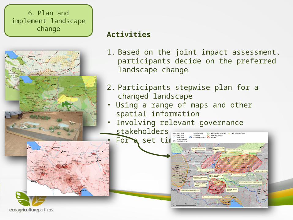
6. Plan and implement landscape change
Activities
1. Based on the joint impact assessment, participants decide on the preferred landscape change
2. Participants stepwise plan for a changed landscape • Using a range of maps and other spatial information • Involving relevant governance stakeholders• For a set time horizon
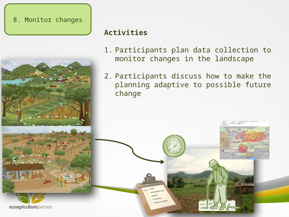
8. Monitor changes
Activities
1. Participants plan data collection to monitor changes in the landscape
2. Participants discuss how to make the planning adaptive to possible future change
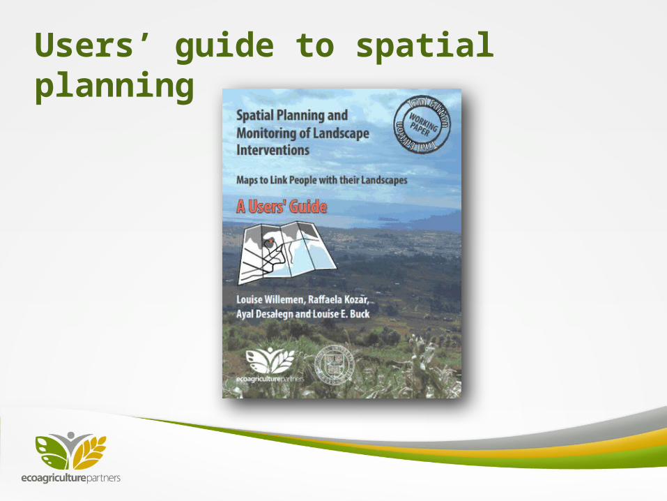
Users’ guide to spatial planning
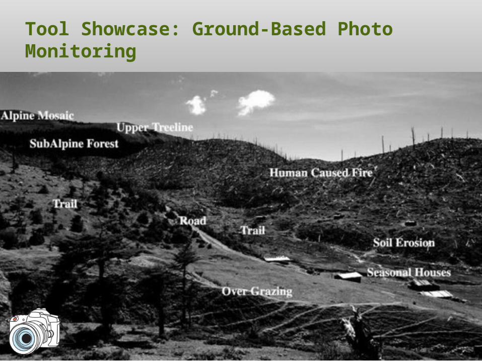
Tool Showcase: Ground-Based Photo Monitoring
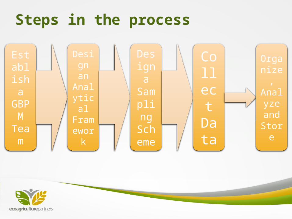
Steps in the process
Establish a
GBPM
Team
Design an
Analytical Framewor
k
Design a Samplin
g Scheme
Collect
Data
Organize, Analyze and Stor
e
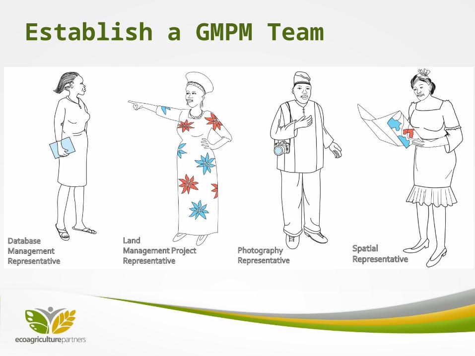
Establish a GMPM Team
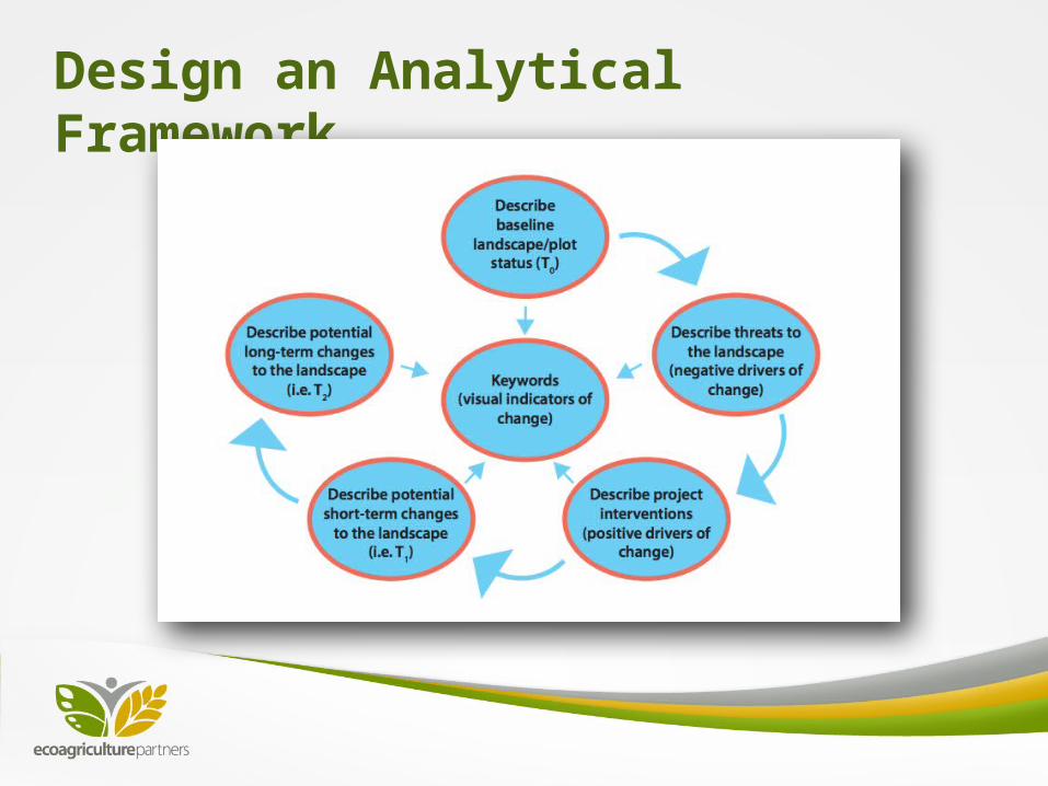
Design an Analytical Framework
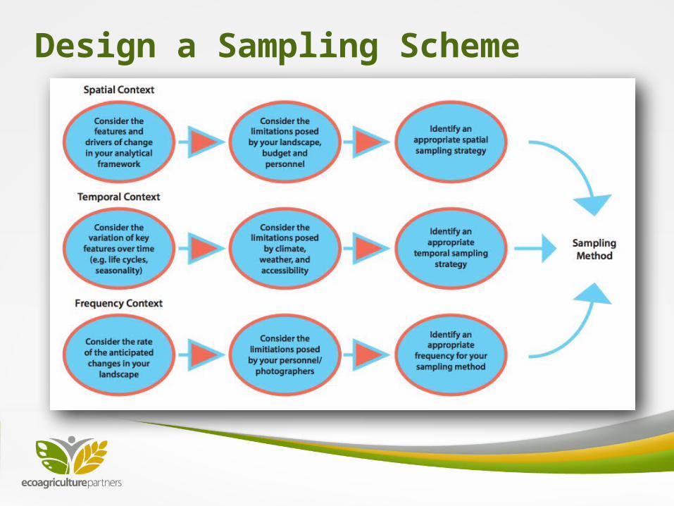
Design a Sampling Scheme
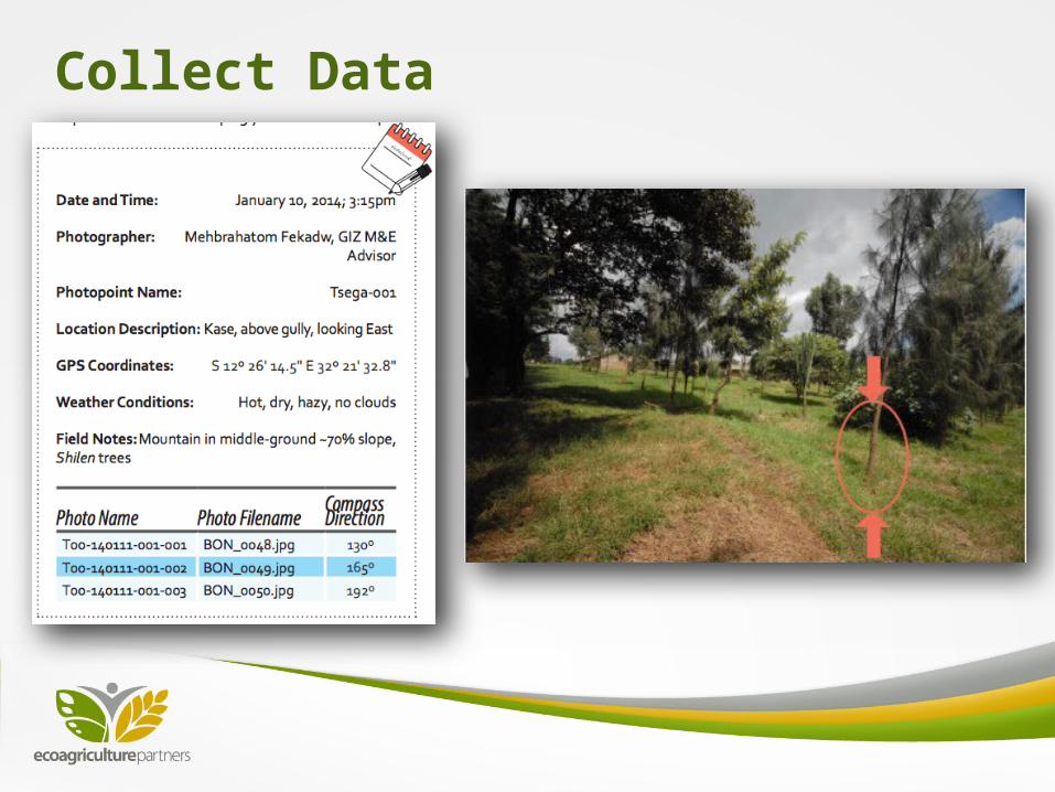
Collect Data
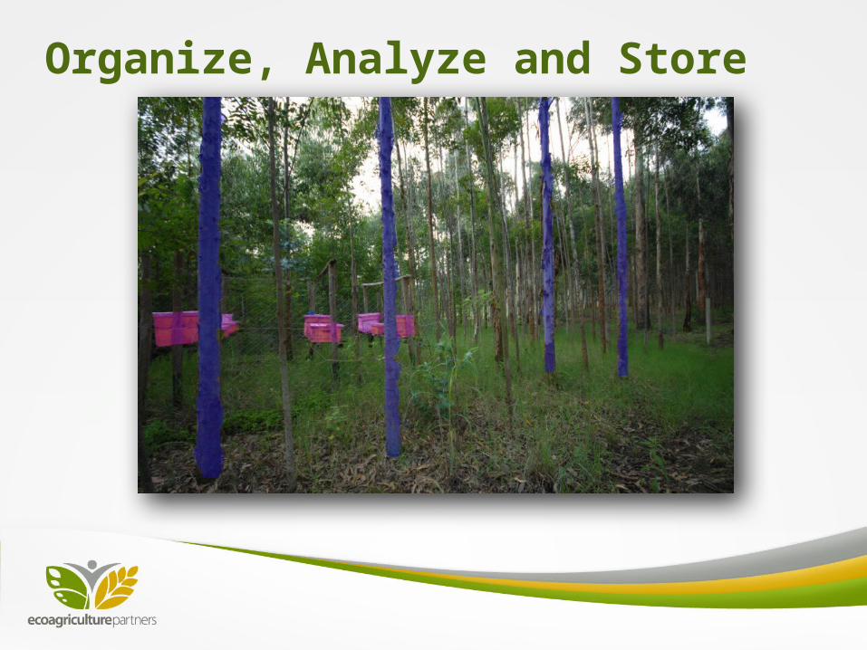
Organize, Analyze and Store