Embed Size (px)
Citation preview
<iframe src="//www.slideshare.net/slideshow/embed_code/45735748" width="476"
height="400" frameborder="0" marginwidth="0" marginheight="0" scrolling="no"></iframe>
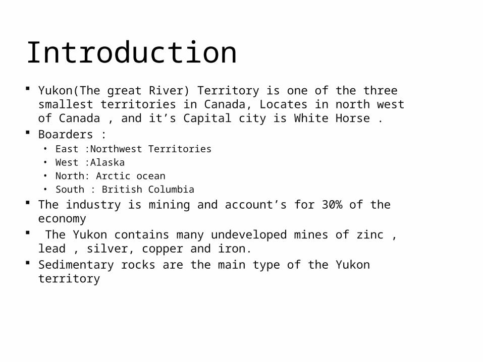
Introduction Yukon(The great River) Territory is one of the three smallest
territories in Canada, Locates in north west of Canada , and it’s Capital city is White Horse .
Boarders :• East :Northwest Territories• West :Alaska• North: Arctic ocean• South : British Columbia
The industry is mining and account’s for 30% of the economy The Yukon contains many undeveloped mines of zinc , lead ,
silver, copper and iron. Sedimentary rocks are the main type of the Yukon territory
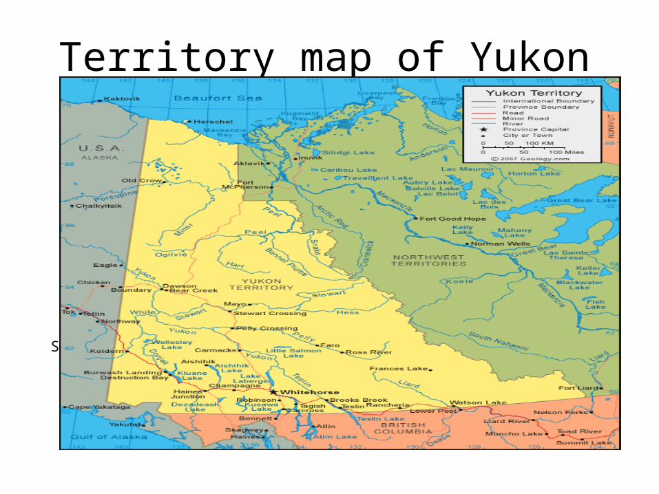
Territory map of Yukon
Source : http://geology.com/canada/yukon-territory.shtml
Over the last 190 million years , the area was affected by folding , faulting , metamorphism and uplifting which ended by stratigraphy of sedimentary units above a stable geological basement.
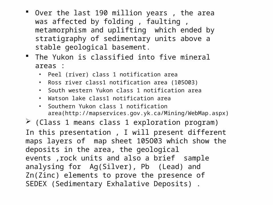
The Yukon is classified into five mineral areas :• Peel (river) class 1 notification area• Ross river class1 notification area (105O03)• South western Yukon class 1 notification area• Watson lake class1 notification area• Southern Yukon class 1 notification
area(http://mapservices.gov.yk.ca/Mining/WebMap.aspx) (Class 1 means class 1 exploration program)In this presentation , I will present different maps layers of map sheet 105O03 which show the deposits in the area, the geological events ,rock units and also a brief sample analysing for Ag(Silver), Pb (Lead) and Zn(Zinc) elements to prove the presence of SEDEX (Sedimentary Exhalative Deposits) .
Yukon Classified Mineral Area
Source : http://mapservices.gov.yk.ca/Mining/WebMap.aspx
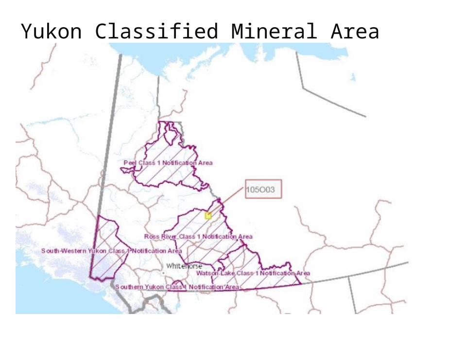
The Google Erath map shows the young belt of Cordi llera province which formed bi ll ion years ago .Map sheet 105O03 location is :Lat.: 63.1347 Long.: -131.2661 (Earth Google)Basin : Selwyn Basin : undeveloped districts and contains massive sulphides
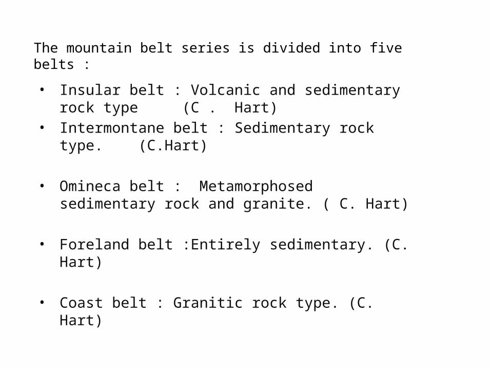
The mountain belt series is divided into five belts :
• Insular belt : Volcanic and sedimentary rock type (C . Hart)
• Intermontane belt : Sedimentary rock type. (C.Hart)
• Omineca belt : Metamorphosed sedimentary rock and granite. ( C. Hart)
• Foreland belt :Entirely sedimentary. (C. Hart)
• Coast belt : Granitic rock type. (C. Hart)
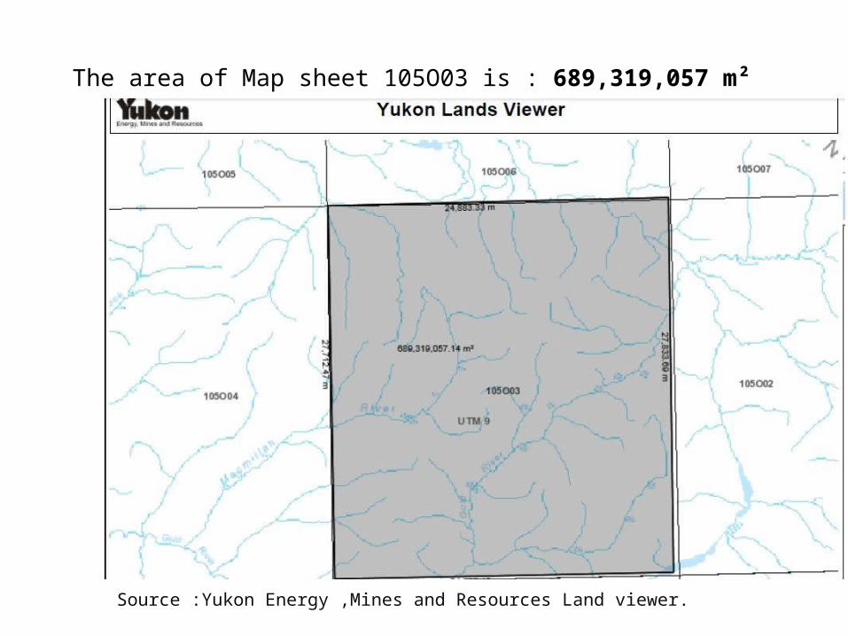
The area of Map sheet 105O03 is : 689,319,057 m²
Source :Yukon Energy ,Mines and Resources Land viewer.
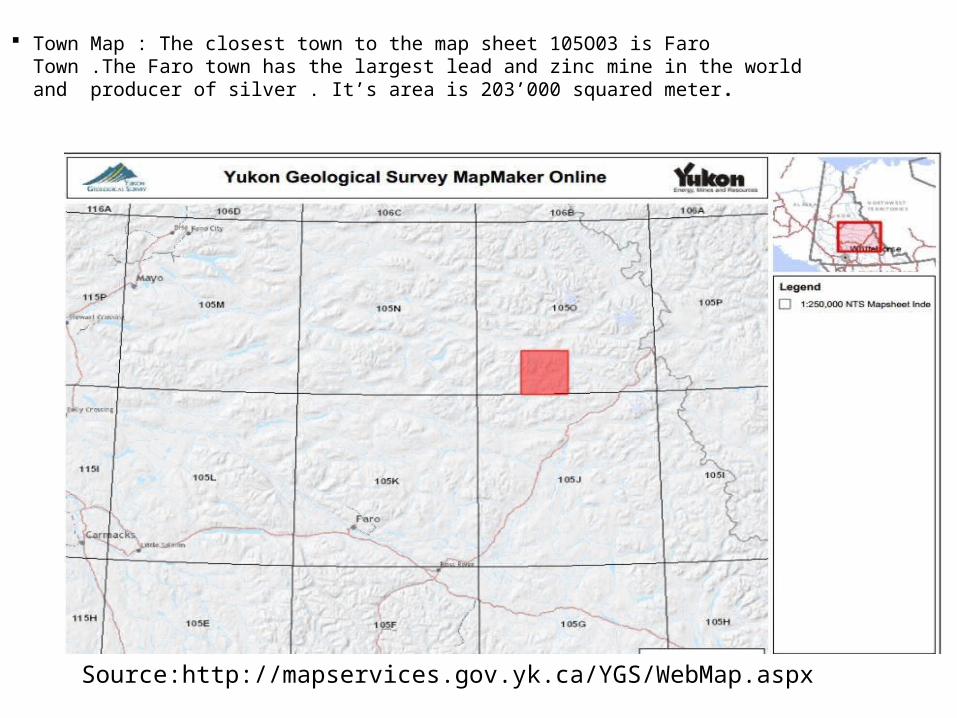
Town Map : The closest town to the map sheet 105O03 is Faro Town .The Faro town has the largest lead and zinc mine in the world and producer of silver . It’s area is 203’000 squared meter.
Source:http://mapservices.gov.yk.ca/YGS/WebMap.aspx
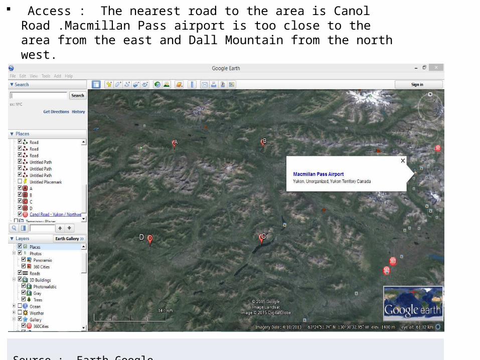
Access : The nearest road to the area is Canol Road .Macmillan Pass airport is too close to the area from the east and Dall Mountain from the north west.
Source : Earth Google
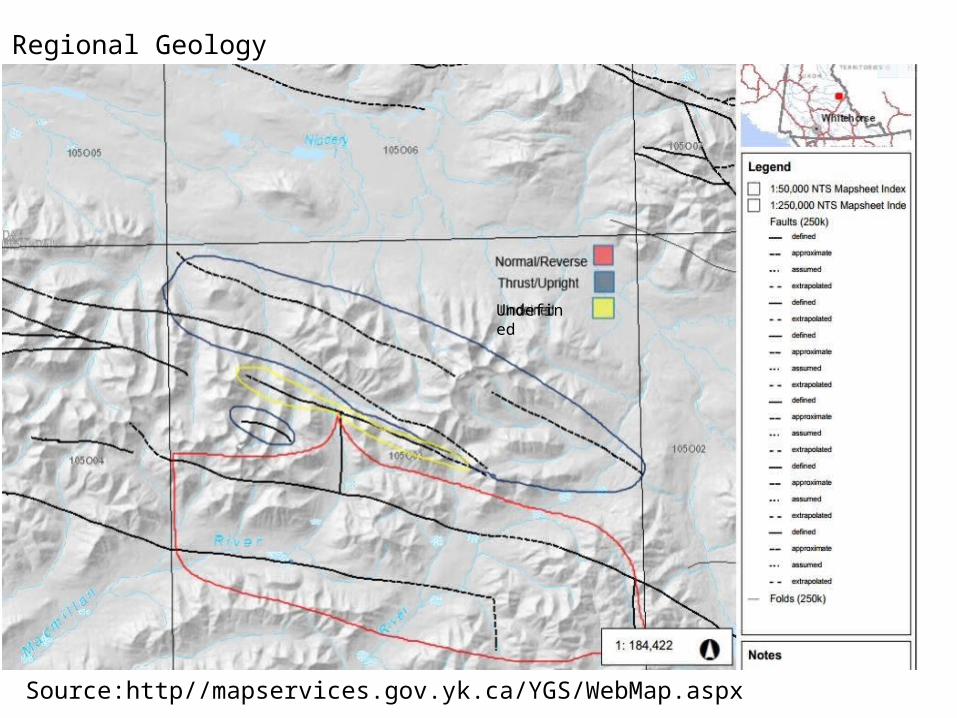
Regional Geology
Source:http//mapservices.gov.yk.ca/YGS/WebMap.aspx
Undefined
The area has two types of Faults :1) Normal/ reverse faults in the lower part.2) Thrust/ upright faults in the upper part.
Tectonic activity result in faults is very important for SEDEX deposits formation.
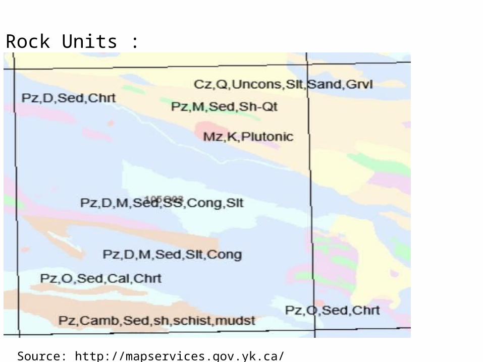
Rock Units :
Source: http://mapservices.gov.yk.ca/
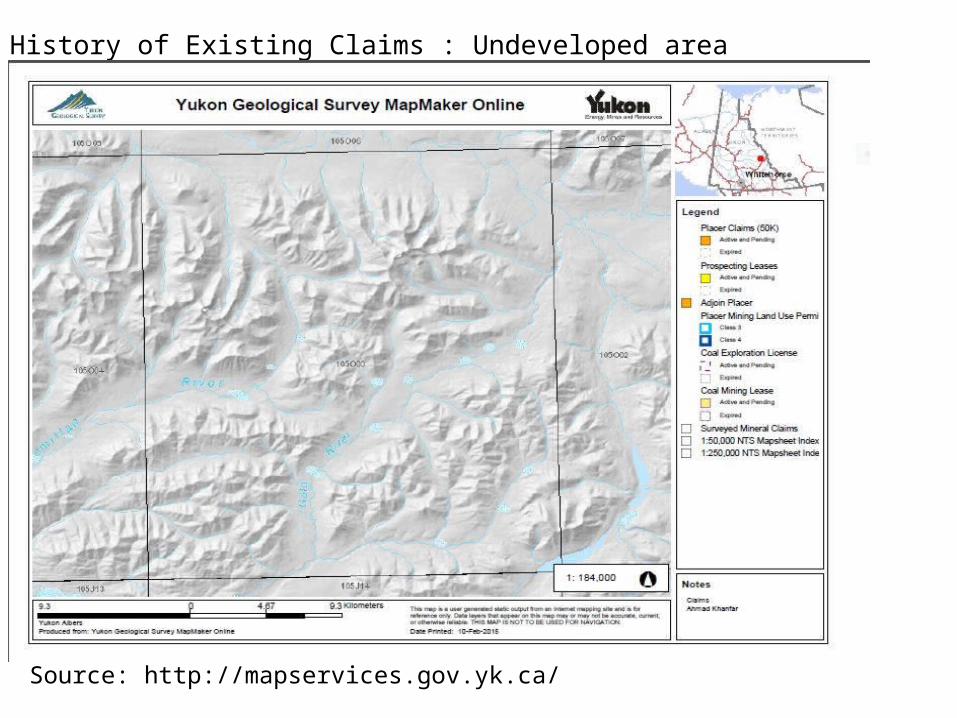
History of Existing Claims : Undeveloped area
Source: http://mapservices.gov.yk.ca/
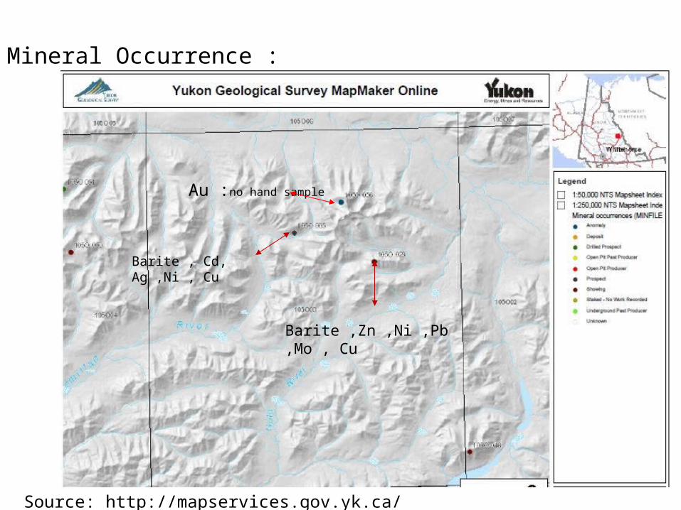
Mineral Occurrence :
Au :no hand sample
Barite ,Zn ,Ni ,Pb ,Mo , Cu
Barite , Cd, Ag ,Ni , Cu
Source: http://mapservices.gov.yk.ca/
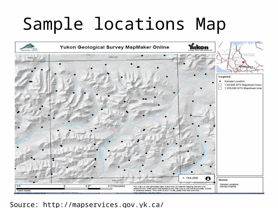
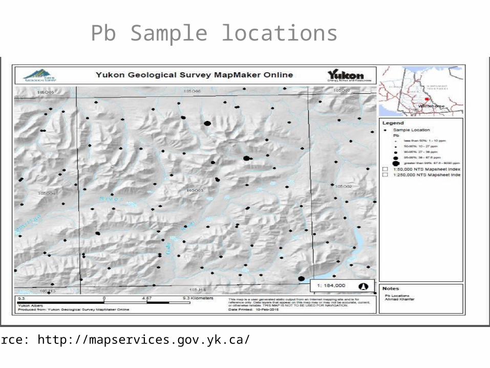
Sample locations Map
Source: http://mapservices.gov.yk.ca/
The drainage pattern in the area is dendritic (common in river ,streams and lakes)Majority of the samples were collected from the river and the distributary.
In the area , there are deposits of Silver ,Lead and Zinc . The Selwyn basin main types of deposits are is the
SEDEX deposits. The tonnage of deposits in Selwyn basin over 9’283’700
tones are as follows:• Ag 69.4 g/t• Pb 7.5%• Zn 6.2%• Cu 1.81% over 8’510’000 tones (http://
www.geology.gov.yk.ca/pdf/SelwynBasin.pdf)
Elements Tonnage By analyzing the data for the concentrations of
metals in map sheet 105O03 ,Silver , Lead ,Zinc and Copper, have the highest concentration and no concentration for Gold was detected .
The deposit type could be VMS or SEDEX.The tonnage value of Sliver is 69.4 g/t which is higher than in case if the sediment is VMS ( max 30g/t).
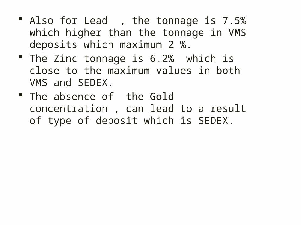
Also for Lead , the tonnage is 7.5% which higher than the tonnage in VMS deposits which maximum 2 %.
The Zinc tonnage is 6.2% which is close to the maximum values in both VMS and SEDEX.
The absence of the Gold concentration , can lead to a result of type of deposit which is SEDEX.
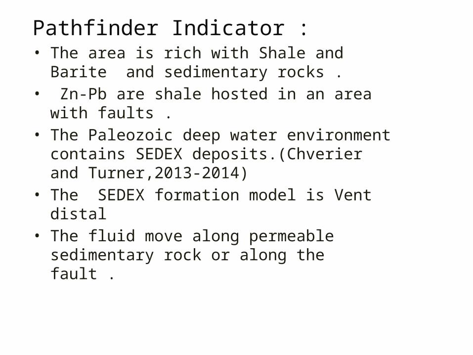
Pathfinder Indicator :• The area is rich with Shale and Barite and
sedimentary rocks .• Zn-Pb are shale hosted in an area with faults .• The Paleozoic deep water environment contains
SEDEX deposits.(Chverier and Turner,2013-2014)• The SEDEX formation model is Vent distal • The fluid move along permeable sedimentary rock or
along the fault .
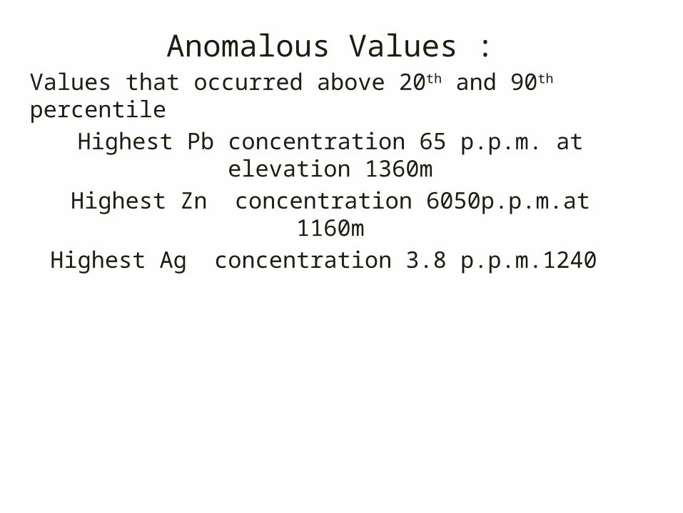
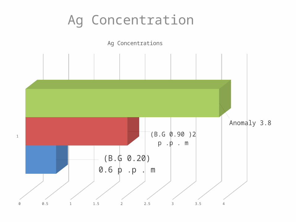
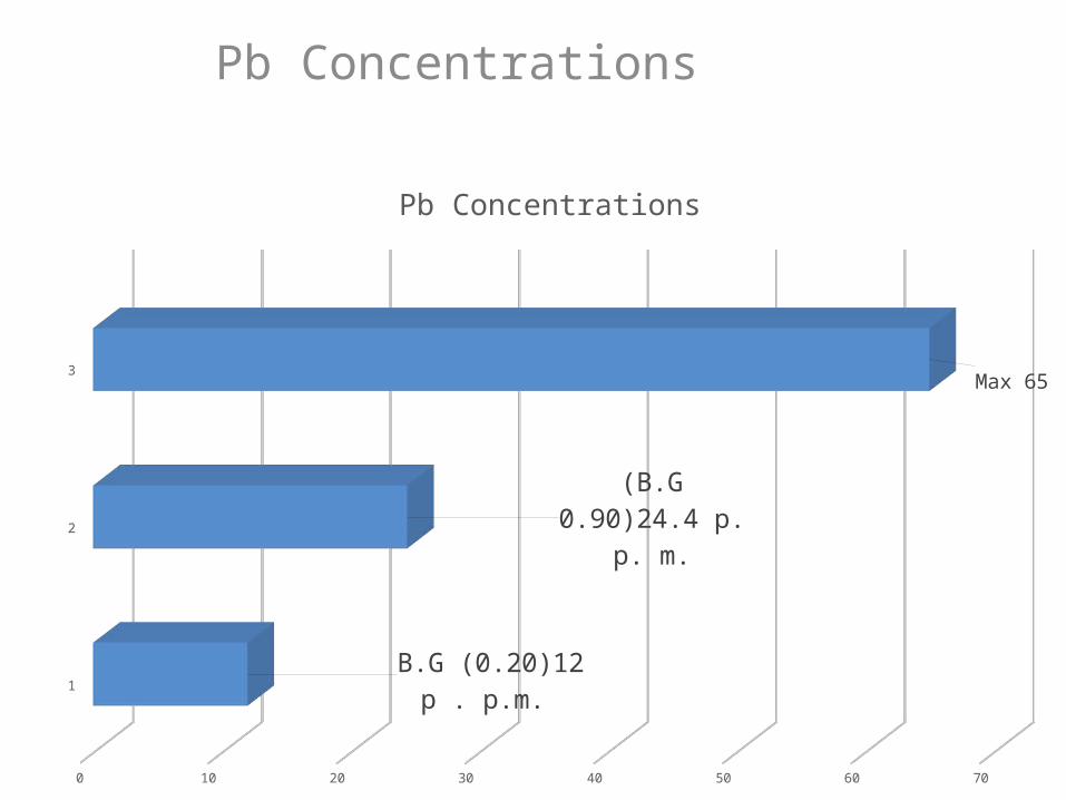
Anomalous Values :Values that occurred above 20th and 90th percentile
Highest Pb concentration 65 p.p.m. at elevation 1360mHighest Zn concentration 6050p.p.m.at 1160m
Highest Ag concentration 3.8 p.p.m.1240
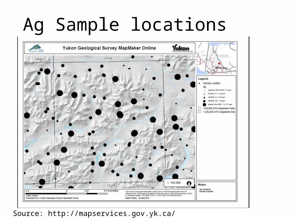
Ag Sample locations
Source: http://mapservices.gov.yk.ca/
Ag Concentration
1
0 0.5 1 1.5 2 2.5 3 3.5 4
(B.G 0.20) 0.6 p .p . m
(B.G 0.90 )2 p .p . m
Anomaly 3.8
Ag Concentrations
Pb Sample locations
Source: http://mapservices.gov.yk.ca/
Pb Concentrations
1
2
3
0 10 20 30 40 50 60 70
B.G (0.20)12 p . p.m.
(B.G 0.90)24.4 p. p. m.
Max 65
Pb Concentrations
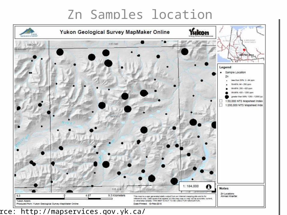
Zn Samples location
Source: http://mapservices.gov.yk.ca/
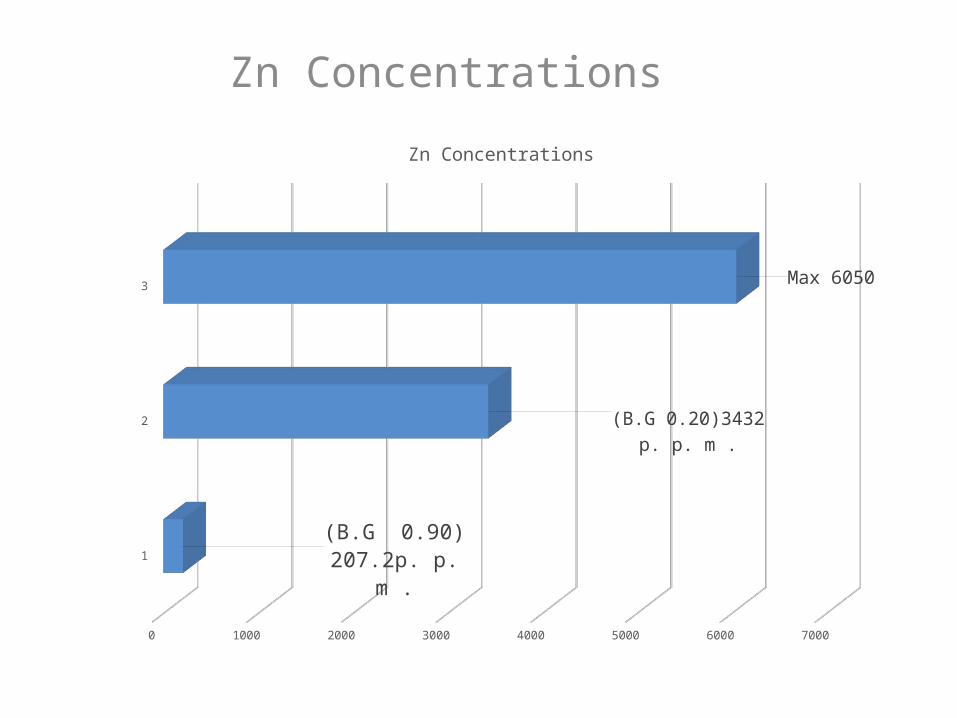
Zn Concentrations
1
2
3
0 1000 2000 3000 4000 5000 6000 7000
(B.G 0.90) 207.2p. p. m .
(B.G 0.20)3432 p. p. m .
Max 6050
Zn Concentrations
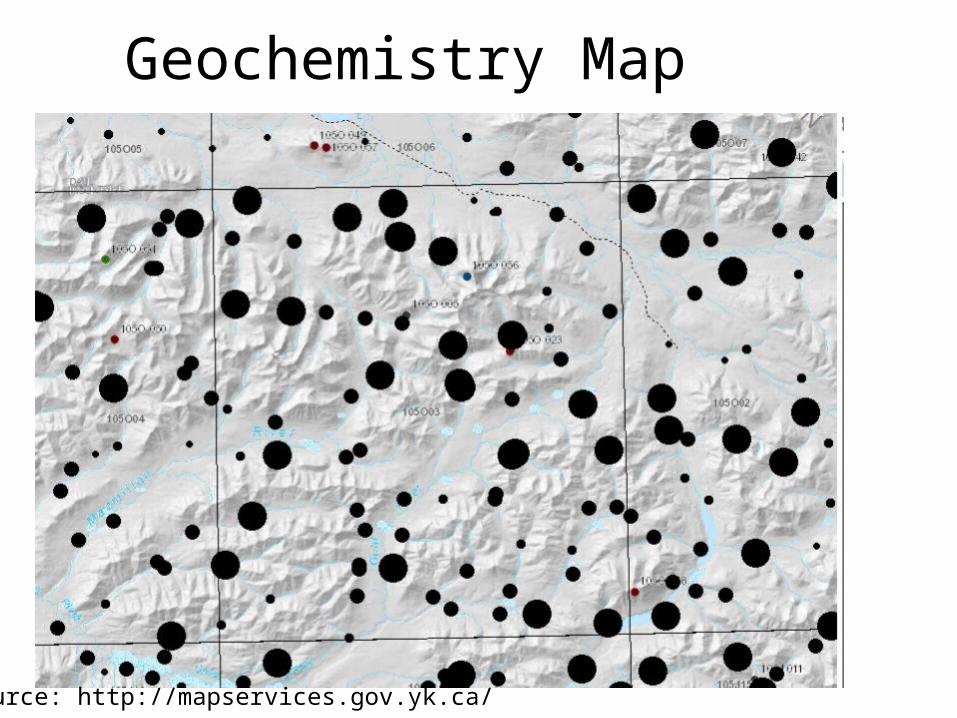
Geochemistry Map
Source: http://mapservices.gov.yk.ca/
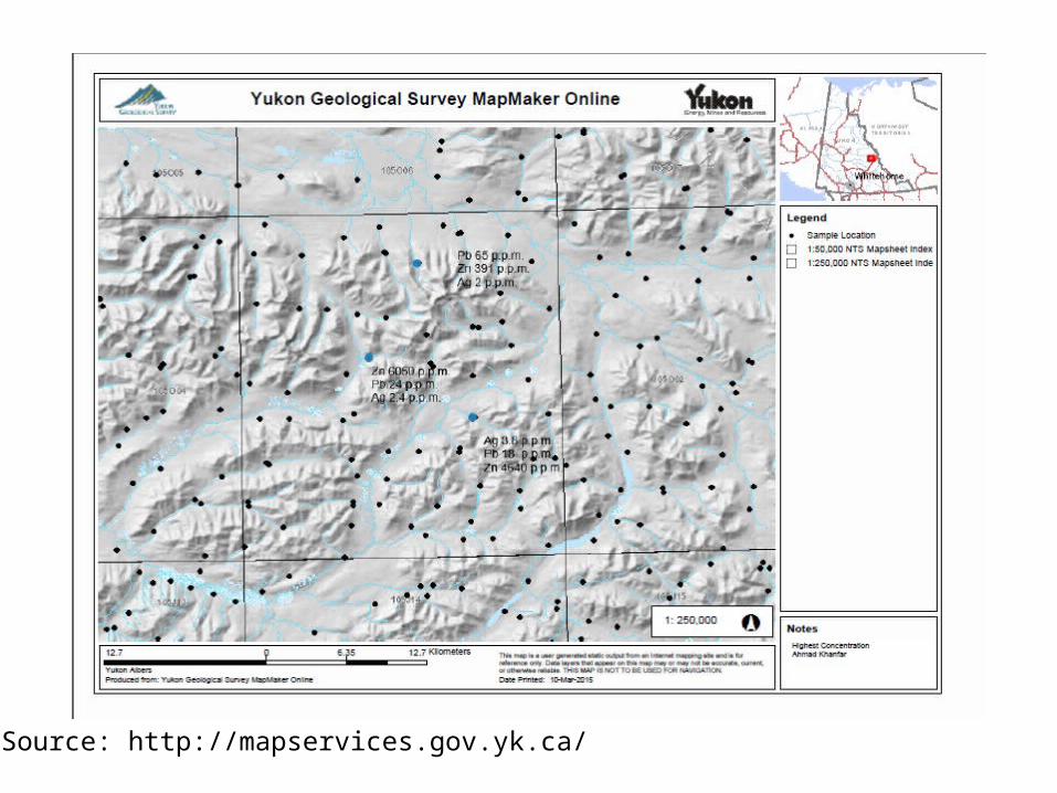
Samples with Highest Concentrations Locations
Source: http://mapservices.gov.yk.ca/
Referenceshttp://miningyukon.ca/miningandexplorationopportunities/mineralexploration/geologicalframework/leadzinc/selwynbasin/http://geoscan.nrcan.gc.ca/starweb/geoscan/servlet.starweb?path=geoscan/downloade.web&search1=R=291878http://mapservices.gov.yk.ca/Mining/WebMap.aspxhttp://www.geogratis.gc.ca/geogratis/search?lang=enhttp://www.aitc.sk.ca/saskschools/canada/facts/yt.htmlhttp://emrlibrary.gov.yk.ca/gsc/open_files/7144/of_7144.pdf

Thank you Questions ?