Embed Size (px)
Citation preview

Place of the Swift Waters:
A History of the First People of the Saratoga Lake Watershed
Jenna Gersie ’10 and Claire Malone Matson ’10
ES375: Case Studies in Environmental Sustainability Professors Karen Kellogg and Josh Ness
May 7, 2010

1
Table of Contents
Abstract……………………………………………………………………………………2 Preface…..............................................................................................................................2 Methods…………………………………………………………………………………....7 Introduction………………………………………………………………………………..9 Food Resources…………………………………………………………………………..21 Trade, Travel, and Warfare.……………………………………………………………...31 The Springs………………………………………………………………………………38 Spirituality and Culture…………………………………………………………………..46 Conclusion………………………………………………………………………...……..53 Afterword………………………………………………………………………………...55 Works Cited……………………………………………………………………………...58

2
Abstract
We examined a history of the native people of the Saratoga Lake Watershed, beginning with archaeological evidence from 12,000 years ago and focusing on the time surrounding early European contact. Though many New England tribes such as the Mahican used the lands in this area, we explored the ways that the Mohawk people in particular related to water in terms of food resources, including fishing, hunting, and agriculture; travel, trade, and warfare along the area's waterways; the medicinal springs of Saratoga; spirituality and culture; and current water-use issues.
Preface
Joseph Bruchac, a Native American local of the Saratoga region, introduces a
book of Native American stories by describing the relationships native peoples of North
America have with the Earth. “The Earth is not something to be bought and sold,
something to be used and mistreated,” he writes. “It is, quite simply, the source of our
lives—our Mother” (Caduto and Bruchac 1991). He continues to explain the role of
native people on the Earth as entrusted with a mission to maintain the natural balance of
the Earth. In Native American philosophy, life is seen as a great circle in which each
person is related to everyone and everything. All natural objects and phenomena are
thought to be inherently spiritual. It is through this philosophy that Native Americans
form connections with the land, water, and other natural resources surrounding them, in
addition to other peoples and cultures.
William Cronon, in Changes in the Land, discusses the interactions between
American Indians, European colonists, and the land of New England. He describes the
relationships between people and their environment as “historical and dialectical” and as
“connected within an interacting system” (2003). Their relationship was dialectical
because they felt a deep desire to be respectful to nature; however, at the same time, they
needed to exploit nature to survive. Whether it was by collecting wood for fuel, clearing

3
land to build houses and plant crops, or setting controlled fires, Native Americans
unavoidably altered the areas in which they lived. However, they did so sustainably,
relying on the wise management of tribe leaders and their vast environmental knowledge
to decide the best times to hunt and plant and to determine when to restrict use of a
resource to protect its existence.
This project aims to develop a better understanding of the way of life for the
Native Americans in the Saratoga Lake Watershed, particularly in respect to the most
vital resource then and now, water. An environmental history of the Saratoga Lake
Watershed, centered on Native American land use, perceptions, culture, and social
interactions, will provide further information about the landscape history and importance
of water in the Saratoga region while revealing to us some attitudes and behaviors that
could promote better conservation of our water and other natural resources. Cronon
writes: “Different peoples choose different ways of interacting with their surrounding
environments, and their choices ramify through not only the human community but the
larger ecosystem as well” (2003). By discovering the ways Native Americans interacted
with the watershed, as well as the changes that took place within the watershed as
European colonists arrived, students of environmental studies and community members
in the Saratoga area can better understand current issues centered on landscape use,
water, and human interactions with the environment.
In doing research for this project, we met several obstacles that need to be
explained to better understand this paper. First, there is a great deal of bias and skewing
of facts regarding Native Americans, who shall henceforth be referred to as the First
People or First Nations. Because the dominant nation of this area, the Iroquois, did not

4
have a written language, European settlers produced most historical documents. This is
troublesome because not only did the Europeans have racial biases against the First
People, but they also deeply lacked an understanding of their beliefs and cultures,
especially as few Europeans spoke native languages. The arrival of the Europeans also
caused many changes for the First People socially, ecologically, and spiritually. Mass
death by disease, altering of environments, introduction of Christianity, and forced
migration all played a part in a significant change in their way of life. As such,
Europeans who documented the First People were not seeing them as they had been prior
to their arrival. Instead, they saw violence, the adoption of white practices, declining
populations, and a lack of organization within tribes, among other changes. Some
Europeans even purposefully presented misleading information about First People as
political propaganda to remove them from desired lands. Presently, information is still
being skewed. People exaggerate history for various reasons. For instance, some sources
may say that a group of First People lived in a specific area or that a place was sacred to
give that area tourist appeal. We often saw this for the Saratoga Springs area, which,
although it was sacred, was never permanently inhabited by any First Nations.
Another obstacle we faced in our research was a lack of archaeological evidence.
This kind of data is sparse for several reasons. For one, most of the items used by First
People were biodegradable. Arrowheads are one of the most commonly found artifacts,
but these do not necessarily point to the location of a permanent settlement and tell us
little about relations to water. Another reason is that these people seldom lived in large
villages and often moved around to follow game, replant after their soils lost nutrients, or
because they were evacuated by warring tribes. Consequently, there are few areas with

5
notably large caches of archaeologically significant goods. Because of this, our study not
only relies on information from local archaeological settlements, but also of neighboring,
related tribes, as it can be assumed that they shared common practices and tools.
It should also be mentioned that the First People did not live by the modern
boundaries or city limits we have defined today. Because this area was used
predominantly as a seasonal hunting ground, the tribes studied lived elsewhere during
other times of the year. Although this is a project that focuses on the Saratoga Lake
Watershed, it will also include information from the areas directly outside of the
watershed. Also, because our project emphasizes connections to water, their main mode
of transportation, our research inevitably takes us to other nearby places.
Our paper focuses largely on the Mohawk, a subset of the greater Iroquois Nation.
Other tribes inhabited the area as well and many tribes passed through the area or visited
the region to exploit its rich hunting resources. For the most part, two linguistic groups,
Iroquois and Algonquian, dominated the northeastern portion of the United States. There
were many nations here that fell under one of these two these groups. The Iroquois were
the more powerful of the two. They had a strong political organization among their tribes
and a fierce passion that allowed them to control the waterways and spread their
influence. This is why Algonquian tribes like the Abenaki and Mohegan are greatly
underrepresented in our research: “It’s who writes history” (pers. comm. Jim Bruchac).
The Iroquois were a large group and managed to stay powerful and influential well after
the arrival of colonists and are thus better represented in historical texts. Accordingly, the
bulk of our information focuses on the Mohawk.

6
Finally, another hindrance in our quest for reliable information on the First
Nations was a general confusion on tribe names. The names by which we know tribes
today, such as “Mohawk,” were not their original names. Rather, they are usually
American misinterpretations or butchered pronunciations of their original names. Most
tribes have multiple spellings and many are spelled very similarly to other unrelated
groups. For example, Mohican, Mohegan, and Mahican are commonly confused.
Contrary to popular belief, the Mohicans, popularized in James Fenimore Cooper’s novel
The Last of the Mohicans, were not an actual tribe. It is said that Cooper combined the
names Mohegan and Mahican to create a fictional tribe, the Mohican (Woodward 1982).
However, variations in spellings have also referred to the Mohicans as an actual tribe.
Usually, this term is used to describe the Mahican people, and both spellings are
considered accurate today. We made a conscious effort to recognize when tribe names
were confused or misspelled in our research and decipher the correct identification. We
will touch upon tribe names further in our Introduction.
Despite the biases, exaggerations, and confusions, we feel we have come to an as
accurate as possible compilation of information on the First People of the Saratoga Lake
Watershed. To confirm this, we have had our paper reviewed by professors and First
People for authenticity. Nonetheless, one should always keep a watchful eye and on open
mind when reading about cultures as widely misunderstood and unknown as these.

7
Methods
We began our research on the First People of the Saratoga Lake Watershed by
speaking with knowledgeable people, including Sue Bender, Professor of Anthropology
at Skidmore College; Barry Pritzker, co-editor of Encyclopedia of American Indian
History; and Jill Sweet, Professor of Anthropology Emeritus at Skidmore College. These
people have had academic experience in researching the historical and archeological
evidence of the lives of First Nations, and with their help, we were able to formulate a
plan for further research. By the recommendations of these people, we defined the scope
of our project in terms of time period and region. We also found valuable resources and
other informed persons to refer to.
We then visited several libraries to find print sources that would support our
research. The bulk of the information we used for our project came from reading books
and archives. We visited the Saratoga Room in the Saratoga Springs Public Library and
Skidmore’s Lucy Scribner Library for the majority of our literature sources. We also
visited the Crandall Public Library’s Center for Folklife in Glens Falls, NY, where Todd
DeGarmo, the Founding Director, guided us in our search for more print sources. Using
the sources recommended to us by librarians, and those we found on our own accord, we
read through numerous historical documents, traditional stories, biographies, journal and
newspaper articles, and other non-fiction sources, and we analyzed many images and
historical maps.
We also visited two museums for more sources of information. At the Brookside
Museum in Ballston Spa, NY, we spoke with Education Director Linda Gorham, who
provided us with more print and archival sources. At the Iroquois Indian Museum in
8
Howes Cave, NY, we spoke with Native American Educator Mike Tarbell, who spoke
with us about the Mohawk people and Iroquois spirituality. Our conversation with Mike
served as an opportunity to verify many of our previous findings to create an accurate
historical account. The exhibits at the Iroquois Indian Museum offered us insight into the
culture of the Iroquois people through art, such as a painting from the Saratoga area;
artifacts, such as fishing supplies; and replications, such as a large birch-bark canoe.
We also visited the Ndakinna Education Center, a wilderness and Native
American education center in Greenfield Center, NY, where we spoke with Founder and
Director James Bruchac. Here we dug deeper into the history of the area through folklore
and oral histories by discussing our project with Jim. We were able to further verify the
research we had completed, as well as expand our understanding of the spirituality and
history of the First People in the Saratoga Lake Watershed. We also looked at exhibits in
the Center, including models of birch-bark canoes and fishing hooks.
Through our visits to libraries, museums, and the Ndakinna Education Center, we
were able to obtain and later synthesize multiple historical accounts and opinions for a
well-rounded, comprehensive report. We aimed to make our report as unbiased as
possible by using multiple sources, taking biases by individual authors into account when
analyzing information, and confirming our findings with several knowledgeable people
such as Mike Tarbell, Jim Bruchac, and Barry Pritzker. We analyzed and organized the
information we collected to compile our research into a thorough and extensive history of
the First People of the Saratoga Lake Watershed and their relationships to water.

9
Introduction
The People of the Saratoga Lake Watershed
The focus of this paper begins several hundred years prior to European contact
and extends to the early development of Saratoga County in the 18th century. However,
an understanding of the prehistoric lives of the First People in the Saratoga Lake
Watershed, as well as a general history of these people, is necessary. In prehistoric times,
the First People who lived in the Saratoga Lake Watershed were the Mohegans, the
Mahicans, and the Mohawks. Many other tribes, including the Abenaki, Oneida,
Pequots, Nipmucs, Wampanoags, Naraganests, Sokokis, and several other New England
tribes used the Saratoga area for its hunting, fishing, and water resources or passed
through on migratory routes to other places at different time periods throughout history.
This paper will briefly introduce the occupancy of the Mohegans, but will focus on the
lives of the Mahicans and Mohawks, those First Nations most commonly associated with
this area. Because the Mahicans and Mohawks were using the resources in the area at the
time of European contact, most of the accessible information about the First People of the
area is centered on these two tribes (See Figure 1).
Both the Mohegans and the Mahicans share the common root language of Proto-
Algonquian. The Proto-Algonquian language family is the largest linguistic family on
the North American continent, and many other tribes who shared the Saratoga area spoke
from this common root language (Olan and Bruchac, Languages 2007). The Mohegans
were a people who inhabited regions of the northeastern United States for centuries.
They originally lived in the upper Hudson River region, including the Saratoga Lake
Watershed, but at the time of European contact, the Mohegan had migrated east to the

10
Thames River valley in present-day Connecticut. The name Mohegan was combined
from the two words Muheconneuw, meaning “people of the waters which are never still,”
and Maingan, or “Clan of the Wolf” (Malinowski and Sheets 1998).
The name Muheconneuw was also used to describe the Mahican, a tribe related to
the Mohegan. The Mahican were also referred to as “people of the waters which are
never still.” Also known as Mahakans, Agotzagena, or Mahicanders, the Mahicans lived
along the shores and tributaries of the upper Hudson River Valley, or the Muhheconneuk,
near present-day Albany (Malinowski and Sheets 1998). The Mahicans traditionally
occupied the area surrounding Saratoga. Their territory included the upper Hudson
River, where it drained from the southern shores of Lake Champlain, to the Catskill
Mountains, including the Mohawk River from its most eastern point to Schenectady, NY,
in the west. Their territory also included the upper Housatonic River in the Berkshire
Mountains and the corners of southwestern Vermont and northwestern Connecticut
(Comer 2007). Their wide-ranging territory meant that they did not settle permanently in
the Saratoga region; rather, they built camps there in the summer to partake of the great
natural resources found there.
Tribe Language Family
Mahican, Mohegan Proto-Algonquian
Mohawk Proto-Iroquoian
Figure 1: A chart to describe the main groups of people in the Saratoga area
and their language families.
The Algonquian-speaking people were often called the Adirondaks by the
Mohawk, a derogatory term meaning “tree-eaters.” When the Algonquian people faced a

11
lack of resources in the winters, they would eat saplings and the bark of trees (Keller
1976). Such name-calling is a simple indicator of the tensions that sometimes existed
between neighboring tribes. The Mohawks, who often competed with the Mahicans for
resources in the Saratoga area, were also known as Mahakinbas, Kajingahaga,
Kaniehkeha:ka, or Maquas. They were an Iroquoian speaking people, and the word
Iroquois comes from European adaptations of two words: the Mohawk word ierokwa,
“they who smoke” and the Montagnais word ironkwedac, “terrible men” (Olan and
Bruchac, Languages 2007).
The Mohawk are a part of the Iroquois League, or the Five Nations, which
included from west to east, respectively, the Seneca, Cayuga, Onondaga, Oneida, and the
Mohawk. The Mohawk are known as “People of the Crystal,” or “People of the Shards
of Light,” a translation which refers to the 18-faceted Herkimer diamond, a high quality
quartz crystal found only in traditional Mohawk territory (Olan 2007, pers. comm. M.
Tarbell).
Each of the original Five Nations share the Proto-Iroquoian root language, one of
the major linguistic groups found in the Northeast, as well as a common culture (Olan
and Bruchac, Languages 2007). The Iroquois refer to themselves as Haudenosaunee,
“people of the longhouse” (Waller 1966). The Haudenosaunee lived in houses 12 to 15
feet wide and 100 to 150 feet long, with fires along the center of the floor and many
families living in one house. They compared their longhouse architecture to the
confederacy of the Five Nations, which stretched along a narrow valley for more than
200 miles through central New York (Sylvester 1979).

12
The Five Nations were brought together by the Peacemaker, a man from the
Huron nation, another Iroquoian speaking group, between 500 and 1,000 years ago.
Discouraged by the social dysfunction, confusion, suspicion, warfare, and general
disharmony that the five tribes faced, the Peacemaker went to each tribe with a message
of peace and unity. Through his efforts, the Five Nations, or the Peace League, was
formed. The Great Law of Peace is an oral constitution among the Haudenosaunee.
Based on peace, power, and righteousness, the Great Law of Peace established a
democracy among the tribes and put an end to intertribal feuding. It also expresses the
respect for and responsibility to the natural world, encompassing many of the ideals that
the Iroquois have lived by for hundreds of years (Malinowski and Sheets 1998, Olan
2007, pers. comm. M. Tarbell). The Great Law of Peace had great implications for our
current society. Benjamin Franklin and other framers of the United States Consitution
met with Haudenosaunee leaders to learn about their constitution, and many similarities
exist between the two constitutions and the two democracies. Additionally, during the
Boston Tea Party, many colonists dressed as Mohawks to express their desire for the
democracy, freedom, and representation that the Haudenosaunee lived by. In 1987,
Senator Daniel Inouye (Democrat, Hawaii), introduced a Senate resolution to
acknowledge the contributions made by the Haudenosaunee to the United States
Constitution (Olan 2007).
In 1720, the Five Nations became the Six Nations, as the Iroquois Confederacy is
known today, with the addition of the Tuscarora (Waller 1966). Within each of the Six
Nations, there are eight clans or tribes, including the Wolf, Deer, Bear, Snipe, Beaver,
Heron, Turtle, and Hawk. The spirits of the animals for which the clans are named act as

13
the guardian spirits of the people in that clan. The name of the clan to which a person
belongs is considered a part of his or her name, and it is mentioned in introductions. For
example, Mike Tarbell, the Native American Educator at the Iroquois Indian Museum,
introduced himself to us as of the Clan of the Turtle (Sylvester 1979, pers. comm. Mike
Tarbell). The Mohawk people, who lived closely with the natural world along the banks
of streams and lakes in the Saratoga area, are able to maintain their natural heritage today
by continuing to follow the Great Law of Peace and the hereditary sachems, or chiefs,
represented by their clan animals (pers. comm. M. Tarbell).
Their History
Evidence of the presence of the First People in the watershed goes back at least
12,000 years, when the Wisconsin Ice Sheet was receding at the end of the last ice age.
Populations then were very low, and small bands of hunters and their families followed
game herds such as caribou during their seasonal movements up and down the river
valleys as the ice advanced and retreated (Walsh).
From 8,000 BCE to 1,000 BCE, populations of the First People increased as the
climate warmed and the presence of deer and turkeys increased. These people hunted
game and gathered acorns from oak trees. Campsites were found at Saratoga Lake, Lake
Lonely, and Fish Creek as early as 8,500 BCE. The First People used the dugout canoe
as their primary means of transportation, and so many of their campsites were found near
navigable waterways such as Saratoga Lake, which feeds into the Hudson River. As
populations continued to increase, Saratoga Lake became a seasonal home to the First
People, primarily those who shared the Proto-Algonquian root language. Their

14
communities flourished at sites such as the Arrowhead Road area and the north end of
Saratoga Lake (Walsh, Skidmore Archaeological Survey).
At about 500 CE, settlements were made at the mouth of the Kayaderosseras
Creek. These settlements were seasonally occupied fishing stations where the First
People took advantage of the spawning of anadromous fish, those which migrate from the
sea to freshwater to spawn, from the Atlantic Ocean. These fish traveled into Saratoga
Lake from the Hudson River and Fish Creek (Walsh). At 1000 AD, early corn fields
were planted along Fish Creek (Skidmore Archaeological Survey). Many seasonal
campsites have been located around Saratoga Lake, Lake Lonely, Fish Creek, and
Kayaderosseras Creek (Simpson 2002), showing that the First People came to the
Saratoga Springs area to use the healing medicinal springs and surrounding hunting
grounds.
The Mahicans continued to camp and fish along the Kayaderosseras Creek and
the shores of Saratoga Lake as the easternmost tribe of the Iroquois Confederacy, the
Mohawk, began to expand their hunting into Mahican territory between about 1100 and
1400 CE (Bruchac). Evidence of many Mahican villages from about 1500 were
discovered on Fish Creek, but during this time, the Mohawks were beginning to push the
Mahicans away from the area. The land that the Mahicans occupied included coastal
uplands, where great rivers such as the Hudson and the St. Lawrence cut through,
providing river valleys rich in resources, including many fish (Brasser). With so many
resources, it is not surprising that the powerful Mohawk began to push the Mahicans out
of the area so they could use the resources themselves. The two tribes often conducted
raids upon each other in an attempt to acquire more territory and claim rights to hunting
15
resources; however, the eastern end of the Mohawk Valley acted as a buffer zone
between the competing tribes.
As the Mohawks pushed east, however, the Mahicans also moved east out of the
Mohawk Valley just before the 1500s. As both tribes shifted east, the Mahicans were
able to retain hunting rights and ownership of choice pieces of land, including those lands
at the mouth of the Mohawk River, which were later sold to the Dutch. By 1534, the
Mahicans and the French fishermen in the St. Lawrence area established a fur trading
alliance (Snell 1980). Such an alliance created further tension between the Mahicans and
the Mohawks, who competed for control of the fur trade. As they took control of the fur
trade, the Mohawk continued to push the Mahicans out of the area. The Mohawk-
Mahican War of 1625-1628 resulted in the Mohawks dominating the lands that used to
belong to the Mahicans (Bruchac).
In 1684, the Mohawks sold their land to Peter Philip Schuyler, as well as other
eminent citizens in the area, including Johannes Wendel, Cornelius Van Dyk, and Jan
Jansen Bleeker. The Mahicans renounced their claims to the land, allowing the Mohawk
to sell it. This sale became known as the Saratoga Patent. The tract of land incorporated
an area beginning to the east of Saratoga Lake and stretching to the western bank of the
Hudson, where settlement began in the 1680s (DeMicco, Sylvester 1979). The rich
farmlands along the banks of the Hudson were settled rapidly, but the upland areas of
poorer farming quality were left isolated, with few roads and much less settlement.
Farms and a mill complex were also established along the lower portion of Fish Creek by
1709, and in the 1730s, European settlers moved into the area of modern Stillwater
(DeMicco). As settlement progressed, the Mohawks also began selling other tracts of

16
land, which traditionally belonged to the Mahicans, to English settlers, as part of the
Schenectady, Hoosic, Canistigione, and Niskayuna Patents (Comer 2007). In part, the
Mohawks were forced out of the area by encroaching European settlement and society,
and unfair land sales and trades are testament to the tensions that existed between the two
groups who wanted to use the land in the Saratoga region.
Perhaps one of the most controversial land sales was that of the Kayaderosseras
Patent. As the Mohawks adapted to the presence of the settlers in the land they
dominated, they began to sell patents of Kayaderosseras land to the English, though the
Mahicans were the traditional owners of this land. Between the 1680s and 1770s, a series
of complicated negotiations with the Mohawks led the land to be sold to English settlers.
In 1703, Samuel Shelton Broughton, attorney-general of the area, obtained a license from
the governor to purchase the tract of land, for which the Mohawk signed a deed in 1704.
In 1708, the deed was finally confirmed by the tribe through the influence of Sir William
Johnson. The tract of land included Saratoga Lake and much of modern Saratoga County
(DeMicco, Sylvester 1979). Conflicts during the French and Indian War, however,
delayed permanent English settlement, and in 1764, the first English families to settle at
the mouth of the Kayaderosseras Creek were driven off by Mohawks. The Mohawks
complained that their hunting territory had never been sold; they testified that the original
grant of the land they sold was only a few farms near Saratoga, as opposed to the 600,000
acres of land being claimed by the English. In 1764, the Mohawks accepted a reduced
patent. Due to these conflicts, few permanently settled in the region until the 1770s. In
1771, the Kayaderosseras land was divided into 25 allotments which were sold to the
English, clearing the issues surrounding the land sales. In 1772, the Kayaderosseras and

17
Saratoga Patents were united by the colonial government, creating the districts of
Saratoga, Halfmoon, and Ball’s Town, or present-day Ballston Spa (Bruchac, DeMicco,
Sylvester 1979).
By the 1780s, the northwest shore of Saratoga Lake was occupied by settlers, and
by 1785, the northern shore was also settled (DeMicco). After the 1780s, most of the
remaining Mahicans had left New York as a result of European settlement and relocated
in Wisconsin to form the Stockbridge Munsee Mahican Nation. Some Mohawk families
also left the area and relocated to Kahnawake, also known as Caughnawauga, and
Akwesasne, as well as other places north of Saratoga.
Other families remained in the Kayaderosseras region through the 1800s and
1900s. During the 1800s, many of the tribes still living in Saratoga County were well-
mingled and intermarried, and during the 1900s, they continued to lose their traditional
lands to white settlement. In the 1920s, three towns belonging to the First People,
Barktown, Indian Stream, and Indian Hollow, built over 12,000 acres of land just west of
Saratoga County, were flooded when the Hudson River Regulating District dammed the
Sacandaga River to prevent spring flooding further downstream. Sacandaga, a
Kanienkehaka Mohawk word, means “drowned lands,” a name that originally referred to
the large bowl-shaped depression caused by an ancient glacial lake (Bruchac, Other
Native Peoples 2006). Now, the name has a new meaning; the drowned lands of the First
People have come to represent the loss of traditional tribal lands to European settlement
and white development into the 21st century in this region.

18
The Place
The First Nations in the Saratoga Lake Watershed, in particular the Mohawk
people on which this paper is focused, made extensive use of the natural resources
available to them. Only living temporarily in the settlements surrounding the streams,
rivers, and lakes, the people allowed forests to re-grow and game and fish stocks to
replenish when they moved elsewhere. The people collected wood for fuel and building
houses, and they collected plant materials to make nets, containers, weapons, canoes,
dyes, and medicines (Dunn 2000). They practiced controlled burning to make the area
suitable for farming and to allow an understory of berries and grasses that would attract
the game they hunted. The interactions that the First Nations in the area held with the
landscape were directly related to the resources that were provided by nature, but “in
nothing is this more clear than in the names they attached to their landscape” (Cronon
2003). In the Saratoga Lake Watershed, the First People named their landscape for their
water resources.
There is a great deal of speculation about the origin of the name “Saratoga” (See
Figure 2). Some accounts indicate that the name is derived from the Iroquoian language,
while others note that the name is derived from the Algonquian language. Original
spellings of the name are varied, and include words such as Sarachtogoe, Serachtague,
Saraghoga, Saraghtogue, Sarachtoga, Saraghtoga, Cheratoge, and Schorachtoge, among
other spellings (Simpson 2002, Waller 1966). Early historians and European settlers
spelled this word in more than twenty different ways, and each word had a slightly
different meaning. The earliest date that a variation of the word is seen in history is 1684
(Sylvester 1979). One definition is “place of the swift waters”; this meaning is made up

19
of two Iroquoian words, saragh meaning “swift water” and oga meaning “place of.”
Other potential definitions include “hillside country of a great river,” “the place of
herrings,” and “place where the track of the heel is seen,” an allusion to an area where
depressions like footprints are seen in the rocks (Sylvester 1979, Waller 1966, Woodward
1982). The Mohawk word Assarat, meaning “sparkling water” is another possible origin
(Bruchac, Names 2006). Algonquian speaking nations that may have named Saratoga
include the MicMac, Mahican, Pequot, and Abenaki. Togue is a MicMac word for
“trout”; Scaghtakook is a Pequot word meaning “where two streams converge”; and an
Abenaki meaning of a variation of the word is “place of the miraculous waters in a rock”
(Dorrough 2006). The Mohawk also knew the area as Ochseratongue or Ochsechrage,
meaning “at the beaver dam,” and the Mahicans called the area Amissohaendiek, meaning
“beaver-hunting territory.” In 1646, Jesuit Father Isaac Jogues transcribed the name for
the area as Ossarague, which he translated to mean “fishing place” (Bruchac, Names
2006). The Abenaki knew the area as Salatogi, where they came to drink nebizonbik,
“the medicine waters” at High Rock Spring (Bruchac, Mineral Springs 2007).
Figure 2: A diagram showing many of the various spellings and possible origins of the name “Saratoga.”

20
The area surrounding the springs of Saratoga was named Kayaderossera by the
Mohawk, or “the land of the crooked water.” The Kayaderosseras Creek flowed into
Caniaderiossera or Saratoga Lake, “the lake of the crooked stream.” Water from
Caniaderiossera then flowed into the Hudson River (Waller 1966). The name for
Kayaderosseras originates from the Mohawk word Kanyataroseras, which means “the
place where the lake mouths out,” a word which describes the seasonal overflow of a lake
into creeks and onto flood plains. Another translation of the word is “lake country.”
Kayaderoga, a word meaning “at the lake” describes the lands surrounding Saratoga
Lake. Many small fishing camps were located along the lower portions of the
Kayaderosseras Creek and along the shores of Saratoga Lake, and foot trails along creek
banks and the creek’s navigable waters themselves allowed easy access to the lake and
neighboring camps.
Another water resource that the First People used was the Hudson River, which
the Mahican people knew as Mohicanituk or Muhheakunnuk, “great everflowing waters”
or “great waters constantly in motion” (Comer 2007, Keller 1976). Such names refer to
the tidal motion of the Hudson River, an extension of the tidal flows of the Atlantic
Ocean (Comer 2007). From the crooked waters of the Kayaderosseras Creek to the tidal
influence of the Atlantic Ocean, the First People of the Saratoga region made great use of
the water resources available to them. The names given to the waters and the areas
surrounding them reflect the importance of these water resources for the First People of
the Saratoga region.

21
Food Resources
First and foremost, water was crucial to the survival of the First People as it
provided them with a bountiful supply of food resources. The water bodies here not only
supplied fish and mollusks, but they also made it possible for large amounts of game to
inhabit the area. The tools and practices the First People used to hunt and gather these
food resources teach us about their culture and provide us with archaeological
information about village locations and which tribes lived in a given area at a given time.
Finally, the practices the First People used influenced their customs spiritually,
politically, and socially. So, we can see that water played an important role in providing
subsistence and was so important that it impacted the First People’s culture.
Resources
The Saratoga area offered a plethora of animals, both in their numbers and in
species diversity. The First People who occupied or visited this area were met with a
seemingly endless supply of fish, birds, and mammals. The Hudson River was an
important and reliable resource for fish before it was dammed, over-fished, and polluted
as it is today. Schools of fish came in numbers that would now be considered
unfathomable. Herring ran up the west side of the Hudson, through Fish Creek, and into
Saratoga Lake. This fish resource was exploited up until 1760, when the construction of
milldams on the lower creek disrupted their migrations (DeMicco). Shad, a favored
delicacy, ran down the east side of the river and rested in vast schools in the falls and
rapids above and below Fort Edward. Sturgeon frequented the nearby Mohawk River
and sunned themselves in the basin below Cohoes Falls. Striped bass and perch were

22
also common in the lakes and rivers. Even whales occasionally traveled the Hudson and
made their way as far north as this hunting ground, though the most recent recording of a
whale sighting was in March of 1647, when two were seen near Cohoes (Sylvester 1979).
Saratoga Lake was once known to store large stocks of trout and eel. However,
trout populations started rapidly declining around 1825. It is believed that this decline
can be attributed to the introduction of new fish species, such as pickerel, for sport
fishing. Formerly, it was not uncommon to catch up to 200 pounds of pickerel in a single
outing, but by 1880, it was unusual to catch 30 pounds, as these populations also
collapsed (DeMicco).
The presence of mollusks is significant to the study of prehistoric First People as
their appearance on land often marks camping sites and has provided archaeologists with
excellent samples to perform carbon dating. In particular, massive piles of oyster shells
(sometimes 12 feet deep) can often identify Mahican sites. Vast oyster beds in the
Hudson River used to stretch from the Lower Bay to Croton Point in southern New York.
Based on a carbon 14 analysis of oyster shells dug from a site on Croton Point, scientists
have determined that the Mahican have lived on the Hudson for at least 6,000 years
(Keller 1976). Whelk, quahog, and other marine shells were also present in local water
bodies and were often fashioned into white and purple beads (Engelbrecht 2003).
Mahican men would use clamshells to pluck hair from their heads and faces, leaving a
long, thin scalp-lock reminiscent of the modern “mohawk” hairstyle (Malinowski and
Sheets 1998). When prepared as food, clams would be baked in sand pits heated by hot
stones and wrapped in seaweed (Keller 1976).

23
Geese, mallards, canvasbacks, teal, and the now extinct heath hen stopped by the
lakes and rivers during their migrations. They were bountiful and easy to catch. Beavers
were also present in these water bodies and were vital clothing resources for the native
people. After the European colonization, the trade of beaver pelts between Mohawks and
white settlers became crucial to the survival of the Mohawk. However, the Saratoga area
was a famous hunting ground not just for beavers, but for all native fauna. The saline
properties of the mineral springs in this area attracted animals and provided the people
with great hunting resources such as rabbits, squirrels, turkey, deer, moose, bears, and the
now extinct passenger pigeon (Keller 1976).
Tools and Practices
Because their culture was so immediately affected by the arrival of European
colonists, there is little recorded history of the authentic fishing, hunting, and agricultural
practices of First People. As a result, historians have come to greatly rely on
archaeological evidence to understand these ancient traditions. Since archaeological
evidence can be hard to find, historians also sometimes rely on assumptions that practices
by neighboring or related tribes may carry over to other groups. In this attempt to discuss
the practices—namely fishing, as it relates most to water—of the Mohawk and
Algonquian tribes living in Saratoga, some information we present here may come from
other Iroquois or neighboring tribes who most likely shared fishing methods with their
Mohawk brethren and neighbors.
Archaeologically speaking, fish bones are more fragile than mammal bones, so
they are often underrepresented in excavations. Furthermore, fish were usually eaten

24
whole. However, because Native Americans of this area recurrently occupied camps at
prime fishing localities, there is other evidence to note (Engelbrecht 2003). From 1964 to
1967, excavations were preformed on Winney Island, which is located on the Fish Kill
stream, which drains into the Hudson, just west of Grangerville. Projectiles, such as
arrowheads and harpoons, were found here that dated around 7,000 to 10,000 years ago,
suggesting that this had been an important fishing locale for thousands of years. Based
on the huge caches of bi-notched fishing sinkers found, archaeologists have determined
that “a sizeable fishing industry existed here” (Davis). An absence of hooks or harpoons
suggests that the people working here mainly relied on nets. Nets were made of hemp
and their floats of wood or pinecones, all of which would have decomposed a long time
ago; however, the presence of stone sinkers confirms this hypothesis. Archaeologists
could tell from the food refuse they encountered at Winney Island that fish were caught
here and probably cleaned, cured, and stored, but not eaten here. Rather, they believe
that the fish catches were most likely transported via canoe to other areas for trade.
During the Iroquois occupation, these catches were most likely brought back to the
Mohawk Valley (Davis).
Nets were common at the Lamoka Lake site, which dates back to 2500 BCE,
suggesting an early use. Hemp that was grown in old cornfields were made into fibers
and cordage by women, which men then used to make nets. In 1644, Johannes
Megapolensis Jr. observed that “when [Mohawk men] want to fish with seines, ten or
twelve… will go together and help each other, all of whom own the seine in common”
(Engelbrecht 2003). Actual fragments of a net made from hemp fiber were recovered at
the Morrow site (500 BC) in Ontario County, NY (Engelbrecht 2003). We also know

25
that Huron netted fish in the winter by passing nets under the ice using poles, and it is
speculated that Mohawks used this same practice on Saratoga Lake. Gill nets were also
used, but probably not until the Late Woodland period (1000 BCE-1000 CE). Unlike
seines, gill nets were used in deep water and required the use of canoes. These were
usually set at a depth of about 30 fathoms (one fathom is equal to about six feet). In 1687
at Mackinac, Henri Joutel observed gill nets 200 fathoms long and two feet deep with
cedar wood floats (Engelbrecht 2003).
Another common practice was the building of V-shaped stone weirs in rivers,
which have been found all over New York State. Stone weirs are difficult to date, but a
wooden weir was found along the Atlantic coast that dated back to 2500 BC (Engelbrecht
2003). These structures were used to channel fish into a catching area where they could
be speared or scooped up with baskets (Dunn 2000) (See Figure 3). The Mohawk would
fish for herring in the Caniaderiossera, or Saratoga Lake, using wicker baskets anchored
at the openings of these weirs. These wicker baskets, called yont-ka-do-qua, were built
from black-ash splint into a conical form about three feet in length, fifteen inches in
diameter at the mouth, and six inches at the smaller end (See Figure 4). Fishermen would
use weirs or sticks to direct the fish into the partly submerged baskets (Morgan 1901).
Other less common forms of fishing included spearing and hooking. Fish, like
sturgeon, were speared at night from canoes by the light of burning pine knots (Dunn
2000). Spears were made of barbed bone points affixed to a shaft. Spears were
eventually replaced by the Middle Woodland period (about 2,000 years ago) by harpoons
with detachable heads (Engelbrecht 2003). Spearing was not the most successful form of

26
Figure 3: First People Harpooning Fish in a Stone Weir (Images)
Figure 4: A Wicker Basket Used to Scoop Fish (Engelbrecht 2003)
fishing; however, sometimes fish were so plentiful, especially during spawning seasons,
that they were easily speared or could literally be scooped up in baskets. Bone and
copper fishhooks have been recovered from archaic sites in the Great Lakes area,
although they are less common tools for fishing (Engelbrecht 2003). Trotlines, which use
hooks, have also been seen occasionally. These were made of hemp and strung across
lakes or rivers. At the Owasco Castle Creek site, a trotline was recovered that had

27
nineteen dropper lines, each with a hook made from two hawthorn spines (Engelbrecht
2003).
Customs
Hunting and fishing were carefully regulated by custom and tribal leadership.
Leaders of the village determined when to hunt, fish, and plant so as to ensure a sufficient
supply of food to last through the winter without threatening the sustainability of animal
populations for the following year (Dunn 2000). Fishing took place all year round, but
was most important in the spring when other animals’ fat reserves were low. At other
times of the year, older men would fish while the younger ones hunted (Engelbrecht
2003). Fish caught in the fall could be stored for winter either by drying them in the sun
or smoking them. Smoking fish, however, required a good deal of energy as this
included the gathering of firewood, construction of drying racks, keeping fires going
constantly, and turning the fish. Once it got colder, however, fish could simply be frozen
and would last. While visiting the Oneida (another tribe of the Five Iroquois Nations) in
December of 1634, Harmen Meyndertsz van den Bogaert observed houses with 70 or
more dried salmon (Engelbrecht 2003). These practices allowed fish and meat to last
year round to be used later as food or as a trading commodity.
When the shadberry blossoms whitened the banks of the streams in the early
spring, hunting bands of the Five Nations came to the hunting grounds that bordered the
Mohawk and Hudson Rivers to fish (Sylvester 1884). In the summer, when shad and
herring fishing was over, these groups would leave the banks of the larger streams and
relocate to the mineral springs to hunt game. While traveling they used temporary
28
teepees they could fold up and move to and from their hunting and fishing grounds (Dunn
2000). These hunters came from and returned to their permanent homes, which were
called Mohawk Castles by colonists, where they grew their corn and other crops; few
were permanently located in the Saratoga region.
Jefferson and Morgan Ramsdell, who lived on the southern end of Saratoga Lake
in the late 1800s, recounted this behavior. As boys, they remembered seeing a group of
15 to 20 Mohawk men and women with papooses (baskets used to carry children) who
came every year. In late spring, they came and erected their teepees just south of the
Ramsdell’s house and would stay there for a month or so. The men fished with nets and
other appliances, while the squaws would dry and smoke the herrings and pack them in
large splint baskets for winter use. These people came from a Mohawk tribe that lived on
the Mohawk River just west of Schenectady. They came by canoe every year until the
dams were built (Durkee 1927).
It was really not until the arrival of the Iroquois people thousands of years before
that Algonquian tribes, such as the Mahican, began farming. The Algonquian relied on
hunting and gathering and had little to no knowledge of agriculture (pers. comm. M.
Tarbell). However, by the seventeenth century, Mahican farmlands could be found along
the Hudson and Housatonic rivers, Catskill Creek, Kinderhook and Roelof Jansen Kills,
and near Saratoga Lake (Dunn 2000). Through their mothers’ lineage, women inherited
garden lands along the rivers where they grew maize, beans, squash, sunflowers, and
other staples. Accordingly, Mahican longhouses were built on hilltops near rivers
because the riverbanks were fertile and provided hydration (Malinowski and Sheets
1998).

29
Mohawks planted in areas of varying drainages. Crops planted in poorly drained
areas would do better in dry years and vice versa, and because it was difficult to predict
whether a year would be dry or wet, they would do both. Great consideration was taken
in choosing these lands, as the sustenance of the people depended on their success. As a
result, crop fields would sometimes be located up to a mile away from their villages
(Engelbrecht 2003). The Mohawks were very aware of their environment in this way and
often acted overly cautious to ensure a bountiful harvest to last throughout the winter.
They were resourceful, too. For example, old cornfields that had been depleted of
nutrients would be used to grow hemp, which was in turn used to make nets, ropes, and
the like. They also used a polyculture system where multiple stands of crops were
planted in the same area in imitation of the natural diversity of ecosystems. Polycultures
provide habitats for more species and can reduce the likelihood of disease among crops.
The Mohawks and the Mahicans both relied on this combination of agriculture,
gathering, seasonal fishing, summer deer hunts and winter moose hunts, and trade among
neighboring tribes to support their diet. Religious ceremonies were held to ensure that
animals would allow themselves to be caught. For example, among the Huron, it was
believed that certain shaman were able to induce fish to be caught in nets. For the
Mohawks, and most First Nation tribes, social norms and customs were instilled to
guarantee hunting success. Young boys were taught early on how to hunt small animals.
Good hunters were honored with community approval and choice marriages (Dunn
2000).
The Mohawk understood the importance of animals to their diets, and because
they believed every creature had a spiritual essence, they were respectful of them. For

30
instance, they avoided throwing their fish and animal bones into the fire out of respect
and for fear that the spirits of these creatures would warn their fellows not to be caught.
However, with the coming of the white settlers many of these subsistence patterns and
cultural practices changed. The Mohawk in particular became reliant on the beaver trade
both for labor-saving conveniences and ready credit. Eventually, European domesticates,
namely swine, were introduced to Mohawks around the 18th century (Rothschild 2003).
The First People held a great appreciation for nature and in particular, water.
They recognized that all things in nature would not be possible without water. Water
provided their subsistence whether it was through fish and other marine life, the animals
that came to use the water, or the agricultural success of the well-hydrated soils of this
area. We will also see in the next section how important water was not only in the
accumulation of subsistence materials, but also in the transportation and trade of them.
31
Trade, Travel, and Warfare
The Saratoga region is one of the most water-rich areas of this country. It is the
meeting place of the “headwaters of all the great waters,” including the Mohawk,
Hudson, and St. Lawrence Rivers (pers. comm. M. Tarbell). These waterways allowed
the people of this area to travel great distances to favored hunting grounds and fishing
areas and then to other villages to trade their catches. It is mainly because of this system
of resource collection and trade that the Iroquois Five Nations were able to develop as
powerfully as they did. Control of the rivers meant control of the land as well. Of
course, with this power came the inevitable struggle to maintain it and, thus, these
waterways also acted as important routes while waging war.
The early history of the Iroquois was mainly spent migrating in the search for
hunting and camping grounds. This search was often met with conflict between other
tribes. However, when conditions were favorable, the Iroquois set up permanent
communities. Once the Iroquois grew powerful enough, they could defend their land and
battle neighboring tribes to expand their territories. The Saratoga area itself, however,
had few large permanent settlements. This is mainly because large settlements were
more prone to the spread of disease and because several Algonquian tribes, who would
intermittently war with the Iroquois, also settled in the area. Instead, Saratoga was more
a place of temporary residency for hunters who visited there in the spring and summer.
Permanent villages that did exist here were more likely satellite villages of larger
establishments.
Canoes were a vital means of transportation. They assisted in the movement of
people during times of war or migration, carried items of trade and fishing and hunting

32
catches to and from villages, and allowed communication between distant tribes. Both
men and women cooperated in the construction of birch bark canoes. They began by
stripping a large section of bark off a birch tree. They would spread it on the ground and
lash false gunwales on the material to give it shape. Next, they would drive stakes into
the bark to hold the sides in place. True gunwales could then be bound inside and outside
with vines with a lining of cedar strips laid lengthwise. Joints were made watertight by
the application of boiled spruce or fir pitch. Thwarts, or seats, were set from side to side
and fastened in place with vines so strongly they could support two or three occupants at
a time. Turkey feathers, goose quills, tails of small animals, and paint were used for
ornamentation (Keller 1976). Canoes varied in size; some were small enough for
individual use, while others could carry large loads of trade items or battalions. During
an interview, Jim Bruchac likened the receipt of a new canoe by a young brave to the
personal freedom of a teenager getting his or her own car (pers. comm. J. Bruchac). The
importance of canoes in native culture again shows the great significance of water in their
lives.
Trade Routes
The Saratoga area served as a giant corridor for passage. The location of present-
day Highway 87, for example, was once a “pathway to the French” during the fur trade
(pers. comm. M. Tarbell). Because of its proximity to so many bodies of water, and
therefore food and trade resources, there were several popular trade and war trails that ran
through Saratoga County. Because canoeing saved time and energy, it was the most

33
popular form of travel and, as such, many of these trails relied on water routes or were
used to get to and from other water bodies.
The oldest known path in the county is the Aalpaats Trail, which runs northeast to
southwest. This trail passes through Saratoga, Saratoga Springs, Malta, Ballston, and
Clifton Park. The trail was predominantly used as a warpath and dates back to
Algonquian occupation of the area (Snell 1980). The Sacandaga Trail originated at Lake
George and ran north to south through Corinth, Greenfield, and Milton to the
Schenectady area where it branched off at the Sacandaga River along Daly Creek and
headed to Ballston. This path was important as it connected the Mohawk and St.
Lawrence Rivers (Snell 1980). The Kayaderosseras Trail began at the southern end of
Lake George and traveled to a bend in the Hudson River about ten miles west of Glens
Falls. From there, it moved south through the towns of Wilton, Greenfield, and Galway
to the Mohawk River (Snell 1980). The great East-West Trail, or Hoosic War Trail,
began on the Atlantic coast and made its way to interior of New York. Along the way it
passed through Halfmoon, Stillwater, and Clifton Park. In peaceful times Algonquian
tribes used it to get to the rich hunting grounds. During war, it was used as a path
between Mohawk and Algonquin. European settlers continued to use this path and it has
since influenced the location of modern cities (Snell 1980). Finally, the Saratoga Water
Trail is significant for a couple of reasons. This trail is unique in that it links the St.
Lawrence and Mohawk Valleys almost strictly via water. It is also unusual in that it is
fairly well documented and still completely intact. The trail starts at the Mohawk River
and follows Aalpaats Creek to its northernmost point. Here, it crosses overland for a
short distance along the outlet to Ballston Lake. It then follows the Mourning Kill, down
34
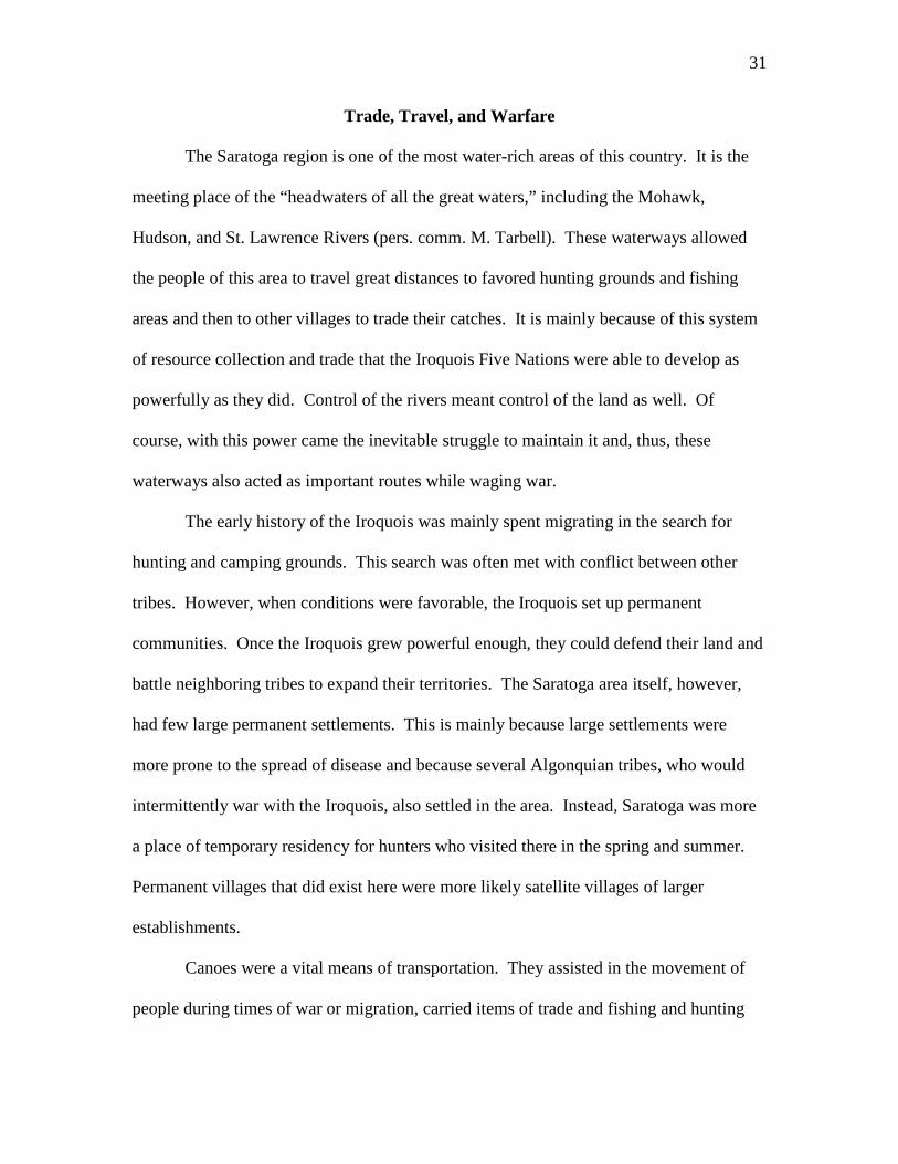
the Kayaderosseras Creek, and into Saratoga Lake. From here, the trail takes Fish Creek
to the Hudson River, which can be taken north up to Lake Champlain (Snell 1980) (See
Figure 5).
Figure 5: Map of Trade Routes in Saratoga County

35
Beaver Wars
When European traders first came to the Americas, they were seen as intrusive.
Forest diplomacy in Iroquois tradition dictates that in order for a visitor to enter a village,
he must wait outside the front door to be invited in. The Mohawk were known as the
“Keepers of the Eastern Door” because this is the direction from which visitors were
expected to enter. When the Europeans arrived, unaware of this, they greatly agitated the
Mohawk (pers. comm. M. Tarbell). Furthermore, some of the Europeans were forcefully
encroaching on Mohawk territory. It is for this reason that Mohawk were friendlier to the
Dutch than the English and other invaders, because the Dutch acted merely as business
partners in trade, as opposed to the English, who were there to colonize.
Life in Saratoga was in a state of transition during European colonization. It was
“a terrible world at that moment”; due to disease, the Mohawk were experiencing a loss
of life that they had never seen before and could not understand (pers. comm. M.
Tarbell). Many were losing faith in the Great Law and feared not only for their lives but
also for the survival of their nation. Generally, the Mohawk were a peaceful people, but
this unfathomable set of circumstances drove them to take arms. And because this
aggression lasted for so long, Mohawks are widely remembered today as being an
incredibly violent group of people. In 1650, Father Ragneau wrote, “my pen has no ink
black enough to describe the fury of the Iroquois” (Sylvester 1979).
At the time of the arrival of the Europeans, the Saratoga area was Mohawk and
Mahican territory. In 1624-1628, the area became solely Mohawk territory as they
pushed the Mahican south to Connecticut in order to take control of the fur trade. The
last half of the seventeenth century saw intermittent warfare and peace as the Iroquois

36
struggled to gain access to more hunting areas to acquire beaver, deer, and other furs and
skins for trade with the English and Dutch. At the time of the arrival of the Europeans,
Europe was going through a “Little Ice Age” and as such, furs had become a lucrative
commodity for coats and felt hats (Johansen and Pritzker 2008).
Like most wars, the “Beaver Wars” had many provocations, the most prominent
of which was the competition over diminishing stocks of fur-bearing animals, particularly
beavers. The Mohawk were situated between two major trading posts, Albany and
Montreal, and as a result had developed a dependency on the fur trade to support their
livelihood, as traditional subsistence methods were no longer adequate in the colonial
world (Johansen and Pritzker 2008).
The Wyandots, a Huron tribe near Lake Huron who had also become dependent
on the fur trade, found themselves facing constant raids by the Iroquois, namely Mohawk
and Seneca groups. These harassments continued for nearly a decade. Finally, between
1647 and 1650, the Wyandots, after being weakened by disease, were pushed out in one
final sweep by the Iroquois. Their confederacy dissolved and the Mohawks and Senecas
usurped their share of the fur trade (Johansen and Pritzker 2008).
By 1700, the Beaver Wars had diminished significantly. The Iroquois were
nearing exhaustion from the continual warfare. Their attention was distracted when they
realized that the English were starting to occupy the Mohawk Valley in upstate New
York. They consequently moved to establish a diplomatic policy of balancing relations
between the French in New France and the British colony of New York. The Iroquois
also tried to create diplomatic alliances and commercial agreements with other First
Nations to the west by promising access to trade at Albany in return for access to hunting

37
and trapping grounds in the Great Lakes region (Johansen and Pritzker 2008). The
Mohawk were progressive people and were willing to make adjustments and adapt to the
modern world (pers. comm. M. Tarbell).
The first beaver pelt hat-making factory was built in Danbury, Connecticut
roughly 400 years ago, though others existed in New York and Albany. The process of
hat-making leached mercury into the waters and soil. The effects of this pollution are
still being felt today (pers. comm. M. Tarbell).
The Beaver Wars are one example of how water played a part in Mohawk
warfare. Of course, there were many battles conducted by this First Nation throughout its
history, but these are not as well documented. The Beaver Wars show the extent that the
Mohawk would go to protect their water and, therefore, hunting resources. Water played
an essential role in the transportation of beaver pelts and other trading goods and also
acted as a means of transportation during battles. All of this is not to say that the
Mohawk did not have peaceful moments with the Europeans. In the next section, we will
discuss how water helped bring the First People and the settlers together.

38
The Springs
Earth movements caused by ancient volcanoes shifted the layers of limestone,
metamorphic crystalline rock, shale, sandstone, and dolomite that existed in the Saratoga
area, causing faults and fissures to form in the limestone layers. The waters of the
springs come from underground streams formed during the prehistoric glacial era. The
subterranean waters collect minerals and trace elements from the limestone as they flow
toward the surface. Over centuries, the streams absorbed the earth’s minerals until
natural gases forced the waters up through the earth’s surface, released as geyser-like
surges of water through the cracks in the rocks. These geological processes created the
mineral springs as we know them today. Oral traditions among the First People attribute
the cause of the springs to the efforts of giant earth-shapers, who molded mountains with
giant hands, carved out lakes and rivers, and forced underground waters to the surface
with their tremendous earth-moving. Such movements allowed the waters to bubble up
in surface pools, form large cones of deposited minerals, or spout forth in bursting
geysers. More than forty different springs, containing carbonic acid, dissolved salts, iron,
sulfur, silica, and trace elements, make up the healing waters to which the First People
attached myth, spirituality, and medicinal powers (Bruchac, Names 2006).
The bubbling waters that made Saratoga Springs famous were discovered by
Native Americans nearly 400 years before European colonists learned of the springs. The
Mahicans originally referred to the area as Amissohiendiek, a name which may have been
of Pequot or Abenaki origin, meaning “place of the miraculous waters in a rock.”
Dandaraga, a Mohawk word, described the area as “vale of springs.” An Algonquian
word, Awasa, described the best spring as “where the bear drinks,” and Nebizonbik is a

39
word that the Abenaki used to refer to the “medicine waters” (Bruchac, Names 2006).
The variety of the names given to the springs and the surrounding area indicate that the
area was used widely by both Iroquoian and Algonquian speaking tribes. The Mohawks
and Mahicans both used the area for the restorative power of the mineral springs, where
the waters could be used internally or externally to solve skin problems, digestive
problems, and other ailments. After the Mohawks subdued the Mahicans in 1628, they
generally claimed the springs and surrounding hunting grounds as their own domain
(Dorrough 2006).
The Mohawks believed that the Medicine Springs, later known as High Rock
Springs, had been created by the Great Spirit when an epidemic threatened to destroy the
tribe. The Mohawk chief, whose loved one lay dying from the disease, prayed to the
Great Spirit, who then created the springs and gave them powerful medicinal qualities
(Waller 1966). Another legend says that the Great Spirit caused the medicine springs to
flow to heal the forest children within the depths of the old hunting ground (Sylvester
1884). One more oral legend describes the limestone rocks from which some of the
waters rise. The rocks are outcroppings of limestone reefs containing fossilized
stromatolites, or lime-secreting algae, which tradition says are the remains of a vibrant
garden planted by ancient ancestors. After the owners of the garden fought with their
neighbors, the sky spirits devastated the village and turned the garden to stone (Bruchac,
Mineral Springs 2007).
The Mohawks were attracted to the springs for both their healing powers and the
beautiful landscape surrounding the springs. In 1853, the New York Herald described the
area: “A descent down the steep hillside seems to tell us that the locality was once

40
somewhat romantic as well as quite beautiful. To this lovely spot the Indian resorted for
relief, and partook with his own hand of the healing waters as they spread over the top
and flowed down the sides of the rocky cone” (The Watering Places 1853). The rocky
cone that the New York Herald describes was a large rock, three or four feet high, and
about nine feet in diameter at the base. The waters could be seen through a hole in the
rock at the top. According to one story, a tree fell over the great rock, causing it to split
near the base and allowing water to flow from the crack. It was from this rocky cone that
the Mohawks gathered the healing waters that were so sacred to their tribe (See Figure 6).
Figure 6: A representation of Mohawk people drinking from the mineral springs (Waller 1966).
The magical healing powers of the springs influenced the Mohawks to establish
temporary settlements with bark-covered long houses in the vicinity of the waters. The
springs contributed to a fertile land with rich forest resources, including many game
animals that drank from the saline waters. The Mohawks believed that the sweet and
tender flesh of the game animals and birds they hunted was due to the mineral salts of the
41
springs (Waller 1966). One of the early spellings and meanings of Saratoga was
Sarghtaga, or “place of the salt springs,” and the Mohawks referred to their hunting
grounds by this name (Moran 1976). The hunting grounds, set in the foothills of the
Adirondack Mountains and the nutrient rich river valley of the Hudson River, reach over
40 miles north to south and 30 miles east to west. This large area, covered with thick
forests and plenty of water resources, provided adequate habitat for the many animal
species the Mohawks hunted during the summer months (Holmes and Stonequist 2000).
Because of the excellent water resources, hunting opportunities, and healing powers that
the medicinal springs provided, the Mohawks kept the springs hidden from European
settlers for many years.
Figure 7: Sir William Johnson (Waller 1966).
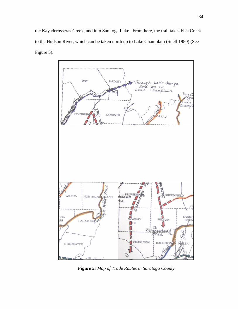
However, the magical waters would not remain a secret from European colonists
forever. Sir William Johnson, Superintendent of Indian Affairs in northern America for
the British Crown, first arrived in the Mohawk Valley in 1738 (See Figure 7). After
trading fairly with the Mohawks, protecting them from dishonorable colonists, and
learning to speak the Mohawk language, Johnson won the respect of the tribe. He was

42
made a chief of the Mohawks and given the name Warraghiyagey, or “He Who Does
Much.” The respect that the Mohawks had for Johnson ultimately saved his life. After
suffering from dysentery, gout, and a wound from the Battle of Lake George, the
Mohawk chiefs decided to bring Johnson to the healing waters of the Medicine Springs of
the Great Spirit (See Figure 8). In 1771, Johnson was the first white man to visit the
sacred springs of the Mohawks. A later white visitor to the scene described what Johnson
must have experienced at the springs:
The view before and around him was, in fact, like a wide sea of forest green. To the north and south it lay level and uniform. To the west and northwest, at the distance of a few miles, it was bounded by a low range of wooded hills, while eastward it stretched away for many a league, growing hazy in the distance until it was terminated by a long chain of misty mountains that lifted their blue and billowy tops against the silver brightness of the morning sky. (quoted in Waller 1966)
In this picturesque setting, Johnson received treatment at the springs for four days as he
bathed in and drank of the mineral waters. Miraculously, his health was restored.
Figure 8: The Mohawks bring Sir William Johnson to the springs (Waller 1966).
After experiencing the wonders of the mineral springs and the healing powers of
nature at the site of the Medicine Springs of the Great Spirit, Johnson wrote a letter to
Philip Schuyler, a local landholder, describing the springs. At the time, Schuyler was

43
establishing a village known as Saratoga within a 4,000 acre tract of land. By 1783,
Schuyler cut a bridle path from his family estates on the Hudson River to the springs.
News of the springs spread among the settlers, and interest in the water fostered the
development of the area, as cabins and roads were built. The site attracted many visitors,
including George Washington. Holmes and Stonequist write, “The springs of Saratoga
were never again neglected. They soon became the source of continual summers of
health and recreation. Over time, they became a legendary attraction” (2000). The
appeal of the mineral springs is what allowed the establishment of a township in 1819.
However, the settlement of the area as a result of this attraction had both good and bad
outcomes.
In some ways, the appeal of the mineral springs allowed the settlers and First
People to come together peacefully. The Mohawks were able to share their culture with
European visitors through teaching traditional skills, serving as guides to the Adirondacks
as well as cooks and camp organizers, and selling traditional crafts. The city of Saratoga
Springs encouraged the First People to make encampments, or large outdoor markets,
during the summer, and the crafts they sold were popular souvenirs for visitors. Such
encampments began in the 1840s, and as they expanded, photographers, fortune tellers,
glass blowers, and other craftspeople began to attend (Corbett 2001). The first camp was
located at Pine Grove near North Broadway; during the 1850s, it was moved to South
Broadway, and by the 1860s it had moved to Congress Park. Traditional crafts and
useful items such as woven ash splint baskets, beaded bags, leather moccasins,
snowshoes, canoes, toboggans, and children’s toys were sold (Bruchac, Native Artisans
2007). Through the sale of such souvenirs and the availability of hunting, fishing, and

44
hiking guides, the appeal of the mineral springs as a tourist attraction allowed the
Mohawks to share their culture with European settlers and visitors as well as to receive
an economic benefit from sharing their skills and traditions.
Despite such sharing of culture and crafts, however, the presence of First People
in Saratoga Springs and near the medicinal springs themselves led to some conflicts with
European settlers. Regardless of the success of the encampments, white racist views of
the time period kept the First People separate from white society. In addition to such
racism, the Mohawks were being pushed from the land they had inhabited each summer
as the area became more settled and developed. While the city still encouraged the
Mohawks to return for the summer encampments, they were less welcome and less able
to use the hunting grounds, lakes and streams, and mineral springs as they had in the past.
Such racist views can be seen in William Strickland’s description of the springs in 1794.
Strickland writes of the springs, “They are resorted to by people chiefly of the lower
order, afflicted with sores and humours in the blood, but no tolerable accommodations
are yet to be met with at the place, and there is nothing about it to tempt the visits of any
one, being situated in a steril country, surrounded by pine barrens” (Horne 2004). The
sacred springs, which the Mohawks had depended on for centuries, had become an
attraction for “people…of the lower order,” and the site has “no tolerable
accommodations” for visitors. Strickland’s perception of the springs is not one of a
pristine, magical, healing place, as it was for the First People and early visitors like Sir
William Johnson, but rather a contaminated site where diseased people visit. The springs
changed from a private and pristine setting to a place where many people traveled to cure
their ailments.

45
The discovery of the Medicine Springs of the Great Spirit led to the development
of the Saratoga area as English, Dutch, and French settlers arrived. Such settlement led
to the migration of the Mohawks out of the Saratoga Springs area as well as new social
dynamics and an end to the traditional hunting, fishing, and healing grounds of the
Mohawks. However, the legacy of the magical healing waters still stands. To confirm
the traditional ownership of the springs by the First People, an excavation and re-tubing
of the High Rocks Spring in 1866 revealed that the remains of platforms and tubing
apparatuses belonged to the ancient people that first inhabited the region. This simple
fact serves to remind present visitors to the springs that the First People were the earliest
to use and value the medicinal powers of the springs.
46
Spirituality and Culture
The Mohawk are very spiritual people. They believe in a great
interconnectedness between nature, humans, and the spirits. The Great Spirit who rules
over everything is called He-wen-ne-ya, while Orenda is the life force that flows through
all of creation. The Mohawk see everything in nature as essentially spiritual and, as a
result, feel that everything in creation should be honored with a song, a dance, and a
story. Thanksgiving is a part of the Great Law of Peace. Songs of Thanksgiving are
performed throughout the day when an individual feels blessed. The Mohawk are
humbled in front of nature because they realize that the earth can survive without them,
but humans cannot survive without nature (pers. comm. M. Tarbell).
One way this appreciation of nature is manifested is through the Water Drum,
which is used by the Iroquois during social dances. These drums are made of basswood
and are carved out from the inside. A cloth ring holds a piece of leather in place on top of
the drum. There is a hole in the side of the drum where water is poured through. A
carved wooden peg is then placed in the hole so the water does not leak out. The drum is
inverted just before playing, until the leather top becomes wet and tight. A carved
wooden beater is used to play the drum. The basswood reminds the people of their
connection to the plants, while the leather reminds them of their connection to the
animals. The water reminds the people that water is life. The circle-shaped top of the
drum and ring symbolize the life cycle, the water cycle, celestial bodies, and the
continuity and recreation of the Natural World in general (Olan and Bruchac, Water Drum
2007).

47
The oral tradition is part of an everyday spiritual existence and is ordained in the
Great Law. Mohawk chiefs were leaders as well as spiritual guides and were responsible
for maintaining such oral traditions. They believe that stories provide many different
ways of looking at something and can give people a more complete understanding of an
issue (pers. comm. M. Tarbell). As such, we have collected five tales, mostly of Mohawk
descent, that relay an understanding of spirituality in this region, particularly in relation
to water.
“The Great Law of Peace”
The Great Law of Peace was proposed by the Peacemaker. For many years, he
and Aionhwatha, an orator, traveled together in hopes of convincing the people to follow
this Law. When all of the five Iroquois nations finally decided to join together, the
Peacemaker pulled up a white pine tree by its roots and asked the people to throw their
weapons of war into the pit that had been created. An underground stream washed the
weapons away so that future generations would never see them again. It is said that this
is where the term “bury the hatchet” comes from. The tree was put back into the ground
and is referred to as the Great Tree of Peace (Olan, Haudenosaunne 2007).
“The Healing Waters”
Nekumonta is remembered as one of the strongest and bravest chiefs of the
Mohawk and is famed for discovering the mineral springs. As legend goes, his tribe had
caught a plague and was suffering terribly. When his wife, Shanewis, fell ill, Nekumonta
knew he had to do something. In desperation, he fled to the woods in search of medicinal

48
herbs. He spent several days in the forest, but was unable to find anything that could
help. Finally, one night while he was dreaming, he was told, “Strong and brave chief of
the Mohawks, here are the healing waters of the Great Spirit. Take us from our prison
and thy loved Shanewis shall live.” Nekumonta woke up and dug frantically on the very
spot he was sleeping to discover a mineral spring. He fashioned a clay jar, stored the
water, and returned to the tribe. The mineral water restored Shanewis’ health and revived
the tribe. Nekumonta had saved his people.
From then on, the mineral springs were seen as highly spiritual and became
famous for their healing properties (Canfield 1902).
“The Battle on the Mourning Kill”
As mentioned earlier, the Mohawk believe everything in nature has a spirit.
Nathaniel Sylvester wrote that the Mohawk believed that the spirits of inanimate objects
“somehow possessed the mysterious power of putting on at will the shapes of the living
forms of animals and birds… so that sometimes the spirit of a mountain stream would
come bounding toward them in the shape of a deer, and sometimes the spirit of a lake
would float on its surface as a graceful swan.” They thought that these spirit forms
always came with a mission to accomplish either good or evil import toward the people
(1884).
Of all the spirit forms, the most famous in this area was the spirit of Saratoga
Lake. This spirit could first assume the bodily shape of an enemy that, after being slain
by its victim would suddenly become magically transformed into a beautiful white dove,
which was widely known as the “White Dove of Kay-ad-ros-se-ra” or the “good spirit-

49
bird of the wilderness.” It was her mission to save the lost wanderer and it was even
believed she could bring the dead back to life. This spirit-bird was also notorious for
being the catalyst of many fierce wars, such as the particularly tragic battle that gives the
Mourning Kill River its name today (Sylvester 1884).
One day, a group of Algonquian and a group of Iroquois of equal size met along
a war trail by a riverside. The two tribes broke out in an incredibly violent battle that
lasted all day. Both tribes could see an eagle perched in a tree watching over them. The
two groups, seeing this as an omen of success, fought harder and harder. All of nature
watched the bloody scene in complete horror. The rose blushed to crimson in deepest
shame, the water lily turned white in terror, the willow bent her boughs in sorrow, and the
branches of the elms wept showers of tears.
At the end of the day, the surviving warriors looked out across the battle scene
and saw their dying brothers and realized with horror that they had been deceived. The
distraught warriors looked to the eagle they had both believed to be a sign of success and
realized it was an evil spirit. Together they shot five hundred arrows into the eagle’s
breast (See Figure 9). As it hit the ground, the eagle transformed into a gentle dove. It
was the spirit-bird of the wilderness, the white dove of Kay-ad-ros-se-ra that had come to
break the spell of the battle-demon.
For generations, during the moon of the roses, the two tribes would return to this
riverside every year, even up until the arrival of the Europeans, to mourn their dead and
to remember the tragic tale. The settlers thus named the river the Mourning Kill. After
the battle, the two tribes lived in peace under Mohawk chiefdom on the western shores of
Saratoga Lake, while the eastern shore belonged to the Mahicans (Sylvester 1884).

50
Figure 9: The Battle on the Mourning Kill (Sylvester 1884)
“The Queen of the Mohawk”
Mohawks customarily tortured young braves to test their powers of endurance.
One such way was by cutting them. If they flinched, the young braves were forever seen
as of a lower class and made to do menial work. Women were also tested. In this region,
Mohawk girls were required at the age of thirteen to swim across Saratoga Lake from a
point on the western shore near the mouth of the Kayaderosseras to the high hill on the
other side known as Tor-war-loon-da, or the “hill of storms.” Only those who passed
were thought worthy to become mothers of a new generation of Mohawk braves
(Sylvester 1884).
Once there was an old sachem that had an only child, a daughter. In her thirteenth
year, the girl attempted the swim across Saratoga Lake. She started off strong, but half

51
way through she began to feel weak and feared she would not make it. As she was
chanting her death-song, a monstrous bird of prey sighted her and swooped down to catch
her. The young girl was too heavy and he dropped her. When the bird tried again, the
girl clung to him for dear life and the two plunged into the lake. The tribe watched from
the shore as they disappeared beneath the surface. Moments later, the girl emerged at the
shore. Sitting upon her head was the white dove of the Kay-ad-ros-se-ra (See Figure 10).
The girl’s father, believing her to be dead, had died of heartache as soon as he saw her go
under, hence making his daughter the queen of the Mohawks. In honor of her rescue by
the white dove, the succession of sachemship has since been kept in the female line
(Sylvester 1884).
Figure 10: The White Dove of the Kay-ad-ros-se-ra Rescues a Mohawk Princess (Sylvester 1884)
Gluskabe
Gluskabe is a cultural folk hero among the Abenaki. He is famous for many
reasons. He was known to have the power to change shape and size and used a stone

52
canoe. As one legend goes, Gluskabe created his body out of clay. He first scooped up a
pile of clay and sculpted his arms, then his torso, and his head; but he had forgotten to
shape legs. So, when Gluskabe tried to stand, he struggled. He reached to one side and
tried to push himself up and instead pushed up mountains. He reached to the other side,
pushing up mountains. These mountains are known today as the Green Mountains and
Adirondack Mountains. When he realized he did not have legs, he formed them. As he
stood up, he pressed his fingers down the sides of the mountains. Where he had been
sitting was a giant indentation. When the rains came, they ran down the mountains,
creating the rivers, and flowed into the hole Gluskabe had made, forming a giant lake.
The Abenaki called this lake the “waters in between,” which is now Lake Champlain.
In other versions of the story, Gluskabe did not shape his legs right away. Instead
he crawled around the land for a while, shaping the topography. Many feel that this
version of the story is actually recalling the glaciers crawling across the land and
reshaping it.
Some believed that after this, Gluskabe later created people. He did so by
shooting a magic arrow into the top of some ash trees that he had carved into the shape of
humans. Gluskabe made the people out of ash trees so they would always remember to
be rooted to the earth. Gluskabe did very much for the people and it is believed today
that he is very angry for the way people are treating the earth (pers. comm. J. Bruchac).

53
Conclusion
Through historical accounts and archaeological evidence, it is clear that water was
an extremely important resource in the lives of the First People of the Saratoga Lake
Watershed. Not only did these people depend on water for the ability to travel and for
numerous food resources, but they also depended on water as a symbol of their spiritual
connections to nature and as a tool by which to heal those suffering of various ailments.
Their connections to water are clear through legends, myths, creation stories, artifacts,
site remains, tradition, and accounts by European settlers and descendants of the First
People.
In our conversation with Mike Tarbell, he told us a story about fishing and
swimming in a river as a child. “That river was our life,” he told us. However, Mike can
no longer swim in the river because of pollution and cannot eat its fish because of the
accumulation of toxins in their bodies. He told us that the Iroquois never abused the
water as it has been abused in recent times. Everything was natural, he told us, and there
was no pollution. The Iroquois did not abuse the water because it was a vital part of
everyday life. Mike expressed the significance of this area as being a part of one of the
largest freshwater systems in the world. This water system, however, is also one of the
most polluted freshwater systems in the world.
Mike also told us that in Mohawk culture, story-telling was used to teach lessons
and pass on history. We hope that the stories you have read in this essay, as well as the
over-arching story of the history of the First People in this area, have taught you the
crucial importance of water to our lives. The Saratoga Lake Watershed must be
sustainably managed not only to ensure our own survival, but also to protect these vital

54
resources for our offspring and generations to come. Furthermore, these water bodies
need to be protected because of their intrinsic value to the region’s history and culture.

55
Afterword
The connections that the First People held with water have not dissipated even as
settlement and development of North America have dispersed them away from their
traditional lands. Today, First People all over the country continue to value water for its
physical and spiritual necessity. Though several First People remain in the Saratoga
region, most of the Mohawk and Mahican people that used to live in this area in the past
have fled to reservations across the northeast. Through current political and
environmental issues, these people express the value of water in their lives, whether they
suffer from large-scale water projects or the fight to maintain fishing rights on tribal
lands.
During the 2000 census, 72,313 people in the state of New York identified
themselves at Native Americans, forming about .4% of the state’s population (US Census
2000). While these numbers may seem small, populations of First People are still greatly
impacted by political and environmental issues related to the use of water. In the past
century, they have faced the loss of land to water projects, as well as changes in their
lifestyles as waters have become polluted by industrialization and development. Policies
have also threatened to discontinue their rights to hunt and fish on ancestral lands and
waters.
In recent times, many major policy conflicts have arisen as First Nations have
battled to maintain hunting and fishing rights, both on reservations and on non-
reservation lands that were once held by their ancestors. Generally, these people
maintain the right to hunt and fish on these lands unless their rights to do so were
officially given up to the federal government; in either case, Congress maintains the
56
power to modify these rights. Under tribal regulations, state governments cannot prohibit
the possession or sale of fish and game taken from non-reservations. However, the rights
of First Nations to hunt and fish on their ancestral lands are subject to some limitations,
and they have had to continually protest to maintain their rights to use the waterways that
once belonged to them (Thompson 2005).
Many environmental injustices that the First Nations face are water-related. In
1965, a portion of the Kahnawake Reservation was destroyed by the construction of the
St. Lawrence Seaway, and one third of the Allegany Reservation was flooded by the
Kinzua Dam, despite the feasibility of less detrimental alternatives. The results were
devastating. The construction of these projects led to entire communities and rich
farmland being drowned by the waters, as well as burial grounds and other significant
spiritual sites. In addition, the New York State Power Authority claimed a portion of the
Tuscarora Reservation near Lewiston for a major hydroelectric project. The First People
have watched the trout in Lakes Erie and Ontario face risk of endangerment and
extinction as introduced species have invaded the waterways, and Mohawk women at
Akwesasne have been warned to stop eating fish from Lake Ontario because of the risk of
passing PCBs to their children through their wombs or breast milk. Toxic waste at the
Akwesasne Reservation, revealed by recent drilling, has contaminated the well water for
many families living there (Engelbrecht 2003).
Such environmental problems have meant great changes in the traditions and lives
of First People. However, not all stories of such environmental injustices have negative
outcomes. The Algonquian people, who formed the Muhheconneuk Intertribal
Committee on Deer Island in 1992, protected sacred burial sites that were threatened by a

57
Boston water treatment project. Additionally, in 1994, the Stockbridge-Munsee tribe
joined with the Menominee, Forest County Potawatomi, and Mole Lake Chippewa as Nii
Win, or “The Four,” to oppose a copper mine that Exxon planned at the headwaters of
Wisconsin’s Wolf River (Malinowski and Sheets 1998). The successes that such people
had in protecting their water resources are testament to the significance of water and the
efforts people will make to protect it. Such efforts should be taken as an example by all;
together, despite our ancestry, history, spirituality, or politics, we can protect the rich
water resources that allow our communities to thrive.

58
Works Cited
Brasser, T. J. Mahican. Unknown Source. Bruchac, J. Conversation with Jim Bruchac at Ndakinna Education Center on April 8, 2010. Bruchac, M. E-mail correspondence checking the accuracy of the exhibit at the Saratoga Springs History Museum. Archive at the Saratoga Room, Saratoga Springs Public Library, Saratoga Springs, New York, USA. Bruchac, M. 2006. Names for Saratoga and the springs. Saratoga Native American Festival Program. September 30 – October 1, 2006. Saratoga Springs, New York, USA. 23-25. Bruchac, M. 2006. Other native peoples in Saratoga County. Saratoga Native American Festival Program. September 30 – October 1, 2006. Saratoga Springs, New York, USA. 20-22. Bruchac, M. 2007. The mineral springs of Saratoga. Saratoga Native American Festival Program. September 29-30, 2007. Saratoga Springs, New York, USA. 29-30. Bruchac, M. 2007. Native artisans and trade in the Saratoga region. Saratoga Native American Festival Program. September 29-30, 2007. Saratoga Springs, New York, USA. 27-28. Caduto, M. J. and J. Bruchac. 1991. Native American stories told by Joseph Bruchac. Fulcrum Publishing, Golden, Colorado, USA. Canfield, W. 1902. The legends of the Iroquois: told by the Cornplanter. Ira J. Friedman Inc., New York, USA. Comer, S. 2007. About the Mohicans. Saratoga Native American Festival Program. September 29-30, 2007. Saratoga Springs, New York, USA. 16-17. Corbett, T. 2001. The making of American resorts: Saratoga Springs, Ballston Spa, Lake George. Rutgers University Press, Piscataway, New Jersey, USA. Cronon, W. 2003. Changes in the land: Indians, colonists, and the ecology of New England. Hill and Wang, New York, New York, USA. Davis, O. H. Winney Island synopsis: being a factual concise account of a multi-component prehistoric and contact Iroquoian fishing village in Saratoga County, New York. Saratoga Room, Saratoga Springs Public Library, Saratoga Springs, New York, USA.

59
DeCoste, J. and C. Taff. 2005. The history of the Kayaderosseras Watershed: an environmental approach. Unpublished. Skidmore College Environmental Studies Program, Saratoga Springs, New York, USA. DeMicco, D. Settlement history and environmental exploitation of the Saratoga Lake area from the late 18th to late 18th century. Archives from the Saratoga Room, Saratoga Springs Public Library, Saratoga Springs, New York. USA. Dorrough, R. 2006. Saratoga. E-mail correspondence. Archive at the Saratoga Room, Saratoga Springs Public Library: Saratoga Springs, New York, USA. Dunn, S. 2000. The Mohican World: 1680-1750. Purple Mountain Press, New York, New York, USA. Durkee, C. 1927. Reminiscences of Saratoga. Reprinted from The Saratogian. Engelbrecht, W. 2003. Iroquoia: the development of a native world. Syracuse University Press, Syracuse, New York, USA. Holmes, T. A. and M. Stonequist. 2000. Saratoga Springs: a historical portrait. Arcadia, Charleston, South Carolina, USA. Horne, F. 2004. The Saratoga reader: writing about an American village 1749-1900. Kiskatom Publishing, Saratoga Springs, New York, USA. Images of the Indians of New Jersey. http://www.getnj.com/njindian.shtml. Accessed May 6, 2010. Keller, A. 1976. Life along the Hudson. Sleepy Hollow Restorations: Tarrytown, New York, USA. Malinowski, S. and A. Sheets, ed. 1998. The Gale Encyclopedia of Native American Tribes, Volume 1. Gale Research Inc., Detroit, Michigan, USA. Moran, M. 1976. Saraghtoga was Indian domain. Archive at the Saratoga Room, Saratoga Springs Public Library, Saratoga Springs, New York, USA. Morgan, L. 1901. League of the Ho-de-no-sau-nee or Iroquois. Dodd, Mead & Co., New York, New York, USA. Olan, M. 2007. About the Haudenosaunee (Iroquois). Saratoga Native American Festival Program. September 29-30, 2007. Saratoga Springs, New York, USA. 22-23. Olan, K. and M. Bruchac. 2007. Algonquian / Iroquoian languages in Festival Notes. Saratoga Native American Festival Program. September 29-30, 2007. Saratoga Springs, New York, USA. 11.

60
Olan, K. and M. Bruchac. 2007. Water drum in Festival Notes. Saratoga Native American Festival Program. September 29-30, 2007. Saratoga Springs, New York, USA. 13. Rothschild, N. A. 2003. Colonial encounters in a Native American landscape: the Spanish and Dutch in North America. Smithsonian Books, Washington D.C., USA. The Saratogian. 1899. Our County and Its People: Saratoga County, New York. The Boston History Company Publishers, New York, New York, USA. Simpson, H. J., ed. 2002. A concise history of the Saratoga area from contemporaneous accounts. The Malta Press, Saratoga Springs, New York, USA. Skidmore Archaeological Survey, Skidmore College. Archaeological Sites of Saratoga Lake, Fish Creek, and Vicinity. Brochure. Design Review Commission, Saratoga Springs, New York, USA. Snell, L. 1980. Saratoga County communities: an historical perspective. Johnstone, J., ed. Clifton Park Printing Co., Clifton Park, New York, USA. Sylvester, N. B. 1884. Indian legends of Saratoga and the Upper Hudson Valley. N. B. Sylvester & Co., Troy, New York, USA. Sylvester, N. B. 1979. History of Saratoga County, New York. Heart of the Lakes Publishing, New York, New York, USA. Tarbell, M. Conversation with Mike Tarbell at the Iroquois Indian Museum on April 3, 2010. Thompson, W. 2005. Native America issues. Second edition. ABC-CLIO Inc., Santa Barbara, California, USA. United States Census. 2000. http://www.census.gov/population/www/cen2000/briefs/phc-t18/tables/tab047.pdf. Accessed May 6, 2010. Waller, G. 1966. Saratoga: Saga of an Impious Era. Prentice Hall: New Jersey, USA. Walsh, J. P. 2009. A brief outline of the Native American presence at Saratoga Lake. Fall quarterly newsletter for the Saratoga Lake Association. Saratoga Springs, New York, USA. The Watering Places. Special Correspondence of the New York Herald. Saratoga. August 22, 1853. Archive at the Saratoga Room, Saratoga Springs Public Library, Saratoga Springs, New York, USA.

61
Woodward, L. 1982. Saratoga Springs: its Native American origins. Mohawk Valley USA 2(8): 33.


![[GPM 223] - USS Saratoga (CV-3)](https://img.pdfslide.tips/doc/110x75/5477f7ceb4af9f81598b4577/gpm-223-uss-saratoga-cv-3.jpg)