Embed Size (px)
Citation preview
6/18/2015
1
Innovative Solutions for tomorrow’s transportation needs
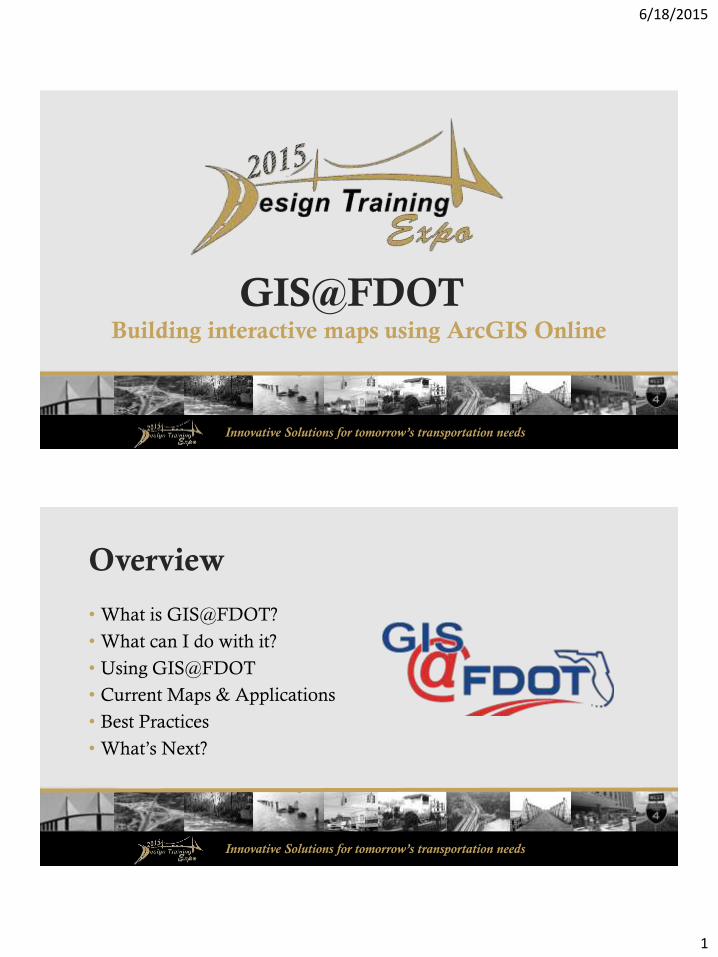
GIS@FDOTBuilding interactive maps using ArcGIS Online
Innovative Solutions for tomorrow’s transportation needs
Overview
• What is GIS@FDOT?
• What can I do with it?
• Using GIS@FDOT
• Current Maps & Applications
• Best Practices
• What’s Next?
6/18/2015
2
Innovative Solutions for tomorrow’s transportation needs
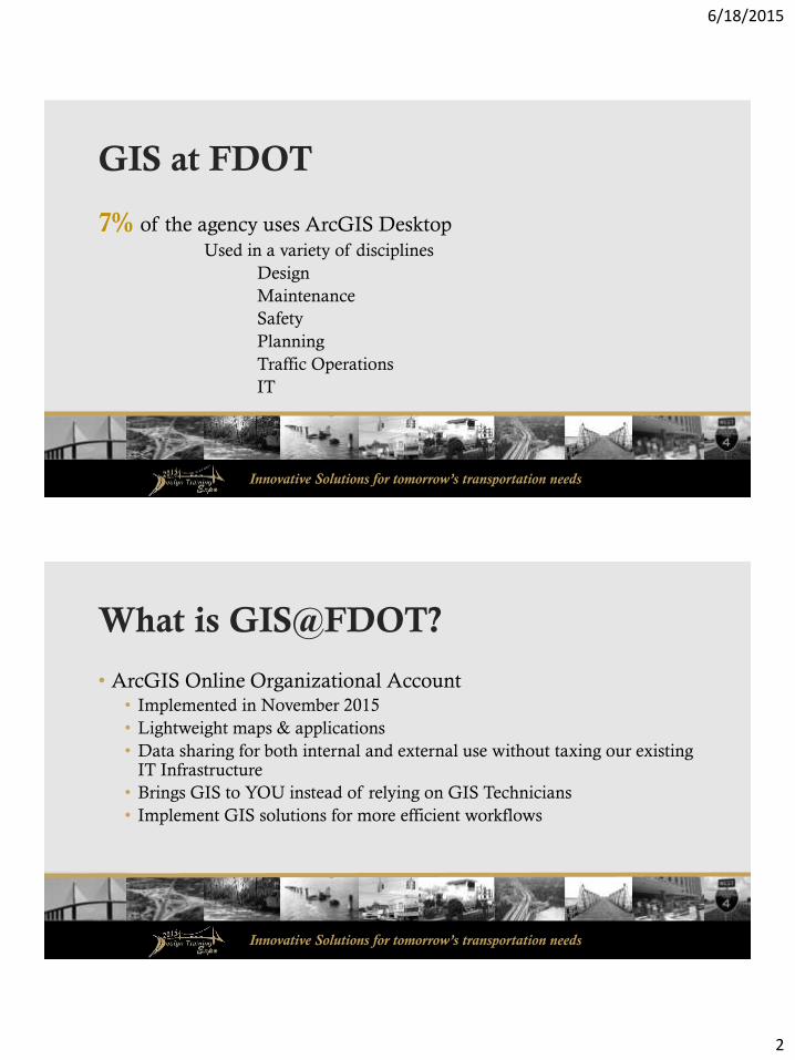
GIS at FDOT
7% of the agency uses ArcGIS Desktop
Used in a variety of disciplines
Design
Maintenance
Safety
Planning
Traffic Operations
IT
Innovative Solutions for tomorrow’s transportation needs
What is GIS@FDOT?
• ArcGIS Online Organizational Account• Implemented in November 2015
• Lightweight maps & applications
• Data sharing for both internal and external use without taxing our existing IT Infrastructure
• Brings GIS to YOU instead of relying on GIS Technicians
• Implement GIS solutions for more efficient workflows

6/18/2015
3
Innovative Solutions for tomorrow’s transportation needs
GIS@FDOT
• Collaborative
• Cloud-based
• Content Management System
• Ready-to-use maps
• Analytics Tools
• Lightweight Development
Image courtesy Esri, Inc.
Innovative Solutions for tomorrow’s transportation needs
GIS@FDOT
• Modeled after UPLAN• UPLAN Phase II
• AASHTO Innovation Initiative• Provided FDOT with 100 named users and 17,500 credits

6/18/2015
4
Innovative Solutions for tomorrow’s transportation needs
Innovative Solutions for tomorrow’s transportation needs
6/18/2015
5
Innovative Solutions for tomorrow’s transportation needs
What can I do with it?
• Create maps
• Create data
• Create web applications
• Perform spatial analysis
• Share information
Innovative Solutions for tomorrow’s transportation needs
Credit Model
• Annual subscription
• Named users
• Service Credits• Storage
• Analytics
• Demographic content• Data Enrichment
6/18/2015
6
Innovative Solutions for tomorrow’s transportation needs
Current Usage
• 63 Named Users
• 34 Groups
• Content• 93 Maps
• 398 Layers
• 58 Files
• 53 Apps
Innovative Solutions for tomorrow’s transportation needs
How to use GIS@FDOT
6/18/2015
7
Innovative Solutions for tomorrow’s transportation needs
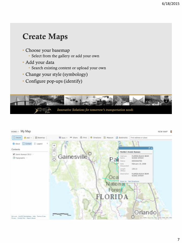
Create Maps
• Choose your basemap• Select from the gallery or add your own
• Add your data • Search existing content or upload your own
• Change your style (symbology)
• Configure pop-ups (identify)
Innovative Solutions for tomorrow’s transportation needs
6/18/2015
8
Innovative Solutions for tomorrow’s transportation needs
Create Data
• Esri Maps for Office• Map and analyze data directly from Excel
• Share maps created from Excel
• Data Enrichment• Add demographic and statistics to existing data
• Uses location of features to determine values
• Can perform analysis on added attributes
Innovative Solutions for tomorrow’s transportation needs
Perform Spatial Analysis
• Find Existing Locations
• Derive New Locations
• Find Hot Spots
• Find Similar Locations
• Plan Routes
6/18/2015
9
Innovative Solutions for tomorrow’s transportation needs
Create Web Applications
• No development skills necessary!
• Configurable Templates• Viewers
• Find, Edit, Filter
• Story Maps
• Time Aware
• Web AppBuilder
Innovative Solutions for tomorrow’s transportation needs
Share information
• Four levels of information sharing• Private
• Group
• Organization
• Public
• Share via web apps
• Embed maps in existing web pages

6/18/2015
10
Innovative Solutions for tomorrow’s transportation needs
Current Applications
Innovative Solutions for tomorrow’s transportation needs
Applications & Maps• Bicycle Friendly Roads
• Work Program Projects
• Virtual State Map
• Florida Bridges
• Pavement Evaluation & Testing
• Safety: Pedestrian Traffic
• Wildflower Locations
• Adopt-A-Highway
• Turnpike Construction
• District Operations
• Asset Management Contracts
• Strategic Intermodal System
• TBX Project Locations
• Soil Borings
• Stormwater Ponds/Outfalls
• Scenic Highways
6/18/2015
11
Innovative Solutions for tomorrow’s transportation needs
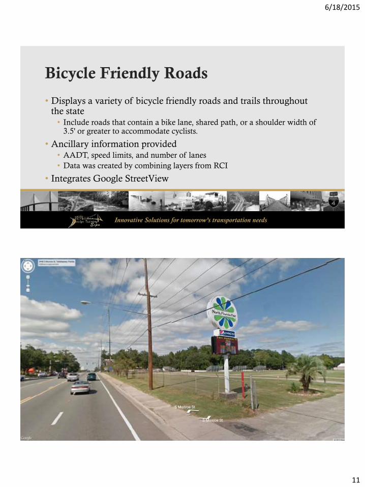
Bicycle Friendly Roads
• Displays a variety of bicycle friendly roads and trails throughout the state• Include roads that contain a bike lane, shared path, or a shoulder width of
3.5' or greater to accommodate cyclists.
• Ancillary information provided• AADT, speed limits, and number of lanes
• Data was created by combining layers from RCI
• Integrates Google StreetView
Innovative Solutions for tomorrow’s transportation needs
• Scenic Highways
• Trail/Shared Use Paths
• Park & Recreational Areas
• East Coast Greenway
• Adventure Cycling Routes

6/18/2015
12
Innovative Solutions for tomorrow’s transportation needs
High Pedestrian Traffic Areas
• Used to collect information on areas with high pedestrian volume
• Helps address pedestrian crashes in Florida• Pedestrian volume is difficult & time consuming to collect
• FDOT Districts, MPOs, other local governments use the app to identify corridors of high volume in their cities/regions.
• Allows the FDOT Safety Office to identify where additional pedestrian safety features (lighting, etc) should be installed.
Innovative Solutions for tomorrow’s transportation needs

6/18/2015
13
Innovative Solutions for tomorrow’s transportation needs
District Operations
• Contains common use data elements used in the day-to-day functions at District 1• Operational Layers
• Access Management
• Surveying & Mapping
• Right of Way
• Parcels
• D1 Transportation Statistics layers
Innovative Solutions for tomorrow’s transportation needs

6/18/2015
14
Innovative Solutions for tomorrow’s transportation needs
NPDES Stormwater Ponds & Major Outfalls
• Identifies stormwater ponds & outfalls along Florida’s Turnpike
• Using Collector for ArcGIS app; mobile data collection• Locations of asset
• Photos of features
Innovative Solutions for tomorrow’s transportation needs
6/18/2015
15
Innovative Solutions for tomorrow’s transportation needs
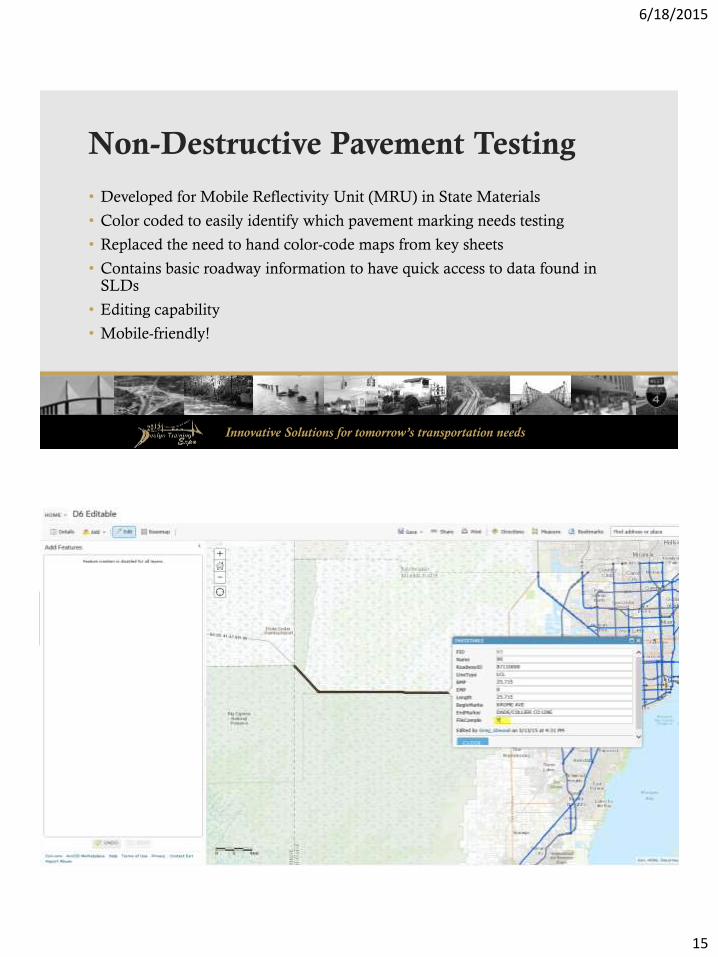
Non-Destructive Pavement Testing
• Developed for Mobile Reflectivity Unit (MRU) in State Materials
• Color coded to easily identify which pavement marking needs testing
• Replaced the need to hand color-code maps from key sheets
• Contains basic roadway information to have quick access to data found in SLDs
• Editing capability
• Mobile-friendly!
Innovative Solutions for tomorrow’s transportation needs

6/18/2015
16
Innovative Solutions for tomorrow’s transportation needs
Florida Bridges
• Provides a virtual tour of prominent bridges in Florida
• Story Map• Easy to create & maintain
• Visual representation for executive or public communication
Innovative Solutions for tomorrow’s transportation needs

6/18/2015
17
Innovative Solutions for tomorrow’s transportation needs
Best Practices
• Use of Groups• Functional Area
• Project Specific
• User Roles• Custom Roles
• Managed at the functional area/district level• Local Admin Role
Innovative Solutions for tomorrow’s transportation needs
Best Practices• Data Publishing
• Sharing content to the public
• Standard metadata
• Tags
• Disclaimer
• Content Management• Quarterly review of content
• Credit Management• Consult administrators before performing credit-heavy tasks
6/18/2015
18
Innovative Solutions for tomorrow’s transportation needs
Live Demo
Innovative Solutions for tomorrow’s transportation needs
What’s next for GIS@FDOT?• Continue to expand users & applications
• 63 members; can have up to 169
• Share data & services with non-FDOT users• Example: Unified Basemap/NAVSTREETS
• Sharing custom templates• Custom “widgets” & tools
• Open Data• Portal for sharing public datasets, maps, & apps in one place
• Imagery Storage

6/18/2015
19
Innovative Solutions for tomorrow’s transportation needs
Questions?
GIS@FDOT Administrators
Jessica Rogers, GISP
GIS/CADD Services Supervisor
Ana Nowak
Geographic Mapping Specialist
Jared Causseaux
FDOT GIS Coordinator