Embed Size (px)
Citation preview
© JoeHanousek, 2004
How Fast-Growing Counties Manage Parcel Mapping
Reducing the Costs of GIS Data EntryESRI Survey Summit
San Diego, California USAAugust 8, 2004
Joe HanousekUCLID Software
Madison, Wisconsin
© JoeHanousek, 2004
How Fast-Growing Counties Manage Parcel Mapping
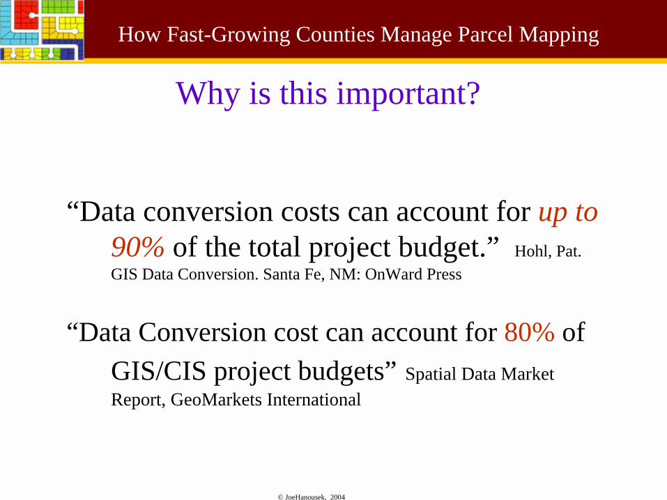
Why is this important?
“Data conversion costs can account for up to 90% of the total project budget.” Hohl, Pat. GIS Data Conversion. Santa Fe, NM: OnWard Press
“Data Conversion cost can account for 80% of GIS/CIS project budgets” Spatial Data Market Report, GeoMarkets International
© JoeHanousek, 2004
How Fast-Growing Counties Manage Parcel Mapping
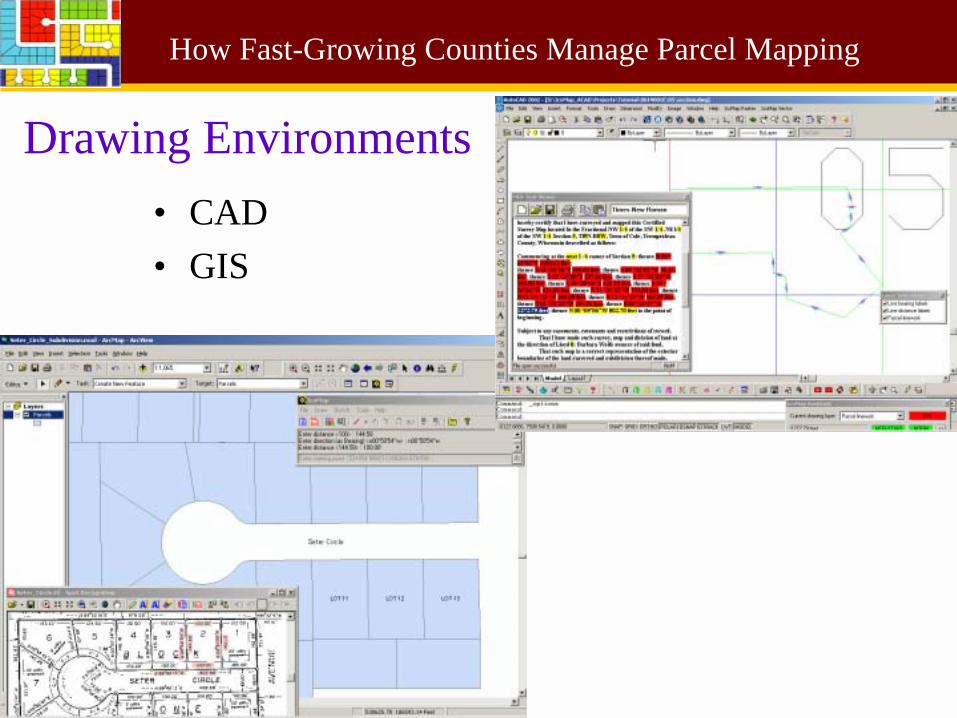
Drawing Environments• CAD• GIS
© JoeHanousek, 2004
How Fast-Growing Counties Manage Parcel Mapping
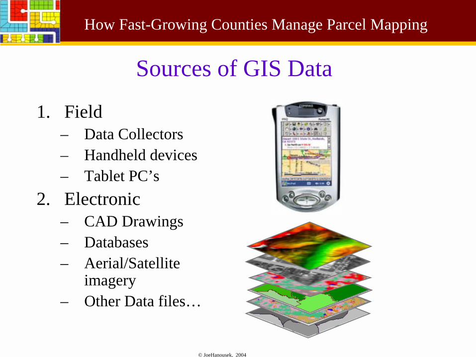
Sources of GIS Data
1. Field– Data Collectors– Handheld devices– Tablet PC’s
2. Electronic– CAD Drawings– Databases– Aerial/Satellite
imagery– Other Data files…
© JoeHanousek, 2004
How Fast-Growing Counties Manage Parcel Mapping
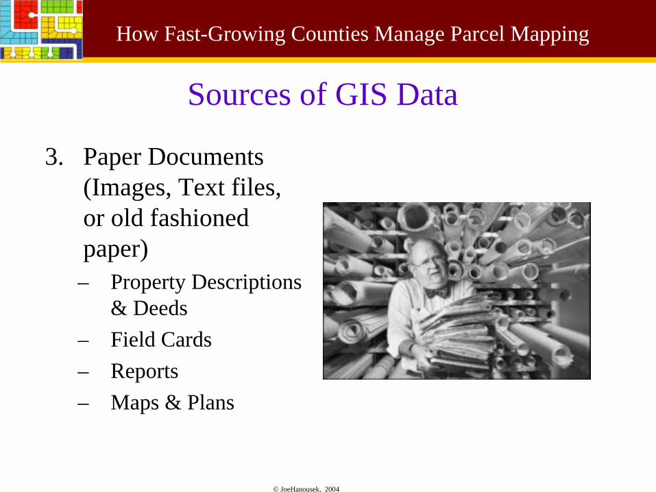
Sources of GIS Data
3. Paper Documents (Images, Text files, or old fashioned paper)– Property Descriptions
& Deeds– Field Cards– Reports– Maps & Plans
© JoeHanousek, 2004
How Fast-Growing Counties Manage Parcel Mapping
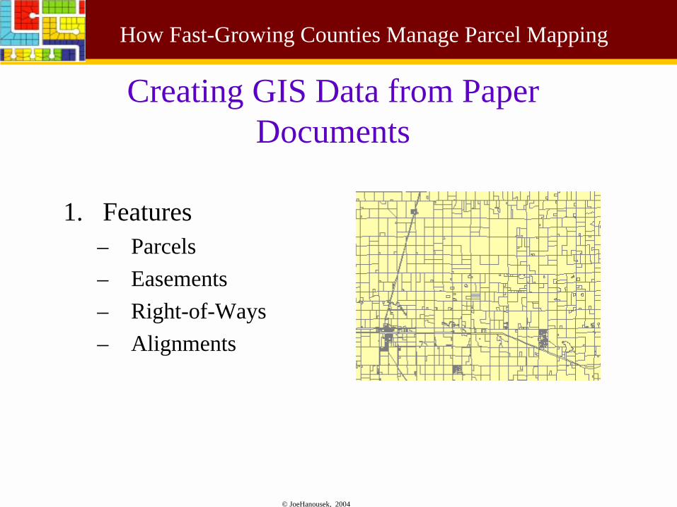
Creating GIS Data from Paper Documents
1. Features– Parcels– Easements– Right-of-Ways– Alignments
© JoeHanousek, 2004
How Fast-Growing Counties Manage Parcel Mapping
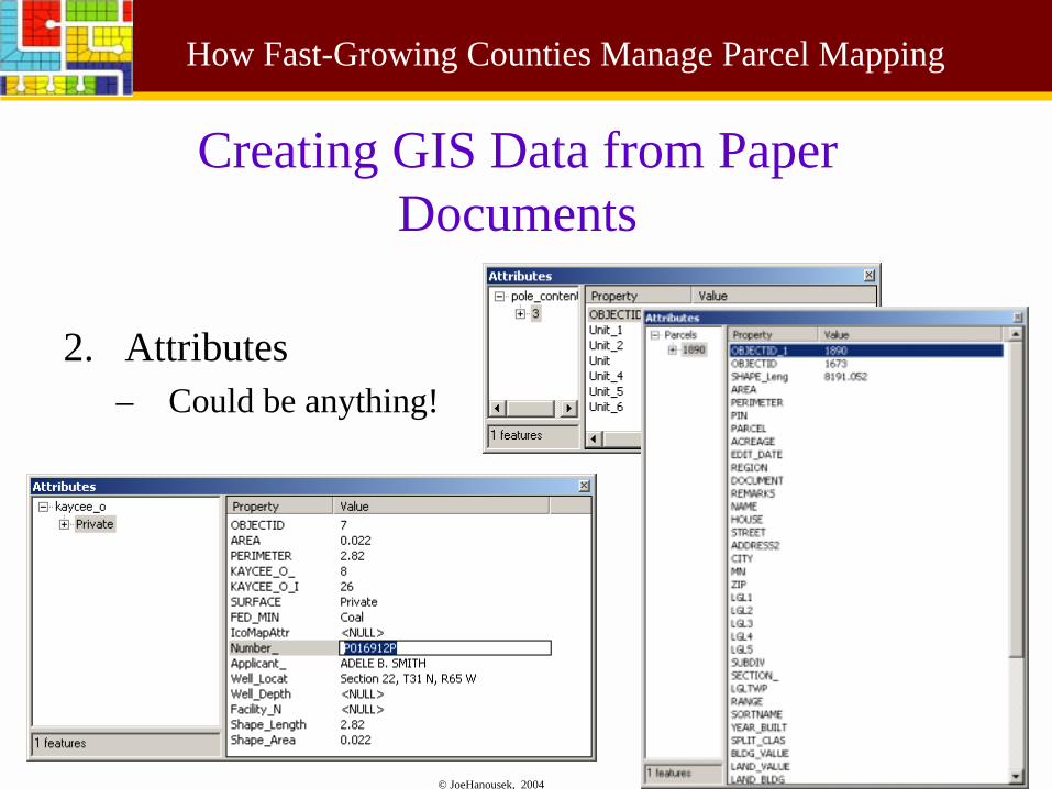
Creating GIS Data from Paper Documents
2. Attributes– Could be anything!
© JoeHanousek, 2004
How Fast-Growing Counties Manage Parcel Mapping
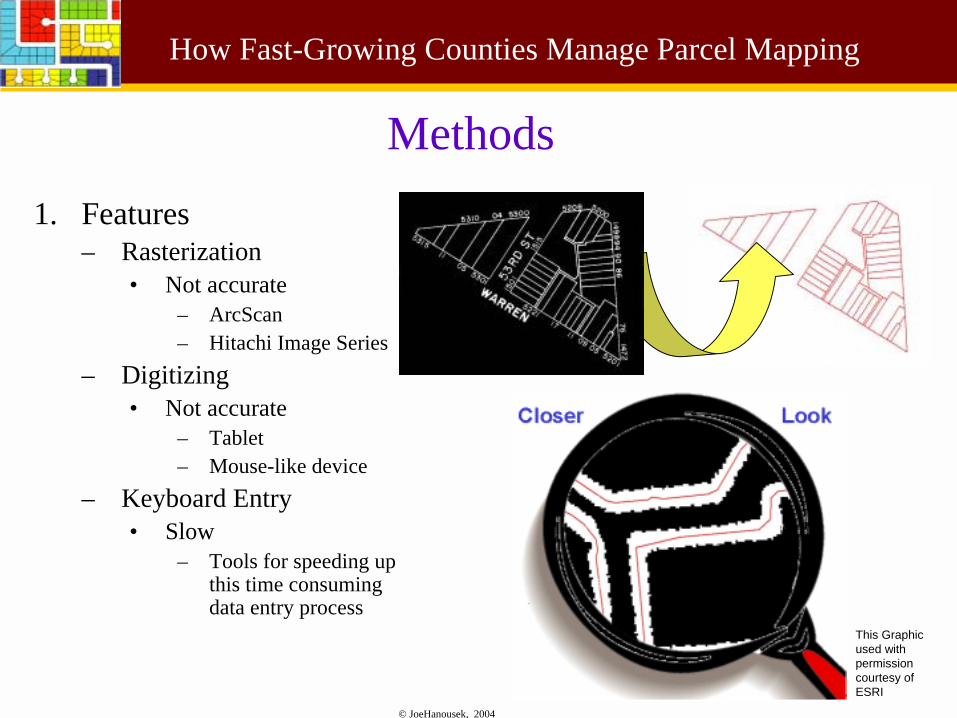
Methods1. Features
– Rasterization • Not accurate
– ArcScan– Hitachi Image Series
– Digitizing• Not accurate
– Tablet– Mouse-like device
– Keyboard Entry• Slow
– Tools for speeding up this time consuming data entry process
This Graphic used with permission courtesy of ESRI
© JoeHanousek, 2004
How Fast-Growing Counties Manage Parcel Mapping
Methods
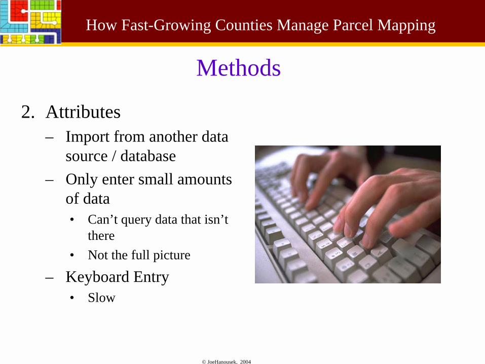
2. Attributes– Import from another data
source / database– Only enter small amounts
of data• Can’t query data that isn’t
there• Not the full picture
– Keyboard Entry• Slow
© JoeHanousek, 2004
How Fast-Growing Counties Manage Parcel Mapping
Tools for Speeding UpKeyboard Entry
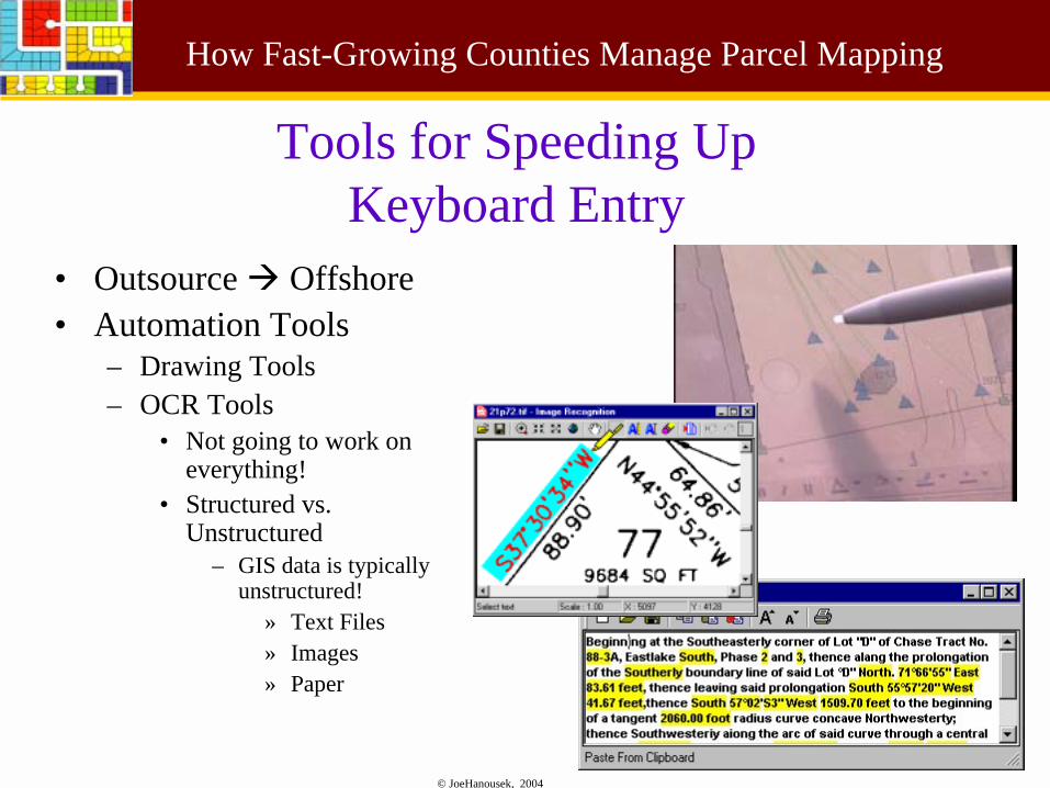
• Outsource ! Offshore• Automation Tools
– Drawing Tools– OCR Tools
• Not going to work on everything!
• Structured vs. Unstructured
– GIS data is typically unstructured!
» Text Files» Images» Paper
© JoeHanousek, 2004
How Fast-Growing Counties Manage Parcel Mapping
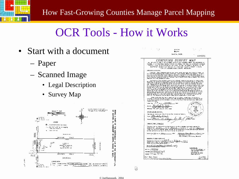
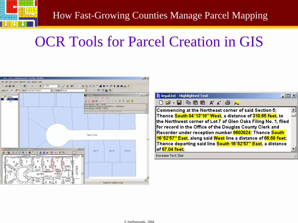
OCR Tools - How it Works• Start with a document
– Paper– Scanned Image
• Legal Description• Survey Map
© JoeHanousek, 2004
How Fast-Growing Counties Manage Parcel Mapping
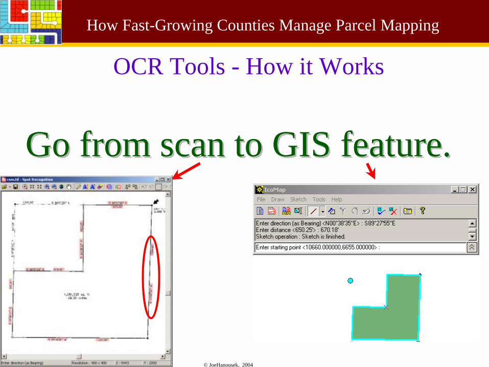
Go from scan to GIS feature.Go from scan to GIS feature.
OCR Tools - How it Works
© JoeHanousek, 2004
How Fast-Growing Counties Manage Parcel Mapping
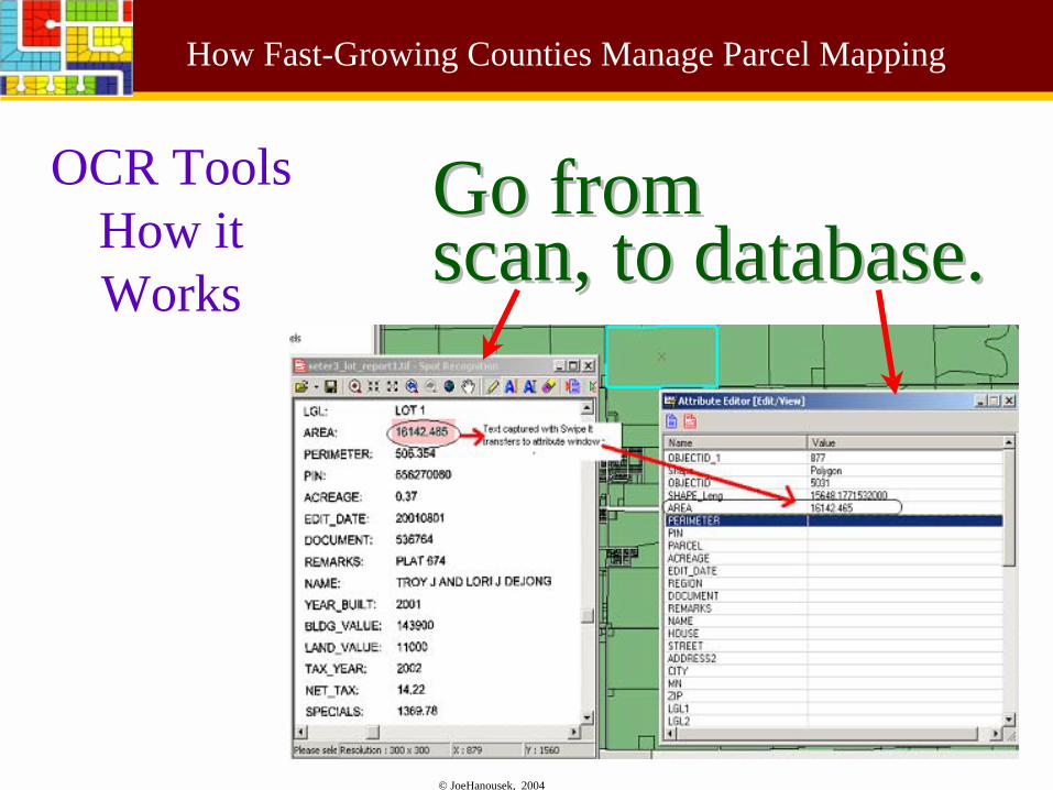
Go from Go from scan, to database.scan, to database.
OCR ToolsHow it Works
© JoeHanousek, 2004
How Fast-Growing Counties Manage Parcel Mapping
OCR Tools, are they Utopia?
+ Fast • 40% to 700% efficiency
gain. Average is 84%• Higher % if documents
already of high quality scans
+ Cost-Effective• Productivity gains quickly
pay for software costs (weeks)
+ Accurate• As the surveys themselves• Stores the original survey
attributes in GIS
+ Accountabilty – You bet!• Links source document to
parcel
– Limitations• Only as good as source
documents• It can’t read bad
handwriting• Will not work on 100% of
documents
© JoeHanousek, 2004
How Fast-Growing Counties Manage Parcel Mapping
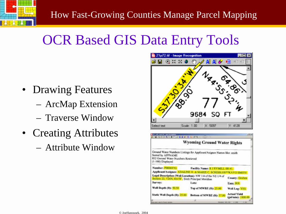
OCR Based GIS Data Entry Tools
• Drawing Features– ArcMap Extension– Traverse Window
• Creating Attributes– Attribute Window
© JoeHanousek, 2004
How Fast-Growing Counties Manage Parcel Mapping
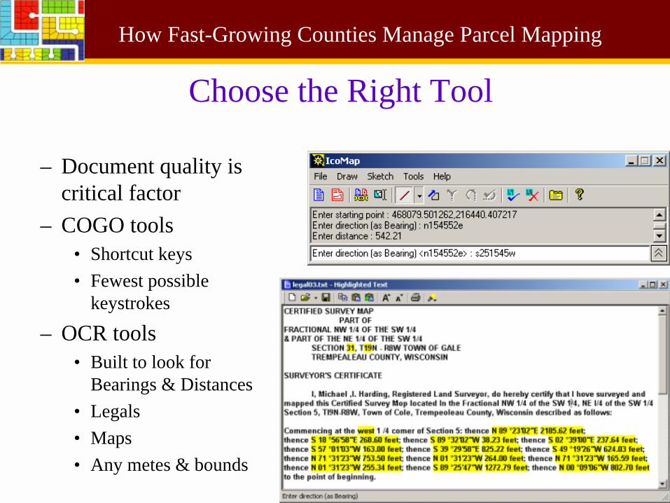
Choose the Right Tool
– Document quality is critical factor
– COGO tools• Shortcut keys• Fewest possible
keystrokes
– OCR tools• Built to look for
Bearings & Distances• Legals• Maps• Any metes & bounds
© JoeHanousek, 2004
How Fast-Growing Counties Manage Parcel Mapping
What to Look For
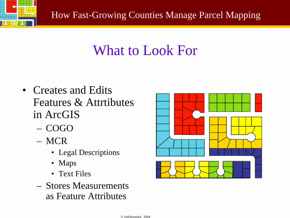
• Creates and Edits Features & Attrtibutesin ArcGIS– COGO– MCR
• Legal Descriptions• Maps• Text Files
– Stores Measurements as Feature Attributes
© JoeHanousek, 2004
How Fast-Growing Counties Manage Parcel Mapping
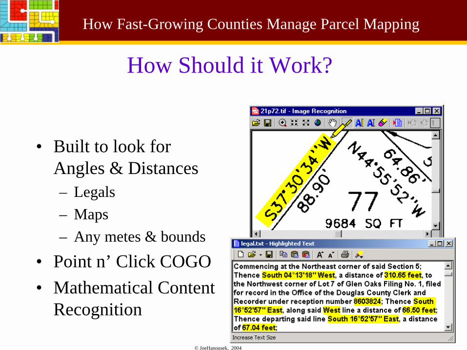
How Should it Work?
• Built to look for Angles & Distances– Legals– Maps– Any metes & bounds
• Point n’ Click COGO• Mathematical Content
Recognition
© JoeHanousek, 2004
How Fast-Growing Counties Manage Parcel Mapping
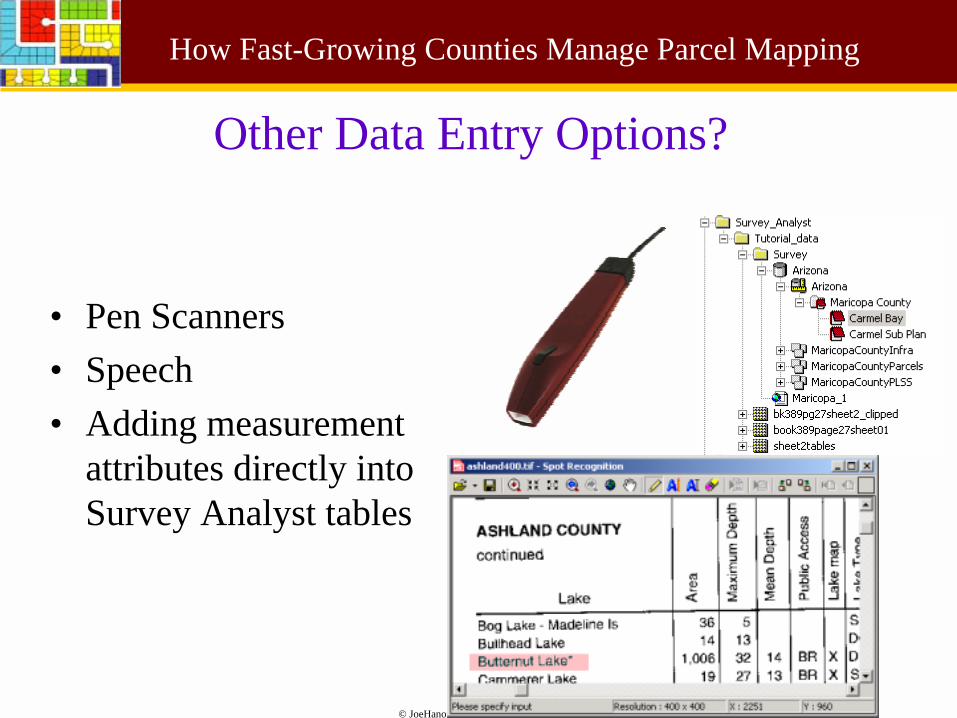
Other Data Entry Options?
• Pen Scanners• Speech• Adding measurement
attributes directly into Survey Analyst tables
© JoeHanousek, 2004
How Fast-Growing Counties Manage Parcel Mapping
Real World Examples
© JoeHanousek, 2004
How Fast-Growing Counties Manage Parcel Mapping
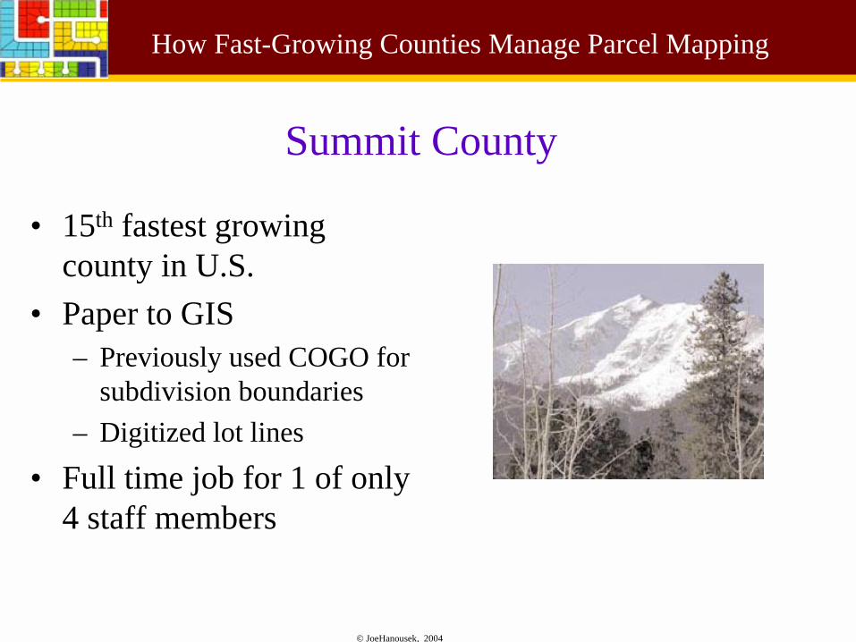
Summit County
• 15th fastest growing county in U.S.
• Paper to GIS– Previously used COGO for
subdivision boundaries– Digitized lot lines
• Full time job for 1 of only 4 staff members
© JoeHanousek, 2004
How Fast-Growing Counties Manage Parcel Mapping
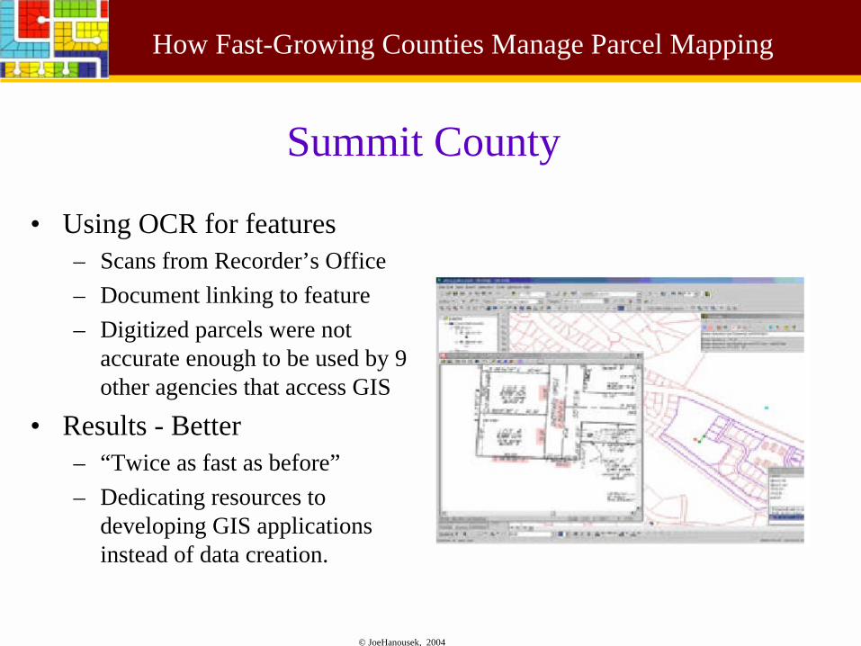
• Using OCR for features– Scans from Recorder’s Office– Document linking to feature– Digitized parcels were not
accurate enough to be used by 9 other agencies that access GIS
• Results - Better– “Twice as fast as before”– Dedicating resources to
developing GIS applications instead of data creation.
Summit County
© JoeHanousek, 2004
How Fast-Growing Counties Manage Parcel Mapping
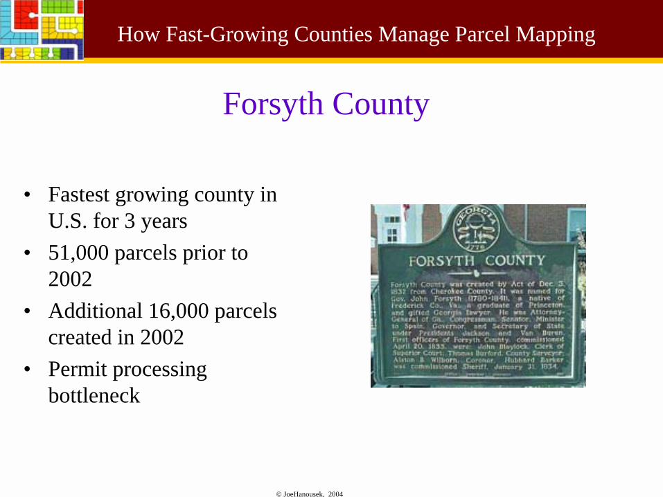
Forsyth County
• Fastest growing county in U.S. for 3 years
• 51,000 parcels prior to 2002
• Additional 16,000 parcels created in 2002
• Permit processing bottleneck
© JoeHanousek, 2004
How Fast-Growing Counties Manage Parcel Mapping
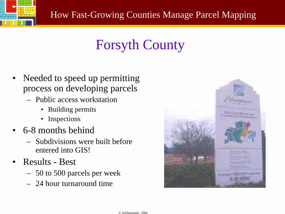
Forsyth County
• Needed to speed up permitting process on developing parcels– Public access workstation
• Building permits• Inspections
• 6-8 months behind– Subdivisions were built before
entered into GIS!• Results - Best
– 50 to 500 parcels per week– 24 hour turnaround time
© JoeHanousek, 2004
How Fast-Growing Counties Manage Parcel Mapping
Conclusions
• Productivity gains with automated mapping can not be ignored
• This technology needs to be applied to your specific workflow processes to be most effective
© JoeHanousek, 2004
How Fast-Growing Counties Manage Parcel Mapping
OCR Tools for Parcel Creation in GIS
© JoeHanousek, 2004
How Fast-Growing Counties Manage Parcel Mapping
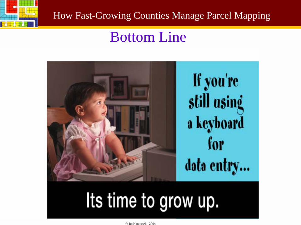
Bottom Line
© JoeHanousek, 2004
How Fast-Growing Counties Manage Parcel Mapping
Contact info
Presenter:
Joe HanousekUCLID Softwarewww.uclid.comMadison, WisconsinPhone: 608-664-0570
E-mail: [email protected]
• http://www.uclid.com/parcelmapping/index.php
Some Graphics in this presentation provided by ESRI. Used with permission.