Embed Size (px)
Citation preview
Journal of Geographic Information System, 2013, 5, 193-197 http://dx.doi.org/10.4236/jgis.2013.53018 Published Online June 2013 (http://www.scirp.org/journal/jgis)
Prototype Geographic Information Systems Mapping of Crop Products Featured Local
Teddy Oswari, Euphrasia Susy Suhendra, Emy Haryatmi, Fenni Agustina Gunadarma University, Jakarta, Indonesia
Email: [email protected], [email protected], [email protected], [email protected]
Received October 11, 2012; revised January 10, 2013; accepted March 10, 2013
Copyright © 2013 Teddy Oswari et al. This is an open access article distributed under the Creative Commons Attribution License, which permits unrestricted use, distribution, and reproduction in any medium, provided the original work is properly cited.
ABSTRACT
Local featured program in Indonesia cannot be separated entirely from commodity strategic bases. Until in 2006, agri- cultural development formulation showed indicative targets for featured crops commodity production. The problem of food security is forming of farmer’s independence to protect local resources in efficiently and optimally, so these re- sources can be more utilized. It can be achieved by assist of information technologies and communication in forming of Geographic Information System (GIS) to support consistency of food security in Indonesia. This research designs pro- totype geographic information system in order to conduct the accurate mapping and to know the local featured crops production in Indonesia. This level is conducted for documentation and mapping of agricultural products which is the local featured production. This documentation requires the usage of potential physical, economic, social and cultural environment by the utilization of information technology and communication, which have the ability of relevancy and accessibility of reliable information. Keywords: Geographic Information System; Mapping; Local Seed Plants
1. Introduction
Local featured program in Indonesia cannot be separated entirely from commodity strategic bases. It is stated from the agricultural development formulation show indicative targets for featured crops commodity production until in 2006. However, the decrease in cultivated area per far- mer and limited supply of irrigation water and high input prices and relatively low price of products can be the limited factors and obstacles for welfare programs and independence farmers based on the local resources.
Efforts towards improving the welfare of farmers will be conducted by empowerment counseling, mentoring, business assurance, price protection, and promotion poli- cies. These efforts are relatively needed, meanwhile the constraints factor should need more attention to the local level.
Grand strategy from Department of Agriculture is de- velopment of agribusiness which basically includes 4 important things, namely: 1) Agricultural development must be the priority of national development. 2) Agri- cultural development must be conducted through agri- business system. 3) The success of the agribusiness de- velopment depends on the factors and policies that are
beyond the jurisdiction of the Department of Agriculture so it is needed the excellent coordination efforts among agencies. 4) Development of agribusiness should be able to improve competitiveness, build economy, sustainable and decentralized within the framework of strengthening the local economy, so agribusiness development is con- ducted by patterns of development potential and capacity of the local economy
Researchers [1], explained and applied Geographic Information System is needed to adjust production bal- ancing of horticultural crops in West Java and useful to get accurate information about the composition of vege- table supply needs for commodity tomatoes, potatoes and red peppers in Bandung regency. Now, this research and application of Geographic Information Systems in local commodities in Indonesia should be the basis of data on all commodities for farmers and businesses in order to increase competitiveness and value of export sales to many countries.
Researcher [2] said in his research, in fact the food security program cannot be separated from the develop- ment of food security to fill the food needs of community in sufficient, nutritious, safe, taste quality and belief,
Copyright © 2013 SciRes. JGIS
T. OSWARI ET AL. 194
through increased productivity, quality, and efficiency of production plant origin food and food diversification.
The problem of food security is forming of farmer’s independence to protect local resources in efficiently and optimally, so these resources can be more utilized. It can be achieved by assist of information technologies and communication in forming of Geographic Information System to support consistency of food security in Indonesia.
Researcher [3], explanation efforts towards improving the welfare of farmers will be conducted by empower- ment counseling, mentoring, business assurance, price protection, and promotion policies. These efforts are relatively needed meanwhile the constraints factor should need more attention to the local level. The farmers in Indonesia can understand the food commodities which classified in terms of subsistence farmers as producers as well as consumers.
Related to this explanation above, the factor which should be conducted is documentation and mapping of agricultural products which is local featured production. This documentation requires the usage of potential phy- sical, economic, social and cultural environment. One of the potential that can be used for documentation and mapping of agricultural products in Indonesia is the utili- zation of information and communication technology. The use of information technology and computer in the pres- ervation of national culture is conducted by the devel- opment of local resources documentation in the field of agriculture which support the food security program with the current available of data with high complexity, and ability of relevancy and accessibility of reliable informa- tion [4].
The purpose of this research is formed of documenta- tion, determination of local resources and formed of Geo- graphic Information System to support the improving agricultural production through the design of prototype Geo- graphic Information System for mapping product of local featured product.
The target plan of crops documentation and forming Geographic Information System is every province on the island of Java, Sumatera and Kalimantan can improve agricultural production, incomes of farmers, quality of agricultural products and agro-industry, and forming of agricultural organizations and institutions also improving of food self-sufficiency.
2. Research Method
This research consists of four steps: 1) Collecting data of crops production in selected provinces in Indonesia; 2) Designing database and crops taxonomy; 3) Mapping of crops in each district on the island of Java; 4) Designing of creation portal digital crops plan with variety of fea- tures such as database of crop productivity, crop taxon- omy, e-book, CAL, Spatial Database with Geographic
Information System for special area of crops and Virtual Reality.
The usage of this research includes: 1) Database which is produced about food crops and taxonomy are expected to know specific of crops in district, so it can reduce de- pendence on crop products. 2) Database of crops Tax- onomy can be reference to crops development in district. 3) Portal virtual crops can fill the needs of each district to develop characteristic of crops in district. 4) Geographic Information System map in portal of virtual crops can be reference for other users to know potential crops of province. 5) Geographic Information System map can invite investors in order to invest their funds for the food crops development.
3. Results and Discussion
The designing steps of prototype web digitizing crops based on Geographic Information System to the local featured commodities are: 1) Decide the observation and research area in Java; 2) Determine the spatial and non-spatial data in certain areas, e.g. in Yogyakarta; 3) Conduct the tracking of spatial data; 4) Create Database; 5) Create web and connection.
Story-board Web Geographic Information System de- signed is began prototype web identification, such as on these charts: 1) Explanation of grant program in design- ing web and slide show of local featured crops figure; 2) Provide web content information and featured commodi- ties graphics, product in each region; 3) Explanation of Geographic Information System web content; 4) Show e-book in several of local featured with information of product and figure; 5) Show map of products location which have the local featured crops; 6) Provide the in- formation of research team; 7) Completeness of web con- tent.
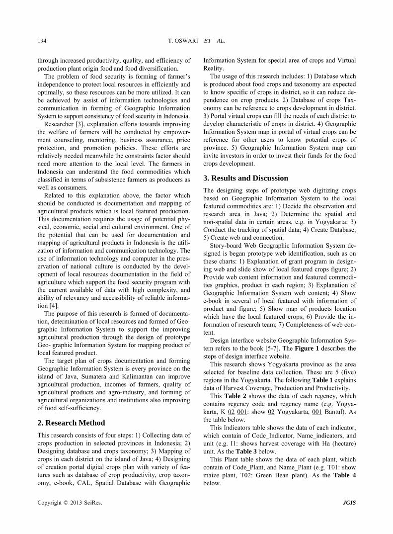
Design interface website Geographic Information Sys- tem refers to the book [5-7]. The Figure 1 describes the steps of design interface website.
This research shows Yogyakarta province as the area selected for baseline data collection. These are 5 (five) regions in the Yogyakarta. The following Table 1 explains data of Harvest Coverage, Production and Productivity.
This Table 2 shows the data of each regency, which contains regency code and regency name (e.g. Yogya- karta, K 02 001: show 02 Yogyakarta, 001 Bantul). As the table below.
This Indicators table shows the data of each indicator, which contain of Code_Indicator, Name_indicators, and unit (e.g. I1: shows harvest coverage with Ha (hectare) unit. As the Table 3 below.
This Plant table shows the data of each plant, which contain of Code_Plant, and Name_Plant (e.g. T01: show maize plant, T02: Green Bean plant). As the Table 4 below.
Copyright © 2013 SciRes. JGIS
T. OSWARI ET AL.
Copyright © 2013 SciRes. JGIS
195
Dasar
Tematik
Data Non
Spasial
Data Spasial
Model Data
Vektor
Model Data
Raster
Polyli
Po
Are
Nod
ne
int
a
e
Figure 1. Design of geographic information system. Table 1. Data of harvest coverage, production and produc- tivity in the province of Yogyakarta.
Table 3. Name of observation indicator.
Indicator Code Indicator Name Unit
I1 Harvest coverage HA
I2 Production TON
I3 Productivity Ku/HA
Indicator: Harvest Coverage
Unit: HA 2008-2010 Regency
08 09 10
Kulon Progo 5.047 5.316 4.986
Bantul 5.739 6.290 5.523
Gunung Kidul 55.347 57.528 71.223
Sleman 5.029 5.570 5.105
Yogyakarta 2 1
Table 4. Name of local featured products in DI Yogyakarta.
Area Code Plants
T01 Maize
T02 Green Bean
T03 Peanut
T04 Soybean
T05 Rice
T06 Sweet potato
T07 Cassava
Indicator: Production Indicator: Productivity
Unit: TON 2008-2010 Unit: Ku/HA
08 09 10 08 09 10
33.279 33.169 27.891 65.94 64.11 55.94
30.177 28.776 29.539 52.58 45.75 53.48
191.007 220.275 256.443 34.51 38.29 36.01
30.896 32.712 31.703 61.44 58.73 62.1
13 5 64.65 49
The main table is relation table between various tables
in above. The main table consists of Primary Key of each table, beside that the amount of data inputted based on the year, i.e. 2008, 2009, 2010 (e.g. Yogyakarta and 5 (five) regency, in maize plant with Harvest coverage in- dicators, we input the data in 2008, 2009, 2010).
Table 2. Code of province of Yogyakarta.
Regency Code Regency Name
K02001 Bantul
K02002 Gunung Kidul
K02003 Kulon Progo
K02004 Sleman
K02005 Yogyakarta
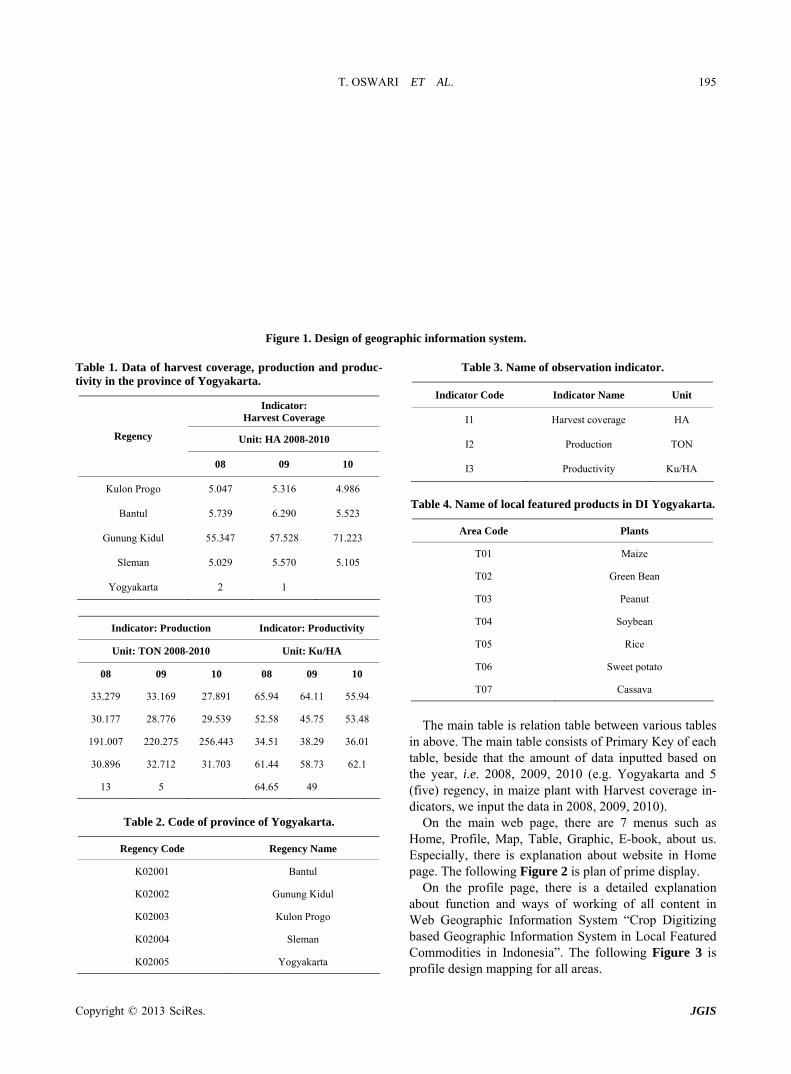
On the main web page, there are 7 menus such as Home, Profile, Map, Table, Graphic, E-book, about us. Especially, there is explanation about website in Home page. The following Figure 2 is plan of prime display.
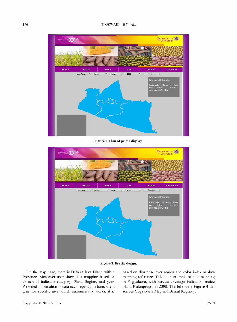
On the profile page, there is a detailed explanation about function and ways of working of all content in Web Geographic Information System “Crop Digitizing based Geographic Information System in Local Featured Commodities in Indonesia”. The following Figure 3 is pr file design mapping for all areas. o
T. OSWARI ET AL. 196
Figure 2. Plan of prime display.
Figure 3. Profile design.
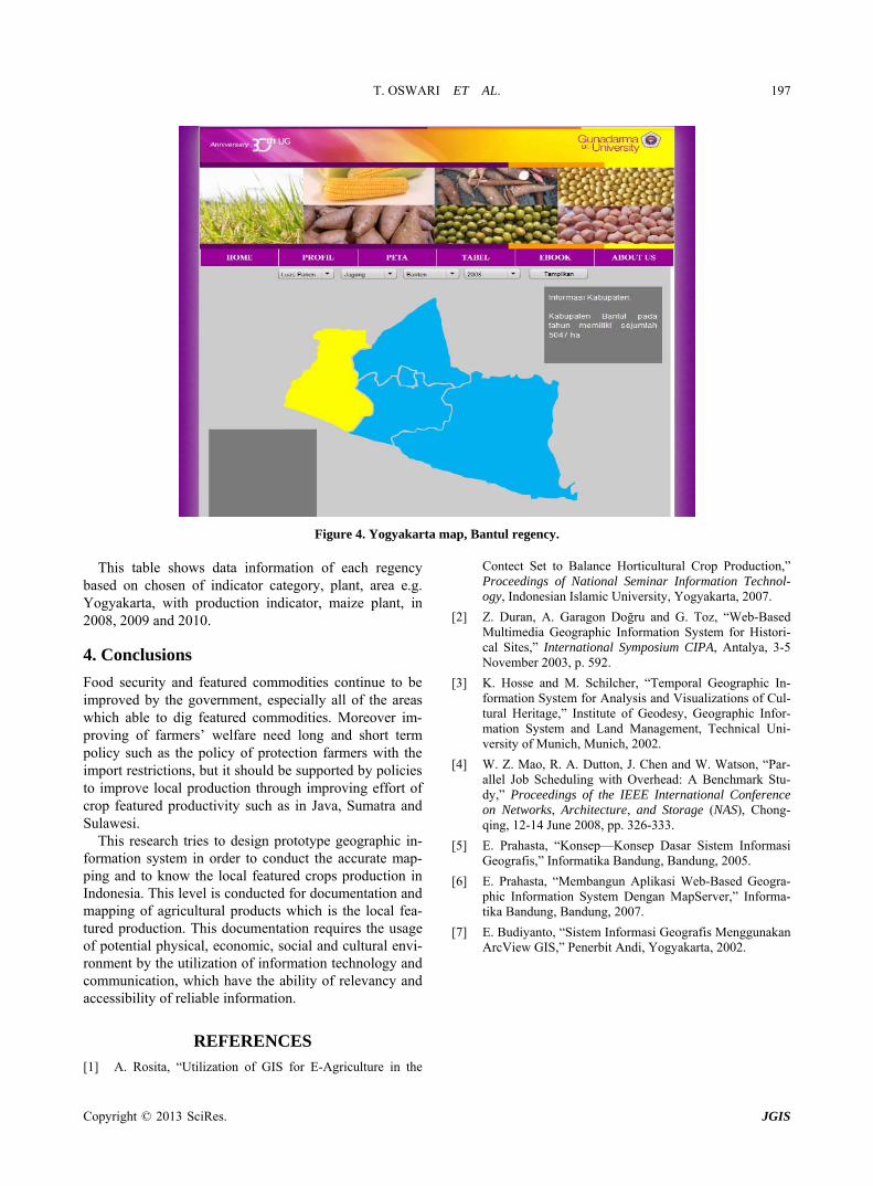
On the map page, there is Default Java Island with 6 Province. Moreover user show data mapping based on chosen of indicator category, Plant, Region, and year. Provided information is data each regency in transparent gray for specific area which automatically works, it is
based on diosmose over region and color index as data mapping reference. This is an example of data mapping in Yogyakarta, with harvest coverage indicators, maize plant, Kulonprogo, in 2008. The following Figure 4 de- scribes Yogyakarta Map and Bantul Regency.
Copyright © 2013 SciRes. JGIS
T. OSWARI ET AL. 197
Figure 4. Yogyakarta map, Bantul regency.
This table shows data information of each regency based on chosen of indicator category, plant, area e.g. Yogyakarta, with production indicator, maize plant, in 2008, 2009 and 2010.
4. Conclusions
Food security and featured commodities continue to be improved by the government, especially all of the areas which able to dig featured commodities. Moreover im- proving of farmers’ welfare need long and short term policy such as the policy of protection farmers with the import restrictions, but it should be supported by policies to improve local production through improving effort of crop featured productivity such as in Java, Sumatra and Sulawesi.
This research tries to design prototype geographic in- formation system in order to conduct the accurate map- ping and to know the local featured crops production in Indonesia. This level is conducted for documentation and mapping of agricultural products which is the local fea- tured production. This documentation requires the usage of potential physical, economic, social and cultural envi- ronment by the utilization of information technology and communication, which have the ability of relevancy and accessibility of reliable information.
REFERENCES [ 1] A. Rosita, “Utilization of GIS for E-Agriculture in the
Contect Set to Balance Horticultural Crop Production,” Proceedings of National Seminar Information Technol- ogy, Indonesian Islamic University, Yogyakarta, 2007.
[2] Z. Duran, A. Garagon Doğru and G. Toz, “Web-Based Multimedia Geographic Information System for Histori- cal Sites,” International Symposium CIPA, Antalya, 3-5 November 2003, p. 592.
[3] K. Hosse and M. Schilcher, “Temporal Geographic In- formation System for Analysis and Visualizations of Cul- tural Heritage,” Institute of Geodesy, Geographic Infor- mation System and Land Management, Technical Uni- versity of Munich, Munich, 2002.
[4] W. Z. Mao, R. A. Dutton, J. Chen and W. Watson, “Par- allel Job Scheduling with Overhead: A Benchmark Stu- dy,” Proceedings of the IEEE International Conference on Networks, Architecture, and Storage (NAS), Chong- qing, 12-14 June 2008, pp. 326-333.
[5] E. Prahasta, “Konsep—Konsep Dasar Sistem Informasi Geografis,” Informatika Bandung, Bandung, 2005.
[6] E. Prahasta, “Membangun Aplikasi Web-Based Geogra- phic Information System Dengan MapServer,” Informa- tika Bandung, Bandung, 2007.
[7] E. Budiyanto, “Sistem Informasi Geografis Menggunakan ArcView GIS,” Penerbit Andi, Yogyakarta, 2002.
Copyright © 2013 SciRes. JGIS