Embed Size (px)
Citation preview
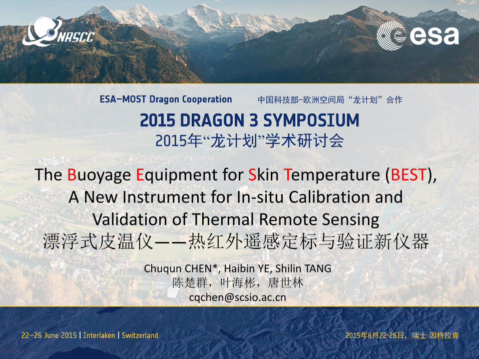
The Buoyage Equipment for Skin Temperature (BEST), A New Instrument for In-situ Calibration and
Validation of Thermal Remote Sensing 漂浮式皮温仪——热红外遥感定标与验证新仪器
Chuqun CHEN*, Haibin YE, Shilin TANG 陈楚群,叶海彬,唐世林
• Introduction • The Instrument • The Applications on Calibration & Validation • Other Potential Applications
Outline
Introduction The Sea Surface Temperature (SST) is one of the most important physical parameters of the ocean. The SST data are widely used in many subjects of meteorology and oceanography. With several decades development, the satellite remote sensing technology has become the main approach for global or regional SST data collection and plays more and more irreplaceable role on oceanography and meteorology studies.
Introduction The satellite measured SST is more closely related to the skin SST than the subsurface bulk SST. It is not convictive to validate the satellite measured SST with the subsurface bulk temperature. It is necessary to measure the skin temperature for calibration of the satellite thermal signals and for validation of satellite measured SST. However, it is not easy to accurately measure the Skin SST of waters as the skin layer is very thin.
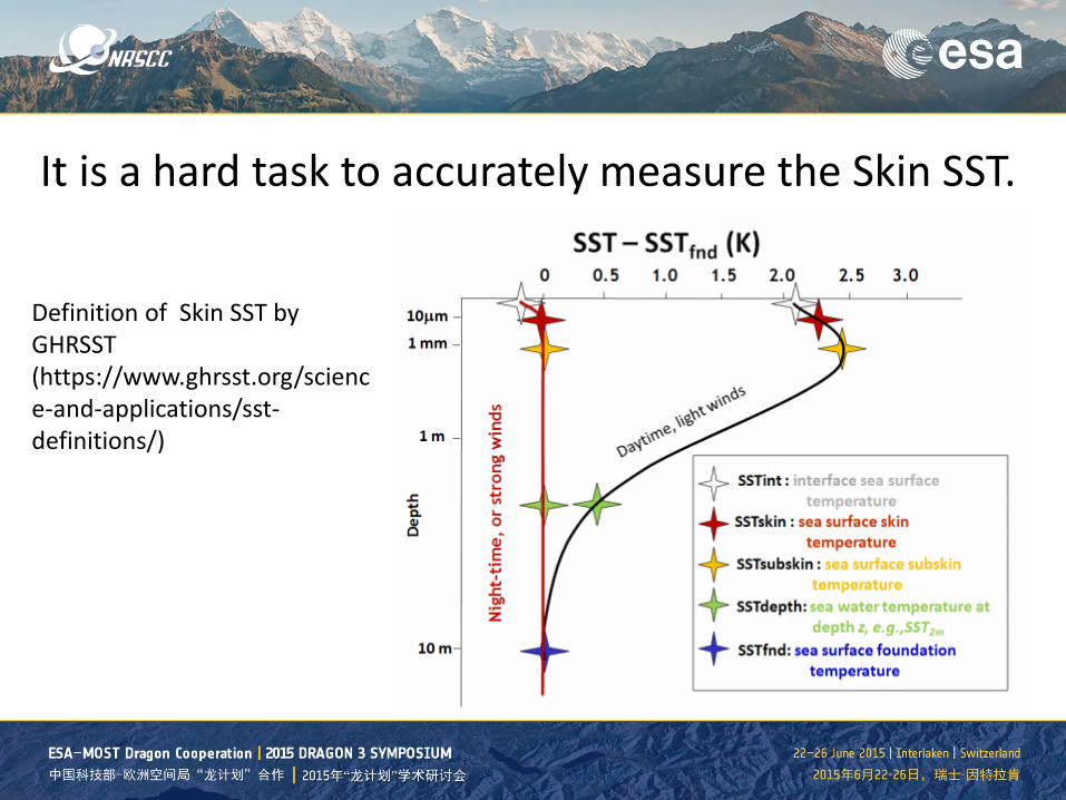
Definition of Skin SST by GHRSST (https://www.ghrsst.org/science-and-applications/sst-definitions/)
It is a hard task to accurately measure the Skin SST.
• Introduction • The Instrument • The Applications on Calibration & Validation • Other Potential Applications
Outline
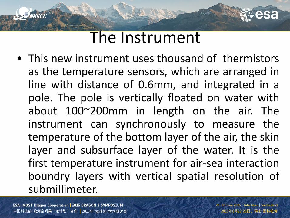
The Instrument • This new instrument uses thousand of thermistors
as the temperature sensors, which are arranged in line with distance of 0.6mm, and integrated in a pole. The pole is vertically floated on water with about 100~200mm in length on the air. The instrument can synchronously to measure the temperature of the bottom layer of the air, the skin layer and subsurface layer of the water. It is the first temperature instrument for air-sea interaction boundry layers with vertical spatial resolution of submillimeter.
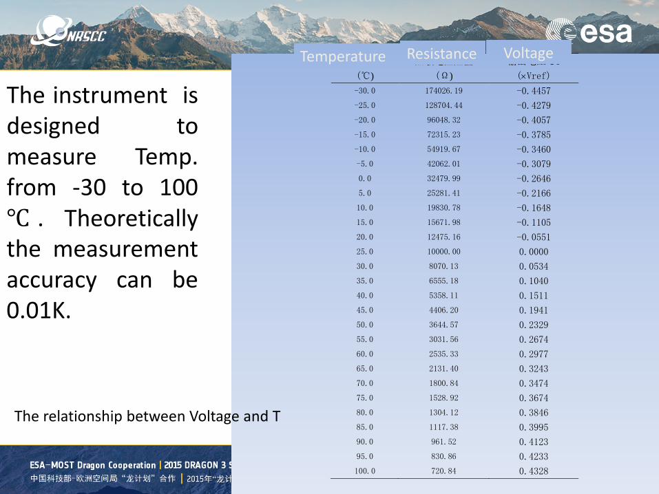
温度
(℃) 热敏电阻阻值
(Ω) 输出电压 Uo (×Vref)
-30.0 174026.19 -0.4457 -25.0 128704.44 -0.4279 -20.0 96048.32 -0.4057 -15.0 72315.23 -0.3785 -10.0 54919.67 -0.3460 -5.0 42062.01 -0.3079 0.0 32479.99 -0.2646 5.0 25281.41 -0.2166 10.0 19830.78 -0.1648 15.0 15671.98 -0.1105 20.0 12475.16 -0.0551 25.0 10000.00 0.0000 30.0 8070.13 0.0534 35.0 6555.18 0.1040 40.0 5358.11 0.1511 45.0 4406.20 0.1941 50.0 3644.57 0.2329 55.0 3031.56 0.2674 60.0 2535.33 0.2977 65.0 2131.40 0.3243 70.0 1800.84 0.3474 75.0 1528.92 0.3674 80.0 1304.12 0.3846 85.0 1117.38 0.3995 90.0 961.52 0.4123 95.0 830.86 0.4233 100.0 720.84 0.4328
Temperature Resistance Voltage
The instrument is designed to measure Temp. from -30 to 100 ℃ . Theoretically the measurement accuracy can be 0.01K.
The relationship between Voltage and T
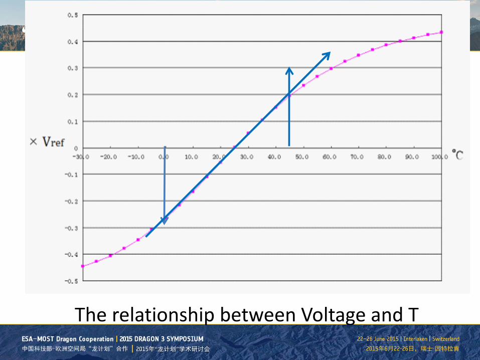
The relationship between Voltage and T
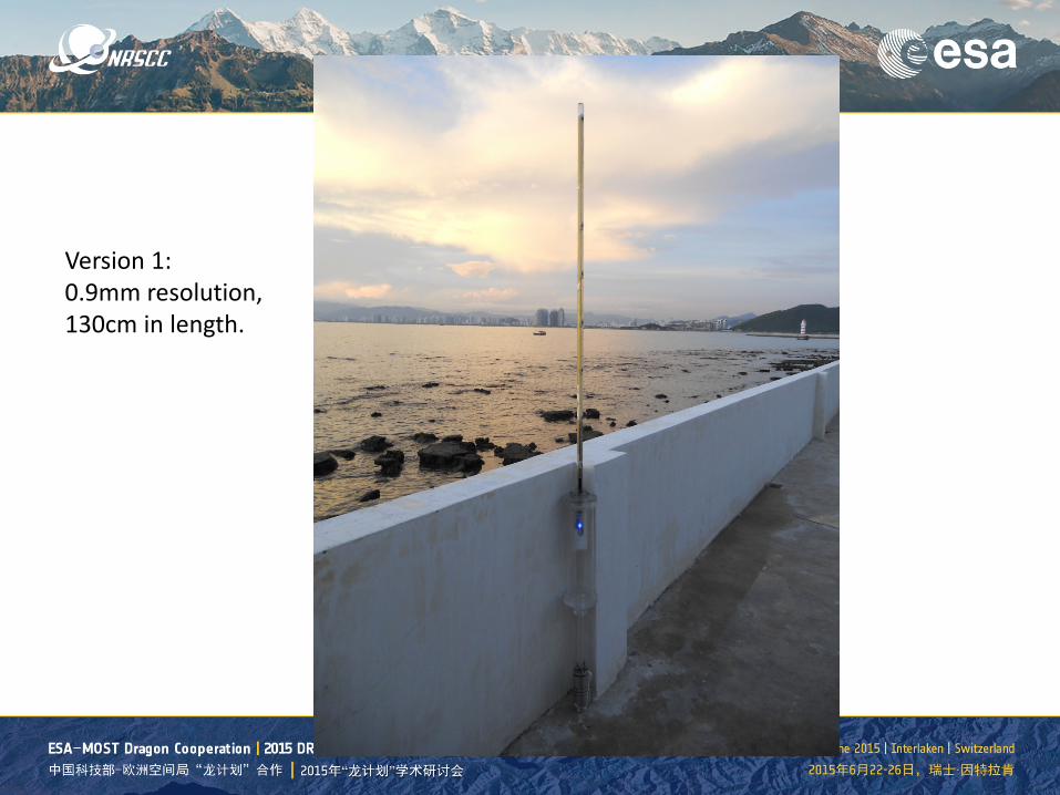
Version 1: 0.9mm resolution, 130cm in length.
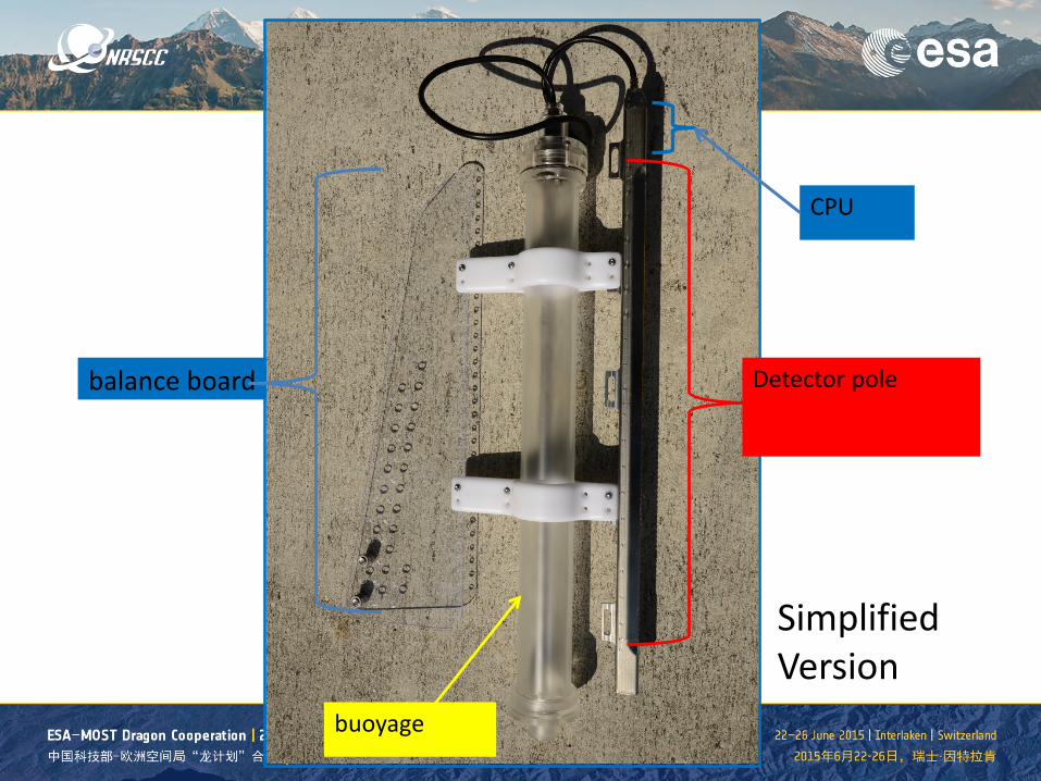
Detector pole
buoyage
balance board
CPU
Simplified Version
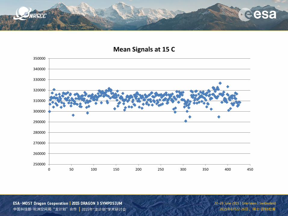
250000
260000
270000
280000
290000
300000
310000
320000
330000
340000
350000
0 50 100 150 200 250 300 350 400 450
Mean Signals at 15 C

640000
650000
660000
670000
680000
690000
700000
0 50 100 150 200 250 300 350 400 450
Mean Signal at 30 C
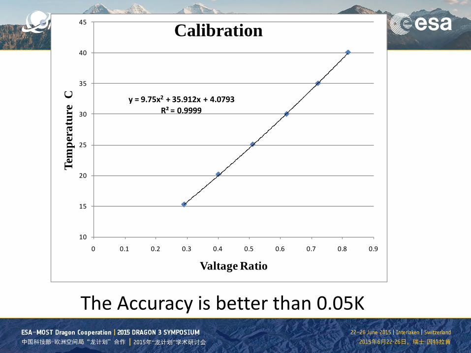
The Accuracy is better than 0.05K
y = 9.75x2 + 35.912x + 4.0793R² = 0.9999
10
15
20
25
30
35
40
45
0 0.1 0.2 0.3 0.4 0.5 0.6 0.7 0.8 0.9
Tem
pera
ture
C
Valtage Ratio
Calibration

An improved version, with heat-isolated CPU part and white plastic cover for keeping from sun heating
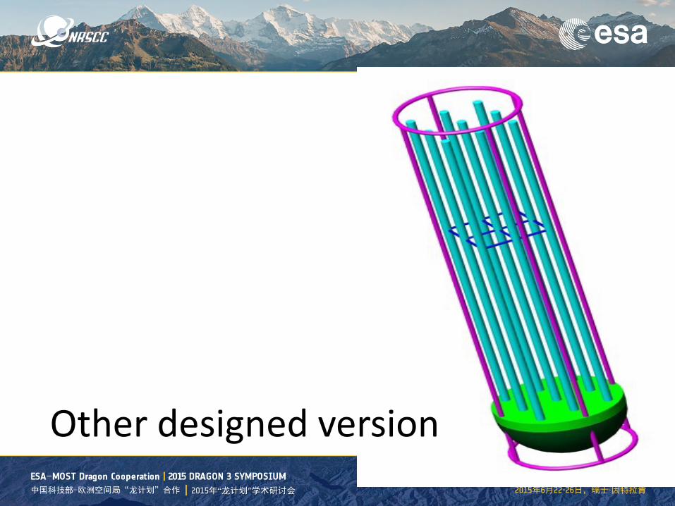
Other designed version
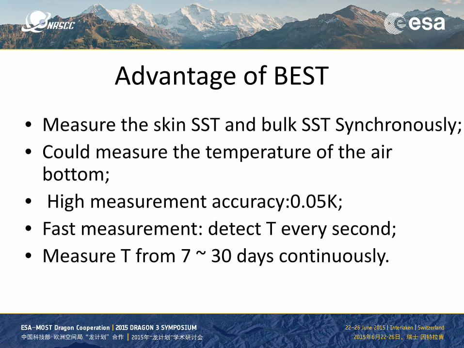
Advantage of BEST
• Measure the skin SST and bulk SST Synchronously; • Could measure the temperature of the air
bottom; • High measurement accuracy:0.05K; • Fast measurement: detect T every second; • Measure T from 7 ~ 30 days continuously.
• Introduction • The Instrument • The Applications on Calibration & Validation • Other Potential Applications
Outline

The Applications on Cal. &Val.
• The new instrument, BEST, can significantly improve the accuracy of skin SST measurement and provide in-situ calibration for thermal camera. With improving the skin SST accuracy and spatial match between in-situ and satellite data, BEST will be play a key role on:
• 1. In-situ calibration for satellite thermal sensors; • 2. In-situ val. of satellite remotely sensed SST;
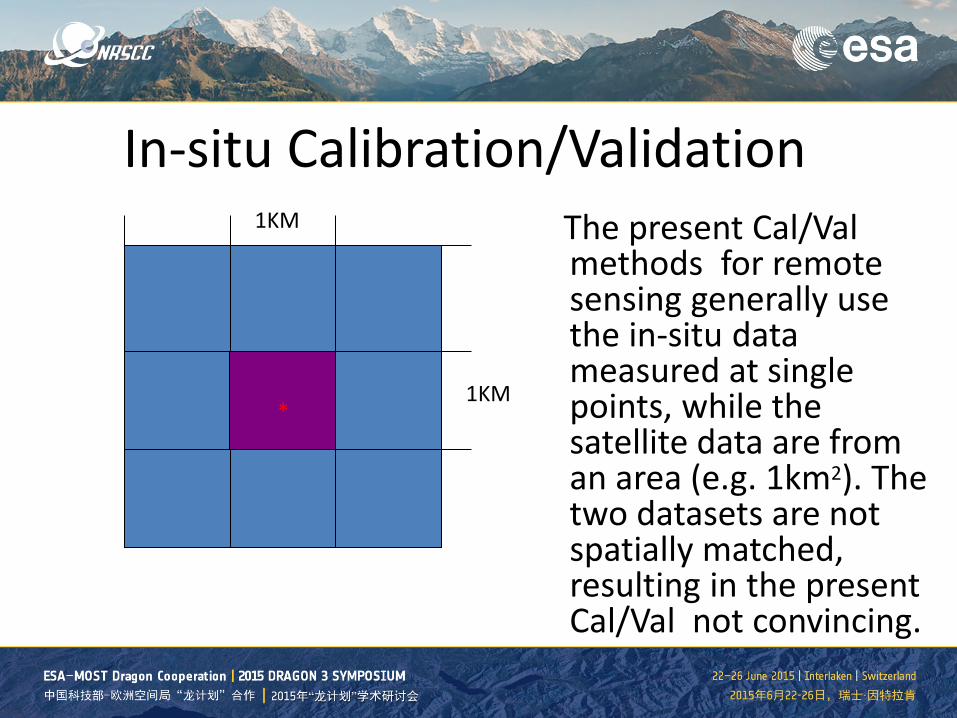
In-situ Calibration/Validation The present Cal/Val
methods for remote sensing generally use the in-situ data measured at single points, while the satellite data are from an area (e.g. 1km2). The two datasets are not spatially matched, resulting in the present Cal/Val not convincing.
*
1KM
1KM *
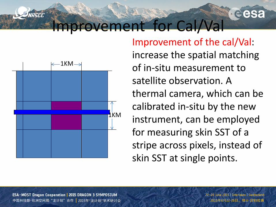
Improvement for Cal/Val
*
1KM
1KM
Improvement of the cal/Val: increase the spatial matching of in-situ measurement to satellite observation. A thermal camera, which can be calibrated in-situ by the new instrument, can be employed for measuring skin SST of a stripe across pixels, instead of skin SST at single points.

• Introduction • The Instrument • The Applications on Calibration & Validation • Other Potential Applications
Outline
Other Potential Applications
• 1. Development of SST algorithm • 2. Study on the relationship of skin and bulk SST; • 3. Air-sea interaction studies
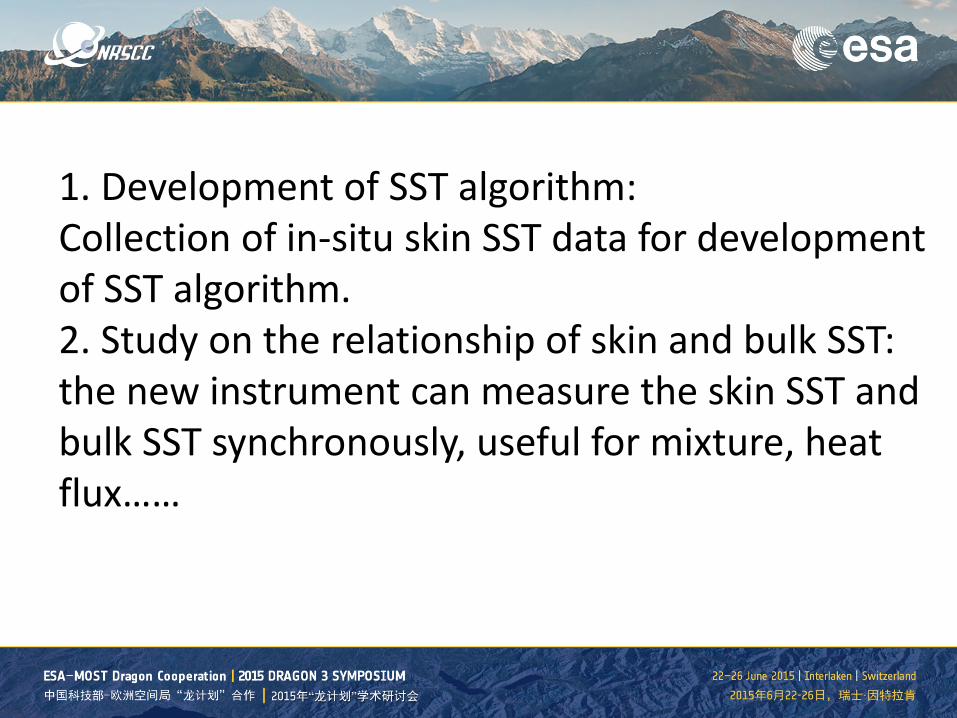
1. Development of SST algorithm: Collection of in-situ skin SST data for development of SST algorithm. 2. Study on the relationship of skin and bulk SST: the new instrument can measure the skin SST and bulk SST synchronously, useful for mixture, heat flux……
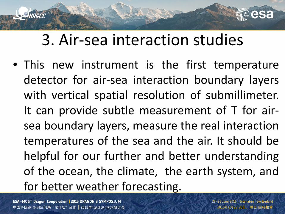
3. Air-sea interaction studies • This new instrument is the first temperature
detector for air-sea interaction boundary layers with vertical spatial resolution of submillimeter. It can provide subtle measurement of T for air-sea boundary layers, measure the real interaction temperatures of the sea and the air. It should be helpful for our further and better understanding of the ocean, the climate, the earth system, and for better weather forecasting.
遥
望
中
外
景
感
慨
古
今
情
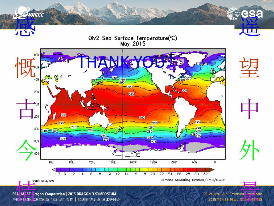
THANK YOU!