Embed Size (px)
Citation preview
GSA National Capital Region
Office of Planning & Design Quality
U.S. General Services Administration 1 FBI Headquarters Consolidation
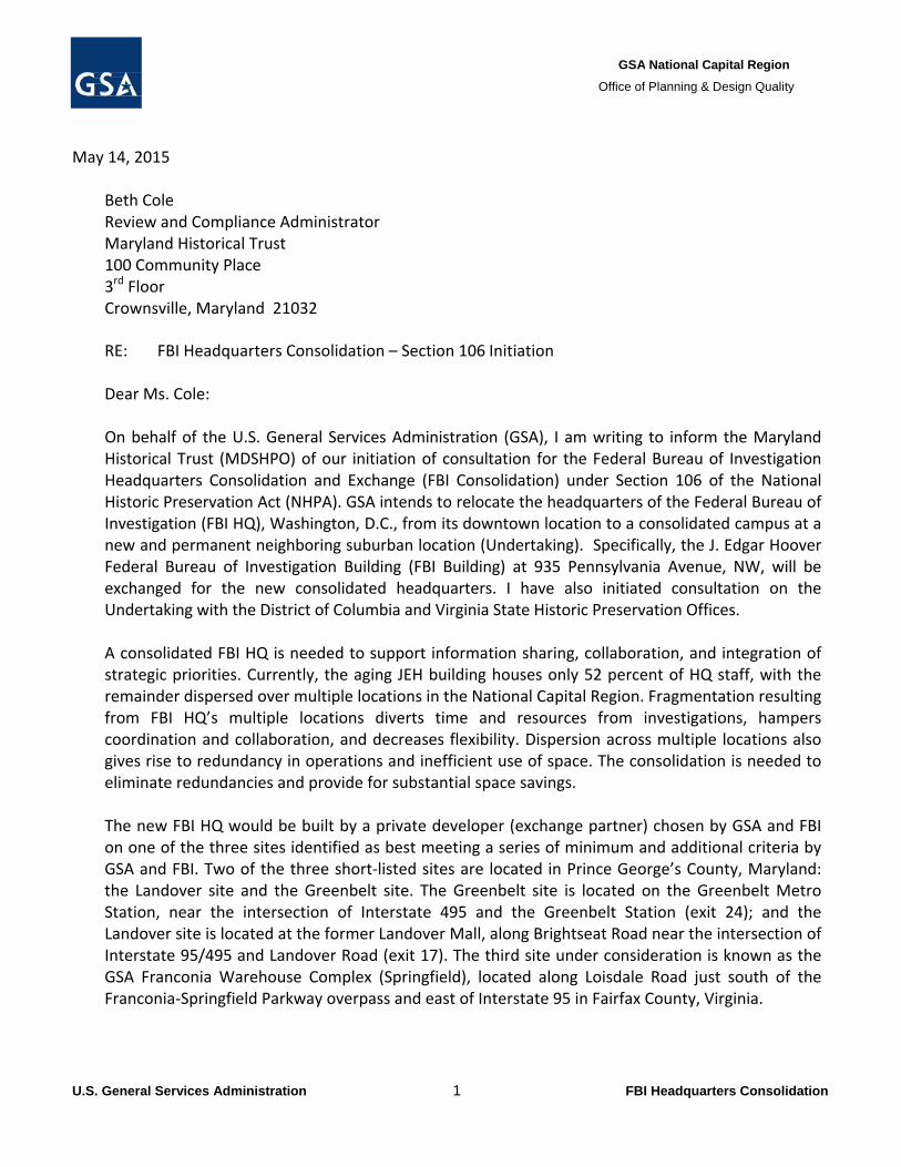
May 14, 2015
Beth Cole Review and Compliance Administrator Maryland Historical Trust 100 Community Place 3rd Floor Crownsville, Maryland 21032
RE: FBI Headquarters Consolidation – Section 106 Initiation
Dear Ms. Cole: On behalf of the U.S. General Services Administration (GSA), I am writing to inform the Maryland Historical Trust (MDSHPO) of our initiation of consultation for the Federal Bureau of Investigation Headquarters Consolidation and Exchange (FBI Consolidation) under Section 106 of the National Historic Preservation Act (NHPA). GSA intends to relocate the headquarters of the Federal Bureau of Investigation (FBI HQ), Washington, D.C., from its downtown location to a consolidated campus at a new and permanent neighboring suburban location (Undertaking). Specifically, the J. Edgar Hoover Federal Bureau of Investigation Building (FBI Building) at 935 Pennsylvania Avenue, NW, will be exchanged for the new consolidated headquarters. I have also initiated consultation on the Undertaking with the District of Columbia and Virginia State Historic Preservation Offices. A consolidated FBI HQ is needed to support information sharing, collaboration, and integration of strategic priorities. Currently, the aging JEH building houses only 52 percent of HQ staff, with the remainder dispersed over multiple locations in the National Capital Region. Fragmentation resulting from FBI HQ’s multiple locations diverts time and resources from investigations, hampers coordination and collaboration, and decreases flexibility. Dispersion across multiple locations also gives rise to redundancy in operations and inefficient use of space. The consolidation is needed to eliminate redundancies and provide for substantial space savings. The new FBI HQ would be built by a private developer (exchange partner) chosen by GSA and FBI on one of the three sites identified as best meeting a series of minimum and additional criteria by GSA and FBI. Two of the three short‐listed sites are located in Prince George’s County, Maryland: the Landover site and the Greenbelt site. The Greenbelt site is located on the Greenbelt Metro Station, near the intersection of Interstate 495 and the Greenbelt Station (exit 24); and the Landover site is located at the former Landover Mall, along Brightseat Road near the intersection of Interstate 95/495 and Landover Road (exit 17). The third site under consideration is known as the GSA Franconia Warehouse Complex (Springfield), located along Loisdale Road just south of the Franconia‐Springfield Parkway overpass and east of Interstate 95 in Fairfax County, Virginia.
GSA National Capital Region
Office of Planning & Design Quality
U.S. General Services Administration 2 FBI Headquarters Consolidation
The exchange process is a new and innovative approach to Federal real estate investment that partners Federal agencies with private developers to cost‐effectively and efficiently meet both public and private sector redevelopment needs. In this particular case, the Undertaking’s process would involve GSA’s acquisition of property and construction of a new facility in exchange for the FBI Building and parcel, pursuant to 40 USC §581(c)3304. Upon completion and acceptance of the new HQ facility, the exchange partner would receive title to the property, offsetting the costs of the new FBI HQ to the Federal Government and therefore the American taxpayer. Given the Undertaking’s multi‐jurisdictional nature, the complexities of correlating regulatory processes, and the project schedule, GSA will establish, as part of this consultation, a Programmatic Agreement (PA) pursuant to 36 CFR §800.14(b)(1)(ii‐iii, v). The PA will state the review processes and outline the multiple facets and phases of the Undertaking. GSA has consulted with the Advisory Council on Historic Preservation (Council), and will carry the Section 106 process forward pursuant to 36 CFR Part §800.8(a), in coordination with agency requirements under the National Environmental Protection Act (NEPA) and the development of the Environmental Impact Statement (EIS). Public scoping for the EIS occurred in late September/early October 2014 with four public meetings and public outreach included an extensive list of agencies, organizations, and individuals. We currently anticipate that the draft EIS, which will analyze all alternative sites identified above, will be available for public review and comment later this year. Attached to this letter please find maps illustrating the preliminary Area of Potential Effect (APE) developed for each of the two sites as well as additional preliminary information on the identification and potential for historic resources in the APEs. Each APE represents a 0.25 mile radius to accommodate impacts to the site itself and to account for potential visual impacts due to the possible height of the new FBI HQ building, which is yet to be determined.
GSA appreciates the time your office has given to preliminary, informal discussions on this proposed effort and now extends an invitation to the MDSHPO to formally participate in consultation. We welcome your review of the enclosed information and look forward to receiving your comments, questions, or concerns. Subsequent agency and Consulting Party meetings will be requested as the exchange partner selection and EIS processes move forward and a preferred alternative is identified as part of the development of the Final EIS. We will be holding a consulting parties meeting on Tuesday, June 16 to discuss the exchange of the J. Edgar Hoover building and will send you an invitation in case you are able to attend.
GSA National Capital Region
Office of Planning & Design Quality
U.S. General Services Administration 3 FBI Headquarters Consolidation
Sincerely,
Nancy Witherell Regional Historic Preservation Officer (202) 260‐0663 [email protected]
cc Amanda Apple, MHT Howard Berger, MNCPPC
Beth L. Savage, GSA Federal Preservation Officer
Addendum FBI Headquarters Consolidation
4
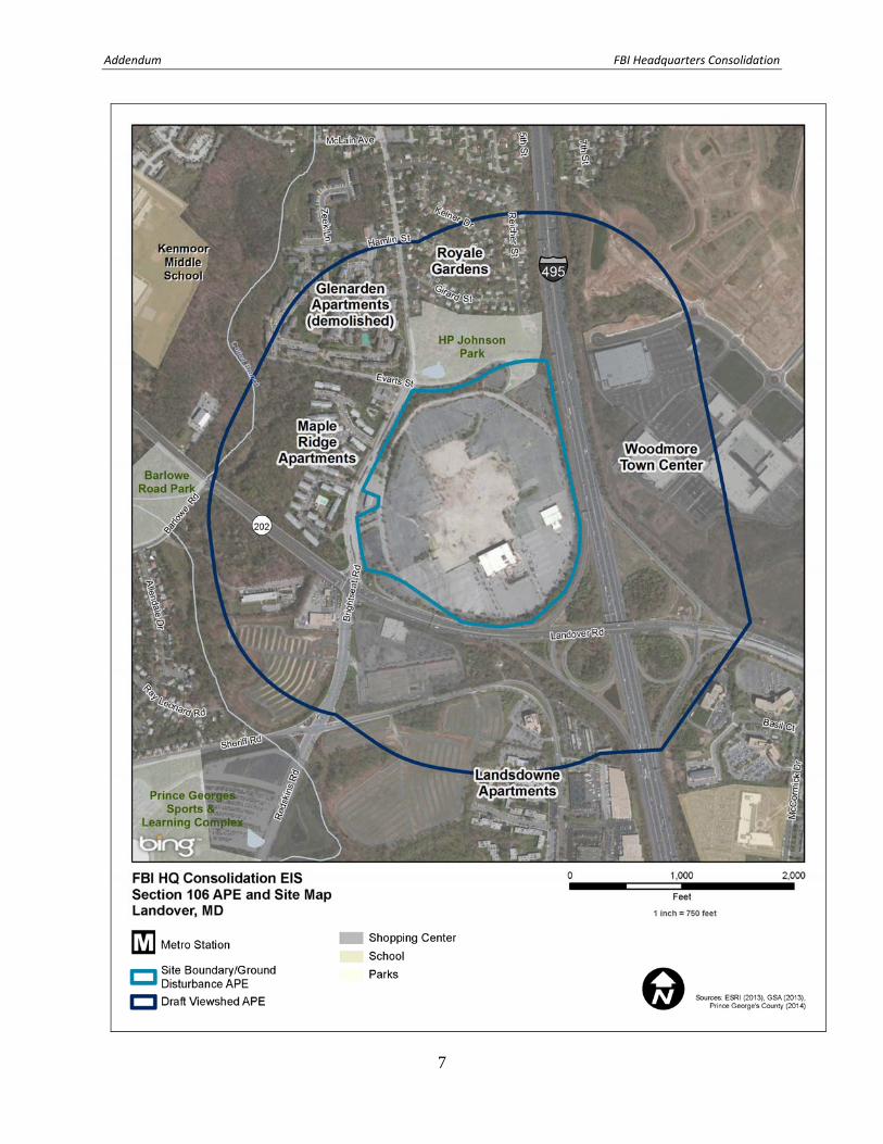
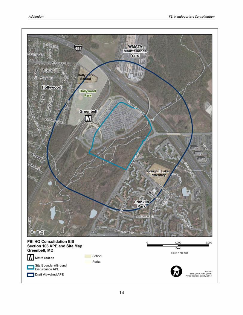
Areas of Potential Effect The Area of Potential Effect (APE) consists of two distinct areas to take into account potential direct and indirect effects to historic resources. The Ground Disturbance APE comprises the project site in its entirety where there is potential for direct impacts from the construction of the new FBI headquarters. The viewshed APE consists of a quarter‐mile radius from the project site boundary for potential visual, indirect impacts from the construction of the new headquarters. The height of the buildings is currently unknown. Background Research/Methodology Background research was conducted to determine if any previously identified architectural or archeological resources are located within the APE and the project vicinity. Background research entailed a thorough review of survey data available at the Maryland Historical Trust (MHT) library in December 2014 to identify recorded historic resources listed in or eligible for the National Register of Historic Places (NRHP) as well National Historic Landmarks. Research identified that there are no previously identified historic resources within the ground disturbance or viewshed APEs. In addition, historical aerial photographs and USGS maps were used to identify the potential for archeological sites within the ground disturbance APE and architectural resources older than 45 years of age within the ground disturbance and viewshed APEs. The year 1970, or 45 years, was used as a benchmark to capture resources that will be approaching 50 years of age at the time of construction initiation. Following this research a windshield survey was conducted in November 2014, by Louis Berger architectural historians Patti Kuhn Sarah Groesbeck to document architectural resources that are older than 45 years of age and within the APEs. Photographs were taken to provide information on the types of resources found within the APEs. LANDOVER Landover Site Description The Landover site consists of 80 acres in Prince Georges County owned by Lerner Enterprises, formerly the site of the Landover Mall. The site stands on the west side of the Capital Beltway (I‐495) and is bounded by Landover Road on the south and Brightseat Road on the west. All of the buildings associated with the mall have been demolished or are currently in the process of being demolished. Previous Studies Background research indicated one previous study within the larger visual APE:
Stuart Paul Dixon, Alan D. Beauregard, Elizabeth L. Roman, and Richard A. Geidel, Phase IB Archaeological and Historic Architectural Identification Survey and Phase II Archaeological Investigations at 18PR505 and 18PR506 For the Proposed Highway Improvements Along I‐95, Between US 50 and MD 214, Prince George’s County, Maryland (Project No. AW534B11). Prepared for the Maryland Department of Transportation State Highways Administration by KCI Technologies, Hunt Valley, Maryland (1997).
Addendum FBI Headquarters Consolidation
5
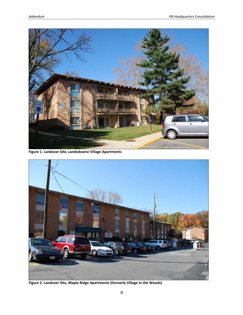
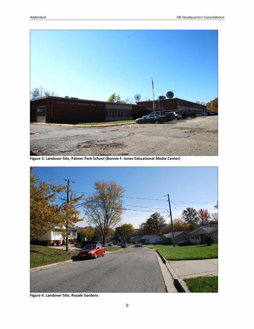
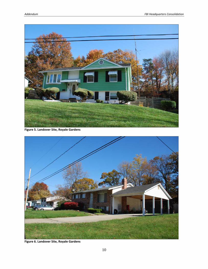
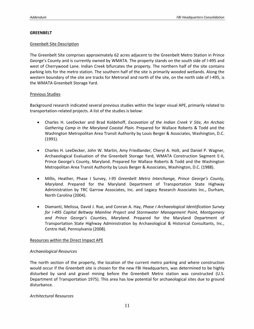
Resources within the Ground Disturbance APE Archaeological Resources No archeological studies have been completed within the Direct Impact APE. The Landover Site in its entirety appears to have been disturbed during the construction of the Landover Mall in the 1970s. Therefore, there is low potential for archeological resources on the Landover Site. Architectural Resources The Landover Alternative Site contains no historic structures or districts. The site was developed in 1972 as the Landover Mall, but none of the buildings related to the mall remain extant. A commercial building along the west side of the parcel was built between 1971 and 1979 and is in the process of being demolished. Resources Identified Within the Viewshed APE Palmer Park School Southwest of the Landover Site, on the south side of Landover Road, is the former Palmer Park School (now the Bonnie F. Johns Educational Media Center), built in 1965. This school is a Prince George’s County public school building that is currently used primarily for administrative and training functions. Maple Ridge Apartments (former Village in the Woods) The Maple Ridge Apartments were built at 2252 Brightseat Road on the west side of the Landover site between 1964 and 1966 as the Village in the Woods garden apartments. The three‐story apartment buildings were built by builder‐developers Max Kraft and Oscar Margulies and designed by architect Harvey Gordon (Washington Post 1966). Landsdowne Village Apartments The Landsdowne Village Apartments stand along the southern edge of the APE, are located at 1720 Brightseat Road, south of Sherriff Road. This garden apartment complex was built between 1964 and 1965 (Washington Post 1965). Royale Gardens A single‐family residential subdivision of Royale Gardens is north of the Landover Alternative site, west of the Capital Beltway and east of Brightseat Road. On the south side of the subdivision, Henry P. Johnson Park serves as a buffer between the Landover Site and Royale Gardens. Royale Gardens consists of one‐story, split level, and two‐story houses built around 1962 by the Canadian firm of Domino Construction, headed by architect Peter Caspari, attorney Samuel Kelner, and engineer Hans Reicher. Plans for the neighborhood called for 119 houses on a 30‐acre tract. By 1964 the firm had only built 93 houses and filed for bankruptcy (Washington Post 1962, 1964).
Addendum FBI Headquarters Consolidation
6
Glenarden (adjacent to the Visual APE) Directly north of Royale Gardens, but outside the visual APE is Glenarden (PG:72‐26). Glenarden is a predominately African‐American community that developed in the early twentieth century as a result of the Washington, Baltimore, and Annapolis Electric Railroad. In 1963, in cooperation with the U.S. Public Housing Administration, the Glenarden Housing Authority constructed a 90‐unit public housing project. In 1974 Glenarden received a HUD Community Development Block Grant and underwent a large urban renewal project. As part of an I‐495/I‐95 Capital Beltway Corridor Transportation Improvement Study, Glenarden was evaluated for NRHP eligibility in 2001 as a Planned Suburban Neighborhood. At the time the majority of the standing structures were less than 50 years of age and it was determined that the neighborhood did not meet National Register Criterion Consideration G. The study recommended that Glenarden should be reevaluated once the majority of the structures reach 50 years (Darsie 2001). References Darsie, Julie. 2001 Historic Glenarden Maryland Inventory of Historic Properties Form (PG:72‐26). Prepared by KCI
Technologies, Hunt Valley, Maryland. Washington Post 1962 “New Models on Display at Royale Gardens.” September 22: B18. 1964 “15 Uncompleted Houses Sold in Bankruptcy Case.” June 9: B5. 1966 Article 18, No Title. March 12: E11. 1965 Landsdowne Apartment Advertisement. April 6: C12.
Addendum FBI Headquarters Consolidation
7
Addendum FBI Headquarters Consolidation
8
Figure 1. Landover Site, Landsdowne Village Apartments
Figure 2. Landover Site, Maple Ridge Apartments (formerly Village in the Woods)
Addendum FBI Headquarters Consolidation
9
Figure 3. Landover Site, Palmer Park School (Bonnie F. Jones Educational Media Center)
Figure 4. Landover Site, Royale Gardens
Addendum FBI Headquarters Consolidation
10
Figure 5. Landover Site, Royale Gardens
Figure 6. Landover Site, Royale Gardens
Addendum FBI Headquarters Consolidation
11
GREENBELT Greenbelt Site Description The Greenbelt Site comprises approximately 62 acres adjacent to the Greenbelt Metro Station in Prince George’s County and is currently owned by WMATA. The property stands on the south side of I‐495 and west of Cherrywood Lane. Indian Creek bifurcates the property. The northern half of the site contains parking lots for the metro station. The southern half of the site is primarily wooded wetlands. Along the western boundary of the site are tracks for Metrorail and north of the site, on the north side of I‐495, is the WMATA Greenbelt Storage Yard. Previous Studies Background research indicated several previous studies within the larger visual APE, primarily related to transportation‐related projects. A list of the studies is below:
Charles H. LeeDecker and Brad Koldehoff, Excavation of the Indian Creek V Site, An Archaic Gathering Camp in the Maryland Coastal Plain. Prepared for Wallace Roberts & Todd and the Washington Metropolitan Area Transit Authority by Louis Berger & Associates, Washington, D.C. (1991).
Charles H. LeeDecker, John W. Martin, Amy Friedlander, Cheryl A. Holt, and Daniel P. Wagner, Archaeological Evaluation of the Greenbelt Storage Yard, WMATA Construction Segment E‐II, Prince George’s County, Maryland. Prepared for Wallace Roberts & Todd and the Washington Metropolitan Area Transit Authority by Louis Berger & Associates, Washington, D.C. (1988).
Millis, Heather, Phase I Survey, I‐95 Greenbelt Metro Interchange, Prince George’s County, Maryland. Prepared for the Maryland Department of Transportation State Highway Administration by TRC Garrow Associates, Inc. and Legacy Research Associates Inc., Durham, North Carolina (2004).
Diamanti, Melissa, David J. Rue, and Conran A. Hay, Phase I Archaeological Identification Survey for I‐495 Capital Beltway Mainline Project and Stormwater Management Point, Montgomery and Prince George’s Counties, Maryland. Prepared for the Maryland Department of Transportation State Highway Administration by Archaeological & Historical Consultants, Inc., Centre Hall, Pennsylvania (2008).
Resources within the Direct Impact APE Archaeological Resources The north section of the property, the location of the current metro parking and where construction would occur if the Greenbelt site is chosen for the new FBI Headquarters, was determined to be highly disturbed by sand and gravel mining before the Greenbelt Metro station was constructed (U.S. Department of Transportation 1975). This area has low potential for archaeological sites due to ground disturbance. Architectural Resources

Addendum FBI Headquarters Consolidation
12
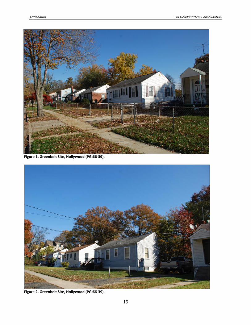
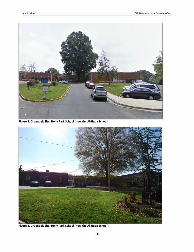
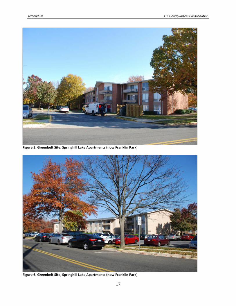
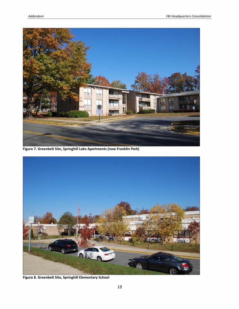
The Greenbelt Alternative Site contains no historic structures or districts. The site is predominately used for surface parking. Any standing structures present on the site would mostly likely date from the development of the Greenbelt Metro Station, between 1988 and 1993, or later. Resources Identified Within the Visual APE Hollywood The subdivision of Hollywood (PG:66‐39), comprised of post‐World War II tract single‐family housing, sits in the northwest section of the APE (Figures 1 and 2). Hollywood was determined not eligible for listing in the NRHP with Maryland Historical Trust (MHT) concurrence in 2001 (Kermes 2001). Holly Park School Along the northeast side of the Hollywood subdivision and within Hollywood Park is the former Holly Park School (now the Al‐Huda School) (Figures 3 and 4). The school was not included in the evaluation of the Hollywood subdivision. John G. Scheibel, Inc. built the eight‐classroom school circa 1957. The school and its 10‐acre site, together with the adjacent 15‐acre Hollywood Park, were part of the Maryland‐National Capital Park and Planning Commission park‐school plan (Washington Post 1957). Spinghill Lake Apartments and Springhill Lake Elementary School On the southeast edge of the APE, on the southeast side of Cherrywood Lane, is the Springhill Lake apartment complex, currently known as Franklin Park. This large complex was built between 1964 and 1972 and consists of groupings of three‐story garden apartments (Figures 5‐7). The Springhill Lake Elementary School, located within the complex, was erected in 1969‐1972 (Figure 8). Greenbelt Historic District National Historic Landmark (outside APE) The Greenbelt Historic District, located outside the APE, was designated a National Historic Landmark (NHL) in 1997. Greenbelt, developed in 1935‐1946, is the first government‐sponsored, planned community in the United States built on "garden city" principles and embodies the regional planning principles and architectural ideals of the mid‐1930s. The Greenbelt Middle School (Rural High School) one of four discontigulous parcels of the NHL district, is approximately one‐half mile from the Greenbelt Site. The largest portion of the historic district (also known as Parcel 1) is approximately one‐half to three‐quarter miles from the Greenbelt Site. References Kernes, Becky 2001 Hollywood (PG:66‐39) Maryland Historical Trust NR‐Eligibility Review Form. On file, Maryland
Historical Trust, Crownsville, Maryland. United States Department of Transportation 1975 Final Environmental Impact Statement for the Regional System. Part II: Route Summaries and Critical Areas. Prepared by the U.S. Department of Transportation Urban Mass Transportation Administration in Cooperation with the Washington Metropolitan Transit Authority.

Addendum FBI Headquarters Consolidation
13
Washington Post 1957 Start of Work on 4 Schools Authorized. September 26:B1.
Addendum FBI Headquarters Consolidation
14
Addendum FBI Headquarters Consolidation
15
Figure 1. Greenbelt Site, Hollywood (PG:66‐39),
Figure 2. Greenbelt Site, Hollywood (PG:66‐39),
Addendum FBI Headquarters Consolidation
16
Figure 3. Greenbelt Site, Holly Park School (now the Al‐Huda School)
Figure 4. Greenbelt Site, Holly Park School (now the Al‐Huda School)
Addendum FBI Headquarters Consolidation
17
Figure 5. Greenbelt Site, Springhill Lake Apartments (now Franklin Park)
Figure 6. Greenbelt Site, Springhill Lake Apartments (now Franklin Park)
Addendum FBI Headquarters Consolidation
18
Figure 7. Greenbelt Site, Springhill Lake Apartments (now Franklin Park)
Figure 8. Greenbelt Site, Springhill Elementary School