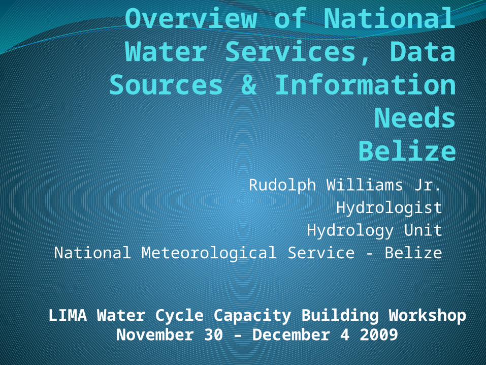
Overview of National Water Services, Data Sources &
Information NeedsBelize
Rudolph Williams Jr.Hydrologist
Hydrology UnitNational Meteorological Service - Belize
LIMA Water Cycle Capacity Building WorkshopNovember 30 – December 4 2009
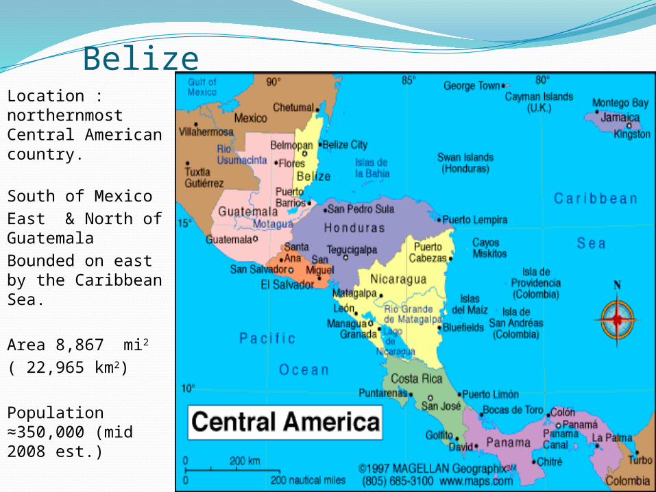
BelizeLocation : northernmost Central American country.
South of MexicoEast & North of GuatemalaBounded on east by the Caribbean Sea.
Area 8,867 mi2
( 22,965 km2)
Population ≈350,000 (mid 2008 est.)
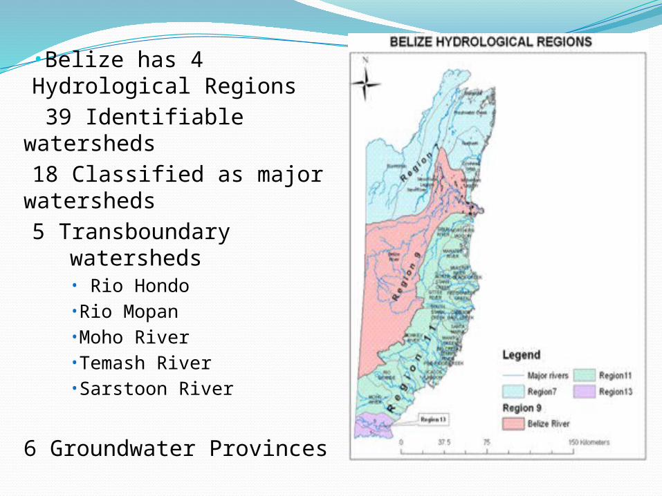
•Belize has 4 Hydrological Regions 39 Identifiable
watersheds18 Classified as major
watersheds5 Transboundary
watersheds• Rio Hondo•Rio Mopan•Moho River•Temash River•Sarstoon River
6 Groundwater Provinces
Water Services/ActivitiesWater classification for Potable, Agriculture,
Industrial and Commercial waterFlood ForecastsDrought Monitoring & ReportingGeneral water quantity & quality assessmentsProtection and Conservation of waterGroundwater AssessmentRegulation of water abstractionsResolution of water conflictsClimate Change impacts on water resources
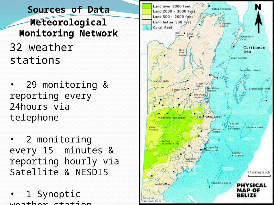
Sources of DataMeteorological
Monitoring Network
32 weather stations
• 29 monitoring & reporting every 24hours via telephone
• 2 monitoring every 15 minutes & reporting hourly via Satellite & NESDIS
• 1 Synoptic weather station hourly monitoring & reporting via WMO GTS & internet
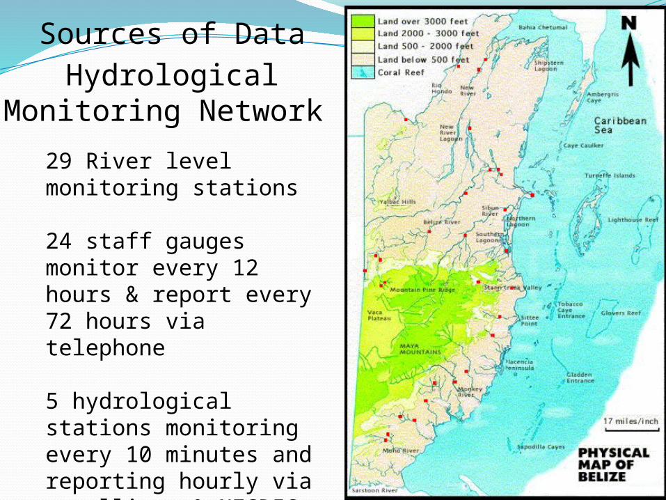
Sources of DataHydrological
Monitoring Network
29 River level monitoring stations 24 staff gaugesmonitor every 12 hours & report every 72 hours via telephone
5 hydrological stations monitoring every 10 minutes and reporting hourly via satellite & NESDIS
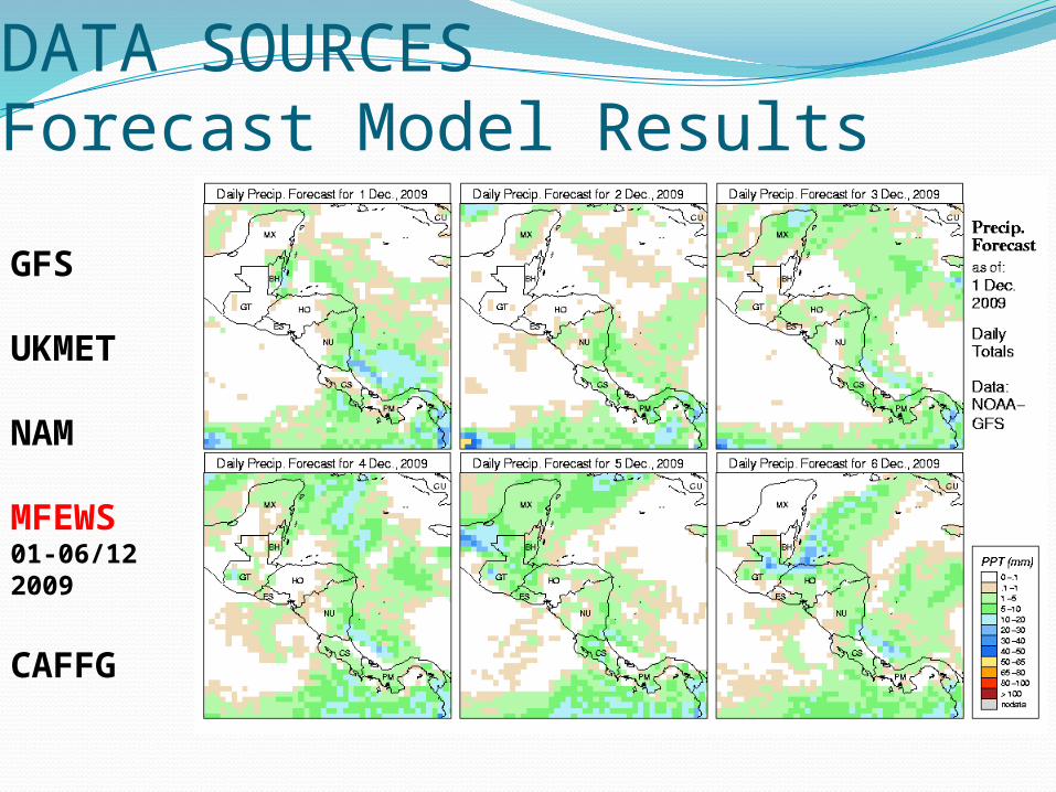
DATA SOURCESForecast Model Results
GFS
UKMET
NAM
MFEWS01-06/12 2009
CAFFG
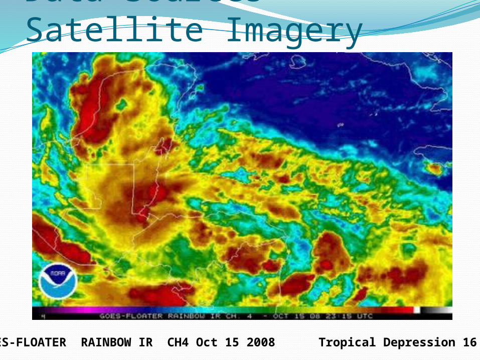
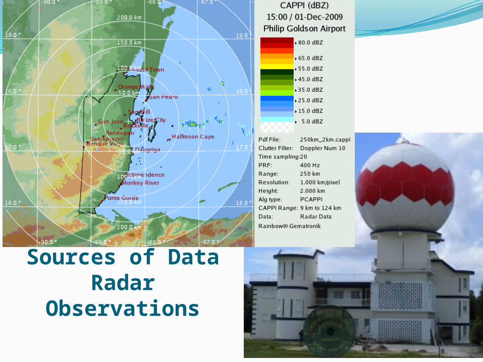
Data Sources - Satellite Imagery
GOES-FLOATER RAINBOW IR CH4 Oct 15 2008 Tropical Depression 16 2008
DATA NEEDSFlood Forecasts/Drought Monitoring & Reporting
Greater station density in the hydro-meteorological networks (more data needed – limited or no river level data in some
watersheds)Real or near real time reporting of rainfall and river levels
(Reporting frequency in some watersheds is greater than time of concentration)
Algorithms to automatically convert models forecasts and radar observations to spatially referenced data for routine modeling
(lumped watershed QPF, temperature, Eto, soil moisture, etc.)Construction, refinement or replacement of hydrologic models(Coarse or no hydrologic models for some watersheds)Construction of Hydraulic models ( no river channel models)
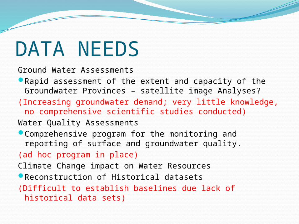
DATA NEEDSGround Water AssessmentsRapid assessment of the extent and capacity of the
Groundwater Provinces – satellite image Analyses?(Increasing groundwater demand; very little knowledge, no
comprehensive scientific studies conducted)Water Quality AssessmentsComprehensive program for the monitoring and reporting
of surface and groundwater quality.(ad hoc program in place)Climate Change impact on Water ResourcesReconstruction of Historical datasets(Difficult to establish baselines due lack of historical data
sets)

THANKS FOR YOUR ATTENTIONQUESTIONS?
http://viryacarvalho.files.wordpress.com/2009/06/blue_hole3.jpg
Recommended