Embed Size (px)
Citation preview

GeoMet 2 : Accès ouvert aux
données météorologiques d’ECCC
par services web géospatiaux
Alexandre Leroux, M.Sc., Ing.
Service météorologique du Canada
Environnement et Changement climatique Canada
Géomatique 2016
19 octobre 2016
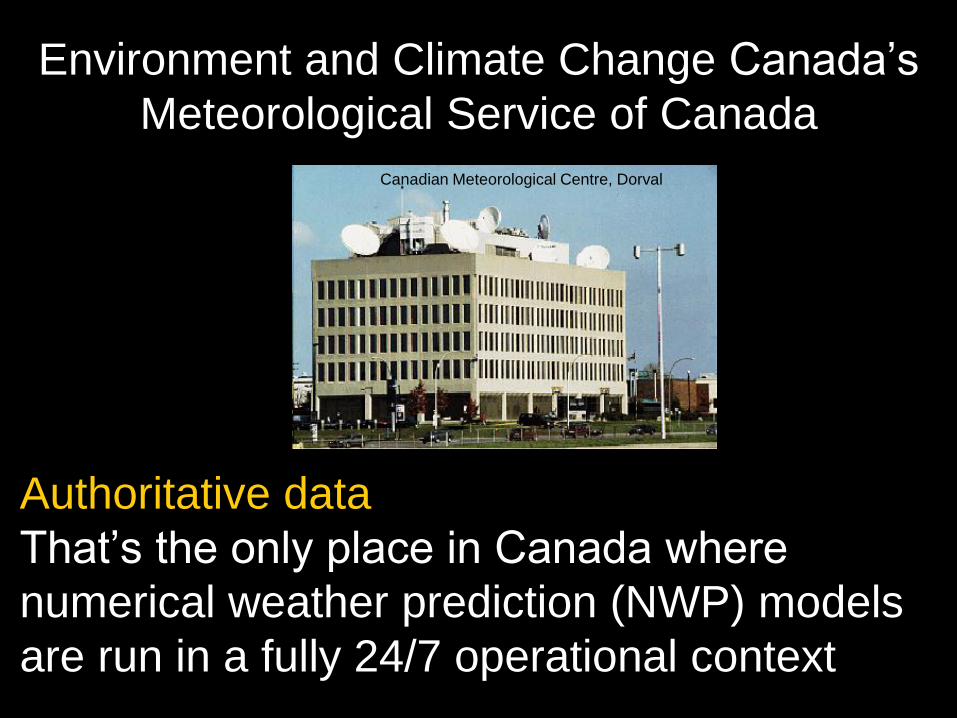
Environment and Climate Change Canada’s
Meteorological Service of Canada
Authoritative data
That’s the only place in Canada where
numerical weather prediction (NWP) models
are run in a fully 24/7 operational context
Canadian Meteorological Centre, Dorval
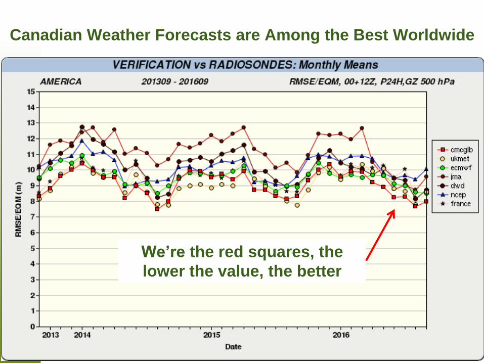
Canadian Weather Forecasts are Among the Best Worldwide
We’re the red squares, the
lower the value, the better
4
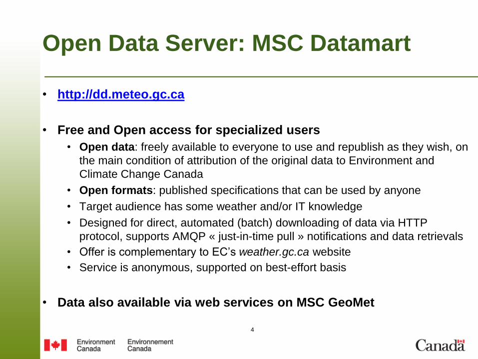
Open Data Server: MSC Datamart
• http://dd.meteo.gc.ca
• Free and Open access for specialized users
• Open data: freely available to everyone to use and republish as they wish, on
the main condition of attribution of the original data to Environment and
Climate Change Canada
• Open formats: published specifications that can be used by anyone
• Target audience has some weather and/or IT knowledge
• Designed for direct, automated (batch) downloading of data via HTTP
protocol, supports AMQP « just-in-time pull » notifications and data retrievals
• Offer is complementary to EC’s weather.gc.ca website
• Service is anonymous, supported on best-effort basis
• Data also available via web services on MSC GeoMet
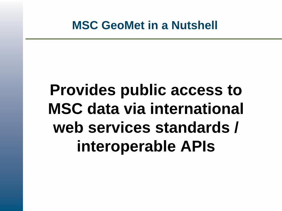
MSC GeoMet in a Nutshell
Provides public access to
MSC data via international
web services standards /
interoperable APIs
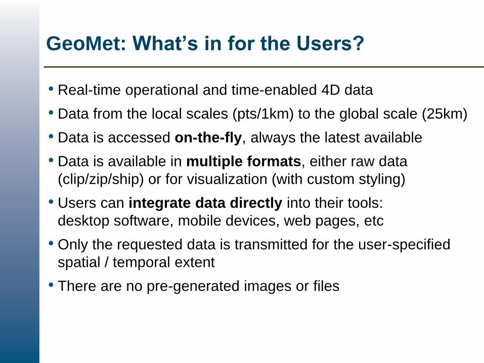
GeoMet: What’s in for the Users?
• Real-time operational and time-enabled 4D data
• Data from the local scales (pts/1km) to the global scale (25km)
• Data is accessed on-the-fly, always the latest available
• Data is available in multiple formats, either raw data
(clip/zip/ship) or for visualization (with custom styling)
• Users can integrate data directly into their tools:
desktop software, mobile devices, web pages, etc
• Only the requested data is transmitted for the user-specified
spatial / temporal extent
• There are no pre-generated images or files

Page 7 – November-1-16
Current Operational MSC GeoMet
• Public real-time Geospatial Web Services delivery of
meteorological data
– NWP
– Radar Mosaic
• OGC Standards
– WMS
– KML
• Operational since 2009
• Officially launched 2013
• TBS policy on geospatial data
• Federal Geospatial Platform

Page 8 – November-1-16
Data Available on Current GeoMet
Data served in WMS and Network-KML:
• NWP models: GDPS, RDPS, HRDPS, RAQDPS,
RDPA, REPS, GIOPS
– Deterministic and probabilistic NWP models, including
Atmosphere-Ocean coupled models
– Layers include: temperature, precipitation, wind speed &
direction, cloud cover, humidity, pressure, probabilistic
ensemble forecasts, ocean temperature and currents, ocean
ice extent, etc
– Derived products: dominant precipitation type, wildfire
forecasts, etc
• Weather radar mosaic: Canadian and American radar
mosaic at 4km resolution updated every 10 minutes,
both 8 and 14-colors styles
Page 9 – November-1-16
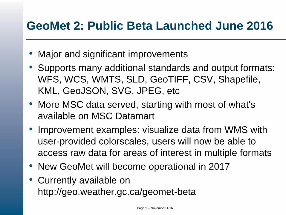
GeoMet 2: Public Beta Launched June 2016
• Major and significant improvements
• Supports many additional standards and output formats:
WFS, WCS, WMTS, SLD, GeoTIFF, CSV, Shapefile,
KML, GeoJSON, SVG, JPEG, etc
• More MSC data served, starting with most of what's
available on MSC Datamart
• Improvement examples: visualize data from WMS with
user-provided colorscales, users will now be able to
access raw data for areas of interest in multiple formats
• New GeoMet will become operational in 2017
• Currently available on
http://geo.weather.gc.ca/geomet-beta
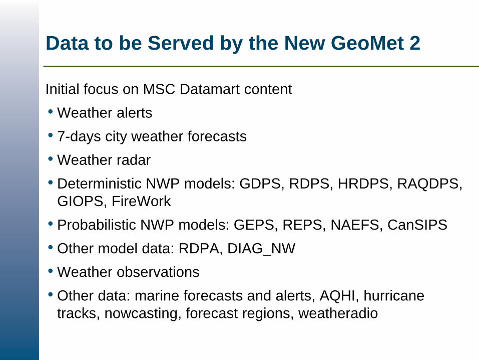
Data to be Served by the New GeoMet 2
Initial focus on MSC Datamart content
• Weather alerts
• 7-days city weather forecasts
• Weather radar
• Deterministic NWP models: GDPS, RDPS, HRDPS, RAQDPS,
GIOPS, FireWork
• Probabilistic NWP models: GEPS, REPS, NAEFS, CanSIPS
• Other model data: RDPA, DIAG_NW
• Weather observations
• Other data: marine forecasts and alerts, AQHI, hurricane
tracks, nowcasting, forecast regions, weatheradio
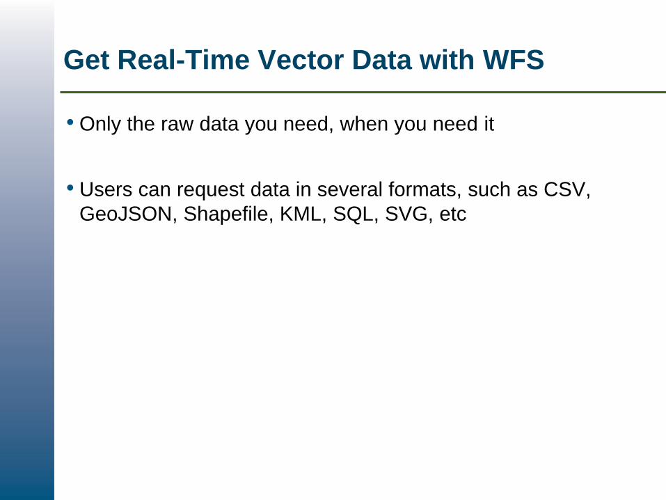
Get Real-Time Vector Data with WFS
• Only the raw data you need, when you need it
• Users can request data in several formats, such as CSV,
GeoJSON, Shapefile, KML, SQL, SVG, etc

Raw Real-Time Data from Rasters with WCS
• Request the raw data for specific areas
• Served live to users in various formats, such as GeoTIFF
and ASCII

Interactive Web Maps & SLD
Users can easily build their own web maps. Features usually
include:
• Pan and zoom anywhere, up to full resolution
• Query data, show raw values and display live graphs
• Overlay multiple data layers, including from external sources
• Animate layers at any scale
SLD
• The Styled Layer Descriptor (SLD) standard allows users to
specify their own symbology for the display of GeoMet
layers
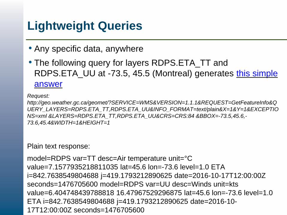
Lightweight Queries
• Any specific data, anywhere
• The following query for layers RDPS.ETA_TT and
RDPS.ETA_UU at -73.5, 45.5 (Montreal) generates this simple
answer
Request:
http://geo.weather.gc.ca/geomet/?SERVICE=WMS&VERSION=1.1.1&REQUEST=GetFeatureInfo&Q
UERY_LAYERS=RDPS.ETA_TT,RDPS.ETA_UU&INFO_FORMAT=text/plain&X=1&Y=1&EXCEPTIO
NS=xml &LAYERS=RDPS.ETA_TT,RDPS.ETA_UU&CRS=CRS:84 &BBOX=-73.5,45.6,-
73.6,45.4&WIDTH=1&HEIGHT=1
Plain text response:
model=RDPS var=TT desc=Air temperature unit=°C
value=7.1577935218811035 lat=45.6 lon=-73.6 level=1.0 ETA
i=842.7638549804688 j=419.1793212890625 date=2016-10-17T12:00:00Z
seconds=1476705600 model=RDPS var=UU desc=Winds unit=kts
value=6.404748439788818 16.47967529296875 lat=45.6 lon=-73.6 level=1.0
ETA i=842.7638549804688 j=419.1793212890625 date=2016-10-
17T12:00:00Z seconds=1476705600
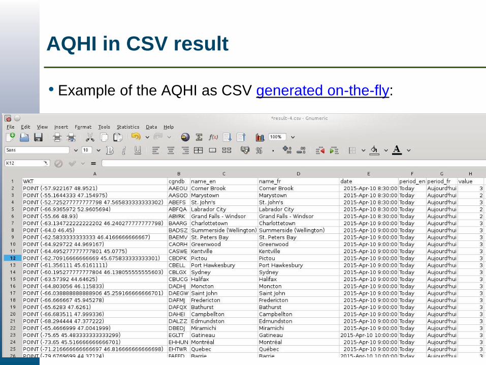
AQHI in CSV result
• Example of the AQHI as CSV generated on-the-fly:
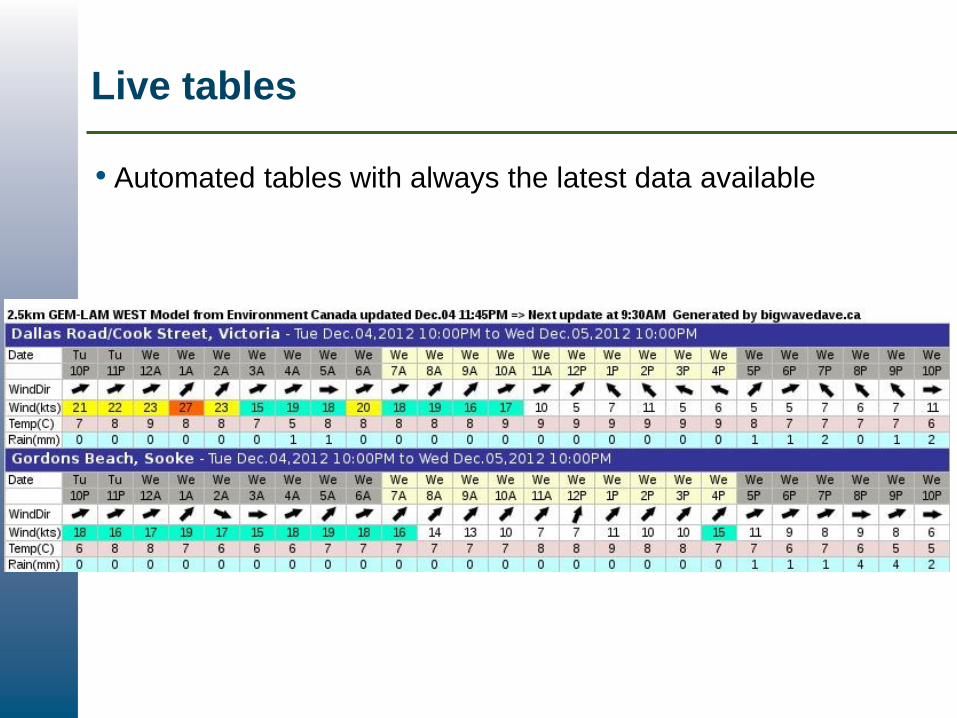
Live tables
• Automated tables with always the latest data available
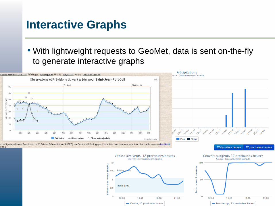
Interactive Graphs
• With lightweight requests to GeoMet, data is sent on-the-fly
to generate interactive graphs
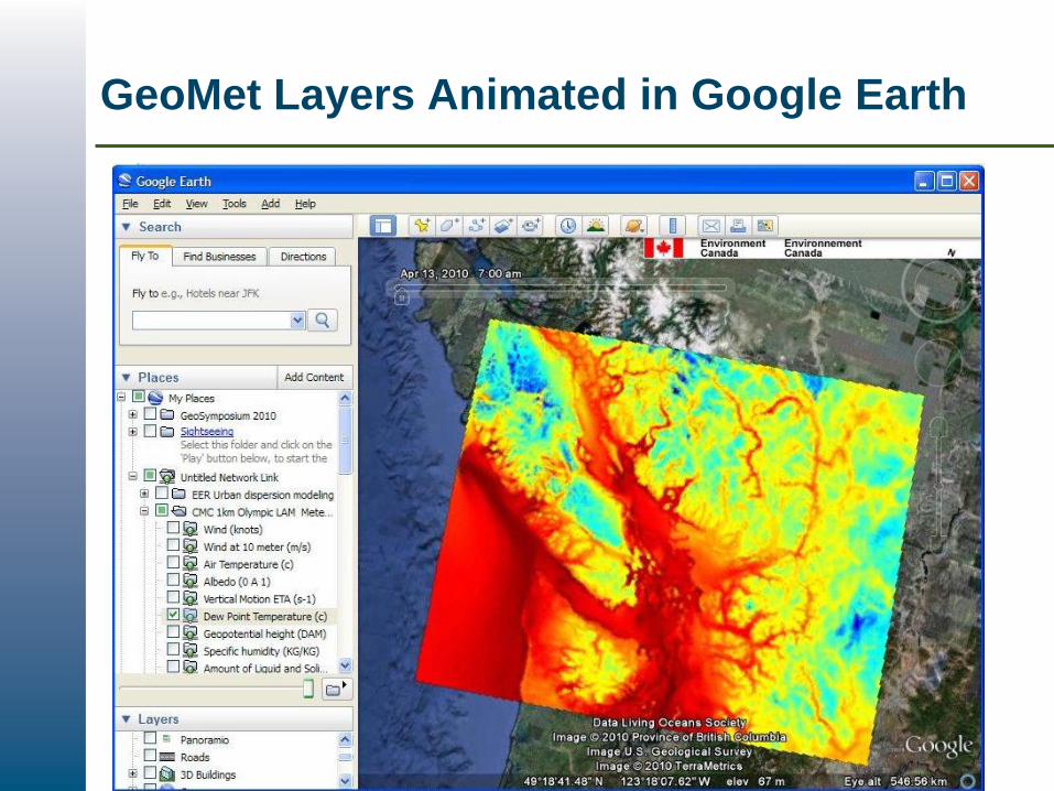
GeoMet Layers Animated in Google Earth
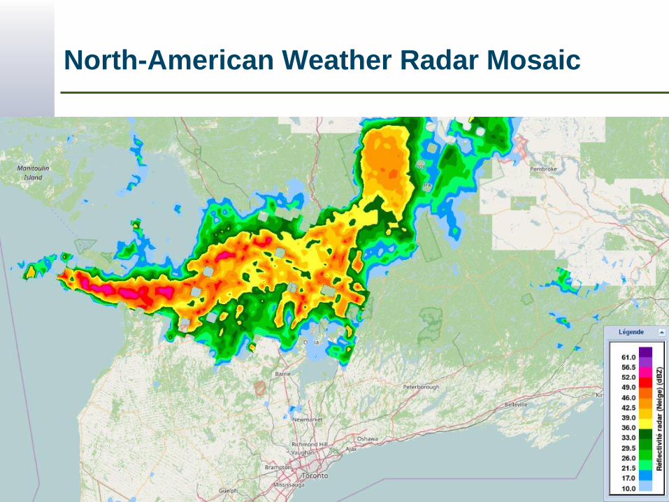
North-American Weather Radar Mosaic
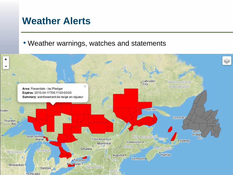
Weather Alerts
• Weather warnings, watches and statements
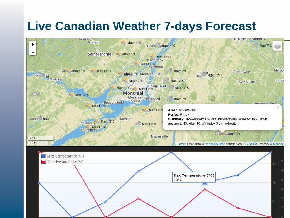
Live Canadian Weather 7-days Forecast
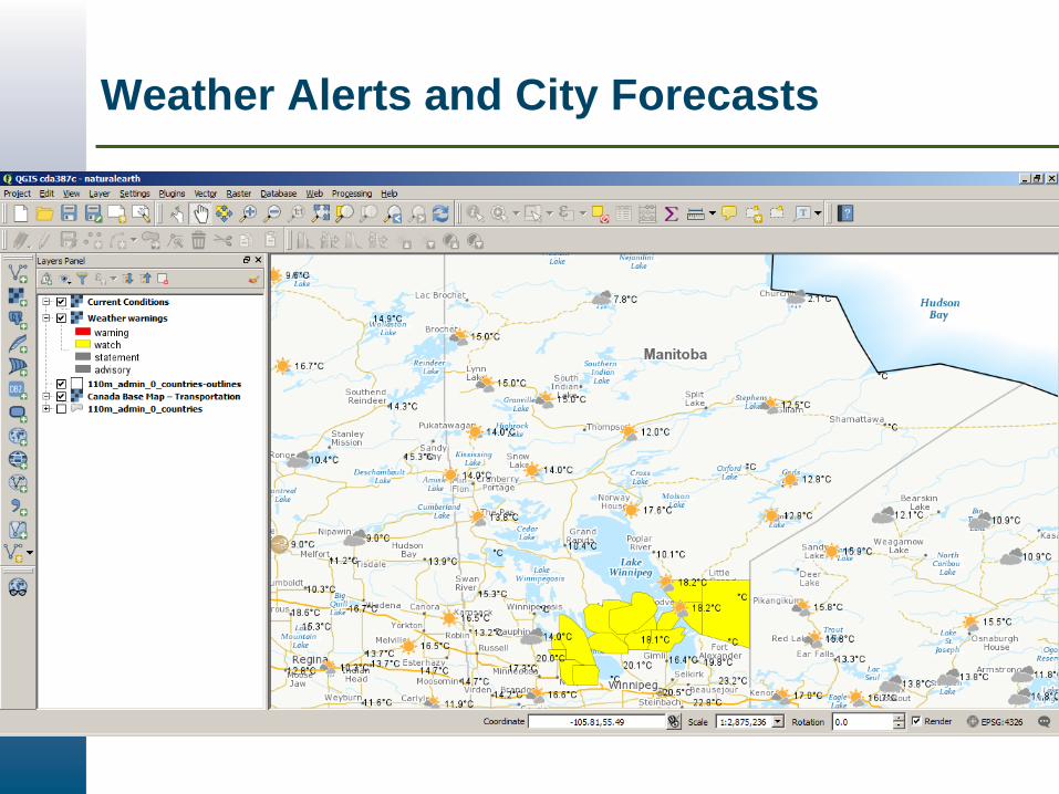
Weather Alerts and City Forecasts
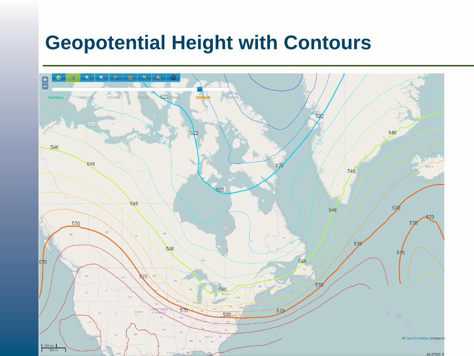
Geopotential Height with Contours
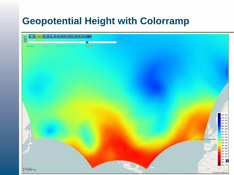
Geopotential Height with Colorramp
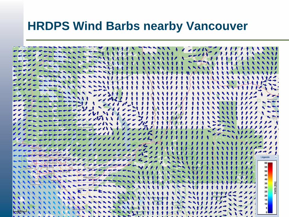
HRDPS Wind Barbs nearby Vancouver

GeoMet in ArcGIS, Time-enabled WMS
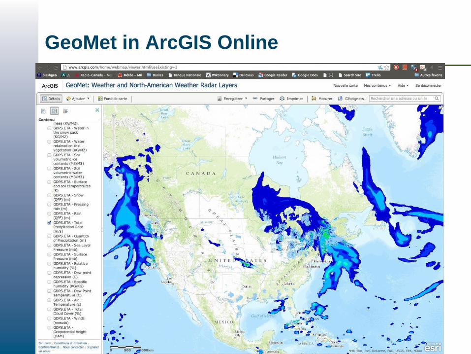
GeoMet in ArcGIS Online

GeoMet on Mobile Devices
• GeoMet layers are ready for
interactive maps on mobile
devices
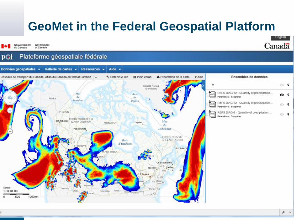
GeoMet in the Federal Geospatial Platform
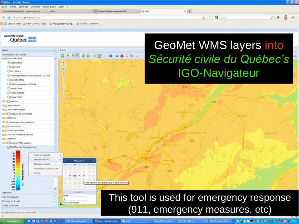
GeoMet WMS layers into
Sécurité civile du Québec’s
IGO-Navigateur
This tool is used for emergency response
(911, emergency measures, etc)
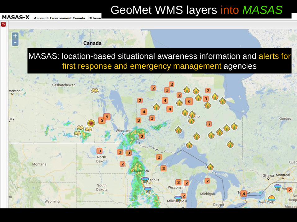
GeoMet WMS layers into MASAS
MASAS: location-based situational awareness information and alerts for
first response and emergency management agencies
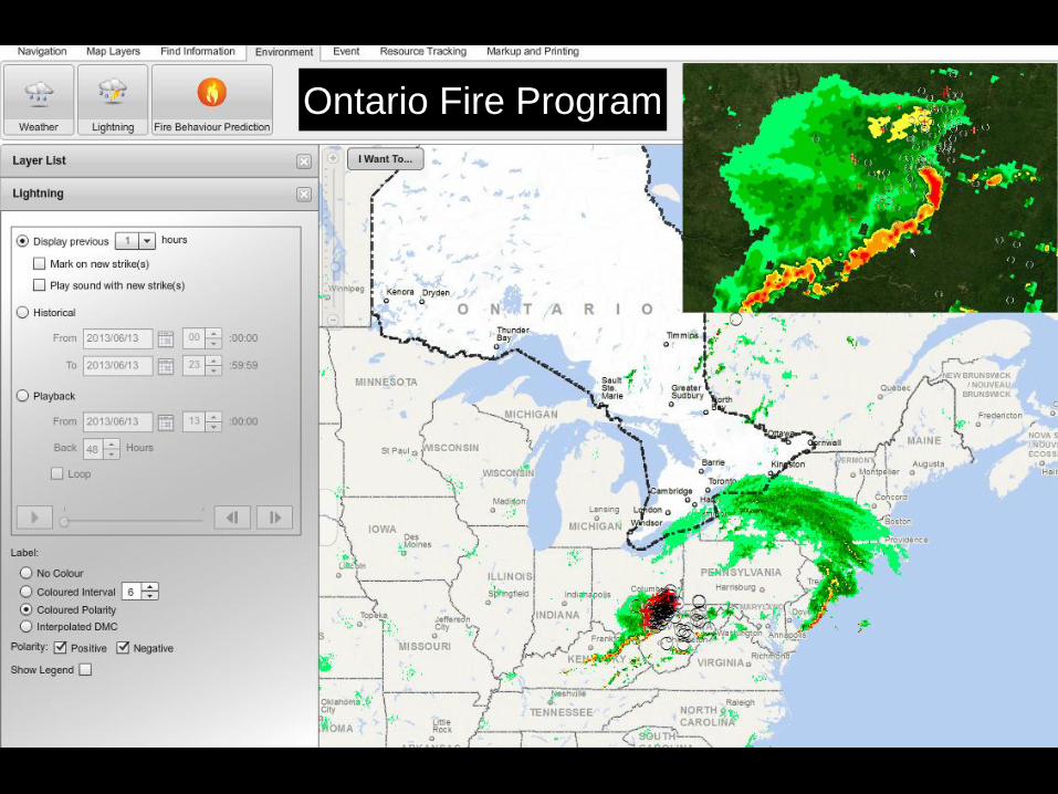
Ontario Fire Program
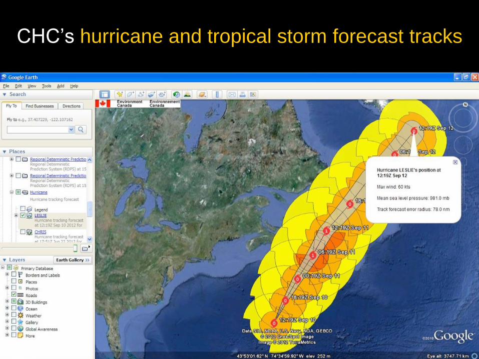
CHC’s hurricane and tropical storm forecast tracks
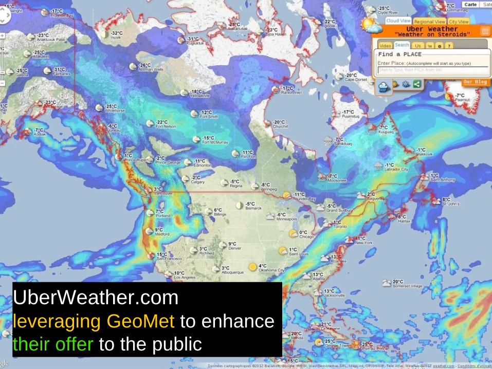
UberWeather.com leveraging GeoMet to enhance
their offer to the public
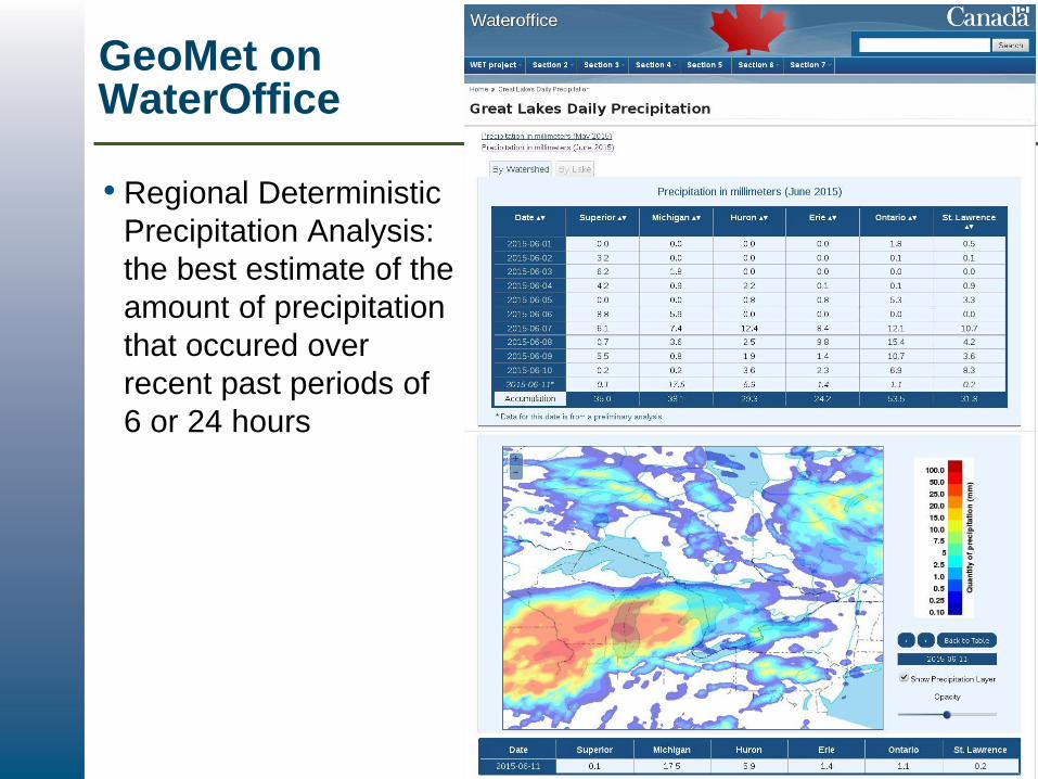
GeoMet on WaterOffice
• Regional Deterministic
Precipitation Analysis:
the best estimate of the
amount of precipitation
that occured over
recent past periods of
6 or 24 hours
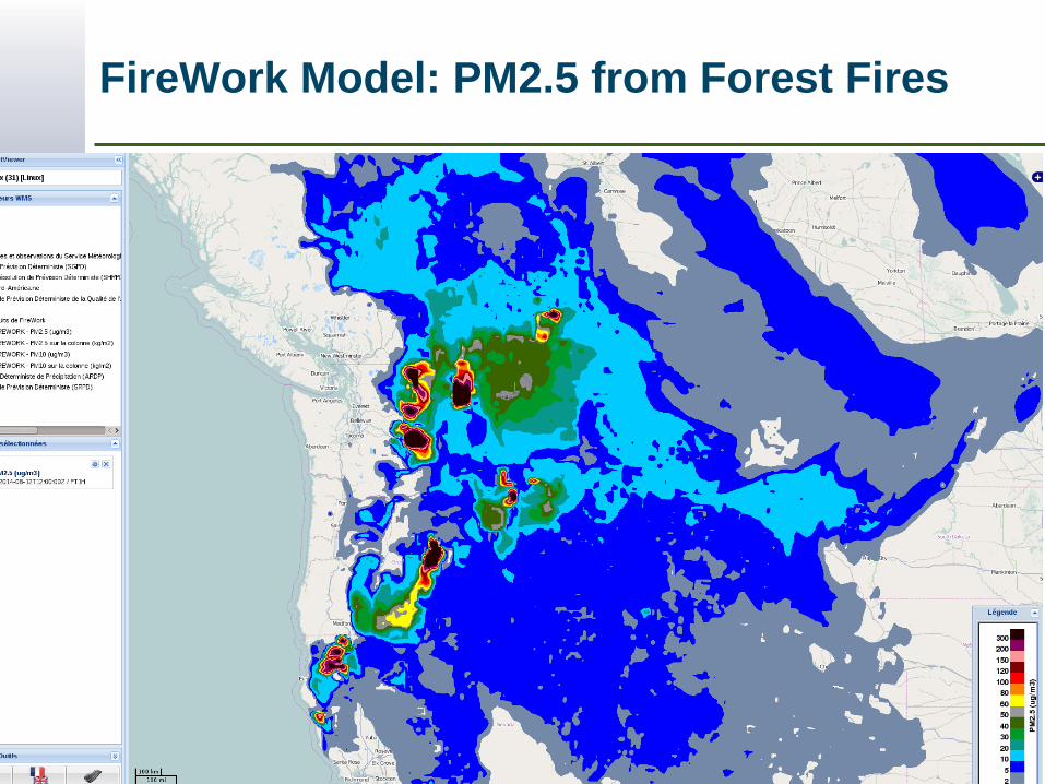
FireWork Model: PM2.5 from Forest Fires
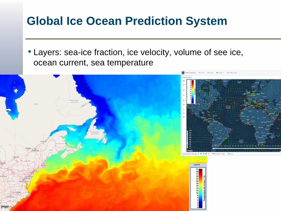
Global Ice Ocean Prediction System
• Layers: sea-ice fraction, ice velocity, volume of see ice,
ocean current, sea temperature
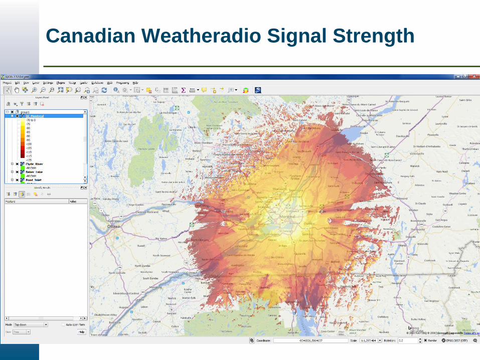
Canadian Weatheradio Signal Strength
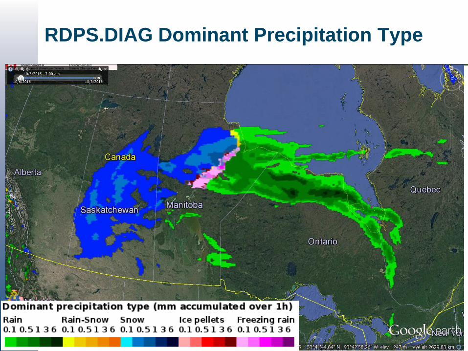
RDPS.DIAG Dominant Precipitation Type
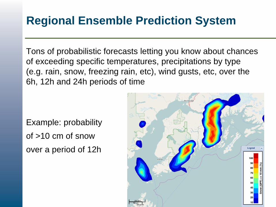
Regional Ensemble Prediction System
Tons of probabilistic forecasts letting you know about chances
of exceeding specific temperatures, precipitations by type
(e.g. rain, snow, freezing rain, etc), wind gusts, etc, over the
6h, 12h and 24h periods of time
Example: probability
of >10 cm of snow
over a period of 12h
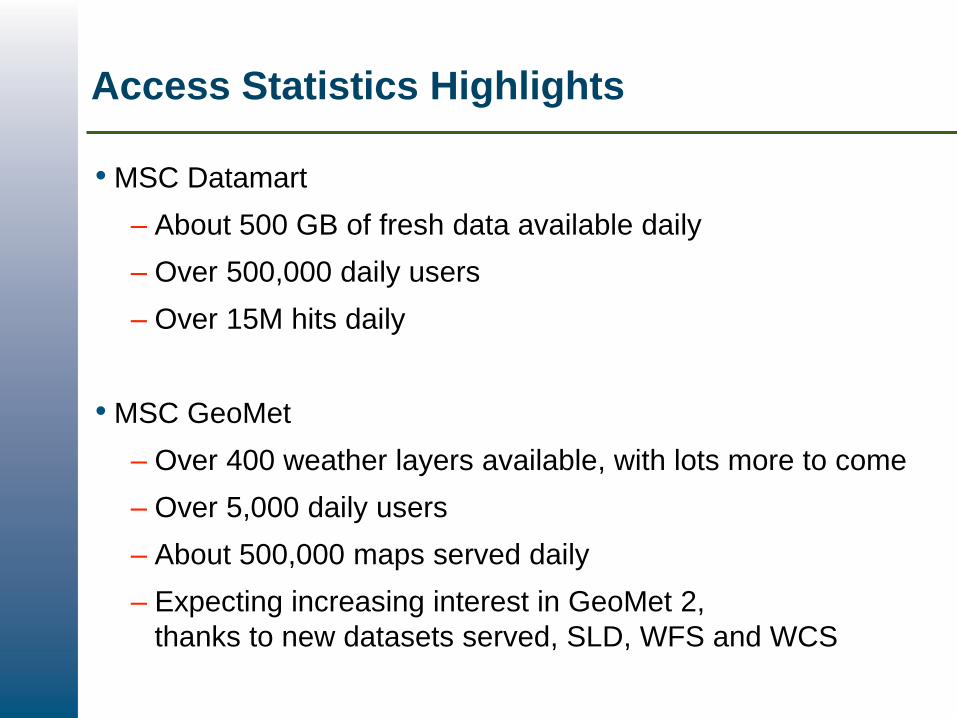
Access Statistics Highlights
• MSC Datamart
– About 500 GB of fresh data available daily
– Over 500,000 daily users
– Over 15M hits daily
• MSC GeoMet
– Over 400 weather layers available, with lots more to come
– Over 5,000 daily users
– About 500,000 maps served daily
– Expecting increasing interest in GeoMet 2,
thanks to new datasets served, SLD, WFS and WCS
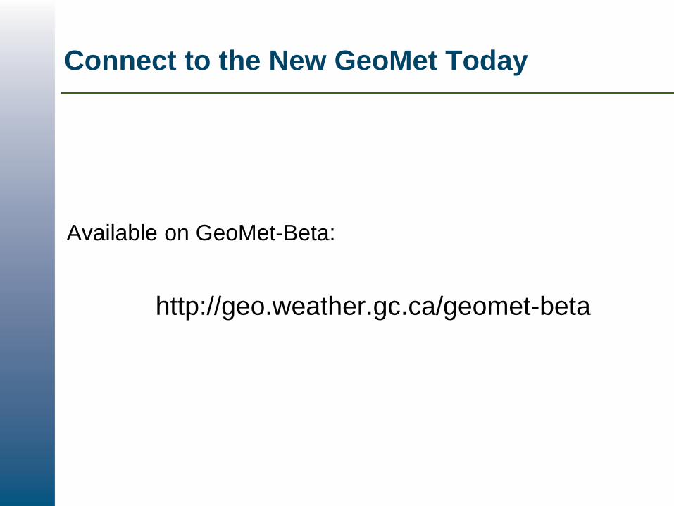
Connect to the New GeoMet Today
Available on GeoMet-Beta:
http://geo.weather.gc.ca/geomet-beta
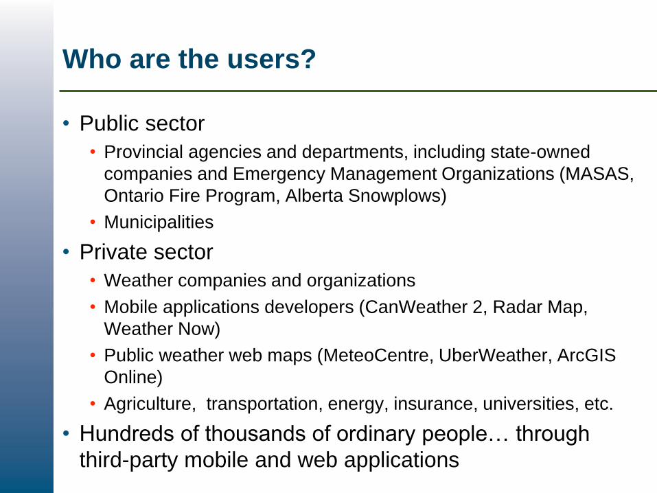
Who are the users?
• Public sector
• Provincial agencies and departments, including state-owned
companies and Emergency Management Organizations (MASAS,
Ontario Fire Program, Alberta Snowplows)
• Municipalities
• Private sector
• Weather companies and organizations
• Mobile applications developers (CanWeather 2, Radar Map,
Weather Now)
• Public weather web maps (MeteoCentre, UberWeather, ArcGIS
Online)
• Agriculture, transportation, energy, insurance, universities, etc.
• Hundreds of thousands of ordinary people… through
third-party mobile and web applications
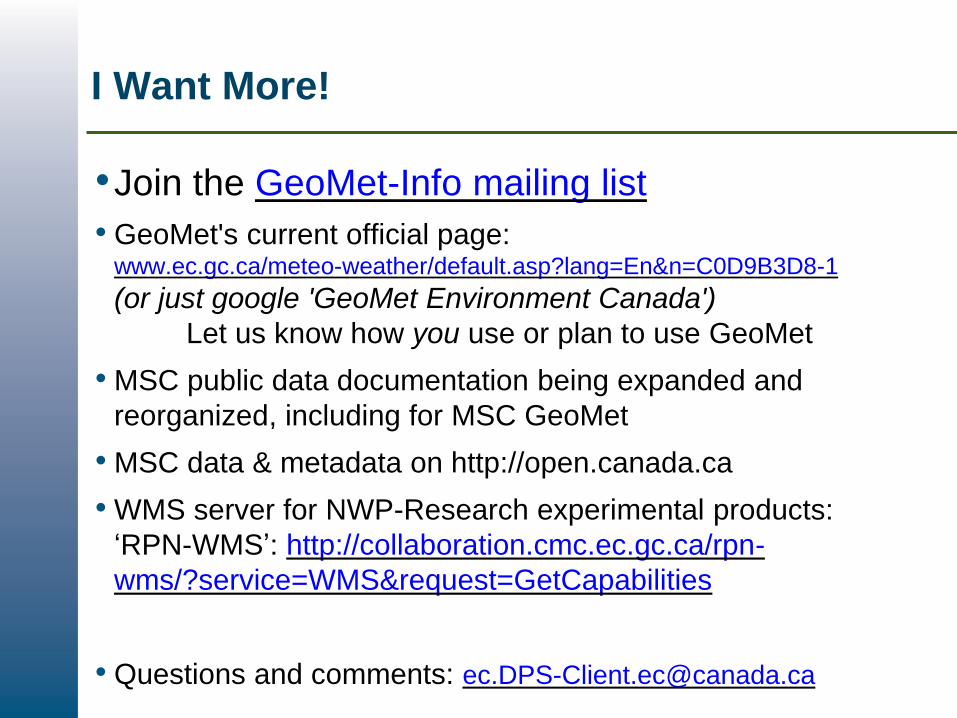
I Want More!
•Join the GeoMet-Info mailing list
• GeoMet's current official page: www.ec.gc.ca/meteo-weather/default.asp?lang=En&n=C0D9B3D8-1
(or just google 'GeoMet Environment Canada')
Let us know how you use or plan to use GeoMet
• MSC public data documentation being expanded and
reorganized, including for MSC GeoMet
• MSC data & metadata on http://open.canada.ca
• WMS server for NWP-Research experimental products:
‘RPN-WMS’: http://collaboration.cmc.ec.gc.ca/rpn-
wms/?service=WMS&request=GetCapabilities
• Questions and comments: [email protected]