Embed Size (px)
Citation preview
GIS for Utility Protection GIS for Utility Protection and Expedited Recovery and Expedited Recovery
after a Hurricane after a Hurricane
Steve HendersonSteve HendersonGIS CoordinatorGIS Coordinator
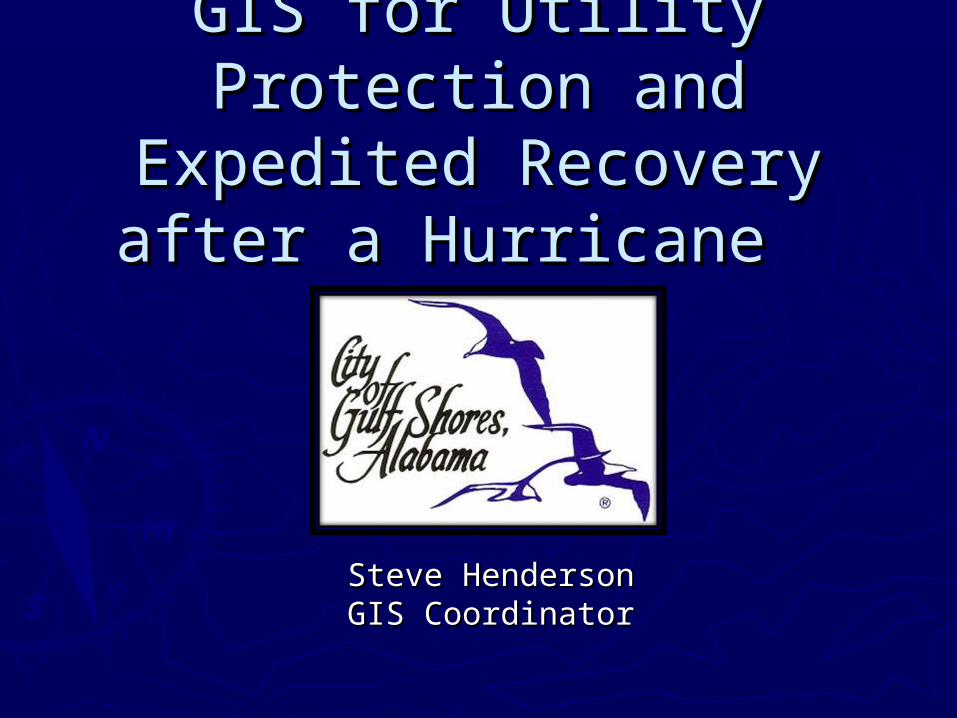
Recent Disaster DeclarationsRecent Disaster DeclarationsGulf Shores, AlabamaGulf Shores, Alabama
► Hurricane Fredrick – Strong Cat. 3 – 1979 – “Historic Hurricane Fredrick – Strong Cat. 3 – 1979 – “Historic Hurricane Event” – Very few storms 80’s to early 90’sHurricane Event” – Very few storms 80’s to early 90’s
► Hurricane Opal – Typical Cat. 2 – 1995Hurricane Opal – Typical Cat. 2 – 1995► Hurricane Danny – “Revenue Event” Cat. 1 – 1997Hurricane Danny – “Revenue Event” Cat. 1 – 1997► Hurricane Georges – Typical Cat. 2 – 1998Hurricane Georges – Typical Cat. 2 – 1998► Tropical Storm Isidore - “Surprising” Storm Surge - Tropical Storm Isidore - “Surprising” Storm Surge -
2002 2002 ► Hurricane Ivan – “Strong” Cat. 3 – 2004Hurricane Ivan – “Strong” Cat. 3 – 2004► Hurricane Katrina – “Very Strong” Near Miss – 2005Hurricane Katrina – “Very Strong” Near Miss – 2005
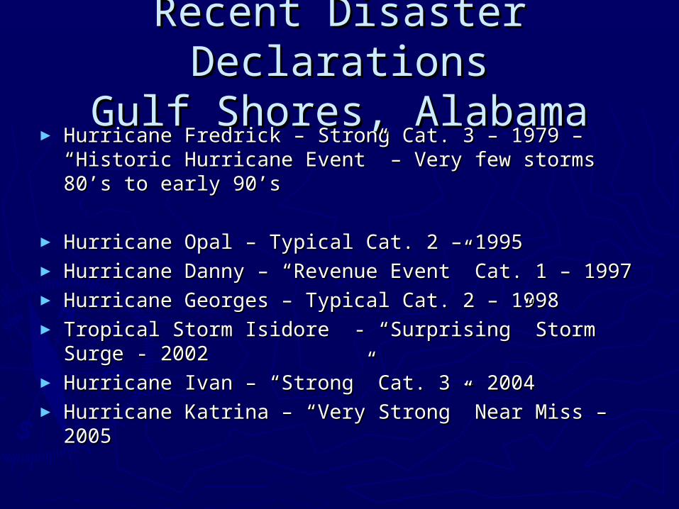
Initial Post Disaster Initial Post Disaster ConditionsConditions
► Storm surge Storm surge deposits lines of deposits lines of thick debris in thick debris in several locationsseveral locations
► Beach roads Beach roads accessing most accessing most rental properties rental properties are covered by sandare covered by sand
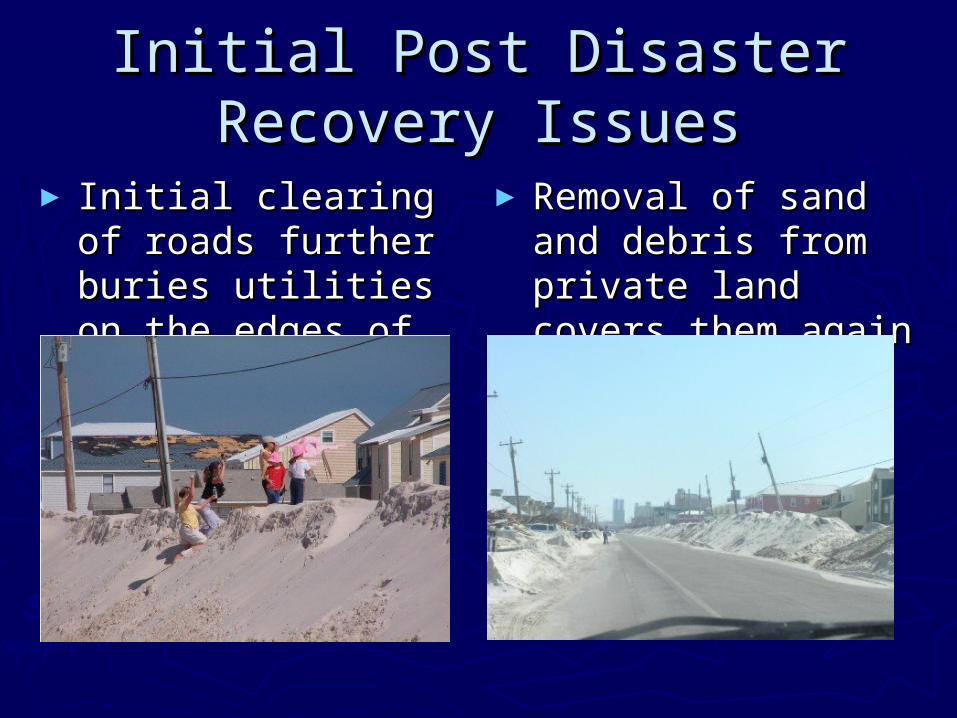
Initial Post Disaster Recovery Initial Post Disaster Recovery IssuesIssues
► Initial clearing of Initial clearing of roads further buries roads further buries utilities on the utilities on the edges of ROW’sedges of ROW’s
► Removal of sand Removal of sand and debris from and debris from private land covers private land covers them againthem again
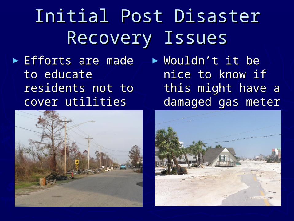
Initial Post Disaster Recovery Initial Post Disaster Recovery IssuesIssues
► Efforts are made to Efforts are made to educate residents educate residents not to cover utilities not to cover utilities during debris during debris removal removal
►Wouldn’t it be nice Wouldn’t it be nice to know if this might to know if this might have a damaged have a damaged gas meter under it?gas meter under it?
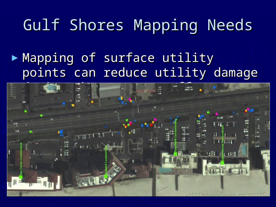
Gulf Shores Mapping NeedsGulf Shores Mapping Needs
►Mapping of surface utility points can Mapping of surface utility points can reduce utility damage during the reduce utility damage during the recovery efforts.recovery efforts.
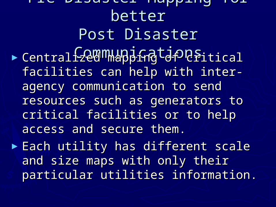
Pre Disaster Mapping for betterPre Disaster Mapping for betterPost Disaster CommunicationsPost Disaster Communications
►Centralized mapping of critical Centralized mapping of critical facilities can help with inter-agency facilities can help with inter-agency communication to send resources such communication to send resources such as generators to critical facilities or to as generators to critical facilities or to help access and secure them. help access and secure them.
►Each utility has different scale and size Each utility has different scale and size maps with only their particular utilities maps with only their particular utilities information.information.
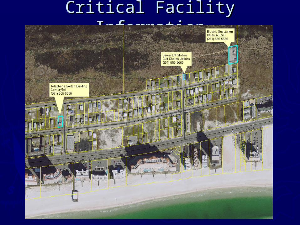
Critical Facility InformationCritical Facility Information
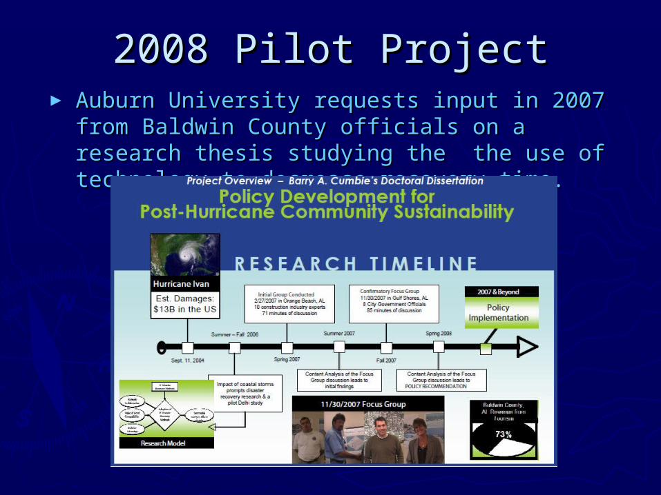
2008 Pilot Project2008 Pilot Project► Auburn University requests input in 2007 from Auburn University requests input in 2007 from
Baldwin County officials on a research thesis Baldwin County officials on a research thesis studying the the use of technology to decrease studying the the use of technology to decrease recovery time.recovery time.
2008 Pilot Project2008 Pilot Project► Participation in the research project leads to Gulf Participation in the research project leads to Gulf
Shores asking Auburn University to partner in a Shores asking Auburn University to partner in a pilot project to determine the feasibility of using pilot project to determine the feasibility of using students to collect utility data using hand held students to collect utility data using hand held GPS units.GPS units.
► Auburn Engineering Technical Assistance Program Auburn Engineering Technical Assistance Program resources includes a multi-discipline Business and resources includes a multi-discipline Business and Engineering course where student learn to solve Engineering course where student learn to solve real-world problems.real-world problems.
► The City asks Volkert and Associates engineering The City asks Volkert and Associates engineering firm to help train students via webinar and setup firm to help train students via webinar and setup the City’s GPS units for the pilot.the City’s GPS units for the pilot.
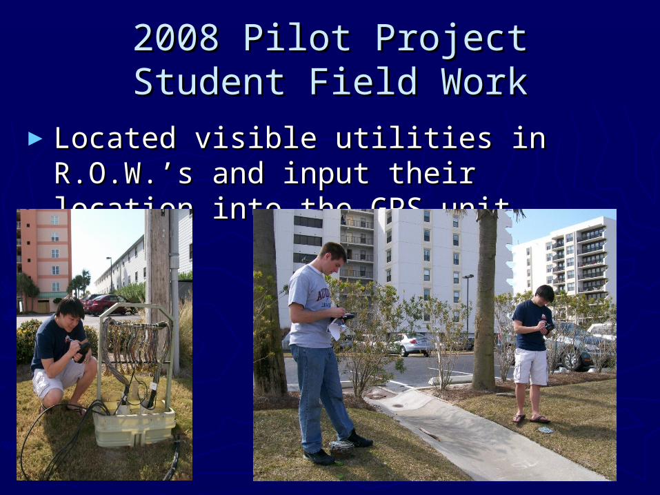
►Located visible utilities in R.O.W.’s and Located visible utilities in R.O.W.’s and input their location into the GPS unitinput their location into the GPS unit
2008 Pilot Project2008 Pilot ProjectStudent Field WorkStudent Field Work
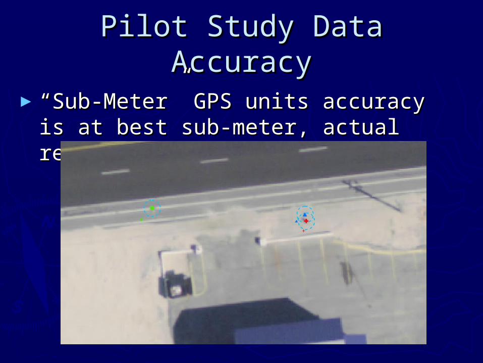
Pilot Study Data AccuracyPilot Study Data Accuracy
►““Sub-Meter” GPS units accuracy is at Sub-Meter” GPS units accuracy is at best sub-meter, actual results +/- six best sub-meter, actual results +/- six feet.feet.
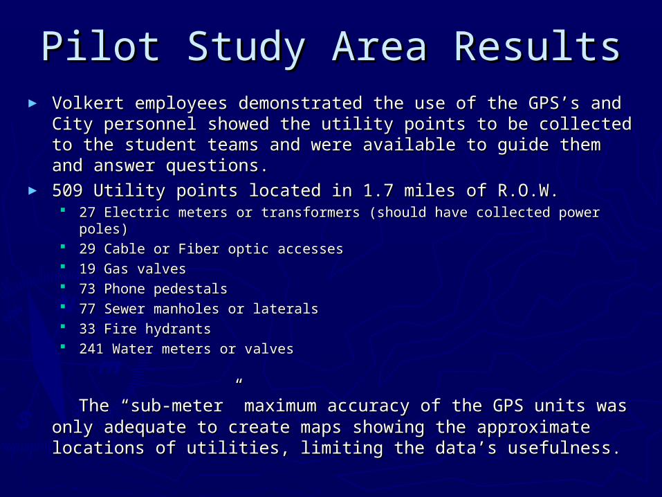
Pilot Study Area ResultsPilot Study Area Results► Volkert employees demonstrated the use of the GPS’s and Volkert employees demonstrated the use of the GPS’s and
City personnel showed the utility points to be collected to the City personnel showed the utility points to be collected to the student teams and were available to guide them and answer student teams and were available to guide them and answer questions.questions.
► 509 Utility points located in 1.7 miles of R.O.W.509 Utility points located in 1.7 miles of R.O.W. 27 Electric meters or transformers (should have collected power poles)27 Electric meters or transformers (should have collected power poles) 29 Cable or Fiber optic accesses29 Cable or Fiber optic accesses 19 Gas valves19 Gas valves 73 Phone pedestals73 Phone pedestals 77 Sewer manholes or laterals77 Sewer manholes or laterals 33 Fire hydrants33 Fire hydrants 241 Water meters or valves241 Water meters or valves
The “sub-meter” maximum accuracy of the GPS units was The “sub-meter” maximum accuracy of the GPS units was only adequate to create maps showing the approximate only adequate to create maps showing the approximate locations of utilities, limiting the data’s usefulness.locations of utilities, limiting the data’s usefulness.
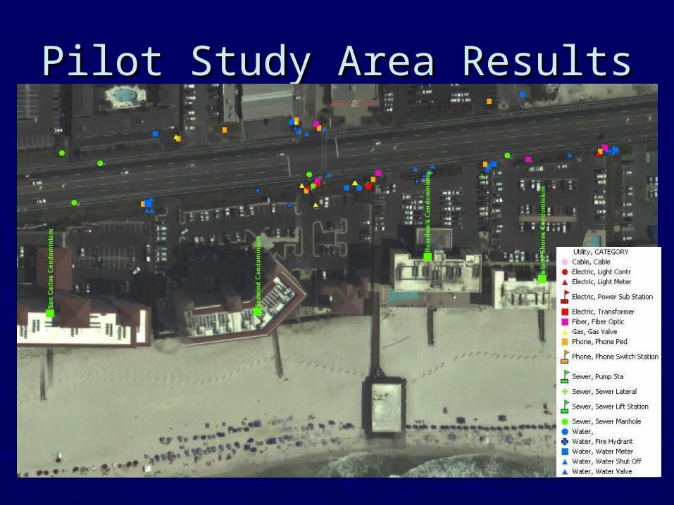
Pilot Study Area ResultsPilot Study Area Results
Auburn University Grant Auburn University Grant ApplicationsApplications
►National Science Foundation National Science Foundation Technology Grant – Not awardedTechnology Grant – Not awarded
►Economic Development Administration Economic Development Administration Grant – Awarded 2 year grant to help Grant – Awarded 2 year grant to help make Alabama coastal communities make Alabama coastal communities more disaster resilient. Includes Gulf more disaster resilient. Includes Gulf Shores, Orange Beach, Dauphin Island, Shores, Orange Beach, Dauphin Island, Bayou La Batre, and Baldwin and Bayou La Batre, and Baldwin and Mobile County Coastal Areas.Mobile County Coastal Areas.
EDA Grant TimelineEDA Grant Timeline
► Grant Awarded by U.S. Department of Commerce’s Grant Awarded by U.S. Department of Commerce’s Economic Development Administration – Sept. 2009 Economic Development Administration – Sept. 2009
► Dept. of Homeland Security – Virtual Alabama becomes Dept. of Homeland Security – Virtual Alabama becomes partners with project - Nov. 2009partners with project - Nov. 2009
► GPS Training Session - Training team leaders – Volkert GPS Training Session - Training team leaders – Volkert and Associates – Jan. 2010and Associates – Jan. 2010
► First data collection session planned for Feb. 13-14 – First data collection session planned for Feb. 13-14 – Canceled due to the “Great Southern Snow of 2010”Canceled due to the “Great Southern Snow of 2010”
► First 3 data collection weekends of Feb 20, 27, Mar. 6, First 3 data collection weekends of Feb 20, 27, Mar. 6, no data collection planned for peak spring break no data collection planned for peak spring break weekendsweekends
► Data collection, review, quality checks to continue in Data collection, review, quality checks to continue in April and through the summer.April and through the summer.
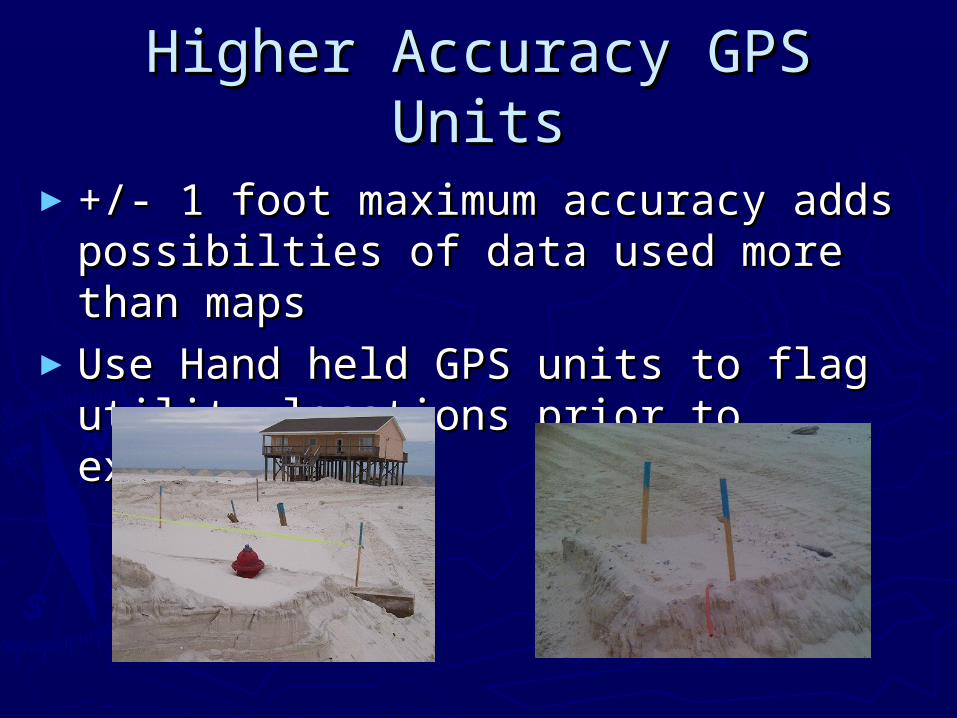
Higher Accuracy GPS UnitsHigher Accuracy GPS Units
►+/- 1 foot maximum accuracy adds +/- 1 foot maximum accuracy adds possibilties of data used more than possibilties of data used more than mapsmaps
►Use Hand held GPS units to flag utility Use Hand held GPS units to flag utility locations prior to excavationlocations prior to excavation
Higher Accuracy GPS UnitsHigher Accuracy GPS Units
►Equipment mounted notebooks/tablets Equipment mounted notebooks/tablets might allow excavation operators to might allow excavation operators to know when they are approaching a know when they are approaching a utility before they digutility before they dig
►Debris removal crews can check as Debris removal crews can check as they approach a debris pile to see they approach a debris pile to see what might have been buried.what might have been buried.
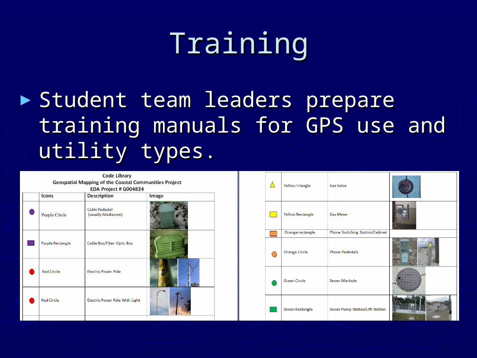
TrainingTraining
►Student team leaders prepare training Student team leaders prepare training manuals for GPS use and utility types. manuals for GPS use and utility types.
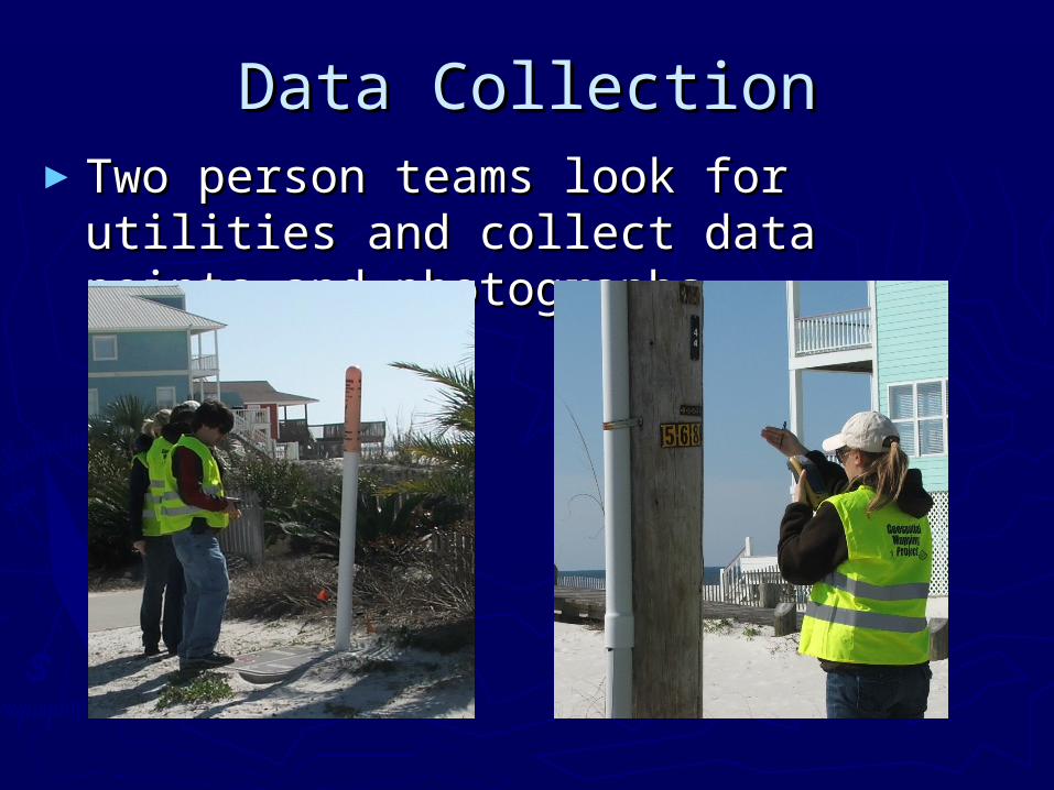
Data CollectionData Collection►Two person teams look for utilities and Two person teams look for utilities and
collect data points and photographs.collect data points and photographs.
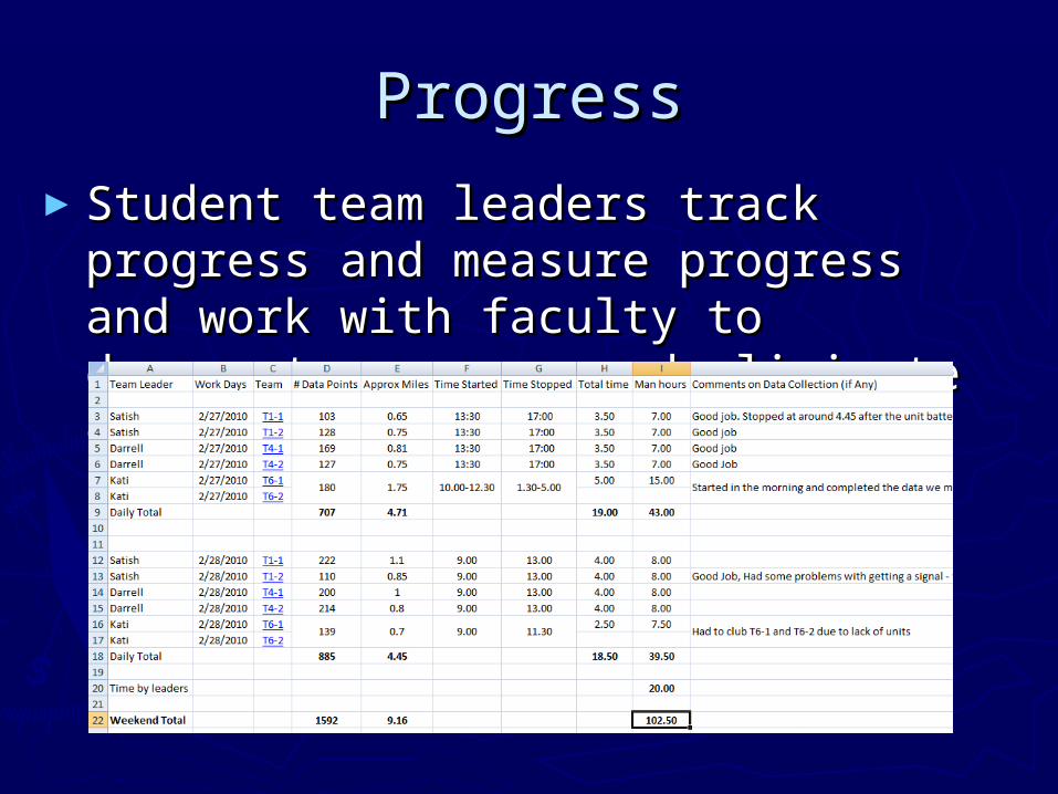
ProgressProgress
►Student team leaders track progress Student team leaders track progress and measure progress and work with and measure progress and work with faculty to document accuracy and faculty to document accuracy and eliminate errors.eliminate errors.
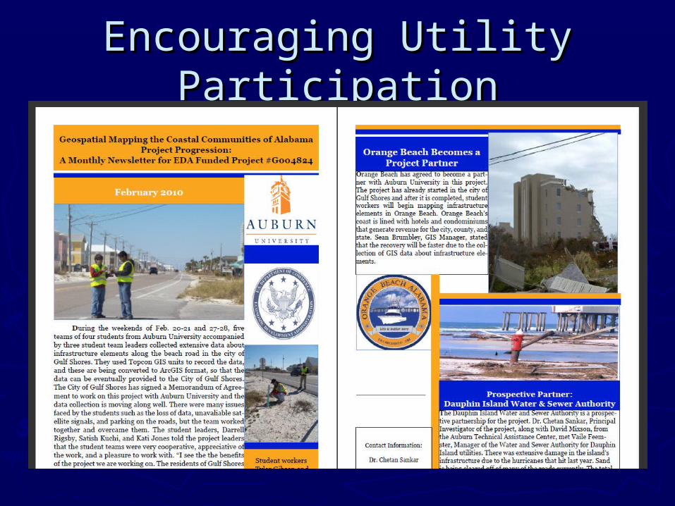
Encouraging Utility Encouraging Utility ParticipationParticipation
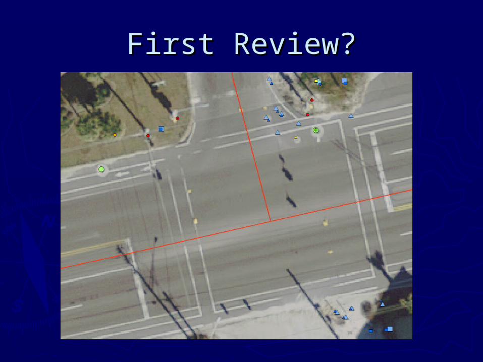
First Review?First Review?
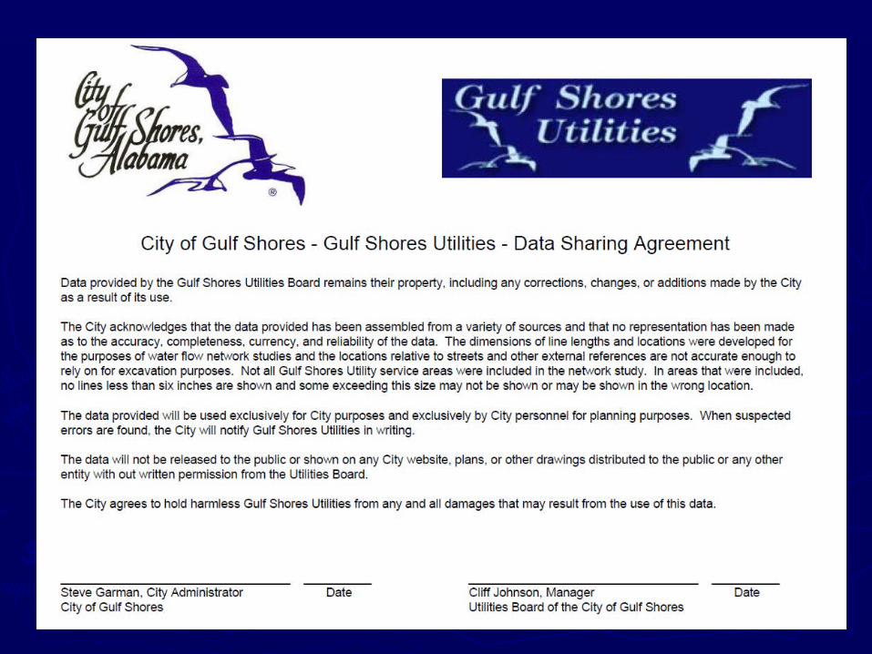
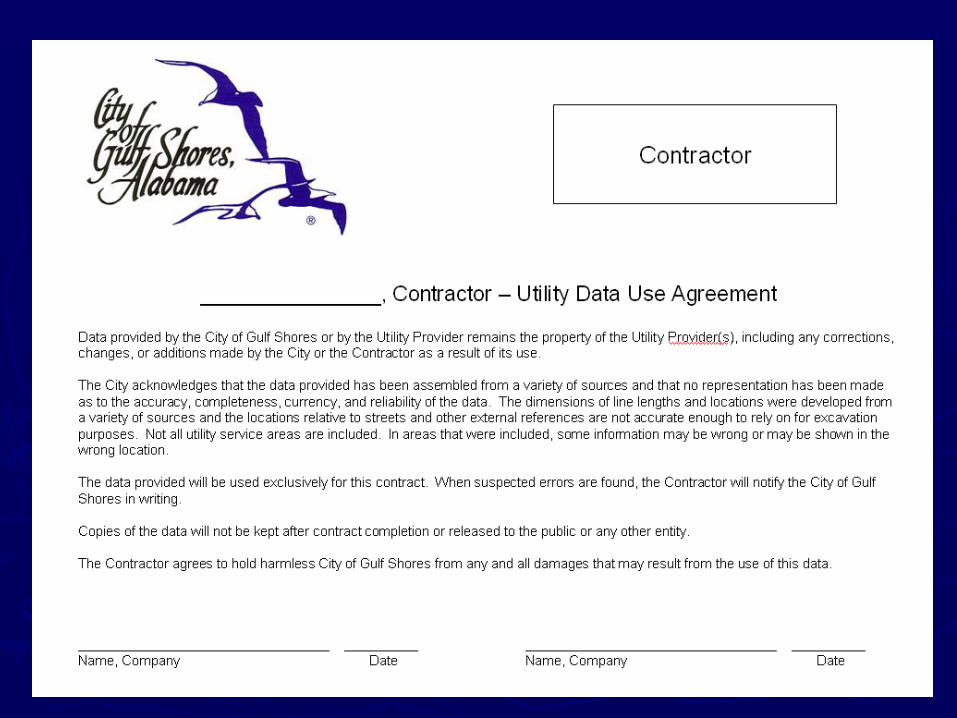
Utility – Data Sharing Utility – Data Sharing Concerns Concerns
► Existing data is not up to dateExisting data is not up to date►Not all areas are mappedNot all areas are mapped► As-builts do not reflect all changesAs-builts do not reflect all changes► Fear of misuse by others - Call before Fear of misuse by others - Call before
you digyou dig► Competitive IssuesCompetitive Issues►Outside Security RequirementsOutside Security Requirements► Loss of ControlLoss of Control
Utility CoordinationUtility Coordination
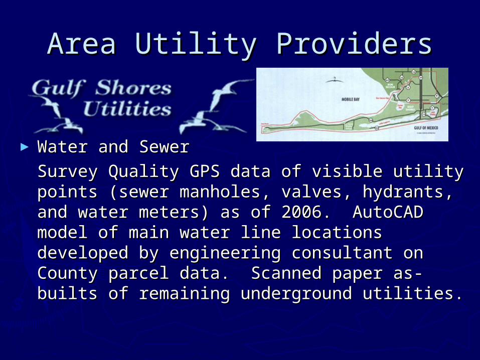
Area Utility ProvidersArea Utility Providers
►Water and SewerWater and Sewer
Survey Quality GPS data of visible utility Survey Quality GPS data of visible utility points (sewer manholes, valves, hydrants, points (sewer manholes, valves, hydrants, and water meters) as of 2006. AutoCAD and water meters) as of 2006. AutoCAD model of main water line locations developed model of main water line locations developed by engineering consultant on County parcel by engineering consultant on County parcel data. Scanned paper as-builts of remaining data. Scanned paper as-builts of remaining underground utilities. underground utilities.
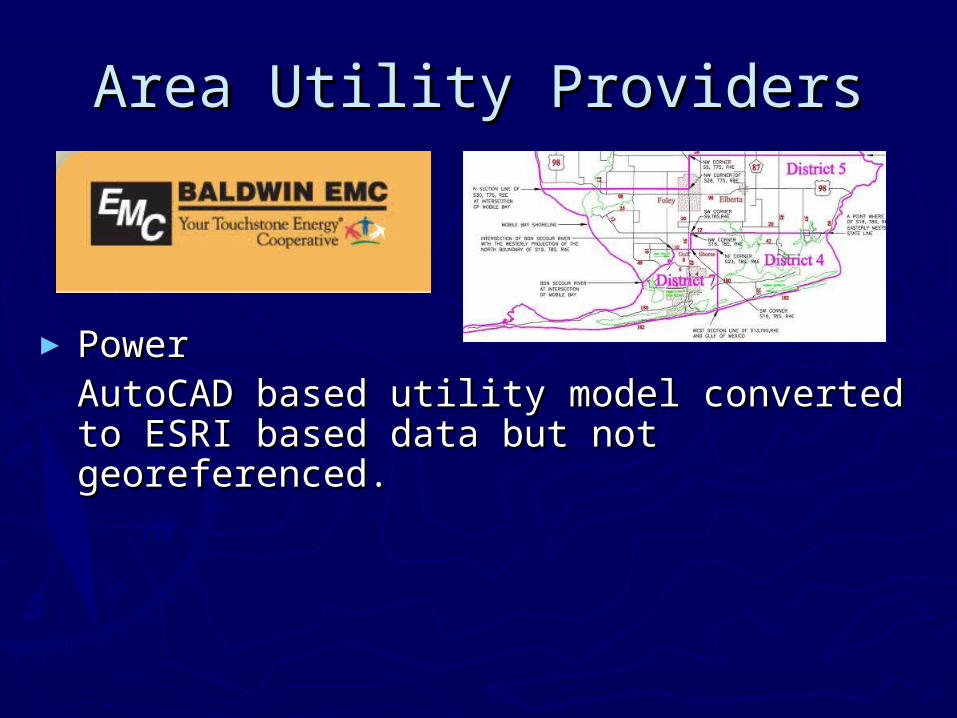
Area Utility ProvidersArea Utility Providers
► PowerPowerAutoCAD based utility model converted to AutoCAD based utility model converted to ESRI based data but not georeferenced.ESRI based data but not georeferenced.
Area Utility ProvidersArea Utility Providers
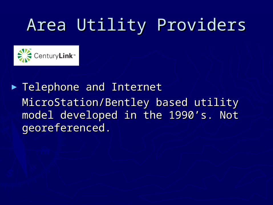
► Telephone and InternetTelephone and Internet
MicroStation/Bentley based utility model MicroStation/Bentley based utility model developed in the 1990’s. Not georeferenced.developed in the 1990’s. Not georeferenced.
Area Utility ProvidersArea Utility Providers
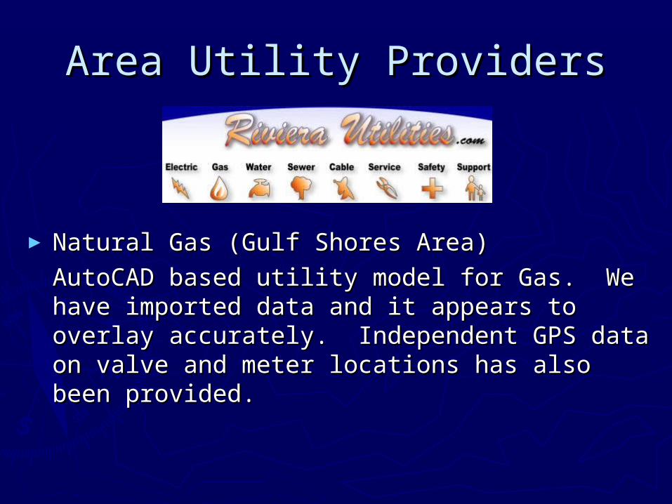
►Natural Gas (Gulf Shores Area)Natural Gas (Gulf Shores Area)
AutoCAD based utility model for Gas. We AutoCAD based utility model for Gas. We have imported data and it appears to overlay have imported data and it appears to overlay accurately. Independent GPS data on valve accurately. Independent GPS data on valve and meter locations has also been provided.and meter locations has also been provided.
Area Utility ProvidersArea Utility Providers
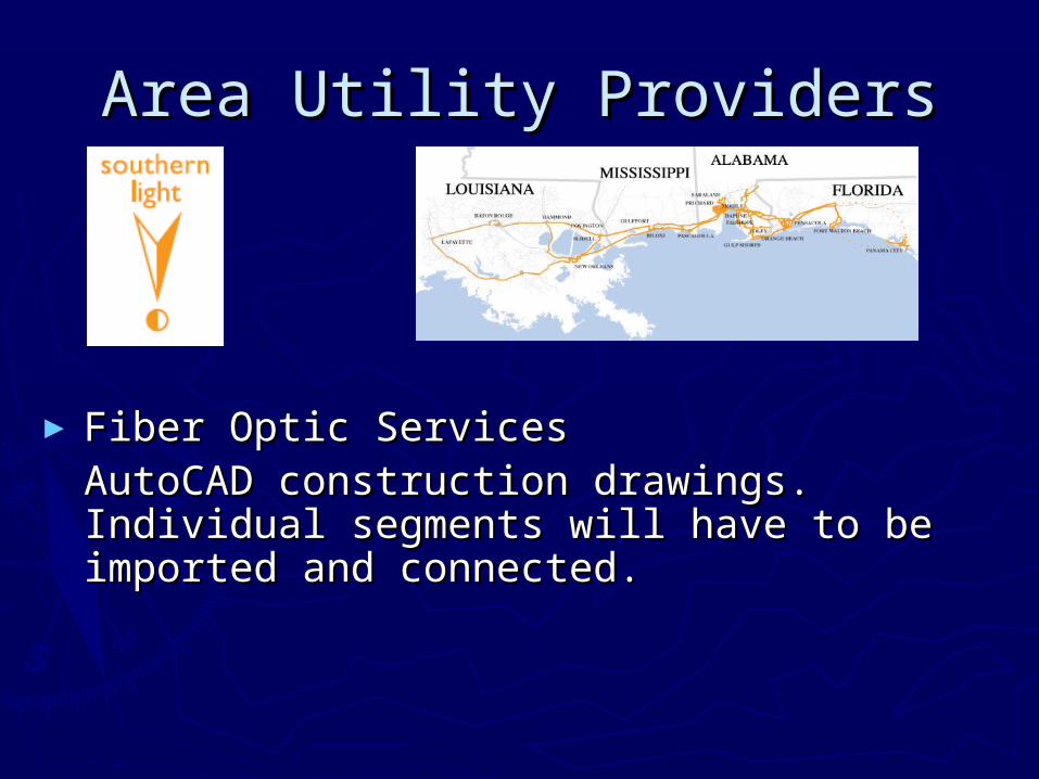
► Fiber Optic ServicesFiber Optic ServicesAutoCAD construction drawings. Individual AutoCAD construction drawings. Individual segments will have to be imported and segments will have to be imported and connected.connected.
Area Utility ProvidersArea Utility Providers
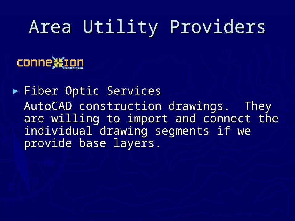
► Fiber Optic ServicesFiber Optic ServicesAutoCAD construction drawings. They are AutoCAD construction drawings. They are willing to import and connect the individual willing to import and connect the individual drawing segments if we provide base layers. drawing segments if we provide base layers.
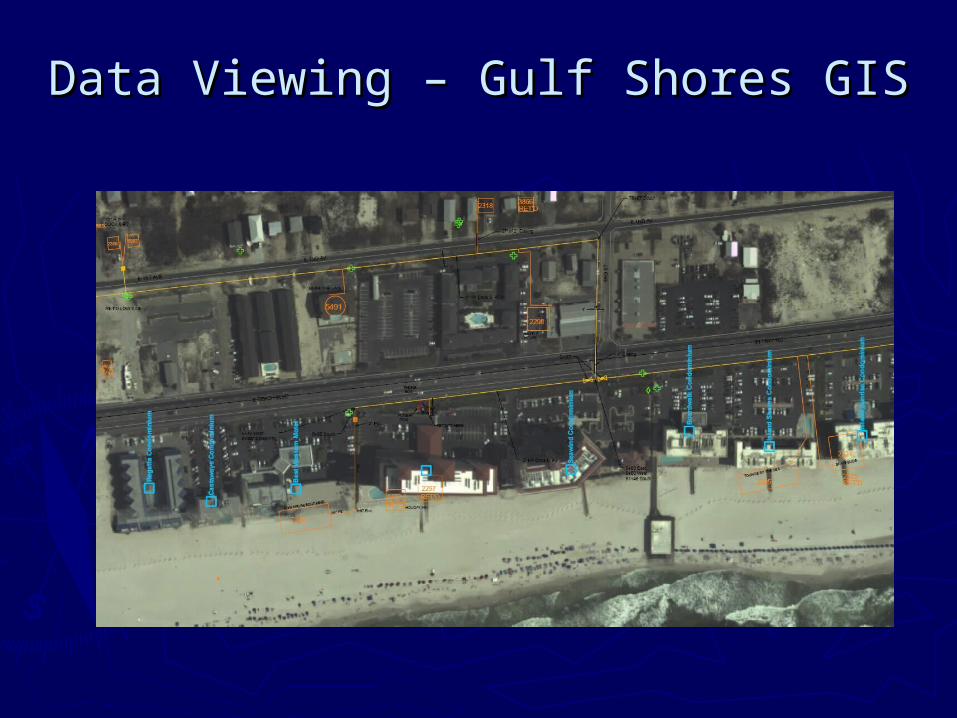
Data Viewing – Gulf Shores GISData Viewing – Gulf Shores GIS
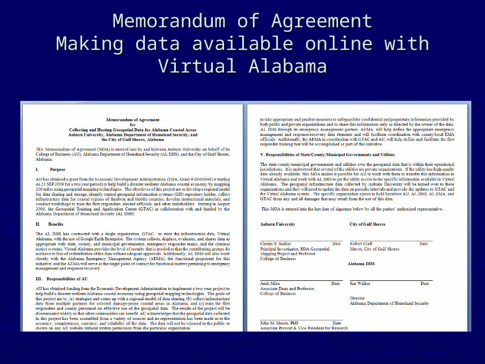
Memorandum of AgreementMemorandum of AgreementMaking data available online with Virtual Making data available online with Virtual
AlabamaAlabama
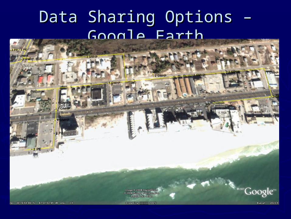
Data Sharing Options – Google Data Sharing Options – Google EarthEarth
Data Sharing OptionsData Sharing OptionsVirtual AlabamaVirtual Alabama
►Developed as a common visualization Developed as a common visualization tool for 2D and 3D data for first tool for 2D and 3D data for first responders.responders.
►Can host data which can be viewed Can host data which can be viewed but not downloaded.but not downloaded.
►Or provide a link to secured offsite Or provide a link to secured offsite data…data…
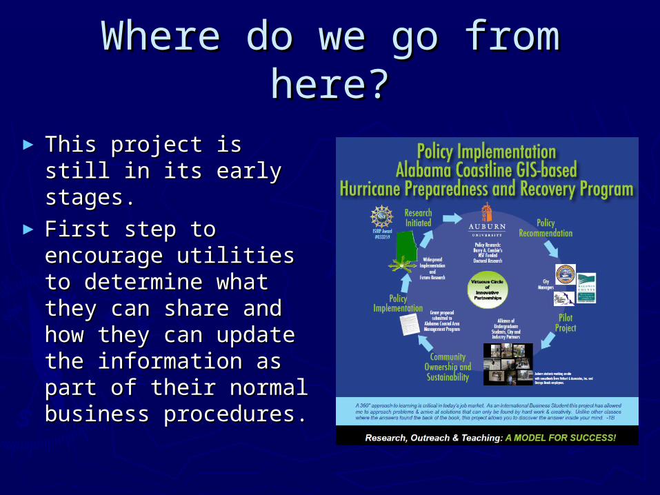
Where do we go from here?Where do we go from here?
► This project is still in This project is still in its early stages.its early stages.
► First step to First step to encourage utilities to encourage utilities to determine what they determine what they can share and how can share and how they can update the they can update the information as part information as part of their normal of their normal business procedures.business procedures.
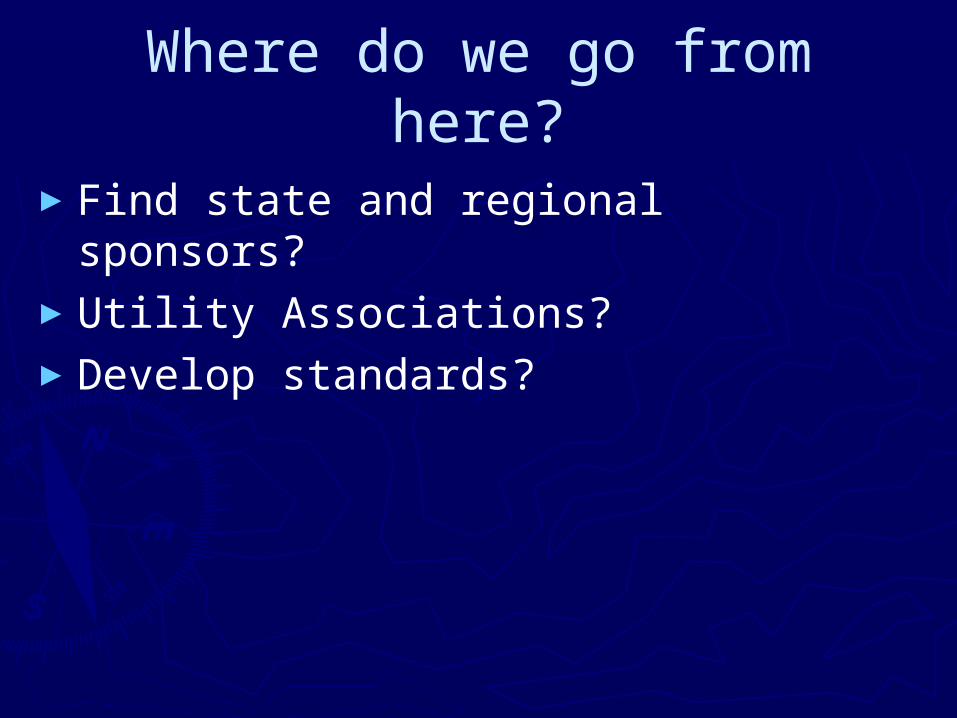
Where do we go from here?
►Find state and regional sponsors?►Utility Associations?►Develop standards?