Embed Size (px)
Citation preview

HiHTEF116-Pu‘u Wa‘awa‘a (123006a)
HE WAHI MO‘OLELO NO PU‘U WA‘AWA‘A A ME NÄPU‘U O NÄ KONA —
A Collection of Cultural and Historical Accounts of Pu‘u Wa‘awa‘a and the Näpu‘u Region — District of Kona, on the Island of Hawai‘i
Kumu Pono Associates LLC
Historical & Archival Documentary Research · Oral History Interview Studies · Researching and Preparing Studies from Hawaiian Language Documents ·
Mähele ‘Äina, Boundary Commission, & Land History Records · Integrated Cultural Resources Management Planning ·
Preservation & Interpretive Program Development

HiHTEF116-Pu‘u Wa‘awa‘a (123006a)
HE WAHI MO‘OLELO NO PU‘U WA‘AWA‘A A ME NÄPU‘U O NÄ KONA —
A Collection of Cultural and Historical Accounts of Pu‘u Wa‘awa‘a and the Näpu‘u Region — District of Kona, on the Island of Hawai‘i
PREPARED BY
Kepä Maly • Cultural Historian - Resource Specialist & Onaona Maly • Researcher PREPARED FOR
The Institute of Pacific Islands Forestry USDA Forest Service 60 Nowelo Street Hilo, Hawai‘i 96720 DECEMBER 30, 2006
© 2006 Kumu Pono Associates LLC
Historical & Archival Documentary Research · Oral History Interview Studies · Researching and Preparing Studies from Hawaiian Language Documents ·
Mähele ‘Äina, Boundary Commission, & Land History Records · Integrated Cultural Resources Management Planning ·
Preservation & Interpretive Program Development 554 Keonaona St. · Hilo, Hawai‘i 96720 · (ph.) 808.981.0196 · (e-mail) [email protected]

This page intentionally left blank

He Wahi Mo‘olelo no Pu‘u Wa‘awa‘a (Kumu Pono Associates LLC – December 30, 2006) HiHETF116a – ii
EXECUTIVE SUMMARY AND ACKNOWLEDGEMENTS
This study of cultural and historical resources of Pu‘u Wa‘awa‘a in the Näpu‘u region of the Kona District on the island of Hawai‘i, was conducted at the request of the United States Department of Agriculture–Institute of Pacific Islands Forestry (the Institute). The Institute proposes to have a portion of the Pu‘u Wa‘awa‘a dryland forest designated as one of two locations that would be a part of the Hawai‘i Experimental Tropical Forest (HETF) program—the other site is situated in the Laupähoehoe region of the Hilo District, also on the island of Hawai‘i. The land division (ahupua‘a) of Pu‘u Wa‘awa‘a is situated along the northern slopes of Hualälai, an ancient volcano that rises to an elevation of 8,271 feet above sea level, in the Kona District on the Island of Hawai‘i. Pu‘u Wa‘awa‘a itself, takes its name from one of the noted geological features on the land, a cinder cone (pu‘u) marked by deep furrows (wa‘awa‘a). This pu‘u is also a significant place on the cultural landscape, named for a deified ancestor of the families of the land. Pu‘u Wa‘awa‘a Ahupua‘a extends from an area in the ocean fronting the land, across the arid lowland kula (plains), into an area of upper kula lands which are host to a unique—though diminishing—Hawaiian dryland forest (formerly the area surrounding the hill of Pu‘u Wa‘awa‘a, and extending across the land to its upper boundary). The land division runs up the slopes of Hualälai, to an elevation of 5,762 and 5,950 feet above sea level at its’ two highest corners. In ancient times, the land of Pu‘u Wa‘awa‘a, and its’ neighbor Pu‘u Anahulu were closely linked in traditions, and in supporting residents who shared familial ties with one another. The people resided in both the upland forest region, and along the coast. In the uplands to about the 3,000 foot elevation, dew-fall and occasional rains provided enough moisture to support agricultural efforts—planting fields were developed amidst the dryland forest and sheltered by the forest canopy. Along the coastal region, small settlements occurred, where fresh and brackish water could be found, and where easy access to marine fisheries was offered. In between these two residential zones, trails provided the people with access to the resources necessary for life, and a wide range of cultural features were developed. Cultural features include, but are not limited to shelters, water catchments, ceremonial sites, burials features, walls and modified caves, fissures and hillocks. In the more remote forested uplands, an area generally known as the wao nahele and wao akua (forest zone and region of the gods), people also traveled, albeit with greater care. But from these regions choice woods, birds for food, and feathers from rare birds could be collected. Indeed, the uplands of Pu‘u Wa‘awa‘a-Pu‘u Anahulu were once famed for their populations of endemic ‘ö‘ö (a black honey creeper which had tufts of yellow feathers used in chiefly adornments), and the ‘alalä (an endemic crow). There also occurred other forms of the endemic nënë (goose) than that which remains today, and sea birds which nested on the mountain lands that were collected for food. Of particular note, we also find in ancient accounts, that the kauila (Colubrina oppositifolia) forests were highly valued, with the wood being sought out for use in heiau (temples), in the gates of fishponds, and other specialized functions. The significance of the kauila forests on Pu‘u Wa‘awa‘a is recorded in the place name Kaluakauila, near the Pu‘u Wa‘awa‘a-Ka‘üpülehu boundary. The diverse and ancient forest resources and native life forms remained healthy on the land through the middle 1800s. By the 1850s, herds of feral goats and wild cattle began to make significant impacts in the region. The dry-region forests took years to mature, and the feral animals consumed everything in their path. The first formal ranching efforts on the Pu‘u Wa‘awa‘a-Pu‘u Anahulu (Näpu‘u) lands were initiated under a lease granted by Kamehameha V to three Hawaiian lessees in 1863. The lease was subsequently let out to Francis Spencer in 1865, and most of the Näpu‘u lands were controlled by him for ranching through the early 1890s. Spencer’s lease ended in 1895, and portions of Pu‘u Anahulu were subdivided into homesteads for native tenants, the remainder of the Näpu‘u lands were leased to the partnership of Eben Low and Robert Hind, and the Pu‘u Wa‘awa‘a Ranch was established. By 1905 Robert Hind controlled all of the ranching interests, and the forest lands

He Wahi Mo‘olelo no Pu‘u Wa‘awa‘a (Kumu Pono Associates LLC – December 30, 2006) HiHETF116a – iii
continued a slow but steady decline. Conditions of the lease required the planting of new trees (of foreign origin), and protection (fencing) of certain sections of the forests. Though efforts were made, ranching activities, growing populations of alien species, fires, and poor management practices led to the continued decline of the flora and fauna at Pu‘u Wa‘awa‘a. Native traditions and historical accounts cited in this study provide readers with numerous descriptions of cultural and historical sites, accounts of traditional and customary practices on the land, and the extent of the native forest system of Näpu‘u. We also learn from the oral history interviews, that over the last 150 years, a small group of people have come to use the land, taking from it what they could get, and then moving on when it was no longer economically profitable or sustainable. Throughout those years, the native residents of Näpu‘u have struggled to remain on the land, and in their own way have done their best to care for special places and resources. Their experiences and knowledge of place, as described in the oral history interviews, provides readers with important guidance for management of the land and its resources. A partnership between the managers and participants in the HETF programs, the families of the land, the State organized Pu‘u Wa‘awa‘a Advisory Committee, and interested parties, will help to ensure that multi-faceted goals and objectives can be achieved. Success in the HETF and State programs will occur if there is encouragement and support for the stewardship programs of the native tenants. Traditional and Kama‘äina Knowledge The voices of our elders are among the most precious resources handed down to us from our past. While the historical and archival records help us understand how we came to be where we are today, the voices of the elders give life to the history, and demonstrate how practices and history are handed down and made. To each of the küpuna who have since passed on, and to the kama‘äina who shared their recollections and history in this study, we extend our sincerest appreciation and aloha—
The late, Raymond Keawe Alapa‘i; Gordon Alapa‘i; Howard Alapa‘i; the late, Lois Alapa‘i-Akao; the late, Nancy Alapa‘i-Hepa; Geo. Kinoulu Kahananui, Sr.; Miki Kato; Caroline Kiniha‘a Keäkealani-Pereira; Robert “Sonny” Keäkealani, Jr.; Shirley Kau‘i Keäkealani; Leina‘ala Keäkealani-Lightner; Luika Ka‘uhane (Keäkealani); Thomas Kamaki Lindsey, Jr.; Charles Mitchell and the late, Edith Kau‘ihelewaleokeawaiki Ka‘ilihiwa Mitchell; Robert Levi Mitchell, William “Billy” Häwawaikaleoonämanuonäkanahele Paris, Jr.; Robert Ka‘iwa Punihaole, Sr.; and Elizabeth “Tita” K. Ruddle-Spielman.
Also to — Ku‘ulei Keäkealani; Debbie Ka‘iliwai-Ray; Mahana Wilcox Gomes; Violet Ha‘o-Ka‘ai; Nora Ka‘uhane Kealanui Ha‘o; Lanihau Keäkealani-Akau; Lehua Keäkealani-Kihe; Lucy Keala Keäkealani-Tagavilla; JK Spielman; C. Hanohano Punihaole; Heather Cole; Jerry King & Conceicao Farias; and staff of the Institute of Pacific Islands Forestry — Mahalo a nui!
Mäua no me ka ha‘aha‘a — Kepä a me Onaona Maly.
Wahi mai nä küpuna, “I ka lökähi ko käkou ola ai!” (Our well-being is in our unity!)

He Wahi Mo‘olelo no Pu‘u Wa‘awa‘a (Kumu Pono Associates LLC – December 30, 2006) HiHETF116a – iv
TABLE OF CONTENTS
INTRODUCTION • 1 Historical and Archival Research • 1 The Pu‘u Wa‘awa‘a Dry Land Forest Region • 3 Caring for the Cultural Landscape of Pu‘u Wa‘awa‘a • 4 Recommendations for Treatment of Cultural Resources • 4
PU‘U WA‘AWA‘A AT NÄPU‘U: AN OVERVIEW OF THE CULTURAL HISTORICAL LANDSCAPE • 7
Hawaiian Settlement • 7 Natural Resources and Land Management in the Hawaiian Cultural System • 8 The Ahupua‘a of Pu‘u Wa‘awa‘a • 9
MO‘OLELO ‘ÄINA: NATIVE TRADITIONS AND HISTORIC ACCOUNTS OF NÄPU‘U AND VICINITY • 11
“The Legend of Kaulanapokii” • 11 Keahualono and Kanikü: Traditions from the Reign of Lono-i-ka-makahiki • 12 ‘Ömu‘o Ceremony at Luahinewai-Pu‘u Wa‘awa‘a and the Dedication of Pu‘u Koholä (ca. 1790-1791) • 12 Kekaha in the Eruptions of 1800-1801 • 14 Näpu‘u: Native Traditions from the Pen of Ka-ohu-haaheo-i-na-kuahiwi-ekolu (J.W.H.I. Kihe) • 15 Ka‘ao Ho‘oniua Pu‘uwai No Ka-Miki (The Heart Stirring Story of Ka-Miki) • 15 Traditions of Pu‘u Anahulu (Ten-day Hill) and Pu‘u Wa‘awa‘a (Furrowed Hill) Recorded in the Story of Ka-Miki • 16 Pu‘u Anahulu i ka uka ‘Iu‘iu, kona mau Luhiehu Hihiu • 17 Näpu‘u (and) Näpu‘upü‘alu (also called Nä-pu‘u-kinikini, and Nä-pu‘u-pü‘alu-kinikini) • 18 “Na Hoonanea o ka Manawa, Kekahi mau Wahi Pana o Kekaha ma Kona” • 18
He Wahi Mo‘olelo no Pu‘u Wa‘awa‘a (Kumu Pono Associates LLC – December 30, 2006) HiHETF116a – v
Luahine Wai (Water of the old Woman) • 18 Ka Loko o Kïholo (The Pond of Kïholo at Pu‘u Wa‘awa‘a) • 19 Ka Pu‘u o Moemoe (The Hill of Moemoe) • 19 Pü‘o‘a o Ka‘uali‘i (Stone House of Ka‘uali‘i) • 22 Ka Loko o Wainänäli‘i (The Pond of Wainänäli’i) • 24 Nä Wahi Pana o Pu‘u Anahulu (The Famous Places of Pu‘u Anahulu) • 25 Kukui-o-Hakau (The Kukui Tree of Hakau) • 25 The Supernatural Dog named Anahulu • 26
KEKAHA AND NÄPU‘U DESCRIBED IN THE JOURNALS AND ARTICLES OF HISTORIC VISITORS (1778-1902) • 27
North Kona (Näpu‘u)-Kawaihae Region Viewed in 1779 • 27 The Journal of William Ellis (1823) • 27 The Journals of Lorenzo Lyons and Cochran Forbes (ca. 1835-1859) • 29 Lava Flow of 1859 Impacts Villages and Resources of Pu‘u Anahulu-Pu‘u Wa‘awa‘a • 30 Kailua to Kawaihae (1840) • 31 The Wilkes Expedition (1840-1841) • 31 Mai Kailua a hiki i Kiholo – From Kailua to Kiholo (1875) • 31 Travel Along the Coastal Roads and Trails in 1880 • 32
NÄPU‘U AND KEKAHA: NATIVE ACCOUNTS OF TRANSITIONS IN THE COMMUNITY • 34
“Na Hoomanao o ka Manawa” (Recollections of Past Times) • 34 Recollections of Näpu‘u (1926) • 37
He Wahi Mo‘olelo no Pu‘u Wa‘awa‘a (Kumu Pono Associates LLC – December 30, 2006) HiHETF116a – vi
PU‘U WA‘AWA‘A – NÄPU‘U REGION RESIDENCY AND LAND USE FOLLOWING 1800 • 39
Population Statistics • 39 Taxation Records: Residents of Näpu‘u Named in 1848 • 40 The Mähele ‘Äina (Land Division) of 1848 • 40 Disposition of Pu‘u Wa‘awa‘a and Pu‘u Anahulu in the Mähele ‘Äina • 43 Claims filed for Kuleana in Pu‘u Wa‘awa‘a and Pu‘u Anahulu • 44 Emergence and Decline of the Hawaiian Church and School System in Näpu‘u (ca. 1848-1910) • 49 School Records (Näpu‘u, at Kekaha) 1848-1908 • 49
KAMA‘ÄINA KNOWLEDGE OF THE LAND RECORDED IN TESTIMONIES AND LAND SURVEYS • 52
Näpu‘u – Pu‘u Wa‘awa‘a and Pu‘u Anahulu Described in Proceedings of the Boundary Commission • 52 Volume B – Puawaa (Pu‘u Wa‘awa‘a) • 53 Volume 1, No. 3 – Puuanahulu • 58 Hawaiian Government Survey Records • 60 Pu‘u Wa‘awa‘a Sites, Features and Named Localities Recorded in J.S. Emerson’s Field Note Books • 61 J.S. Emerson – Letter Communications (1882-1885) • 81
NÄ ALA HELE I HEHI AI (TRAILS AND ACCESS) • 85 Noted Trails of Pu‘u Wa‘awa‘a and Vicinity • 86 Government Roads and Trails Described in Historical Communications (1847-1902) • 86 The Roads of Kohala and Kona (1902) • 92
DEVELOPMENT OF RANCHING AND LAND TENURE INTERESTS IN THE NÄPU‘U REGION • 95
Introduction and Establishment of Cattle in the Hawaiian Islands • 95 Grazing Impacts on Hawaiian Forests • 98

He Wahi Mo‘olelo no Pu‘u Wa‘awa‘a (Kumu Pono Associates LLC – December 30, 2006) HiHETF116a – vii
Pu‘u Anahulu and Pu‘u Wa‘awa‘a Ranch — An Overview of Historical Leases and Ranch Operations • 98 Pu‘u Wa‘awa‘a Ranch— Leasehold Interests and Conservation of the Forest Lands • 104 Wild Goats and Sheep Impact Grazing Operations • 110 R. Hind, Jr. – Tenancy at Pu‘u Wa‘awa‘a and Pu‘u Anahulu • 111 Pu‘u Wa‘awa‘a Ranch (1929) • 112 Consolidation of Lease-hold Lands and Transitions in Lease Tenure (1937-2000) • 113 Puuwaawaa Quarry Site: Terms of General Lease No. 3528 (1955 to 1988) • 123 Land Holdings of Native Tenants: The Homesteading Program at Näpu‘u • 123 The Land Settlement Association of Pu‘u Anahulu (1894): Native Tenants Request that Homestead Lots be Surveyed at Pu‘u Anahulu • 124 Pu‘u Anahulu-Pu‘u Wa‘awa‘a Beach Lots • 129
HISTORICAL ACCOUNTS: AN OVERVIEW OF SITES AND PRACTICE DOCUMENTATION RECORDED IN THE EARLY TWENTIETH CENTURY • 131
North Kona Region: Research of Thos. Thrum (1908) and J.F.G. Stokes (1906-1909) • 131 Petroglyph Fields of Näpu‘u Described by A. Baker (1919 & 1920) • 131 Archaeology of Kona, Hawaii (Reinecke ms. 1930) • 133 Site Numbers and Descriptions • 133 Native Cultivation Practices at Näpu‘u in the 1930s • 137
ORAL HISTORICAL ACCOUNTS OF FAMILIES AT NÄPU‘U • 138 Background • 138 Overview and Methodology of the Oral History Programs • 139 Participants in the Näpu‘u Oral History Programs • 140 Overview of Interview Documentation and Recommendations • 141 Conditions on Citation of Interview Narratives • 143

He Wahi Mo‘olelo no Pu‘u Wa‘awa‘a (Kumu Pono Associates LLC – December 30, 2006) HiHETF116a – viii
Mo‘olelo ‘Ohana: Excerpts From Oral History Interviews with Kama‘äina of the Näpu‘u Region • 145 Robert “Sonny” Keäkealani, Jr., Leina‘ala Keäkealani-Lightner and Ku‘ulei Keäkealani mä February 19, 1998 – Interview at Kïholo Bay, Pu‘u Wa‘awa‘a with Kepä Maly • 145 Raymond Keawe Alapa‘i Pu‘u Anahulu and Pu‘u Wa‘awa‘a July 16, 1999 – Oral History Interview with Kepä Maly and Ku‘ulei Keäkealani • 162 Raymond Keawe Alapa‘i, Miki Kato, Robert “Sonny” Keäkealani, Jr., Robert Levi Mitchell, Elizabeth “Tita” Ruddle-Spielman, September 24, 1999 – at Pu‘u Wa‘awa‘a with Kepä Maly, Ku‘ulei Keäkealani and Debbie Ka‘iliwai-Ray • 198 William Johnson Häwawaikaleoonämanuonäkanahele “Billy” Paris, Jr. Pu‘u Anahulu – Pu‘u Wa‘awa‘a Oral History Study Oral History Interview at Honua‘ino with Kepä Maly September 28, 1999 (with notes from January 14, 2000) • 247 Raymond Alapa‘i, Nancy Alapa‘i-Hepa, Kinoulu Kahananui, Caroline Kiniha‘a Keäkealani- Pereira, Charlie Mitchell, Edith K. Ka‘ilihiwa- Mitchell, Robert Levi Mitchell, Robert Ka‘iwa Punihaole, Luika Kauhane (Keäkealani), and Robert “Sonny” Keäkealani at Pu‘u Wa‘awa‘a October 16, 1999, with Kepä Maly • 287 Charles Mitchell and Edith Kau‘ihelewaleokeawaiki Ka‘ilihiwa-Mitchell Oral History Interview at Pu‘u Wa‘awa‘a October 22, 1999, with Kepä Maly (with Ku‘ulei Keäkealani and Debbie Ka‘iliwai-Ray) • 315 Thomas Kamaki Lindsey, Jr. Oral History Interview Recollections of Pu‘u Wa‘awa‘a Ranch April 27, 2000 – with Kepä Maly at Makalawena • 337 Howard Alapa‘i, Raymond Alapa‘i, Lois Alapa‘i Akao, Gordon Alapa‘i, and Robert “Sonny” Keäkealani June 4, 2000, at Kapalaoa, Pu‘u Anahulu with Kepä Maly, Ku‘ulei Keäkealani • 352 Robert Ka‘iwa Punihaole, Sr.; Geo. Kinoulu Kahananui, Sr.; Charles Levi Mitchell; Thos. Kamaki Lindsey; Raymond Alapa‘i; Robert “Sonny” Keäkealani; June 17, 2000 – with Kepä Maly and family members Excerpts from a Hualälai Site Visit Interview • 360

He Wahi Mo‘olelo no Pu‘u Wa‘awa‘a (Kumu Pono Associates LLC – December 30, 2006) HiHETF116a – ix
Charles Levi Mitchell, Raymond Keawe Alapa‘i, and Robert “Sonny” Keäkealani Pu‘u Wa‘awa‘a-Pu‘u Anahulu Site Tour Interview September 9, 2000 – with Kepä Maly (Ku‘ulei Keäkealani and Heather Cole) • 377 Miki Kato Pu‘u Wa‘awa‘a Ranch Field Interview May 30, 2003 with Kepä Maly • 428
REFERENCES CITED • 457
FIGURES Figure 1. Ahupua‘a of Pu‘u Wa‘awa‘a and Vicinity; North Kona, Island of Hawai‘i (Portion of HTS Map 1928; State Survey Division) • 2 Figure 2. Pu‘u Wa‘awa‘a – Wahi Pana ma Näpu‘u o Kona (Pu‘u Wa‘awa‘a – A Storied and Sacred Landscape of Näpu‘u, Kona) (Photo No. KPA-N4033) • 4 Figure 3. Reduction of Register Map No. 515, Boundary Survey of Pu‘u Anahulu Ahupua‘a (D.H. Hitchcock. May 1, 1876) • 59 Figure 4. J.S. Emerson, Field Note Book Map – Book 251:61 (State Survey Division) • 62 Figure 5. J.S. Emerson, Field Note Book Map – Book 251:79 (State Survey Division) • 64 Figure 6. J.S. Emerson, Field Note Book Map – Book 251:83 (State Survey Division) • 65 Figure 7. J.S. Emerson, Field Note Book Map – Book 251:119 (State Survey Division) • 67 Figure 8. J.S. Emerson, Field Note Book Map – Book 252:7 (State Survey Division) • 68 Figure 9. J.S. Emerson, Field Note Book Map – Book 252:9 (State Survey Division) • 70 Figure 10. J.S. Emerson, Field Note Book Map – Book 252:41 (State Survey Division) • 71 Figure 11. J.S. Emerson, Field Note Book Map – Book 252:47 (State Survey Division) • 73 Figure 12. J.S. Emerson, Field Note Book Map – Book 252:75 (State Survey Division) • 75 Figure 13. J.S. Emerson, Field Note Book Map – Book 252:107 (State Survey Division) • 76

He Wahi Mo‘olelo no Pu‘u Wa‘awa‘a (Kumu Pono Associates LLC – December 30, 2006) HiHETF116a – x
Figure 14. J.S. Emerson, Field Note Book Map – Book 253:1 (State Survey Division) • 78 Figure 15. J.S. Emerson, Field Note Book Map – Book 253:25 (State Survey Division) • 80 Figure 16. Kii o na alanui o Kona Akau, Hawaii (Diagram of the Government Roads of North Kona); J. Kaelemakule, Sr. Road Supervisor (Dec. 22, 1890) • 93 Figure 17. Pu‘u Anahulu and Pu‘u Wa‘awa‘a Lease Lands (1902). (Lease 971– State Survey Division) • 100 Figure 18. Pu‘u Anahulu and Pu‘u Wa‘awa‘a (C.S.F. 8592), Feb. 25, 1938 • 114 Figure 19a. Hilo Tribune-Herald Pu‘u Wa‘awa‘a Ranch– Hind Family Article Series • 116 Figure 19b. Hilo Tribune-Herald Pu‘u Wa‘awa‘a Ranch– Hind Family Article Series • 117 Figure 19c. Hilo Tribune-Herald Pu‘u Wa‘awa‘a Ranch– Hind Family Article Series • 118 Figure 19d. Hilo Tribune-Herald Pu‘u Wa‘awa‘a Ranch– Hind Family Article Series • 119 Figure 19e. Hilo Tribune-Herald Pu‘u Wa‘awa‘a Ranch– Hind Family Article Series • 120 Figure 20. Paddocks and Fencing Projects of Pu‘u Wa‘awa‘a Ranch (reduction of map compiled by Chas. L. Murray, 1948) • 122 Figure 21. Map after Reinecke (Bishop Museum - Ms. 1930:1&2) Showing Approximate Locations of Sites and Features Described in the Coastal Region of the Pu‘u Wa‘awa‘a- Pu‘u Anahulu Vicinity • 134 Figure 22. Annotated Interview Map Depicting Approximate Locations of Selected Cultural-Historical Features on the Pu‘u Wa‘awa‘a-Pu‘u Anahulu Landscape (Base Map – Register Map No. 2633, G.F. Wright, Surveyor, ca. 1909) • at end Figure 23. Kupuna Caroline Kiniha‘a (Kuehu) Keäkealani Pereira And Kupuna Charles Mitchell at Pihanakalani, Pu‘u Wa‘awa‘a (Photo No. KPA-S867. May 31, 2003) • 144 Figure 24. Members of the Extended Alapa‘i, Ha‘o, Keäkealani-Ka‘ilihiwa, Manu, Mitchell families at Pihanakalani – Pu‘u Wa‘awa‘a (KPA Photo No. S-863. May 31, 2003) • 144

He Wahi Mo‘olelo no Pu‘u Wa‘awa‘a (Kumu Pono Associates LLC – December 30, 2006) HiHETF116a – xi
Unnumbered Figures in Study Include: • Copies of Selected Documents of the Mähele ‘Äina, and • Photographs Accompanying Oral Historical Accounts
Cover Photos:
• Haukuahiwi (Hibiscadelphus) at Pu‘u Wa‘awa‘a (KPA-N4137) • Wiliwili (Erythrina) at Pu‘u Wa‘awa‘a (KPA-N548) • Halapepe (Pleomele hawaiiensis) at Pu‘u Wa‘awa‘a (KPA-S174) • Pihanakalani ca. 1920
(KPA-S847 copy photo; courtesy of Jerry King & Conceicao Farias) • Kapalaoa Homestead (KPA-N719) • Lehua Mamo (Metrosideros spp) at Pu‘u Wa‘awa‘a (KPA-S810) • Hähä (Cyanea stictophylla) at Pu‘u Wa‘awa‘a (KPA-S2694) • Paniolo, Charles Mitchell and Kamaki Lindsey, Jr., mä (KPA-N152) • Paniolo of Pu‘u Wa‘awa‘a Ranch, ca. 1950s (courtesy of Keäkealani family) • Map of Pu‘u Wa‘awa‘a-Pu‘u Anahulu (por. CSF 3000)
TABLES
Table 1. Ahupuaa Auhau Poalua (Names of Tax Paying Residents-Näpu‘u Vicinity) • 40 Table 2. Disposition of Lands in the Mähele of 1848 • 43 Table 3. Background of Primary Participants in Oral History Interviews • 140

He Wahi Mo‘olelo no Pu‘u Wa‘awa‘a (Kumu Pono Associates LLC – December 30, 2006) HiHETF116a – 1
INTRODUCTION
The following collection of archival and oral historical-consultation records, describing the lands of Pu‘u Wa‘awa‘a in the Näpu‘u region of North Kona on the island of Hawai‘i, was compiled by Kumu Pono Associates LLC, at the request of the USDA Institute of Pacific Islands Forestry. The study was prepared in conjunction with a proposal to designate a section of the Hawaiian dry land forest preserve of Pu‘u Wa‘awa‘a, as a Hawai‘i Experimental Tropical Forest (HETF) site. The HETF program is a federal initiative of the United States Department of Agriculture, seeks to establish a portion of the Pu‘u Wa‘awa‘a Forest Preserve as a research forest, a demonstration forest, and a teaching forest. It is envisioned as a place where individuals of varying research and conservation backgrounds could work towards better understanding the unique nature of Hawaiian ecosystems; develop approaches for long-term protection of Hawai‘i’s dryland forests; and improve our understanding of the dynamic nature of such a forest region in both its natural and cultural settings (see Governor Linda Lingle; to U.S. Secretary of Agriculture, Michael Johanns, March 1, 2006). This study seeks to provide state and federal resource managers, and members of the community at large with access to documentation pertaining to the cultural and historical significance of the lands considered as a part of the Hawai‘i Experimental Tropical Forest Program. It is hoped that such information will help all interested parties appreciate and value the traditions, customs and practices of the Hawaiian people, recognizing that their culture is an integral part of any program that might be considered in management of the forest resources. The primary area of interest to this study is the upper region of the ahupua‘a1 of Pu‘u Wa‘awa‘a (see area indicated in Figure 1). But the traditional land division included, and was managed as a larger cultural-ecological system, extending from approximately 6,000 feet above sea level to the off-shore fisheries fronting the land. As a traditional land division, Pu‘u Wa‘awa‘a is comprised of approximately 40,000 acres with around five miles of shoreline frontage. Perhaps because of its rugged nature and limited fresh water supplies, Pu‘u Wa‘awa‘a is often coupled with its neighbor to the north, the ahupua‘a of Pu‘u Anahulu. The natural and cultural resources of these lands, as well as the familial associations, have been shared together since the earliest of Hawaiian times, and the relationship of the native families of the land remains strong to the present day. Thus, when talking about either Pu‘u Wa‘awa‘a or Pu‘u Anahulu — collectively called “Näpu‘u”2 — one will find that both lands share common threads of environment, traditions, land tenure, familial and cultural attachments. We also find that the significant changes in the landscape, as a result of western influences, span both Pu‘u Wa‘awa‘a and Pu‘u Anahulu, since for the better part of the last 150 years, they have been managed as one land unit. This study provides readers with important historical documentation pertaining to some of the significant cultural and natural features of the landscape of the Pu‘u Wa‘awa‘a-Näpu‘u region, and the relationship of those resources to other locales of the larger kalana (region) of North Kona known as Kekaha.
Historical and Archival Research The historical-archival research conducted for this study was performed in a manner consistent with Federal and State laws and guidelines for such studies. Among the pertinent laws and guidelines are
1 Ahupua‘a is a traditional term used to describe an ancient Hawaiian land unit (extending from sea to mountain
lands), and remains the primary land unit of the modern land classification system. 2 Näpu‘u (The-hills) is a general name for the hilly region of Pu‘u Wa‘awa‘a and Pu‘u Anahulu. The name also
includes variations, such as Nä-pu‘u-pü‘alu (The-loose, crumpled, or folded-hills) or Nä-pu‘u-pü‘alu-kinikini (The-many-folded-hills), which describe the topography—the rolling folds of the hills.

He Wahi Mo‘olelo no Pu‘u Wa‘awa‘a (Kumu Pono Associates LLC – December 30, 2006) HiHETF116a – 2
Figure 1. Ahupua‘a of Pu‘u Wa‘awa‘a and Vicinity; North Kona, Island of Hawai‘i (Portion of HTS Map 1928; State Survey Division)

He Wahi Mo‘olelo no Pu‘u Wa‘awa‘a (Kumu Pono Associates LLC – December 30, 2006) HiHETF116a – 3
the National Historic Preservation Act (NHPA) of 1966, as amended in 1992 (36 CFR Part 800); the Advisory Council on Historic Preservation’s “Guidelines for Consideration of Traditional Cultural Values in Historic Preservation Review” (ACHP 1985); National Register Bulletin 38, “Guidelines for Evaluating and Documenting Traditional Cultural Properties” (Parker and King 1990); the Hawai‘i State Historic Preservation Statue (Chapter 6E), which affords protection to historic sites, including traditional cultural properties of on-going cultural significance; the criteria, standards, and guidelines of the Department of Land and Natural Resources-State Historic Preservation Division (DLNR-SHPD) for the evaluation and documentation of cultural sites and practices, Title 13 Sub-Title 13:275-284 (October 21, 2002); and the November 1997 guidelines for cultural impact assessment studies, adopted by the Office of Environmental Quality Control (which also facilitate the standardized approach to compliance with Act 50 amending HRS Chapter 343; April 26, 2000). While conducting the research, primary references included, but were not limited to—land use records, including an extensive review of Hawaiian Land Commission Award (L.C.A.) records from the Mähele ‘Äina (Land Division) of 1848; Boundary Commission Testimonies and Survey records of the Kingdom and Territory of Hawai‘i; and historical texts authored or compiled by—D. Malo (1951); J.P. I‘i (1959); S. M. Kamakau (1961, 1964, 1976, and 1991); Wm. Ellis (1963); Chas. Wilkes (1845); A. Fornander (1916-1919 and 1996); G. Bowser (1880); and Handy and Handy with Pukui (1972). The study also includes several native accounts from Hawaiian language newspapers (compiled and translated from Hawaiian to English by Kepä Maly), and historical records authored by nineteenth century visitors, and residents of the region. The records also include important oral testimonies of elder kama‘äina of the lands which make up, and surround Pu‘u Wa‘awa‘a and the Näpu‘u region. Historical and archival resources were located in the collections of the Hawai‘i State Archives, Land Management Division, Survey Division, Natural Area Reserves office, and Bureau of Conveyances; Hawaiian Historical Society; University of Hawai‘i-Hilo Mo‘okini Library; private family collections; and in the collection of Kumu Pono Associates LLC. This information is generally cited in categories by chronological order of the period depicted in the narratives.
The Pu‘u Wa‘awa‘a Dry Land Forest Region The proposed Pu‘u Wa‘awa‘a HETF study area is situated in the upper lands of the ahupua‘a3 of Pu‘u Wa‘awa‘a. While the primary dryland forest zone is now found in region extending from around the 2,000 to 5,000 foot elevation, the proposed HETF program would partnership with the community and other agencies in research and stewardship of the larger ahupua‘a of Pu‘u Wa‘awa‘a. Thus, this study looks at the cultural-historical context of the ahupua‘a of Pu‘u Wa‘awa‘a (extending from mountain to sea), and the lands that adjoin it, being the Näpu‘u sub-district of Kekaha, North Kona. In traditional times, the forest resources of the region were highly valued. Each part of the earth, each tree, insect, bird, breeze, and all forms of life, both animate and inanimate were considered to be alive—the kinolau (embodiments) of gods and creative forces of nature. The hardwoods of the forest region were used in many facets of life, ranging from ceremonial to domestic. Some birds were caught for their feathers and released, while others were trapped for food which sustained the people. The natives of the land possessed an intimate knowledge of the land and resources, and their presence is evidenced all across the ahupua‘a. There are several well known trails that cut across the forest region, laterally along the mountain slope, and between mauka-makai localities. Pu‘u Wa‘awa‘a (the land and hill of that name), Pu‘u Huluhulu, Pu‘u Iki, Ana o Maui, and Pu‘u Nähähä—areas extending from the lowland forests to the upper reaches of the ahupua‘a—were all named for deified residents of the land (Figure 2).
3 Ahupua‘a – a traditional land division that extends from an area in the sea, fronting the land, to an area on the
mountain. Such land divisions included all the primary environmental zones of the Hawaiian Islands, and when managed in the traditional system of religious, political and social protocols, ensured that residents had access to all the natural resources necessary to sustain life upon the land.

He Wahi Mo‘olelo no Pu‘u Wa‘awa‘a (Kumu Pono Associates LLC – December 30, 2006) HiHETF116a – 4
Figure 2. Pu‘u Wa‘awa‘a – Wahi Pana ma Näpu‘u o Kona (Pu‘u Wa‘awa‘a – a Storied and Sacred Landscape of Näpu‘u, Kona) (Photo No. KPA-N4033)
Unfortunately, by the middle 1800s, herds of feral goats and wild cattle had made significant impacts on the land. The dry-region forests took years to mature, and the feral animals consumed everything in their path. The first formal ranching efforts on the Pu‘u Wa‘awa‘a-Pu‘u Anahulu (Näpu‘u) lands were initiated under a lease granted by Kamehameha V to Hawaiian lessees in 1863. The lease was subsequently let out to Francis Spencer in 1865, and most of the Näpu‘u lands were controlled by him for ranching through the early 1890s. A portion of lower Pu‘u Wa‘awa‘a was granted in leasehold interest to native residents at Kïholo. Spencer’s lease ended in 1895, and portions of Pu‘u Anahulu were subdivided into homesteads for native tenants, the remainder of the Näpu‘u lands were leased to the partnership of Eben Low and Robert Hind. By 1905 Robert Hind controlled all of the ranching interests, and the forest lands continued a slow but steady decline. Conditions of the lease required the planting of new trees (of foreign origin), and protection (fencing) of certain sections of the forests. Though efforts were made, ranching activities, growing populations of alien species, fires, and poor management practices led to the continued decline of the flora and fauna at Pu‘u Wa‘awa‘a. An example of this is found in the ‘alalä (the native Hawaiian crow), which was last seen around the main ranch residences of Pu‘u Wa‘awa‘a in the early 1960s. Today, none are known to remain in the region.
Caring for the Cultural Landscape of Pu‘u Wa‘awa‘a In the Hawaiian mind, care for each aspect of nature—the kinolau (myriad body-forms) of the gods and creative forces of nature—was a way of life. This concept is still expressed by Hawaiian küpuna (elders) through the present day, and passed on in many native families. In Näpu‘u, the native families of the land have remained constant—being a steady presence on the land. All others—lessees, ranchers, quarriers, researchers and conservationists, have come and gone. The land has

He Wahi Mo‘olelo no Pu‘u Wa‘awa‘a (Kumu Pono Associates LLC – December 30, 2006) HiHETF116a – 5
continued to change, and the resources diminished. In the Hawaiian cultural context, anything which damages the native nature of the land, forests, ocean, and kinolau therein, damages the integrity of the whole. Thus caring for, and protecting the land and ocean resources, is a way of life. As küpuna across the islands express it, “Care for the land, the land cares for you.” In the traditional context above referenced, we find that the mountain landscape, its’ native species, and the intangible components therein, are a part of a sacred Hawaiian landscape. Thus, the landscape itself is a highly valued cultural property. Its protection, and the continued exercise of traditional and customary practices in a traditional and customary manner, are mandated by native custom, and State and Federal Laws. It is important to point out that in this discussion, protection does not mean the exclusion, or extinguishing of traditional and customary practices. It simply means that such practices are done in a manner consistent with cultural subsistence, where each form of native life is treasured and protected. Küpuna express this thought in the words, “Ho‘ohana aku, a ho‘öla aku!” (Use it, and let it live!). The families of Näpu‘u have formed an organization called “Hui ‘Ohana Mai Pu‘u Anahulu a me Pu‘u Wa‘awa‘a.” Their ancestors’ bones rest in the lands of Näpu‘u, and it is their goal to continue their efforts as stewards of the land, and work in partnership with all others who seek to work for the good of Näpu‘u. Recommendations for Treatment of Cultural Resources In regards to work which may be undertaken in the proposed Pu‘u Wa‘awa‘a HETF, it is important that cultural resources—both tangible and intangible—be respected. For example, should fencing programs or work shelters be developed, care to ensure that cultural remains are not impacted, should be taken. It should be the goal of any undertakings to minimize the foot-print, and ensure that the landscape is left in a natural state. Fencing programs, to protect treasured natural-cultural resources from degradation by introduced animals have a long history in the region. Fencing and control of feral animals dates from the nineteenth century, and was expanded with the development of forest reserve programs in the region. Early fencing programs were at times destructive of the resources, today, programs designed to minimize the impacts should be employed. All participants in oral history interviews we have conducted over the last twelve-plus years for lands of the Näpu‘u-Kekaha region expressed the thought that care of the land, cultural resources, and forests are important. We recommend that the HETF program managers and field crew members meet with a Department of Land and Natural Resources-State Historic Preservation Division (DLNR-SHPD) staff person, prior to undertaking any work on fence lines or other ground altering activities. All field crew members employed on any projects in the preserve should be informed of Historic Preservation Guidelines, and made aware that if any stone features (such as walls, terraces, mounds, platforms, shelters, caves, trails or boundary ahu) are found, work in the area is to be modified so as to minimize impact on such features. The management staff should also monitor all clearing as it is undertaken, to ensure proper treatment of sites, should any be discovered. Should cultural sites be encountered, it is recommended that members of the Hawaiian community at Näpu‘u— Hui ‘Ohana Mai Pu‘u Anahulu a me Pu‘u Wa‘awa‘a—be contacted, and consultation on site treatment be undertaken along with representatives of the DLNR-SHPD. The Hawai‘i State Historic Preservation Statute (Chapter 6E), which affords protection to historic sites, including traditional cultural properties of ongoing cultural significance; the criteria, standards, and guidelines currently utilized by the DLNR-SHPD for the evaluation and documentation of cultural sites should be complied with. The Hawai‘i Island Representative of DLNR-SHPD should be notified of any findings, when they are made. If inadvertently discovered, burial remains should be protected in place. Work in the immediate vicinity of the remains will be terminated, and the Hawai‘i Island Representative of DLNR-SHPD will
He Wahi Mo‘olelo no Pu‘u Wa‘awa‘a (Kumu Pono Associates LLC – December 30, 2006) HiHETF116a – 6
be notified of any findings. Final disposition of remains will be determined in consultation with DLNR-SHPD, and native Hawaiian descendants of the families associated with the original inhabitants of Näpu‘u. If any burial remains should be discovered, they should be treated on a case-by-case basis in concurrence with Chapter 6E-43 (as amended by Act 306). Finally, it is suggested here, that if funding opportunities arise, and a work-force be needed for various projects (e.g., fencing, game control, and resource monitoring, etc.), that individuals with historical ties to the Näpu‘u lands be involved in the programs. Research and stewardship programs will have greater long-term success when members of the local community are informed and active participants. Educational opportunities for local school programs will also help to inform communities of the values of the research being done, while researchers will also be exposed to traditional and historical values the community places on the natural and cultural landscape.

He Wahi Mo‘olelo no Pu‘u Wa‘awa‘a (Kumu Pono Associates LLC – December 30, 2006) HiHETF116a – 7
PU‘U WA‘AWA‘A AT NÄPU‘U: AN OVERVIEW OF THE CULTURAL HISTORICAL LANDSCAPE
This section of the study provides readers with a general overview of the Hawaiian landscape—with emphasis on the Pu‘u Wa‘awa‘a-Näpu‘u region—including discussions on Hawaiian settlement; population expansion; and land management practices that are the basis of the sustainable relationship shared between the Hawaiian people and the land.
Hawaiian Settlement Archaeologists and historians describe the inhabiting of these islands in the context of settlement which resulted from voyages taken across the vast open ocean, with people coming from small island groups. For many years archaeologists have proposed that early Polynesian settlement voyages between Kahiki (the ancestral homelands of the Hawaiian gods and people) and Hawai‘i were underway by AD 300, with long distance voyages occurring fairly regularly through at least the thirteenth century. It has been generally reported that the sources of the early Hawaiian population—the Hawaiian “Kahiki”—were the Marquesas and Society Islands (Emory in Tatar 1982:16-18). For generations following initial settlement, communities were clustered along the watered, windward (ko‘olau) shores of the Hawaiian Islands. Along the ko‘olau shores, in areas such as Waipi‘o, Laupähoehoe and Punahoa-Waiäkea, streams flowed, rainfall was reliable, and agricultural production became established. The ko‘olau region also offered sheltered bays from which deep sea fisheries could be easily accessed. Also, near-shore fisheries, enriched by nutrients carried in the fresh water flowing from the mountain streams, could be maintained in fishponds and estuarine systems. It was around these bays that clusters of houses where families lived could be found. In these early times, the residents generally engaged in subsistence practices in the forms of agriculture and fishing (Handy, Handy and Pukui 1972:287). Over a period of several centuries, areas with the richest natural resources became populated and perhaps crowded, and by ca. 900 to 1100 AD, the population began expanding to the kona (leeward side) and more remote regions of the island (Cordy 2000:130). Kirch (1979) reported that by ca. AD 1200, there were small coastal settlements at various areas along the western shore line of Hawai‘i—for example, the Kona lands of Makalawena, Ka‘üpülehu, Pu‘u Wa‘awa‘a and Pu‘u Anahulu. These leeward coastal lands provided the near-shore and deep sea fishery resources necessary for the families of the larger Kona region. In this system, the near-shore communities of Kïholo at Pu‘u Wa‘awa‘a, and Wainänäli‘i and Kapalaoa at Pu‘u Anahulu, shared extended familial relations with those people of the Näpu‘u uplands. Handy, Handy and Pukui (1972) provided the following summary of residency and the cultivation of food crops in the Kekaha region:
Wherever a little soil could be heaped together along the dry lava coast of North Kona, a few sweet potatoes were planted by fishermen at such places as Honokohau, Mahai‘ula, Makalawena, Kaupulehu, Kiholo, Keawaiki, and Kapalaoa. Doubtless potatoes were planted on the upland of North Kona, on the lower slopes of Hualalai toward Pu‘u Wa‘awa‘a, up to a considerable altitude in rainy seasons… [Handy and Handy 1972:527-528]

He Wahi Mo‘olelo no Pu‘u Wa‘awa‘a (Kumu Pono Associates LLC – December 30, 2006) HiHETF116a – 8
Natural Resources and Land Management in the Hawaiian Cultural System In Hawaiian culture, natural and cultural resources are one and the same. Native traditions describe the formation (literally the birth) of the Hawaiian Islands and the presence of life on, and around them, in the context of genealogical accounts. All forms of the natural environment, from the sky and mountain peaks, to the watered valleys and lava plains, and to the shore line and ocean depths are believed to be embodiments of Hawaiian gods and deities. One Hawaiian genealogical account, records that Wäkea (the expanse of the sky–father) and Papa-hänau-moku (Papa, who gave birth to the islands)—also called Haumea-nui-hänau-wäwä (Great Haumea, born time and time again)—and various gods and creative forces of nature, gave birth to the islands. Hawai‘i, the largest of the islands, was the first-born of these island children. As the Hawaiian genealogical account continues, we find that these same akua (gods), or creative forces of nature which gave birth to the islands, were also the parents of the first man (Häloa), and from this ancestor all Hawaiian people are descended (David Malo, 1951; Beckwith, 1970; Pukui and Korn, 1973). It was in this context of kinship, that the ancient Hawaiians addressed their environment, and it is the basis of the Hawaiian system of land use. In the generations that followed initial settlement, the Hawaiians developed a sophisticated system of land use and resource management. By the time ‘Umi-a-Lïloa rose to rule the island of Hawai‘i in ca. 1525, the island (moku-puni) was divided into six districts or moku-o-loko. Kona—extending from the summit of Mauna Loa in the south, crosses the summit of Hualälai, and extends through Pu‘u Wa‘awa‘a and Pu‘u Anahulu, to a point near the shore at Keahualono and Hi‘iakaika‘ale‘ï, on the boundary with Kohala in the north—is one of those major districts (cf. Fornander 1973–Vol. II:100-102). The large districts (moku-o-loko) like Kona, were further divided into sub-regions (‘okana and kalana), such as Kekaha (Kekaha wai ‘ole) and Näpu‘u of Northern Kona. They were also further divided into political regions and manageable units of land. These smaller divisions or units of land were tended to by the maka‘äinana (people of the land) (see Malo 1951:63-67). Of all the land divisions, perhaps the most significant management unit in the islands was the ahupua‘a. Ahupua‘a are subdivisions of land that were usually marked by altars with images or representations of a pig placed upon them, thus the name ahu-pua‘a or pig altar. In their configuration, the ahupua‘a may be compared to wedge-shaped pieces of land that generally radiate out from the center of the island, extending to the ocean fisheries fronting the land units. Their boundaries are generally defined by topography and geological features such as pu‘u (hills), ridges, gullies, valleys, craters, or areas of a particular vegetation growth (see Boundary Commission testimonies in this study). The ahupua‘a were also divided into smaller manageable parcels of land—such as the ‘ili, kö‘ele, mahina ‘ai, mäla, and kïhäpai)—that generally run in a mauka-makai orientation, and are often marked by stone wall (boundary) alignments. In these smaller land parcels the maka‘äinana cultivated crops necessary to sustain their families, and supplied the needs of the chiefly communities they were associated with. As long as sufficient tribute was offered and kapu (restrictions) were observed, the common people who lived in a given ahupua‘a had access to most of the resources from mountain slopes to the ocean. These access rights were almost uniformly tied to residency on a particular land, and earned as a result of taking responsibility for stewardship of the natural environment and supplying the needs of ones’ ali‘i (see Malo 1951:63-67 and Kamakau 1961:372-377). Entire ahupua‘a, or portions of the land were generally under the jurisdiction of appointed konohiki or subordinate chief-landlords, who answered to an ali‘i-‘ai-ahupua‘a (chief who controlled the ahupua‘a resources). The ali‘i-‘ai-ahupua‘a in turn answered to an ali‘i ‘ai moku (chief who claimed the abundance of the entire district). Thus, ahupua‘a resources supported not only the maka‘äinana and

He Wahi Mo‘olelo no Pu‘u Wa‘awa‘a (Kumu Pono Associates LLC – December 30, 2006) HiHETF116a – 9
‘ohana (families) who lived on the land, but also contributed to the support of the royal community of regional and/or island kingdoms. This form of district subdividing was integral to Hawaiian life and was the product of strictly adhered to resource management planning. In this system, the land provided fruits, vegetables and some meat in the diet, and the ocean provided a wealth of protein resources.
The Ahupua‘a of Pu‘u Wa‘awa‘a It is worthy to mention that Pu‘u Wa‘awa‘a is one of twenty-three ancient ahupua‘a within an ‘okana (sub-district) of North Kona called Kekaha wai ‘ole (The arid region). Within Kekaha, is found the smaller sub-district of Näpu‘u (The hills). Each of these names describe some facet of the natural environment in which we find Pu‘u Wa‘awa‘a. Traditional accounts, historical literature, and oral history narratives tell us that the ahupua‘a of Pu‘u Wa‘awa‘a was one of the favored lands in this region. The protected bay at Kïholo was home to a significant fishpond; there were also numerous springs and water caves. The land provided sheltered canoe landings, rich ocean and near-shore fisheries, and important salt making resources. The inland agricultural field systems and diverse forest and mountain resources, also attracted native residents to the area. Through these diverse resources, the native families were sustained on the land. The ahupua‘a of Pu‘u Wa‘awa‘a crosses a number of important environmental zones. Traditionally, these zones were called “wao.” The wao included the near-shore fisheries and shoreline strand (kahakai) and the kula kai-kula uka (shoreward and inland plains). The kula region of Pu‘u Wa‘awa‘a-Näpu‘u is now likened to a volcanic desert —
The lower kula lands receive only about 15-20 inches of rainfall annually, and it is because of their dryness, the larger region of which Pu‘u Wa‘awa‘a is a part, is known as “Kekaha.” While on the surface, there appears to be little or no potable water to be found, the very lava flows which cover the land contain many underground streams that are channeled through subterranean lava tubes.
Continuing along the kula uka (inland slopes), the environment changes as elevation increases. In the wao kanaka (region of human activities) and wao nahele (forest region) where rainfall increases to 30 or 40 inches annually, forest growth occurred —
This region provided native residents with shelter for residential and agricultural uses, and a wide range of natural resources which were of importance for religious, domestic, and economic purposes. In Pu‘u Wa‘awa‘a, this region is generally situated between the 1,800 to 2,400 foot elevation, and is crossed by the present-day Mämalahoa Highway (which also generally follows portions of an ancient ala loa, or foot trail that was part of a regional trail system).
Most notably in this area, the now endangered kauila (Colubrina oppositifolia)
forests of Pu‘u Wa‘awa‘a were highly valued, and in ancient times provided the wood resource for many fishponds, temples and other ceremonial features throughout Kona.
Continuing further inland, Pu‘u Wa‘awa‘a ends in the north, at Pu‘u Nähähä, at the 5,400 foot elevation. On the south, the land of Pu‘u Wa‘awa‘a ascends the slopes of Hualälai reaching approximately the 6,900 foot elevation. On this inland slope between the c. 4,000 to 7,000 foot elevation, we find the wao ma‘ukele (a rain forest-like environment) and the wao akua (literally translated as the “region or zone of deities”).

He Wahi Mo‘olelo no Pu‘u Wa‘awa‘a (Kumu Pono Associates LLC – December 30, 2006) HiHETF116a – 10
The wao akua is so named because of the pattern of cloud cover and precipitation which settles upon the mountain slope—this covering was interpreted as concealing from view the activities of the deity (cf. David Malo 1959:16-18; and M.K. Pukui, pers. comm. 1975).
Early native historians and old kama‘äina to the lands of the Pu‘u Wa‘awa‘a-Näpu‘u and the larger Kekaha region shared a deep cultural attachment with their environment—their customs, beliefs, practices, and history was place based. The ancient Hawaiians saw (as do many Hawaiians today) all things within their environment as being interrelated. That which was in the uplands shared a relationship with that which was in the lowlands, coastal region, and even in the sea. This relationship and identity with place worked in reverse as well, and the ahupua‘a as a land unit was the thread which bound all things together in Hawaiian life. One of the famous sayings of this land describes the sense of attachment that the native residents of the Pu‘u Wa‘awa‘a-Näpu‘u region shared with the land. While the saying may seem simple to those who are unfamiliar with the natural environment of the region, its depth touches the heart of the Hawaiian relationship with the natural environment —
Ola aku la ka ‘äina kaha, ua pua ka lehua i ke kai — The natives of the Kaha lands have life, the lehua blossoms are upon the sea! [John Whalley Hermosa Isaac Kihe in Ka Hoku o Hawaii, February 21, 1928; Maly, translator]
This saying describes the seasonal practice of natives of the region, who during the winter planting season, lived in the uplands, where they cultivated their crops under the shelter of the lehua trees. Then when the fishing season arrived with the warmer weather, the natives would travel to the shore, where the fishing canoe fleets could be seen floating upon the sea like lehua blossoms. It was as a result of this knowledge of seasons, and the relationship between land, ocean, and community, that the residents of Pu‘u Wa‘awa‘a and greater Kekaha region were sustained by the land.
In another early account written by Kihe (In Ka Hoku o Hawaii, 1914-1917), with contributions by John Wise and Steven Desha, Sr., the significance of the dry season in Kekaha and the custom of the people departing from the uplands for the coastal region is further described. Of the dry season, Kihe et al., wrote—
…‘Oia ka wä e ne‘e ana ka lä iä Kona, hele a malo‘o ka ‘äina i ka ‘ai kupakupa ‘ia e ka lä, a o nä känaka, nä li‘i o Kona, pühe‘e aku la a noho i kahakai kähi o ka wai e ola ai nä känaka! It was during the season, when the sun moved over Kona, drying and devouring the land, that the chiefs and people fled from the uplands to dwell along the shore where water could be found to give life to the people. [April 5, 1917; Maly, translator]
As recorded in oral history interviews in this study, the custom of traveling between the mauka and makai regions remained important in the lives of the families of the Pu‘u Wa‘awa‘a-Näpu‘u region through the early 20th century. While life upon the land has changed dramatically since the 1930s, the interviews demonstrate that the native families of the area are still very “place based.” Place names, native traditions, and historic accounts of the land—connecting the uplands to the shore—are intricately bound together with the features of the landscape and environment of Pu‘u Wa‘awa‘a.

He Wahi Mo‘olelo no Pu‘u Wa‘awa‘a (Kumu Pono Associates LLC – December 30, 2006) HiHETF116a – 11
MO‘OLELO ‘ÄINA: NATIVE TRADITIONS AND HISTORIC ACCOUNTS OF NÄPU‘U AND VICINITY
This part of the study presents readers with a variety of mo‘olelo or native traditions spanning many centuries (some translated from the original Hawaiian accounts by Maly). These mo‘olelo reference the land and resources of Pu‘u Wa‘awa‘a and the larger Näpu‘u-Kekaha region. Some of the narratives make specific references to sites, events and residents of Näpu‘u, while other accounts are part of larger traditions that are associated with regional and island-wide events. The native traditions describe customs and practices of the native people who resided on these lands, walked the trails, and who were sustained by the wealth of the land and adjacent marine fisheries. It is also appropriate to note here, that the occurrence of these traditions—many in association with place names of land divisions, cultural sites, features of the landscape, and events in the history of these lands are an indicator of the rich native history of the area. Readers will find that most of the traditional accounts focus on lands extending from the near-shore habitation and fishery zones, to the agricultural and residential areas situated between the hills of Pu‘u Anahulu and Pu‘u Wa‘awa‘a (up to around the 2,500 foot elevation). Some of the narratives also include references to the region of the upland forests and pu‘u (hills) of the upper ahupua‘a. “The Legend of Kaulanapokii” Perhaps one of the earliest traditions which can be placed in a datable context by genealogy, and that references the Näpu‘u-Kekaha region, was collected by Abraham Fornander (1916-1917). Titled “The Legend of Kaulanapokii,” the mo‘olelo speaks of traveling through the uplands, viewing Kïholo and Kapalaoa from Hu‘ehu‘e, and describes the practice of salt making Puakö (a practice that was also very important in the coastal lands of Pu‘u Wa‘awa‘a). By association with Hïkapöloa, chief of Kohala at the time of the events described in this story, the narrative dates back to around the thirteenth century. The narratives below, are a paraphrased summary of Fornander’s texts:
Kaumalumalu was the father and Lanihau was the mother (both of these names are also the names of lands in North Kona) of ten children, five boys and five girls. When the children grew to adulthood, the eldest girl, Mailelauli‘i invited her four sisters to go sight-seeing with her. The girls set out on their journey from the lowlands of Kona, and traveled to Hu‘ehu‘e. Looking upon the shore from Hu‘ehu‘e, the girls saw the beaches of Kïholo and Kapalaoa, and desired to see them up close. They then descended to the shore and visited Kïholo and Kapalaoa. From Kapalaoa, the sisters then traveled to Kalähuipua‘a where they met Puakö, a handsome man who lived in the area. Puakö immediately fell in love with Mailelauli‘i, and she consented to becoming his wife that day. The next morning, Puakö rose early and began carrying sea water to the salt ponds for making salt. Mailelauli‘i’s sisters did not like the thought of Puakö being a salt maker and feared that they too would be put to work at carrying water to fill the salt beds. as a result, the sisters encouraged Mailelauli‘i to bid farewell to Puakö and continue on their journey further into Kohala… [Fornander 1916-1917 Vol. 4-3:560-568]
The narrative continues by describing how Mailelauli‘i married the chief Hïkapöloa, who by treachery, killed the brother of Mailelauli‘i. In the end, Hïkapöloa was killed himself, the brothers returned to life, and all the family returned to Kona, never again to sleep with another person of Kohala. (Fornander 1916-1917 Vol. 4-3:560-568)

He Wahi Mo‘olelo no Pu‘u Wa‘awa‘a (Kumu Pono Associates LLC – December 30, 2006) HiHETF116a – 12
Keahualono and Kanikü: Traditions from the Reign of Lono-i-ka-makahiki The primary traditional narratives which describe events and the occurrence of place names, throughout the region of South Kohala date from around the middle 1600s when Lono-i-ka-makahiki—grandson of ‘Umi-a-Lïloa—ruled the island of Hawai‘i (cf. Kamakau 1961; Fornander 1916-1917 Vol. 4-2:342-344, Vol. 5-2:446-451, and 1996; and Barrère 1971). In this account readers are told of battles that occurred in the region and how the altar marker near the makai boundary of Waiköloa-‘Anaeho‘omalu and Pu‘u Anahulu (also the South Kohala-North Kona boundary) came to be built. We also learn that the fishpond of Kïholo, situated on the shore of Pu‘u Wa‘awa‘a, was in existence in the 1600s. During the reign of Lono-i-ka-makahiki (Lono), his elder brother Kanaloa-kua‘ana attempted to rebel and take control of Hawai‘i. The rebel forces were situated at:
…the land called Anaehoomalu, near the boundaries of Kohala and Kona. The rebel chiefs were encamped seaward of this along the shore. The next day Lono marched down and met the rebels at the place called Wailea, not far from Wainanalii, where in those days a watercourse appears to have been flowing. Lono won the battle, and the rebel chiefs fled northward with their forces… [Fornander 1996:120-121]
Following two other engagements, in which Lono’s forces were victorious, the relationship between Lono and Kanaloakua‘ana was restored, and we find them mentioned once again in traditions of the area, that occurred a few years later. Native historian, Samuel Kamakau (1961) recorded that during the reign of Lono-i-ka-makahiki, Kamaläläwalu (the king of Maui), made plans to invade the island of Hawai‘i. Kamaläläwalu (Kama) sent spies to determine how many people lived on the island. The spies “landed at Kawaihae,” and one of them, Ka-uhi-o-ka-lani, traveled the trail between Kawaihae to Kanikü (Kamakau 1961:56). Returning to his companions, Ka-uhi-o-ka-lani reported “I went visiting from here to the lava bed and pond that lies along the length of the land.” He was told “Kaniku is the lava bed and Kiholo, the pond” (Kamakau 1961:56). In another of Kamakau’s historical accounts readers find an interesting reference to eighteenth century events in the Kekaha region—with particular emphasis on the lands of Pu‘u Wa‘awa‘a and Ka‘üpülehu. When Alapa‘i-nui—ruler of Hawai‘i—died in 1754, and his son Keawe‘öpala was chosen as his successor (Kamakau 1961:78). In the years preceding that time, the young chief Kalani‘öpu‘u, had been challenging Alapa‘i’s rule. The challenge continued after Alapa‘i’s death, and following a short reign, Kalani‘öpu‘u killed Keawe‘öpala and secured his rule over Hawai‘i. Kamakau also reports that in ca. 1780, as a result of their valor and counsel Kalani‘öpu‘u granted “estate lands” in Kekaha to the twin chiefs Kame‘eiamoku and Kamanawa (ibid.:310). Kamakau also records, that at the time of Kalani‘öpu‘u’s death, Kame‘eiamoku was living at Ka‘üpülehu, and his twin, Kamanawa was living at Kïholo, Pu‘u Wa‘awa‘a (ibid.:118). Kamakau also reports that “the land of Kekaha was held by the kahuna [priestly] class of Ka-uahi and Nahulu” (ibid. 231); to which the twin chiefs are believed to have belonged. ‘Ömu‘o Ceremony at Luahinewai-Pu‘u Wa‘awa‘a and the Dedication of Pu‘u Koholä (ca. 1790-1791) In ca. 1790, Kamehameha I and his chiefs were living at Kawaihae. Following the advice of a priest from Kaua‘i, Kamehameha undertook the reconstruction of the heiau Pu‘u Koholä, to dedicate it as a house for his god, Kükä‘ilimoku (Kamakau 1961:154) During this time, “thousands of people were encamped on the neighboring hillsides” (Fornander 1996:328). In ca. 1791, Kamehameha dedicated this heiau , and his cousin, Keöuakü‘ahu‘ula (Keöua)—a rival for supremacy on Hawai‘i—was offered

He Wahi Mo‘olelo no Pu‘u Wa‘awa‘a (Kumu Pono Associates LLC – December 30, 2006) HiHETF116a – 13
as the sacrifice. The narratives below are excerpted from Kamakau’s account of the events that led up to the dedication of the heiau, and include references to several places along the coast, between Pu‘u Wa‘awa‘a and Kawaihae. In order to construct the heiau, Kamehameha—
…summoned his counselors and younger brothers, chiefs of the family and chiefs of the guard, all the chiefs, lesser chiefs, and commoners of the whole district. Not one was allowed to be absent except for the women, because it was tabu to offer a woman upon the altar; a man alone could furnish such a sacrifice… When it came to the building of Pu‘u-koholà no one, not even a tabu chief was excused from the work of carrying stone. Kamehameha himself labored with the rest. The only exception was the high tabu chief Ke-ali‘i-maika‘i [Kamehameha’s younger brother]… As soon as the heiau was completed, just before it was declared free, Kamehameha’s two counselors, Keawe-a-heulu and Ka-manawa [who resided at Kïholo], were sent to fetch Keoua, ruling chief of the eastern end of the island of Hawaii… Keoua was living in Ka-‘u mauka in Kahuku with his chiefs and the warriors of his guard. Keawe-a-heulu and his companion landed at Ka‘iliki‘i and began the ascent to Kahehawahawa… Close to the extreme edge of the tabu enclosure of Keoua’s place the two…messengers rolled along in the dirt until they came to the place where Keoua was sitting, when they grasped his feet and wept… “We have come to fetch you, the son of our lord’s older brother, and to take you with us to Kona to meet your younger cousin, and you two to be our chiefs and we to be your uncles. So then let war cease between you.” [Kamakau 1961:154-155]
Keöua agreed to accompany his uncles, the two messengers sent by Kamehameha. Some of the party traveled by foot over-land, while Keöua and some of his trusted counselors and guards traveled with the messengers by canoe. Along the way, certain members of his party kept urging Keöua to kill Kamanawa and Keawe-a-heulu, and turn around, but the chief refused:
…They left Kailua and went as far as Luahinewai at Kekaha [in the land of Pu‘u Wa‘awa‘a], where they landed the canoes. Keoua went to bathe, and after bathing he cut off the end of his penis (‘omu‘o), an act which believers in sorcery call “the death of Uli,” and which was a certain sign that he knew he was about to die.* There for the sixth time his counselors urged the killing of the messengers and the return by the mountains to Ka-‘u, since to go to Kawaihae meant death. Keoua refused… When all was ready, Keoua and his followers went aboard the canoes, twenty-seven in all. Keoua, with Uhai carrying the kahili and another chief carrying the spittoon, was on the platform (pola), and the paddlers took their places. Just outside of Puakò they came in sight of the plain of Kawaihae and Pu‘u-koholà standing majestic. The fleet of canoes grouped in crescent formation like canoes out for flying fish. Keoua remarked to Keawe-a-heulu, “It looks stormy ashore; the storm clouds are flying!” The chief replied, “From whence can a storm come on such a pleasant day?” Again Keoua repeated, “It looks stormy ashore; the storm clouds are flying.” They kept on their course until near Mailekini, when Ke‘e-au-moku and some others carrying spears, muskets, and other weapons broke through the formation of the fleet, surrounded the canoes of Keoua, separating them from those of Keawe-a-heulu and his followers and calling to Ka-manawa to paddle ahead. Keoua arose and called to Kamehameha, “Here I am!” Kamehameha called back, “Stand up and come forward that we may greet each other.” Keoua rose again, intending to spring ashore, when Ke‘e-au-moku thrust a spear at him which Keoua dodged, snatched, and thrust back at Ke‘e-au-moku, who snatched it away…Keoua and all those who were with him on the canoe were killed… By the death
* “The death of Uli” refers to death caused by the vengeance of the sorcerer, since Uli is the goddess worshipped
by Sorcerers. The part cut off is used for the purpose of sorcery so that those who do a man to death may themselves be discovered and punished.

He Wahi Mo‘olelo no Pu‘u Wa‘awa‘a (Kumu Pono Associates LLC – December 30, 2006) HiHETF116a – 14
of Keoua Kuahu-‘ula and his placing in the heiau of Pu‘u-koholà the whole island of Hawaii became Kamehameha’s. [Kamakau 1961:156-157]
Kekaha in the Eruptions of 1800-1801 One of the most significant natural events on the island of Hawai‘i, that occurred during the reign of Kamehameha I, was the eruption of Hualälai in 1800-1801. Hawaiian historian, S.M. Kamakau (1961) provides readers with an early written description of the eruptions and their affect on the land and impact on the people of the region between Kïholo and Kalaoa —
One of the amazing things that happened after the battle called Kaipalaoa, in the fourth year of Kamehameha’s rule, was the lava flow which started at Hu‘ehu‘e in North Kona and flowed to Mahai‘ula, Ka‘upulehu, and Kiholo. The people believed that this earth-consuming flame came because of Pele’s desire for awa fish from the fishponds of Kiholo and Ka‘upulehu and aku fish from Ka‘elehuluhulu; or because of her jealousy of Kamehameha’s assuming wealth and honor for himself and giving her only those things which were worthless; or because of his refusing her the tabu breadfruit (‘ulu) of Kameha‘ikana4 which grew in the uplands of Hu‘ehu‘e where the flow started… Kamehameha was in distress over the destruction of his land and the threatened wiping-out of his fishponds. None of the kahuna, orators, or diviners were able to check the fire with all their skill. Everything they did was in vain. Kamehameha finally sent for Pele’s seer (kaula), named Ka-maka-o-ke-akua, and asked what he must do to appease her anger. “You must offer the proper sacrifices,” said the seer. “Take and offer them,” replied the chief. “Not so! Troubles and afflictions which befall the nation require that the ruling chief himself offer the propitiatory sacrifice, not a seer or a kahuna.” “But I am afraid lest Pele kill me.” “You will not be killed,” the seer promised. Kamehameha made ready the sacrifice and set sail for Kekaha at Mahai‘ula. When Ka-‘ahu-manu and Ka-heihei-malie heard that the chief was going to appease Pele they resolved to accompany him… Ulu-lani also went with them because some of the seers had said, “That consuming fire is a person; it is the child of Ulu-lani, Keawe-o-kahikona, who has caused the flow,” and she was sent for to accompany them to Kekaha.‡ Other chiefs also took the trip to see the flow extinguished. From Keahole Point the lava was to be seen flowing down like a river in a stream of fire extending from the northern edge of Hualalai westward straight toward Ka‘elehuluhulu and the sweet-tasting aku fish of Hale‘ohi‘u. There was one stream whose flames shot up the highest and which was the most brilliant in the bubbling mass as it ran from place to place. “Who is that brightest flame?” Asked Ulu-lani of the seer. “That is your son,” he answered. Then Ulu-lani recited a love chant composed in honor of her first-born child as his form was seen to stand before her…The flow had been destroying houses, toppling over coconut trees, filling fishponds, and causing devastation everywhere. Upon the arrival of Kamehameha and the seer and their offering of sacrifices and gifts, the flow ceased; the goddess had accepted the offering. The reasons given for the flow may be summed up as: first, Pele’s wanting the aku of Hale‘ohi‘u and the awa fish of Kiholo; second, her anger at being denied the ‘ulu (breadfruit) of Kameha‘ikana in upper Hu‘ehu‘e; third, her wrath because Kamehameha was devoting himself to Ka-heihei-malie and neglecting Ka-‘ahu-manu. It was said that Pele herself was seen in the body of a woman leading a procession composed of a multitude of goddesses in human form dancing the hula and chanting… [Kamakau in Kuokoa, July 13-20, 1867 and 1961:184-186]
4 Kämeha‘ikana, one of the many names used for the earth-mother, goddess Haumea; symbolic of her many
descendants. In her form as Kämeha‘ikana, Haumea is associated with the ‘ulu (breadfruit), also a form she took to save her husband Ku from his captors (cf. Kamakau 1991:11-13).
‡ John Wise (personal communication) says, “The Hawaiians believe that the fires of Pele are dead persons who have worshipped the goddess and become transformed into the likeness of her body.”

He Wahi Mo‘olelo no Pu‘u Wa‘awa‘a (Kumu Pono Associates LLC – December 30, 2006) HiHETF116a – 15
John Papa I‘i, a native historian and companion of the Kamehamehas, adds to the historical record of the fishpond Pa‘aiea which extended from the Mahai‘ula vicinity to Kalaoa, and was destroyed by the 1801 lava flows. I‘i reports that in the 1790s, as a result of his exceptional abilities at canoe racing, Kepa‘alani “became a favorite of the king, and it was thus that he received [stewardship of] the whole of Puuwaawaa and the fishponds Paaiea in Makaula and Kaulana in Kekaha” (I‘i 1959:132). Näpu‘u: Native Traditions from the Pen of Ka-ohu-haaheo-i-na-kuahiwi-ekolu (J.W.H.I. Kihe) Hawaiian traditions provide readers with documentation pertaining to land use, practices, and features of the cultural landscape, the narratives also convey values and expressions of the relationship between ancient Hawaiians and their environment. One of the most prolific native writers of the late nineteenth and early twentieth centuries, lived on the island of Hawai‘i at Pu‘u Anahulu. His name was John Whalley Hermosa Isaac Kihe, who also wrote under the penname Ka‘ohuha‘aheoinäkuahiwi‘ekolu (The proud mist on the three mountains). Born in 1853, Kihe’s parents came from Honoköhau and Kaloko. During his life, Kihe taught at various schools in the Kekaha region, served as legal counsel to native residents applying for homestead lands, worked as a translator on the Hawaiian Antiquities collections of A. Fornander, and was a prolific writer himself. In the later years of his life, Kihe lived at Pu‘u Anahulu with his wife, Kaimu (Pu‘u Anahulu Homestead Grant No. 7540), and served as the postman of Näpu‘u. Kihe is still fondly remembered by a few of the elder members of the families of the area. Kihe, who died in 1929, was also one of the primary informants to Eliza Maguire, who translated some of Kihe’s writings, publishing them in abbreviated form in her book “Kona Legends” (1926). During his career, Kihe collaborated with several other noted Hawaiian authors, among them were John Ka‘elemakule of Mahai‘ula, John Wise (who also worked with Kihe on translations of the Fornander Collection), and Reverend Steven Desha, Sr., editor of the Hawaiian newspaper, Ka Hoku o Hawaii. Kihe was the preeminent historian of Näpu‘u and Kekaha, and from his pen (with contributions from his peers), came a rich collection of native traditions. His narratives ranged from native traditions to historical commentary. In his traditional accounts, are found subjects of island-wide significance, and importantly for the Näpu‘u region, he provided readers with historical accounts that were place based—the native traditions of the people of Näpu‘u, the people who were most knowledgeable of the land that sustained them.
In the following section of the study, are translations (prepared by Maly) of several of Kihe’s contributions to the history, documenting traditions, beliefs, customs, and practices of Näpu‘u and the Kekaha region. Ka‘ao Ho‘oniua Pu‘uwai No Ka-Miki (The Heart Stirring Story of Ka-Miki) The historical account titled “Kaao Hooniua Puuwai no Ka-Miki” (The Heart Stirring Tale of Ka-Miki), was published in the Hawaiian language newspaper Ka Hoku o Hawaii (1914-1917). The story of Ka-Miki is a long and complex account, that was recorded for the paper by Hawaiian historians John Wise and J.W.H.I. Kihe—with contributions by local informants. While “Ka-Miki” is not an ancient account, the authors used a mixture of local stories, tales, and family traditions in association with place names to tie together fragments of site specific history that had been handed down over the generations. The complete narratives include historical accounts for approximately 800 place names (many personified, commemorating particular individuals) of the island of Hawai‘i. While the personification of all the identified individuals and their associated place names may not be entirely “ancient,” the site

He Wahi Mo‘olelo no Pu‘u Wa‘awa‘a (Kumu Pono Associates LLC – December 30, 2006) HiHETF116a – 16
documentation within the “story of Ka-Miki” is of significant cultural and historical value. The narratives below (translated by Maly), are excerpted from various parts of the tradition, and provide readers with descriptions of the land, resources, areas of residence, and practices of the native residents, as handed down by kama‘äina (those familiar with the land) of the Näpu‘u-Kekaha region. The story of Ka-Miki is about two supernatural brothers, Ka-Miki (The quick, or adept one) and Maka-‘iole (Rat [squinting] eyes) who traveled along the ancient ala hele and ala loa (trails and byways) that encircled the island of Hawai‘i. Born in ‘e‘epa (mysterious-premature) forms, Ka-Miki and Maka-‘iole were the children of Pöhaku-o-Käne and Kapa‘ihilani, ali‘i of the lands of Kohana-iki and Kaloko. Reared by their great grandmother, Ka-uluhe-nui-hihi-kolo-i-uka (The great entangled growth of uluhe fern which spreads across the uplands), the brothers were instructed in the uses of their supernatural powers. Ka-uluhe, who was also one of the manifestations of the earth-mother goddess and creative force of nature, Haumea (also called Papa), who dwelt at Kalama‘ula on the heights of Hualälai, was also a goddess of competitors. The narratives are set in the time when Pili had established himself as the sovereign chief of the Kona District (around the thirteenth century). Following completion of their training, Ka-uluhe sent Ka-Miki and Maka-‘iole on a journey around the island of Hawai‘i to challenge disreputable ‘ölohe (experts, skilled in all manner of fighting techniques and competing in riddling, running, leaping, fishing and debating contests, etc.) and priests whose dishonorable conduct offended the gods of ancient Hawai‘i. It was while on this journey, that the narratives pertaining to Pu‘u Anahulu came to be told. The following English translations (completed by the author of this report) are a synopsis of the Hawaiian texts, with emphasis upon the main events of the narratives of the legendary account. Traditions of Pu‘u Anahulu (Ten-day Hill) and Pu‘u Wa‘awa‘a (Furrowed Hill) Recorded in the Story of Ka-Miki
Pu‘u Anahulu (Ten-day Hill 5) and Pu‘u Wa‘awa‘a (Furrowed Hill). Pu‘u Anahulu was named for Anahulu, the chiefess wife of Wa‘awa‘a, and mother of ‘Anaeho‘omalu (w), Puakö (w), Pü‘äla‘a (k), and Mauiloa (a mystical child). The family came to the Kekaha region from Pü‘äla‘a, a hill near the Ka‘ü and Puna border (at ‘Äpua). ‘Anaeho‘omalu and Puakö were exceedingly beautiful, and they went in search of suitable husbands. Both sisters moved to the Kohala sites which now bear their names. Because of their great love for ‘Anaeho‘omalu and Puakö, Anahulu, Wa‘awa‘a, their family and attendants also moved to the Kekaha region as well [July 19, 1917]. Among the family members were: The child Maui-loa (Long or distant Maui), who is described as “a mysterious mist formed child,” a child born in premature form, who had assumed a spirit body. The area which bears his name is on the northern flats below Pu‘u Anahulu [July 19 and September 13, 1917]. Pu‘u-huluhulu (Bristled or shaggy hill – descriptive of plant growth) was named for one of two attendants who moved with Anahulu and Wa‘awa‘a, when they left Puna. Pu‘u Huluhulu was of the kuhikuhi pu‘eone (seer - reader of the lay of the lands; architect) class of priests. Pu‘u Iki (Little hill) was named for Iki, who was a käkä‘ölelo orator-counselor for the chiefess-seer Anahulu. [Kihe in Ka Hoku o Hawaii; September 13, 1917]
5 In another series of articles, Kihe, described planting in upland Kekaha and referenced a ten-day ceremonial time
of harvesting: “As the seasons changed from the days of the moon (winter) to the days of the sun (summer), the sun dried all the surface growth, but the taro, sweet potatoes, and different plants continued to growing because there was water below the surface in the rocks of the kïhäpai (cultivated patches). When the sweet potatoes matured and were ready for harvest, the family returned to the uplands for ten days. They baked a pig and offered chants and prayers in kahukahu ceremonies of the planter” (Feb. 7, 1928). Thus, another source of the naming of Pu‘u-Anahulu may commemorate this ten-day ceremonial practice of native residents of the region.

He Wahi Mo‘olelo no Pu‘u Wa‘awa‘a (Kumu Pono Associates LLC – December 30, 2006) HiHETF116a – 17
Pu‘u Anahulu i ka uka ‘Iu‘iu, kona mau Luhiehu Hihiu In another article series entitled Pu‘u Anahulu i ka uka ‘Iu‘iu, kona mau Luhiehu Hihiu (Pu‘u Anahulu of the Distant Uplands, with its Uncommon Beauty), J.W.H.I. Kihe, writing under his pen name Ka‘ohuha‘aheoinäkuahiwi‘ekolu, told readers more about Anahulu, her family, the nature of the land, and described the origins of place names and natural phenomena of the region:
Ka-holoi-wai-a-ka-Näulu (The cleansing waters of the Näulu [Southerly] showers) was an elder brother of the makäula (seer-priestess), Anahulu. When Anahulu and Wa‘awa‘a mä (folks) moved from Puna, to be closer to Anaeho‘omalu and Puakö, Kaholoiwai followed as well. From his dwelling place at Kaho‘opulu, a hill overlooking the Kawaihae region, Kaholoiwai cared for his sister, watching for her needs. When periods of dryness came upon the land, Kaholoiwai would send the Näulu showers across the lands. These rains would moisten Näpu‘u, reaching up to Pu‘u Wa‘awa‘a. There are many wondrous things to be told about this community, from the mountain slopes to the shore which is nestled by the sea, and bathed in the ocean mists. On this land in ancient times there was once a kapu (restriction) that lü‘au (taro greens) could not be eaten in the night, the greens were only eaten during the day. If the greens were eaten at night, rocks would fall and no one would know who had thrown them. There were many heiau here also, heiau ho‘oülu ‘ai (temples to increase the growth of foods), and heiau ho‘oüluulu ua (temples to increase the abundance of rainfall). There were also many ki‘o (water pools) and papawai (paved ponds) in which the water was caught during times of rain. Some of the ponds were made in the fashion of pao wai (dug out water catchments). There was also a kapu regarding these ponds, it was forbidden for a woman in her ma‘i (menstrual period), also called waimaka o lehua (the tear drops of the lehua blossoms) to step over the catchments. If a woman did step over one of these areas or take water from the ponds, the water would dry up, and the sun would remain firmly set overhead. As a result, all the growing things would be parched, the food crops and grasses would all dry up. It was during this time that the Makäula and Käula Pele (seers and Pele priesthood) would work their works in those days, and in that way the rains would return. This is the wondrous nature of this land of Nä pu‘u alu kinikini. The name of one of the heiau which remains to this day is Hälulu-ko‘ako‘a. It is a heiau at which the Käula Pele and Makäula worshipped at that time. And from this heiau all manner of crops were encouraged to grow, covering the land. At this heiau could be heard the beating of drums on the nights of Käne and Lono-moe. Another heiau was named Manohili, it was a heiau for increasing the rainfall; it was here that things pertaining to the rains would be done by our elders and ancestors who have since departed. There are many hills which rise up here–from one side to the other, and which descend to the shore from the place which is called Anahulu, and it was at Anahulu that the old seer-woman dwelt. The land, from this area to the side of the cliffs, and down to the low lands is a broad expanse with Nä-pu‘u-alu-kinikini (The hills of the many folds or ravines and gullies) is called Pu‘u Anahulu. It is a land of much soil, with the upper portions covered with a scattering of stones. This entire area is now divided into the homesteads. Some of the areas are planted in külina (corn) and mau‘u (pasture grasses) which grow well. There are also many pä pipi (cattle walls - corrals), and it is a place where cattle and horses are grazed; and indeed the animals are well fed.

He Wahi Mo‘olelo no Pu‘u Wa‘awa‘a (Kumu Pono Associates LLC – December 30, 2006) HiHETF116a – 18
The place at which Anahulu lived carries her name to this day. Anahulu caused great fields of ‘uala (sweet potatoes), kalo (taro), kö (sugar cane), and mai‘a (bananas) to be planted, indeed the fields stretched as far as the eye could see. Anahulu was also known to be a caring person who offered sanctuary to those individuals who were in need. [Kihe in Ka Hoku o Hawaii; “Pu‘u Anahulu i ka uka ‘Iu‘iu, Kona mau Luhiehu Hihiu” – September 2nd, to October 21st, 1915]
Näpu‘u (and) Näpu‘upü‘alu (also called Nä-pu‘u-kinikini, and Nä-pu‘u-pü‘alu-kinikini)
Nä-pu‘u (The hills); Nä-pu‘u-pü‘alu (Interpretive translation: The crumpled/folded, or gullied hills); and Näpu‘u-pü‘alu-kinikini (The multitudinous crumpled or gullied hills) are traditional names of the region in which Pu‘u Anahulu, Pu‘u Wa‘awa‘a, Pu‘u Huluhulu, and Pu‘u Iki are situated. The region was commonly known by the name Näpu‘u until the priestess-chiefess Anahulu, her husband Wa‘awa‘a, and their family settled in the Kekaha region of Kona and Kohala. [Kihe in Ka Hoku o Hawaii; September 13, 1917; Maly, translator]
“Na Hoonanea o ka Manawa, Kekahi mau Wahi Pana o Kekaha ma Kona” In the series of articles entitled “Na Hoonanea o ka Manawa, Kekahi mau Wahi Pana o Kekaha ma Kona” (Pleasant Passing of Time [Stories] About Some of the Famous Places of Kekaha at Kona), J.W.H.I. Kihe presented readers with detailed narratives of native traditions of Näpu‘u and Kekaha (in Ka Hoku o Hawaii; Dec. 6th 1923 to Feb. 21st 1924). Kihe described some of the famous places (wahi pana) of the land (from mountain to sea), and how they came to be named. He also identified some of the early residents of the region, and practices associated with water catchment and agriculture in Kekaha. The translations are near verbatim renderings of Kihe’s original texts. Luahine Wai (Water of the old Woman)–
This is a large pond near Kïholo and Laemanö, it is a famous bathing place of the chiefs of ancient times. The water there is cold, and causes the skin to tingle. Because it is so cold, it is like ice water. It is said that there is an opening in this pond by which an old woman (luahine) enters. And there below the pond, are said to be laid out the bones of the chiefs of ancient times. It has even been said that the bones of Kamehameha are among those buried there. Now one cannot be certain if this is true or not, but, if someone was to enter the hidden cave, it might be known what is in the secret cave. This pond is about five fathoms deep at its deepest point near the center of the pond. That too, is where the water is the coldest. And if you should dive in and pass this area, you will find the cold water and not be able to stay there long. You will quickly retreat and wrap yourself up with a cloth. The one who dives into the pond at its deepest point, will also see that his/her skin will turn red like the red coral. There are also pebbles at the bottom of this pond, and it is a good thing, as you will not strike your foot upon any rocks. This is an attractive and good pond. The only one problem is that there are no people in this quiet place. It is an unpopulated region, which is regretful for this famous bathing pond of the beloved chiefs of distant times.

He Wahi Mo‘olelo no Pu‘u Wa‘awa‘a (Kumu Pono Associates LLC – December 30, 2006) HiHETF116a – 19
The chiefs and those fearless warriors of ancient times have passed from this side of the dark waters of death, and the bathing pool of Luahine Wai remains with its’ beauty, playing in the ocean mist and the gentle blowing of the breezes. This generation too, shall pass, and the next generation that follows, but Luahine Wai shall remain as it was found in the beginning.
Ka Loko o Kïholo (The Pond of Kïholo at Pu‘u Wa‘awa‘a)
This pond was consumed by the wondrous fires of the mysterious woman of the crater of Kïlauea, Madam Pele of the mountain castle, Halema‘uma‘u; it was completely covered with pähoehoe in 1857 [1859], and remains covered to this day. There are many small ponds that remain from this famous pond of Kïholo. They remain as evidence to this young generation whose thoughts return to this ancient land, and the stories of Pele who directed the pähoehoe lava to flow into the famous pond of Kïholo as it is now, and for all generations who will follow. [Kihe in Ka Hoku o Hawaii; December 6, 1923; Maly, translator]
Ka Pu‘u o Moemoe (The Hill of Moemoe) The account of the priest Moemoe, and the shark-man, ‘Ïwaha‘ou‘ou includes in it several important names of localities in the lowlands of Pu‘u Wa‘awa‘a. Significantly, there are named caves and sites, and descriptions of cultivating practices in the uplands of Näpu‘u. The former residence of shark-man, ‘Ïwaha‘ou‘ou, situated near the Pu‘u Wa‘awa‘a-Pu‘u Anahulu boundary, overlooking the kula (plains) is still pointed out by elder kama‘äina of the land. The locality bears the name, ‘Ïwaha‘ou‘ou.
Ka Pu‘u o Moemoe is a stone outcropping from which one could look to the village at Kïholo in days gone by. On this side was the pond of Kïholo, and from this outcropping to Kïholo, it was about one mile, and to Keawaiki, almost one half a mile. The hill is so called because of a Makäula (priest-seer) who guided and protected the people of the Kaha lands. Before many men and women were eaten by a shark as they swam in the ocean, or perhaps while fishing, and this became a burden for the people. This Makäula, Moemoe discerned the reason that so many men and women were killed by the shark. So he instructed the men to make a large imu (earthen oven), like none ever before made, and he had the men pile the timber high upon the imu. He also instructed them how to carefully capture the “man with the mouth of a shark on his back,” telling them to watch that he did not break their arms when they captured him. And one thing which the priest Moemoe forcefully instructed them in while they were preparing the imu for the baking of the “shark man,” was that they needed to be watchful, that when he had been completely cooked, that not one bit of ash or one bit of the kindling should be touched by the sea. If one ash or perhaps a bit of kindling from the imu was touched by the ocean, the task would not be completed, and the man with the shark’s mouth on his back would live again. It is perhaps appropriate to talk here about the deeds of this Shark who ate men. He had a human body, but on his back was the mouth of a shark, and he ate the people who went to the sea and fished at Näpu‘u. And here, we shall speak of ‘Ïwaha‘ou‘ou, the man who had the mysterious shark’s body, in the uplands of Näpu‘u. There at the place called Puakö-hale, at Pu‘u Anahulu, that is where the house of this shark man was. It was also there that he had his gardens of ‘uala, kalo, kö, and mai‘a (sweet potatoes, taro, sugar cane and bananas). Also, it was there that the trail to the shore was situated.

He Wahi Mo‘olelo no Pu‘u Wa‘awa‘a (Kumu Pono Associates LLC – December 30, 2006) HiHETF116a – 20
When the people would go to the shore, and pass close to the place where ‘Ïwaha‘ou‘ou was cultivating the land, he would call out to the people. “You are going down?” They would respond, “Yes, to swim in the sea and remove the dirt of the Näpu‘u-alu-kinikini.” ‘Ïwaha‘ou‘ou would then answer, “You go down, but the shark has not yet had his morning meal. Do not pick any of the sugar cane that bears his name, ‘Mai o Hu‘i,’ that is the firm restriction of Hu‘i, of that sugar cane. It is the restricted sugar cane of this land for Hu‘i, the fish which gnashes at the people of these shores on the sea of Kapa‘ala.” The people did not heed the warning as they descended the cliff side to Kapa‘ala which is shoreward of the cave called Ke ana o Na‘alu. When the people arrived at the beach of this place, they heard a voice calling out: “The sugarcane, ‘Mai o Hu‘i’ has been taken.” The people then said among themselves “Hoo! We were told before by ‘Ïwaha‘ou‘ou not to take any of the sugarcane that was restricted to Hu‘i.” So the people threw away that particular type of sugarcane and departed, leaving it along the trail side at the cave called Ke ana o Na‘alu. (Here, the storyteller once again offers an explanation.) This man, ‘Ïwaha‘ou‘ou, who spoke to the people who were descending to the shore, he was also the shark who was named Hu‘i, they were one and the same. When the group of travelers passed by, descending to the shore, the shark entered into the cave and traveled to the shore, arriving at the place where the travelers were at; it was there that ‘Ïwaha‘ou‘ou called out to them as mentioned… [December 20, 1923; Maly, translator]
Recounting events that led up to Moemoe’s first meeting with ‘Ïwaha‘ou‘ou, Kihe wrote:
A story about this hill is, Moemoe was a seer, of the käula Pele (Pele prophet) line, and he was a runner who could run as swiftly as the whirlwind. He was very fast and well known, there was no one that could compete against Moemoe. It is for Moemoe that the hill is named and the saying is given: “Palakï o Moemoe6, palakï o Moemoe, auhea o Moemoe? Pane mai la ka palakï o Moemoe, ‘Kalakahi—ko—ia‘u—wale—ka—la’.” (“Excrement of Moemoe, excrement of Moemoe, where is Moemoe? The excrement of Moemoe answered, ‘At the first of the day—I am fulfilled—only by the sun).” That is, the transgression will not be forgiven by Moemoe, at noon, at the
declining of the sun or any other time.
One time, when Moemoe arrived at the hillock and rested, he heard the roaring of voices rising from the shore. Turning and looking down, he saw that the place was filled with people, and the voices enticed the prophet to descend to them—he wondered what it was that the people were doing, causing them to call out loud on this afternoon? The people had gathered together for a contest of könane (checkers), being played before the chief Ka‘uali‘i and the chiefess, Welewele. Arriving there, Moemoe saw that one of the competitors was a man from the uplands of Näpu‘u, and his name was ‘Ïwaha‘ou‘ou. He was a man of a dual nature, for he had the body of a shark and the body of a man. But the people did not know the nature of this man, the people all thought that he was a regular man with a real body, not possessed of two bodies. When Moemoe entered the
6 Puku‘i (1983:285 No. 2592) recorded that “Moemoe was a prophet whose excrement, when questioned, was said
to reply of his whereabouts.”

He Wahi Mo‘olelo no Pu‘u Wa‘awa‘a (Kumu Pono Associates LLC – December 30, 2006) HiHETF116a – 21
crowd, he immediately knew that this man was a mysterious one, the voracious shark of this place. When Moemoe sat down among the crowd, ‘Ïwaha‘ou‘ou, quickly spoke to him, “Do you know either the game of no‘a or könane?” Moemoe answered, “I have been instructed in those things, and taught the skills of racing, and discerning omens—whether or not it will be a stormy day or a good day, a troublesome day or a day of life—and know the features of man, the women, children, old men, and the humpbacked old women… ...Moemoe and ‘Ïwaha‘ou‘ou exchanged subtle challenges, and agreed to compete. But first, ‘Ïwaha‘ou‘ou invited Moemoe to go with him for a swim in the sea, and then they would return and compete. Moemoe replied, “It is needful for you to go and bathe in the sea, for there is dirt all over you, covering you in layers. It is as if you slept in the dirt before descending here to the shore, the dust on you is like that of the dry field.” ‘Ïwaha‘ou‘ou was outraged at these words, saying that he had slept in the dirt, and that it was set in layers upon his skin. ‘Ïwaha‘ou‘ou stood up and answered, “You wait here, and I will return, then we will compete, and I will take you up like bait for the shark.” Moemoe responded, “It will be my pleasure. We two shall meet and you will see that there is no branch on which this bird (competitor) cannot land; landing on dry branches and landing on the wet branches.” Now when ‘Ïwaha‘ou‘ou departed, Moemoe remained with the gathering of people, and that was the time that he instructed them about the true nature of ‘Ïwaha‘ou‘ou… [December 27, 1923] While ‘Ïwaha‘ou‘ou was out swimming, he killed and ate a few women, and there was much lamenting on the shore. When ‘Ïwaha‘ou‘ou returned, the men were ready to trap him. It was then that Moemoe leapt and took him, and ‘Ïwaha‘ou‘ou began thrashing about, but the people held him tightly and then bound him hand and foot. Thus, this despised man was safely held. When his shawl was removed from his back, everyone saw the open jaws of the shark, the shark’s eyes, and that his flesh was like that of the nïuhi (great white shark). While ‘Ïwaha‘ou‘ou was lying helplessly there, Moemoe called to all of the men and women to come and throw him upon the imu. The families of those who had been killed by the shark were filled with wrath for this man whom they had thought was a real man, and who had dwelt with them in the uplands of Näpu‘u… They took ‘Ïwaha‘ou‘ou and threw him upon the imu which was burning with a raging fire. When he fell upon the fire of the imu, his shark form was completely burned and turned to ashes. So died the evil one of the uplands of Näpu‘u. If Moemoe had not come forward, as was his practice, and helped, the people would not have know that this man had the body of a shark, and that eventually no people would have remained at Näpu‘u. In ancient times, this was a land of many people, and he [Moemoe] is the one who helped establish ‘Ehu as the chief of these districts of Keawe–Nui–a–‘Umi, and he is the one who established the cultivation of sweet potatoes in the uplands of Näpu‘u… [Kihe in Ka Hoku o Hawaii; January 3, 1924; Maly, translator]

He Wahi Mo‘olelo no Pu‘u Wa‘awa‘a (Kumu Pono Associates LLC – December 30, 2006) HiHETF116a – 22
Pü‘o‘a o Ka‘uali‘i (Stone house of Ka‘uali‘i) This tradition is one of the few that provides readers of the modern day with references to the upland region of Pu‘u Anahulu and upper Pu‘u Wa‘awa‘a. In addition to the descriptions of the ‘ülei (Osteomeles anthyllidifolia), kauila (Colubrina oppositifolia) and ‘iliahi (Santalum paniculatum) forests, and the upland trail which passed through Pu‘u Wa‘awa‘a, we also learn of the naming of other locations such as Pu‘u Nähähä, Kuahiku, Anahulu, and Pü‘o‘a a Ka‘uali‘i—areas that extend from the top of the ahupua‘a to the shore.
This was a famous Pü‘o‘a in ancient times, for there dwelled one of the chiefs, famous in the traditions of the chiefs of those times. He was Ka‘uali‘i. In the tradition of this chief, it is said that he was a kind and good chief, and his people were very important to him. Inside of this Pü‘o‘a, there were regularly pleasant gatherings with the chief and those who ate with him and his stewards. And because Ka‘uali‘i regularly stayed in this Pü‘o‘a with his priests and orators and with those who discerned the nature of the land, this Pü‘o‘a was greatly liked by the chief. The chief remained there and was in good health, until one day when he became ill, it was an illness of diarrhea. As a result of this illness, his stewards had built a temporary shelter in which the chief could be isolated and shaded from the heat of the day while relieving himself. Now one day, while the chief was relieving himself, there arrived some mischievous men from Kona, one was named Pa‘a‘äina and the other was Kuahiku. While the chief was relieving himself, these two mischievous men saw the nature of the chief’s illness. Seeing the men, the chief responded, “Are you two visitors?” “Yes, visitors. And here you are, a native of this land.” Ka‘uali‘i asked, “Where do you two come from?” They responded, “We two come from Kona.” Ka‘uali‘i then asked, “Where are your travels taking you?” [At this point the two visitors began answering the chiefs’ questions using a play on words that sounded straight forth, but were actually teasing him about his illness, the “hï” (diarrhea).] One man responded, “To Hämäkua; he to Ou-hï-loa, and I to Pa‘au-hï-loa.” “Oh! You two are traveling a great distance. And how is the rain of Kona?” The men responded, “Palahï-pua‘a ka ua o Kona (The rain of Kona falls like the diarrhea of a pig). It is true, the rains have made Kona reddened (inflamed).” The chief then asked, “How about the aku of Kona?” They responded, “There are aku, caught with the lure (hï ka pä) and the bait carrier (hï ka malau). There are aku, caught by the large canoes and the little canoes. Greatly loved is this fish held close to the breast in the calm, on the streaked sea.” When these two mischievous men departed, the chief returned to his place and met with his stewards and orators. The stewards asked, “Who were those men standing by you?” The chief answered, “Some visitors from Kona.” “What were their names, and where were they going?” The chief answered, “They told me they were going to Hämäkua, one to Ouhïloa and the other to Pa‘auhïloa. I also inquired about news from Kona, and they told me that there was much rain in Kona, it fell like the diarrhea of the pig. I also asked, ‘how were the aku of Kona?’ And they told me that the aku were plentiful caught on the lure and with the bait carrier. That is what they told me.” The stewards and orators thought about these things that had been said to their chief—their names were Pu‘u-nähähä and Nahu-a-Nöweo. They heard these things and told the
He Wahi Mo‘olelo no Pu‘u Wa‘awa‘a (Kumu Pono Associates LLC – December 30, 2006) HiHETF116a – 23
chief, “Hoo! These outcasts with the burning eyes (kauwä makawela) and marked foreheads, they were reviling you. They saw you relieving yourself, the result of your illness of loose bowels, and so they thus spoke. Here is the hidden meaning of their words to you. They said they were going to Hämäkua, to Ou-hï-loa and Pa‘au-hï-loa, because they saw you were sick and that you relieved yourself (diarrhea). So they chose their words, saying to you that they were going to Ouhïloa and Pa‘auhïloa; they are small land parcels in the district of Hämäkua of the long corner (Hämäkua Kihi Loa). In saying “Palahï pua‘a ka ua o Kona, a ‘Hï’ no ka pä, hi no ka malau (The rain of Kona is like the runny excrement of the pigs, and [the aku] were caught with the lure and the bait container); this was said with only one thought, it was to ridicule you, oh chief… …Outraged, Ka‘uali‘i sent his runners out to try and capture the two tricksters, that they be brought back and cooked in the imu, as was the custom of killing people such as them, in those times. The runners departed and followed after those mischievous men of Kaloko of the bitter waters (Kaloko wai ‘awa‘awa). Now let us look at these two mischievous tricksters. They had traveled to the resting place in the uplands of Puakö; the name of this trailside resting place has been commemorated with the name Hukukae. While looking about, these two men saw the runners traveling with great speed. Pa‘a‘äina said to Kuahiku, “Say! These runners are seeking after us because of our words to the chief; words said with wit, but the chiefs’ orators have discerned our meaning and sent the runners to bring us back.” Kuahiku replied, “Let us not rise and run away, but let us go to them.” Pa‘a‘äina agreed and they went to meet the runners. When they met the runners, the runners asked “Did you not see two men on the way?” They responded, “Yes we did see two men.” “Where were they?” asked the runners. “In the uplands of Hukukae, a resting place as you ascend the trail to Uhu [in Kawaihae uka]. They were traveling with great speed along the trail and passed us by.” “Yes, those are the two that we seek, they are the two men who spoke evil words of the chief…” The runners departed with great swiftness, and the two mischievous ones, continued on their way till they met with one of the natives of these shores, named Pöhakuahilikona. They asked Pöhakuahilikona, “Where is the trail of the Priests (alaiki a Kahuna)...?” [January 10, 1924] Pöhakuahilikona replied, “It is the trail here. If you two are going to travel on it, you must walk upon the flat stones that have been set upon the ‘a‘ä and dirt, in that way, you will come before Makahuna, his house is there atop the promontory, and he is the one who directs the heiau ceremonies at Anahulu, the Pele prophet of the uplands of Näpu‘u-alu-kinikini.” So these two mischievous men traveled forward and Kuahiku said to Pa‘a‘äina, “While we walk, let us two overturn and cast aside all the stones. Then when the runners return this way seeking us, they will have to travel slowly upon the ‘a‘ä. In that way, we will be freed. Pa‘a‘äina asked, “Who is it that you seek out as our friend in the uplands of Näpu‘u, one who will hide us from the runners?” Kuahiku told him, “It is my grandmother the seer, her name is Anahulu, and it is for that reason that I was named Kuahiku-ka- lapa-o-Anahulu.” As the two walked along the trail, they overturned the stones all the way to the house of Makahuna. There, they asked her where the house of Anahulu was. She directed them to the path by which they would arrive before Anahulu. Arriving there, the old woman saw them and asked, “What are your names?” Kuahiku answered, “Kuahiku-

He Wahi Mo‘olelo no Pu‘u Wa‘awa‘a (Kumu Pono Associates LLC – December 30, 2006) HiHETF116a – 24
ka-lapa-o-Anahulu.” “Ohh! So it is you, the active one of your grandmother. Come forward my grandson.” She then told them, “There are people following after you because you spoke rudely about the chief Ka‘uali‘i, so they seek to kill you.” The two asked her to hide them. Anahulu commanded them to hide beneath the clumps of sugar cane leaves. So they two hid beneath the tangled mass of sugarcane. And that was when the runners then came up to Anahulu. The runners asked Anahulu, “Did you meet with two men?” “No, none have come this way.” The runners told her that they had followed foot prints to the area, and Anahulu told them they could look around if they desired. The runners looked all around, but could find no one, so they returned to the chief and his orators empty handed. Pu‘uanöweo asked, “Where could those two men have gone, that they could not be found. We went all over and sought them out, when we found two men on the trail, we thought that they were different men because they were traveling towards Kona… (the runners described their search in Kohala, Mahiki, and Hämäkua)… When we arrived at the uplands of Näpu‘u, at the place of the old priestess, Anahulu, we then lost their footprints, and could not find them. Thus we have returned to you with nothing.” Now, the two men joined Anahulu, she took them to her home and fed them to their satisfaction. She then cautioned them that the runners would return in search of them. When they finished eating, Anahulu then took them to the ‘ülei forest (ulu nahele ‘ülei), which grew in a great tangle. Anahulu told them, “Here is the trail for you to travel upon, it is the ala huna (hidden trail), the famous trail of Hïkühia in the uplands of Näpu‘u. You may return by this trail, upon the ‘ülei, and you will reach Kahawai which is next to Ka‘ulupülehu, and ‘Ua‘u-po‘o-‘ole in the forest of Hïkühia, thus, you two shall be saved. Let us go together, me in the front, and you two behind me. Where I step, you two must step, then it will be thought that it is a native of this land that travels in the uplands, searching for ‘iliahi, kauila and such.” Thus, Anahulu led these two mischievous men to the ala ‘Ülei (‘Ülei covered trail), and these two famous ones of Kaloko-wai-‘awa‘awa were able to go on their way… [Kihe in Ka Hoku o Hawaii; January 17, 1924]
Ka Loko o Wainänäli‘i (The Pond of Wainänäli’i)
This pond was one of the great ponds of the ahupua‘a of Pu‘u Anahulu in ancient times. Today, it is a place of ‘a‘ä, the lava flow that is called Kanikü. That is where the pond is covered by ‘a‘ä till this day. Within the boundaries of the pond, it was like a lake, and the character of this pond was astonishing, and it was exceedingly famous. Perhaps, if the pond had not been covered by the eruption, there might be thousands of dollars that could be made by the Government for the multitudes of fish within it. There were awa, ‘anae, ‘ama‘ama, and ähole living within the pond. It is said that the width of the pond was about 1 ½ miles and its length was about 2 miles or more. There are many places that show this to be true, as the people of old have said. It is said that upon the walls (kuapä) of the pond, there were houses for the pond guardians, and that there were sluice gates (mäkähä) at various locations as well.

He Wahi Mo‘olelo no Pu‘u Wa‘awa‘a (Kumu Pono Associates LLC – December 30, 2006) HiHETF116a – 25
Nä Wahi Pana o Pu‘u Anahulu (The Famous Places of Pu‘u Anahulu)
Pu‘u-huluhulu (Shaggy, or bushy hill – on the boundary of Pu‘u Anahulu and Pu‘u Wa‘awa‘a). It is said that Pu‘uhuluhulu is one of the guardians of Pu‘u Anahulu, and this is why the area is called Näpu‘u, because the hills each watch out for one another. Hao-nä-pä-ipu (Scooped out of the gourd containers) was a protected area where kalo (taro), ‘uala (sweet potatoes), mai‘a (bananas), and kö (sugar cane) were planted; this was a rich agricultural field. Because the crops were all placed in gourd containers when they were harvested, the area was called Hao-nä-pä-ipu by the ancient people of days gone by. ‘Äwikiwiki-lua (interpretive translation: ‘Äwikiwiki pit) is a burial cave. Within this cave are the remains of some of the natives of this community who are awaiting the sounding trumpet of the angel who will awaken those individuals who are now sleeping from season to season. [An ‘ili by the name of ‘Awikiwiki is identified on the flats below Kuahiku; Kühulukü, is also said to be the name of a cave in the vicinity (cf. Register Map No. 1877; and Emerson 1883, in this study).] Pähoa (Dagger) – This place is the entry way along the cliff route which ascends the ridge to Pu‘u Anahulu. It is on the Ka‘ü side of the land towards Pu‘u Wa‘awa‘a. Mano-hili (interpretive translation: Many intertwinings) is a water channel in the uplands. In ancient times, following the Näulu showers, this channel was filled with water which overflowed into dug-out catchments which had been made secure by paving the catchments with stones. ‘Äwikiwiki lua-wai (‘Äwikiwiki waterhole) was paved with stones like the above catchments and it remains in place to this day. Maü-kï (interpretive translation: Damp ti plants) is a catchment like ‘Äwikiwikiluawai. Kuahiku-ka-lapa-o-Anahulu (Kuahiku {Seventh} ridge of Anahulu) is the highest place on the hills of Pu‘u Anahulu, and from that ridge one may look to the shore of Kïholo, Keawaiki, Kapalaoa, ‘Anaeho‘omalu and all the shoreline places between Ka‘üpülehu and Kawaihae.
Kukui-o-Hakau (The Kukui tree of Hakau) An account of how kukui (Aleurites moluccana) trees came to grow on the lands of Pu‘u Anahulu and Pu‘u Wa‘awa‘a. The storied locality of Kukui-o-Hakau, is situated near the boundary of these two lands. Other named localities from the tradition are also shared between Pu‘u Anahulu and Pu‘u Wa‘awa‘a.
There are many kukui trees here, that refresh the flat lands. The story of these kukui trees is this. Hakau (k), was a native of the cliffs of Pu‘u Anahulu. Because he desired a beautiful woman from Hämäkua of the steep cliff side trails, he traveled to see the land of the steep trails where one dangles by a rope and the teeth gnash with fear as one is let down the cliffs… [February 14, 1924]

He Wahi Mo‘olelo no Pu‘u Wa‘awa‘a (Kumu Pono Associates LLC – December 30, 2006) HiHETF116a – 26
Arriving in Hämäkua, Hakau went to Kukuihaele and was welcomed by the natives there. Because of his exceptional skills in all manner of practices, Hakau secured a maiden as his wife and companion to live with in the land of the many hills, Näpu‘u in the distant uplands. Now this maiden had a great desire for kukui nut relish, and because of this, Hakau gathered up many nuts in his gourd container and traveled with the nuts to his land at Pu‘u Anahulu. And this is how the name Kukui-haele (Traveling kukui) came about, because Hakau took up the nuts and traveled with them to his native home. Upon returning to Pu‘u Anahulu with his beautiful wife, Hakau planted the first of his kukui trees. This tree and the place where it grew, came to be called Kukui-o-Hakau. When Hakau died, the first kukui tree he planted died also, but all of the kukui offspring grew and spread throughout the area. Places where the kukui trees of Hakau grew, included Nä-ahu-a-Kamali‘i, Hale-o-Nïheu, and Pöhaku-o-Wai-o-ka-lani. When the rains came, and caused water to flow over the cliffs, these places became standing springs which contained water for several months Other places where the kukui were planted included ‘Ähinahina, which is the flat land next to the pähoehoe lava flow of Pele that closed the fishpond of Kïholo in 1859, and Ka‘ala where the cliff ends towards Kohala, and also at Pa‘akea7 and Anahulu... There are also many dug-out water catchments, more than one-hundred... Among the papawai (paved water catchments) were Ka‘eka‘eka, Pu‘uhanalepo, Lepelao, Pikohana-nui [Pikohena], Pikohana-iki, and Kümua8... [Ka Hoku o Hawaii, February 21, 1924. Maly, translator].
The Supernatural Dog named Anahulu While conducting ethnographic work in South Kona, in November 1952, Henry Kekahuna and Theodore Kelsey learned from the aged Kaua Panui, about a stone form of a dog situated at Paumoa, Keökea (near Hönaunau). Panui told them that the dog’s name was Anahulu, and that it had been born at Pu‘u Anahulu. The dog’s eyes opened ten days following it’s birth, and it then went to Paumoa (notes in collection of June Gutmanis).
7 The land section called Pa‘a-kea (Firm white; perhaps descriptive of a mist or cloud phenomena which is
associated with the area) is an ‘ili below the pu‘u which bears the name of Anahulu. 8 Kümua - has been identified by native residents, as the name of a heiau (Site 13162) situated on the flats below
Pu'uolili (pers comm., Leina‘ala Keäkealani, Dec. 20, 1993 & and oral history interviews in this study). Emerson’s field work in Näpu‘u in 1882, identified the site name as Kumua o iwi Kau (see Emerson 1882, in this study).
He Wahi Mo‘olelo no Pu‘u Wa‘awa‘a (Kumu Pono Associates LLC – December 30, 2006) HiHETF116a – 27
KEKAHA AND NÄPU‘U DESCRIBED IN THE JOURNALS AND ARTICLES OF HISTORIC VISITORS (1778-1902)
There follow below, selected narratives recorded by early visitors to the Kekaha-Näpu‘u region—explorers, missionaries, and local travelers—who described the landscape at the time of their visits. The earlier accounts (those of the late eighteenth and early nineteenth centuries) focus on Kawaihae and South Kohala (extending into North Kona), as Kawaihae was used as an anchorage and supply stop. The general descriptions of the small coastal villages, land use practices, and general topography may be considered applicable to those of the Pu‘u Wa‘awa‘a-Näpu‘u region. While specific references to localities such as Kïholo and Lae Manö, are situated in Pu‘u Wa‘awa‘a. It will be seen, that those travelers who came from afar, the foreigners, looked at the land very differently than the natives, who had developed spiritual and kinship attachments to it. The themes common to most of the narratives of the foreign visitors include descriptions of an arid and desolate land that was only sparsely inhabited by the time of recording the various accounts.
North Kona (Näpu‘u)-Kawaihae Region Viewed in 1779 The earliest foreign description of the South Kohala region, in which Kekaha (Näpu‘u) of North Kona was included (Beaglehole 1967:607:1 and 608:2), is found in the Journals of Captain James Cook (Beaglehole 1967). The journal entry of February 6, 1779, penned by Captain James King, describes the journey along the Kohala coast (north to south) and specifically describes Kawaihae (spelled Toe-yah-yah), and land to the south—
Although the Neern part of the bay which (the whole or part) is call’d Toe-yah-ya looks green & pleasant, yet as it is neither wooded or hardly any signs of culture, & a few houses, It has certainly some defect, & does not answer the purposes of what the natives cultivate. The s [southern – Näpu‘u] part appeard rocky & black, & partakes more of the nature of the land about Karakakooa. [Beaglehole 1967:525]
Later, in March 1779, while sailing north from Kealakekua, the ships passed the North Kona-South Kohala shoreline. King compared the region to the arid shore of Ka‘ü, and reported that there appeared to be few residents in the area—
We now come to Ko-Harra the NW & last district. It is bounded by two tolerable high hills [thought to mean Hualälai and the Kohala Mountains], & the Coast forms a very extensive bay calld Toe Yah-Yah… In the head of the bay as far as we could judge distant the Country lookd tolerably, but the s side is partook of the same nature as Kao, & along the NE side of the bay close to which we Saild, It is very little Cultivated, & we saw but few houses; the Peoples appearance shewd that they were the lowest Class that inhabited them… [Beaglehole 1967:608]
The Journal of William Ellis (1823) Following the death of Kamehameha I in 1819, the Hawaiian religious and political systems began undergoing radical change. Just moments after his death, Ka‘ahumanu proclaimed herself “Kuhina nui” (Prime Minister), and within six months the ancient kapu system was overthrown. Less than a year after Kamehameha’s death, Protestant missionaries arrived from America (cf. I‘i 1959, Kamakau 1961, and Fornander 1973). In 1823, British missionary William Ellis and members of the American Board of Commissioners for Foreign Missions (ABCFM) toured the island of Hawai‘i seeking out communities in which to establish church centers and schools for the Calvinist mission. Ellis’ writings (1963) generally offer readers important glimpses into the nature of native communities and history

He Wahi Mo‘olelo no Pu‘u Wa‘awa‘a (Kumu Pono Associates LLC – December 30, 2006) HiHETF116a – 28
as spoken at the time. As a part of his trip (with two visits to the Kawaihae-Kekaha region), Ellis and party visited some of the coastal communities between Kawaihae and Kailua, including Kapalaoa, Wainänäli‘i, Kïholo, and Ka‘üpülehu. Departing from Kawaihae, Ellis traveled by canoe to Kailua, and he wrote that the sea breeze —
…carried us along a rugged and barren shore of lava towards Kairua, which is distant from Towaihae about thirty miles… In the evening we were opposite Lae Mano (Shark’s Point), but strong westerly currents prevented our making much progress. [Ellis 1963:58]
While in Kailua, Ellis and his companions learned of an eruption of Hualälai which had occurred about 23 years before their visit (c. 1800-1801), and which contributed to the lava flows viewed on their canoe journey to Kailua. Ellis was told that the flows —
…inundated several villages, destroyed a number of plantations and extensive fish-ponds, filled up a deep bay twenty [this should perhaps be two] miles in length, and formed the present coast. An Englishman [John Young], who has resided thirty-eight years in the islands, and who witnessed the above eruption, has frequently told us he was astonished at the irresistible impetuosity of the torrent. Stone walls, trees, and houses, all gave way before it; even large masses or rocks of ancient lava, when surrounded by the fiery stream, soon split into small fragments, and falling into the burning mass, appeared to melt again, as borne by it down the mountain’s side. Numerous offerings were presented, and many hogs thrown alive into the stream, to appease the anger of the gods, by whom they supposed it was directed, and to stay its devastating course. All seemed unavailing, until one day the king Tamehameha went, attended by a large retinue of chiefs and priests, and, as the most valuable offering he could make, cut off part of his own hair, which was always considered sacred, and threw it into the torrent. A day or two after, the lava ceased to flow. The gods, it was thought, were satisfied… [Ellis 1963:30-31]
Following his last visit to Kawaihae, Ellis visited several of the coastal villages along the way. In Näpu‘u, Ellis stopped at Kapalaoa, Wainänäli‘i, and Kïholo. At that time, Kapalaoa—situated at Pu‘u Anahulu, near the boundary with Kohala—was a village of approximately 22 houses. He wrote —
About nine a.m. I stopped at Kaparaoa, a small village on the beach, containing twenty-two houses, where I found the people preparing their food for the ensuing day, on which they said the governor [Kuakini] had sent word for them to do no work, neither cook any food. When the people were collected, I addressed them, and after answering a number of inquiries respecting the manner in which they should keep the Sabbath-day, again embarked on board my canoe, and sailed to Wainanarii, where I landed, repaired to the house of Waipa, the chief, who, as soon as the object of my visit was known, directed the people to assemble at his house. At Kaparaoa I saw a number of curiously carved wooden idols, which formerly belonged to an adjacent temple. I asked the natives if they would part with any? They said, Yes; and I should have purchased one, but had no means of conveying it away, for it was an unwieldy log of heavy wood, twelve or fourteen feet long, curiously carved, in rude and frightful imitation of the human figure. After remaining there till two p.m. I left them making preparations to keep the Sabbath-day, according to the orders they had received from the governor.

He Wahi Mo‘olelo no Pu‘u Wa‘awa‘a (Kumu Pono Associates LLC – December 30, 2006) HiHETF116a – 29
Kamehameha’s Fish-Pond at Kiholo9 About four in the afternoon I landed at Kihoro, a straggling village, inhabited principally by fishermen. A number of people collected, to who I addressed a short discourse… [Ellis 1963:294] …This village exhibits another monument of the genius of Tamehameha. A small bay, perhaps half a mile across, runs inland a considerable distance. From one side of this bay, Tamehameha built a strong stone wall, six feet high in some places, and twenty feet wide, by which he had an excellent fish-pond, not less than two miles in circumference. There were several arches in the wall, which were guarded by strong stakes driven into the ground so far apart as to admit the water of the sea; yet sufficiently close to prevent the fish from escaping. It was well stocked with fish, and water-fowl were seen swimming on its surface.
The people of this village, as well as the others through which I had passed, were preparing to keep the Sabbath, and the conversation naturally turned on the orders recently issued by the governor. They said it was a bad thing to commit murder, infanticide, and theft, which also had been forbidden; that it would be well to abstain from these crimes; but, they said, they did not know of what advantage the palapala (instruction, &c.) would be. I remained some time with them, and told them I hoped missionaries would soon come to reside permanently at Kairua, wither I advised them to repair as frequently as possible, that they might participate in the advantages of instruction—be made better acquainted with the character of the true God, and the means of seeking his favour. [Ellis 1963:296]
Departing from Kïholo, Ellis passed Laemano (Ka-lae-manö), “a point of land formed by the last eruption of the great crater on Mouna-Huararai” (Ellis 1963:296). He also reported that he landed at the village of Ka‘üpülehu at night, and that the residents were all asleep. Thus, from Ka‘üpülehu, Ellis sailed directly to Kailua (Ellis 1963:296). The Journals of Lorenzo Lyons and Cochran Forbes (ca. 1835-1859) On July 16 1832, Lorenzo Lyons (Makua Laiana), one of the most famed and beloved missionaries of all those who came to Hawai‘i, replaced Reverend Dwight Baldwin as minister at Waimea, Hawai‘i. Lyons’ “Church Field” was centered in Waimea, at what is now the historic church ‘Imiola and included both Kohala and Hämäkua (Doyle 1953:40 & 57). Lyons described his walk on the ala loa (main trail) along the coast from Kohala through Pu‘u Wa‘awa‘a, and described Kïholo Fishpond, while on his way to Kailua—
Aug. 8, 1843. Took the road from Kapalaoa to Kailua on foot. Passed the great fish pond at Kiholo, one of the artificial wonders of Hawaii; an immense work! A prodigious wall runs through a portion of the ocean, a channel for the water, etc. Half of Hawaii worked on it in the days of Kamehameha… [Doyle 1953:137]
During the time that Lyons was tending to his mission in South Kohala, Cochran Forbes (his South Kona counterpart), visited him and reports having walked to Kïholo from Kailua where he stayed a short while prior to continuing on to Wainänäli‘i and Kohala. Forbes (1984) described the 1841 journey with the following narratives —
9 Based on historical accounts and Boundary Commission testimonies cited in this study, it appears that the fishpond at Kïholo was re-constructed at the order of Kamehameha I in ca. 1810-1811.

He Wahi Mo‘olelo no Pu‘u Wa‘awa‘a (Kumu Pono Associates LLC – December 30, 2006) HiHETF116a – 30
Jany. 1. On the 29th left home for Kohala… [On Dec. 31] …had a long & tedious journey by land to Kiholo. Arrived there at dark. Our canoe with baggage had not got along in the bad sea & head wind, mumuku & hoolua blowing. Spent the night at Kiholo & preached. Next morning our canoe got along as far as Wainanalii where we took breakfast and leaving the canoe, a strong mumuku blowing, we came by land over the lava to Puako, arrived there about 3 oclock and encamped with Daniela (Loli) one of Bro Lyons’ deacons. Here we spent the night and early this morng. the men returned for the baggage & brought it by land as the sea is rough & strong winds blowing… [Forbes 1984:91]
On January 29, 1841, Forbes and party departed by canoe from Kawaihae returning to Kailua. Forbes mentioned Lae Manö at Pu‘u Wa‘awa‘a, and a visit he paid to the village at Ka‘üpülehu—
…Before noon…the wind shifted around and the sea again grew rough before we reached Lae mano. It was now near noon so we kept on till we reached Kaupulehu. Here we put in and found a kind reception. The old head man Kuahahela [i.e. Kuakahela] led us to a house of the Gov. well furnished with mats where we spent the remainder of the day & that night very comfortably. Poor old man he cannot renounce his tobacco pipe, it seemed almost his idol. He formerly was a priest and one of a vanquished party, by which he came near his death. He escaped only by creeping under the mats in a house while his enemies in pursuit of him passed by. He said he had no hopes for his life… [Forbes 1984:93; see also Kamakau 1968:7,15–for a detailed account of Kuakahela’s role as a kahuna, and his narrow escape from Pu‘ukoholä in ca. 1791].
Lava Flow of 1859 Impacts Villages and Resources of Pu‘u Anahulu-Pu‘u Wa‘awa‘a One of the significant events that impacted residency in the Näpu‘u region, was the 1859 eruption of Mauna Loa. The eruption began at approximately the 10,500 foot elevation, and in eight days it reached the ocean at Pu‘u Anahulu-Pu‘u Wa‘awa‘a, destroying the community of Wainänäli‘i and the great fishpond at Kïholo. In his annual Mission report for the year 1858 (L. Lyons to R. Anderson, February 1-3, 1859), Lyons described the eruption and it’s destruction of the coastal villages—
...Though this report is designed for 1858 only, yet I cannot close without mentioning a wonderful volcanic eruption. On Sabbath eve the 23rd of January we were called to gaze upon the most terrific & sublime volcanic exhibition we had ever seen. We had heard by the ear, we had seen the smoke, the reflection, & some of the fire of volcanic eruptions, but now we had the full view of the whole scene. The eruption took place on the North side of Maunaloa so near the top as to be in the region of the snow. As being the evening we could not determine the exact position. But the mountain top seemed to be in a blaze, & a flow of liquid fire passed out of the opening crater & rolled down the mountain side in a northwestward direction, lighting up the whole heavens. The light shone directly into our windows & made our rooms so light as the rays of the moon would make them. The succeeding day was cloudy – we could not see much of the volcano, but it was possible at night & we could discern that considerable progress had been made. The fiery stream rolled on increasing in length & presenting at night an exceeding grand yet awful spectacle. The process seemed to be 5 or 6 miles per day, till the whole distance from the crater to a hill that intercepted our vision [Pu‘u Ke‘eke‘e], became one long river of fire. On Monday morning a little over a week from the time of the eruption, the fiery stream reached the sea at Wainanalii on the border of Kona about 2 miles from the boundary of my field & and some 18 or 20 miles from our house. The whole stream cannot be far from 40 miles, more if anything. Wainanalii has a small village, but its

He Wahi Mo‘olelo no Pu‘u Wa‘awa‘a (Kumu Pono Associates LLC – December 30, 2006) HiHETF116a – 31
houses, fishponds and salt beds are now a sea of fire. The inhabitants, doubtless fled ere the fire reached them. About 3 miles inland from this place there seems to be a new eruption from an old extinct crater, but I wait further information. Feb. 3rd. The inhabitants of the destroyed village & the isolated region above it but barely made their escape, the flowing lava came so suddenly upon them. They saved what they could & contended with the all consuming fluid as long as they could & fled. The fire flowed some distance into the sea, destroying the precious canoe landing place. The last visitation of volcanic fires in that place is not within the memory of any now living... [ABCFM Collection, Houghton Library, Reel 808, Letter 197]
Kailua to Kawaihae (1840) J.J. Jarves, editor of the Polynesian, traveled around the island of Hawai‘i with members of the United States Exploring Expedition (under the command of Captain Charles Wilkes). On July 25, 1840, he provided his readers with the following brief description of his journey from Kailua to Kawaihae:
…The coast presented nothing but a dreary aspect of extinct craters, and blackened streams of lava, without vegetation. Mauna Hualalai, with its craggy peaks rose abruptly in the background, and occasionally Mauna Kea gleamed its snowy tops from out of the surrounding mist. Kawaihae is a barren, cheerless place, containing but few houses and a store, as a depot for goods for the interior. A tolerable cart road leads to Waimea; distance fourteen miles… [The Polynesian, July 25, 1840:26]
The Wilkes Expedition (1840-41) In 1840-41, Charles Wilkes of the United States Exploring Expedition traveled through the Kekaha region. Wilkes’ narratives offer readers a brief description of agricultural activities in coastal communities and also document the continued importance of fishing and salt making to the people who dwelt in Kekaha:
...A considerable trade is kept up between the south and north end of the district. The inhabitants of the barren portion of the latter [i.e., Kekaha] are principally occupied in fishing and the manufacture of salt, which articles are bartered with those who live in the more fertile regions of the south [i.e. Kailua-Keauhou], for food and clothing... [Wilkes 1845, 4:95-97]
The practice of inter-regional trade of salt and other articles described by Wilkes above, was based on traditional customs (cf. Malo 1951 & Kamakau 1961), and remained important to the livelihood of residents in the Näpu‘u-Kekaha region through the ca. 1930s (see oral history interviews in this study). The Wilkes account reminds us of the inter-regional relationship among ahupua‘a in both pre- and post-contact eras. Mai Kailua a hiki i Kiholo – From Kailua to Kiholo (1875) In 1875, a native resident of the Kailua vicinity wrote a letter to the editor of the Hawaiian newspaper, Kuokoa, responding to a letter which had been previously published in the paper (written by a visitor to Kona), describing the plight of the people of the Kekaha region. It had been reported that a drought on Hawai‘i was causing difficulty for crop production, and a “famine” was occurring. In the following letter, the writer, J.P. Pu‘uokupa, responded to the account and described the situation as he knew from living upon the land —

He Wahi Mo‘olelo no Pu‘u Wa‘awa‘a (Kumu Pono Associates LLC – December 30, 2006) HiHETF116a – 32
…The people who live in the area around Kailua are not bothered by the famine. They all have food. There are sweet potatoes and taro. These are the foods of these lands. There are at this time, breadfruit bearing fruit at Honokohau on the side of Kailua, and at Kaloko, Kohanaiki, Ooma and the Kalaoas where lives J.P. [the author]. All of these lands are cultivated. There is land on which coffee is cultivated, where taro and sweet potatoes are cultivated, and land livestock is raised. All of us living from Kailua to Kalaoa are not in a famine, there is nothing we lack for the well being of our bodies. Mokuola10 is seen clearly upon the ocean, like the featherless back of the ‘ukeke. So it is in the uplands where one may wander gathering what is needed, as far as Kiholo which opens like the mouth of a long house into the wind. It is there that the bow of the boats may safely land upon the shore. The livelihood of the people there is fishing and the raising of livestock. The people of the uplands of Napuu are farmers, and as is the custom of those people of the backlands, they all eat in the morning and then go to work. So it is with all of the native people of these lands, they are a people that are well off… …As was said earlier, coffee is the plant of value on this land, and so is the raising of livestock. From the payments for those products, the people are well off and they have built wooden houses. If you come here you shall see that it is true. Fish are also something which benefits the people. The people who make the pai ai on Maui bring it to Kona and trade it. Some people also trade their poi for the coffee of the natives here… [J.P. Puuokupa, in Kuokoa November 27, 1875. Maly, translator]
Travel Along the Coastal Roads and Trails in 1880 George Bowser, editor of “The Hawaiian Kingdom Statistical and Commercial Directory and Tourists Guide” (1880) wrote about various statistics and places of interest around the Hawaiian Islands. In his narratives about the island of Hawai‘i, Bowser described travel along the ala nui aupuni (government road) and smaller ala hele (trail system) from Puakö to Kïholo, and to the uplands of Pu‘u Wa‘awa‘a-Ka‘üpülehu, and on to Kailua. Excerpts from Bowsers’ narratives for the larger South Kohala-North Kona (Kekaha) region are included below as they may be applied to the general patterns of residency and customs of the region including the lands of Näpu‘u —
…I made my start from the house of Mr. Frank Spencer, leaving the Kohala district…Fifteen miles of a miserably rough and stony road brought me to Puako, a small village on the sea-coast, not far from the boundary between the Kohala and Kona districts. There was nothing to be seen on the way after I had got well away from Waimea except clinkers; no vegetation, except where the cactus has secured a scanty foothold. At Puako there is some relief for the eye, in the shape of a grove of cocoa-palms, which are growing quite close to the water’s edge. These had been planted right amongst the lava, and where they got their sustenance from I could not imagine. They are not of any great height, running from twenty to sixty feet. There are about a dozen native huts in the place. These buildings are from twenty to forty feet long and about fifteen feet high to the ridge of the roof. They only contain a single room each, and are covered with several layers of matting. From Puako we had a view of Mauna Hualalai, which is distant about twenty-five miles. The country all round is nothing but lava, although, near the sea, a scarcity of vegetation has established itself. On the shore, which is composed of lava-rock, there is an abundance of mussels and periwinkles, but not of a very large size. All the way from Waimea I had not seen a drop of water, but at Puako I found a fine spring of excellent
10 Moku-ola — literally: Island of life — is a poetic reference to a small island in Hilo Bay which was known as a
place of sanctuary, healing, and life. By poetic inference, the Kekaha region was described as a place of life and well-being.
He Wahi Mo‘olelo no Pu‘u Wa‘awa‘a (Kumu Pono Associates LLC – December 30, 2006) HiHETF116a – 33
water. It is some ten or fifteen feet from the edge of the sea, and is called by the natives Makahiwa. The land, which gradually slopes up from the shore at Puako to Mauna-Hualalai, is almost devoid of vegetation, and in the whole district there is not a tree to be seen. From Puako to Kalahuipuaa is about four miles. The traveler cannot mistake the road in this district, as the paths are always plainly marked. The road to Kalahuipuaa is along the sea beach, and is in good order. A few shrubs are growing along the route, but on my left I had nothing but a sea of lava. At this place [Kalahuipuaa] there are several waterholes in two small groves of cocoanut trees. There is a splendid view from here of the south side of the Island of Maui, which is something short of thirty miles away, in a crows line. On the road to this place we passed over the scene of the lava flow of 1859, one of the grandest that has ever been seen in Hawaii. Here the lava is turned and twisted in all directions. This stream of lava reached to the sea from its source on the north flank of Maunaloa (about thirty miles distant in a straight line) in the incredibly short space of three [sic] days. One of the pieces of mischief it did was to destroy a splendid fish pond and its contents. There is still a pool of water left to mark the place where this fish pond used to be. From Kalahuipuaa to Kiholo, my next halting place, the road leaves the sea beach and turns inland in a southerly direction. [as seen from the distance] On the way we saw the great lava flow of 1801, which burst out from the base of Mauna Hualalai, not more than six miles from the sea. There is nothing to be seen all the way but lava; lava to the right of you, lava to the left of you, lava ahead of you, lava behind you, and lava beneath you; the road for a dozen miles or more is composed of nothing but clinkers of every size. The tourist, on his way southwards, will probably keep to this inland road until it leads him upwards into woodland country, and so on to Kailua. The route I had laid out for myself involved a detour to Kiholo, which is reached by a side-track that returns towards the coast over a barren and waterless expanse of lava. There is, indeed, no water to be had anywhere after leaving Kalahuipuaa until the traveler reaches Kiholo, nor from that place again until within a few miles of Kailua, which is the next coast town to be visited. Kiholo is situated on a small inlet of the sea, and in its neighborhood the lava has, at some time, run right down to the sea… In the foreground the sea of dark gray lava, far off, some patches of grass which are anything but green, but which, nevertheless, supply food for numbers of goats, and in the background the fine mountain Hualalai. Around the village are a few cocoanut groves, but they are small, and the trees are of stunted growth. Accommodations can be had by any one who visits the place at the house of a native named Kauai11, who will also find plenty of grass and water for your horse. There is a splendid bathing place, and plenty of fish are to be had, and fishing for those who desire it. From Kiholo the road southwards is rough and laborious. Perpetual travelling over lava is very hard upon our horses, and it is impossible to travel faster than the slowest walk. On the road we met with some awful chasms of unknown depth and numberless cracks and fissures in the lava. Some twelve miles from Kiholo we began to cross the western shoulder of Mauna Hualalai… [Bowser 1880:546-548]
11 Kaua‘i, an elderly resident of Kïholo, was interviewed by J.S. Emerson on August 30, 1883 (Bishop Museum
HEN I:473). From him, Emerson learned about several of the sites and traditions of Näpu‘u (accounts cited later with Emerson’s work). Kaua‘i is an elder of several participants in the oral history interviews cited in this study.

He Wahi Mo‘olelo no Pu‘u Wa‘awa‘a (Kumu Pono Associates LLC – December 30, 2006) HiHETF116a – 34
NÄPU‘U AND KEKAHA: NATIVE ACCOUNTS OF TRANSITIONS IN THE COMMUNITY
In the columns of Ka Hoku o Hawaii, J.W.H.I. Kihe and J. Ka‘elemakule presented readers with powerful and moving descriptions of their community—how it was and how it had changed in their life times (ca. 1860 to 1930). Excerpts from their narratives are presented below. Some of the narratives are general to Kekaha and various sites in the region, while others make specific references to the lands and/or families of Näpu‘u. It is noted here, that based on interview records (cited in this study), nearly all of the families of Mahai‘ula, Makalawena, Küki‘o, Ka‘üpülehu, Kïholo, and Kapalaoa shared a familial relationship and a common attachment to care of and use of resources throughout the region.
“Na Hoomanao o ka Manawa” (Recollections of Past Times) In 1924, while Ka Hoku o Hawaii was publishing a variety of traditional accounts of Kekaha, penned by J.W.H.I. Kihe (cited earlier in this study), he also submitted an article reflecting on the changes he’d seen in the days of his life. The following excerpts (translated by the present author), provide insights into the historic community of Kekaha (ca. 1860 to 1924). In the two-part series, he shared his gut feelings about the changes which had occurred in this area—the demise of the families, and the abandonment of the coastal lands of Kekaha. Kihe tells us who the families were, that lived in areas such as Kaulana, Mahai‘ula, Makalawena, Awake‘e, Küki‘o, Ka‘üpülehu, Kïholo, Pu‘u Wa‘awa‘a, Pu‘u Anahulu, Keawaiki, and Kapalaoa. And it will be seen that a number of the names he mentions, are those that have been mentioned in various historical documents cited in this study:
Selected References to Places and Events: · Honoköhau · Hawaiian language spoken in the schools of Kekaha · Kïholo · Makalawena · Kalaoa · Kaloko · Honoköhau
Narrative: There has arisen in the mind of the author, some questions and thoughts about the nature, condition, living, traveling, and various things that bring pleasure and joy. Thinking about the various families and the many homes with their children, going to play and strengthening their bodies. In the year 1870, when I was a young man at the age of 17 years old, I went to serve as the substitute teacher at the school of Honoköhau. I was teaching under William G. Kanaka‘ole who had suffered an illness (ma‘i-lolo, a stroke). In those days at the Hawaiian Government Schools, the teachers were all Hawaiian and taught in the Hawaiian language. In those days, the students were all Hawaiian as well, and the books were in Hawaiian. The students were all Hawaiian… There were many, many Hawaiian students in the schools, no Japanese, Portuguese, or people of other nationalities. Everyone was Hawaiian or part-Hawaiian, and there were only a few part Hawaiians. The schools included the school house at Kïholo where Joseph W. Keala taught, and later J.K. Ka‘ailuwale taught there. At the school of Makalawena, J. Ka‘elemakule, Sr., who now resides in Kailua, was the teacher. At the Kalaoa School, J.U. Keawe‘ake was the teacher. There were also others here, including myself for four years, J. Kainuku, and J.H. Olohia who was the last one to teach in the Hawaiian language. At Kaloko, Miss Ka‘aimahu‘i was the last teacher before the Kaloko school was combined as one with the Honoköhau school where W.G. Kanaka‘ole was the teacher. I taught there for two years as well... [Kihe includes additional descriptions on the schools of Kona]
He Wahi Mo‘olelo no Pu‘u Wa‘awa‘a (Kumu Pono Associates LLC – December 30, 2006) HiHETF116a – 35
· When the schools were required to stop teaching in Hawaiian, and start teaching in English, Hawaiian families and education began to deteriorate · Honoköhau · Most of the people of Kekaha are now dead · Families lived in all the lands of Kekaha, from Honokökau to Pu‘u Wa‘awa‘a · Honoköhau · Kaloko · Kohanaiki · ‘O‘oma, Kalaoa, Kaulana and Mahai‘ula · Mahai‘ula noted for it’s great fishermen (families named)
It was when they stopped teaching in Hawaiian, and began instructing in English, that big changes began among our children. Some of them became puffed up and stopped listening to their parents. The children spoke gibberish (English) and the parents couldn’t understand (nä keiki namu). Before that time, the Hawaiians weren’t marrying too many people of other races. The children and their parents dwelt together in peace with the children and parents speaking together… [June 5, 1924] …Now perhaps there are some who will not agree with what I am saying, but these are my true thoughts. Things which I have seen with my own eyes, and know to be true… In the year 1870 when I was substitute teaching at Honoköhau for W.G. Kanaka‘ole, I taught more than 80 students. There were both boys and girls, and this school had the highest enrollment of students studying in Hawaiian at that time [in Kekaha]. And the students then were all knowledgeable, all knew how to read and write. Now the majority of those people are all dead. Of those things remembered and thought of by the people who yet remain from that time in 1870; those who are here 53 years later, we cannot forget the many families who lived in the various (‘äpana) land sections of Kekaha. From the lands of Honoköhau, Kaloko, Kohanaiki, the lands of ‘O‘oma, Kalaoa, Hale‘ohi‘u, Maka‘ula, Kaü, Pu‘ukala-‘Öhiki, Awalua, the lands of Kaulana, Mahai‘ula, Makalawena, Awake‘e, the lands of Küki‘o, Ka‘üpülehu, Kïholo, Keawaiki, Kapalaoa, Pu‘u Anahulu, and Pu‘u Wa‘awa‘a. These many lands were filled with people in those days. There were men, women, and children, the houses were filled with large families. Truly there were many people [in Kekaha]. I would travel around with the young men and women in those days, and we would stay together, travel together, eat together, and spend the nights in homes filled with aloha. The lands of Honoköhau were filled with people in those days, there were many women and children... Today [1924], the families are lost, the land is quiet. There are no people, only the rocks and trees remain, and only occasionally does one meet with a man today. Kaloko is like that place mentioned above, it is a land without people at this time. The men, women, and children have all passed away. The only one who remains is J.W. Ha‘au, he is the only native descendant upon the land. At Kohanaiki, there were many people on this land between 1870 and 1878. These were happy years with the families there. In those years Kaiakoili was the haku ‘äina (land overseer)... Now the land is desolate, there are no people, the houses are quiet. Only the houses remain standing, places simply to be counted. I dwelt here with the families of these homes. Indeed it was here that I dwelt with my kahu hänai (guardian), the one who raised me. All these families were closely related to me by blood, while on my fathers’ side, I was tied to the families of Kaloko. I am a native of these lands. The lands of ‘O‘oma, and Kalaoa, and all the way to Kaulana and Mahai‘ula were also places of many people in those days, but today there are no people. At Mahai‘ula is where the great fishermen of that day dwelt. Among the fishermen were Po‘oko‘ai mä, Pä‘ao‘ao senior, Ka‘ao mä, Kai‘a mä, Ka‘ä‘ïkaula mä, Pähia mä, and John Ka‘elemakule, Sr., who now dwells at Kailua.

He Wahi Mo‘olelo no Pu‘u Wa‘awa‘a (Kumu Pono Associates LLC – December 30, 2006) HiHETF116a – 36
· Ka‘elemakule family members buried near their home · Makalawena also noted for great fishermen · Families of Makalawena- Awake‘e named · Küki‘o and Ka‘üpülehu, now without people. · Kïholo once populated, now without native families. · It is the same at Keawaiki and Kapalaoa. · Pu‘u Anahulu described, and families named. · Pu‘u Anahulu Homestead program. · Children born to Pu‘u Anahulu Homesteaders.
Ka‘elemakule moved from this place [Mahai‘ula] to Kailua where he prospered, but his family is buried there along that beloved shore (kapakai aloha). He is the only one who remains alive today… At Makalawena, there were many people, men, women, and their children. It was here that some of the great fishermen of those days lived as well. There were many people, and now, they are all gone, lost for all time. Those who have passed away are Kaha‘iali‘i mä, Mama‘e mä, Kapehe mä, Kauaionu‘uanu mä, Hopulä‘au mä, Kaihemakawalu mä, Kaomi, Keoni Aihaole mä, and Pahukula mä. They are all gone, there only remains the son-in-law of Kauaionu‘uanu, J.H. Mahikö, and Jack Punihaole, along with their children, living in the place where Kauaionu‘uanu and Ahu once lived. At Küki‘o, not one person remains alive on that land, all are gone, only the ‘a‘ä remains. It is the same at Ka‘üpülehu, the old people are all gone, and it is all quiet. Before, there were many people on this land. The last of the families living upon the land were those of D.P. Kaoahu, Kaolelo, Luahine, Paapu, and the very last ones were J.K. Pu‘ipu‘i, and Kaailuwale who have died. Only their children and the wife remain. Kïholo was a populated place before, but today, there is not one Hawaiian there, only a Japanese, who works for Robert Hind as a caretaker of the land and house. It is a place without people. It is the same at Keawaiki until Kapalaoa. At Kapalaoa, there is only one Hawaiian man, Alapa‘i. But he is returning to the uplands of Pu‘u Anahulu, and there remains only his son, Keawe Alapa‘i. All the old natives are gone, none are alive, only Alapa‘i and his family. They are the natives of Kapalaoa. At Pu‘u Anahulu there are only three old natives who remain on the land, living to this day. Most have already passed away. The true natives who are still living are D. Alapai Kahinu, Konanui, and G. Kahuila. This is one of the important places for the people today, because it was passed that the Government land be established as a Homestead District. And it is because of that, that the author has remained there as a tenant in the community of the mountain land. As a result of the Homesteads, there are many people who have taken up homes for themselves. Men and women, with their own belongings, living independently on their own. Living like this in their own homes, they cultivate their own food and such as well. There are parents, children, grandchildren, and grandparents. The homes are full and festive, and there is joy with the growing numbers of offspring. Many children have been born to the mothers at Pu‘u Anahulu — Mrs. Jas. Kiliona Alapa‘i has 7 children living, and one that passed away. Mrs. Keawe Alapa‘i has 5 living children in good health. Mrs. Ka‘ailuwale Maka‘ai has 7 living children in good health. Mrs. Keäkealani has 5 living children in good health. Mrs. Mitchell has 4 living children in good health. Mrs. Kaholo has 6 children living. Mrs. Solomon Ka‘ilihiwa, Jr. recently gave birth to a daughter. And Mrs. Keli‘i ‘Aipia has a new child…

He Wahi Mo‘olelo no Pu‘u Wa‘awa‘a (Kumu Pono Associates LLC – December 30, 2006) HiHETF116a – 37
· New school built at Pu‘u Anahulu. · Pu‘u Wa‘awa‘a ranch provides families with livelihood.
All combined, there are 44 children, 22 girls and 22 boys… One of the beautiful things is that we have gotten a new school house in which to teach the children. There is a good teacher too, Mrs. Lily Kekuewa Smythe… At Pu‘u Wa‘awa‘a, there are no natives left, they all passed away long ago. Senator Robert Hind, with his family, are the ones that are upon the land now. He is raising livestock. Caring for the livestock is the employment of the people of this place. It is that which keeps the people secure upon this mountain land of Pu‘u Anahulu, like a parent who loves her children… [June 12, 1924. Maly, translator]
Recollections of Näpu‘u (1926) In 1926, Reverend Steven L. Desha, Sr., editor of the Hawaiian newspaper, Ka Hoku o Hawaii, penned a series of articles that described Kapalaoa and practices of the native families of the coastal region of Näpu‘u and Kekaha. While the article focuses on the land of Pu‘u Anahulu—adjoining Pu‘u Wa‘awa‘a—excerpts are cited here, as they provide us with a description of named localities and events in history, that share common themes with those of the land and families of Pu‘u Wa‘awa‘a. In the article, Reverend Desha told readers about the work of Reverend George “Holokahiki” Ka‘önohimaka, who was the beloved elder leader of the churches of the Kekaha region of North Kona. Desha reported that it was Ka‘önohimaka who founded the school and church at Kapalaoa (in ca. 1880), on the family land of D. Alapa‘i Kahinu (Alapa‘i) (Ka Hoku o Hawaii, August 10, 1926:3). It was while on visits to Kapalaoa, that Desha himself developed a great love for the area—in 1928 Desha purchased Kapalaoa Homestead Lot No. 39. Desha (translated by Maly), wrote:
Several weeks ago, our editor took a break and went to the shore at a place called Kapalaoa near the boundary of North Kona and South Kohala, close to the place called ‘Anaeho‘omalu. There are three houses at this place called Kapalaoa, they are the pandanus thatched house of D.A. Kahinu, known by the name of Alapa‘i, and the house of his family, and a school house which was gotten from him when he got his 17 acre homestead lot, and the house of the late Kimo Hale (James Purdy), which his daughters now own. They are Mrs. Maka‘ai of Pu‘u Anahulu and Mrs. Lindsey of Waimea. It was in their home that the editor, his family, and some guests were hosted… At the home of Kimo Hale, where his descendants reside, there is a punawai (spring) dug into the earth, a spring in the coral stones. The spring was made by the Hawaiians, by cooking some of the coral as in an imu, at the instruction of Mr. Spencer, the grandfather of Sam. M. Spencer. The spring is known by the name “Pakana.” The spring, made about fifty years ago, remains there to this day. It is from this spring that visitors obtained water while resting at the village of Kapalaoa, and through the graciousness of the family of Kimo Hale, who made the spring known to the visitors. In the shallow waters of Kapalaoa, there are also many ku‘una ‘upena (net fishing spots), and more than enough fish may be caught in the nets, filling the fish bowls of the natives of this desirable shore. There is a boastful saying, that one “Lights the fire and is filled with joy, before going to catch the fish, which are placed jumping on the flames.” These words are not true, but are said in boast of the good fishing. [S.L. Desha, Sr. August 3, 1926]

He Wahi Mo‘olelo no Pu‘u Wa‘awa‘a (Kumu Pono Associates LLC – December 30, 2006) HiHETF116a – 38
Later, in the same series of articles, Desha wrote that by the 1870s, Reverend George P. Ka‘önohimaka assumed pastorship for the field of Kekaha, and through his efforts, at least six churches in the Kekaha region were established. The “Statistical Table of the Hawaiian Churches for 1877” identified G.P. Ka‘önohimaka as the Pastor of the Kekaha Church, with a total of 174 members in good standing (Hawaii State Archives, Lyons’ Collection; M-96). Desha noted that the period he was writing about was the time when he was the minister of the churches at Kealakekua and Lanakila (ca. 1889):
During the tenure of Rev. G.P. Kaonohimaka as Minister of the Churches of Kekaha, he worked with true patience. He traveled the “kihapai laula” (broad field or expansive parish) on his donkey, keeping his work in the various sections of the field. There were times when he would begin his journey by going to the section of Näpu‘u (The Hills), that is Puuanahulu and Puuwaawaa. Then when he was done there, he would go down to Kapalaoa, at the place known as Anaehoomalu. When he was finished there, he would travel to the various places, being Keawaiki, Kiholo, Kaupulehu, Kukio, Makalawena, Mahaiula, and Honokohau and Kaloko. Kaonohimaka would then return to the uplands of Kohanaiki and Kalaoa. He would be gone for several weeks at a time till he returned once again to his home. He would sleep as a guest in the homes of the brethren. There were many Church Elders (Luna Ekalasia) in these places where the people dwelt. In these various places, there were many residents, and the prayer services would be held in the homes of some of the people if there was no school house or meeting house at certain places. It was the custom of the people he visited to give him gifts of various kinds… One time, while on one of his journeys to Näpu‘u to hold a meeting, when the gathering was over, he was given a chicken. He took the chicken, held it in his hand, and then secured it to the saddle of his very patient donkey. This was a good and patient donkey who took him every where. Holding on to his umbrella, Ka‘önohimaka departed, to go down to Kapalaoa, and hold a meeting with the families of the shore. Shortly after he passed the place called “Puu Anahulu,” the chicken began fluttering all around, which greatly startled the donkey, and caused him to buck about. So the favorite donkey of Reverend Ka‘önohimaka, threw him off with his umbrella, which broke. Fortunately Reverend Ka‘önohimaka was not hurt in the fall, and the donkey did not run away, leaving him in the middle of the pähoehoe fields. Instead the donkey came back and with a smile, Reverend Ka‘önohimaka got back on and continued his journey… [Desha in Ka Hoku o Hawaii, August 17, 1926:3. Maly, translator]

He Wahi Mo‘olelo no Pu‘u Wa‘awa‘a (Kumu Pono Associates LLC – December 30, 2006) HiHETF116a – 39
PU‘U WA‘AWA‘A – NÄPU‘U REGION RESIDENCY AND LAND USE FOLLOWING 1800
In the preceding sections of the study, readers were provided with historical information (most from regional residents and native writers) about the lands of Näpu‘u. In their writings we learned about native families, the range of environmental zones in which they lived and worked; resource development; land use practices; and features of the cultural landscape spanning the traditional period (the time preceding ca. 1800). This section of the study provides readers with detailed documentation—of the nineteenth and early twentieth centuries—recorded in governmental and mission station communications pertaining to lands and families of the Näpu‘u region of Kekaha, North Kona. Communications include important records establishing land tenure, land use practices; transitions in ownership; and historic features—primarily recorded through the efforts of native residents and government surveyors. The primary repositories of the original documentation cited below were the: Hawai‘i State Archives; Survey Division12; Land Management Division; Bureau of Conveyances; University of Hawaii-Hilo, Mo‘okini Library; and family collections. The information is generally presented in chronological order (by category), and communications translated by Maly are noted (italics emphasis is included by the authors of this study, to note place names and features of particular interest to the study).
Population Statistics Based on missionary calculations (partially a result of the Ellis Tour cited above), the population on the island of Hawai‘i was estimated at 85,000 individuals in 1823 (Schmitt 1973:8). The total population of Kona in 1831 was 6,649, and in 1835, it was 5,957 individuals; a four year decline of 692 persons. In 1835, population records for the region of Kekaha (Kapalaoa to Kealakehe, including the land of Pu‘u Wa‘awa‘a), listed a population of 1,233 individuals (Schmitt 1973:31). Historical accounts of the early 1800s document a continual decline of the native population in the period from ca. 1850 to 1920. J.W. Coulter (1931) reviewed various records that detailed population statistics and land utilization records in the Hawaiian Islands up to 1853. He chose 1853, as that was the first year that a census report, by district, for each of the islands was undertaken (Coulter 1931:3-4). On the island of Hawai‘i, Coulter reports that by 1853, the native population numbered 24,450 (cf. Armstrong, April 8, 1854). The decline of remote area populations is partially explained by the missionary’s efforts at converting the Hawaiian people to Christianity, and encouraging them to leave remote areas (cf. Ellis 1963:296). Logically, churches were placed first in the areas of larger native communities, where chiefly support could be easily maintained. In this way, the missionaries got the most out of the limited number of ministers. Large groups of natives lived under the watchful eyes of church leaders, close to churches, and in “civilized” villages and towns. Overall, the historic records document that western residency patterns had a significant effect on Hawaiians throughout the islands. Drawing people from isolated native communities into selected village parishes and Hawaiian ports-of-call had a dramatic, and perhaps unforeseen impact on native residency patterns, health, and social and political affairs (cf. I‘i 1959, Kamakau 1961, Doyle 1953, and McEldowney 1979).
12 While various topics are presented under separate sub-titles, survey records of the Hawaiian Kingdom—primarily
recorded in the field note books of J.S. Emerson (ca. 1882-1888)—include further documentation on residences, trails, schools, churches, and cultural features.

He Wahi Mo‘olelo no Pu‘u Wa‘awa‘a (Kumu Pono Associates LLC – December 30, 2006) HiHETF116a – 40
Taxation Records: Residents of Näpu‘u Named in 1848 The earliest government records found to date that provide us with names of native residents of Pu‘u Wa‘awa‘a, Pu‘u Anahulu and neighboring lands of Kekaha, come from Kingdom taxation journals. The “Auhau Poalua” (Tuesday Tax) was collected to help pay for government services—for example, public service projects such as roads, and the school programs.
The Auhau Pö‘alua was paid by native tenants in labor services, goods, or financial compensation. On January 1, 1849, Samuela Ha‘anio, Tax Assessor (District II, Island of Hawai‘i) submitted a report titled “Inoa o na kanaka auhau/poalua ma Kona Akau mai Puuanahulu a Honuaino—483 kanaka” (Names of people who come under the Poalua Tax Laws in North Kona, from Puuanahulu to Honuaino—483 people). The records identify fifteen residents in the lands of Pu‘u Anahulu and Pu‘u Wa‘awa‘a (see Table 1).
Table 1. Ahupuaa
Auhau Poalua (Names of Tax Paying Residents-Näpu‘u Vicinity)
Puuanahulu
Kepookoaioku, Kuaiwa, Paka, Kaiwehena, Kuakahela, Kalawaia
Puuwaawaa Pinamu, Palaualelo, Kauo, Napunielua, Kainoa, Kauai, Kanaina, Naaiohelo, Paaluhi
Kaupulehu
Kaihumanumanu, Kalaehoa, Wainee, Aeae, Kanaina, Nauha, Wahapuu… [Hawai‘i State Archives; Series 262, Hawaii – 1849]
The Mähele ‘Äina (Land Division) of 1848 As noted earlier, in c. 1780, Kalani‘öpu‘u gave Kame‘eiamoku and Kamanawa various lands of the Kekaha region, as their personal properties (Kamakau 1961:147, 307). When Kamehameha I rose to power with the help of Kame‘eiamoku and Kamanawa, his “Kona uncles,” their rights to the lands were retained, and handed down to their descendants (Kamakau, 1961:175, 188 & 190). In pre-western contact Hawai‘i, all land and natural resources were held in trust by the high chiefs (ali‘i ‘ai ahupua‘a or ali‘i ‘ai moku). The use of these lands and resources were given to the hoa‘äina (native tenants), at the prerogative of the ali‘i and their representatives or land agents (konohiki), who were generally lesser chiefs as well. This manner of land division was practiced throughout history to 1848, when Hawaiian land tenure was radically altered by the Mähele ‘Äina (Land Division). The Mähele ‘Äina (Mähele) defined the land interests of Kamehameha III (the King), the high-ranking chiefs, and the konohiki. As the Mähele evolved, it defined the land interests of Kauikeaouli (King Kamehameha III), some 252 high-ranking Ali‘i and Konohiki, and the Government. As a result of the Mähele, all land in the Kingdom of Hawai‘i came to be placed in one of three categories: (1) Crown Lands (for the occupant of the throne); (2) Government Lands; and (3) Konohiki Lands. The “Enabling” or “Kuleana Act” of the Mähele (December 21, 1849) further defined the frame work by which hoa‘äina (native tenants) could apply for, and be granted fee-simple interest in “Kuleana” lands (cf. Kamakau in Ke Au Okoa July 8 & 15, 1869; and 1961:403-404). The “Kuleana Act” laid out the frame work by which native tenants could apply for, and be granted fee-simple interest in “Kuleana” lands, and their rights of access and to collection of resources necessary to their life upon the land in their given ahupua‘a. The Act, as passed on August 6, 1850, reads:

He Wahi Mo‘olelo no Pu‘u Wa‘awa‘a (Kumu Pono Associates LLC – December 30, 2006) HiHETF116a – 41
An Act confirming certain resolutions of the King and Privy Council passed on the 21st day of December 1849, granting to the common people allodial titles for their own lands and house lots, and certain other privileges. Be it enacted by the Nobles and Representatives of the People of the Hawaiian Islands in Legislative Council assembled; That the following sections which were passed by the King in Privy Council on the 21st day of December A.D. 1849 when the Legislature was not in session, be, and are hereby confirmed, and that certain other provisions be inserted, as follows: Section 1. Resolved. That fee simple titles, free of commutation, be and are hereby granted to all native tenants, who occupy and improve any portion of any Government land, for the land they so occupy and improve, and whose claims to said lands shall be recognized as genuine by the Land Commission; Provided, however, that the Resolution shall not extend to Konohikis or other persons having the care of Government lands or to the house lots and other lands, in which the Government have an interest, in the Districts of Honolulu, Lahaina and Hilo. Section 2. By and with the consent of the King and Chiefs in Privy Council assembled, it is hereby resolved, that fee simple titles free of commutation, be and are hereby granted to all native tenants who occupy and improve any lands other than those mentioned in the preceding Resolution, held by the King or any chief or Konohiki for the land they so occupy and improve. Provided however, this Resolution shall not extend to house lots or other lands situated in the Districts of Honolulu, Lahaina and Hilo. Section 3. Resolved that the Board of Commissioners to quiet Land titles be, and is hereby empowered to award fee simple titles in accordance with the foregoing Resolutions; to define and separate the portions belonging to different individuals; and to provide for an equitable exchange of such different portions where it can be done, so that each man’s land may be by itself. Section 4. Resolved that a certain portion of the Government lands in each Island shall be set apart, and placed in the hands of special agents to be disposed of in lots of from one to fifty acres in fee simple to such natives as may not be otherwise furnished with sufficient lands at a minimum price of fifty cents per acre. Section 5. In granting to the People, their House lots in fee simple, such as are separate and distinct from their cultivated lands, the amount of land in each of said House lots shall not exceed one quarter of an acre. Section 6. In granting to the people their cultivated grounds, or Kalo lands, they shall only be entitled to what they have really cultivated, and which lie in the form of cultivated lands; and not such as the people may have cultivated in different spots, with the seeming intention of enlarging their lots; nor shall they be entitled to the waste lands. Section 7. When the Landlords have taken allodial titles to their lands the people on each of their lands shall not be deprived of the right to take firewood, aho cord, thatch, or ti leaf from the land on which they live, for their own private use, should they need them, but they shall not have a right to take such articles to sell for profit. They shall also inform the Landlord or his agent, and proceed with his consent. The people shall also have a right to drinking water, and running water, and the right of way. The springs of water, and running water, and roads shall be free to all should they need them, on all lands granted in fee simple. Provided, that this shall not be applicable to wells and water courses which individuals have made for their own use.

He Wahi Mo‘olelo no Pu‘u Wa‘awa‘a (Kumu Pono Associates LLC – December 30, 2006) HiHETF116a – 42
Done and passed at the Council House, Honolulu this 6th day of August 1850. [copied from original hand written “Enabling Act”13 – DLNR 2-4]
The lands awarded to the hoa‘äina (native tenants) became known as “Kuleana Lands.” All of the claims and awards (the Land Commission Awards or LCA) were numbered (Helu), and the LCA numbers (Helu Kuleana) remain in use today to identify the original owners of lands in Hawai‘i. The work of the Land Commission was brought to a close on March 31, 1855. The program, directed by principles adopted on August 20, 1846, met with mixed results. In its’ statement to the King, the Commissioners to Quiet Land Titles (George M. Robertson, March 31, 1855) summarized events that had transpired during the life of the Commission:
…The first award made by the Commission was that of John Voss on the 31st March 1847. The time originally granted to the Board for the hearing and settlement of all the land claims in the kingdom was two years, ending the fourteenth day of February, 1848. Before the expiration of that term it became evident that a longer time would be required to perform a work… Accordingly, the Legislature on the 26th day of August 1847, passed an Act to extend the duration of the Board to the 14th of February, 1849, adding one year to the term first prescribed, not however, for the purpose of admitting fresh claims, but for the purposes of hearing, adjudicating and surveying those claims that should be presented by the 14th February, 1848. It became apparent to the Legislature of 1848 that the labors of the Land Commission had never been fully understood, nor the magnitude of the work assigned to them properly appreciated, and that it was necessary again to extend the duration of the Board. An act was accordingly passed, wisely extending the powers of the Commissioners “for such a period of time from the 14th day of February 1849, as shall be necessary for the full and faithful examination, settlement and award upon all such claims as may have been presented to said Board.” …[T]he Board appointed a number of Sub-Commissioners in various parts of the kingdom, chiefly gentlemen connected with the American Mission, who from their intelligence, knowledge of the Hawaiian language, and well-known desire to forward any work which they believed to be for the good of the people, were better calculated than any other class of men on the islands to be useful auxiliaries to the Board at Honolulu… …During the ten months that elapsed between the constitution of the Board and the end of the year 1846, only 371 claims were received at the office; during the year 1847 only 2,460, while 8,478 came in after the first day of January 1848. To these are to be added 2,100 claims, bearing supplementary numbers, chiefly consisting of claims which had been forwarded to the Board, but lost or destroyed on the way. In the year 1851, 105 new claims were admitted, for Kuleanas in the Fort Lands of Honolulu, by order of the Legislature. The total number of claims therefore, amounts to 13,514, of which 209 belonged to foreigners and their descendants. The original papers, as they were received at the office, were numbered and copied into the Registers of the Commission, which highly necessary part of the work entailed no small amount of labor… …The whole number of Awards perfected by the Board up to its dissolution is 9,337, leaving an apparent balance of claims not awarded of say 4,200. Of these, at least 1,500 may be ranked as duplicates, and of the remaining 2,700 perhaps 1,500 have been rejected as bad, while of the balance some have not been prosecuted by the parties interested; many have been relinquished and given up to the Konohikis, even after surveys were procured by the Board, and hundreds of claimants have died, leaving no
13 See also Kanawai Hoopai Karaima no ko Hawaii Pae Aina (Penal Code) 1850.

He Wahi Mo‘olelo no Pu‘u Wa‘awa‘a (Kumu Pono Associates LLC – December 30, 2006) HiHETF116a – 43
legal representatives. It is probable also that on account of the dilatoriness of some claimants in prosecuting their rights before the Commission, there are even now, after the great length of time which has been afforded, some perfectly good claims on the Registers of the Board, the owners of which have never taken the trouble to prove them. If there are any such, they deserve no commiseration, for every pains has been taken by the Commissioners and their agents, by means of oft repeated public notices and renewed visits to the different districts of the Islands, to afford all and every one of the claimants an opportunity of securing their rights… [Minister of Interior Report, 1856:10-17]
It is estimated that the total amount of land awarded to hoa‘äina equaled approximately 28,658 acres (cf. Kame‘eleihiwa 1992:295). Disposition of Pu‘u Wa‘awa‘a and Pu‘u Anahulu in the Mähele ‘Äina In the “Buke Kakau Paa no ka Mahele Aina” (Land Division Book of 1848), between Kamehameha III and his supporters, we learn of the chiefly disposition of the ahupua‘a of Pu‘u Wa‘awa‘a and Pu‘u Anahulu. Table 2 provides readers with a summary of the Royal claims and government disposition of Näpu‘u, and also lists the number of claims found in the records of the Mähele ‘Äina made by native tenants.
Table 2. Disposition of Lands in the Mähele of 1848
Ahupua‘a
Mähele Claimant
Disposition
Reference
Kuleana Claims Registered by Native Tenants
Puuwaawaa
Mikahela Kekauonohi (a granddaughter of Kamehameha I)
Relinquished to Kamehameha III (January 28th 1848); Retained by Kamehameha III in the Mahele (March 8th, 1848).
Buke Mahele, 1848:27-28 Buke Mahele, 1848:178-179 (Interior Department Land File - Doc. 374 and letter of Apr. 25, 1866)
Five additional claims were recorded by native tenants for kuleana in Puuwaawaa. None of the claims were awarded.
Puuanahulu
I.A. Kuakini opio (the son of Waipa, a chief under Kamehameha I)
Relinquished to Kamehameha III (February 3rd, 1848) Granted by Kamehameha III to the Government on March 8th, 1848.
Buke Mahele, 1848:180-181 (Interior Department Land File - Doc. 374 and letter of Apr. 25, 1866)
No native tenant claims for kuleana in Puuanahulu were located in the records of the Mahele Aina. Both Kuakini and Waipa filed separate claims in Puuanahulu as well. Kuakini died in 1848, and his father pursued the claim.

He Wahi Mo‘olelo no Pu‘u Wa‘awa‘a (Kumu Pono Associates LLC – December 30, 2006) HiHETF116a – 44
Claims filed for Kuleana in Pu‘u Wa‘awa‘a and Pu‘u Anahulu In addition to the claims filed by high status Ali‘i for land rights in Pu‘u Wa‘awa‘a and Pu‘u Anahulu (Näpu‘u), claims of several native tenants and lesser chiefs were also made. The following documents are copies of the original handwritten Hawaiian records of native tenants for kuleana in Pu‘u Wa‘awa‘a and Pu‘u Anahulu. The only records found in more than 60,000 documents of the Mähele for these lands were those of the Native Register Volumes of the Land Commission. In those records were found five claims for kuleana at Pu‘u Wa‘awa‘a, and two claims at Pu‘u Anahulu. None of the claims were awarded. We do find important references to place names, and practices of the residents on the land, though most, if not all claims seem to be for the near-shore kula lands. Following the copy of each of the original documents, are translations of the accounts prepared by Maly for this study. Helu 7358 (Native Register 8:263) Kahauliko Kiholo, Puuwaawaa 01228 Native Register 8:512 Helu 7898 Kahinalii Ahualala, Puuwaawaa
Greetings to you Commissioners Who Quiet Land Titles. Here I am, Kahauliko, telling you of my claim, a lot that is 27 fathoms long, 18 fathoms wide, and 70 in circumference. By Kahauliko. Kiholo, Kona, Hawaii. January 25, 1848. [Maly, translator]
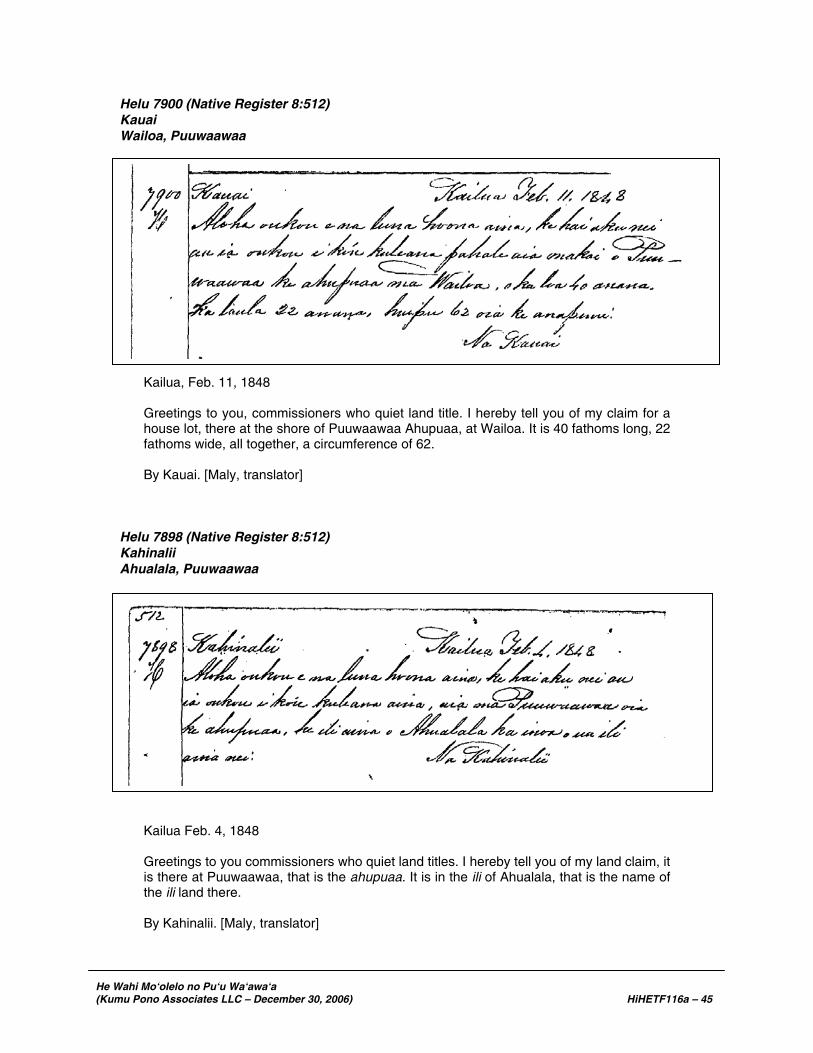
He Wahi Mo‘olelo no Pu‘u Wa‘awa‘a (Kumu Pono Associates LLC – December 30, 2006) HiHETF116a – 45
Helu 7900 (Native Register 8:512) Kauai Wailoa, Puuwaawaa
Kailua, Feb. 11, 1848 Greetings to you, commissioners who quiet land title. I hereby tell you of my claim for a house lot, there at the shore of Puuwaawaa Ahupuaa, at Wailoa. It is 40 fathoms long, 22 fathoms wide, all together, a circumference of 62. By Kauai. [Maly, translator]
Helu 7898 (Native Register 8:512) Kahinalii Ahualala, Puuwaawaa
Kailua Feb. 4, 1848 Greetings to you commissioners who quiet land titles. I hereby tell you of my land claim, it is there at Puuwaawaa, that is the ahupuaa. It is in the ili of Ahualala, that is the name of the ili land there. By Kahinalii. [Maly, translator]

He Wahi Mo‘olelo no Pu‘u Wa‘awa‘a (Kumu Pono Associates LLC – December 30, 2006) HiHETF116a – 46
Helu 9198 (Native Register 8:543) Kuheana Kiholo, Puuwaawaa
Greetings to you commissioners who quiet land titles. Here am I, describing to you, my house lot. It is 12 [fathoms] long, 7 wide, with a circumference of 38. Done by me, Kuheana. Kiholo, Here on Hawaii. [Maly, translator]
Helu 10700 (Native Register 8:600) Pelukua Kiholo, Puuwaawaa
Kiholo, Hawaii Greetings to you, the commissioners who quiet Land titles. Here I am, describing my house lot. It is 11 [fathoms] long, 10 wide, with a circumference of 42. Done by me, Pelukua. [Maly, translator]

He Wahi Mo‘olelo no Pu‘u Wa‘awa‘a (Kumu Pono Associates LLC – December 30, 2006) HiHETF116a – 47
Helu 6230 (Native Register 5:260) I.A. Kuakini Wainanalii, Puuanahulu
Honolulu. Feb. 5, 1848 Greetings to you Commissioners who Quiet Land Claims. Here is my claim on the island of Hawaii, in the land of Puuanahulu, 15 Salt beds, 3 fishponds, 1 land section of pandanus trees, and 1 coconut grove at Wainanalii. That is my right received from my parents, and for me to reside on. I.A. Kuakini. For John A. Kuakini’s Land Divisions, Maulili Ahupuaa at Kipahulu, Maui. Title may be given for the land. S.P. Kalama, Secretary. Hale Alii February 3, 1848. [Maly, translator]

He Wahi Mo‘olelo no Pu‘u Wa‘awa‘a (Kumu Pono Associates LLC – December 30, 2006) HiHETF116a – 48
Helu 10990 (Native Register 8:607-608) Waipa Wainanalii, Puuanahulu

He Wahi Mo‘olelo no Pu‘u Wa‘awa‘a (Kumu Pono Associates LLC – December 30, 2006) HiHETF116a – 49
Wainanalii, Dec. 11, 1848 Greetings to you honorable commissioners who quiet land titles of the Hawaiian Kingdom. William L. Lee, here is my land claim petition. It is of old origin, from when Kaliopuu [Kalaniopuu] held the Kingdom. Kaupulehu is the first, 2nd is Puuanahulu, 3rd is Kawanui, 4th is Kaauhuhu, Hamakua is the 5th. The Kingdom became Kamehameha I’s as a result of the battle at Mokuohai. When Kalaiopuu was King, Lonoakai held these five lands. When Kamehameha I won the battle at Mokuohai, Lonoakai was with him in battle. The lands all about, became Kamehameha I’s. When Lonoakai died, the lands went to his son, Kuaiwa. Kamehameha was the lord. Afterwards, Kameeiamoku took Kaupulehu, and Kamanawa took Puuwaawaa. When his son, Kaenoka [sp.?] died, the land went to Kuaiwa. When the Lord, Kamehameha I died, the Kingdom became Liholihos’, that is Kamehameha 2. When Kamehameha II died in London, Britain, the kingdom became that of Kamehameha III. When Kuaiwa died, the land went to Kewawehookino, with Kamehameha III, the lord. Keawehookino, my father died, the land came to me, his son. Kamehameha III is the lord. I am his subject. I am Waipa, the one who tells you this, my father Keawehookino is dead. The witnesses are Kila and I, two witnesses. Done by me, Waipa. [Maly, translator]
Emergence and Decline of the Hawaiian Church and School System in Näpu‘u (ca. 1848-1910) Throughout the Hawaiian Islands, important communities (generally near ports and ali‘i residences) were selected as primary church and school centers. On Hawai‘i, such locations as Hilo Town; Pü‘ula and ‘Öpihikao, Puna; Wai‘öhinu, Ka‘ü; Ka‘awaloa and Kailua, Kona; Waimea and Iole, Kohala; and Kukuihaele, Hämäkua; served as the bases for outreach work on the island. From these centers—all under the jurisdiction of foreign missionaries—outlying churches were being established. The instruction of students (most of whom were adults in the early years), in reading, writing and other skills also fell to the missionaries and trained native teachers. By 1831, eleven hundred schools were in operation throughout the islands, with more than thirty thousand students (Kuykendall and Day 1970:79). These schools—usually associated with native churches—were organized in most populated ahupua‘a around the island of Hawai‘i, and native teachers and lay-ministers were appointed to oversee their daily activities. By ca. 1840, most of the native residents of the Hawaiian Islands could read and write, and interest in the schools began to diminish. On October 15, 1840, Kamehameha III enacted a law that required the maintenance and local support (through Tuesday or “Poalua” taxation revenues) of the native schools in all populated areas (cf. Kuykendall and Day 1970:80 and records cited below). Records of 1848 report that in the Kekaha region there were ten church-school meeting houses. School Records (Näpu‘u, at Kekaha) 1848-1908 The following documentation provides readers with an overview of activities undertaken, and statistics recorded in the churches and schools of the Kekaha regions, with emphasis on schools of Näpu‘u:
· Schools in 1848: Wainänäli‘i, Kalua was the teacher, with 18 students. Kïholo, Punihaole was the teacher; with 21 students. [Hawai‘i State Archives
Series 262-box 2, General Reports, January-December 1848].

He Wahi Mo‘olelo no Pu‘u Wa‘awa‘a (Kumu Pono Associates LLC – December 30, 2006) HiHETF116a – 50
· The lava flow of 1859 destroyed the Pu‘uanahulu school of Wainänäli‘i. [Apparently, no records were submitted for Kïholo or Wainänäli‘i in the preceding years.]
· In 1861 Punihaole was the teacher at Kïholo. Twenty-three students were
enrolled. [Hawai‘i State Archives Series 262-box 2, 1861 Reports] · In 1865, Chas. Gulick, School Inspector conducted a detailed survey of 85 of the
94 “common schools” on the island of Hawai‘i, traveling to each district, and reporting back to the Department of Public Instruction. While important documentation was provided by Gulick, for the Kekaha region schools, he reported—
“The schools at Honokohau, Kaloko, Kalaoa, and Kiholo I did not visit at this
time…” [Hawai‘i State Archives Series 262 – Folder Hawaii - 1865:32] · The 1873 report on the schools of North Kona noted that the school at
Ka‘elehuluhulu (Kaulana), had been moved to Makalawena, where 16 students were under the instruction of Kahao. No record was found for Kïholo. [Hawai‘i State Archives Series 262, 1873 Reports]
In the same year, the South Kohala District reported that there was a school at
Kapalaoa14. J.W. Poai was the teacher, and there were twelve students; five boys and seven girls. The school house was a wooden building. [Hawai‘i State Archives Series 262, Box 4; 1873 Reports]
· By 1880, school reports for the District of South Kohala, began reporting on the
schools at Kïholo and Puuanahulu15. Lorenzo Lyons, School Superintendent reported:
A. Kekahukula was the teacher at Puuanahulu; there were fourteen students, six
boys and eight girls. The school was in good condition. I. Kaonohi was the teacher at Kïholo; there were eight boys and three girls. The
school was situated in the church. [Hawai‘i State Archives Series 262, Box 4; 1880, Reports]
There was no reference to the school at Kapalaoa. By the 1890s, E.
Kamaipelekane was listed as the teacher at Kïholo. [Hawai‘i State Archives Series 262; 1893 Reports]
No records for the schools at Kapalaoa or Pu‘uanahulu were located in this
period. · On January 3, 1890, H.N. Greenwell appointed Keala school teacher at Kiholo,
at 75 cents per day. [H.N. Greenwell Journals in the collection of James S. Greenwell]
14 This communication appears to be the first reference to a school being established at Kapalaoa. Additional
information pertaining to the establishment of the school was provided by Rev. S. Desha Sr., in his 1926 article series titled “Ka Huaka‘i Lawai‘a i Kapalaoa” (translated in this study).
15 Field records compiled by J.S. Emerson, while conducting surveys in the region, provides specific documentation
on the locations of the Pu‘u Anahulu and Kapalaoa school houses in 1882 (see Emerson in this study).

He Wahi Mo‘olelo no Pu‘u Wa‘awa‘a (Kumu Pono Associates LLC – December 30, 2006) HiHETF116a – 51
By 1898, the coastal region schools of Kekaha were in decline, and the mauka school at Pu‘u Anahulu was replacing the Kïholo school. Oral history interviews (cited in Volume II) describe a process of seasonal residency—when school was in session or during droughts, families with children lived in the uplands; when school was out, or other activities called for it, the families lived at Kapalaoa, Keawaiki, Kïholo, and Ka‘üpülehu. On October 6th, 1898 E.H. Gibson made the following report to Dr. C.T. Rodgers of the Department of Public Instruction —
I have visited all the schools in this District – N. Kona. Two of them, Kiholo and Makalawena, are reached by a ride of three hours over aa and pahoehoe. In Kiholo there are four houses and 13 children at present. It’s down on the beach. Nothing grows there but a few halas and some hawani [loulu] trees. All their food except fish is brought there. There ought not to be any school there, for people shouldn’t live there. Makalawena has 9 houses and 32 children. In both places school is held in the church. At Kiholo the church is of stone, roofless & windowless. At Makalawena the church is a bare wooden shanty, 16 x 24, with a few old pews. Both teachers [not named] do as good work as could be expected of them… [State Archives, Series 261, Box 82; Public Instruction Files, October 6, 1898]
By the turn of the century, the coastal schools at Kïholo and Kapalaoa had been abandoned, and school instruction only took place at Pu‘u Anahulu. Writing to Mr. Davis, Superintendent of Public Instruction, Reverend A. S. Baker reporting on the decline in the number of residents and students, noting that it had led to the abandonment of some of the facilities—
…at Makalawena and Puuanahulu the public school is held in the chapels. All these were built for chapels, and have services at stated intervals, with a possible exception at Puuanahulu. However the last has been in use as a chapel, though school has not been held there regularly I am informed. No one seems to remember for which purpose it was first built. In the past we also had stations at Kiholo and Kapalaoa, but as the inhabitants moved away, we abandoned these locations… [State Archives, Series 261, Box 82 – Public Instruction File; 1905]
In March 1908-09, Geo. F. Wright surveyed the Pu‘u Anahulu School lot, in preparation for the formal transfer of the land to the Department of Public Instruction. In the survey diagram, he also located the old school house, in proximity to the newer one. On July 6, 1908, the Commissioner of Public Lands issued Land Transfer No. 12 to the Superintendent of Public Instruction, formally setting aside the new Pu‘u Anahulu School Lot in C.S.F. No. 1895. The school assessors report on School Buildings (1907-1911), recorded that the school at “Puu-anahulu” consisted of “One frame building, a school and teacher’s cottage combined, made of T&G with a shingle roof and one outhouse (Hawaii State Archives, Series 261 Reports).

He Wahi Mo‘olelo no Pu‘u Wa‘awa‘a (Kumu Pono Associates LLC – December 30, 2006) HiHETF116a – 52
KAMA‘ÄINA KNOWLEDGE OF THE LAND RECORDED IN TESTIMONIES AND LAND SURVEYS
The emergence of fee-simple title of lands in Hawai‘i, facilitated by the Mähele ‘Äina, led to a rapid growth of business interests in the Kingdom. In 1857, J.F.B. Marshall addressed the Annual Meeting of the Royal Hawaiian Agricultural Society, and reported on the increasing development of business in the islands—much of it spreading over vast tracts of land in the form of ranching and plantation development. Business ventures included cultivation of sugar and coffee; harvesting pulu for mattresses and pillows, and kukui for oil; ranching and export of hides, tallow and wool; and salt manufacture (Pacific Commercial Advertiser; November 5, 1857). Fee-simple title and emerging businesses also heightened the need to establish boundaries of the large (ahupua‘a) awards of land so that “private property rights” could be protected. As a part of the Mähele, the Interior Department initiated a surveying program in order to facilitate the issuing of title for awards, and enable the Kingdom to establish lease and sale policies of Crown and Government lands. As seen in the preceding section, the land descriptions tended to be simple forms of recordation, only leading to more formal surveys when land awards were confirmed. Unfortunately, none of the native tenant claims in Pu‘u Wa‘awa‘a or neighboring Pu‘u Anahulu and Ka‘üpülehu were awarded. Thus, surveys were not initiated until the 1860s. Pu‘u Anahulu was among the Government Lands described in the surveys of Kingdom surveyor and land agent, S.C. Wiltse. The following notes are taken from a list of Government lands on the island of Hawai‘i, which the Minister of the Interior requested a description of:
S.C. Wiltse, Surveyor; to Minister of Interior September 5, 1865. Kona, Hawaii Government Lands in this District not sold… “Puuanahulu.” This land extends from the sea inland about 16 miles and contains about 50,000 Ac., about ½ of which is grazing land (mostly pili); the other part contains very little vegetation of any kind. The last lava flow covered a considerable part of this land. It is leased to three natives for 30 years [cf. Lease No. 106 in this study]… [State Archives; Interior Department, Lands]
Näpu‘u – Pu‘u Wa‘awa‘a and Pu‘u Anahulu Described in Proceedings of the Boundary Commission It was not until 1873 that detailed surveys of the boundaries of Pu‘u Wa‘awa‘a and Pu‘u Anahulu began to be recorded. These detailed surveys document cultural and natural features on the land, and named localities with specific and practices. These testimonies and survey records are the single most historical narratives available, in that they provide readers with summaries of traditional knowledge of place, and identify localities ranging from the shore to the upper most boundaries of Pu‘u Wa‘awa‘a and neighboring lands. The testimonies and surveys resulted from an Act in 1862, by which a Commission of Boundaries (the Boundary Commission) was established in the Kingdom of Hawai‘i to standardize and legally set the boundaries of all the ahupua‘a that had been awarded as a part of the Mähele. Subsequently, in 1874, the Commissioners of Boundaries was authorized to certify the boundaries for lands brought before them (W.D. Alexander in Thrum 1891:117-118). Rufus A. Lyman served as the Commissioner of Boundaries for the Third Judicial Circuit—Hawai‘i. The primary informants for the boundary

He Wahi Mo‘olelo no Pu‘u Wa‘awa‘a (Kumu Pono Associates LLC – December 30, 2006) HiHETF116a – 53
descriptions were old native residents of the areas being discussed; in this case many of the witnesses had been born in one of the lands of Näpu‘u, or in neighboring lands of Kekaha, between the 1790s to the 1830s. Thus, the testimonies provide invaluable oral historical documentation pertaining to the area. The native witnesses usually spoke in Hawaiian, and their testimony was translated into English and transcribed as the proceedings occurred. Readers here will note that there are often inconsistencies in spelling of many words such as place names, people names and feature types. We have also observed that often, when two of the same vowels were used by the original translator/transcriber, it indicated that he heard a lengthened pronunciation of a particular vowel. This emphasis of pronunciation is now indicated by a macron mark—for example, the Pu‘u Wa‘awa‘a place name, “Puuoa Lonoakai,” would be written “Pü‘o‘a Lonoakai”. Unfortunately, the reverse is sometimes true, as in the case of Pu‘u Wa‘awa‘a, which was consistently written “Puawaa” in the transcribed accounts. The narratives below are excerpted from the testimonies given by native residents—or surveyors who recorded them from native guides—for the lands of Pu‘u Wa‘awa‘a and Pu‘u Anahulu, and those lands which share a common boundary with portions of them. Not all of the documentation provided by each witness, is repeated here, though primary documentation regarding ahupua‘a boundaries and narratives regarding native customs, practices, and cultural features are cited. Italics and square bracketing are used by the authors to highlight particular points of historical interest at Pu‘u Wa‘awa‘a, that are cited in the narratives. Most of the place names and other locations cited in the Boundary Commission records can be located on Kingdom and Territorial Survey Maps numbered 515, 1278, 1877, and 2633, dating from 1876 to 1909. The narratives describe: trails and forest resources of Pu‘u Wa‘awa‘a; the occurrence of historical features, including residences and agricultural fields; the practice of salt making; and name many localities on the land.
Volume B Puawaa (Pu‘u Wa‘awa‘a)
August 13, 1873
Aoa K. Sworn: I was born at Puawaa North Kona Hawaii at the time of Keoua 1st [ca. 1791] lived there till a few months ago when I moved to the adjoining land of Puanahulu [Puuanahulu]. I am kamaaina and know the boundaries. Lono an older cousin of mine, now dead, pointed out the boundaries to me; as the different lands had different Konohiki and different Koele [agricultural fields] &c. The land of Puawaa is bounded on the south side by Kaupulehu and mauka by the same. On the North by the land of Puanahulu, and makai by the sea. The ancient fishing rights of the land extend out to sea. The boundary at sea shore between this land and Kaupulehu, is at Pohakuokahai, a rocky point in the aa on the lava flow of 1801; the flow from Hualalai to sea. I think it is the third point from Kiholo, in the flow as you go toward Kona. Thence the boundary between these lands runs mauka on aa to Keahupuaa, a pile of stones, a short distance makai of the Government road, on a spot of old lava in the new flow. Thence mauka to Oweowe, a hill covered with trees said hill being surrounded by the flow, the kipuka pili [an area of pili grass growth] to the south is on Kaupulehu. Thence mauka to mawae [fissure] on a narrow strip of aa in the middle of the flow with smaller branches of the flow on each side of this strip, thence [page 253] mauka to where the aa turns toward Kona, as you go up Hualalai; thence the boundary follows up the East side of the flow to Puuako [Puuakowai], a water hole in the Pukiiawe trees on the old trail from Kainaliu to Puanahulu above the woods.

He Wahi Mo‘olelo no Pu‘u Wa‘awa‘a (Kumu Pono Associates LLC – December 30, 2006) HiHETF116a – 54
There the boundary of these lands turns toward Kohala, along the old trail to Waikulukulu, a cave with water dripping from the sides, a little above the woods. Thence along the trail to Punahaha, a hill with cracks running along the top; this is above the large hill at the base of Hualalai; mauka of here, it can be seen from here when the mountain is clear. This hill is the corner of Puawaa where Kaupulehu and Puanahulu unite and cut it off. From this boundary point the boundary between Puawaa and Puanahulu runs makai to Iana o Maui [Ana-o-Maui], a large cave in the Pahoehoe, thence makai along the edge of the aa (the pahoehoe being on Puanahulu, to Kapohakahiuli a large cave with water in it). Thence makai and running along edge of aa, on south side of Haahaa, a place with old cultivating ground at the foot, thence to Kaluakauwila, a pali running towards the sea and along the Northern edge of the aa near the foot of the pali. Thence the boundary runs to Kukuihakau, a place where people used to live, along the edge of aa. Thence to Kalanikamoa and along an old iwi aina [boundary or planting field wall] through this place. Thence the boundary runs to Ahuakamalii; a pile of stones, built in olden times on soil. Thence along old trail to Ahinahina running through the middle of the old cultivating ground; thence makai along the road to Uliulihiaka, a Kahawai [stream channel] now covered by lava flow of 1859; thence makai on the flow of 1859 to Kuanahu, an ahua in lava; thence makai to Mimiokauahi, an ahua covered by flow of 1859. Thence makai between Puuoa Lonoakai on Puawaa, and Puuoa Kaualii on Puanahulu, now covered with lava, except small portions of the one on this land. Thence to Kalaiokekai a point on old lava, on the edge of the flow of 1859 near Keawaiki. I used to go on the mountain after sandal wood, and know these boundaries. C.X.d. A hill called Mailihahei is the corner of Keauhou and Kaupulehu. I do not know the boundaries of Keauhou beyond this point. Keauhou does not reach Puawaa. [page 254]
Nahinalii K. Sworn: I was born here [Pu‘u Wa‘awa‘a] at the time of the building of Kiholo [ca. 1810], and lived here till 1865 when I moved to Kawaihae. Keopu an old Kamaaina, now dead, told me some of the boundaries, and afterwards I went and saw them. Pohakuokahai is the boundary on the shore, between this land and Kaupulehu. From this point the boundaries between these two lands, runs mauka to Keahukaupuaa. Paniau is the name of the place where the ahu stands, thence mauka to Oweowe; which is as far as I know the boundaries on that side. The kamaaina of this land told me that the boundary at shore between Puawaa and Puanahulu, is between Lonokai on Puawaa and Puuokaualii on Puanahulu, they are very close to the shore. The kamaaina of Puanahulu, told me that the boundary is at Laeokaaukai, on the Kona side of the house at Kaawaiki. I do not know the boundaries mauka of this point, until you come to Ahuaokamalii, an ahua on the Kona side of the pali some distance from the base; from thence the boundary runs mauka to Puuloa, a pali in the woods which runs mauka toward Hualalai. Thence the boundary runs mauka to Kaluakauila, a long iwi aina [usually a boundary- or planting field-wall] through a cultivating ground. This is as far as I know the boundaries and have not heard what the other boundaries are. Have heard that Kaupulehu cuts Puawaa off, above the woods and joins Puanahulu C.X.d. [page 255]
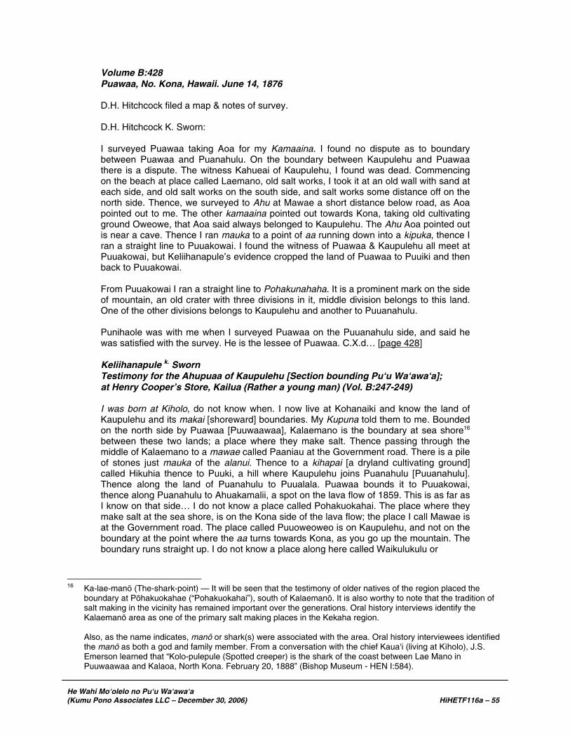
He Wahi Mo‘olelo no Pu‘u Wa‘awa‘a (Kumu Pono Associates LLC – December 30, 2006) HiHETF116a – 55
Volume B:428 Puawaa, No. Kona, Hawaii. June 14, 1876 D.H. Hitchcock filed a map & notes of survey. D.H. Hitchcock K. Sworn: I surveyed Puawaa taking Aoa for my Kamaaina. I found no dispute as to boundary between Puawaa and Puanahulu. On the boundary between Kaupulehu and Puawaa there is a dispute. The witness Kahueai of Kaupulehu, I found was dead. Commencing on the beach at place called Laemano, old salt works, I took it at an old wall with sand at each side, and old salt works on the south side, and salt works some distance off on the north side. Thence, we surveyed to Ahu at Mawae a short distance below road, as Aoa pointed out to me. The other kamaaina pointed out towards Kona, taking old cultivating ground Oweowe, that Aoa said always belonged to Kaupulehu. The Ahu Aoa pointed out is near a cave. Thence I ran mauka to a point of aa running down into a kipuka, thence I ran a straight line to Puuakowai. I found the witness of Puawaa & Kaupulehu all meet at Puuakowai, but Keliihanapule’s evidence cropped the land of Puawaa to Puuiki and then back to Puuakowai. From Puuakowai I ran a straight line to Pohakunahaha. It is a prominent mark on the side of mountain, an old crater with three divisions in it, middle division belongs to this land. One of the other divisions belongs to Kaupulehu and another to Puuanahulu. Punihaole was with me when I surveyed Puawaa on the Puuanahulu side, and said he was satisfied with the survey. He is the lessee of Puawaa. C.X.d… [page 428]
Keliihanapule k. Sworn Testimony for the Ahupuaa of Kaupulehu [Section bounding Pu‘u Wa‘awa‘a]; at Henry Cooper’s Store, Kailua (Rather a young man) (Vol. B:247-249) I was born at Kiholo, do not know when. I now live at Kohanaiki and know the land of Kaupulehu and its makai [shoreward] boundaries. My Kupuna told them to me. Bounded on the north side by Puawaa [Puuwaawaa], Kalaemano is the boundary at sea shore16 between these two lands; a place where they make salt. Thence passing through the middle of Kalaemano to a mawae called Paaniau at the Government road. There is a pile of stones just mauka of the alanui. Thence to a kihapai [a dryland cultivating ground] called Hikuhia thence to Puuki, a hill where Kaupulehu joins Puanahulu [Puuanahulu]. Thence along the land of Puanahulu to Puualala. Puawaa bounds it to Puuakowai, thence along Puanahulu to Ahuakamalii, a spot on the lava flow of 1859. This is as far as I know on that side… I do not know a place called Pohakuokahai. The place where they make salt at the sea shore, is on the Kona side of the lava flow; the place I call Mawae is at the Government road. The place called Puuoweoweo is on Kaupulehu, and not on the boundary at the point where the aa turns towards Kona, as you go up the mountain. The boundary runs straight up. I do not know a place along here called Waikulukulu or
16 Ka-lae-manö (The-shark-point) — It will be seen that the testimony of older natives of the region placed the
boundary at Pöhakuokahae (“Pohakuokahai”), south of Kalaemanö. It is also worthy to note that the tradition of salt making in the vicinity has remained important over the generations. Oral history interviews identify the Kalaemanö area as one of the primary salt making places in the Kekaha region.
Also, as the name indicates, manö or shark(s) were associated with the area. Oral history interviewees identified
the manö as both a god and family member. From a conversation with the chief Kaua‘i (living at Kïholo), J.S. Emerson learned that “Kolo-pulepule (Spotted creeper) is the shark of the coast between Lae Mano in Puuwaawaa and Kalaoa, North Kona. February 20, 1888” (Bishop Museum - HEN I:584).

He Wahi Mo‘olelo no Pu‘u Wa‘awa‘a (Kumu Pono Associates LLC – December 30, 2006) HiHETF116a – 56
Puuohaha. Puuohaha is an Ahua aa [stone cairn or mound] in the middle of Kaupulehu. I do not know where Puulehu is. [page 248] Kahueai k. Sworn. (Vol. B:249-250) I was born here at Kailua at the time of building the heiau [perhaps a reference to Keikipu‘ipu‘i c. 1812]. Am a kamaaina of Kona and now live at Puawaa. Know the land of Kaupulehu, my kupuna (now dead) told me the boundaries, he was an old bird catcher. The boundary on the Kohala side [between Ka‘üpülehu and Pu‘u Wa‘awa‘a] at shore is a spot of sand called Kalomo17 on the south side of Kalaemano, thence to Keanaowaea at the Government road, way towards the aa. Thence to Hikuhia, crossing at the aa, thence to Oweowe, a cave. Thence to Pualala [Puualala] a koa grove, thence to Pualalaiki [Puualalaiki] a second koa grove, there the boundary turning towards Kona runs to a crater called Pohokinikini, thence to Kalulu, a cave. Thence to Puuakowai, a water hole. There the boundary turns towards Mauna Kea, and runs to Kolekole. Thence to Puuiki, thence to a strip of aa opposite a hill called Mailehahei where Keauhou cuts Kaupulehu off… [page 249] Keakaikawaik. Sworn. (Vol. B:249-250) (Witness on Keauhou 2nd) [section of testimony describing mauka region of Pu‘u Wa‘awa‘a-Pu‘u Anahulu, Ka‘üpülehu and Keauhou]: The boundary of Keauhou runs up the mountain to a cave on the side of the mountain above the woods called Waikulukulu. Thence to Puuakowai an old water hole now filled up by cattle tramping around it. This place is the junction of the land of Kaupulehu with Keauhou… [page 251] Kaupulehu Volume D No. 5. June 15, 1886 J.M. Alexander – Sworn: During the year 1885, I surveyed the land of Kaupulehu, mauka it joins Puwaawaa. The Kamaainas, Luahine and others, shewed me the boundaries. Ikaaka of Kaupulehu kai was the guide, makai. Mr. Hitchcock had surveyed this land formerly, but never made a map. On our surveying tour, we often came to piles of stones which the guides said were put up by Mr. Hitchcock; one celebrated place, “Keahukaupuaa,” below the Government Road, was a pile of stones, and Hitchcock’s flag pole. Above that to Oweowe, Ikaaka and Luahine were the guides, and to Puluohia; they told me the boundaries went on to “Puakowai” water hole. Punihaole and Keanini – sent Keanini a guide who went with Hitchcock to point out the places, Puakowai, Puupohaku etc. We found the water hole as was said. Keanini, Kalamakini, and some other old men at Kaupulehu kai described the mauka boundary to me, and sent Aalona to show me the boundary at “Mailehahee” where we found the pile and mark that Aalona said Hitchcock put up when surveying. Kalamakini told me the boundary from [page 30] Mailehahee to East of Hualalai, and we went there, to the Government Trig. Station. At Puunahaha, Keauhou 2d joins Kaupulehu and they run along together to the top of Honuaula, the West Trig. Station, where is an iron pin in the ground, and marks on rocks. Then on to a koa grove, and on in woods, adjoining sundry lands. We marked all the corners of this land with large piles of stones
17 Kalomo. As noted throughout these texts, the transcriber had difficulty with the spelling of place names; Kalomo
may actually have been the name “Kolomu‘o” which is one of the “wahi pana” or storied places of Ka‘üpülehu; being situated on the shore formed by the 1800 lava flow.

He Wahi Mo‘olelo no Pu‘u Wa‘awa‘a (Kumu Pono Associates LLC – December 30, 2006) HiHETF116a – 57
and marked rocks. Kalamakini also went on, adjoining Kaloko, to place near Palahalaha, then to Kawaiokalaepuni, and to Pulehu. Hopulaau and son showed the rest of the boundary on to Moanuiahea, and on to “Puhiapele,” and on to head of Kukio 1st, survey by J. Fuller, Grant 2121 to Kukulii [sic – Pupule]. I took the boundaries as per, said Grant, from there to the sea. This is the Map and notes of survey I made. I surveyed along the sea shore, but do not give the bearings as the sea is the boundary. Some of the witnesses are too far off, or too feeble to come here today. The land is much of it lava. … I have brought Aalona and Kalamakini as witnesses. Kalamakini – S. I now live at Kahaluu, have lived formerly at Kaupulehu, and know that land well to Puuwaawaa. At Puakowai, I began to shew the boundary to Alexander, and on to Pohakuloa, and Mailehahae, and Pukaiki, between Honuaula and Kaupulehu, and on to “Hinakapoula,” adjoining Kaloko; thence to Palahalaha, along Kaloko, then to “Waiakalaepuni,” and on to Pulehu, where the Government lands end; then on to “Moanuiahea,” adjoining “Puukala.” That was all I knew, others showed the rest. Aalona – S. – I live at Kailua – I shewed the surveyor Alexander, the place “Mailehahee,” a hill between Kaupulehu and Keauhou 2nd on the East of Kaupulehu and North of Keauhou – then to Puumauu – then to Lalakaukolo on the summit of Hualalai, then I [page 31] returned home… [page 32] Volume C No. 4:55-57 No. 160 Certificate of Boundaries of the land of Kaupulehu. District of North Kona, Island of Hawaii. Third Judicial Circuit, F.S. Lyman Esq. Commissioner; In the matter of the boundaries of the land of Kaupulehu… Judgment An application to decide and certify the Boundaries of the land of Kaupulehu, District of North Kona, Island of Hawaii having been filed with me on the 13th day of May, A.D. 1886, by J.M. Alexander, for and in behalf of Mrs. Bernice Pauahi Bishop’s Estate, in accordance with the provisions of an Act to facilitate the settlement of Boundaries etc., approved on the 22nd day of June, A.D. 1886; now therefore, having duly received and heard all the testimony offered in reference to the said boundaries, and having endeavored otherwise to obtain all information possible to enable me to arrive at a just decision, which will more fully appear by reference to the records of this matter by me kept in Book No. 5, page 30, and it appearing to my satisfaction that the true and lawful and equitable boundaries, are as follows, viz. Beginning at the S.W. corner of Puu Waawaa at the seaward extremity of the ledge called Pohakuokahae, whence the Gov’t. trig. Station on Akahipuu is S. 2º31’43”W (True) 36137 feet; thence the boundaries run by the true meridian to [page 55] corners marked by ahus over rectangles cut in rock with crosses cut on the surrounding rocks as follows…
[Coordinates cited in original description are not repeated here; only features and named localities are cited in the following notes.]
S… along Puuwaawaa to Keahukaupuaa on the West side of an “aa” flow and 440 feet below the Kiholo road… S…16752 feet along Puuwaawaa to a “lae aa” on the West side of a lava flow in Oweowe… N 77º 11’ 11’’ W 32178 feet; thence S…7423 feet along Puuwaawaa to an “aa” flow in Puluohia; thence S…16726 feet along Puuwaawaa to the waterhole Puakowai; thence
He Wahi Mo‘olelo no Pu‘u Wa‘awa‘a (Kumu Pono Associates LLC – December 30, 2006) HiHETF116a – 58
S…8530 feet along Puuwaawaa to the knoll Pohakuloa; thence S…10481 feet along Puuwaawaa to the knoll Mawae; thence S…9290 feet along Puuwaawaa to the S.W. peak of the rent crater hill, Puu Nahaha, at the upper edge of the forest and at the South corner of Puuwaawaa… [end of Pu‘u Wa‘awa‘a coordinates] [page 56]
Volume 1 No. 3 Puuanahulu
[Incomplete. Side note reads – “Recorded by mistake”] by Levi Chamberlain, Certificate not necessary. (R.A. Lyman) Certificate of the Boundaries of the Land of Puuanahulu, District of North Kona, Is. of Hawaii. Commission of Boundaries 3rd Judicial Circuit, R.A. Lyman Esq. Commissioner. Judgment …Commencing at Sea Coast at an ahu, line of Anaehoomalu and running to Keahualono. North 79º25’ East 20.00 Chains. Thence along Waikoloa, as follows: North 89º00’ East 522.00 Chains, passing Puukoa, Palihai, Hanamauloa, Kaua, Kahialaa, Kapalihookaakaa, to Kapukaiki — South 47º00 East 84.00 Chains to an ahu…
[Coordinates cited in original description are not repeated here; only features and named localities are cited in the following notes.]
…South/East to Kikaha. South/East to lava of Hanaialii. South/East to Wawaekea. South/East to Ahu. South/East to Keamuku. South/East to Hewia. South/East to ahu. South/East to Kaawa. South/East to Puukapele, on southern slope. Thence to Kaohe. South/West to large ahu on Aa of 1859 at place called “Naohuleelua.” Here it corners on Keauhou. Thence along line of Kaupulehu to Pohakunahaha. North 74º00’ West 613 Chains. Thence along line of Puuwaawaa. North 11º00’ West 260.00 Chains to “Ana o Maui,” a sleeping Cave. North 31º00’ West 260.00 Chains to point on “Aa” opposite Puuhuluhulu. North 54 ½ º West 130.00 Chains to an ahu on “Aa.” North 29 ½ º West 60.00 Chains to an ahu on “Aa.” North 53 ½ º West 13.00 Chains. North 21º00’ West 34.00 Chains to Ahuakamalii. North 51º.37’ West 129.50 Chains to an ahu on hill [page 272] near “flow of 1859.” North 50º.00’ West 182.80 Chains to Pond of Keawaiki on Sea Coast. Thence along the Sea Coast. North 54º15’ East 150.00 Chains to Ahu at point of Commencement — and Containing an area of 86,945 Acres – more or less as per Map & Survey of D.H. Hitchcock. Oct. 30, 1878. [page 273; see Figure 3, Register Map No. 515]

He Wahi Mo‘olelo no Pu‘u Wa‘awa‘a (Kumu Pono Associates LLC – December 30, 2006) HiHETF116a – 59
Figure 3. Reduction of Register Map No. 515, Boundary Survey of Pu‘u Anahulu Ahupua‘a (D.H. Hitchcock. May 1, 1876)

He Wahi Mo‘olelo no Pu‘u Wa‘awa‘a (Kumu Pono Associates LLC – December 30, 2006) HiHETF116a – 60
Hawaiian Government Survey Records Also in the class of survey records, and in the case of the North Kona Lands, another significant collection of historic Government records, are the field notebooks of Kingdom Surveyor, Joseph S. Emerson. Born on O‘ahu, J.S. Emerson (like his brother, Nathaniel Emerson, a compiler of Hawaiian traditions) had the ability to converse in Hawaiian, and he was greatly interested in Hawaiian beliefs, traditions, and customs. As a result of this interest, his survey notebooks record more than coordinates for developing maps. While in the field, Emerson sought out knowledgeable native residents of the lands he surveyed, as guides. Thus, while he was in the field, he also recorded their traditions of place names, residences, trails, and various features of the cultural and natural landscape (including the extent of the forest and areas impacted by grazing). Among the lands that Emerson worked in was Näpu‘u and the greater Kekaha region of North Kona and South Kohala. Another unique facet of the Emerson field note books is that his assistant, J. Perryman, was a talented artist. While in the field, Perryman prepared detailed sketches that in the present-day, help to bring the landscape of the period to life. In a letter to W.D. Alexander, Surveyor General, Emerson described his methods and wrote that he took readings off of:
…every visible hill, cape, bay, or point of interest in the district, recording its local name, and the name of the Ahupuaa in which it is situated. Every item of local historical, mythological or geological interest has been carefully sought & noted. Perryman has embellished the pages of the field book with twenty four neatly executed views & sketches from the various trig stations we have occupied… [Emerson to Alexander, May 21, 1882; Hawai‘i State Archives – DAGS 6, Box 1]
In his field communications (letter series to W.D. Alexander), Emerson comments on, and identifies some of his native informants and field guides. While describing the process of setting up triangulation stations from Puakö to Kaloko, Emerson reported that the “two native men are extra good. I could not have found two better men by searching the island a year.” (State Archives, HGS DAGS 6, Box 1; February 15, 1882). We learn later, that the primary native guides were Iakopa and Ka‘ilihiwa—küpuna of the Keäkealani family of Näpu‘u (State Archives, HGS DAGS 6, Box 1; May 5, and August 30, 1882). Discussing the field books, Emerson also wrote to Alexander, reporting “I must compliment my comrade, Perryman, for his very artistic sketches in the field book of the grand mountain scenery…” (State Archives, HGS DAGS 6, Box 1; Apr. 5, 1882). Later he noted, “Perryman is just laying himself out in the matter of topography. His sketches deserve the highest praise…” (ibid.:May 5, 1882). Emerson’s letter of June 7, 1882, describing the neighboring ‘Akähipu‘u region, gives readers an indication of the beauty of the upland region of Kekaha —
Our animals enjoyed the richest pasture, such as they will not see again during this campaign. The country about there appears to be in its primitive freshness without the curse of cattle, horses, and goats. Pohas were very abundant and luscious… [ibid.:June 7, 1882]
Selected sketches, cited in the following section of the study, provide readers with a glimpse of the country side of Näpu‘u and vicinity, of more than 125 years ago.

He Wahi Mo‘olelo no Pu‘u Wa‘awa‘a (Kumu Pono Associates LLC – December 30, 2006) HiHETF116a – 61
Pu‘u Wa‘awa‘a Sites, Features and Named Localities Recorded in J.S. Emerson’s Field Note Books The following documentation is excerpted from the Field Note Books of J.S. Emerson. The numbered sites and place names coincide with maps that are cited as figures in text (some documentation on sites or features beyond the Näpu‘u study area is also included here). Because the original books are in poor condition—highly acidic paper that has darkened, making the pencil written and drawn records hard to read—the copies have been carefully traced to enhance readability.
J.S. Emerson Field Notebook Vol. 1 Reg. No. 251 West Hawaii Primary Triangulation, Kona District Puu Hinai 2; March 18th, 1882 [see Figure 4 for locations discussed below] Site # and Comment: 1 – Lae Mano.
2 – Hikuhia. [Book 251:59]
Puki.
Kalulu.
Kalua Makani.
Mailehahae.
Kuainiho.
Puu Huluhulu.
1 – Puu o Lili. Jacob’s [Iakopa’s] house at Napuu in vicinity.
2 – Kuahiku.
3 – Pohakau. Rock on hill.
4 – Kumua o iwi Kau.
Puu Hinai Crater.
Puu ka Pele.
Kapukaiki Flag. [Book 251:63]

He Wahi Mo‘olelo no Pu‘u Wa‘awa‘a (Kumu Pono Associates LLC – December 30, 2006) HiHETF116a – 62
Figure 4. J.S. Emerson, Field Note Book Map – Book 251:61 (State Survey Division)

He Wahi Mo‘olelo no Pu‘u Wa‘awa‘a (Kumu Pono Associates LLC – December 30, 2006) HiHETF116a – 63
J.S. Emerson Field Notebook Vol. 1 Reg. No. 251 West Hawaii Primary Triangulation, Kona District Nohonaohae; March 23 & 29,1882 [see Figure 5 for locations discussed below] Site # and Comment (Map Section 2): 1 – Lae o Mano.
2 – Kiholo Bay.
3 – Lae Hou.
4 – Lae o Kaiwi.
5 – Keawaiki Bay.
6 – Lae o Leleiwi.
7 – Kapalaoa Sch. H.
Site # and Comment (Map Section 1): 1 – Lae o Kawaihae.
2 – Lae o Honokoa.
3 – Lae o Waiakailio.
4 – Lae o Puulaula.
5 – Lae o Waima. [Book 251:93]
Nohonaohae; March 29,1882 [see Figure 6 for locations discussed below] Site # and Comment: 1 – Mailehahae.
2 – Hainoa.
3 – Hualalai Peak.
4 – Kalulu.
5 – Puki 2.
6 – Puki 1.
7 – Hikuhia. [Book 251:91]
8 – Puu Nahaha.
9 – Kahoowaha.
10 – Kuainiho.
11 – Puu Papapa.
12 – Warren’s House.
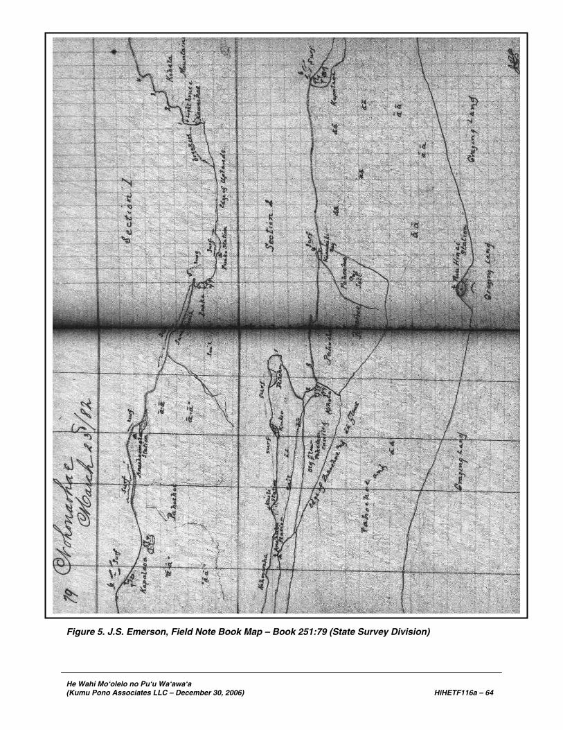
He Wahi Mo‘olelo no Pu‘u Wa‘awa‘a (Kumu Pono Associates LLC – December 30, 2006) HiHETF116a – 64
Figure 5. J.S. Emerson, Field Note Book Map – Book 251:79 (State Survey Division)

He Wahi Mo‘olelo no Pu‘u Wa‘awa‘a (Kumu Pono Associates LLC – December 30, 2006) HiHETF116a – 65
Figure 6. J.S. Emerson, Field Note Book Map – Book 251:83 (State Survey Division)

He Wahi Mo‘olelo no Pu‘u Wa‘awa‘a (Kumu Pono Associates LLC – December 30, 2006) HiHETF116a – 66
13 – Puu Huluhulu.
14 – Puu o Lili.
15 – Pohakau.
16 – Kumua o iwi Kau. [Book 251:93]
J.S. Emerson Field Notebook Vol. 1 Reg. No. 251 West Hawaii Primary Triangulation, Kona District Sea Coast from Ahumoa (Kapalaoa Village to Kuili); April 8th, 1882 [see Figure 7 for locations discussed below] Site # and Comment: 1 – Lae o ka Mano.
2 – Lae o ka Mano.
3 – Nawaikulua. Cape.
4 – Lae o Luahinewai. Extremity.
5 – Nawaikulua Beach.
6 – Luahinewai Beach.
7 – Lae Waiaelepi. Sand beach on N. side of cape and ää on S. side.
8 – Kapalaoa sch. House. Same number on Sect. 1 – Page 109 [Book 251:125]
April 11th.
Puu Ka Pele
1 – Kuainiho. (sight on highest point)
2 – Puu Huluhulu. (sight on highest point)
3 – End of Keamuku flow. [Book 251:127]
J.S. Emerson Field Notebook Vol. II Reg. No. 252 West Hawaii Primary Triangulation, Kona District Keamuku; April 17th, 1882 [see Figure 8 for locations discussed below] Site # and Comment: Puu Waawaa.
1 – Muku flows.
2 – “ “ .
3 – “ “ .
4 – Spencer’s grass hut.
[Francis Spencer held a ranching lease on Pu‘u Anahulu in this period – see discussion of Ranching Leases]
5 – Mauna Loa.

He Wahi Mo‘olelo no Pu‘u Wa‘awa‘a (Kumu Pono Associates LLC – December 30, 2006) HiHETF116a – 67
Figure 7. J.S. Emerson, Field Note Book Map – Book 251:119 (State Survey Division)

He Wahi Mo‘olelo no Pu‘u Wa‘awa‘a (Kumu Pono Associates LLC – December 30, 2006) HiHETF116a – 68
Figure 8. J.S. Emerson, Field Note Book Map – Book 252:7 (State Survey Division)

He Wahi Mo‘olelo no Pu‘u Wa‘awa‘a (Kumu Pono Associates LLC – December 30, 2006) HiHETF116a – 69
J.S. Emerson Field Notebook Vol. II Reg. No. 252 West Hawaii Primary Triangulation, Kona District Hualalai - Keamuku; April 18th, 1882 [see Figure 9 for locations discussed below] Site # and Comment: Puu Waawaa. 1 – Mailehahei.
2-8 – Unknown names
9 – Hikuhia. [Book 252:17]
April 22nd.
10 – Puu Kipahae.
11 – Hainoa.
12 – Hualalai.
13 – Kalua Makani.
14 – Puu Iki. (“makai” peak)
15 – Puu Iki. (highest point)
Kuahiku (highest point).
Pohakau (highest point).
Puu Kaua – “Battle hill.” [Book 252:27]
Puu Anahulu Station. April 24, 1882 Kamauoha’s grass house. A living house at Keawaiki bay and on the boundary line between the ahupuaa of P. Anahulu and P. Waawaa. Lae o Mano. Tangent to small cape which is situated in the ahupuaa of Puu Waawaa. Kauakahialaa. Boundary point on ää between the ahupuaa of Waikoloa, Kohala and Puu Anahulu, Kona. [Book 252:33]
Puu Waawaa [see Figure 10 for locations discussed below]
Site # and Comment:
1 – Lae o Hiki.
2 – Bay.
3 – Lae Hou.
4 – Keawakeekee – tangent, canoe landing.
5 – Reef.
6 – Lake Keawaiki – fishpond, south side.
7 – Lake Keawaiki – fishpond, north side.
8 – Akinakahi.
9 – Lae o Naubaka.
10 – Kapalaoa Sch. house. Site on Center.
11 – Anaehoomalu bay.
12 – Lae Anae.
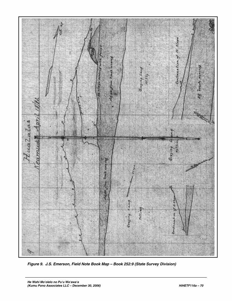
He Wahi Mo‘olelo no Pu‘u Wa‘awa‘a (Kumu Pono Associates LLC – December 30, 2006) HiHETF116a – 70
Figure 9. J.S. Emerson, Field Note Book Map – Book 252:9 (State Survey Division)

He Wahi Mo‘olelo no Pu‘u Wa‘awa‘a (Kumu Pono Associates LLC – December 30, 2006) HiHETF116a – 71
Figure 10. J.S. Emerson, Field Note Book Map – Book 252:41 (State Survey Division)
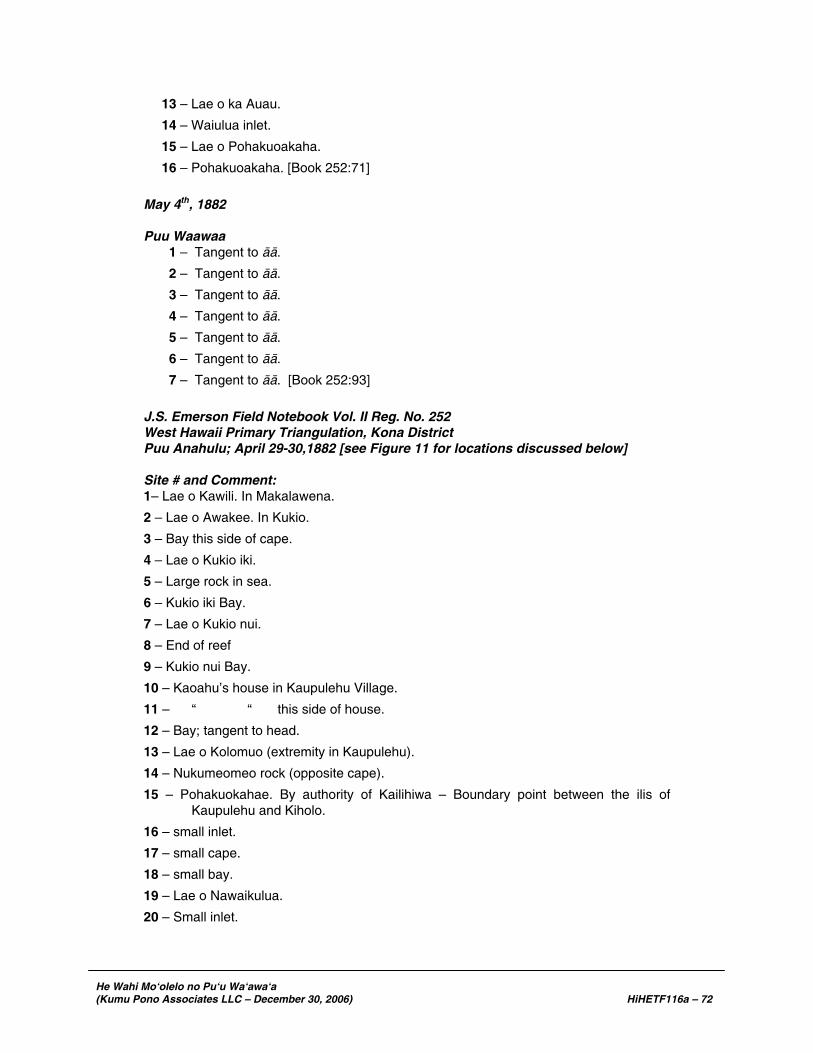
He Wahi Mo‘olelo no Pu‘u Wa‘awa‘a (Kumu Pono Associates LLC – December 30, 2006) HiHETF116a – 72
13 – Lae o ka Auau.
14 – Waiulua inlet.
15 – Lae o Pohakuoakaha.
16 – Pohakuoakaha. [Book 252:71]
May 4th, 1882 Puu Waawaa
1 – Tangent to ää.
2 – Tangent to ää.
3 – Tangent to ää.
4 – Tangent to ää.
5 – Tangent to ää.
6 – Tangent to ää.
7 – Tangent to ää. [Book 252:93]
J.S. Emerson Field Notebook Vol. II Reg. No. 252 West Hawaii Primary Triangulation, Kona District Puu Anahulu; April 29-30,1882 [see Figure 11 for locations discussed below] Site # and Comment: 1– Lae o Kawili. In Makalawena.
2 – Lae o Awakee. In Kukio.
3 – Bay this side of cape.
4 – Lae o Kukio iki.
5 – Large rock in sea.
6 – Kukio iki Bay.
7 – Lae o Kukio nui.
8 – End of reef
9 – Kukio nui Bay.
10 – Kaoahu’s house in Kaupulehu Village.
11 – “ “ this side of house.
12 – Bay; tangent to head.
13 – Lae o Kolomuo (extremity in Kaupulehu).
14 – Nukumeomeo rock (opposite cape).
15 – Pohakuokahae. By authority of Kailihiwa – Boundary point between the ilis of Kaupulehu and Kiholo.
16 – small inlet.
17 – small cape.
18 – small bay.
19 – Lae o Nawaikulua.
20 – Small inlet.

He Wahi Mo‘olelo no Pu‘u Wa‘awa‘a (Kumu Pono Associates LLC – December 30, 2006) HiHETF116a – 73
Figure 11. J.S. Emerson, Field Note Book Map – Book 252:47 (State Survey Division)

He Wahi Mo‘olelo no Pu‘u Wa‘awa‘a (Kumu Pono Associates LLC – December 30, 2006) HiHETF116a – 74
21 – Keawawamano.
22 – Waiaelepi.
23 – Lauhala Grove.
24 – Keanini’s Grass house.
25 – Kauai’s Grass house.
26 – Kiholo meeting house. [church and school house]
Puu Waawaa.
27 – Lae o Keawaiki.
28 – Honuakaha.
29 – Lae Iliili.
30 – inside bay [Book 252:69-71]
While conducting the Pu‘u Anahulu survey, Perryman prepared a sketch of the Näpu‘u region depicting the area from Pu‘u Anahulu, upland to Pu‘u Wa‘awa‘a and the southeastern slope of Hualälai. Though Perryman’s sketch is not keyed, it includes important visual references and is included here as Figure 12.
J.S. Emerson Field Notebook Vol. II Reg. No. 252 West Hawaii Primary Triangulation, Kona District Puu Waawaa; May 16th, 1882 [see Figure 13 for locations discussed below] Site # and Comment: Puu Waawaa. 1 – Aea’s grass house. On Puu Huluhulu.
2 – School house, framed. On Kaipohaku.
3 – Jacob’s [Iakopa’s] house, grass. On Pawaa.
Kapalaoa Sch. House.
4 – Puu Kuahiku. Anahulu range.
5 – Puu Pohakau.
6 – Puu o Lili.
7 – Kumua o iwi Kau.
8 – Mauiloa
9 – Puu Anahulu.
• Puu Iki. In Puu Anahulu – Boundary of P.A. and Waawaa Ahupuaa, half way between this station and Puu Iki according to the “boy.”
• Ana o Maui. In Anahulu covered with rock. [Book 252:116]

He Wahi Mo‘olelo no Pu‘u Wa‘awa‘a (Kumu Pono Associates LLC – December 30, 2006) HiHETF116a – 75
Figure 12. J.S. Emerson, Field Note Book Map – Book 252:75 (State Survey Division)
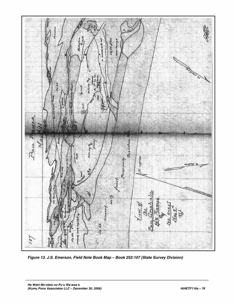
He Wahi Mo‘olelo no Pu‘u Wa‘awa‘a (Kumu Pono Associates LLC – December 30, 2006) HiHETF116a – 76
Figure 13. J.S. Emerson, Field Note Book Map – Book 252:107 (State Survey Division)
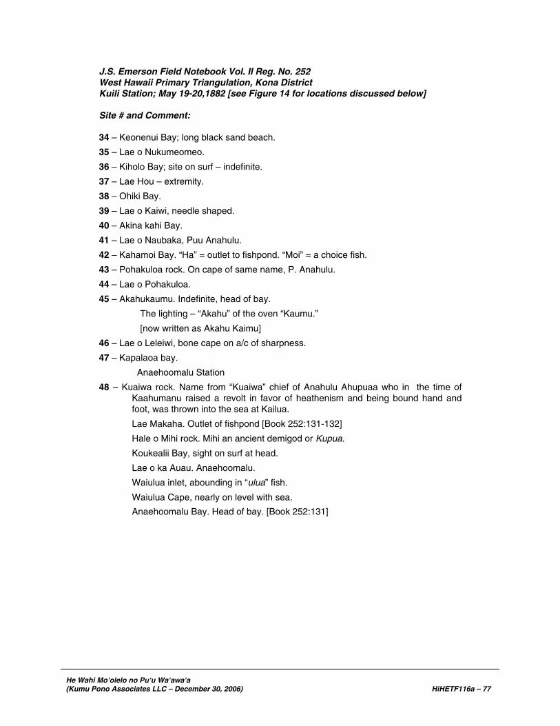
He Wahi Mo‘olelo no Pu‘u Wa‘awa‘a (Kumu Pono Associates LLC – December 30, 2006) HiHETF116a – 77
J.S. Emerson Field Notebook Vol. II Reg. No. 252 West Hawaii Primary Triangulation, Kona District Kuili Station; May 19-20,1882 [see Figure 14 for locations discussed below] Site # and Comment: 34 – Keonenui Bay; long black sand beach.
35 – Lae o Nukumeomeo.
36 – Kiholo Bay; site on surf – indefinite.
37 – Lae Hou – extremity.
38 – Ohiki Bay.
39 – Lae o Kaiwi, needle shaped.
40 – Akina kahi Bay.
41 – Lae o Naubaka, Puu Anahulu.
42 – Kahamoi Bay. “Ha” = outlet to fishpond. “Moi” = a choice fish.
43 – Pohakuloa rock. On cape of same name, P. Anahulu.
44 – Lae o Pohakuloa.
45 – Akahukaumu. Indefinite, head of bay.
The lighting – “Akahu” of the oven “Kaumu.”
[now written as Akahu Kaimu]
46 – Lae o Leleiwi, bone cape on a/c of sharpness.
47 – Kapalaoa bay.
Anaehoomalu Station
48 – Kuaiwa rock. Name from “Kuaiwa” chief of Anahulu Ahupuaa who in the time of Kaahumanu raised a revolt in favor of heathenism and being bound hand and foot, was thrown into the sea at Kailua.
Lae Makaha. Outlet of fishpond [Book 252:131-132]
Hale o Mihi rock. Mihi an ancient demigod or Kupua.
Koukealii Bay, sight on surf at head.
Lae o ka Auau. Anaehoomalu.
Waiulua inlet, abounding in “ulua” fish.
Waiulua Cape, nearly on level with sea.
Anaehoomalu Bay. Head of bay. [Book 252:131]