Embed Size (px)
Citation preview
1
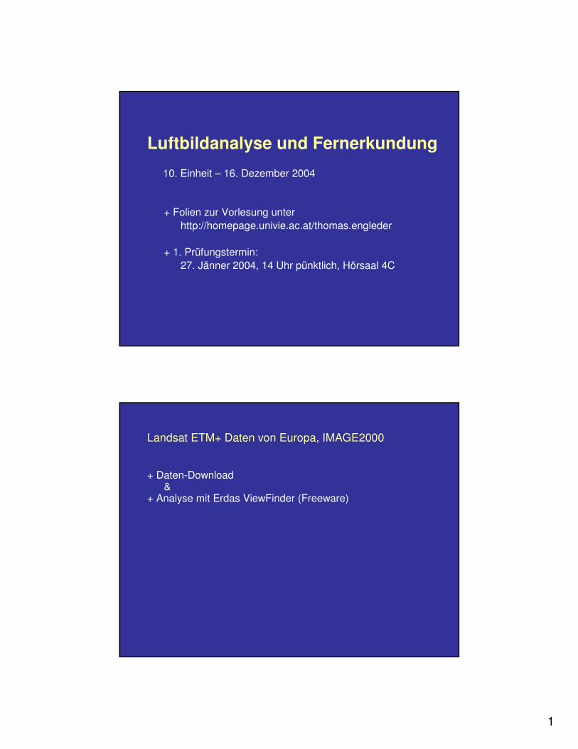
Luftbildanalyse und Fernerkundung
10. Einheit – 16. Dezember 2004
+ Folien zur Vorlesung unterhttp://homepage.univie.ac.at/thomas.engleder
+ 1. Prüfungstermin: 27. Jänner 2004, 14 Uhr pünktlich, Hörsaal 4C
Landsat ETM+ Daten von Europa, IMAGE2000
+ Daten-Download&
+ Analyse mit Erdas ViewFinder (Freeware)

2
Bandkombinationen
Für die Unterschiedlichen Zielsetzungen werden die verschiedenen Graustufenbilder der einzelnen Spektralkanäle einer Aufnahmefläche zu einem 3 farbigen RGB-Bild zusammen gefügt.
Zusammenfassung der gebräuchlisten Kanal-Kombinationen bei Landsat:
R G B Interpretations Anwendung3 2 1 natürlichen Reihenfolge = Echtfarbendarstellung4 3 2 CIR-Falschfarbenbild 5 4 3 Vegetation & Landnutzung4 5 3 Vegetation & Landnutzung7 4 1 Geologie7 4 2 Geologie5 7 2 Geomorphologie7 5 3 pseudo-natürliche Kombination
Landsat ETM+ Daten von Europa
http://mapserver.jrc.it/website/image2000/viewer.htm
+ Auswahl einer Szene+ multispektral (25m), panchromatisch (12,5 m)+ Registrierung+ Login
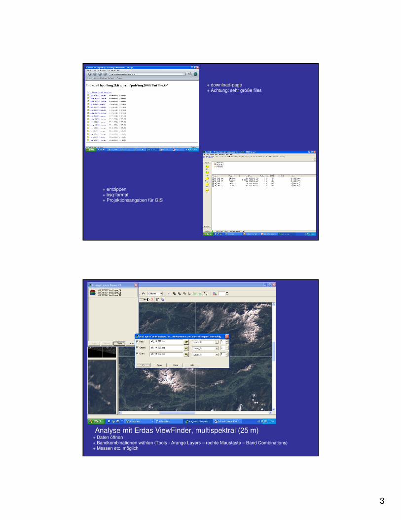
3
+ download-page+ Achtung: sehr große files
+ entzippen+ bsq-format+ Projektionsangaben für GIS
Analyse mit Erdas ViewFinder, multispektral (25 m)+ Daten öffnen+ Bandkombinationen wählen (Tools - Arange Layers – rechte Maustaste – Band Combinations)+ Messen etc. möglich
4
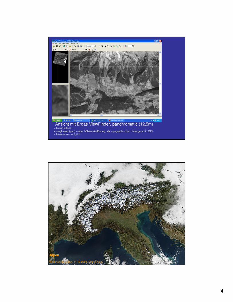
Ansicht mit Erdas ViewFinder, panchromatic (12,5m)+ Daten öffnen+ singl-layer (pan) – aber höhere Auflösung, als topographischer Hintergrund in GIS+ Messen etc. möglich
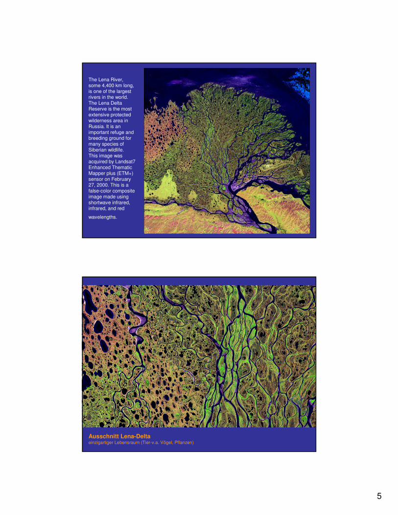
Alpen
Hochnebelsituation, 11.12.2004, Modis-Aqua
5
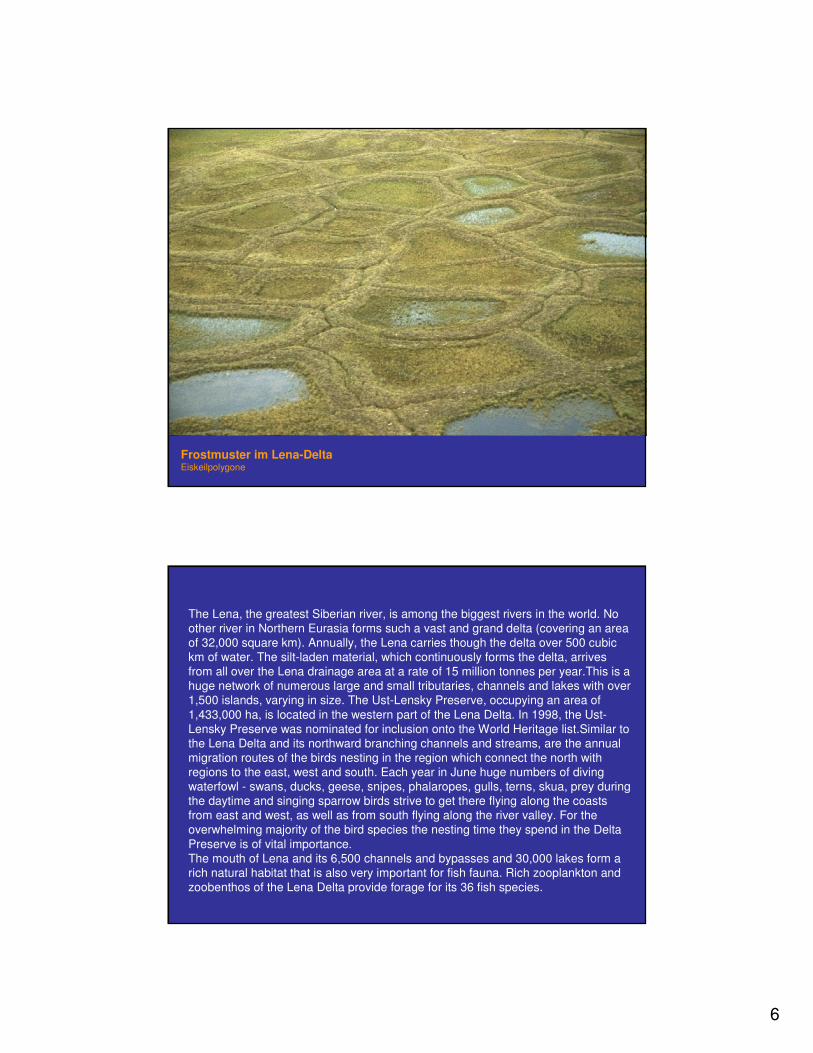
The Lena River, some 4,400 km long, is one of the largestrivers in the world. The Lena Delta Reserve is the mostextensive protectedwilderness area in Russia. It is an important refuge and breeding ground formany species of Siberian wildlife.This image was acquired by Landsat7 Enhanced ThematicMapper plus (ETM+) sensor on February27, 2000. This is a false-color compositeimage made usingshortwave infrared, infrared, and red
wavelengths.
Ausschnitt Lena-Deltaeinzigartiger Lebensraum (Tier-v.a. Vögel, Pflanzen)
6
Frostmuster im Lena-DeltaEiskeilpolygone
The Lena, the greatest Siberian river, is among the biggest rivers in the world. No other river in Northern Eurasia forms such a vast and grand delta (covering an areaof 32,000 square km). Annually, the Lena carries though the delta over 500 cubickm of water. The silt-laden material, which continuously forms the delta, arrivesfrom all over the Lena drainage area at a rate of 15 million tonnes per year.This is a huge network of numerous large and small tributaries, channels and lakes with over1,500 islands, varying in size. The Ust-Lensky Preserve, occupying an area of 1,433,000 ha, is located in the western part of the Lena Delta. In 1998, the Ust-Lensky Preserve was nominated for inclusion onto the World Heritage list.Similar to the Lena Delta and its northward branching channels and streams, are the annualmigration routes of the birds nesting in the region which connect the north withregions to the east, west and south. Each year in June huge numbers of divingwaterfowl - swans, ducks, geese, snipes, phalaropes, gulls, terns, skua, prey duringthe daytime and singing sparrow birds strive to get there flying along the coastsfrom east and west, as well as from south flying along the river valley. For theoverwhelming majority of the bird species the nesting time they spend in the Delta Preserve is of vital importance.The mouth of Lena and its 6,500 channels and bypasses and 30,000 lakes form a rich natural habitat that is also very important for fish fauna. Rich zooplankton and zoobenthos of the Lena Delta provide forage for its 36 fish species.
7
The mouths of the river channels are inhabited by various marine mammalspecies: the white whale, narwhal, walrus, and bearded and ringed seals. Polar bears are also common on the pack ice of the islands situated northward fromthe Delta. The Laptev Sea population of walrus inhabiting the area (a sub-species that is on the verge of extinction) accounts for only a few hundredanimals. Terrestrial mammals inhabiting the preserve represent tundra, mountainous and northern boreal species. Of these, 17 species are indigenousyear-round and 8 species periodically migrate in and out of the Preserve. Approximately 30,000 reindeers migrate across the Delta in the summermonths, easily negotiating various channels and streams.The vascular plant flora accounts for 372 species, including 24 speciesrecorded on the Sakha (Yakutia) Republic Red Book, while Trautfetter's blue-meadow grass is of particular interest as an endemic species of the lowerreaches of Lena, not encountered elsewhere in the world. The Lena Delta was also a place where individual arctic civilization originated. The Even, the Evenkand the Yakut and later years Russian settlers were successful in sustainingthemselves by fishing and hunting in the Lena Delta region. They took the mostactive part in the discovery and the scientific studies of the Delta of Lena and the New Siberian Islands. Many of the geographical names used in the LaptevSea and the New Siberian's reflect the role of the local people in regional studies.
The Lena River begins near Lake Baikal and flows 4270 km to reach theLaptev Sea, part of the Arctic Ocean. The Lena is the ninth largest river in theworld, transporting 500 km3 of water across the delta at an average rate of 16,300 m2/s. The delta with its alluvial plains covers 32,000 km2, making it thesecond largest in the world after the Mississippi Delta. The delta begins to branch like a hand at Stolb Island, breaking into five major channels withhundreds of smaller streams running between them. The largest channels are: Arynskaya (178 km long), Bykovskaya (106 km), Bolshaya Tumatskaya (a continuation of the Lena River), and Oleneskaya. The delta is frozen for seven months a year during the long, harsh winters. While the sun never rises in winter (polar winter), it never sets in summer(polar day). Driving winds and snowstorms can last for up to three weeks. Temperatures in January drop to more than 30 °C below zero. The lowesttemperature recorded is -53°C, in February. Summers in the delta are shortand cool. Mid-July to mid-August is the warmest time of the year, when themaximum temperature rises to 26°-30°C. The high level of humidity in thedelta (78-93%), combined with low temperatures, often create foggyconditions. The northern part of the delta receives about 170 mm of precipitation a year, whereas the southern portion of the reserve gets morethan 200 mm per year.
8
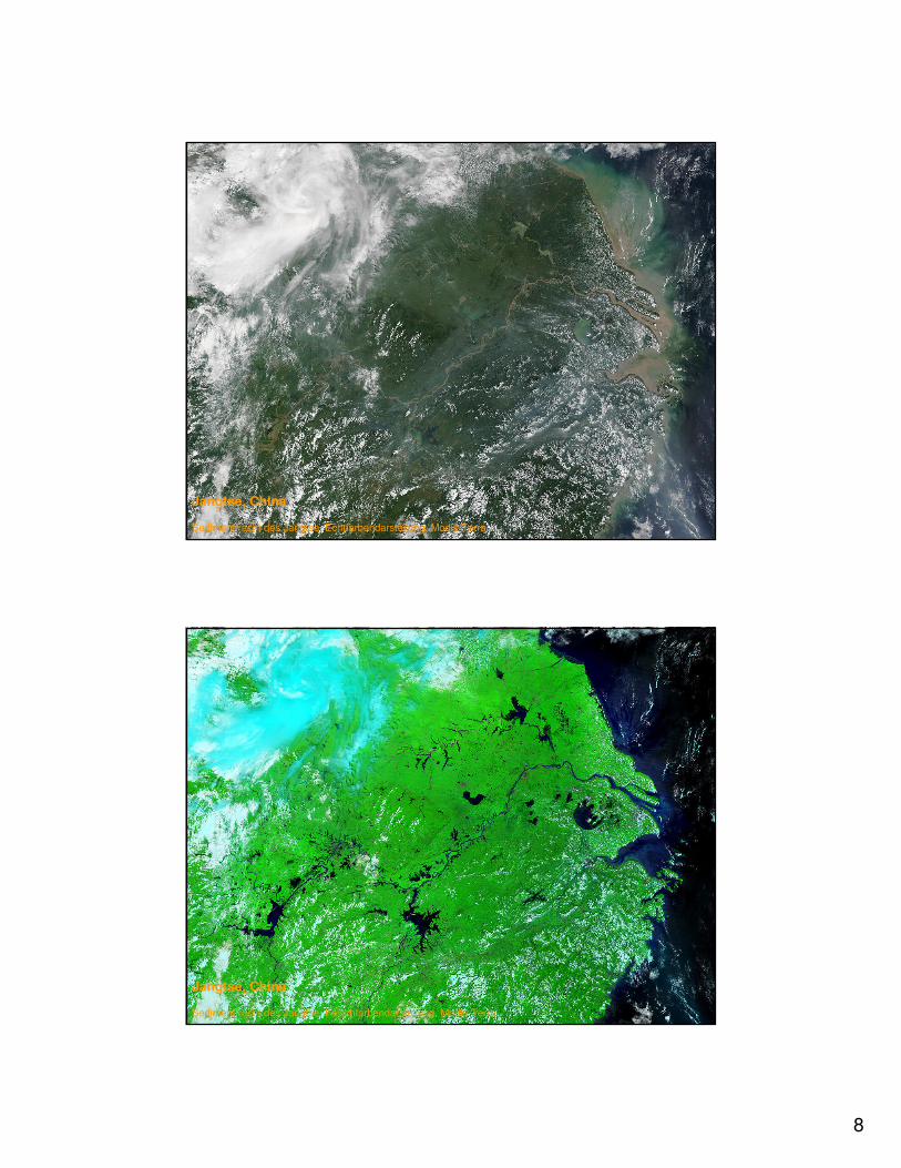
Jangtse, China
Sedimentfracht des Jangtse, Echtfarbendarstellung, Modis-Terra
Jangtse, China
Sedimentfracht des Jangtse, Falschfarbendarstellung, Modis-Terra
9
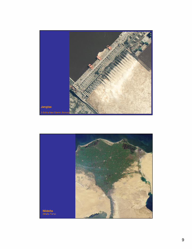
Jangtse
3-Schluchten-Damm (Ikonos)
Nildelta(Modis-Terra)
10
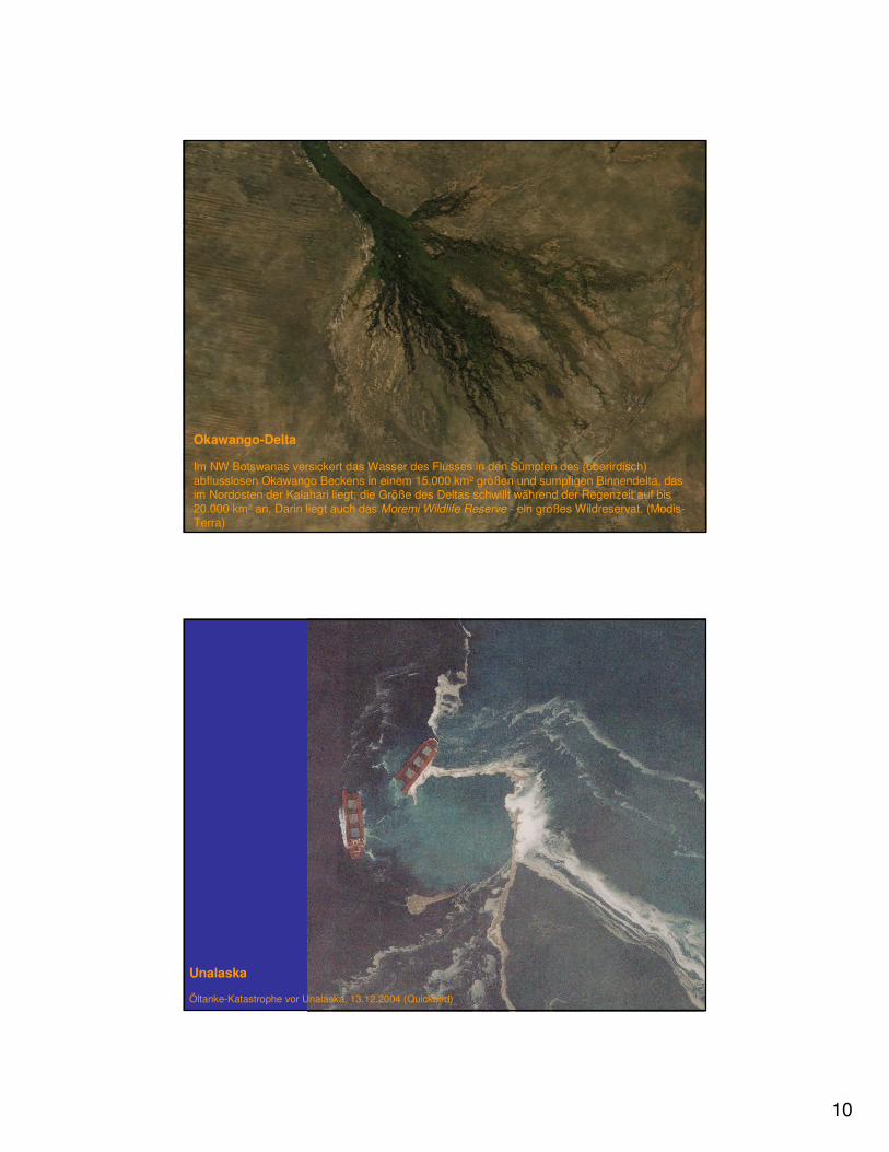
Okawango-Delta
Im NW Botswanas versickert das Wasser des Flusses in den Sümpfen des (oberirdisch) abflusslosen Okawango Beckens in einem 15.000 km² großen und sumpfigen Binnendelta, das im Nordosten der Kalahari liegt; die Größe des Deltas schwillt während der Regenzeit auf bis 20.000 km² an. Darin liegt auch das Moremi Wildlife Reserve - ein großes Wildreservat. (Modis-Terra)
Unalaska
Öltanke-Katastrophe vor Unalaska, 13.12.2004 (Quickbird)
11
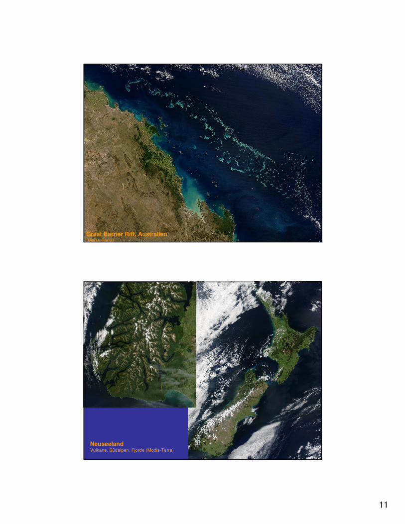
Great Barrier Riff, Australien(Modis-Terra)
NeuseelandVulkane, Südalpen, Fjorde (Modis-Terra)
12
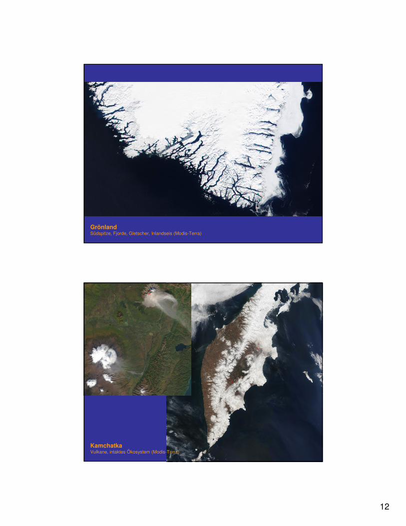
GrönlandSüdspitze, Fjorde, Gletscher, Inlandseis (Modis-Terra)
KamchatkaVulkane, intaktes Ökosystem (Modis-Terra)
13
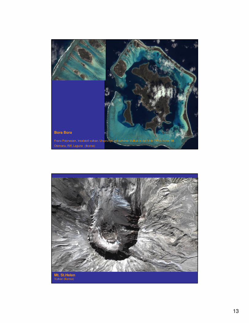
Bora Bora
Franz.Polynesien, Inselatoll vulkan. Ursprungs, erloschener Vulkan in der Mitte 727 m hoher Mt.
Otemanu, Riff, Lagune (Ikonos)
Mt. St.HelenVulkan (Ikonos)
14
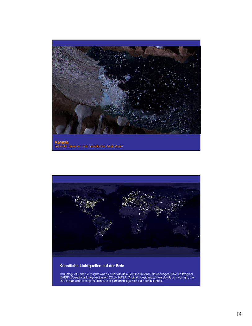
Kanadakalbender Gletscher in der kanadischen Arktis (Aster)
Künstliche Lichtquellen auf der Erde
This image of Earth’s city lights was created with data from the Defense Meteorological Satellite Program (DMSP) Operational Linescan System (OLS), NASA. Originally designed to view clouds by moonlight, the OLS is also used to map the locations of permanent lights on the Earth’s surface.
15
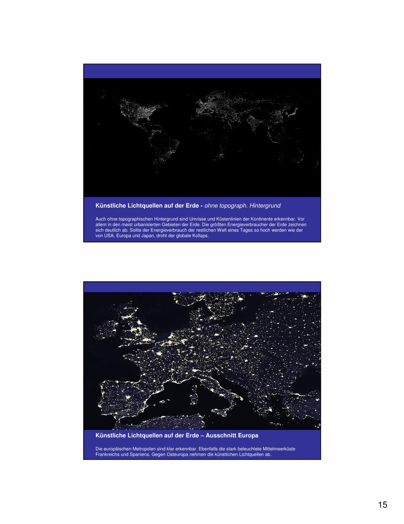
Künstliche Lichtquellen auf der Erde - ohne topograph. Hintergrund
Auch ohne topographischen Hintergrund sind Umrisse und Küstenlinien der Kontinente erkennbar. Vor allem in den meist urbanisierten Gebieten der Erde. Die größten Energieverbraucher der Erde zeichnen sich deutlich ab. Sollte der Energieverbrauch der restlichen Welt eines Tages so hoch werden wie der von USA, Europa und Japan, droht der globale Kollaps.
Künstliche Lichtquellen auf der Erde – Ausschnitt Europa
Die europäischen Metropolen sind klar erkennbar. Ebenfalls die stark beleuchtete Mittelmeerküste Frankreichs und Spaniens. Gegen Osteuropa nehmen die künstlichen Lichtquellen ab.
16
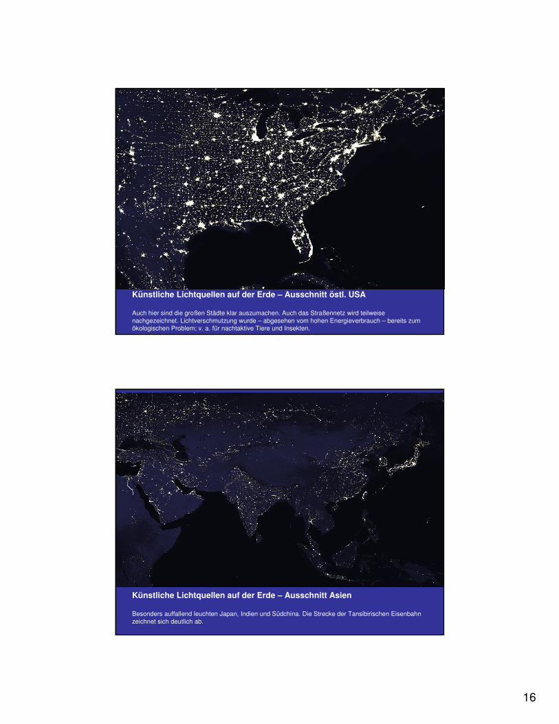
Künstliche Lichtquellen auf der Erde – Ausschnitt östl. USA
Auch hier sind die großen Städte klar auszumachen. Auch das Straßennetz wird teilweise nachgezeichnet. Lichtverschmutzung wurde – abgesehen vom hohen Energieverbrauch – bereits zum ökologischen Problem; v. a. für nachtaktive Tiere und Insekten.
Künstliche Lichtquellen auf der Erde – Ausschnitt Asien
Besonders auffallend leuchten Japan, Indien und Südchina. Die Strecke der Tansibirischen Eisenbahn zeichnet sich deutlich ab.
17
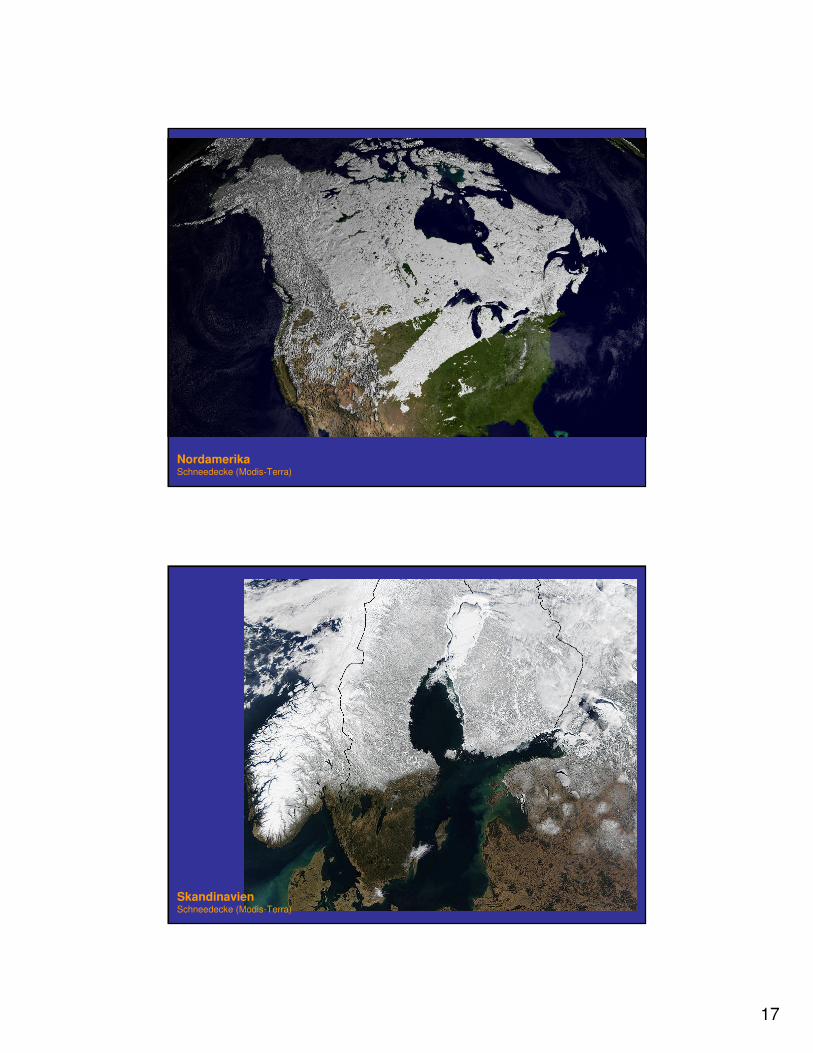
NordamerikaSchneedecke (Modis-Terra)
SkandinavienSchneedecke (Modis-Terra)
18
Frohe Weihnachten


![Cop4Stat und SDG Fernerkundung für die Statistik · Cop4Stat und SDG – Fernerkundung für die Statistik Sylvia Seissiger [Cop4Stat], Patrick Knöfel [SDG] Bundesamt für Kartographie](https://img.pdfslide.tips/doc/110x75/5d56300a88c993aa308b9578/cop4stat-und-sdg-fernerkundung-fuer-die-statistik-cop4stat-und-sdg-fernerkundung.jpg)