Embed Size (px)
Citation preview
PRE FEASIBILITY REPORT
Of
Stone Quarry (Area – 1.07ha)
Survey No: - 148 Village – Longadaga, Taluka – Warora,
Dist - Chandrapur (M.S).
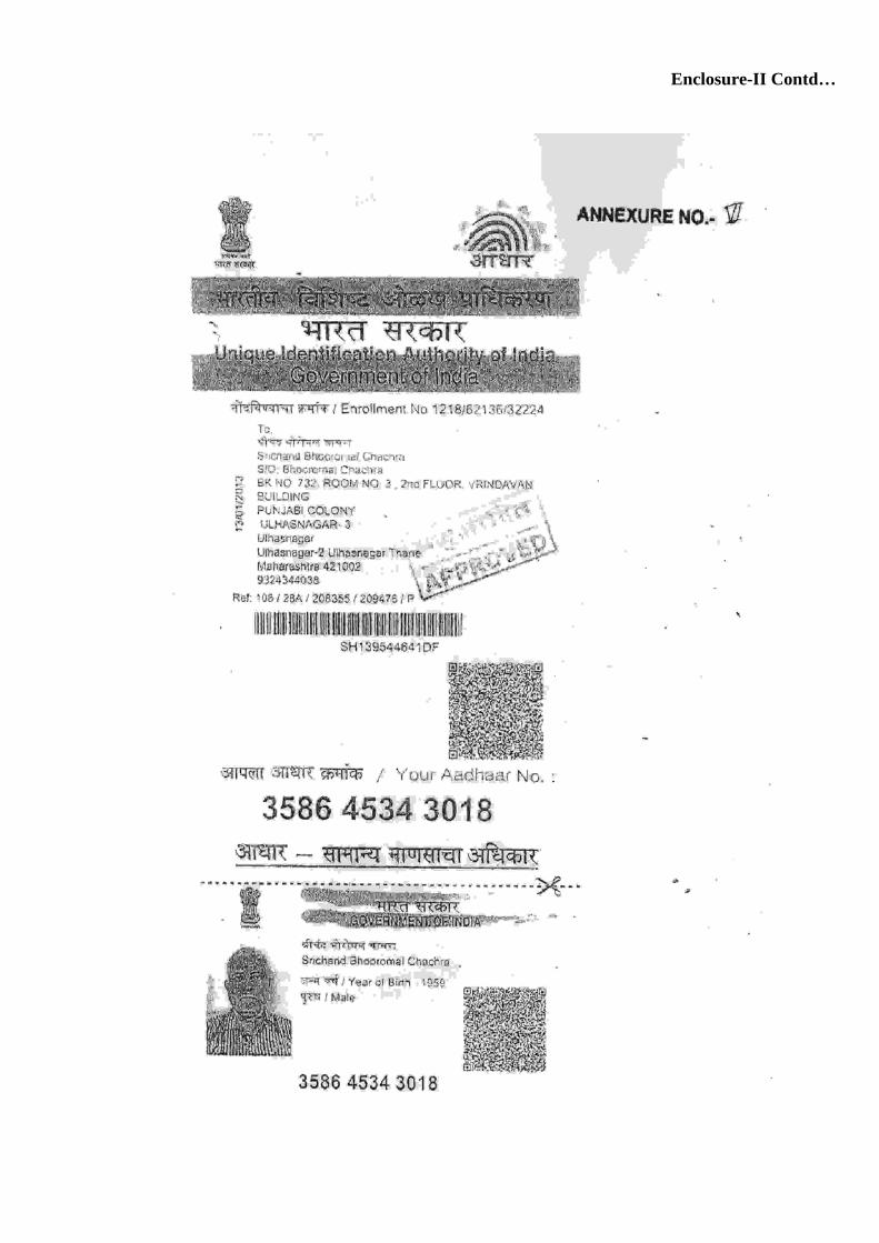
Owner & Lessee M/s. Krishna Construction Company through
Shri. Shrichand B. Chachra
Prepared by
NABET Accredited EIA Consultant EARTHCARE LABS PVT. LTD,
C-11, Amar Enclave Commercial Wing, Jog Layout, Prashant Nagar,
Near Ajni Square, Nagpur – 440 015 email- [email protected]
March-2017
Prefeasibility Report (PFR) (as per MoEF Guidelines vide O.M. J-11013/41/2006-IA.II (I)
dtd. 30-12-2010) 1. EXECUTIVE SUMMARY
1. Executive Summary Chandrapur is located in the easternmost region of Maharashtra. Nagpur & Bhandara
lies to its north, Gondia lies to its north-west, Telangana lies to its south, Gadchiroli lies to its
east, Yavatmal lies to its west. This district is divided into 15 talukas (tehsils). The talukas
are Chandrapur, Badravati, Warora, Chimur, Nagbhid, Brahamapuri, Pobhurna, Sindewahi,
Mool, Saoli, Gondpipari, Rajura, Korepana, Ballarasha and Jivati.
Chandrapur lies between 18° 41' and 20°50' north latitudes and 78°48’ and 80° 55'
east longitudes falls in p arts of Survey of India degree sheets 55 P , 56 M, 5 5 L and 56 I.
In 2011, Chandrapur had population of 22,04,307 out of which 51 % is male population. The
average literacy rate of Chandrapur was 80.01 %. The district has a geographical area of
11,443 sq. km. in which forest covers 3810 sq.km. area and 4870 sq.km. of land is covered by
agriculture land.
Wardha, Wainganga and Penganga are the important rivers in Chandrapur district. The
Wardha river flows into the district from the western boundary and then flows along the
boundaries of Warora, Chandrapur, Korapna, Rajura, Ballarpur and Gondpipri Talukas. The
Wainganga flows along the eastern boundary of the district. This river flows from north to
south. Chandrapur district is the richest district in the State in respect of forest wealth. The
forests range from well known valuable teak of Allapalli to low quality miscellaneous ones of
Warora and are spread over an area of 3810 km2 which makes 69.99 % of the total
geographical area of the district.
Geologically Chandrapur District comprises various lithologic formations starting age
wise from Archeans to the Recent i.e. from Granite Gneiss, Quartz Magnetite, Amphibolites,
Phyllite (Sakoli Group) Overlain by Late Pre-Cambrian System include Cuddapah and
Vindhyan System, this overlain by Upper Carboniferous to Upper Triassic include Gondwana
System , this is also overlain by cretaceous Lametas, Beds Followed by major Hot-Spot
activities in Creataceous-Eocene Deccan trap with Intertrappeans, which is also overlain by
Laterite (Pleistocene-Recent) and Alluvium Soil of Recent age. In the Chandrapur-Wardha
valley several coal mines are being worked. The coal from this area has high moisture (10.3 to
11.3%) and is of grade II. The collieries are raising about 35,560 tonnes of coal per month. The
occurrence of malachite has been recorded at Thanwasana in stray traces in quartz veins,
traversing phyllitic quartzites and argillaceons sandstones. The stone quarry owner is well
experienced in operation of stone quarry and about implementation of various environmental
measures.
Granite, Vindhyan sand-stone and quartzite, limestone, Gondwana sandstone and basalts of
Creataceous age can yield substantial supplies of material for being used in buildings and
roads. The stone quarry under consideration will be further developed scientifically by
opencast mining method. The operation at quarry is manual and semi mechanized type. The
mining operations will be carried out on a single shift basis. Drilling and blasting operations
will be carried out scientifically through experienced & licensed contractors.
The various aspects of the Pre-Feasibility Report as per MoEF Guidelines vide O.M. J-
11013 /41/2006-IA.II(I) dtd. 30-12-2010 are given in the subsequent sections.
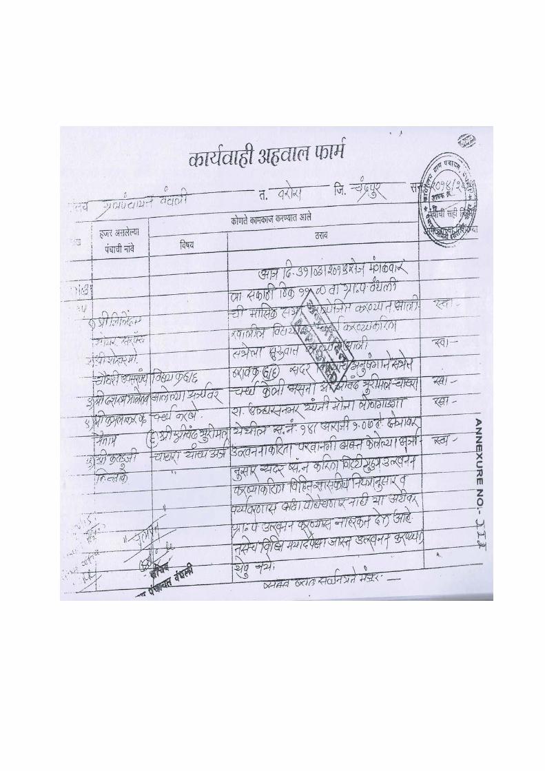
2. Introduction of the Project/Background Information (i) Identification of Project and Project Proponent
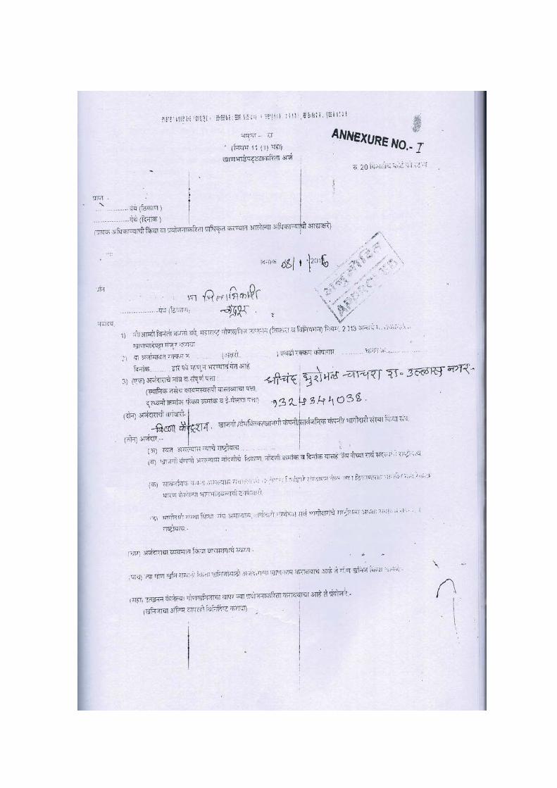
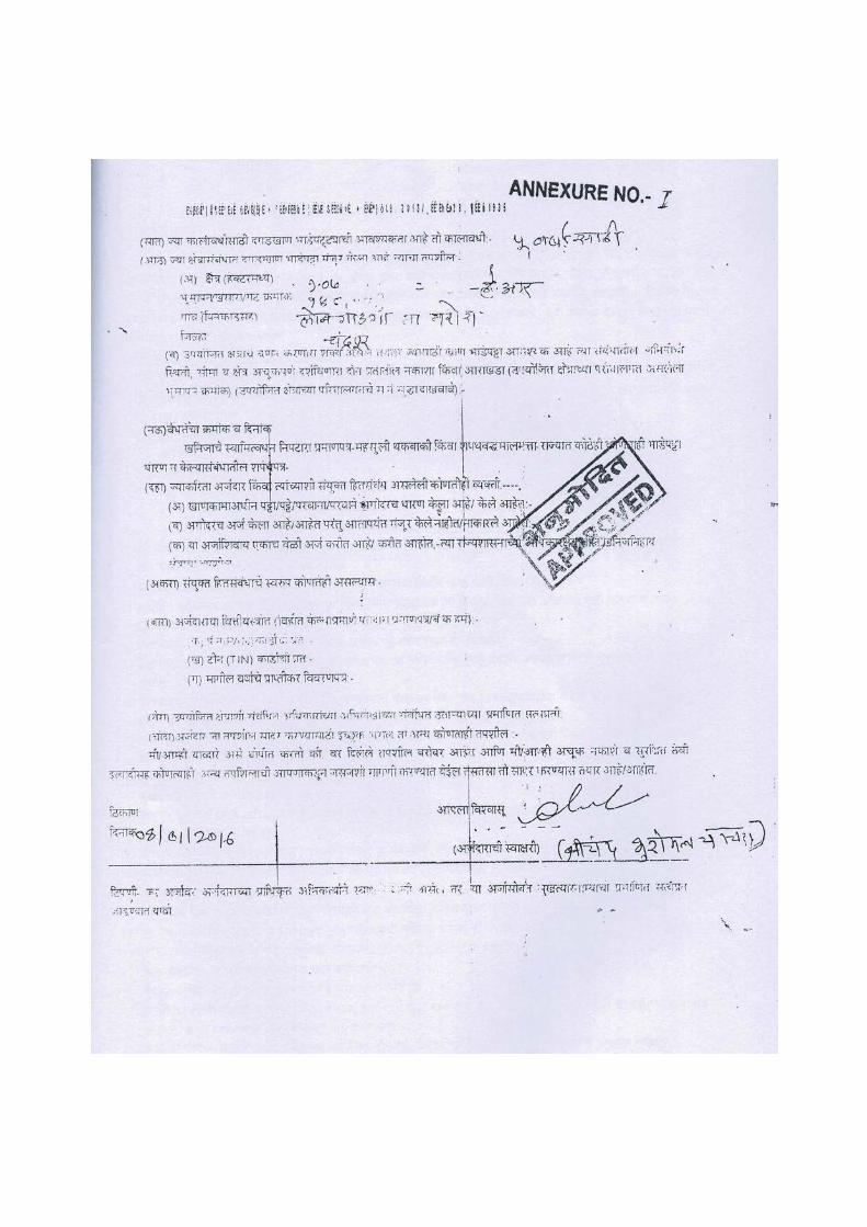
Stone quarry (Owner & Lessee – M/s. Krishna Construction Company through Shri.
Shrichand B. Chachra) is existing on Pvt. land (Area – 1.07HaR). The stone quarry is located
near Longadaga village of Taluka – Warora, Dist- Chandrapur (M.S). The location maps of the
stone quarry are enclosed as Enclosure - 1.
The District Collector, Chandrapur has granted lease to this stone quarry regularly in
view of compliances including environmental mitigation measures. The copy of the Mining
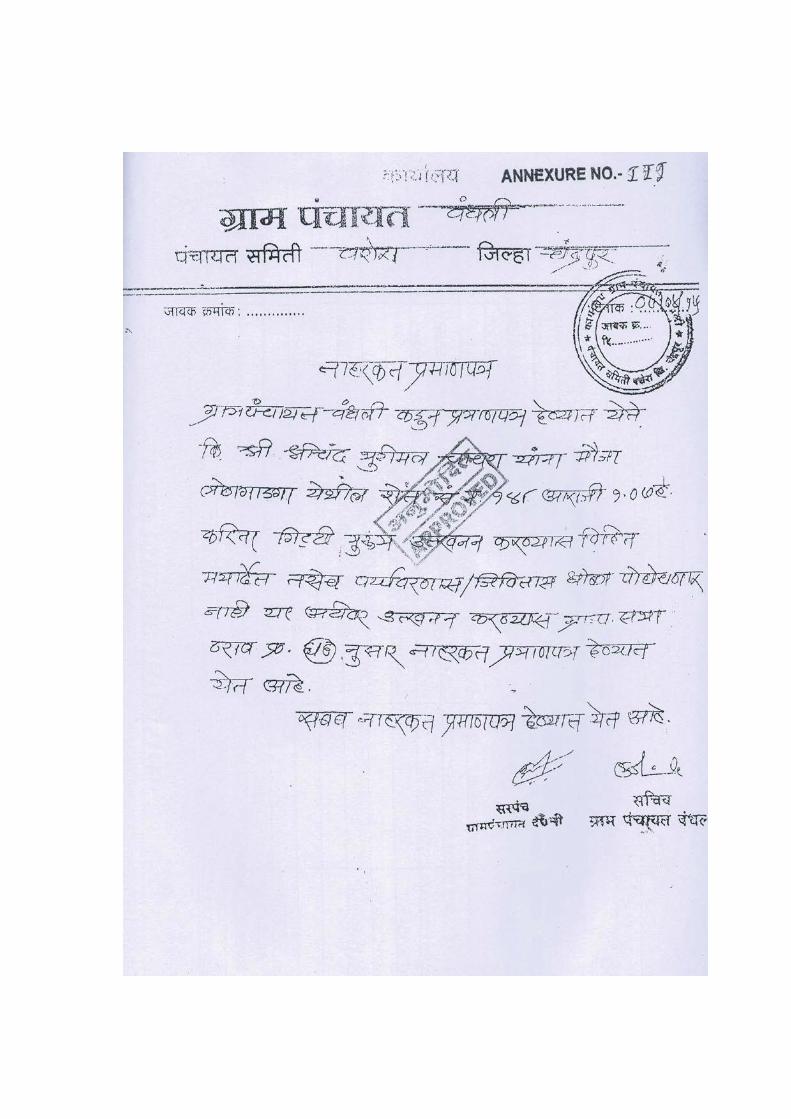
Order, NOC from Grampanchayat , 7/12 documents etc are enclosed as Enclosure - 2.
The project proponent M/s. Krishna Construction Company through Shri. Shrichand B.
Chachra is in the business of stone quarrying since last several years. The project proponent has
office at Longadaga village of Taluka – Warora, Dist- Chandrapur (M.S). The project
proponent has wide experience in the field of stone quarrying & crushing. He is operating the
stone quarry with all precautionary measures and taking measures for environmental
conservation. The stone material is supplied for infrastructure development, construction
activities etc.
(ii) Brief description of nature of the project
The stone quarry is basically a very small scale project in which quarrying of minor
mineral stone is carried out. The stone quarries exist in clusters, as it depends on availability of
stone in the particular area. The murum and stone is excavated out from the rocky land area
during day time.
As per EIA Notification 2006, the stone quarrying falls under Schedule in serial No.
1(a) (i) Mining of Minerals. Based on lease area and general conditions mentioned in the
amendments of EIA Notification, the project is categorized as Category B 2
(iii) Need for the project and its importance to the country and or region
The Stone (Rubble, Murum, Metal etc.) is the basic material required for infrastructure
development and construction activities. The rapid development of the country is directly
related to stone quarrying. Though the capacity of each stone quarry is very small, there local
existence (shortest distance from developmental activity) is very important in view of low
transportation cost and comparatively smaller investment in environmental conservation. The
existence of stone quarry at each village and taluka level plays important role in getting the
regular employment to the locals also. In the Nagpur District many developmental activities are
going on. There is huge demand to stone material and its regular supply can keep the prices in
control. The occurrence of Deccan trap is proved a beneficial factor. The stone quarry under
consideration is need of the region.
(iv) Demand Supply Gap
Building construction & developmental activities in Chandrapur District are good.
Chandrapur city is under development. The village level building construction activities are
also on significant level. These towns and villages are going to develop simultaneously with
enhanced pace in future and hence, the demand of the stone materials for building construction
in Chandrapur District is rapidly increasing.
Chandrapur Industrial Area is one of the best Industrial Area in Nagpur region. This
Industrial Area is the best Black Gold city of Maharashtra in the region.
MIDC has been set-up with the main objective to promote industrial growth and attract
foreign direct investment in Maharashtra. MIDC has made efforts to promote the resource
based industrial growth of this region and many corporate have set up industries in this
backward district. Addl. Chandrapur Industrial Area spans a total area of 70.23 hectares.
Besides, MIDC has acquired 214.40 ha of lands and developed 46 plots at Padolee and 154.62
ha of lands at Korpana, Bhoyegaon, Nandgaon, Ekodi and Kawthala villages to promote the
industrial growth in Chandrapur district.
It is planned to utilize these areas for setting up of cement manufacture, power plant and
lime mining activities. Tadali has been identified as a growth center for sponge iron
manufacturing industries considering the ample availability of the iron ore and coal in this
region.
The industrial development will also attract foreign direct investments in the region.
MIDC has provided the best possible infrastructure to facilitate industrial development and
every assistance is provided for their growth.
Road network of the District is Average. Chandrapur is well connected by road and rail
to the nearby cities like Nagpur, Yavatmal & Wardha. The nearest airport is in Nagpur (130
km) which serves as a common airport for Nagpur, Wardha, Chandrapur, Gadchiroli, Yavatmal,
Bhandara & Gondia. The district having 9637.71 Km long Road network as on 31-09-2013 as
per 2001-2013 Road development plan. The density of road per 100 Km is 61 Km and length of
road per 10,000 population is 45.2 Km.
There is a state highway connecting Nagpur, Yavatmal & Gadchiroli. The biggest
railway station near Chandrapur is Chandrapur Railway Station which is connected to Nagpur,
Mumbai, Banglore, and Hyderabad by direct trains. An excellent network of kms of state
highway connects the interior parts of the District with the major marketing centers and District
headquarters. Besides the above, good network of major District roads; village roads and other
roads are exisiting in the District.
In these MIDC areas, regular construction of industries and road development
continues and has regular demand of stone materials.
There are total of 17 Major Dams (Height from foundation 10 meters or more) in
Chandrapur District. Several small scale irrigation KT dams are under construction in the
District and they also require stone materials regularly.
In general, there is good demand of stone material in the district, which also shows
increasing trend day by day due to developmental activities.
The supply of stone material is solely depends on the existing stone quarries and
crushers of the District. The capacity of stone quarries of the District is lower than the demand
and there is a supply-demand gap in the District.
In general, there is good demand of stone material in the district, which also shows
increasing trend day by day due to developmental activities.
The supply of stone material is solely depends on the stone quarries and crushers of the
District. The proposed quarry area is the major source of supply of this stone material and
hence the Stone quarry under consideration will prove to be helpful in fulfilling the supply-
demand on regular basis, provided the quarry operation is continued.
(v) Imports vs. Indigenous Production
The stone materials cannot be imported as it is abundantly available indigenously in the
District. The transportation cost and distance criteria for immediate supply are the major factor
of these small scale enterprises/units. Deccan trap basalt deposits of Chandrapur are good in
quality and indigenous production is only better option in view of its economy, fuel
conservation, environmental conservation etc.
(vi) Export Possibility
At present, the stone materials are not exported out.
(vii) Domestic/Export Markets
The market in the district for stone materials is well established and regular demand is fulfilled
to the possible extent by the stone quarries. The local associations of the stone quarries are
active in the District. Associations regularly monitors market requirement, production targets
and other activities for environmental conservation
(v) Imports Vs. Indigenous Production The stone materials cannot be imported as it is abundantly available indigenously in the
District. The transportation cost and distance criteria for immediate supply are the major
factors of these small scale enterprises/units. Deccan trap basalt deposits of Chandrapur are
good in quality and indigenous production is only better option in view of its economy, fuel
conservation, environmental conservation etc.
(vi) Export Possibility At present, the stone materials are not exported out.
(vii) Domestic/Export Markets The market in the district for stone materials is well established and regular demand is
fulfilled to the possible extent by the stone quarries. The local associations of the stone quarries
are active in the District. Association regularly monitors market requirement, production
targets and other activities for environmental conservation.
(viii) Employment Generation (Direct and Indirect) due to the project The stone quarry under consideration has about 8-10 persons on regular basis.
3. Project Description (i) Type of project including interlinked and interdependent project, if any
In this stone quarry, mining of minor minerals (stone) is carried out by opencast
method in one shift only. The crushing of stone in crusher is an interlinked and interdependent
project.
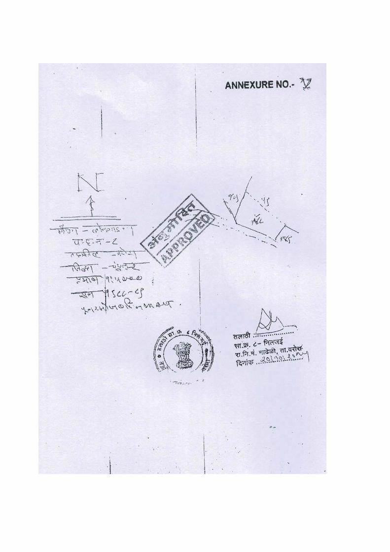
(ii) Location (map showing general location, specific location and project boundary & project site layout) with coordinates The stone quarry lease area is covered in Survey of India Toposheet No.55 O/4. The
location maps viz. topographic location map is attached herewith Enclosure -I.
(iii) Details of alternate sites considered and the basis of selecting the proposed site, particularly the environmental consideration gone into should be highlighted The stone quarry is a site-specific activity and it is in operation since last several years.
The site is selected mainly due to availability of basalt stone in plenty. The site is well
connected by road to city and distance is also within the range. There was no tree cutting
involved. The site land is completely barren with no vegetation. The rights of the site are with
mine owner and agricultural activities were not possible on the selected land.
(iv) Size or Magnitude of operation The stone quarry is small scale activity and magnitude of operation is also low. The
activity is carried out during day time only. The operations are also not carried out
simultaneously and all are scattered. The production rates are totally dependent on market
demand and there is no point in maintaining stock of the material, as it is very low margin
product.
(v) Project description with process details (a schematic diagram/flow chart showing the project layout, components of the project etc. should be given) The stone quarry operation involves site clearing, drilling, blasting, loading/unloading,
crushing, screening, loading of finished stone materials etc. Initially site is cleared for any
unwanted objects/dust. As per plan, the internal roads are earmarked. For the development of
benches, the drilling site is selected. In a stretch, drilling is carried out by compressed air
operated jack hammer drill. The depth of holes is kept to 1.5 m. Burden & spacing is kept to
1.0 x 1.0 m. The diameter of hole is 32 mm. In each hole, two emulsion explosive cartridge of
size 25 mm dia x 150 mm length are inserted. In one of the cartridge, electric detonator is
inserted and its wire is taken out of the hole. The hole is then completely filled by dust and
stone bags are kept for muffling. All the holes are connected in series by additional wire to all
detonators. The circuit of the all detonators is completed and wire ends are then connected to
charge box. The charge to circuit is given as per requirement by experienced & licensed blaster
in terms of charge rotations required. Once the circuit is completely charged, the light in the
box blows and by pressing the knob, blasting is carried out. All the precautionary measures
during blasting are taken out. Due to blasting the compact stone material became loose in the
form of rubble. The rubble is removed by JCB/manually and taken to suitable place for sorting.
The rubble pieces are then sized to 8 to 10 inch and shifted by tractor trolley to crusher. In the
feeding pocket of crusher, all sized stone material is unloaded. The material moves downward
in to crusher. The crushed stone through conveyor is taken to screens. At screens, various sizes
of material are separated out including dust and oversized material. The sized material is
conveyed through conveyor to different places and oversized material is again charged to
feeding hopper of crusher. The sized material as various grades of metal are loaded by loader
to trucks / trolley and transported to the construction sites as per order.
(vi) Raw material along with estimated quantity, likely source marketing area of final products, mode of transport of raw material and finished product In the stone quarry, as such no raw material is required. For 3.0 T of stone material
excavation, 0.25 kg of emulsion explosive cartridges is consumed with one electric detonator.
There is less consumption of diesel in the tractor mounted compressor, JCB, loader, tractor
trolley, trucks etc as applicable.
The major market to the stone material is building construction, road construction sites,
industrial areas, dam under construction etc. Stone material is transported by existing roads
through covered trucks.
(vii) Resource optimization/recycling and reuse envisaged in the project, if any, should be briefly outlined
In stone quarry, waste material does not generate. All the materials are salable as
rubble, boulder, murum, metal, dust etc. Hence, there is total resource optimization.
(viii) Availability of water its source, energy/power requirement and source should be given
In the stone quarry, due to compact nature of basalt rock, ground water does not exist at
shallow depths. The seam of the basalt rock goes deep. The ground water may exist below this
rock. The intersection of total seam of stone is not feasible and it is not carried out in any stone
quarry. The rain water collected in pit also remains in the pit as it is difficult to percolate
through impermeable layer of the stone. The rain water collected in the pits is the source of
water for various purposes of stone quarry such as sprinkling of water on haulage roads, dust
suppression during crushing, sprinkling on conveyor belts, fixed sprinklers installed in the
quarry, green belt development etc. Drinking water is normally brought from the dugwells
existing away from the quarry area as there are no dugwell or borewell exist in quarry area.
(ix) Quantity of waste to be generated (liquid and solid) and scheme for their management/disposal In stone quarry, there is no industrial effluent generation as such. The water table is not
intercepted in the stone quarry due to basalt rock deepness. The rain water accumulated in the
pit during monsoon is uncontaminated. The silt is settled down under gravity. Normally in the
mine, deepening of one of the corner of the pit is carried out and rain water is collected
throughout the year in it. The excess rain water collected in the pit is pumped out during non-
monsoon season and this mine discharge water becomes the source of water for agricultural
purposes in the nearby area.
In stone quarry, there is no solid waste generation. All the forms of stones are salable in
the market.
(x) Schematic representation of the feasibility drawing which give information of EIA purpose The stone quarry is small scale activity and operations have very less negative impacts
on environment as there are no contaminations of chemicals or similar substances addition to
the environment, the fugitive dust generated is inert and inorganic in nature.
4. Site Analysis (i) Connectivity
The stone quarry under consideration has very well connectivity to city.
(ii) Land Form, Land use and Land ownership The land form of the stone quarry area is rocky and it is a wasteland. The land is barren
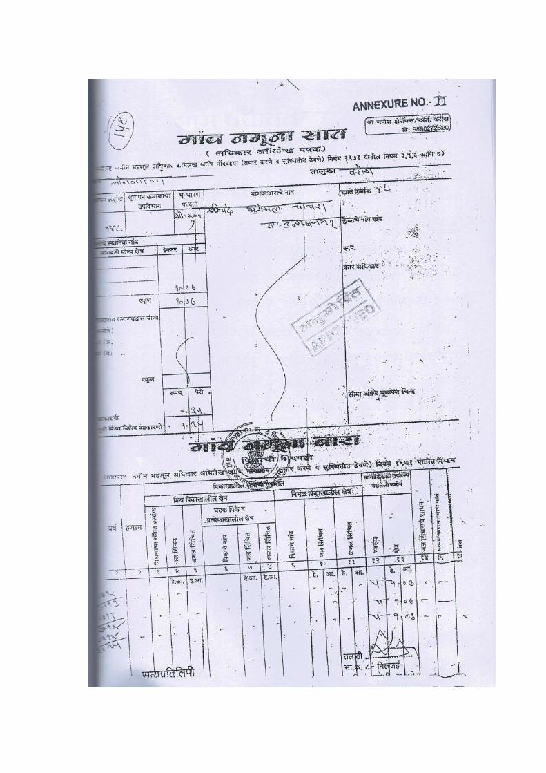
and it is under the control of mine owner. The area of 1.07 HaR of Khasara No. 148, Village-
Longadaga Taluka – Warora, Dist- Chandrapur (M.S) is in use for stone quarrying as per NOC
and permission from Concerned Authorities (Enclosure 2).
(iii) Topography (along with map)
The stone quarry area is plain at an altitude of about 196 msl. The topographic map of
the stone quarry area and surrounding area is enclosed in Enclosure 1
Existing land use pattern (agriculture, non-agriculture, forest, water bodies (including
area under CRZ), shortest distances from the periphery of the project to periphery of the forest,
national park, wild life sanctuary, eco sensitive areas, water bodies (distance from the HFL of
the river), CRZ. In case of notified industrial area, a copy of the Gazette notification should be
given.
The existing land use of the stone quarry area is non-agriculture. The land is barran,
wasteland, rocky and without vegetation. Surface area is murmad type and unsuitable for
agricultural purposes. In the 15 km radius area from the boundary of the stone quarry, notified
forests, national park, notified wild life sanctuary, notified eco sensitive areas, notified water
bodies, notified CRZ areas are not existing.
(v) Existing Infrastructure There are other stone quarries adjacent to each other forming cluster of stone quarries
in the area. Road infrastructure to the cluster area is developed. Power distribution network is
also developed.
(vi) Soil classification There are six types of soils found in Chandrapur district. Soils are classified on basis of
colour are as follows:
i) Kali soils: These are black cotton soils which are fine grained clayey in texture and varies in depth from 1 m to 6 m or more and retain moisture.
ii) Morand soils: These are predominant in the district. They are black cotton soils with higher percentage of lime than the Kali soils. They are black, grey or light to dark brown in colour, clayey in texture.
iii) Khardi soils: They are shallow soils mixed with sand and found mainly in hills. These are grey in colour, clay loam in texture.
iv) Bardi soils: They are red gravel covered with boulders found on summits and slopes of trap hills and are less fertile in nature.
v) Kachchar soils: They are mainly found in the banks of River Wardha and are alluvial soils, loamy in nature and vary in depth from 1 to 3 m.
vi) Wardi soils: They are red soils with a large amount of sand. They are shallower and clayey loam in nature. They are mainly found in the paddy tracts in the eastern part of the district.
The stone quarry area is barren with wasteland. The pit in the stone quarry area is
existing. The soil cover is very less to the majority of the stone quarry area. However, soil
cover at some places is murum type.
(vii) Climatic data from secondary sources (viii) The climate of this district is characterized by a hot summer, well distributed rainfall
during the south-west monsoon season and general dryness except in the rainy season.
The cold season is from December to February. This is followed by the hot season
from March to May. The south-west monsoon season is from June to September
October and November constitute the post-monsoon season.
(ix) Records of rainfall in the district arc available for 18 stations for periods ranging from
12 to 94 years. The average annual rainfall in the district is 1,420.2 mm. (55.91
inches). The rainfall in the district generally increases from the west towards the east
and varies from 1,184.8 mm (46.65 inches) at Warora to 1,826.5 mm. (71.92 inches) at
Murumgaon.
(x) There are three meteorological observatories in the district, one each at Brahmapuri,
Chandrapur and Sironcha. After October both day and night temperatures decrease
progressively till December which is the coldest month. In the northern parts of the
district, the mean daily maximum temperature in December is 28.2° C (82.8° F) and
the mean daily minimum 11.6° C (52.9° F). Temperatures rise rapidly after February
till May which is the hottest month of the year. The mean daily maximum temperature
in May is about 43.0°C (109.4° F) and the mean daily minimum is about 28 or 29°C
(82.4 or 84.2° F).
(xi) Winds are generally light with some increase in wind force during the latter part of the
summer season and in the south-west monsoon season. In the post-monsoon and cold
seasons winds blow mostly from directions between north and east. In the first half of
the summer season winds gradually change over to direction between east and south
and by May winds from directions between south-west and north-west become more
common.
(xii) Social Infrastructure available In 2011, Chandrapur District had population of 2204307 of which male and female
were 1123834 and 1062993 respectively. Chandrapur District population constituted 1.96
percent of total Maharashtra population.
The initial provisional data released by census India 2011, shows that density of
Chandrapur district for 2011 is 193 people per sq. km.
Average literacy rate of Chandrapur in 2011 was 80.01%. If things are looked out at
gender wise, male and female literacy were 86.79 and 72.97 respectively. With regards to Sex
Ratio in Chandrapur District, it stood at 961 per 1000 male.
Chandrapur City is a part of District and due to it adequate social infrastructure is
available. The social infrastructure comprising hospitals, schools, colleges, community halls,
places of worship, cemetery, crematory etc are existing and within hour these facilities can be
availed.
5. Planning Brief (i) Planning concept (type of industries, facilities, transportation, etc.) Town and
country planning/development authority classification The area is dominantly covered by stone quarries & stone crusher. The ancillary
activities as transport, engineering workshops, fabrication shops etc. are also developed. The
area will be further developed in the quarrying activities. At the closure of quarry, the pits will
be converted to ponds or sloppy area will be covered by green belt. The district authority has
issued lease with conditions for safe operation and environmental conservation.
(ii) Population Projection In the stone quarry, local villagers are employed and direct employment is very low.
The local manpower is already trained in quarry and crusher operation. There is direct and
indirect employment in terms of drivers, mechanics, contract laborers etc. The manpower from
the nearby village(s) is already engaged and trained in these jobs. Hence, additional population
increase in the area is not anticipated.
(iii) Land use planning (breakup along with green belt etc.) The quarry and crusher activities are carried out in the leased area. At the closure of
quarry, the pit land will be converted to pond or sloppy land will be covered by plantation.
(iv) Assessment of Infrastructure Demand (physical & social) The road infrastructure is already developed in the area, which requires for the transport
of the stone material to the consumers. The manpower is local and their social infrastructure is
also developed. The inflow of money in terms of taxes to grampanchayat and salaries to the
manpower will further improve the physical and social infrastructure.
(v) Amenities/Facilities At the stone quarry under consideration have facilities as drinking water, first aid box,
communication facilities, emergency vehicle for shifting the workers during accident etc. are
available.
6. Proposed Infrastructure (i) Industrial Area (Processing Area)
The infrastructural facilities are already developed in the area for the unit operations as
required in stone quarrying.
(ii) Residential Area (Non-Processing Area) The local villagers are employed in the stone quarrying activities and the development
of residential area is not needed.
(iii) Green belt At present, a few trees are existing. At the closure of mine about 7.5 m or more of the
lease area will be converted to green belt.
(iv) Social Infrastructure The social infrastructure in the cluster area has been improved due to activities of stone
quarries.
(v) Connectivity (Traffic and Transportation Road/Rail/Metro/Water ways etc.) The connectivity in terms of traffic, transportation road is already developed and good.
There are well connected roads in the area. The nearest railway station is existing at
Kalmeshwar.
(vi) Drinking Water Management (Source & Supply of Water) The dugwell / borewell water existing in the nearby areas is brought to the site for
drinking purposes through tankers.
(vii) Sewerage System The manpower requirement at the stone quarry is very less and hence sewerage system
is not required.
(viii) Industrial Waste Management Industrial waste generation from the stone quarry under consideration is nil.
(ix) Solid Waste Management Except insignificant amount of municipal solid wastes, no solid waste is generated from
the stone quarry under consideration.
(x) Power Requirement & Supply/Source The power requirement is fulfilled by MSEDCL and its network is well developed.
Power supply to the area is also regular.
7. Rehabilitation and Resettlement (R & R) Plan (i) Policy to be adopted (central/state) in respect of the project affected person
including home oustees, land oustees and landless laborers (a brief outline to be given)
The rehabilitation and resettlement (R&R) is not required for the stone quarry under
consideration as it is located in the notified mining zone.
8. Project Schedule & Cost Estimates (i) Likely date of start of construction and likely date of completion (Time schedule
for the project to be given) The lessee has vast experience of stone quarrying and crushing operations. All the
plant, machinery and infrastructural facilities are provided. All necessary statutory permissions
are taken by lessee. Adequate reserves are available. Market is well established. Manpower is
available with lessee. The operation can be continued subject to the grant of Environmental
Clearance and renewal of mining lease.
(ii) Estimated project cost along with analysis in terms of economic viability of the project The gross capital investment of the stone quarry is about Rs. 15 lacs and recurring
expenditure including crusher activity is about 1.5 Lacs / month. Though there are fewer
margins in the business due to competition, the economic viability is still good due to
availability of stone materials, market and infrastructural facilities.
9. Analysis of Proposal Final Recommendations (i) Financial and social benefits with special emphasis on the benefit to the local
people including tribal population, if any, in the area The stone quarry area development has widened financial transaction in the area. The
land prizes are increased for wasteland and it has benefited locals to great extent. Some of
them have started their own stone queries as well as allied business. Overall, the socio-
economic status of the local population has been improved in many ways including direct and
indirect employment due to stone quarries existing in the area.
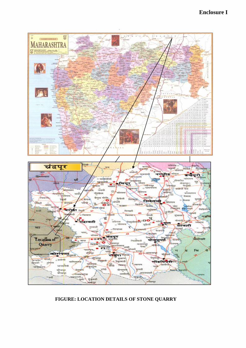
Enclosure – I
Site details of Stone Quarry under Study
Enclosure I
Enclosure - I
Location of Quarry
FIGURE: LOCATION DETAILS OF STONE QUARRY
Enclosure-II Contd…