Embed Size (px)
Citation preview
Peter R. Baye, Ph.D. Botanist, Coastal Ecologist
P.O. Box 65, Annapolis, California 95412
(415) 310-5109 [email protected]
Analysis of Clean Water Act Section 404(b)(1)
“Special Aquatic Site” Status of Redwood City Saltworks Site, San Mateo County, California
Prepared by Peter R. Baye Ph.D.
Prepared for: Citizen’s Committee to Complete the Refuge,
Palo Alto, California
January 2010
Peter R. Baye Ph.D. Redwood City Saltworks Botanist, Coastal Ecologist Special Aquatic Site Analysis [email protected]
1
EXECUTIVE SUMMARY
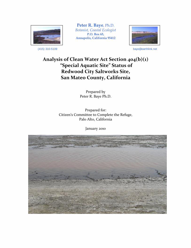
The purpose of this report is to analyze and assess the Clean Water Act “special aquatic site” status of the salt ponds of the Cargill Salt Redwood City salt pond complex in South San Francisco Bay at Redwood City, San Mateo County, California. The diked bayland site has been proposed for urban development by Cargill and its partner, DMB Associates. A previous (2002) analysis of “special aquatic site” status of the salt pond interiors of this site prepared by Cargill’s biological consultant concluded that no “special aquatic sites” were present. The current report provides additional evidence from the scientific literature and new regulatory critical review that reverses the negative findings of the previous “special aquatic site” analysis. Two types of special aquatic sites, “mud flats” and “sanctuaries and refuges”, apply extensively to the existing salt pond interiors at Redwood City, and “wetlands” occur at least in areas outboard of the salt pond levees, but within the site as a whole. The extensive distribution of “special aquatic sites” in the project area provides important regulatory context for permit evaluation under Section 404(b)(1) of the Clean Water Act to place fill within “special aquatic sites”.
Peter R. Baye Ph.D. Redwood City Saltworks Botanist, Coastal Ecologist Special Aquatic Site Analysis [email protected]
2
1.0 Introduction The purpose of this report is to analyze and assess the Clean Water Act “special aquatic site” status of the salt ponds (including crystallizers, desalting ponds, wash ponds, bittern ponds, ditches) of the Cargill Salt Redwood City salt pond complex in South San Francisco Bay at Redwood City, San Mateo County, California. The diked bayland site has been proposed for urban development as “Redwood City Saltworks” by Cargill and its partner, DMB Associates. Cargill has initiated pre-application discussion and correspondence with the U.S. Army Corps of Engineers, San Francisco District (USACE) and the Environmental Protection Agency (EPA) regarding jurisdiction and permit evaluation of the proposed development. These discussions have included pre-application discussions of “special aquatic site” status of the “Saltworks” site, including a site-specific analysis of prepared by Cargill’s biological consultant (Wetlands Research Associates 2002). This report revisits the special aquatic site evaluation of the 2002 report, focusing on site-specific applicability of two special aquatic site types, “sanctuaries and refuges” and “mudflats”, with evidence from the relevant scientific literature specific to San Francisco Bay published during or after 2002. 2.0 Background
2.1 Project site hydrology and substrate The Redwood City salt pond complex is privately owned by Cargill Salt Division, and was not included in the sale by Cargill of 16,500 acres (fee-title and mineral rights acquisition) to the Department of Interior and the State of California. The Redwood City salt pond system consists of approximately 1400 acres of salt ponds (levees, ditches, locks, and all enclosed types of basin that retain, convey, or form concentrated (hypersaline) brines derived from evaporation of bay water, with variable ionic composition. The South Bay salt pond system is no longer producing new brines from evaporation of bay intake water. Since the South Bay salt ponds ceased new production of brines in 2004, remaining brines processed in the system have been concentrated in the last salt ponds that remained in industrial operation: the Newark and Redwood City plant sites (U.S. Fish and Wildlife Service and California Coastal Commission 2007). The Redwood City salt pond complex was connected to the Newark salt plant by brine pipelines that run under the bay, and received brines produced by East Bay salt evaporation ponds. The recent (post-industrial production) conditions at Redwood City salt ponds reflect changes in the bay-wide system operation since the phased transition to system retirement and South Bay Salt Pond Restoration Project operations began. Evaporation (concentrator) ponds were converted either to tidal mudflat (salt marsh succession) or bay water management regimes (circulating or choked tidal flows) that do not accumulate salt. The salt pond hydrology at Redwood City is influenced by natural rainfall inputs, overtopping of levees during extreme high tides, evaporation, and active artificial
Peter R. Baye Ph.D. Redwood City Saltworks Botanist, Coastal Ecologist Special Aquatic Site Analysis [email protected]
3
management of brines and impounded rainwater (by gravity drainage, water control structure operation, pumping) (Ver Planck 1958). Brine depths in the South Bay salt ponds in general is highly variable (Warnock et al. 2002), ranging from partly or completely emergent pond beds (exposure of bay mud; Warnock et al. 2002) to depths supporting abundant migratory shorebirds, dabbling and diving ducks (Takekawa et al. 2000). The salt ponds at Redwood City, like the majority of those of the South Bay in general, were originally formed in the 20th century by converting tidal salt marshes to non-tidal impoundments that function as salt evaporation ponds (solar salterns or salt pans). The most recent industrial uses of Redwood City salt ponds (WRA 2002) were crystallization (precipitation and harvest of halite, sodium chloride salts), bittern storage (potassium/magnesium sulfate and chloride supernatant), bittern “desalting” pond processing, “wash pond” processing (saturated brine/bay mud deposition, storage, and removal), “pickle” ponds (near-saturated or saturated brine processing). Hydrology within Redwood City salt ponds is no longer influenced by managed intake of tidal bay water (intake ponds) or sequential transfer of concentrated brines among ponds by gravity or pumping through water control structures). Hydrology (including salinity and ionic composition) of the post-industrial production Redwood City salt ponds are now influenced by accumulated salt and bittern loads, evaporation rates (wind, temperature control), rainfall, and potentially infrequent overtopping of subsided or eroded levee segments by extreme high tides or wave runup, and post-industrial management of brines and levees. With the exception of levees and berms, the bay mud substrate of Redwood City salt ponds consists of unvegetated non-tidal hypersaline flats composed of bay mud with variable salt or mineral film deposits, either emergent or submerged under variable depths of brines. The substrate is composed of hypersaline bay mud, natural clay-silt estuarine sediment that dominates the surface of San Francisco Bay. The underlying bay mud beds of the salt ponds were deposited naturally over the original tidal marsh surface soils and impounded tidal channels. Relict tidal drainage topography, including First Slough, remained evident in aerial photography of the salt ponds from the 1940s to the present, including traces of relict drainage patterns in multiple crystallizer beds. The surface bay mud sediment in the salt ponds may be original tidal marsh sediment (bay mud with decomposed organic matter from vascular plants), or a veneer of naturally redeposited bay mud (resuspended fine sediment either from internal salt pond wind-wave erosion or suspended sediment load of former bay intake water). In the crystallizer beds, bay mud has been artificially redeposited by mechanical placement of wash pond mud (sediment removed from harvested halite by washing with saturated brines). The bay mud surfaces of salt ponds retaining saturated brines (including bittern, brines with high concentrations of potassium and magnesium salts) may also become mantled with precipitated halite (water-soluble sodium chloride solids or slush-like crystals suspended in saturated brine) as well as mineral precipitates of relatively insoluble calcium sulfate (gypsum). Halite precipitated in crystallizer beds was periodically harvested (along with some adhering bay mud), partially re-exposing underlying bay mud. (Ver Planck 1958).
Peter R. Baye Ph.D. Redwood City Saltworks Botanist, Coastal Ecologist Special Aquatic Site Analysis [email protected]
4
There is no evidence that any salt pond beds at Redwood City include significant areas of any artificial substrates; the pond bed surfaces are composed of either bare bay mud, bay mud coated with precipitated halite, or bay mud coated with mineral precipitates from hypersaline brines. With the cessation of additional brine production in the South Bay, the remaining brines and halite in the Redwood City ponds will either be processed and harvested (evacuating the system), or will remain unharvested and stored. Bittern (waste by-product of fractional crystallization of sea salt; ponds 8e and 9) is likely to be either stored or reprocessed. The site was legislatively exempted from the Surface Mining Reclamation Act (SMARA), and so no reclamation plan will be prepared to modify the substrates of the post-industrial salt ponds. The San Francisco Bay Conservation and Development Commission (BCDC) was the former lead agency salt pond reclamation under SMARA.
2.2 Pre-application USACE permit consultation history On June 26, 2002, Cargill (William Britt) submitted to the District Engineer of the USACE San Francisco District (T. O’Rourke) a report prepared for Cargill by Wetlands Research Associates (WRA 2002) titled “Special Aquatic Habitat Assessment – Cargill Redwood City Salt Plant Site, Redwood City California”, dated June 2002. The report summarily rejected applicability of all potential “Special Aquatic Site” categories to the Redwood City salt ponds. The report text was less than three pages, and included almost no environmental analysis, no review of scientific literature on tidal or nontidal mudflats, and no review of any designations that may fall within the meaning of “refuges and sanctuaries” – the categories of special aquatic sites with greatest potential relevance to salt ponds in San Francisco Bay. Two days later, on June 28, 2002, the District Engineer replied in a letter to Cargill (Bill Britt):
While it is premature for the Corps to make any of these determinations [404(b)(1)], we can offer the following advice to assist Cargill in developing its analysis of these issues. Regarding the alternatives analysis, an important threshold issue concerns whether the site at issue is a Special Aquatic Site. ….Based on your consultant’s June, 2002, Special Aquatic Site Assessment, it appears that wetlands and other Special Aquatic Sites are not present on the Redwood City Plant Site. We encourage Cargill to further develop its analysis of these issues so that all parties interested in the evaluation of this permit decision will have a clear understanding of how the alternatives analysis will need to be framed.
In a letter dated July 17, 2002, Alexis Strauss, director of the Water Division of the Environmental Protection Agency Region IX, advised Cargill (W. Britt) that EPA had reviewed the four page WRA report on Special Aquatic Habitats and concurred with its conclusion that no special aquatic sites within the meaning of Section 404(b)(1) Guidelines existed at the Redwood City plant site. EPA further advised Cargill (at least eight years in advance of even a draft submittal of a permit application for a project involving fill in Redwood City salt ponds) that the lack of special aquatic sites there implied that the
Peter R. Baye Ph.D. Redwood City Saltworks Botanist, Coastal Ecologist Special Aquatic Site Analysis [email protected]
5
presumption of a non-aquatic “least environmentally damaging practicable alternative” would not apply to this site in evaluation of the 404(b)(1) Guidelines. EPA provided no critical review, analysis, or comments on the WRA Special Aquatic Site report, and no additional information. As of the date of this report, no permit application for discharges of fill in salt ponds at the Redwood City Saltworks proposed development site has been filed.
2.3 “Special Aquatic Site” in the Clean Water Act Section 404(b)(1) Guidelines “Special aquatic site” is a category of Clean Water Act jurisdictional “waters of the United States”, with special status under the Environmental Protection Agency’s Section 404(b)(1) “Guidelines” (40 CFR §230-233) that govern permit evaluation and decision procedures for aquatic discharges of earthen fill. The most familiar type of the six “special aquatic site” categories is “wetlands”, but other distinctive aquatic habitats with special ecological importance are recognized under the Guidelines as having the same regulatory status as “wetlands” with respect to the Guidelines. “Special aquatic sites” are enumerated and defined in Subpart E of the Guidelines (40 CFR §230.40-45), and comprise “sanctuaries and refuges”, “wetlands”, “mudflats”, vegetated shallows, “coral reefs”, and “riffle and pool complexes”.
2.4 Regulatory definition of “Special Aquatic Site” (40 CFR §230.3(q-1) “Special aquatic sites” is defined in the Guidelines at 40 CFR §230.3(q-1) as
“…those sites identified in Subpart E. They are geographic areas, large or small, possessing special ecological characteristics of productivity, habitat, wildlife protection, or other important and easily disrupted ecological values. These areas are generally recognized as significantly influencing or positively contributing to the general overall environmental health or vitality of the entire ecosystem of a region (See 230.10(3).”
The regulatory definition of special aquatic sites is not an academic or abstract classification exercise; it is directly related to the public interest values of the Clean Water Act. The definition of “special aquatic sites” at 40 CFR §230.3(q-1) is expressly based on “special ecological characteristics” related to “productivity, habitat, wildlife protection” or “other important ecological values” – that is, it is a definition based on geographic areas with important aquatic ecological functions. The “special aquatic site” definition at 40 CFR §230.3(q-1) also expressly identifies the regional importance of special aquatic sites to “the overall environmental health or vitality of the entire ecosystem of a region” as essential to the interpretation and application of the definition. The analysis of “special aquatic site” status of the Redwood City Saltworks site in this report is conducted in light of the context and interpretation made explicit in the definition at 40 CFR §230.3(q-1). This is particularly important for the San Francisco Bay setting, where salt

Peter R. Baye Ph.D. Redwood City Saltworks Botanist, Coastal Ecologist Special Aquatic Site Analysis [email protected]
6
ponds are regionally among the most important unvegetated aquatic habitats in the baylands (Takekawa et al. 2002, Warnock et al. 2002, Goals Project 1999).
2.5 Regulatory applications of “special aquatic site” status Special aquatic sites are pertinent to multiple sections of the Section 404(b)(1) Guidelines and the overall 404 permit evaluation process. Special Aquatic Sites are defined and explained in terms of characteristics and potential impacts in Subpart E of the Guidelines (40 CFR §230.40-45). They are first cited for use in evaluation procedures (General Procedures) at CFR 40 §230.5(f)), which instructs:
(f) Identify and evaluate any special or critical characteristics of the candidate disposal site, and surrounding areas which might be affected by use of such site, related to their living communities or human uses (Subparts D, E, and F)
Special aquatic sites are a critical regulatory element of “Restrictions on discharges” at 40 CFR §230.10. They are cited as part of the “significant degradation” prohibition of Subpart B, 40 CFR §230.10(c), which states:
….Under these Guidelines, effects contributing to significant degradation considered individually or collectively, include:
(1) Significant adverse effects of the discharge of pollutants on human health or welfare, including but not limited to effects on municipal water supplies, plankton, fish, shellfish, wildlife, and special aquatic sites. [emphasis added]
Special aquatic sites status is also a regulatory criterion for whether evaluation of non-water-dependent projects must presume availability of less environmentally damaging “practicable alternatives” (LEDPA) outside special aquatic sites, unless clearly demonstrated otherwise (Guidelines Subpart B, 40 CFR §230.10(3). No fill in waters of the U.S. shall be permitted unless this alternatives test is met (40 CFR §230.10(a)). The elevated environmental status of Special Aquatic Sites is reflected in its role in the alternatives test. Of the six special aquatic site types, only “wetlands” have official empirical technical protocols for determination and delineation, developed primarily by USACE. For the rest of the special aquatic site categories, USACE and EPA make determinations on the basis of analysis or professional judgment, without the formal protocols or criteria other than interpretation of explicit narrative criteria in the 404(b)(1) guidelines. The “factual determinations” of the Guidelines (40 CFR §230.11), in combination with the findings required in Subpart C (Potential Impacts on Physical and Chemical Characteristics of the Aquatic Ecosystem) and Subpart D (Potential Impacts on Biological Characteristics of the Aquatic Ecosystem ) presumably supply sufficient information for an objective and sound determination of special aquatic site presence/absence and assessment. Neither USACE nor EPA conducted the functional or substantive equivalent of Guidelines factual determinations or Subpart C or D assessments in 2002 when they concurred with the WRA (2002) summary findings of no special aquatic sites at the Redwood City plant site, which
Peter R. Baye Ph.D. Redwood City Saltworks Botanist, Coastal Ecologist Special Aquatic Site Analysis [email protected]
7
was submitted as a pre-application document (prior to permit evaluation procedures; as of January 2010, no USACE jurisdictional delineation or Public Notice for the Saltworks site is on file). The following section provides new analysis of the special aquatic site status of the Redwood City Plant site, and a critical review of the WRA (2002) report. This analysis is intended to be equivalent to the scope and content of factual determinations and evaluations mandated by the 404(b)(1) guidelines (Subparts C, D and 40 CFR §230.11) for the USACE permit evaluation process. It is based on a comprehensive review of pertinent scientific literature and government documents, some of which were published after the 2002 WRA report and 2002 pre-application consultation correspondence from EPA and USACE on this subject. 3.0 Special Aquatic Site analysis of the Redwood City Saltworks Site Special Aquatic Site categories potentially applicable to jurisdictional waters of the Saltworks site are “sanctuaries and refuges”, and “mudflats”; these are analyzed in detail below. Other special aquatic site categories are either precluded or limited to insignificant (for purposes of 404(b)(1) Guidelines evaluation of the proposed project) extent for the following reasons:
• Vegetated shallows (40 CFR §230.43). Although the halophytic submerged aquatic plant wigeongrass (Ruppia maritima, R. cirrhosa) could potentially colonize some salt pans with seasonal variability between brackish and hypersaline (schizohaline) conditions, the constant to extreme hypersaline (hyperhaline) conditions prevalent at Redwood City appear to exclude all vascular submerged aquatic vegetation. Eelgrass (Zostera marina) is ecologically excluded in non-tidal and hyperhaline impoundments. No visible Ruppia colonies were detected any aerial photographs, aerial surveys, or ground-based perimeter of Redwood City salt ponds since 1991 (Baye, pers. observ.).
• Coral reefs (40 CFR §230.44): No coral reefs occur in the temperate climate marine
or estuarine waters of Central California. They are biologically excluded from the region and the site. This finding concurs with the findings of the WRA report (2002)
• Riffle and Pool Complexes (40 CFR §230.45) : The Redwood City salt ponds lack
fish habitat, freshwater or oligohaline (fresh-brackish) stream conditions, stream channel morphology, and they contain only fine (clay-silt) sediment and the flat topographic gradients that preclude confined, rapid, turbulent flow essential to riffles. Thus, riffle and pool complexes are physically impossible and irrelevant to the site. This conclusion is consistent with the findings of WRA (2002).
Wetlands (40 CFR §230.41) are indicated by hydric soils, wetland hydrology, and prevalence of (vascular) wetland vegetation. Under existing (2010) and recent conditions, extreme hypersalinity within the existing Redwood City salt pond basins apparently excludes even extremely tolerant halophytes. Brine concentrations apparently restrict primary production to halobacteria, halotolerant green algae (primarily Dunaliella salina, which contains the
Peter R. Baye Ph.D. Redwood City Saltworks Botanist, Coastal Ecologist Special Aquatic Site Analysis [email protected]
8
pigments that color salt ponds), and halotolerant cyanobacteria. WRA (2002) reported that all salt pond interiors at Redwood City were generally unvegetated. The existing conditions of the Redwood City salt pond interiors fail the essential “wetland vegetation” criterion for “wetlands”, but the cessation of industrial salt production brine management, and concentration and indefinite storage of bittern and pickle brines at Redwood City, arguably represent new and atypical circumstances relative to historic normal salt pond operations) that may affect the legal interpretation of wetlands at the site. The interpretation of “normal circumstances” of wetlands inboard of salt ponds at Redwood City is outside the scope of this report. The scope of the WRA assessment did not expressly include outboard levee slopes of salt ponds, which do in fact support jurisdictional wetlands below the High Tide Line. The presence of fringing tidal wetlands, and nontidal wetlands bordering perimeter interior ditches landward of the salt ponds, may be significant for purposes of §404(b)(1) evaluation of the project as a whole, even if this special aquatic site is relatively small compared with salt pond interiors. The WRA report did not include documentation of tidal and nontidal wetlands peripheral to the salt pond levees. The scope of the WRA report was limited to “Cargill salt processing lands inside this levee area (“Study Area”)…”, and did not address the Saltworks site as a whole. Both “sanctuaries and refuges” and “mudflats” categories of special aquatic sites, as defined and described in the 404(b)(1) Guidelines, do apply extensively to the existing conditions of interior salt ponds of Redwood City Saltworks site. These findings are explained in detail below.
3.1 Sanctuaries and Refuges The authorized boundary of Don Edwards San Francisco Bay National Wildlife Refuge expressly includes Tracts 165 and 166 (Redwood City salt ponds including current and past crystallizers, bittern, wash ponds, pickle ponds, desalting ponds) identified in the September 1990 Land Use Protection Plan of the U.S. Fish and Wildlife Service San Francisco Bay National Wildlife Refuge. On October 28, 1988, Congress passed Public Law 100-556, which increased the Service’s acquisition authority for the refuge to a total of 43,000 acres. The maps provided in the Land Use Protection Plan show the boundaries of areas approved by Congress for inclusion in the San Francisco Bay National Wildlife Refuge. The plan (U.S. Fish and Wildlife Service 1990) identifies “abandoned salt ponds” (salt ponds removed or planned for removal from industrial production) as the highest priority for acquisition, and specifically identifies Redwood City salt pond tracts 165 and 166. In 1990, these tracts were in active industrial use, which placed them in Priority 3 for acquisition; in their current (decommissioning transition) condition, they would be Priority 1. The Department of Interior can have no stronger “designation” for a refuge “to be” managed for preservation of fish and wildlife on lands threatened with conversion to uses adverse to fish and wildlife. The definition of “sanctuaries and Refuges” at 40 CFR §230.40(a) states that they consist of “areas designated under State or Federal laws or local ordinances to be managed principally for the preservation and use of fish and wildlife sources. The same “designated….to be managed for” language is also used to define “parks, national and historical monuments, national

Peter R. Baye Ph.D. Redwood City Saltworks Botanist, Coastal Ecologist Special Aquatic Site Analysis [email protected]
9
seashores, wilderness areas, and similar preserves” at 40 CFR §230.54. The definition explicitly refers to “designated under law” as the essential first criterion. The definition does not establish a criterion of actual fee-title ownership, lease, or active contemporary management by State or Federal government. The language does not refer to “areas under Federal or State jurisdiction, lease, or ownership”, but areas designated (specified, nominated, named, identified, selected, appointed, or authorized by a State or Federal law or official plan) for special protected wildlife management. The second criterion in the definition is that the area is to be (future tense or infinitive) managed principally for fish and wildlife habitat; the definition does not limit “sanctuaries and refuges” to areas that have been or currently are managed principally for preservation and use by fish and wildlife. This indicates that geographic areas designated by State, Federal or local government as primary fish and wildlife conservation land use, whether or not the fish and wildlife-priority land use is ongoing, pending, or legally authorized in an official refuge/sanctuary plan, are consistent with the definition of “sanctuaries and refuges”. There is no indication in the 404(b)(1) Guidelines, its Federal Register preamble, or the Clean Water Act itself, that either congress or EPA intended to exclude from this definition areas that have been officially designated (authorized) as State or Federal refuges or sanctuaries, but are not owned fee-title or leased by government agencies at the time the Guidelines are applied for evaluation of special aquatic site status. It is precisely the areas designated as refuges and sanctuaries, but not yet fully protected by fee-title government ownership or lease, that are at highest risk of “potential loss of values” due to discharges of pollutants – the aim of the basic protective purpose of Section 404. If the definition of sanctuaries and refuges were narrowly and arbitrarily limited to previously established refuges and sanctuaries which are defined as “managed principally for the preservation and use of fish and wildlife resources”, then the definition would serve no useful purpose in Section 404(b)(1), because such areas would already be “managed principally for preservation and use of fish and wildlife”, and would be most unlikely to be threatened by permit applications for fill that would significantly degrade the aquatic ecosystem. The inclusion of all areas designated as refuges and sanctuaries to be (future) managed principally for habitat, would in contrast serve the purpose of the Clean Water Act and particularly Section 404(b)(1), which emphasizes protection of aquatic ecosystem, including geographic areas not yet fully protected or currently managed as fish and wildlife refuges and sanctuaries. Section 404(b)(1) would apply to permit applications to discharge fill in privately owned areas that may be designated as refuges or sanctuaries. Decommissioned crystallizers in the San Francisco Bay National Wildlife are now restored to the spectacular LaRiviere Marsh, a wildlife-rich mosaic of salt pan and salt marsh habitat showcasing the entrance of the Refuge headquarters in Newark. This is the clearest demonstration of why Congress and the Department of Interior originally designated these former privately owned salt ponds of San Francisco Bay as a National Wildlife Refuge. The same history of public acquisition of crystallizers and brine ponds (physically indistinguishable from those of Redwood City) for inclusion in a “sanctuary and refuge” is currently (2009) being reenacted in San Pablo Bay, at the former Cargill Napa East Side salt plant, where they are also being restored to become improved salt pan and salt marsh
Peter R. Baye Ph.D. Redwood City Saltworks Botanist, Coastal Ecologist Special Aquatic Site Analysis [email protected]
10
wildlife habitat in an expansion of the California Department of Fish and Game’s Napa Marsh Unit. In fact, of the three historic Leslie Salt crystallizer sites in the San Francisco Bay area, Redwood City is the only exception in having no restored or ecologically enhanced crystallizer areas under State or Federal management. The Napa and Newark restored or enhanced crystallizer sites are testimony to the underlying reasons “special aquatic site” status is attached to saline mudflats (including crystallizers) and refuges/sanctuaries alike. The Redwood City (local government) Strategic General Plan (1990) also reflects the special wildlife priorities attached to salt ponds, including crystallizers. Large areas of Redwood City are designated for Open Space and Urban Reserve. The open space consists primarily of the Leslie Salt crystallizers, the South San Francisco Bay National Wildlife Refuge, and publicly owned recreational facilities. The general plan states, “Due to the sensitive nature of these open space areas, it should be assumed that they will remain open space forever.” (p. 2-2, Redwood City Strategic General Plan.). This language does not itself constitute a ‘designation’ of a refuge or sanctuary, but it reflects the recognition of the Refuge setting and the same fish and wildlife importance of the lands that justified Congress’ approval of including the Redwood City salt ponds in the Refuge. The San Francisco Bay Area Wetlands Ecosystem Goals Project (Goals Project 1999) published its recommendations in a report of habitat recommendations in 1999. The Goals Report does not itself “designate” areas authorized by State or Federal governments to be managed primarily for fish and wildlife habitat, as Public Law 100-556 did. The report, however, provides more recent, scientific and expanded conservation biology justification of the Refuge designation of 1990, amplifying the ecological significance of the site in terms of its regional context – precisely as the definition of special aquatic sites explains at 40 CFR §230.3(q-1) (“These areas are generally recognized as significantly influencing or positively contributing to the general overall environmental health or vitality of the entire ecosystem of a region”.). The Goals Report provided the following site-specific assessment and recommendation for Redwood City salt ponds (pp. 126-127):
Segment N - Redwood City Area. Location: Western edge of San Francisco Bay between Steinberger Slough and the Dumbarton Bridge. The Bay’s extensive tidal flats continue to provide excellent foraging habitat for shorebirds…This area has high potential for tidal marsh restoration and enhancement of seasonal wetlands and salt ponds for shorebirds and waterfowl…The Redwood City Crystallizers and associated salt ponds offer the opportunity to maintain and enhance shorebird and waterfowl habitat in close proximity to the large tidal flats that are so important for foraging shorebirds. Recommendations: ….
• Restore tidal marsh along Westpoint Slough and Redwood Creek, but modify the salt crystallizers adjacent to Redwood Creek as salt pan habitat for shorebirds and waterfowl…
…Enhancing the salt ponds would benefit shorebirds and waterfowl and would provide an opportunity to improve snowy plover nesting habitat. [underlining added for emphasis]
Peter R. Baye Ph.D. Redwood City Saltworks Botanist, Coastal Ecologist Special Aquatic Site Analysis [email protected]
11
The Goals Report leaves no question of the ecological importance of the site and the reasons for including it in the Refuge, identifying regionally important, site-specific and unique restoration opportunities, endangered species habitat – prior to the South Bay Salt Pond Restoration Project’s reduction of the region’s salt pan habitat area (high tide foraging and roost habitat) for shorebirds because of conversion to tidal mudflat and marsh. These are precisely the aquatic functions and values that the “special aquatic site” status of sanctuaries and refuges is aimed at protecting under the 404(b)(1) Guidelines in circumstances like the present, when such designated refuges are threatened with adverse land use conversion involving discharges of fill. The WRA (2002) assessment of “sanctuaries and refuges” special aquatic site status erroneously rejected “sanctuaries and refuges” status for Redwood City salt ponds. WRA ignores the key terms “designated…to be managed….” and arbitrarily rejects the “sanctuaries and refuges” status merely because the site is “privately owned” and “not located in a federal or state sanctuary or refuge”. This argument is unsound. First, public ownership is not a criterion in the definition of “sanctuaries and refuges”, and does not in itself disqualify a site from being “designated” (officially named, selected or authorized) as included within a State or Federal Refuge. Second, Redwood City salt ponds are in fact designated as an area to be managed primarily for fish and wildlife protection, and they have been Federally designated (authorized) to be part of the San Francisco Bay National Wildlife Refuge Complex since 1990. Public Law 100-556 and the Refuge’s Land Protection Plan of 1990 (U.S. Fish and Wildlife Service 1990) specify the Redwood City salt ponds in their entirety as within the authorized boundaries of the Refuge. In effect, the WRA report arbitrarily substitutes a narrower (exclusionary) implicit definition of “sanctuaries and refuges”, disregarding the actual regulatory definition’s key term, “designated under State or Federal laws…”, and changes the subject to fee-title ownership of the site – a criterion which is irrelevant to the regulatory definition. Thus, within the meaning of sanctuaries and refuges at 40 CFR §230.40, all of the Redwood City Saltworks site’s Section 404 jurisdictional waters fall within the class of “sanctuaries or refuges” special aquatic sites.
3.2 Mudflats “Mud flats” (alternately spelled as a single word, “mudflat” at 40 CFR §230.3(s)3)) are defined in the Guidelines at 40 CFR §230.42(a) as:
…broad flat areas along the sea coast and in coastal rivers to the head of tidal influence and in inland lakes, ponds, and riverine systems. When mudflats are inundated, wind and wave action may resuspend bottom sediments. Coastal mud flats are exposed at extremely low tides and inundated at high tides with the water table at or near the surface of the substrate. The substrate of mud flats contains organic material and particles smaller in size than sand. They are either unvegetated or vegetated only by algal mats.
Peter R. Baye Ph.D. Redwood City Saltworks Botanist, Coastal Ecologist Special Aquatic Site Analysis [email protected]
12
As defined at 40 CFR §230.42(a), mudflats are stipulated to have the following characteristics:
(1) broad and flat topography, (2) either tidal or non-tidal hydrology (inland lakes, ponds, and riverine systems are identified as having mudflats during their emergent phases), (3) substrate composition of sediments containing organic matter and silt or clay sediment sizes (“particles smaller than sand”), with no minimum or maximum proportion of sediment texture classes or mineral composition stated, (4) sediment dynamics subject to fine (silt or clay) sediment resuspension, (5) unvegetated or algal-matted (note: in 1980, the year the Guidelines were published, cyanobacterial mats typical of hypersaline aquatic flats were known as “blue-green algae” mats).
The Redwood City salt pond interior beds meet all these physical and biological criteria of “mud flats” as defined at 40 CFR §230.42(a). Furthermore, the global and regional scientific literature addressing physical characteristics and environmental settings of mudflats, tidal flats, playa, salt pans, and their biota, support the interpretation of salt pan beds as a type of “mudflat” within the regulatory definition and classification of mudflats as landforms and aquatic habitats. “Coastal” mud flats are defined in the Guidelines as exposed at extremely low tides and inundated at high tides – i.e., “coastal” mudflats are defined as synonymous with tidal flats that contain at least some fine sediment subject to resuspension. Yet the Subpart E definition expressly identifies non-tidal special aquatic site “mud flats” within “ponds”, as well as “lakes” and “riverine systems”, including “inland” locations, consistent with the definition of “waters of the United States at 40 CFR §230.3(s)(3), which lists “mudflats, sandflats…playa lakes…”. The definition of “mud flats” at 40 CFR §230.42(a) does not establish additional explicit demarcation criteria for “mud flats” and other related types of waters of the U.S. This raises the key question of whether “mud flats” defined at 40 CFR §230.42(a) are incompatible with, reasonably include, or necessarily include some types of salt pan and playa formed in mud beds of evaporation basins such as ponds or lakes beyond the limits of ordinary (diurnal) ebb and flow of the tide. The regulatory definition of “mud flat” also establishes no minimum or maximum duration of sediment bed emergence and submergence periods (within or among years) in rivers, ponds, lagoons or lakes with non-tidal or irregularly flooded hydrologic regimes. The list of exemplary “waters” at 40 CFR (§230.3(s)(3)) including “mudflats” is particularly instructive for interpretation of the scope of the “mud flat” definition at §230.42(a), because it includes a heterogeneous series of non-exclusive classes of aquatic sites including wetlands, mudflats, sandflats, ponds, and playas – some of which are explicitly defined as “special aquatic sites” in Subpart E. For example, after the example “wetlands”, the list follows with “prairie potholes” and “wet meadows”, which are types of vegetated (seasonal) wetlands (thus special aquatic sites), not distinct classes of aquatic ecosystems. Thus, the list of
Peter R. Baye Ph.D. Redwood City Saltworks Botanist, Coastal Ecologist Special Aquatic Site Analysis [email protected]
13
exemplary jurisdictional aquatic habitats contains at least some overlapping categories of special aquatic sites and broader classes of aquatic habitats regulated under Section 404. Following “mudflats”, the list of exemplary “waters” at 40 CFR §230.3(s)(3) also includes “playa lakes” and “natural ponds” as jurisdictional aquatic habitat classes. The definition of “mud flat” in Subpart E expressly identifies mud flat special aquatic sites as broad, flat fine-grained areas that may occur within inland lakes and ponds (nontidal environmental settings). Playas (or “playa lakes”) are not distinguished from or excluded from the definition of “mud flats” in Subpart E. In the scientific literature, playa (specifically in California) is described as synonym of “salt pan”: “The salt pan or playa of a dry lake usually is salt-encrusted and devoid of plants” (Vasek and Barbour 1980). Chapman (1961), in his monograph of global salt marshes and salt deserts, also classified playas as a nontidal type of salt pan in alkali deserts associated with dry saline lake mud beds, distinguished from groundwater-saturated salt pans termed “salinas”. Thus, the physical characteristics and environmental setting of at least some playa and salt pans are consistent with the regulatory definition of “mud flat”, just as “prairie potholes” and “wet meadows” are types of the special aquatic site “wetland”, at least some playa (syn. salt pans) and pond beds are potentially types of nontidal (“inland”) “mud flats” special aquatic site, at least in some environmental settings. The question of whether the Redwood City salt ponds beds specifically fall within the regulatory definition of “mud flats” at CFR §230.42(a) requires examination of local ecological evidence; review of the scientific literature on mudflats and related shallow to emergent aquatic habitats (salt pans, playa, tidal flats), particularly in a regional context; and federal guidance on aquatic habitat classification and functional assessment. The Goals Report (Goals Project 1999) and its companion volume covering species biological profiles of shorebirds and waterfowl (Goals Project 2000) summarize a wide range of research specific to San Francisco Bay that emphasize the regionally and globally important related migratory shorebird habitat functions of tidal mudflats and the non-tidal beds and interior shorelines of adjacent salt ponds with hypersaline bay mud beds. Warnock et al. (2002) conducted investigations of shorebird use of salt ponds and mudflats in south San Francisco Bay, including the effects of tidal stage and salt pond salinity. Warnock et al. (2002) explicitly referred to the beds of San Francisco Bay salt ponds as “mudflats” and “mud habitat” used by shorebirds for foraging or roosting at high or low tide, but particularly at high tide when intertidal mudflats were unavailable. Their analysis indicated the structural and functional equivalence of tidal mudflats and the diked bay mud beds of salt pond interiors as alternative habitats for some shorebird species when tidal mudflats were flooded at high tide:
Over half of all the birds we observed foraging in the salt ponds were either on mudflats or in water we classified as being less than about 10 cm deep, while roosting birds made greater use of islands and dikes…. For birds observed foraging at high tide, 58% of the birds were seen using mud habitat and 38% water, while on the low tide 41% used the mud habitat and 56% used the water (Fig. 6). For roosting birds, while mud was the most frequently used habitat (38%) on the

Peter R. Baye Ph.D. Redwood City Saltworks Botanist, Coastal Ecologist Special Aquatic Site Analysis [email protected]
14
high tide, man-made structures were the most frequently used habitats (31 %) on the low tide. (Warnock et al. 2002; emphasis added)
The geographic scope of the Warnock et al. references to “mud habitat” and “mudflats” were entirely within salt pond interiors (Warnock et al. 2002 p. 80). The “mud habitat” and “mudflats” of South Bay salt pond beds investigated by Warnock et al. are in fact the same bay mud substrate that composes adjacent tidal salt marshes and intertidal mudflats. All Redwood City salt ponds were formed by diking tidal salt marsh and some reworking of the bay mud sediment in crystallizer beds and wash ponds. From an ecological perspective, salt pond beds, salt pans, and tidal mudflats represent a geomorphic and ecological continuum of functionally equivalent unvegetated mud flat habitats distinguished by degrees of tidal influence. Tidal influence is a factor that is explicitly not required for meeting the inclusive, broad regulatory definition of “mud flat” at 40 CFR §230.42(a) A review of the literature on geomorphic coastal sciences also supports the geomorphic continuum of salt pan and tidal flat from a physical perspective. Woodroffe (2002) reviewed the geomorphic evolution of coastal landforms globally, and described the broad continuum of intertidal and supratidal mudflats (p. 386):
The term ‘tidal flat’ is very broad, and covers a range of generally muddy low-gradient intertidal or supratidal surfaces (Amos, 1995; Dyer, 1998; Eisma 1998)….Supratidal (supralittoral) flats are near-horizontal flats that occur beyond the regular reach of the tides and are rarely inundated except under exceptional storm-surge conditions…extensive plains can develop that are flooded rarely, or by seasonal rainfall rather than tidal processes. (Woodroffe 2002)
Woodroffe’s account of the spectrum of microtidal and supratidal mudflats, and their indistinct boundaries, is supported by Davies and Fitzgerald (2004) and Davies’ global review of coastal landforms (1980):
On coasts which are more or less tideless, the high tide flat is constructed by relatively irregular wind-induced tides, for example in the Red Sea (Vesey-Fitzgerald 1957) and Gulf of Mexico (Hayes 1967). Price called these “wind-tide flats. Under such conditions, particularly with high salinities and little or no plant colonization, the break between the high tide flat and intertidal slopes may be very difficult to determine.” (Davies 1980, p. 172).
Davies (1980) noted that the high tide flats of tropical latitudes and arid coasts in particular form large salt pan areas above daily tides, characterized by algal mats and unvegetated, barren salt flats. The historic examples of this type of extensive supratidal (natural) salt ponds in San Francisco Bay, such as Crystal Salt Pond of San Lorenzo were eliminated in the 19th century by conversion to industrial salt ponds (Goals Project 1999, Ver Planck 1958). On a regional California scale, the closest natural regional analogs to supratidal salt pans in San Francisco Bay occur in Mugu Lagoon, California, and were investigated by Warme (1971). Warme identified “barren zone…commonly called mud flats” located in unvegetated
Peter R. Baye Ph.D. Redwood City Saltworks Botanist, Coastal Ecologist Special Aquatic Site Analysis [email protected]
15
lagoon beds, and “salt pans” in the high salt marsh zone. Warme (1971) found that salt pans were directly related to mudflat “barrens” through geomorphic evolution and sedimentation of the lagoon: they originated as remnants of the lagoon mudflats or mud creek beds that became isolated by high marsh, forming closed depressions on the marsh that are flooded by spring tides and rainfall, and dry (by evaporation) and concentrate salts. Stratigraphic analysis of lagoon mudflat “barrens” and “salt pans” revealed closely similar structures and sediment composition (well-bedded laminations and thin beds, desiccation cracks characteristic and abundant; Warme 1971). Thus, Warme confirmed for a California coastal marsh setting the same geomorphic continuity between tidal mudflat and supratidal flats and salt pans identified for other arid regions of the world by Woodroffe (2004), Davies (1980) and others. The Cowardin aquatic habitat typology (Cowardin et al. 1979) remains the standard federal aquatic habitat classification system. Cowardin et al. (1979) identify the “coastal salt flats” classification of U.S. Fish and Wildlife Circular 39 (an antecedent wetland classification) with salt marsh pans cited in the scientific literature, and reclassify them (table 4, p. 29) as a type of “Irregularly flooded Mud Shores”: “unconsolidated shore, regularly flooded or irregularly flooded, hyperhaline or euhaline”. The Cowardin (USFWS) classification thus treats “coastal salt flats” as synonymous with “salt pans”, and treats both as subordinate classes of a high-order “Unconsolidated Mud Shore” aquatic habitat category that covers tidal and nontidal mudflats. This is particularly relevant to the regulatory (404(b)(1) definition of “special aquatic site” definition of mudflat that is expressly indifferent to tidal or nontidal hydrology. The Cowardin classification of coastal salt flats/unconsolidated Mud Shores differs marginally from their classification of “inland salt flats” in terms of the water regime (hydrology), distinguishing merely “seasonal, temporarily, or intermittent” rather than “irregular” flooding regimes. The Cowardin classification of Mud Shores has no subordinate class distinguishing salt flats and pans from irregularly flooded, upper intertidal mudflats, again recognizing both as a continuum with only water chemistry and water regime modifiers (lower levels in their classification hierarchy) to distinguish them from inland, nontidal salt flats:
Irregularly flooded Mud Shores in the Estuarine System have been called salt flats, pans, or pannes. They are typically high in salinity and are usually surrounded by, or lie on the landward side of, Emergent Wetland…In Many arid areas, Palustrine and Lacustrine Mud Shores are encrusted or saturated with salt. Martin et al. (1953) called these habitats inland saline flats (Type 9; they are also called alkali flats, salt flats, and salt pans. Mud Shores may also result from removal of vegetation by man….(Cowardin et al. 1979 p. 19)
Thus, the prevailing federal classification system for aquatic habitat types, the Cowardin system, is consistent with the 404(b)(1) Guidelines definition and criteria for “mud flats” and the prevailing scientific literature on coastal geomorphology in explicitly identifying salt pans, playa, and mudflats as a continuous spectrum of aquatic habitat types subordinate to mud flats, a.k.a. “unconsolidated mud shores”, in either coastal or inland settings.

Peter R. Baye Ph.D. Redwood City Saltworks Botanist, Coastal Ecologist Special Aquatic Site Analysis [email protected]
16
Federal methodology for aquatic habitat functional assessment also agrees with the scientific literature and Cowardin classification in establishing a broad, inclusive concept of mudflats embedded in a larger regional context, but with emphasis on ecological functions. The comparative approach of establishing a regional framework of reference sites to assess the functional attributes of special aquatic sites like mudflats is consistent with current USACE guidelines for evaluating wetland functions (Smith et al. 1995) by integration of hydrogeomorphic classification, reference wetlands, and functional indices. Smith et al. (1995) propose that reference wetlands be selected from a defined geographic area, or reference domain, which may include all, or part, of the geographic area in which the regional subclass actually occurs, with attention to anthropogenic modification:
Reference wetlands are actual wetland sites that represent the range of variability exhibited by a regional wetlands subclass as a result of natural processes and anthropogenic disturbance. (Smith et al. 1995 p. 29.)
This is consistent with the comprehensive geomorphic, hydrologic, and ecological overview of the regional domain of tidal mudflat and salt pans/ponds in San Francisco Bay (existing and historic), California (Mugu Lagoon), contrasted with global variation. Smith et al. (1995) specifically identify a broad functional class of “wetland” (broad habitat classification sense) they term “mineral soil flats” that are entirely consistent with, or indistinct from, the nontidal phase of mudflats defined in Subpart E of the 404(b)(1) Guidelines:
Mineral soil flats are most common on interfluves, extensive relic lake bottoms, or large floodplain terraces where the main source of water is precipitation…Dominant hydrodynamics are vertical fluctuations… They are distinguished from flat upland areas by their poor vertical drainage, often due to spodic horizons and hardpans, low lateral drainage, usually due to low hydraulic gradients…” (Smith et al. 1995 p. 16)
The ecological functional attributes of San Francisco Bay salt ponds and tidal mudflats are indeed closely related and similar. The physical (geomorphic) continuity and relationship between tidal mudflats and salt pans, the ecological or “special aquatic” importance of salt pond bed “mud habitat” (Warnock 2002) in San Francisco Bay, and their direct relationship with tidal mudflats, is beyond question. Warnock et al (2002) explain:
…this study has shown, each year on high and low tides, salt ponds in San Francisco Bay are used by hundreds of thousands of waterbirds representing over 70 species. This habitat provides valuable roosting habitat to birds that have lost enormous amounts of traditional roosting sites to development around San Francisco Bay, especially super high tide, seasonal roost sites used during winter storms, similar to what has been noted for other man-made wetland types (Davidson and Evans 1986). These ponds also serve as refuges for waterbirds in a disturbance-prone urban environment (Swarth et al. 1982). Additionally, we have shown that this habitat provides foraging areas to many species of waterbirds that traditionally feed on tidal mudflats. This open foraging habitat may compensate, in part, for the roughly 40% of tidal mudflats lost in San Francisco Bay to landfills and dredging in the past 200 years (Goals Project 1999) [emphasis added].
Peter R. Baye Ph.D. Redwood City Saltworks Botanist, Coastal Ecologist Special Aquatic Site Analysis [email protected]
17
The results of the Warnock et al. (2002) studies of salt pond ecological functions for shorebirds, conducted by PRBO Conservation Science, were in agreement with related studies on Long-billed Dowitchers by the U.S. Geological Survey (Takekawa et al. 2002), which found that salt ponds among most important habitats in San Francisco Bay for Long-billed Dowitchers, in addition to tidal mudflats. Long-billed Dowitchers were found feeding and roosting in muted tidal impoundments and salt pond habitats with large expanses of unvegetated areas The short-term variability in the ecological functions of salt pond habitats correspond with variation in water depth and salinity, just as tidal mudflat ecological function varies with tidal phase (depth of flooding and duration of emergence). Warnock et al. (2002) provide evidence that shallow flooding depths (4 cm or less) correspond with high shorebird foraging and roosting density in salt ponds, but salt pond salinity is neither strongly nor linearly related to shorebird use.
…it has been well demonstrated that water depth can be predictive of waterbird species (Velasquez 1992, 1993; Elphick and Oring 1998). Shorebirds generally do not feed in water at depths much greater than about 10-15 cm, and most prefer water depths under about 4 cm (Isola et al. 2000), except for those that swim such as the phalaropes. In South Africa, Velasquez (1993) found that highest foraging densities of waterbirds were in salt ponds of 25-70 ppt salinity and 170-220 ppt salinity. Combining all waterbird species and controlling for various effects, we found highest numbers of birds in salinities around 140 ppt and highest species diversity in salinities around 126 ppt. This non-linear effect of salinity on numbers and diversity of waterbirds undoubtedly relates to prey diversity. For invertebrates, species richness declines with increasing salinity (Britton and Johnson 1987; Williams et al. 1990), but for invertebrate biomass, this is not a linear effect. Highest densities of important waterbird prey species in San Francisco Bay …occur in salinities of 60-200 ppt (Carpelan 1957; Larsson 2000; Maffei 2000a,
The conclusions of Warnock et al. (2002) regarding the influence of brine depth and salinity influences on shorebird use of salt pond mudflat beds were also supported by a similar study by Strahlberg et al. (2006).
Depth and salinity variables were most important across groups, with salinity having the highest partial R2 for winter dabbling ducks (0.42) and small shorebirds (0.28). Shallow proportion was the variable with the highest explanatory power for spring small shorebirds (0.50), while mean depth was highest for fall small shorebirds (0.51).
…..While both salinity and water depth variables were important, we found that in general, water depth had more explanatory power than salinity for individual species. Strahlberg et al. (2006)
It is evident from regional and global research on shorebird ecology that brine depth and salinity in salt pans (syn. salt ponds, salt flats, saline mudflats) circumstantially affect the degree to which they perform ecological support functions for shorebirds in the short term. These variables, however, are not intrinsic to the Redwood City site or its setting. Both water (brine) depth and salinity at the Redwood City salt ponds vary according to artificial

Peter R. Baye Ph.D. Redwood City Saltworks Botanist, Coastal Ecologist Special Aquatic Site Analysis [email protected]
18
seasonal water (brine) management and uncontrolled natural hydrologic inputs (seasonal rainfall and infrequent storm high tide overtopping of low segments of levees). Crystallizers, for example, were emergent mud beds after harvest (Van de Kamp 1986). Prior to the decommissioning of the Cargill salt pond system in the South Bay, brine (pickle) was distributed throughout the south bay ponds, and a wide range of salinities and brine depths were maintained across the system. Currently, the remaining industrially operated salt ponds in production at Newark and Redwood City receive all the brine batches that are being evacuated from the system as new brine production shuts down (U.S. Fish and Wildlife Service and State Coastal Commission 2007). Circumstantial, artificial, or temporary hydrologic conditions at Redwood City particularly those that are primarily artifacts of regional salt pond decommissioning and consolidation of residual brine production, are not relevant to the assessment of the Redwood City salt ponds as “mud flat” special aquatic sites. Salt pond types are subject to interconversion (e.g., conversion of concentrators to crystallizers or bittern storage and bittern desalting ponds) at the discretion of the operator (Van de Kamp 1986, p. 13), and thus the habitat functions they provide at any point in time are artifacts of operational discretion, and not inherently attached to the geographic salt pond area. Thus, the ecological evaluation (functional assessment) of any particular salt pond at any particular time is not a reflection of inherent, site-specific characteristics. The distinction between functional capacity and site potential in USACE functional assessment of aquatic habitat (Smith et al. 1995) is essentially one of existing versus potential functional capacity of a wetland. The USACE methodology for aquatic habitat functional assessment defines site potential as “the highest sustainable functional capacity that can be achieved in a reasonable period of time by a wetland, given disturbance history, land use, or other ecosystem and landscape scale factors that influence function (Smith et al. 1995). This methodological perspective is particularly relevant to critical review of the WRA (2002) assessment of mudflat “special aquatic site” status of the Redwood City salt ponds. The brief WRA (2002) rationale for rejecting “mud flat” status of the salt pond beds is wholly based on irrelevant and arbitrary criteria – this is, criteria neither implicit nor explicit in the regulatory definition of “mud flat” at CFR §230.42(a). The WRA argument for excluding “mud flat” special aquatic site status inexplicably emphasized a lack of tidal hydrology (which is explicitly not required as a condition for “mud flat” status, which is defined to include inland lakes, ponds and riverine systems), industrial and artificial hydrology and maintenance (no criteria for natural or managed lake or pond hydrology or sediments of nontidal “mud flats” appear in the regulatory definition), industrial salt production purposes (no land use purposes are stated or implied in the regulatory definition) and hypersalinity (salinity or salt crusts are nowhere discussed or implied in the regulatory definition of “mud flat):
The crystallizer ponds, desalting ponds, bittern ponds, and bittern ponds are filled with brine liquids or salts throughout the year or seasonally depending on the saltmaking process. They are not subject to tidal action and the bottoms are maintained artificially in order to retain brine liquids or to produce salt. As part of an industrial process in which the basins are regularly filled and drained for salt
Peter R. Baye Ph.D. Redwood City Saltworks Botanist, Coastal Ecologist Special Aquatic Site Analysis [email protected]
19
production, the crystallizers, desalting ponds, bittern ponds, and pickle ponds are not considered “mudflats” as defined by the EPA (WRA 2002).
The WRA assessment failed to analyze the continuum of natural historic salt ponds, other salt pans, high tide mudflats, playa, and artificial San Francisco Bay salt ponds in terms of either physical characteristics or ecological functions for which they may be qualitatively similar, equivalent in a landscape ecology context, such as biological productivity (invertebrate prey base for shorebird foraging habitat functions) and shallow or emergent high tide shorebird roost sites. In conclusion, the Redwood City salt ponds meet all the physical criteria for “mudflats” as defined at 40 CFR §230.42(a), following a precise reading of its definition, and review of the context provided by the regulatory definition of “special aquatic sites” and “waters of the United States under the 404(b)(1) Guidelines. This conclusion is supported by a rigorous review of Federal (Cowardin) aquatic habitat classification; USACE wetland functional assessment guidance; global and regional geomorphic literature on the continuum of mudflats, salt flats, salt pans, and playa; and regional scientific studies on shorebird ecology in salt ponds and mudflats. All of these sources converge on the lack of any fundamental general biological or geomorphic distinction between mudflats, salt flats, salt pans, salt ponds, and playa, either in a scientific or regulatory context. Indeed, the term “mudflat” is directly applied to salt pond beds in the peer-reviewed primary scientific literature in an ecological (shorebird habitat) context (Warnock et al. 2002) and the term “salt flat” is reduced to a subordinate class of “unconsolidated mud shore” synonymous with “mudflat” in the prevailing Federal classification of aquatic habitats.
4.0 Summary of conclusions and recommendations The Redwood City salt ponds of the proposed Saltworks development site definitively meet the regulatory criteria and meaning of “mudflat” and “sanctuaries and refuges” categories of “special aquatic sites”. This conclusion is supported by critical review of the Section 404(b)(1) guidelines, relevant Federal guidance on wetland classification and assessment, and applicable scientific literature in coastal geomorphology and ecology.. The analysis of special aquatic site status in this report approximates the rigor of factual determinations and evaluations required by the Section 404(b)(1) guidelines. The conclusions of WRA (2002) to the contrary were unsound, due primarily to misreading of the regulatory definitions of these special aquatic sites, and reliance on invalid, arbitrary additional criteria unrelated to the regulatory definitions for “mudflat” and “sanctuaries and refuges”. The preliminary (pre-application) informal opinions by USACE and EPA concurring with the cursory WRA analysis in the absence of additional critical review or evidence were also invalid and unsound, and should be set aside.
Peter R. Baye Ph.D. Redwood City Saltworks Botanist, Coastal Ecologist Special Aquatic Site Analysis [email protected]
20
LITERATURE CITED Chapman, V.J. 1961. Salt Marshes and Salt Deserts of the World. Leonard Hill Ltd. 392 pp. Cowardin, L.M., V. Carter, F.C. Golet, E.T. Laroe. 1979. Classification of Wetlands and Deepwater Habitats of the United States. U.S. Fish and Wildlife Service FWS/OBS-79/31 December 1979. Davis, R.A. and D. M. Fitzgerald. 2004. Beaches and Coasts. Blackwell Publishing. 419 pp. Davies, J.L. 1980. Geographical Variation in Coastal Development. Second Edition. Longman Group Ltd. 212 pp. Goals Project. 1999. Baylands Ecosystem Habitat goals. A report of habitat recommendations prepared by the San Francisco Bay Area Weltlands Ecosystem Goals Project. U.S. Environmental Protection Agency, San Francisco, California and San Francisco Bay Regional Water Quality Control Board, Oakland, California. Smith, R.D., A. Ammann, C. Bartolus, and M.M. Brinson. 1995. An approach for assessing wetland functions using hydrogeomorphic classification, reference wetlands, and functional indices. U.S. Army Corps of Engineers Waterways Experimental Station, Wetlands research Program Technical Report WRP-DE-9, October 1995 – Final Report. Strahlberg, D. Mark Herzog, Nils Warnock,Nadav Nur, and Samuel Valdez 2006. Habitat-based modeling of wetland bird communities: an evaluation of potential restoration alternatives for South San Francisco Bay. Habitat Conversion Model: Phase Two Draft final report to California Coastal Conservancy December 2006. PRBO Conservation Science, Petaluma, CA Contract # 03-88 Takekawa, J.Y., G.W. Page, J.M. Alexander, and D.R. Becker. 2000. Waterfowl and shorebirds of the San Francisco Estuary. in: Olofson, P.R., ed. 2000. Baylands Ecosystem Species and Community Profiles: life histories and environmental requirements of key plants, fish, and wildlife. Goals Project (Baylands Ecosystem Habitat Goals), San Francisco Bay Regional Water Quality Control Board, Oakland, California. Takekawa, J.Y., A.K. Miles, D.H. Schoellhamer, N.D. Athearn, M.K. Saiki, W.D. Duffy, S. Kleinschmidt, G.G. Shellenbarger & C.A. Jannusch. 2006. Trophic structure and avian communities across a salinity gradient in evaporation ponds of the San Francisco Bay estuary Hydrobiologia 567:307–327 U.S. Fish and Wildlife Service. 1990. Land Use Protection Plan (LUPP) - Potential Additions to SFBNWR, Alameda, San Mateo, and Santa Clara Counties 1990. U.S. Fish and Wildlife Service and State Coastal Commission 2007. South Bay Salt Pond Restoration Project Environmental Impact Statement/Report (EIS/R), March 2007
Peter R. Baye Ph.D. Redwood City Saltworks Botanist, Coastal Ecologist Special Aquatic Site Analysis [email protected]
21
Van de Kamp 1986. Informal opinion regarding BCDC salt pond jurisdiction. Letter (legal report) from State of California Attorney General’s Office to San Francisco Bay Conservation and Development Commission, Executive Director. July 3, 1986. 22 pp. Vasek, F.C. and M.G. Barbour. Mohave desert scrub vegetation. Pp. 835-868 in: Terrestrial Vegetation of California, Second Edition, M.G. Barbour and J. Major, eds. 1980. California Native Plant Society Publications, Special Publication No. 9. Ver Planck, W.E. 1958. Salt in California. State of California Department of Natural Resources, Division of Geology and Mines, Bulletin 175 Warme, J.E. 1971. Paleoecological aspects of a modern coastal lagoon. University of California Publications in Geological Sciences Volume 87. University of California Press. 131 pp + maps. Warnock, N., G.W. Page, T.D. Ruhlen, N. Nur, J.Y. Takekawa, and J. Hansen. 2002. Management and Conservation of San Francisco Bay Salt Ponds: Effects of Pond Salinity, Area, Tide, and Season on Pacific Flyway Waterbirds. Waterbirds 25(Special Publication 2): 79-92. Woodroffe, Colin D. 2002. Coasts – Form, Process, and Evolution. Cambridge University Press. 623 pp. WRA (Wetlands Research Associates) 2002. Special aquatic habitat assessment – Redwood City plant site, Redwood City, California. Report prepared by Mike Josselyn, Wetlands Research Associates, San Rafael, California, for Cargill Salt Division, Newark California. 4 pp plus map.
Peter R. Baye Ph.D. Redwood City Saltworks Botanist, Coastal Ecologist Special Aquatic Site Analysis [email protected]
22
STATEMENT OF QUALIFICATIONS Peter Baye (Ph.D. Plant Sciences, University of Western Ontario, Canada) is a coastal ecologist and botanist with over 30 years professional experience in management, restoration, regulation, applied research, and planning of coastal wetlands, beaches, and dunes. He was a environmental analyst and regulatory project manager for the U.S. Army Corps of Engineers, San Francisco District, from 1991 to 1997, where he prepared Clean Water Act Section 404(b)(1) analyses, jurisdictional determinations, public interest evaluations, endangered species consultations, and analysis of environmental impacts, mitigation and alternatives pursuant to the National Environmental Policy Act (including joint EIS/EIR management). He was responsible for regulatory and scientific analysis of the Leslie Salt/Cargill levee and salt pond operation permit application from 1991-1994, and collaborated with the District’s Office of Counsel and Department of Justice during litigation over enforcement actions and jurisdictional disputes within the scope of the Cargill permit application. He worked as staff biologist for the U.S. Fish and Wildlife Service (Sacramento Fish and Wildlife Office) Endangered Species Division from 1997-2002, where he prepared endangered species recovery plans, assisted with recovery implementation and technical support, and Endangered Species Act Section 7 consultations. During both USACE and USFWS employment, he contributed to writing the San Francisco Bay Area Wetland Habitat Goals Project. Since 2002, he was worked as an independent consulting coastal ecologist, with emphasis on conservation, restoration and management of coastal wetlands, lagoons, beaches, and dunes, and implementation of endangered species recovery actions.