Embed Size (px)
Citation preview

Development of an Automatic Near‐Real‐Time
Image Processing Chain for Small Satellites
Krištof Oštir, Aleš Marsetič, Peter Pehani, M t j P š Kl Z kš kMatej Perše, Klemen Zakšek, Janez Zaletelj, Tomaž Rodič
Space‐SI, Ljubljana, Sloveniahttp://www.space.si
5th Nano-Satellite Symposium, Tokyo, Japan, November 20th-22nd, 2013
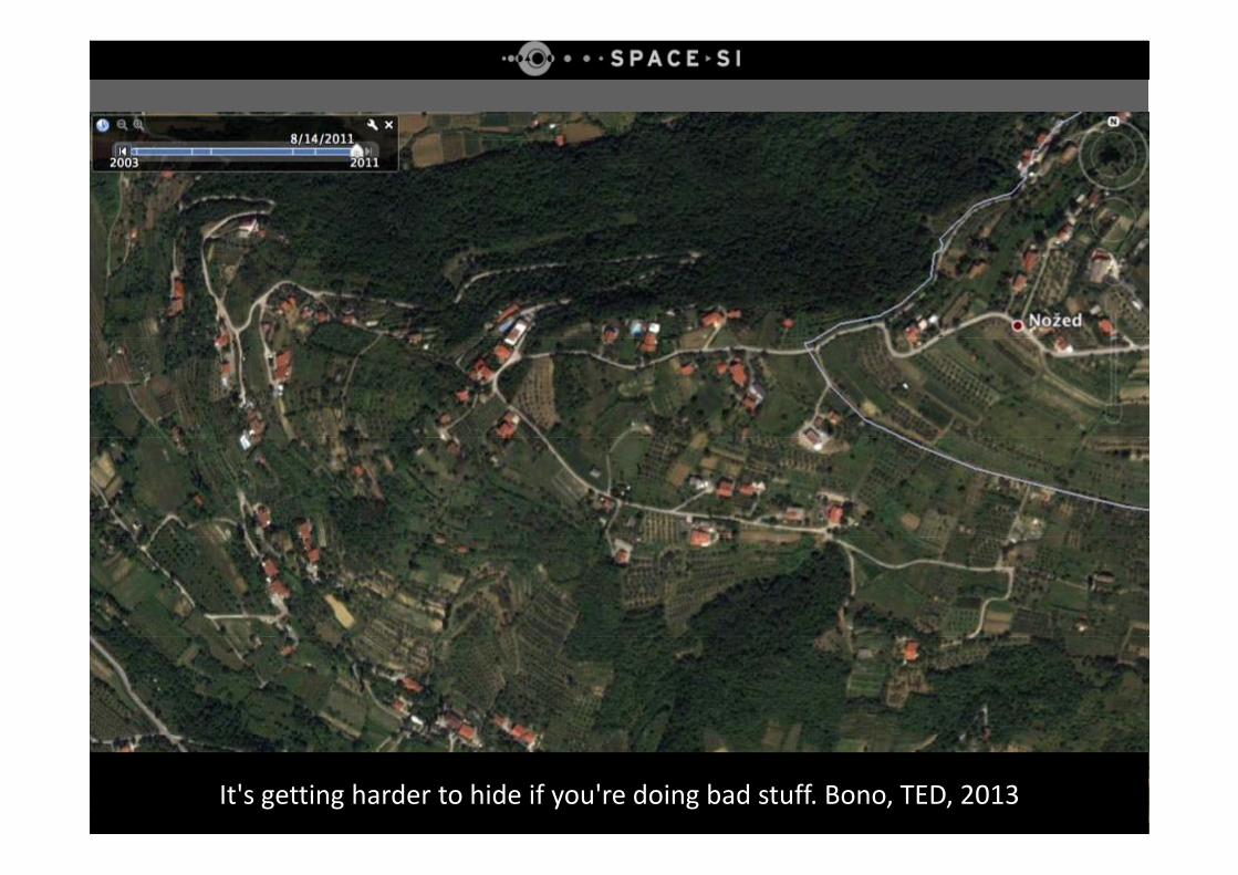
It's getting harder to hide if you're doing bad stuff. Bono, TED, 2013
OverviewOverview
• Motivation
• General facts about Space‐SI processing chain
• Details about individual modules of prototype Space‐SI processing chain – current status
• Future plans
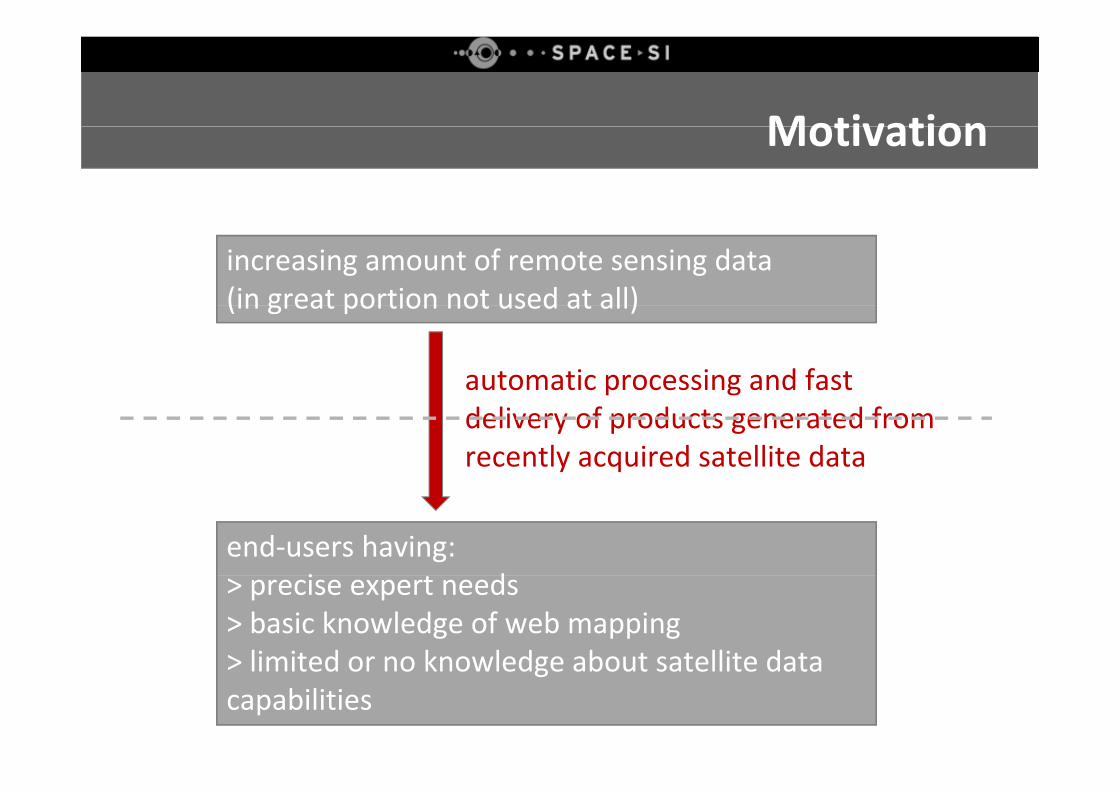
MotivationMotivation
increasing amount of remote sensing data(in great portion not used at all)(in great portion not used at all)
automatic processing and fast delivery of products generated from recently acquired satellite data
end‐users having:i d> precise expert needs
> basic knowledge of web mapping> limited or no knowledge about satellite data> limited or no knowledge about satellite data capabilities
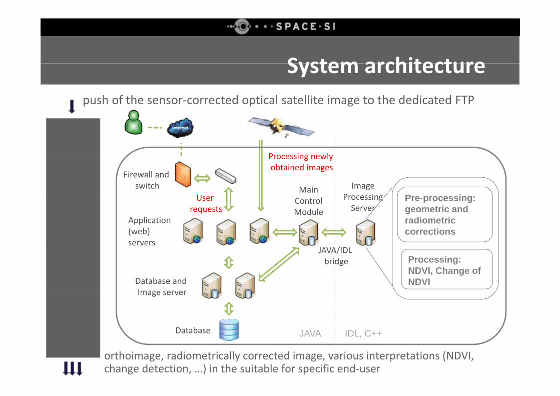
System architectureSystem architecturepush of the sensor‐corrected optical satellite image to the dedicated FTP
i l
Pre-processing:Image
Processing
Firewall andswitch
User
Processing newly obtained images
Main C l Pre-processing:
geometric and radiometric corrections
Application(web) servers
Processing Server
User requests
Control Module
Processing: NDVI, Change ofNDVIDatabase and
serversJAVA/IDL bridge
Image server
Database JAVA IDL C++Database JAVA IDL, C++
orthoimage, radiometrically corrected image, various interpretations (NDVI, change detection, …) in the suitable for specific end‐user
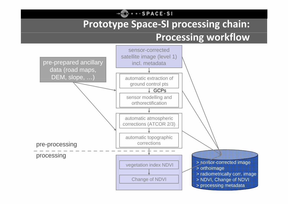
Prototype Space‐SI processing chain: Processing workflow
sensor-corrected satellite image (level 1)
pre-prepared ancillary data (road maps, DEM, slope, …)
satellite image (level 1) incl. metadata
automatic extraction ofDEM, slope, …)automatic geometric
correctionssensor modelling and
th tifi ti
automatic extraction of ground control pts
GCPs
automatic radiometric
orthorectification
automatic atmosphericcorrections (ATCOR 2/3)automatic radiometric
corrections
pre-processingautomatic topographic
corrections
corrections (ATCOR 2/3)
generation of > sensor-corrected image> orthoimage
processingvegetation index NDVI
products > radiometrically corr. image> NDVI, Change of NDVI> processing metadata
Change of NDVI
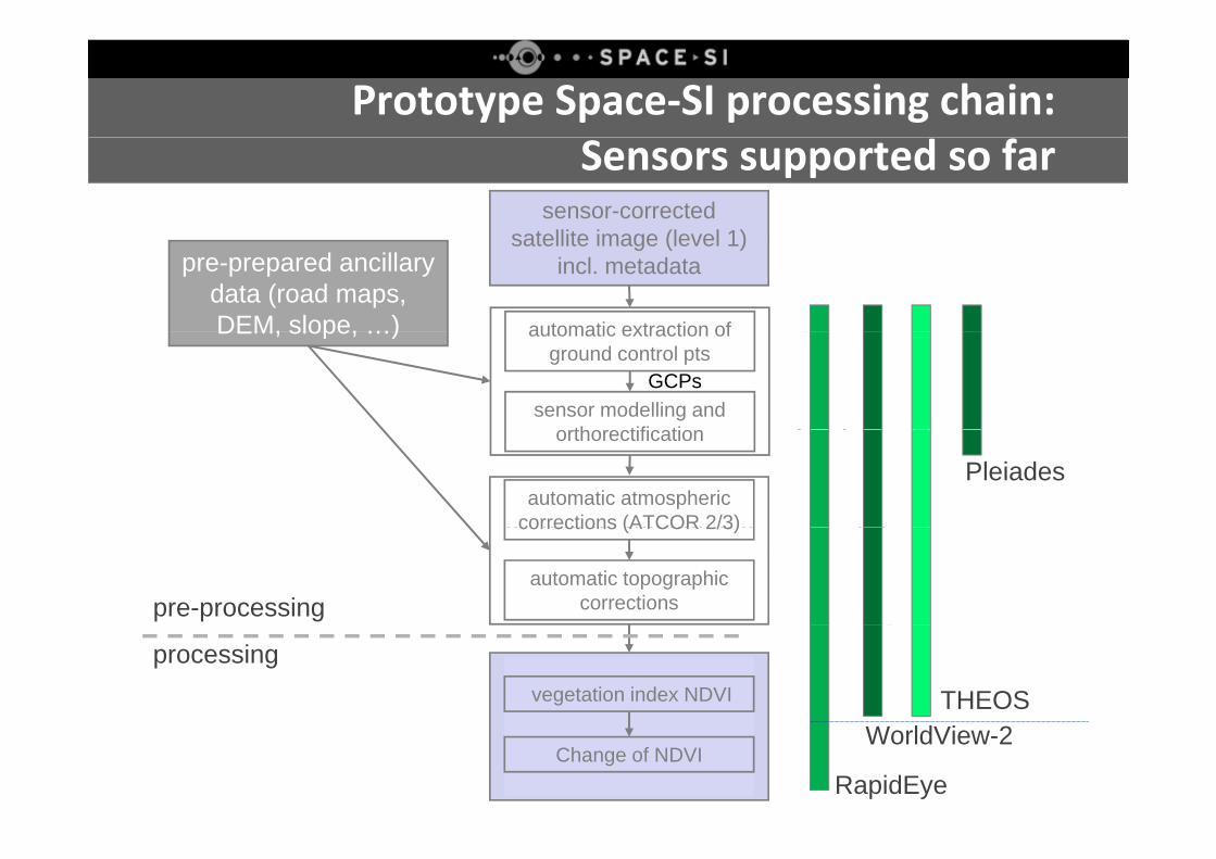
Prototype Space‐SI processing chain:Sensors supported so far
sensor-corrected satellite image (level 1)
pre-prepared ancillary data (road maps, DEM, slope, …)
satellite image (level 1) incl. metadata
automatic extraction ofDEM, slope, …)automatic geometric
correctionssensor modelling and
th tifi ti
automatic extraction of ground control pts
GCPs
automatic radiometric
orthorectification
automatic atmosphericcorrections (ATCOR 2/3)
Pleiades
automatic radiometriccorrections
pre-processingautomatic topographic
corrections
corrections (ATCOR 2/3)
> sensor-corrected image> orthoimagegeneration of
processingvegetation index NDVI THEOS
> radiometrically corr. image> NDVI, Change of NDVI> processing metadata
productsChange of NDVI
RapidEye
WorldView-2
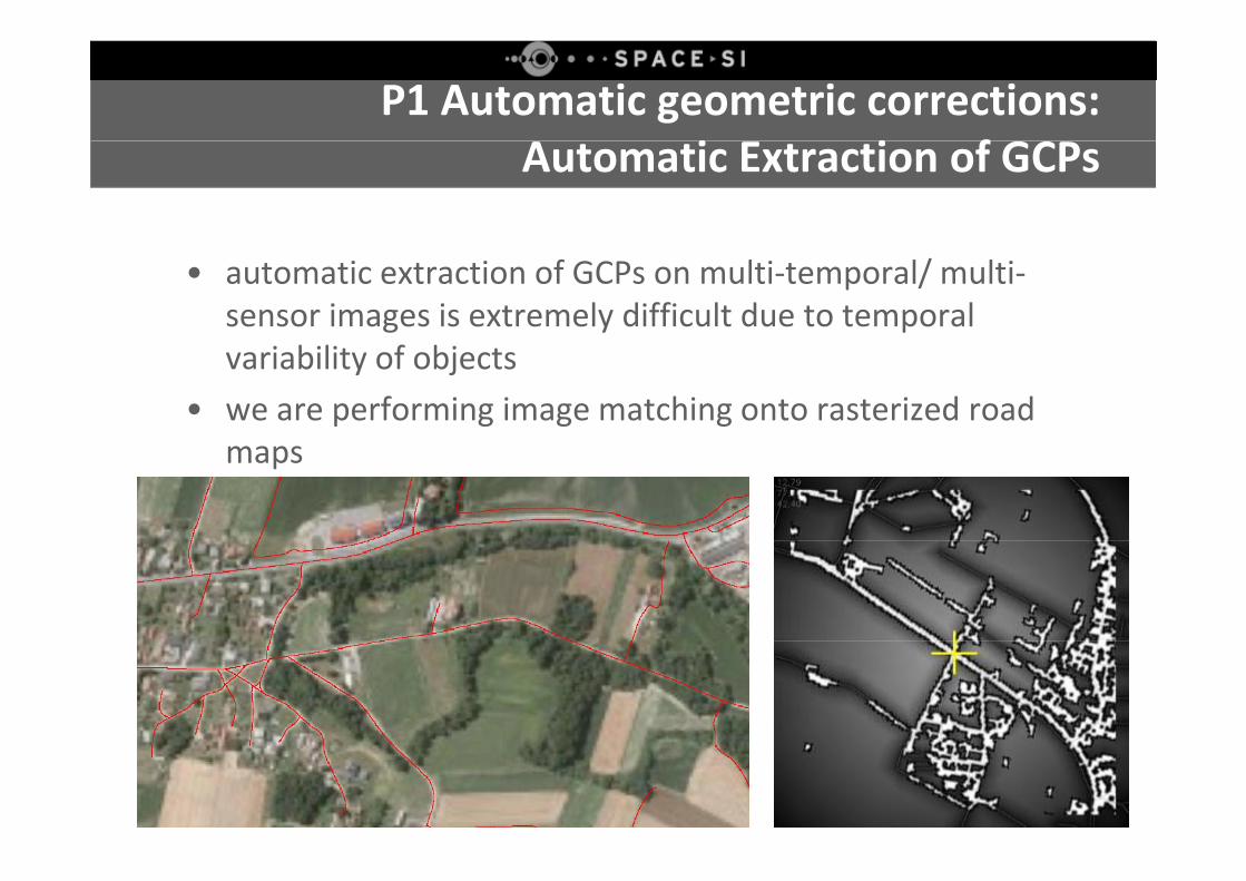
P1 Automatic geometric corrections: i i fAutomatic Extraction of GCPs
• automatic extraction of GCPs on multi‐temporal/ multi‐sensor images is extremely difficult due to temporal variability of objects
• we are performing image matching onto rasterized road maps
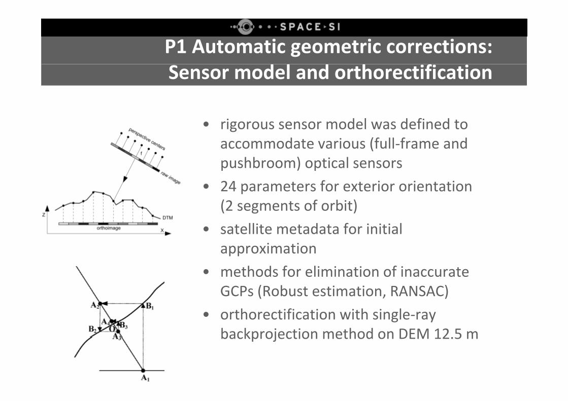
P1 Automatic geometric corrections: Sensor model and orthorectification
• rigorous sensor model was defined to accommodate various (full‐frame and pushbroom) optical sensors
• 24 parameters for exterior orientation (2 f bi )(2 segments of orbit)
• satellite metadata for initial approximationapproximation
• methods for elimination of inaccurate GCPs (Robust estimation RANSAC)GCPs (Robust estimation, RANSAC)
• orthorectification with single‐ray backprojection method on DEM 12.5 mbackprojection method on DEM 12.5 m
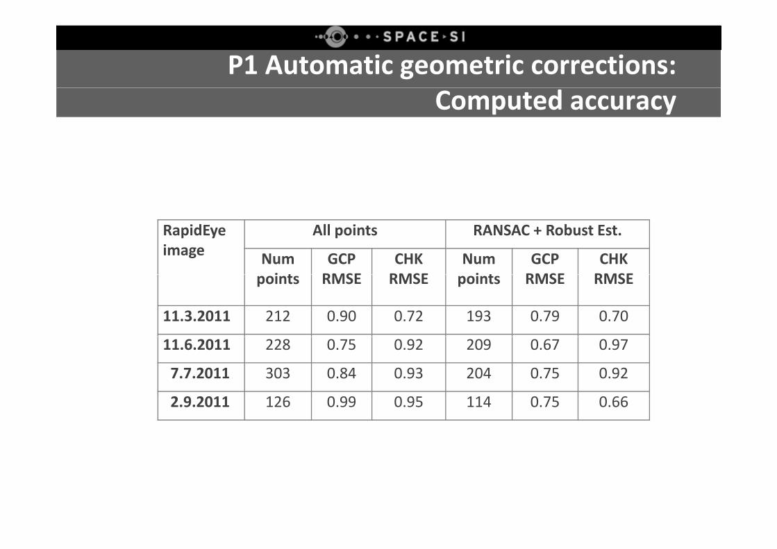
P1 Automatic geometric corrections: Computed accuracy
RapidEyeimage
All points RANSAC + Robust Est.
Numi t
GCP RMSE
CHK RMSE
Numi t
GCP RMSE
CHK RMSEpoints RMSE RMSE points RMSE RMSE
11.3.2011 212 0.90 0.72 193 0.79 0.70
11.6.2011 228 0.75 0.92 209 0.67 0.97
7.7.2011 303 0.84 0.93 204 0.75 0.92
2 9 2011 126 0 99 0 95 114 0 75 0 662.9.2011 126 0.99 0.95 114 0.75 0.66
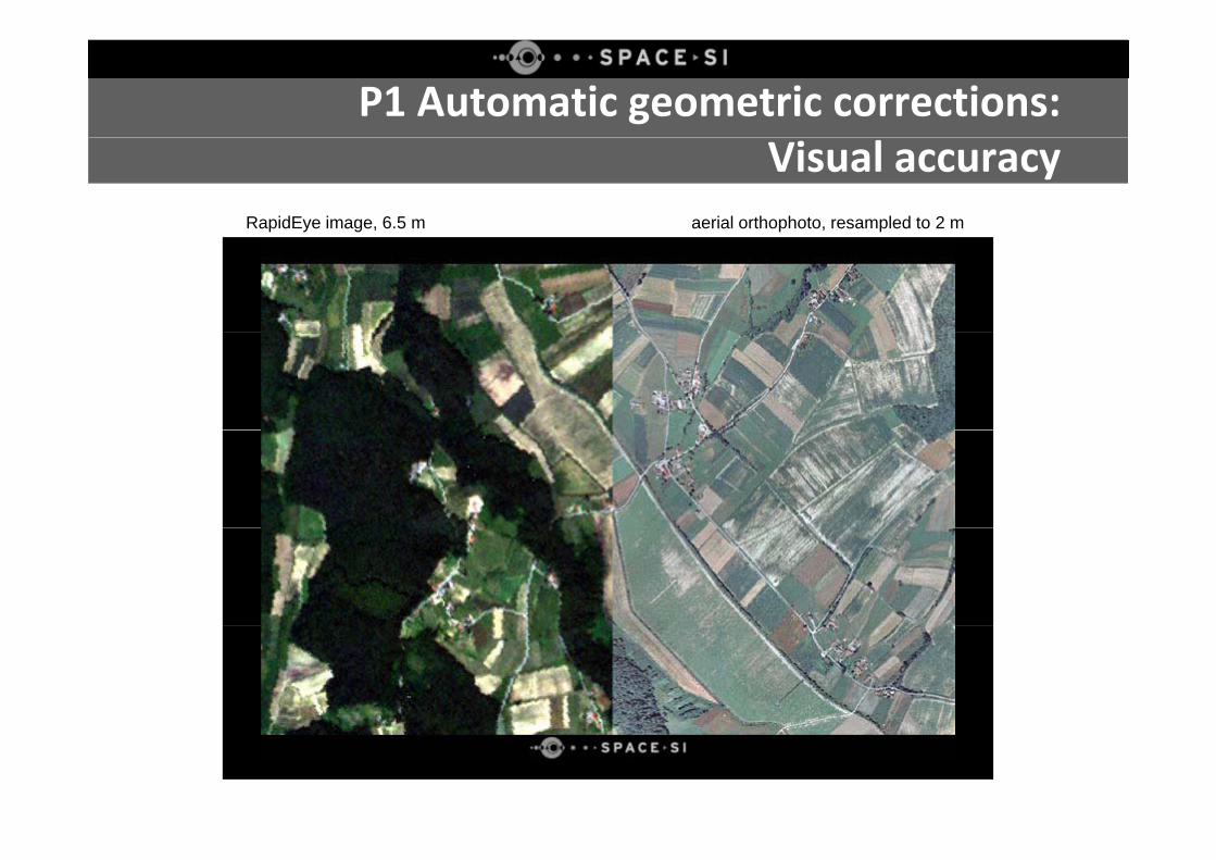
P1 Automatic geometric corrections: Visual accuracy
RapidEye image, 6.5 m aerial orthophoto, resampled to 2 m
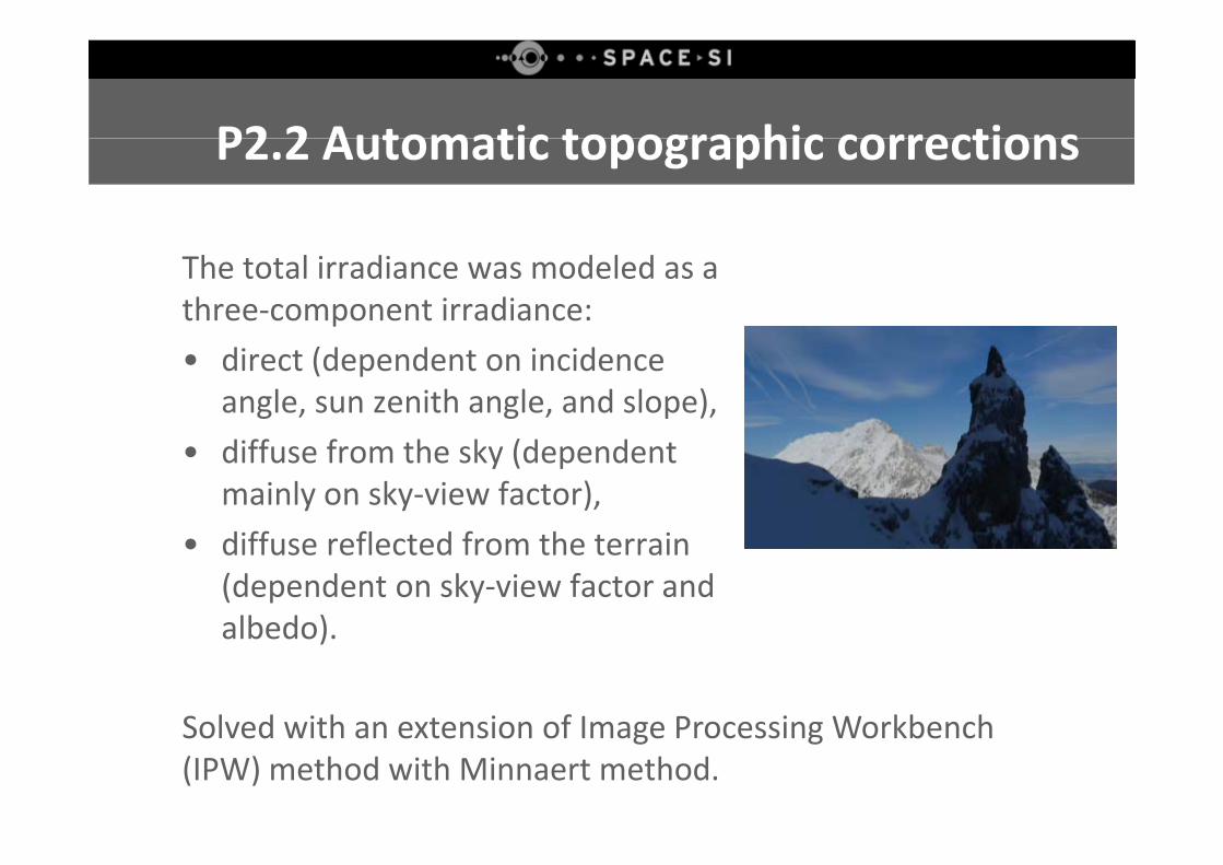
P2 2 Automatic topographic correctionsP2.2 Automatic topographic corrections
The total irradiance was modeled as a three‐component irradiance: • direct (dependent on incidence
angle, sun zenith angle, and slope), • diffuse from the sky (dependent
mainly on sky‐view factor), • diffuse reflected from the terrain
(dependent on sky‐view factor and albedo)albedo).
Solved with an extension of Image Processing WorkbenchSolved with an extension of Image Processing Workbench (IPW) method with Minnaert method.
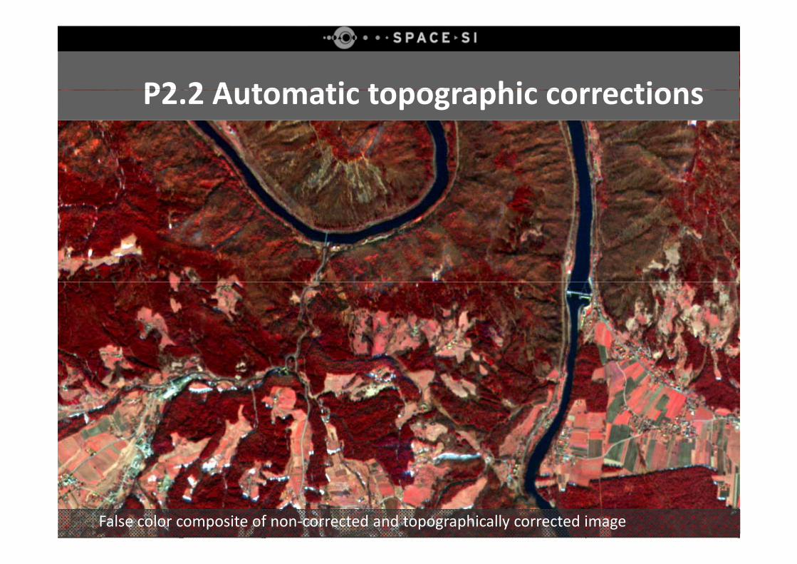
P2 2 Topographic corrections resultsP2 2 Automatic topographic correctionsP2.2 Topographic corrections ‐ resultsP2.2 Automatic topographic corrections
False color composite of non‐corrected and topographically corrected image
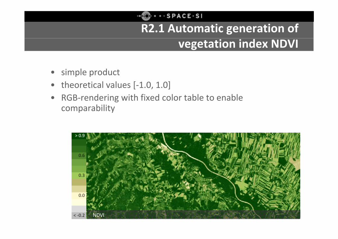
R2.1 Automatic generation ofvegetation index NDVI
• simple product• theoretical values [‐1.0, 1.0] • RGB‐rendering with fixed color table to enable
comparability
NDVI
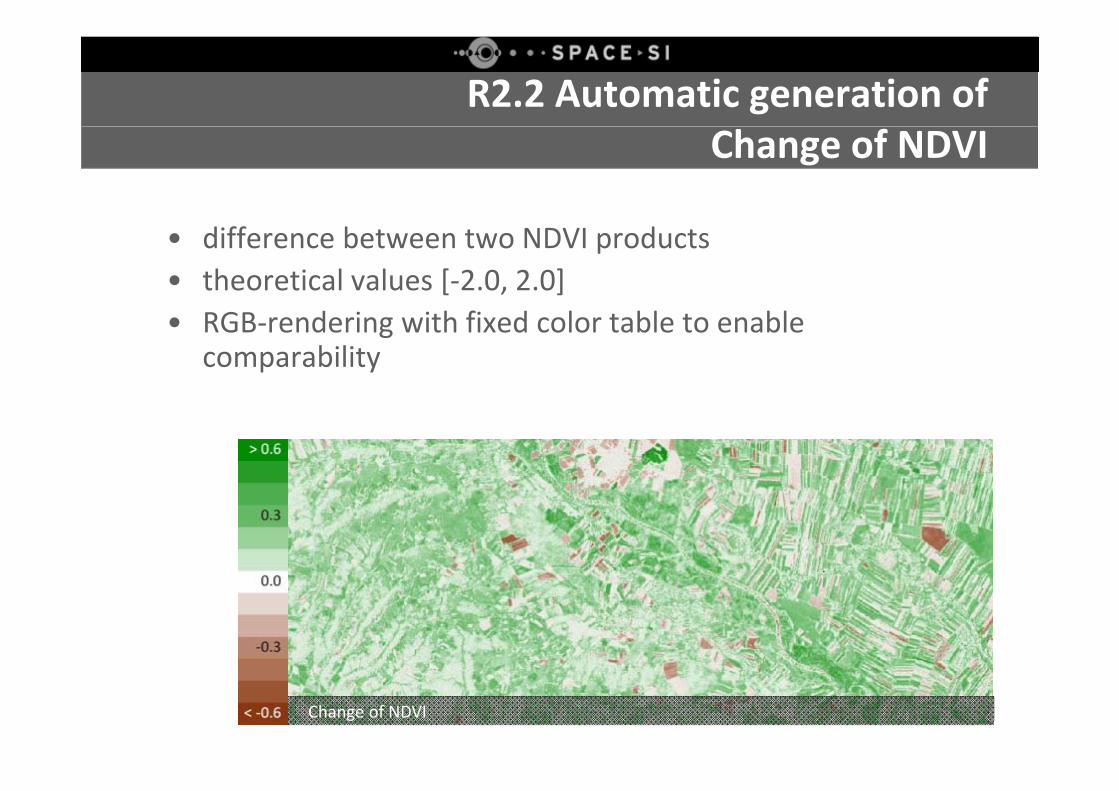
R2.2 Automatic generation ofChange of NDVI
• difference between two NDVI products• theoretical values [‐2.0, 2.0] • RGB‐rendering with fixed color table to enable
comparability
Change of NDVI
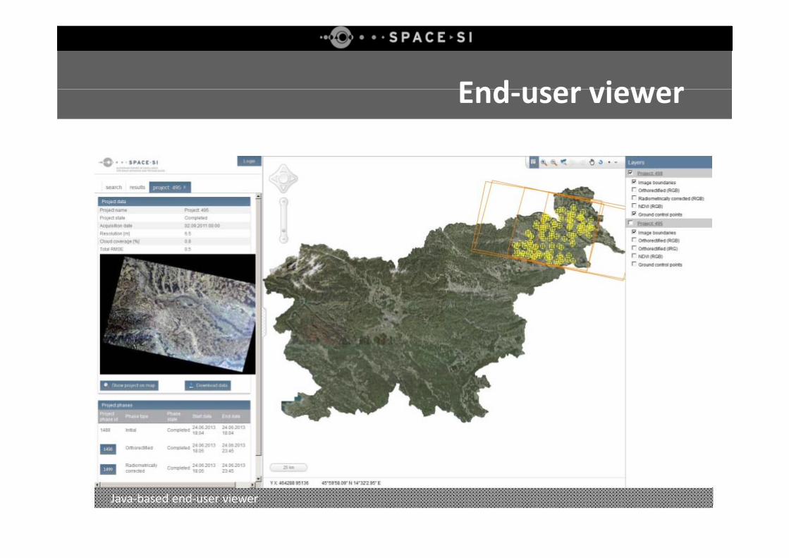
End user viewerEnd‐user viewer
Java‐based end‐user viewer
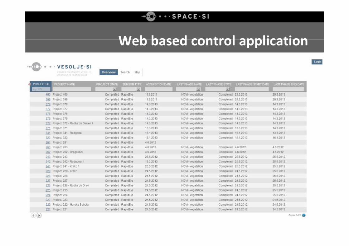
Web based control applicationWeb based control application
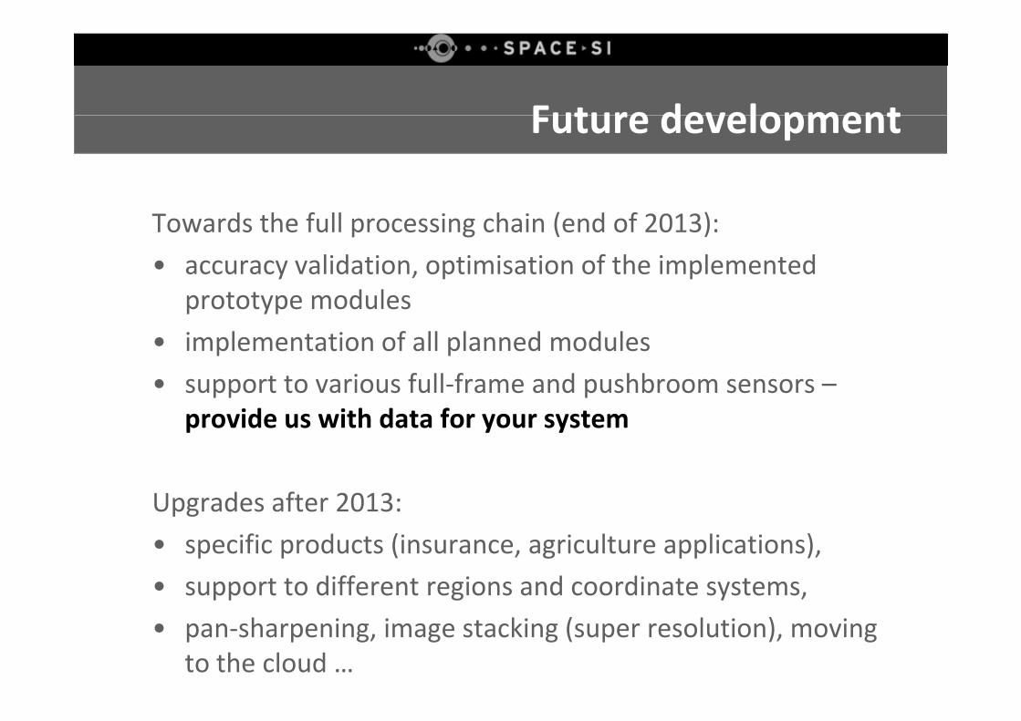
Future developmentFuture development
Towards the full processing chain (end of 2013):• accuracy validation, optimisation of the implemented y p p
prototype modules• implementation of all planned modules• support to various full‐frame and pushbroom sensors –
provide us with data for your system
Upgrades after 2013: • specific products (insurance, agriculture applications), • support to different regions and coordinate systems, • pan‐sharpening, image stacking (super resolution), moving
to the cloud …
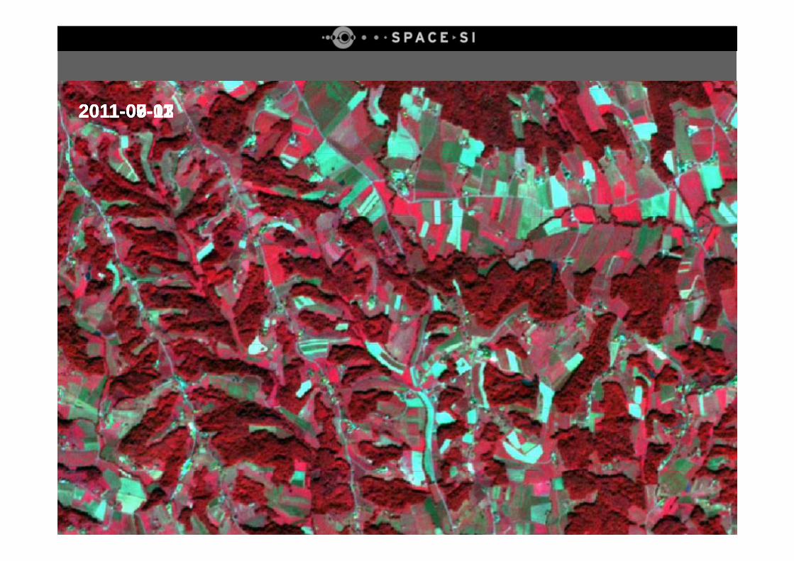
2011-05-122011-06-112011-09-132011-07-07
SummarySummary
• Fully automatic processing chain is a dream for every remote sensing professional
• Implemented prototype is functional
• More effort is put towards the pre‐processing steps than to• More effort is put towards the pre processing steps than to the processing/interpretation steps
• Finetuning and upgrades• Finetuning and upgrades
"A journey of a thousand miles begins with a single step." – Confucius

ContactsContacts
E‐mail: [email protected]
Web: www.space.si
AcknoledgementsAcknoledgements
SPACE‐SI is an operation partly financed by the European Union, European Regional Development Fund, and Republic of Slovenia, Ministry of Education, Science, Culture and Sport.
Special thanks goes to UNISEC who has kindly provided support for travel and accommodationand accommodation.