Embed Size (px)
Citation preview
8/3/2019 GIS Programming
http://slidepdf.com/reader/full/gis-programming 1/28
GIS ProgrammingGIS Programming
Why Do We Want to Program GIS?Why Do We Want to Program GIS?
AML AML ± ± ARC Macro Language ARC Macro Language
ArcObject, VBA, COM and Custom Interfaces ArcObject, VBA, COM and Custom Interfaces
8/3/2019 GIS Programming
http://slidepdf.com/reader/full/gis-programming 2/28
Why Do We Want to Program GISWhy Do We Want to Program GIS
Automate repetitive tasks
To present a custom interface for users
Document work Maintain Consistency
8/3/2019 GIS Programming
http://slidepdf.com/reader/full/gis-programming 3/28
AML AML ± ± ARC Macro Language ARC Macro Language
Most often used for scripting repetitive tasks. It
is possible to create a custom interface but this
is now easier with ArcObjects.
It is the command line scripting environment
It is an interpreted language that can be very
slow. Looping is exceptionally slow. Slow for a
computer is still much faster than I can type.
8/3/2019 GIS Programming
http://slidepdf.com/reader/full/gis-programming 4/28
AML Directive AML Directive
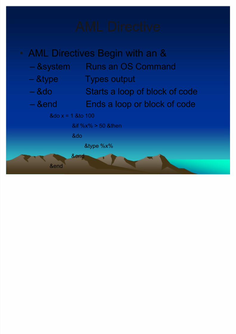
AML Directives Begin with an &
± &system Runs an OS Command
± &type Types output ± &do Starts a loop of block of code
± &end Ends a loop or block of code
&do x = 1 &to 100
&if %x% > 50 &then
&do
&type %x%
&end
&end
8/3/2019 GIS Programming
http://slidepdf.com/reader/full/gis-programming 5/28
AML Functions AML Functions
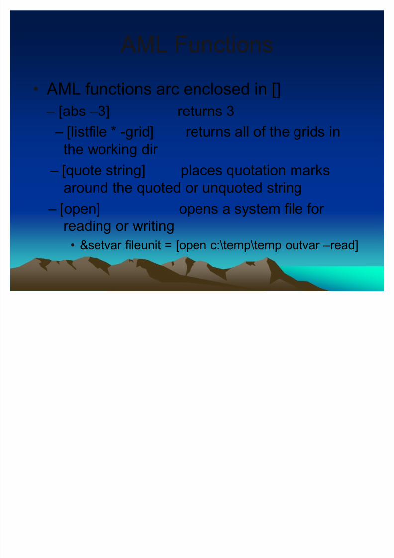
AML functions arc enclosed in []
± [abs ±3] returns 3
± [listfile * -grid] returns all of the grids inthe working dir
± [quote string] places quotation marks
around the quoted or unquoted string
± [open] opens a system file for reading or writing
&setvar fileunit = [open c:\temp\temp outvar ±read]
8/3/2019 GIS Programming
http://slidepdf.com/reader/full/gis-programming 6/28
AML Variables AML Variables
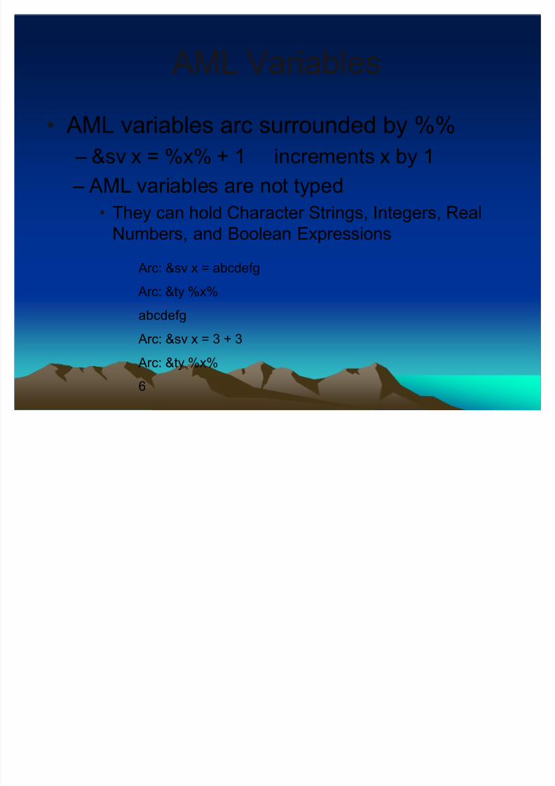
AML variables arc surrounded by %%
± &sv x = %x% + 1 increments x by 1
± AML variables are not typed They can hold Character Strings, Integers, Real
Numbers, and Boolean Expressions
Arc: &sv x = abcdefg
Arc: &ty %x%
abcdefg
Arc: &sv x = 3 + 3
Arc: &ty %x%
6

8/3/2019 GIS Programming
http://slidepdf.com/reader/full/gis-programming 7/28
Watch FilesWatch Files
&WATCH <watch_file> {&APPEND} {&COMMANDS} {&COORDINATES}
Watch files capture the system input an output to a file
Useful for documenting procedures and creating aml
Arc: &watch test
Arc: lc
Workspace C:\GIS_CLASS\GIS_PROGRAMMING does
not exist
Arc: &watch off
Arc: &sys more test
Arc: |> lc <|
Workspace C:\GIS_CLASS\GIS_PROGRAMMING does
not exist
Arc: |> &watch off <|
Arc:
8/3/2019 GIS Programming
http://slidepdf.com/reader/full/gis-programming 8/28
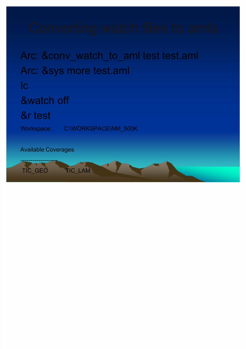
Converting watch files to amlsConverting watch files to amls
Arc: &conv_watch_to_aml test test.aml
Arc: &sys more test.aml
lc&watch off
&r test
Workspace: C:\WORKSPACE\NM_500K
Available Coverages
-------------------
TIC_GEO TIC_LAM
8/3/2019 GIS Programming
http://slidepdf.com/reader/full/gis-programming 9/28
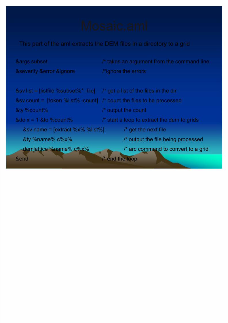
Mosaic.amlMosaic.aml
&args subset /* takes an argument from the command line
&severity &error &ignore /*ignore the errors
&sv list = [listfile %subset%* -file] /* get a list of the files in the dir
&sv count = [token %list% -count] /* count the files to be processed
&ty %count% /* output the count
&do x = 1 &to %count% /* start a loop to extract the dem to grids
&sv name = [extract %x% %list%] /* get the next file
&ty %name% c%x% /* output the file being processed
demlattice %name% c%x% /* arc command to convert to a grid
&end /* end the loop
This part of the aml extracts the DEM files in a directory to a grid
8/3/2019 GIS Programming
http://slidepdf.com/reader/full/gis-programming 10/28
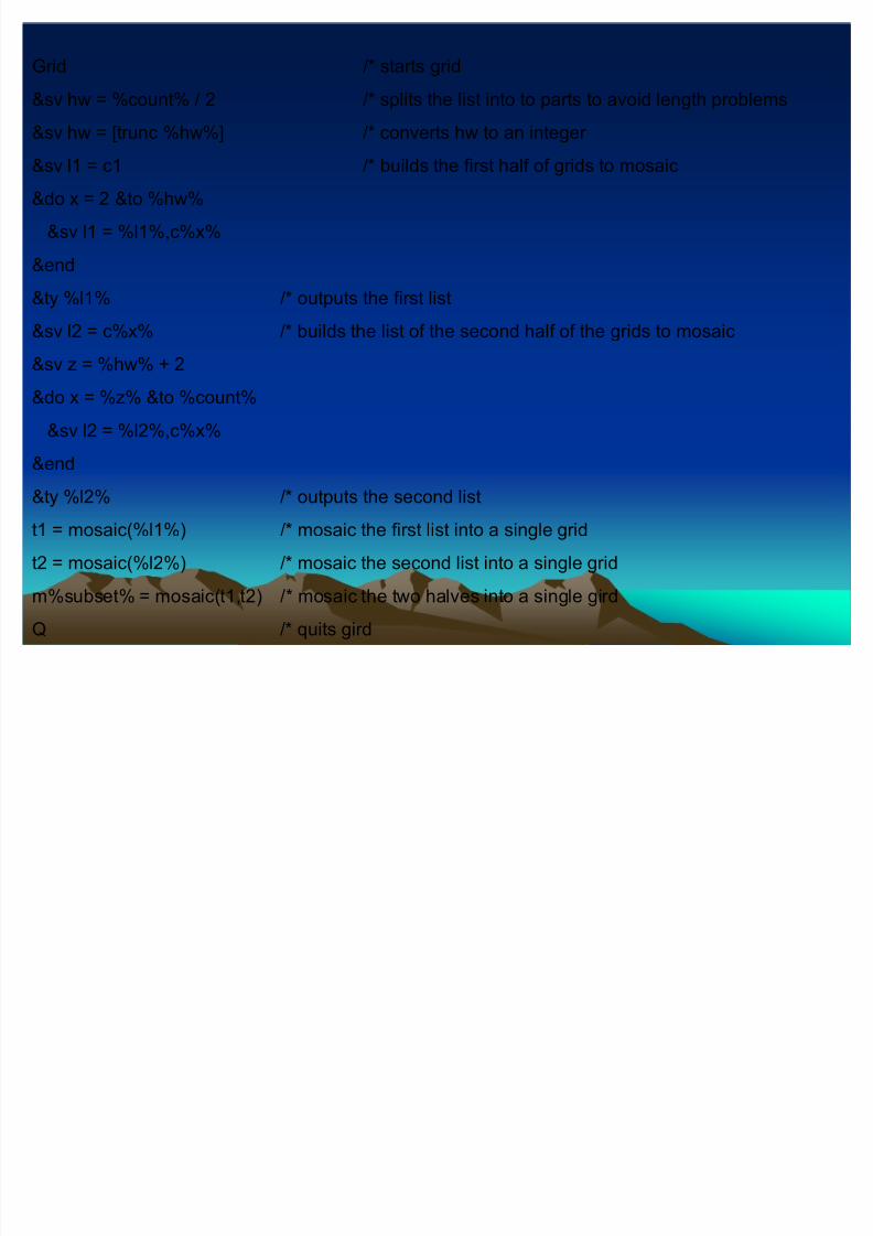
Grid /* starts grid
&sv hw = %count% / 2 /* splits the list into to parts to avoid length problems
&sv hw = [trunc %hw%] /* converts hw to an integer
&sv l1 = c1 /* builds the first half of grids to mosaic
&do x = 2 &to %hw%
&sv l1 = %l1%,c%x%
&end
&ty %l1% /* outputs the first list&sv l2 = c%x% /* builds the list of the second half of the grids to mosaic
&sv z = %hw% + 2
&do x = %z% &to %count%
&sv l2 = %l2%,c%x%
&end
&ty %l2% /* outputs the second list
t1 = mosaic(%l1%) /* mosaic the first list into a single grid
t2 = mosaic(%l2%) /* mosaic the second list into a single grid
m%subset% = mosaic(t1,t2) /* mosaic the two halves into a single gird
Q /* quits gird
8/3/2019 GIS Programming
http://slidepdf.com/reader/full/gis-programming 11/28
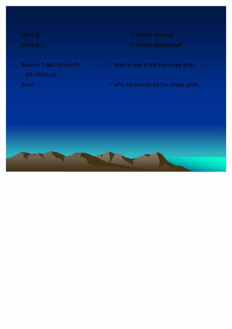
kill t1 all /* kill the first half
kill t2 all /* kill the second half
&do x = 1 &to %count% /* start a loop to kill the single girds
kill c%x% all
&end /* end the loop to kill the single grids
8/3/2019 GIS Programming
http://slidepdf.com/reader/full/gis-programming 12/28
Customize the InterfaceCustomize the Interface
Click tools
Select customize
Commands tab
Select the category Pan/Zoom
Drag the tool to a toolbar
These tools will be save in the normal.mxt andwill be present when ArcMap is restarted
To remove a tool drag it off a toolbar
You can make you own toolbar
8/3/2019 GIS Programming
http://slidepdf.com/reader/full/gis-programming 13/28
ArcObjects, VBA, and COM ArcObjects, VBA, and COM
ArcObjects is a collection of COM objectsthat can be used to create customprograms and VBA macros.
ArcGIS Desktop is made from the sameCOM objects.
VBA ± Visual Basic for Applications COM ± Component Object Model is a
Microsoft programming standard
8/3/2019 GIS Programming
http://slidepdf.com/reader/full/gis-programming 14/28
Custom InterfacesCustom Interfaces
You can add and remove tools from
toolbars and create your own toolbars.
You can create custom applications using
the components(ArcObjects) from ArcGIS.
8/3/2019 GIS Programming
http://slidepdf.com/reader/full/gis-programming 15/28
ArcObjects ArcObjects
Introduction to ArcObjects
ArcObjects is the development platform for the ArcGISfamily of applications such as ArcMap, ArcCatalog, andArcScene. The ArcObjects software components expose
the full range of functionality available in ArcInfo andArcView ® to software developers.
ArcObjects is a framework that lets you create domain-specific components from other components. TheArcObjects components collaborate to serve every data
management and map presentation function common tomost GIS applications. ArcObjects provides aninfrastructure for application customization that lets youconcentrate on serving the specific needs of your clients.
From arcobjectsonilne.esri.com
8/3/2019 GIS Programming
http://slidepdf.com/reader/full/gis-programming 16/28
ObjectObject--oriented programming 101oriented programming 101
There are 3 principales that all OOP
languages share.
Encapsulation Inheritance
Polymorphism

8/3/2019 GIS Programming
http://slidepdf.com/reader/full/gis-programming 17/28
InheritanceInheritance
Classes can inherit properties and method from the class they are derivedfrom
If you have a class called pet with the fallowing properties and methods
± Name
± Eat
You can declare a new class that is a type of pet. This class has aditionalproperties.
± DOG:pet
Bark
Eat
You can use the dog object to do the fallowing
± Dim mydog as dog
± Set mydog = new dog
± MYDog.bark; mydog.eat; mydog.name = µREX
± myDOG.EAT
8/3/2019 GIS Programming
http://slidepdf.com/reader/full/gis-programming 18/28
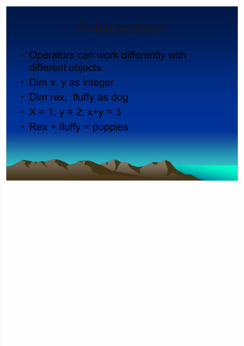
PolymorphismPolymorphism
Operators can work differently with
different objects
Dim x, y as integer Dim rex, fluffy as dog
X = 1; y = 2; x+y = 3
Rex + fluffy = puppies
8/3/2019 GIS Programming
http://slidepdf.com/reader/full/gis-programming 19/28
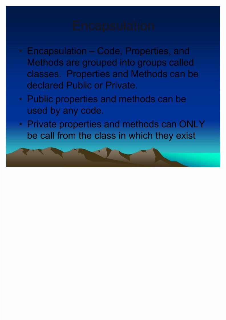
EncapsulationEncapsulation
Encapsulation ± Code, Properties, and
Methods are grouped into groups called
classes. Properties and Methods can be
declared Public or Private.
Public properties and methods can be
used by any code.
Private properties and methods can ONLY
be call from the class in which they exist
8/3/2019 GIS Programming
http://slidepdf.com/reader/full/gis-programming 20/28
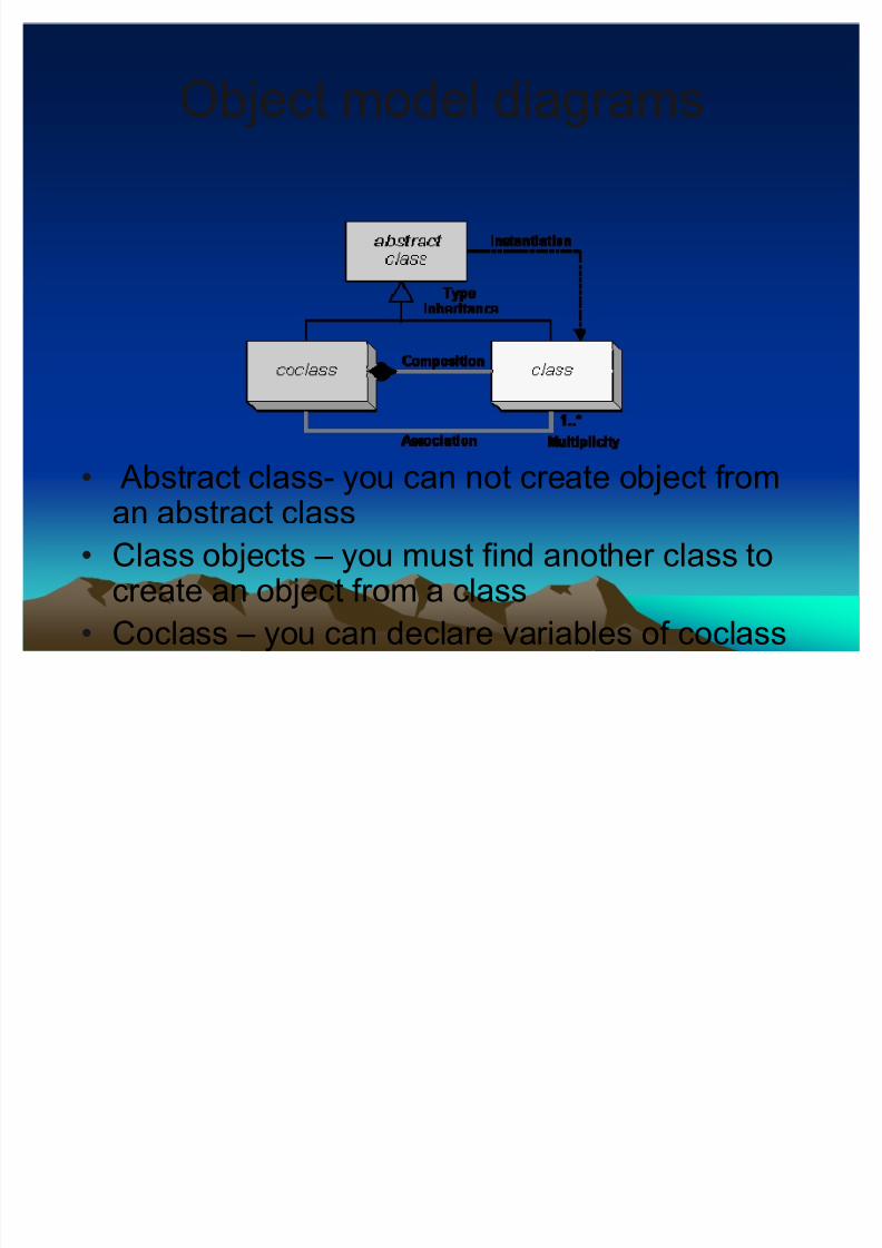
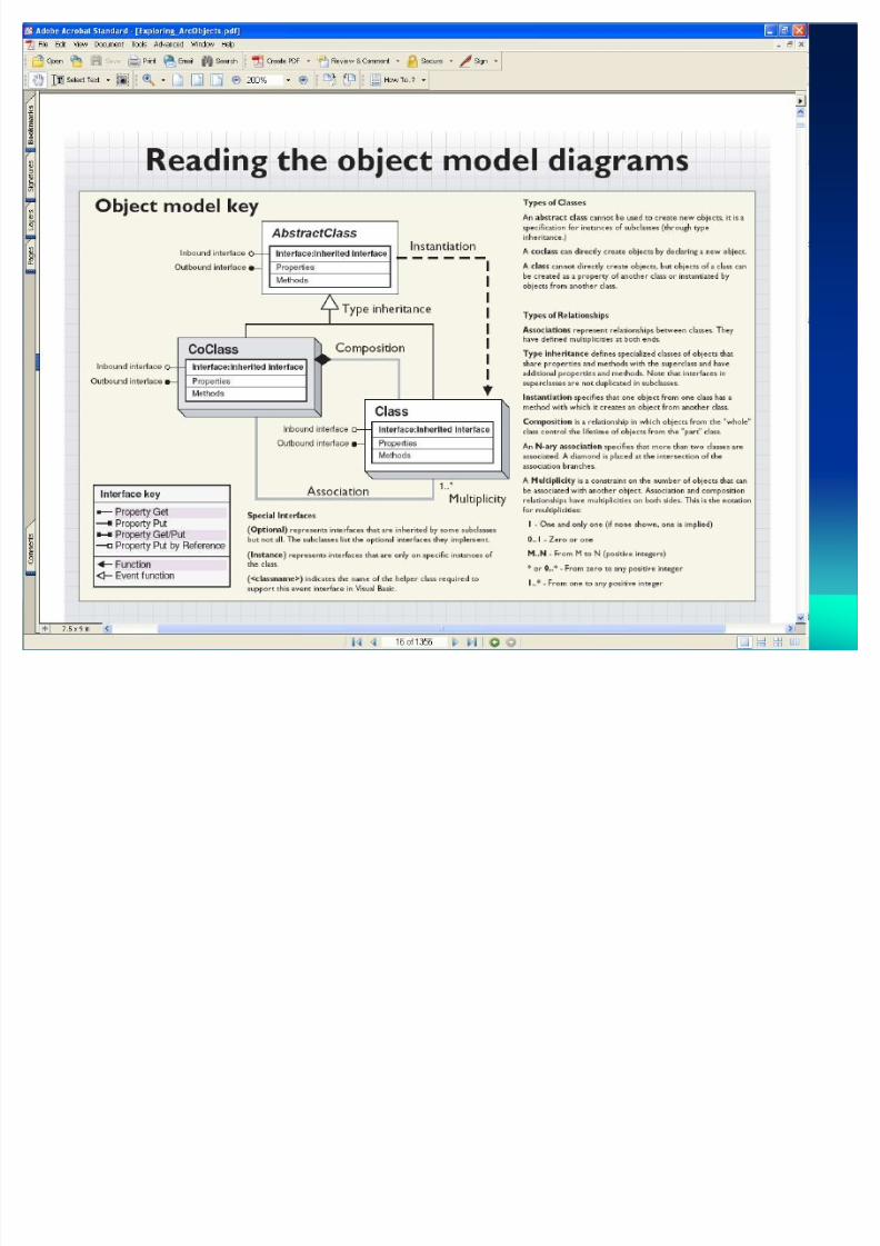
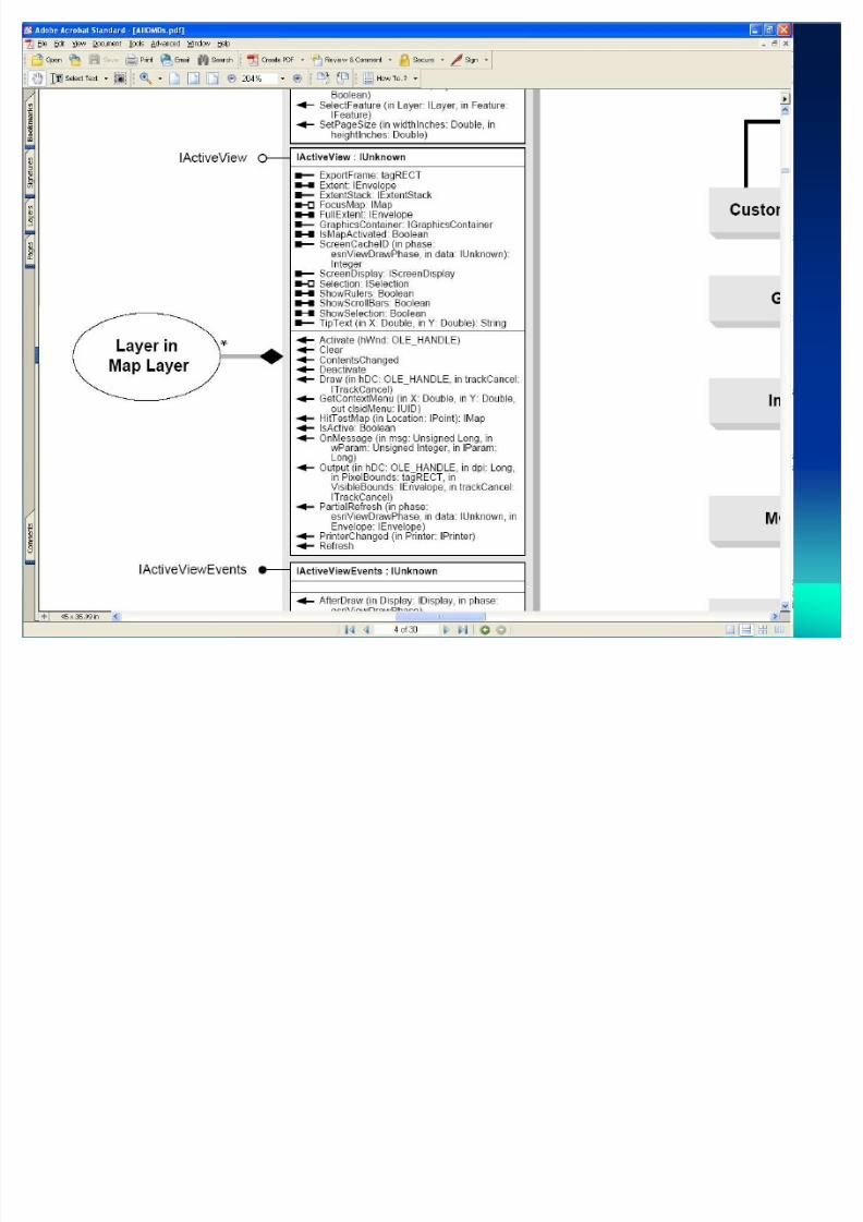
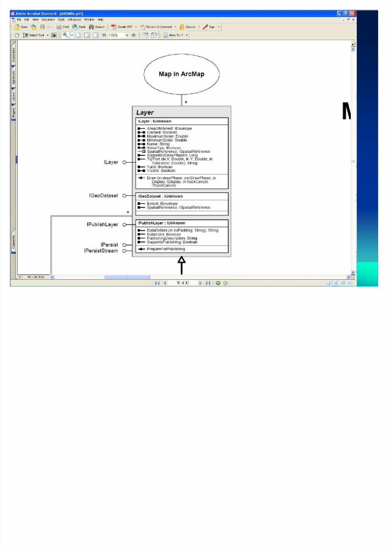
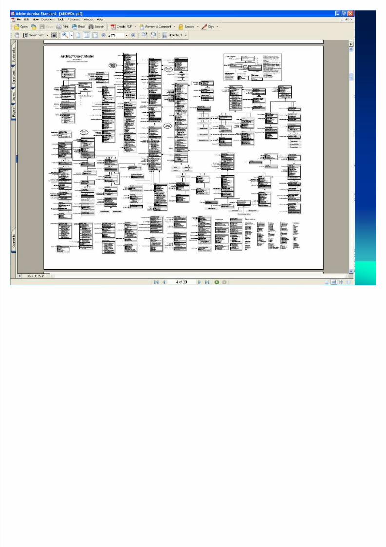
Object model diagramsObject model diagrams
Abstract class- you can not create object froman abstract class
Class objects ± you must find another class tocreate an object from a class
Coclass ± you can declare variables of coclass
8/3/2019 GIS Programming
http://slidepdf.com/reader/full/gis-programming 21/28
8/3/2019 GIS Programming
http://slidepdf.com/reader/full/gis-programming 22/28
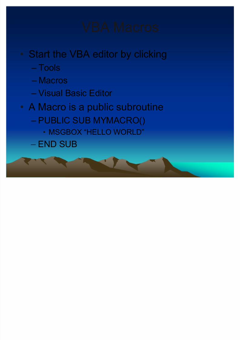
VBA MacrosVBA Macros
Start the VBA editor by clicking
± Tools
± Macros ± Visual Basic Editor
A Macro is a public subroutine
± PUBLIC SUB MYMACRO()
MSGBOX ³HELLO WORLD´
± END SUB
8/3/2019 GIS Programming
http://slidepdf.com/reader/full/gis-programming 23/28
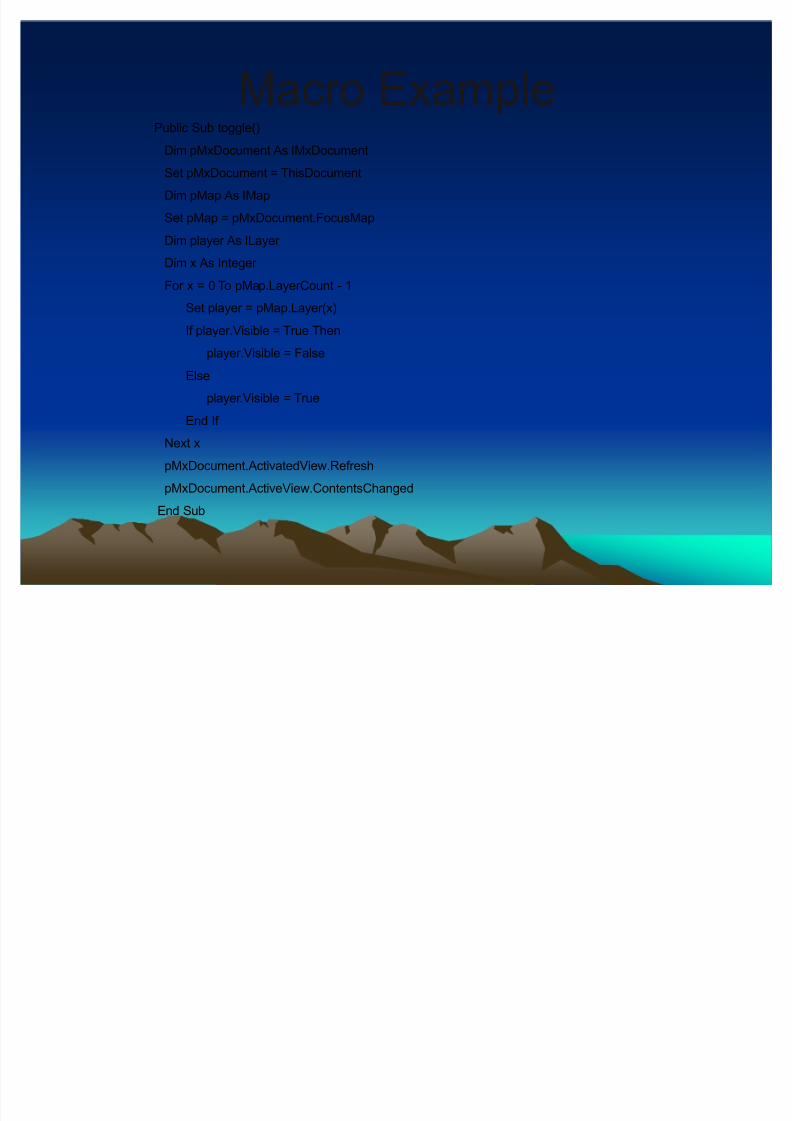
Macro ExampleMacro ExamplePublic Sub toggle()
Dim pMxDocument As IMxDocument
Set pMxDocument = ThisDocument
Dim pMap As IMap
Set pMap = pMxDocument.FocusMap
Dim player As ILayer
Dim x As Integer
For x = 0 To pMap.LayerCount - 1
Set player = pMap.Layer(x)
If player.Visible = True Then
player.Visible = False
Else
player.Visible = True
End If
Next x
pMxDocument.ActivatedView.Refresh
pMxDocument.ActiveView.ContentsChanged
End Sub
8/3/2019 GIS Programming
http://slidepdf.com/reader/full/gis-programming 24/28
8/3/2019 GIS Programming
http://slidepdf.com/reader/full/gis-programming 25/28
8/3/2019 GIS Programming
http://slidepdf.com/reader/full/gis-programming 26/28
8/3/2019 GIS Programming
http://slidepdf.com/reader/full/gis-programming 27/28
8/3/2019 GIS Programming
http://slidepdf.com/reader/full/gis-programming 28/28
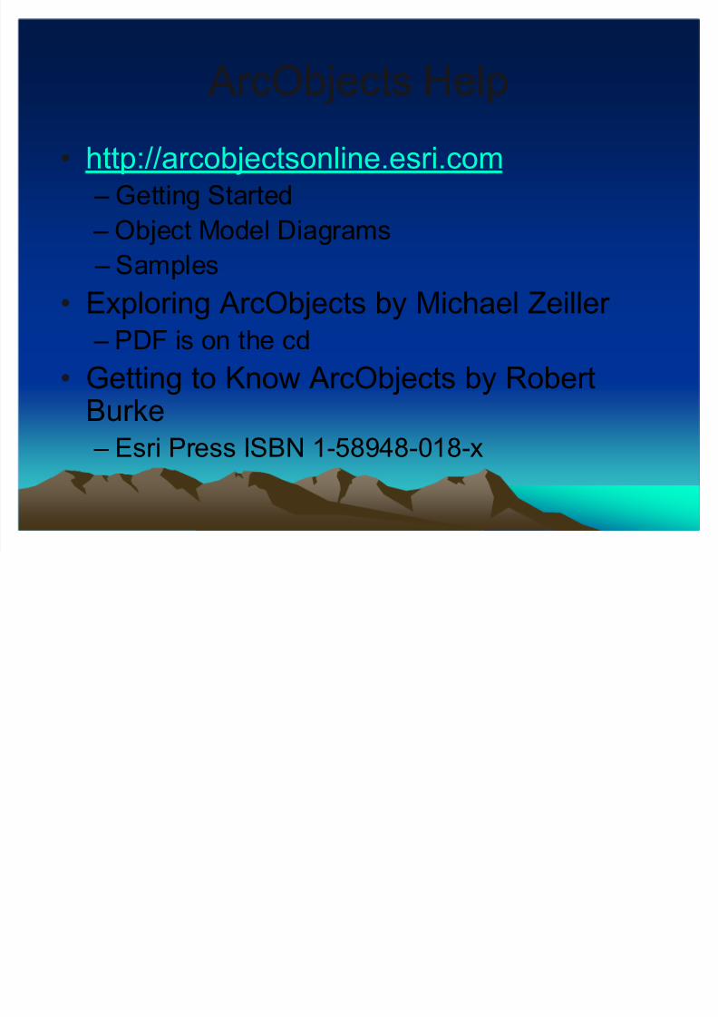
ArcObjects Help ArcObjects Help
http://arcobjectsonline.esri.com
± Getting Started
± Object Model Diagrams
± Samples
Exploring ArcObjects by Michael Zeiller
± PDF is on the cd
Getting to Know ArcObjects by RobertBurke
± Esri Press ISBN 1-58948-018-x


![090601 GIS 예방진단 시스템 예방진단 시스템.pdf · [ 목 차] 1. gis 예방진단시스템의개요 2. gis 예방진단시스템의필요성 3. gis 열화요인 4. 부분방전의종류및원인](https://img.pdfslide.tips/doc/110x75/5b8cea6b09d3f21d638db2c1/090601-gis-pdf-1-gis.jpg)