Embed Size (px)
Citation preview
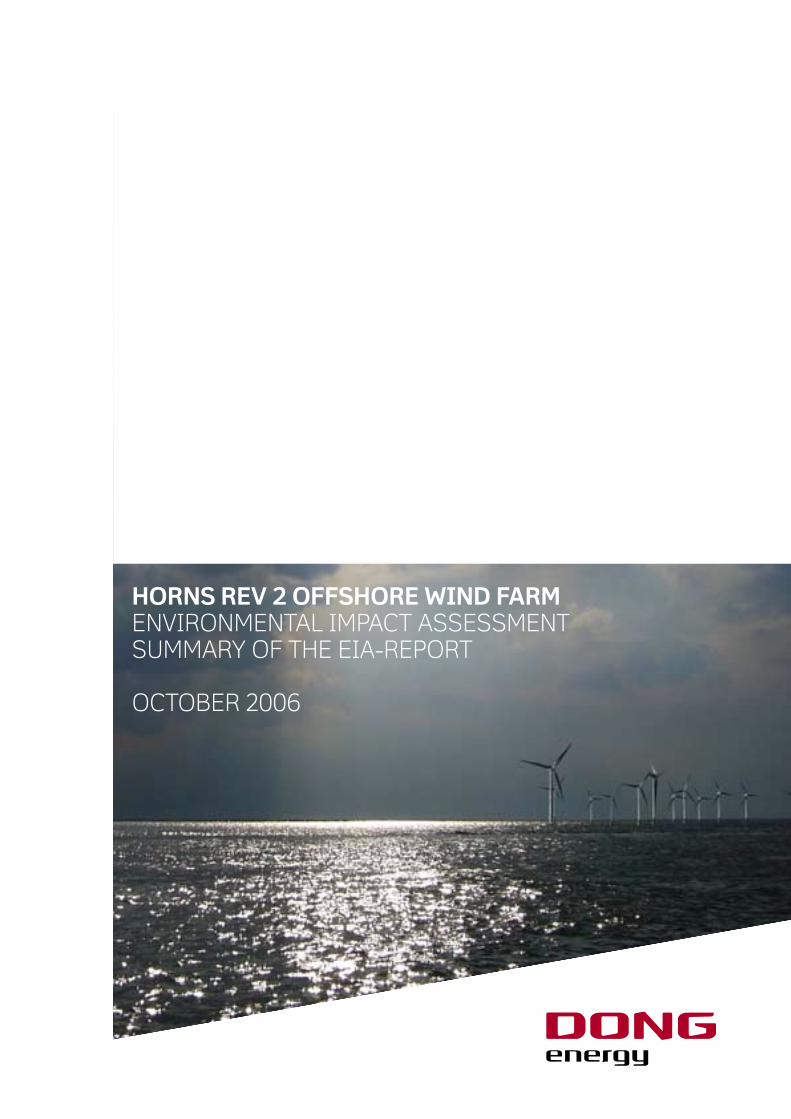
HORNS REV 2 OFFSHORE WIND FARMEnvironmEntal impact assEssmEnt summary of thE Eia-rEport
octobEr 2006

Horns Rev 2 Offshore Wind FarmEnvironmental Impact Assessment Summary of the EIA-reportOctober 2006
Prepared by:
DONG Energy - Renewables
A. C. Meyers Vænge 9
DK-2450 Copenhagen SV
Tel.: +45 4480 6000
Fax.: +45 4480 6010
Homepage: www.dongenergy.com
Cover : Hasløv & Kjærsgaard, Architects and Planners M.A.A.
Charts : © National Survey and Cadastre
Printing : F. Hendriksen Eftf.
Impression : 150
The cover illustration is a model photo
Copying of the material is subject to prior permission from DONG Energy
HORNS REV 2 OFFSHORE WIND FARMENVIRONMENTAL IMPACT ASSESSMENT SUMMARY OF THE EIA-REPORT
October 2006
1 Introduction and background
In the summer of 2002, a broad political agreement was
made between the Danish Government and a number of par-
ties concerning wind energy and energy savings. In continua-
tion of this agreement, another political agreement was made
in the spring of 2004. Among other things this agreement
implied the establishment of two offshore wind farms each of
200 MW. Tenders were to be invited for the two offshore wind
farms to obtain the lowest possible electricity price for the
consumers.
The aim of the agreement was to locate the two wind farms
in areas at Horns Rev and Omø Stålgrunde. Screening of the
areas resulted in the area at Horns Rev being selected for fur-
ther development.
On 2 July 2004, the Danish Energy Authority published an
invitation to tender for construction of an offshore wind farm
at Horns Rev. On 30 June 2005, shortly after the deadline for
submission of tenders, the Danish Energy Authority granted
DONG Energy (former ENERGI E2) the concession of Horns
Rev 2 Offshore Wind Farm.
On 25 August 2005, DONG Energy received permission to
perform preliminary investigations at Horns Rev, and was
thus ready to start work on the EIA.
The EIA for Horns Rev 2 Offshore Wind Farm is based on a
base case layout comprising 95 2.3 MW wind turbines and
three large demonstration wind turbines with a total maxi-
mum power output of 15 MW. Due to the current rapid devel-
opment of wind technology, it cannot be ruled out that the
layout may be amended to comprise fewer but larger wind
turbines. From an environmental point of view, the layout
comprising many small turbines will have the largest environ-
mental impact in terms of number of wind turbines, founda-
tions, cable lengths, etc.
The possibility of an increase in the number of wind turbines
in relation to the draft layout cannot be precluded; such an
increase would nevertheless be marginal. However, the total
area of the wind farm will definitely not exceed 35 km2, includ-
ing the tree demonstration wind turbines.
The EIA comprises the offshore wind farm and the three dem-
onstration wind turbines, including wind farm internal cabling
up to connection of the submarine cable to the off-shore and
an accommodation platform. Conditions in relation to the
off-shore substation and cabling to shore are handled by En-
erginet.dk. Energinet.dk are not obliged to submit an EIA.
However, the offshore substation will be included in the visu-
alisation of the wind farm.
Throughout the planning and performance of the individual
investigations, the knowledge obtained in connection with
the extensive environmental monitoring programme at Horns
Rev Offshore Wind Farm in the North Sea off Blåvands Huk
and Nysted Offshore Wind Farm at Rødsand south of Lolland
has been used. The methods, which were developed and used
in connection with these two demonstration offshore wind
farms, have been considered to the widest possible extent.
This present report is a summary of the EIA for Horns Rev 2
Offshore Wind Farm. The entire EIA may be downloaded from
DONG Energy’s homepage (www.dongenergy.com) and from
the Danish Energy Authority’s homepage (www.ens.dk).
HORNS REV 2 OFFSHORE WIND FARMENVIRONMENTAL IMPACT ASSESSMENT SUMMARY OF THE EIA-REPORT
October 2006
2 HORNS REV 2 OFFSHORE WIND FARM - SUMMARY OF THE EIA-REPORT
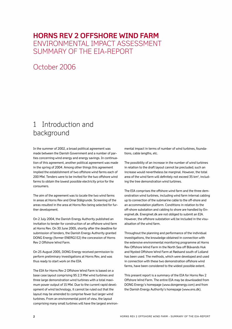
2 Project location and scopeHorns Rev extends from the coast at the westernmost point
of the Danish coast, Blåvands Huk, and approx 40 km to the
west. The reef consists of an inner and an outer part only
separated by the channel “Slugen”.
The base case scenario for the offshore wind farm is located
on the outer reef. The wind turbine closest to shore is loca-
ted approx 30 km west of Blåvands Huk, which is the nearest
coast. The wind farm is thus located on the western part of
the reef and extends towards north from the reef. The area of
the wind farm, including the three demonstration wind tur-
bines will be 35 km2. The shortest distance between Horns
Rev 2 and the existing Horns Rev Offshore Wind Farm is ap-
prox 14 km – see figure 1. The water depth in the area varies
between 9 and 18 metres, and in the greater part of the area
the water depth is between 11 and 14 metres.
The maximum power output of the offshore wind farm will
be 215 MW net in the grid connection point, of which 15 MW
are reserved for demonstration wind turbines, if any. The
wind farm will be able to produce approx 800 million kWh a
year, corresponding to the electricity consumption of approx
200,000 households.
The offshore wind farm is scheduled for commissioning by
late 2009, and according to the time schedule all wind tur-
bines are to be commissioned before 1 October 2009.
The 95 wind turbines assumed in the base case layout are
placed in 14 rows in 6-7 radial circles. The three demonstra-
tion wind turbines are located at the largest water depth pos-
sible in the area and are exposed to the predominantly west-
ern winds.
The wind turbines will be three-bladed wind turbines with ta-
pered tubular steel towers. Wind turbine and tower will be of
a discrete light grey colour.
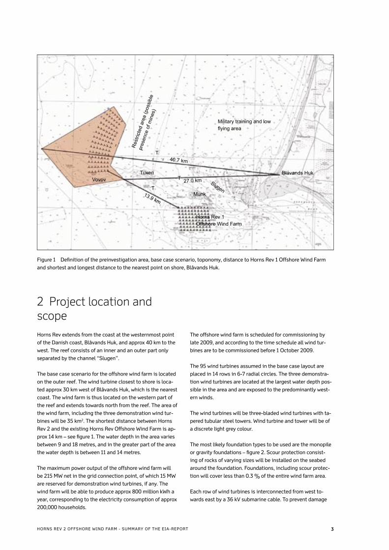
The most likely foundation types to be used are the monopile
or gravity foundations – figure 2. Scour protection consist-
ing of rocks of varying sizes will be installed on the seabed
around the foundation. Foundations, including scour protec-
tion will cover less than 0.3 % of the entire wind farm area.
Each row of wind turbines is interconnected from west to-
wards east by a 36 kV submarine cable. To prevent damage
Figure 1 Definition of the preinvestigation area, base case scenario, toponomy, distance to Horns Rev 1 Offshore Wind Farm
and shortest and longest distance to the nearest point on shore, Blåvands Huk.
�HORNS REV 2 OFFSHORE WIND FARM - SUMMARY OF THE EIA-REPORT
Vovov
Res
trict
ed a
rea
(pos
sibl
e
pres
ence
of m
ines
)
Military training and low flying area
Blåvands Huk
Horns Rev 1 Offshore Wind Farm
Munk
Tuxen
Slugen
40.7 km
27.0 km
13.9 km
T
T
T
to the cables, all submarine cables will be trenched/jetted/
ploughed at least 1 metre into the seabed.
Assuming that the base case layout of 14 wind turbine rows
divided into seven groups, each group consisting of 12-14
wind turbines, is used, the easternmost wind turbine of each
group will be connected to the substation by a submarine ca-
ble. The total 36 kV cable route will be approx 68 km. Com-
bined with cabling to and from the seabed, the total cable
consumption will be approx 72 km.
It is assumed that PEX cables or similar single-armoured sub-
marine cables will be used. The submarine cables include
built-in fibre-optic cables for communication, etc. The subma-
rine cables will not contain oil.
The connection point to the onshore high-voltage transmis-
sion grid is assumed to be at Blåbjerg. A 150 kV submarine
cable is installed from the offshore substation to the coast at
Blåbjerg. From Blåbjerg an onshore cable connects the wind
farm to the high-voltage transmission grid.
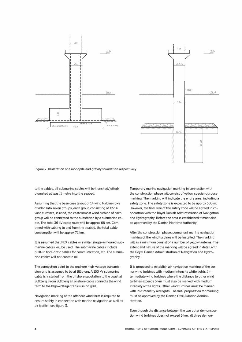
Navigation marking of the offshore wind farm is required to
ensure safety in connection with marine navigation as well as
air traffic - see figure 3.
Temporary marine navigation marking in connection with
the construction phase will consist of yellow special-purpose
marking. The marking will indicate the entire area, including a
safety zone. The safety zone is expected to be approx 500 m.
However, the final size of the safety zone will be agreed in co-
operation with the Royal Danish Administration of Navigation
and Hydrography. Before the area is established it must also
be approved by the Danish Maritime Authority.
After the construction phase, permanent marine navigation
marking of the wind turbines will be installed. The marking
will as a minimum consist of a number of yellow lanterns. The
extent and nature of the marking will be agreed in detail with
the Royal Danish Administration of Navigation and Hydro-
graphy.
It is proposed to establish air navigation marking of the cor-
ner wind turbines with medium intensity white lights. In-
termediate wind turbines where the distance to other wind
turbines exceeds 5 km must also be marked with medium
intensity white lights. Other wind turbines must be marked
with low intensity red lights. The final proposition for marking
must be approved by the Danish Civil Aviation Admini-
stration.
Even though the distance between the two outer demonstra-
tion wind turbines does not exceed 5 km, all three demon-
Figure 2 Illustration of a monopile and gravity foundation respectively.
� HORNS REV 2 OFFSHORE WIND FARM - SUMMARY OF THE EIA-REPORT
STEEL SHEET
stration wind turbines, if erected, will be marked with flash-
ing white lights (adjusted to the background luminance). The
intensity of the lights will depend on the final height of the
demonstration wind turbines.
In the operation period, trawling will be prohibited in the wind
farm area. This is the only limitation in the general use of the
area. However, for safety reasons, it will be prohibited to dis-
embark onto the wind turbines and the offshore substation.
Land areasIt will be necessary to make use of land areas for the project,
both during the construction and the operation phases.
During the construction phase, harbour areas for installa-
tion, temporary storage and shipping of components will be
required. These activities are expected to be performed from
existing harbours in either Esbjerg or Hvide Sande. From both
harbours, the distance will be approx 60 km. The construc-
tion work is scheduled to begin in 2008, at which time a har-
bour area of approx 30,000 m2 is expected to be required, and
continues in 2009, at which time a harbour area of approx
60,000 m2 is expected to be required. Furthermore, berths for
vessels used in the construction of the offshore wind farm will
be required.
In the operation phase, the required area is reduced to around
500 m2 for storage of spare parts and operation and mainte-
nance facilities located in the immediate vicinity of the quay.
In connection with major repair works, temporary storage of
materials and components will also be required at the quay.
In general, the land areas required for the construction and
operation phases are expected to be in local harbours either
in Esbjerg or Hvide Sande where the provisions of the town
plans allow for such areas.
Activities in the wind farm areaThe work in connection with construction of the wind farm is
scheduled to start in the spring of 2008 with installation of
foundations. The construction of the wind farm is expected to
take place over two seasons with fewer activities in the win-
ter months. Hence, wind turbines and cables will mainly be
installed in the spring, summer and autumn of 2009, and the
wind farm is scheduled for commissioning in October 2009.
In the construction period, there will be an increased traffic
of vessels in the wind farm area and in the navigation routes
to and from the port of disembarkation. It is not possible to
determine the extent of this traffic until type of wind turbine
and foundation have been selected. However, it is estimated
that the number of vessels in the construction phase will vary
between 3 and 15 on a daily basis, with the highest number
Figure 3 The figure shows the proposed permanent marking for marine and air navigation.
Special marine navigational marking with a range of 5 nautical miles and white flashing light on top of the nacelle for air traffic safety.
Special marine navigational marking with a range of 2 nautical miles
�HORNS REV 2 OFFSHORE WIND FARM - SUMMARY OF THE EIA-REPORT
in the summer months and the lowest number in the autumn/
winter. In addition to these vessels, traffic of smaller boats for
personnel transportation and other service navigations must
be foreseen.
The operation and maintenance concept for Horns Rev 2 will
be established in connection with choice of wind turbines for
the project, as it is expected that a service agreement will be
made with the wind turbine supplier.
During ordinary operation, the wind farm will be unmanned
and remote monitoring will be performed from an onshore
control room. However, the wind turbines are inspected and
service is performed at intervals of 6-12 months or more.
Moreover, there will be annual overhauls in the summer, when
scheduled maintenance is carried out on all wind turbines.
Even though the project is to be based on established and
well-tested technology, it may become necessary to perform
additional remedy of defects and repairs. This is estimated to
entail approx 1-2 visits per wind turbine per year.
At present, permanent stationing of service personnel in the
wind farm is not considered a solution in connection with or-
dinary operation and maintenance. However, it may become
relevant to station service personnel in the wind farm in con-
nection with certain service jobs, eg annual overhauls. In this
connection, an accommodation platform for approx 20 per-
sons is proposed. The total area of the accommodation plat-
form will be 600-700 m2 distributed onto 3-4 floors, and it
will be established in connection with the offshore substation
or on a separate foundation pile with a bridge between the ac-
commodation platform and the substation.
DecommissioningThe offshore wind farm is designed for a lifetime of 25 years,
after which period, the wind farm is to be decommissioned
and removed.
The decommissioning schedule will contain a statement on
how to remove the plants. Furthermore, the decommission-
ing plan will contain a statement on and an assessment of the
environmental and safety impacts of the plan as well as a de-
commissioning time schedule.
At present, it is not possible to predict the requirements,
which will apply to sorting and recycling of the individual
components of the offshore wind farm at the time of decom-
missioning.
However, the offshore wind farm will be established in a man-
ner, which enables reestablishment of the previous conditions
and handling of the individual materials in compliance with
the applicable legislation in force at the time of decommis-
sioning. Wind turbines, cables and any met masts may be dis-
mantled and scrapped after use. Removal of the foundation
will depend on the selected foundation type. The monopile is
assumed cut off one metre below the seabed and scrapped
after the transition piece has been stripped of concrete. The
gravity foundation may be removed in one piece, crushed and
shredded after which the materials are sorted. Similarly, the
cables may be dismantled, shredded and sorted for reuse.
3 AlternativesAs part of the EIA, a number of alternatives have been as-
sessed; other types of renewable energy, alternative onshore
wind energy solution and an alternative location within the
assigned pre-investigation area.
The no-action alternativeThe assessment of the no-action alternative, ie the alternative
where Horns Rev 2 Offshore Wind Farm is not established, as-
sumes that the political objectives stated in “Energistrategi
2025” (Danish Energy Strategy 2025 from 2005) are main-
tained. This means that the energy contribution of the off-
shore wind farm is to be replaced by other renewable energy.
In general, this replacement of renewable energy may be pro-
vided by:
- solar cells and/or wave power
- geothermal plants
- biomass-fired power plants
- onshore wind turbines
Even though the technological development within solar cells
and wave power has been enormous in the past years, these
technologies have not achieved a level of efficiency, which
can compete with wind technology on commercial terms.
Hence, solar cells and wave power are currently not consi-
dered viable alternatives to wind power.
Utilisation of heat from the underground is a well-established
technology. In Denmak geothermal plants are so far only able
to produce heat as the water from the Danish underground
is not warm enough for electricity production. It is therefore
not considered possible to replace the energyproduction from
Horns Rev 2 with geothermal power.
Over the last nearly ten years several Danish power plants
have been upgraded to use biomass as fuel. The biomass
technology for combined production of heat and power has
thus reached a level where it is no longer a technical problem
to make use of large volumes of biomass. Nevertheless, only
a limited amount of the biomass resource is available to the
energy sector, and a potential substitution of the power gen-
erated from the wind farm with power produced from Danish
biomass will call for a comprehensive mapping of the avail-
able resources. Within the past few years, the biomass in-
cineration target of the “biomass agreement” from 1993 has
been met, and at present there are no future subsidy plans for
biomass energy. Therefore it is uncertain to assume that bio-
mass power plants can replace the energy from Horns Rev 2
offshore wind farm.
� HORNS REV 2 OFFSHORE WIND FARM - SUMMARY OF THE EIA-REPORT
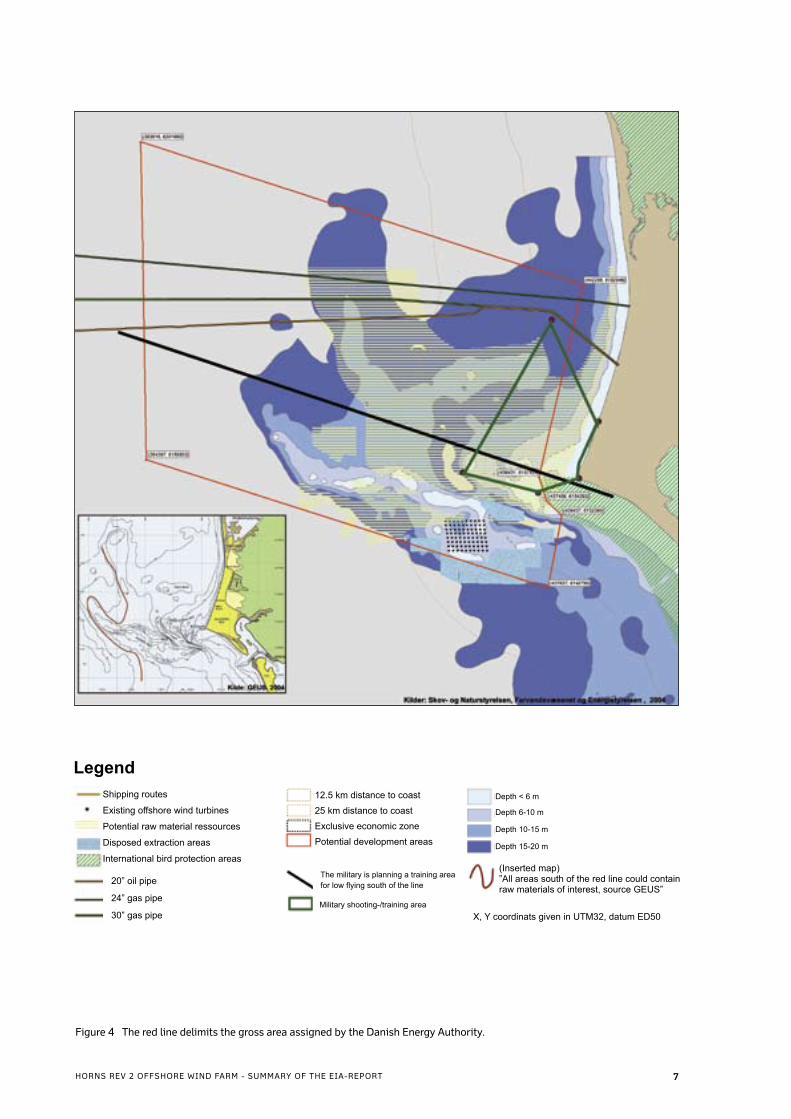
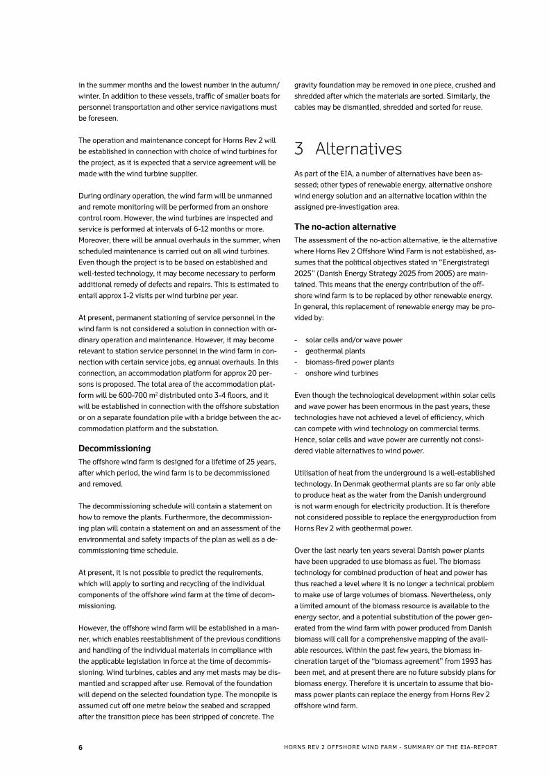
Figure 4 The red line delimits the gross area assigned by the Danish Energy Authority.
LegendShipping routes
Potential raw material ressources
Disposed extraction areas
International bird protection areas
20” oil pipe
24” gas pipe
30” gas pipe
12.5 km distance to coast
25 km distance to coast
Exclusive economic zone
Potential development areas
The military is planning a training area for low flying south of the line
Military shooting-/training area
Depth < 6 m
X, Y coordinats given in UTM32, datum ED50
Depth 6-10 m
Depth 10-15 m
(Inserted map)”All areas south of the red line could contain raw materials of interest, source GEUS”
Depth 15-20 m
Existing offshore wind turbines
�HORNS REV 2 OFFSHORE WIND FARM - SUMMARY OF THE EIA-REPORT
The possibility of further extension of onshore wind power is
very limited in Denmark. After several rounds of replacement-
programmes the utilisation of the best wind resources on-
shore has been optimised. Further extension of onshore wind
power would thus have to involve locating the wind turbines
in less favourable areas resulting in increased costs.
Moreover, lately there has been a tendency towards it becom-
ing increasingly difficult to obtain approval of new sites on-
shore, eg increasing wind turbine sizes lead to increasing re-
sistance from the local population. This may also be seen as
an indication that the limit of the number of wind turbines in
the Danish landscape has been reached.
Therefore, even though some possibilities of increasing the
wind power contribution by exchanging less efficient old on-
shore wind turbines remain, this is not considered a realis-
tic alternative to the establishment of a second offshore wind
farm at Horns Rev.
Other alternativesAn alternative to electricity production by means of wind
turbines could be an increased effort to obtain energy sav-
ings, as this would also be a way to reduce CO2 emissions. At
present, this is not a realistic alternative, as the energy de-
mand has shown an upward tendency in recent years rather
than a downward tendency.
Based on the above argumentation, the only viable alternative
to providing the renewable energy otherwise to be produced
at Horns Rev 2 Offshore Wind Farm is to find another offshore
location for the wind farm.
Alternative locationIn connection with tendering for Horns Rev 2 Offshore Wind
Farm, a large area at Horns Rev was assigned by the Danish
Energy Authority for location of the wind farm (see figure 4).
Based on environmental, technical, financial and planning
considerations, DONG Energy proposed a possible location
of the wind farm within this area. After the concession was
granted and according to consultation with the Danish Ener-
gy Authority a pre-investigation area was selected within the
assigned gross area. Within this pre-investigation area, two
location options are considered; a base case location and an
alternative location (see figure 5).
The base case location and the alternative location are de-
scribed in the EIA. In compliance with the Danish EIA regula-
tion guidelines an actual alternative to the proposed location
is presented.
Both locations are described in the EIA-report.
At present a new plan of action for offshore wind turbines is
being prepared as a replacement for the previous “Havmølle-
handlingsplan for de danske farvande” (the Offshore wind
turbine strategy for Danish waters) from 1997, and this plan
is expected to be available in late-2006/early-2007.
Figure 5 The figure shows the base case (a) and the alternative location (b). The pink area marks the pre-investigation area.
� HORNS REV 2 OFFSHORE WIND FARM - SUMMARY OF THE EIA-REPORT
4 The wind turbines in the Horns Rev areaFor periods after the last Ice Age when the sea level has been
approx 14-22 metres lower than today, there have been lit-
toral regions where Mesolithic and/or Neolithic settlements
may have occurred. However, traces of such settlements have
not been found and neither have wreckages, ballast piles or
other preservation-worthy objects.
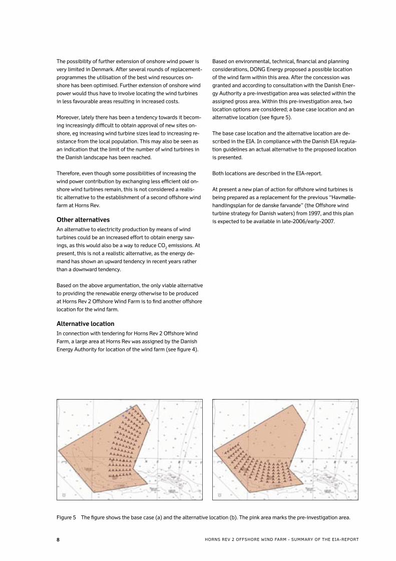
The relatively distant location of the wind farm from the shore
means that the wind farm will only be visible from the coast to
a limited extent in very clear weather conditions - see figure 6.
The large demonstration wind turbines are located as far from
the coast as possible in the northwestern corner of the area.
The selected wind farm layout is very distinct from the tradi-
tional row or group layout. In the design of the layout, empha-
sis has been placed on establishing a layout to which several
individual wind turbines can be added or to which subsequent
wind farms may be added thus providing a higher level of flex-
ibility than the traditional row or group layout.
The layout is based on a radial/circular structure, which
makes it possible to reduce/increase the distance between
the individual radials or circles without disrupting the layout.
The selected layout makes it possible to expand the wind
farm with other wind turbine dimensions and other distances
between the wind turbines without it impacting the visual ap-
pearance of the wind farm.
The selected layout provides flexibility in connection with mi-
nor adjustments of difinite wind turbine locations due to eg
foundation conditions. It is a significant improvement of the
project that it is possible to change the location of individual
wind turbines, if the results of the preliminary investigations
in the area show critical foundation conditions at some of
the selected wind turbine locations or other conditions which
makes it preferable to change the wind turbine location.
Another advantage of placing the wind turbines in radial cir-
cles is that the wind farm is “opened up” towards the domi-
nant wind directions, ie the distance between the rows is lar-
gest towards west and smallest towards east. At the same
time, the limited distance between the rows in the east means
that the length of the interconnecting cables up to the con-
nection of the submarine cable to the offshore substation
is reduced. Finally, the central point of the radial circles is
located in the sea. The maximum visual impact of the wind
turbines will only be experienced at the central point, which
means that the visual impact on shore will never be as signifi-
cant as at the central point.
The wind turbines will all have the same colour; a light grey
colour. This choice of colour ensures that the appearance of
the wind turbines is light and bright, and the colour blends
easily with the colours of the sea and the sky. At the same
time the light grey colour ensures that the wind turbines are
not too bright and white which would significantly increase
the visibility.
Figure 6 Visualisation of the offshore wind farm from Blåvands Huk app. 30 km from from the nearest turbine under very clear
weather conditions. Notice Horns Rev 1 Offshore Wind Farm in the foreground to the left.
�HORNS REV 2 OFFSHORE WIND FARM - SUMMARY OF THE EIA-REPORT
5 Environmental impactsThe construction and operation phases of Horns Rev 2 Off-
shore Wind Farm may impact the environment in the area sur-
rounding the wind farm. Based on a baseline description of
the area, analyses and assessments of the potential environ-
mental impacts of the wind farm have been made for this EIA
using a broad range of methods.
The environmental impacts may be temporary, thus prima-
rily relating to the construction period, or they may be per-
manent, thus primarily relating to the operation period. As it
is the first time that two large wind farms are established in
the same local area, it is important to uncover any potential
cumulative impacts, which might result from Horns Rev 1 be-
ing located only approx 14 km east-south-east of Horns Rev 2
Offshore Wind Farm.
The distance between the wind farm and the existing na-
ture reserves in the Wadden Sea and the southern part of the
North Sea is relatively large.
Construction phaseDuring the construction phase, impacts in the wind farm area
and the immediate surroundings are expected to be more in-
tense but of a shorter duration than the impacts in the opera-
tion phase. Depending on choice of foundation type, the pri-
mary impact sources during construction will be:
• Impact on seabed and resuspension of sediment caused
by levelling for gravity foundation
• Noise in connection with pile driving for monopile founda-
tions
In addition, the construction works will entail:
• Impact on seabed caused by trenching of cables
• Other impacts such as increased navigation of construc-
tion vessels, limitations to the commercial fishing, etc.
Suspended sedimentIf the wind turbines are erected on gravity foundations, this
entails of excavation works, which may cause resuspension of
sediment. Trenching of interconnecting cables will also dis-
rupt the seabed. As the top seabed layer in the entire wind
farm area consists of predominantly medium-coarse grained
sand with a high settling velocity, no environmental impacts
from suspended sediment are expected. In addition, there is
a natural very high general concentration of suspended sand
due to the interaction of the rough wave and current condi-
tions and the active seabed contours in the very dynamic ma-
rine environment.
The absence of fine-grained and organic material in the sedi-
ment is also reflected in the total absence of bottom vegeta-
tion in the area.
NoiseProvided that the monopile foundation type is selected, the
most significant noise impact during the construction phase
will be from pile driving. Moreover, trenching of cables, possi-
ble excavation works, navigation, etc. will provide minor con-
tributions to the noise impact.
The noise is particularly expected to affect porpoises, seals,
fish and birds in the area. In connection with pile driving,
sonic equipment will be used to actively scare away the mam-
mals from the area. Furthermore, pile driving will start with
small impacts and gradually be intensified to give the fish and
mammals time to leave the area. Noise impacts during con-
struction are expected to be temporary. In connection with
pile driving at Horns Rev 1, porpoise activity was recorded
to return to its original level a few hours after pile driving
ceased.
Impacts in relation to birds are also expected to be temporary
and in addition the construction activities will be concentra-
ted in the summer months when very few birds are present in
the Horns Rev area compared to the rest of the year.
Other impacts during constructionFor safety reasons, the construction area will be closed off
to prevent unauthorised traffic. This will entail restriction of
commercial fishing in the area. DONG Energy has initiated a
dialogue with the affected fishermen in order to limit the in-
conveniences to the widest possible extent.
Closing off the construction area will also affect yachts, sea
hunters, etc. who might use the area. However, it is assessed
that due to the distance to the coast and the rough wave and
current conditions, the use of the area for recreational activi-
ties is very limited.
Operation phaseCompared to the construction phase, the impacts in the ope-
ration phase will be permanent impacts in the entire 25-year
lifetime of the wind farm. The impacts in the operation phase
will primarily be caused by:
• the physical presence of the offshore wind farm
• noise and vibration from the wind turbines
• other impacts of the offshore wind farm
Physical presence of the offshore wind farmThe wind turbine foundations potentially affect the water
movements; locally as well as in the area around the wind
farm. Based on conservative estimates, it is assessed that
the reduction of the wave height in immediate lee of the wind
farm will be 2-4%. Waves close to the shore will therefore vir-
tually be unaffected by the presence of the wind farm. Simi-
larly, the reduction of the current velocity through the wind
farm is also assessed to be insignificant, and it will thus not
impact sediment transportation or coastal morphology in the
area.
10 HORNS REV 2 OFFSHORE WIND FARM - SUMMARY OF THE EIA-REPORT
Locally around the foundations, increased turbulence with the
risk of consequential erosion must be expected. Putting down
large rocks as scour protection around the foundations will
limit the sand transportation close to the turbines to a mini-
mum.
Physically speaking, foundations and scour protection, re-
gardless of choice of foundation type, cover max 0.3% of the
seabed in the wind farm area. This will cause a direct, though
very limited, loss of habitat for seabed fauna. No bottom ve-
getation has been observed in the area.
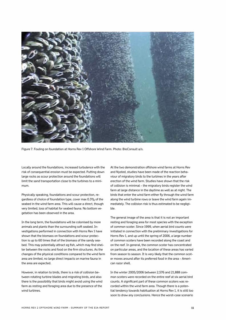
In the long term, the foundations will be colonised by more
animals and plants than the surrounding soft seabed. In-
vestigations performed in connection with Horns Rev 1 have
shown that the biomass on foundations and scour protec-
tion is up to 60 times that of the biomass of the sandy sea-
bed. This may potentially attract eg fish, which may find shel-
ter between the rocks and food on the firm structures. As the
changes of the physical conditions compared to the wind farm
area are limited, no large direct impacts on marine fauna in
the area are expected.
However, in relation to birds, there is a risk of collision be-
tween rotating turbine blades and migrating birds, and also
there is the possibility that birds might avoid using the wind
farm as resting and foraging area due to the presence of the
wind turbines.
At the two demonstration offshore wind farms at Horns Rev
and Nysted, studies have been made of the reaction beha-
viour of migratory birds to the turbines in the years after
erection of the wind farm. Studies have shown that the risk
of collision is minimal – the migratory birds register the wind
farm at large distance in the daytime as well as at night. The
birds that enter the wind farm either fly through the wind farm
along the wind turbine rows or leave the wind farm again im-
mediately. The collision risk is thus estimated to be negligi-
ble.
The general image of the area is that it is not an important
resting and foraging area for most species with the exception
of common scoter. Since 1999, when aerial bird counts were
initiated in connection with the preliminary investigations for
Horns Rev 1, and up until the spring of 2006, a large number
of common scoters have been recorded along the coast and
on the reef. In general, the common scoter has concentrated
on particular areas, and the location of these areas has varied
from season to season. It is very likely that the common scot-
er moves around after its preferred food in the area – Ameri-
can razor shell.
In the winter 2005/2006 between 2,576 and 21,888 com-
mon scoters were recorded on the entire reef at six aerial bird
counts. A significant part of these common scoters was re-
corded within the wind farm area. Though there is a poten-
tial tendency towards habituation at Horns Rev 1, it is still too
soon to draw any conclusions. Hence the worst-case scenario
Figure 7. Fouling on foundation at Horns Rev 1 Offshore Wind Farm. Photo: BioConsult a/s.
11HORNS REV 2 OFFSHORE WIND FARM - SUMMARY OF THE EIA-REPORT
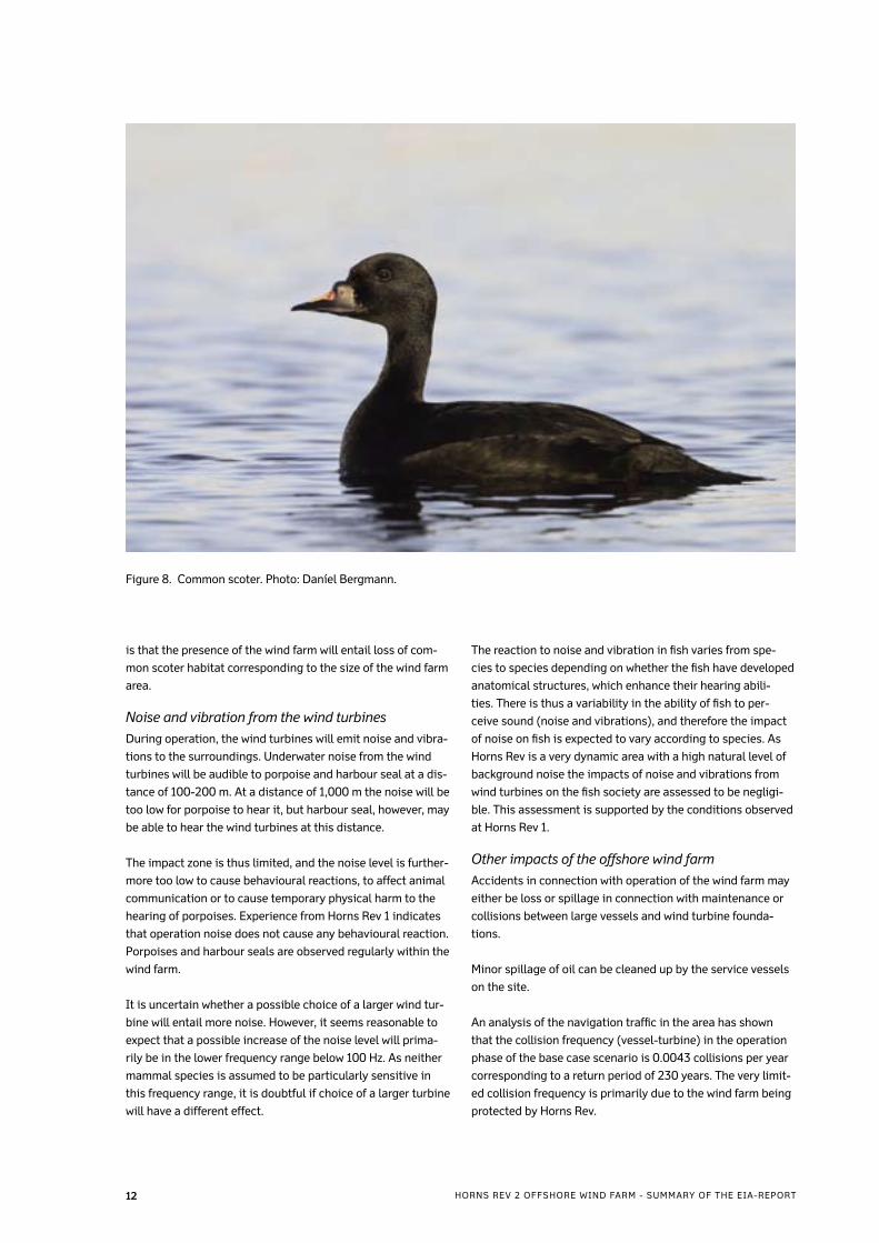
is that the presence of the wind farm will entail loss of com-
mon scoter habitat corresponding to the size of the wind farm
area.
Noise and vibration from the wind turbinesDuring operation, the wind turbines will emit noise and vibra-
tions to the surroundings. Underwater noise from the wind
turbines will be audible to porpoise and harbour seal at a dis-
tance of 100-200 m. At a distance of 1,000 m the noise will be
too low for porpoise to hear it, but harbour seal, however, may
be able to hear the wind turbines at this distance.
The impact zone is thus limited, and the noise level is further-
more too low to cause behavioural reactions, to affect animal
communication or to cause temporary physical harm to the
hearing of porpoises. Experience from Horns Rev 1 indicates
that operation noise does not cause any behavioural reaction.
Porpoises and harbour seals are observed regularly within the
wind farm.
It is uncertain whether a possible choice of a larger wind tur-
bine will entail more noise. However, it seems reasonable to
expect that a possible increase of the noise level will prima-
rily be in the lower frequency range below 100 Hz. As neither
mammal species is assumed to be particularly sensitive in
this frequency range, it is doubtful if choice of a larger turbine
will have a different effect.
The reaction to noise and vibration in fish varies from spe-
cies to species depending on whether the fish have developed
anatomical structures, which enhance their hearing abili-
ties. There is thus a variability in the ability of fish to per-
ceive sound (noise and vibrations), and therefore the impact
of noise on fish is expected to vary according to species. As
Horns Rev is a very dynamic area with a high natural level of
background noise the impacts of noise and vibrations from
wind turbines on the fish society are assessed to be negligi-
ble. This assessment is supported by the conditions observed
at Horns Rev 1.
Other impacts of the offshore wind farmAccidents in connection with operation of the wind farm may
either be loss or spillage in connection with maintenance or
collisions between large vessels and wind turbine founda-
tions.
Minor spillage of oil can be cleaned up by the service vessels
on the site.
An analysis of the navigation traffic in the area has shown
that the collision frequency (vessel-turbine) in the operation
phase of the base case scenario is 0.0043 collisions per year
corresponding to a return period of 230 years. The very limit-
ed collision frequency is primarily due to the wind farm being
protected by Horns Rev.
Figure 8. Common scoter. Photo: Daníel Bergmann.
12 HORNS REV 2 OFFSHORE WIND FARM - SUMMARY OF THE EIA-REPORT
The Danish Executive Order on Cabling protects an area of
200 m around submarine cables against eg anchoring, trawl-
ing and recovery of raw materials. In practice this renders
these activities impossible in the wind farm area in the entire
lifetime of the wind farm.
Prior to establishment of the base case layout, meetings with
local fishermen in the area have been held with the intention
to limit the inconveniences to the fishing industry as much
as possible. This has resulted in the location being adjust-
ed to consider most importantly sand eel fishing on the reef,
but also shrimping in the northernmost part of the pre-study
area.
So far, no raw material recovery areas have been designated
within the wind farm area, and therefore there are no impacts
in relation to existing areas. The geophysical surveys have
shown that there are no large occurrences of important ma-
terials in terms of raw materials such as gravel, pebble gravel
and stone, and the wind farm is thus not expected to occupy
areas of importance in terms of raw material in the future.
Electro-magnetic fields may be formed around the cables
in the wind farm. As the cables are trenched to a minimum
depth of one metre into the seabed, and as the voltage of the
interconnecting cables does not exceed 36 kV, the electro-
magnetic fields are not expected to influence neither fish nor
mammals in the area.
Service and maintenance of the wind turbines will require
a certain amount of navigation in small vessels in the area.
Trips will also be made between the port of disembarkation
and the accommodation platform, and navigation in connec-
tion with distribution of service personnel between accommo-
dation platform and the individual wind turbines. This type of
navigation will not contribute significantly to the total naviga-
tion in the area. Maintenance work at the wind turbines will
mainly be performed inside the tower or in the nacelle, which
will limit the environmental impact.
Cumulative impactsIt is the first time that two large offshore wind farms are lo-
cated in the same local area, and therefore it is not possible in
advance to determine which cumulative impacts will occur.
The distance between the wind turbines of the two wind
farms, which are located closest to each other, is approx 14
km, and the wind farms will as such be considered as two se-
parate units. Therefore it is considered unlikely that the wind
farms will constitute a barrier to migrating birds, just as they
are not expected to have a blocking effect for the movement
of fish and marine mammals.
The worst-case scenario is that the presence of the two wind
farm will entail loss of common scoter habitat corresponding
to the size of the two wind farm area. The individuals would
have to forage in other parts of the area, hence increasing the
pressure on forage locations in general in the area.
There could also be cumulative impacts related to the visual
impression of the two wind farms. From coastal areas north
of Blåvands Huk a significant stretch of the horizon will ap-
pear covered by wind turbines on a day with very clear weath-
er conditions. However, considering the distance from Horns
Rev 2 to the coastline, the additional visual impact from this
wind farm is considered to be of minor importance.
1�HORNS REV 2 OFFSHORE WIND FARM - SUMMARY OF THE EIA-REPORT
6 Mitigation measures
In connection with detailed planning of the wind farm, a
number of procedures will be established to limit negative
environmental impacts from the offshore wind farm. An envi-
ronmental management system will be established for both
construction and operation. When planning the activities of
both phases, DONG Energy will aim to ensure that the work
is planned to minimise the environmental impacts under con-
sideration of technical, financial and time aspects. Moreover,
as already mentioned, environmental and planning conditions
have been considered in the final design of the wind farm.
Experience from the construction of the two existing off-
shore wind farms at Horns Rev and Rødsand has shown that
by means of relatively simple measures it has been possible
to establish the wind farms without them causing significant
long-term impacts on the surrounding environment.
7 Environmental monitoring programmesThe large-scale environmental monitoring programme
launched in connection with the demonstration offshore wind
farms has contributed valuable knowledge about the impacts
involved in the establishment of large wind power systems
in marine environment. The impacts of Horns Rev 2 Offshore
Wind Farm are thus not expected to deviate significantly from
the general observations made particularly at Horns Rev 1.
However, as mentioned environmental impacts may occur as
a result of the cumulative impression of the two wind farms in
combination.
Even though it is considered unlikely that the birds will not
use the 14 km wide “opening” between the two wind farms to
migrate, no previous results unambiguously indicate that this
will be the case. An environmental monitoring programme for
migrating birds would thus be able to contribute with know-
ledge about this subject.
The high number of common scoter recorded in the area, also
calls for a proposal of an investigation of the species’s future
use of the area. An environmental monitoring programme on
common scoter should furthermore be planned to include the
many years of already existing data from the area in addition
to new observations. The interaction between Horns Rev 1
and 2 in relation to the location of the common scoter should
also be included in the programme. Moreover, it will be possi-
ble to establish any habituation tendencies by including both
wind farms and existing knowledge.
1� HORNS REV 2 OFFSHORE WIND FARM - SUMMARY OF THE EIA-REPORT


DONG Energy - RenewablesA. C. Meyers Vænge 9
DK-2450 København SV
Tlf. +45 44 80 60 00
www.dongenergy.com