Embed Size (px)
Citation preview
Place No 211Gahtoollitcll/Page 1
SHIRE OF ESPERANCE
MUNICIPAL HERITAGE INVENTORY PLACE RECORD FORM
LGA Place No: 21
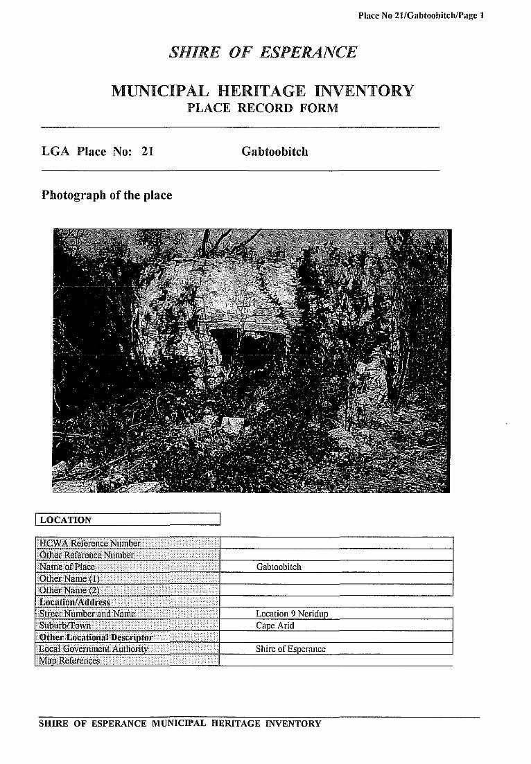
Photograph of the place
I LOCATION
i .( ···i ....... \/i
<\ .......... .
.. > .•... ·ii<../i< \\\ •.. \ .. \> •.....••.
····<i/«<L······ .. ··. . ...... .
Gabtoobitch
(
T nroHn" 9
Cape Arid
Shire or
SHIRE OF ESPERANCE MUNICIPAL HERITAGE INVENTORY
Place No 2t1GabtoobitchlPage 2
I OWNERSHIP & LAND DESCRIPTION
i~ = Addresi ..... · ... i~~~. Phonci(dx-··.··.··Silltlls.··.· •. ·.· ..• · .. ·· .• ·.· No.···.
CALM 92 Dempster Street Esperance. (090)713733 6450
Re~i!/'WNo; ~LoifLoca11tfnNo> . ··\PlanIDiaf'rom·····.·······i.·· ... · .•..... ' .•. ·.1 VOfIFdlio ...•.....•...• ·>lNti .. >1 A 24047 1 Cane Arid National Park 1 I
I DESCRIPTION
house and
and doors
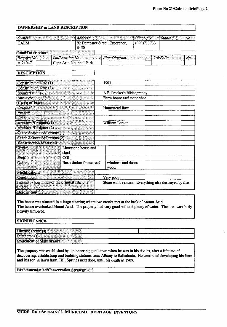
walls remain. Everything else destroyed by fire.
The house was situated in a large clearing where two creeks met at the back of Mount Arid. The house overlooked Mount Arid. The property had very good soil and plenty of water. The area was fairly heavily timbered.
1
at II The property was established by a pioneering gentleman when he was in his sixties. after a lifetime of discovering. establishing and building stations from Albany to Balladonia. He continued developing his farm and his son in law's farm. Hill Springs next door. until his death in 1909.
SHIRE OF ESPERANCE MUNICIPAL HERITAGE INVENTORY
I I
Place No 21/GaIJtooIJitchIPage 3
I OTHER
Supp(n1in1!]nformatloJl ........•.. . •.... . ....... <I A E Crockers Bibliography LiiitililtaiidAsses~mcllt ...•....• > .......•.....•..•....•....•....... As.~esscji(siN(lllle. ............. ...................... ..... ...... . .. . AS8~880r(8)Addre8,iPho!1e .............................. · ............................................. .
Community Committee clo Shire of Esperance Ph 090 711666
Classified blithe NationaiTtusl (YIN) ..•.•...•. R.egister dflneNatiolk1lEslate(YIN}.· .••......•.•.•.•..
SHIRE OF ESPERANCE MUNICIPAL HERITAGE INVENTORY
Place No 22/Giilson Soa" Wayside Inn and Trees/Pagc I
SHIRE OF ESPERANCE
MUNICIPAL HERITAGE INVENTORY PLACE RECORD FORM
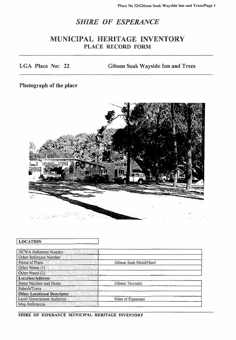
LGA Place No: 22 Gibson Soal{ Wayside Inn and Trees
Photog.-aph of the place
I LOCATION
B;CwARefetenceNumber ....... ( ... . .... O(lierRetere~(;¢i'/tlmbe{ ........• •• •.. > .... . . Nilrne oj'PI~ce .......•.... «....<\ . . .............. Gibson Soak Motel/Hotel Otllei Name(lj.. . .......... •......................... OUlerNanle(2) ... •.... ..•••.•. ... .•.... .........< ••.••.••.••..........•.•
LOC,ltiOnJAd(lI"cSS . ..••.•..••.... .•..• .•.•..•.• •.•• •• < ........
Street Number 11 ndNanie .. ..... ... . .... < ..•.• Gibson Townsite Sublirbff6'l'fl . •.. i .. . ........ . .......
Other Locntion,,[ Dcscnllt"r ......... ...... ....... .....
L(]~FGovernmen( Authority •. ..•...... ...... ...... Shire of Esperance Map. RefcJ"Qllces ................. .................. ........
SHIRE OF ESPERANCE MUNICIPAL HERITAGE INVENTORY
Place No 22/Gibson Soak Wayside Inn and Trees/Page 2
I OWNERSHIP & LAND DESCRIPTION
I DESCRIPTION
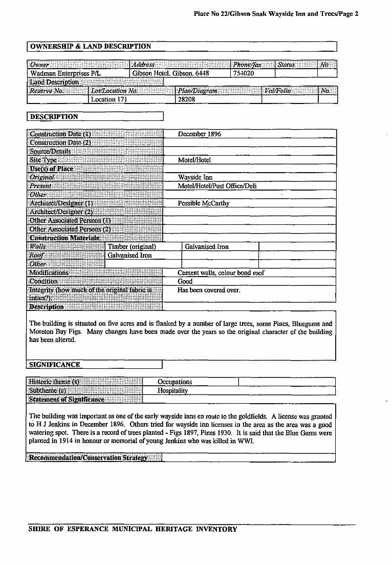
The building is situated on five acres and is flanked by a number of large trees, some Pines, Bluegums and Moreton Bay Figs. Many cbanges bave been made over the years so the original cbaracter of the building bas been altered.
The building was important as one of the early wayside inns en route to the goldfields. A license was granted to H J Jenkins in December 1896. Others tried for wayside inn licenses in the area as the area was a good watering spot There is a record of trees planted - Figs 1897, Pines 1930. It is said !bat the Blue Gums were planted in 1914 in honour or memorial of young Jenkins who was killed in WWI.
SHIRE OF ESPERANCE MUNICIPAL HERITAGE INVENTORY
Place No 221Gihson Soal< Wayside [lin and TreeslPage 3
I OTHER
. SUPllortillglnforInatioo·· ......... . .... , Esperance Chronicle 1895/96 Survey A W Canning. Esperance Times 1611/1897 [eatured an advertisement [or it. Feb-Nov 1896. Li.siini!ar1,IAssessment ... .. .... ..... . ..
)L,cseSSQI'i.i)}fq,!/I' ......... · .... . ............ .. ..... . .. ... .. Ass(!ssorMAddre.I:~!Phol1e ............. ... .... . .................. Community Committee cia Shire of Esperance Ph 090 711666 State RegisterpfFledtagcPlaces:(Y1N) Classifiecl.byLheNational.T11.isl(YIN1 ......... Register of the Nilllo'lalEstate (YIN) ..••...•.••• LocaITbwuPlannlngSclienle(Y/N) .. . ....
SHIRE OF ESPERANCE MUNICIPAL HERITAGE INVENTORY
Place No 23/Gilmnre's Temperance Hntel Scaddan/Pagc 1
SHIRE OF ESPERANCE
MUNICIPAL HERITAGE INVENTORY PLACE RECORD FORM
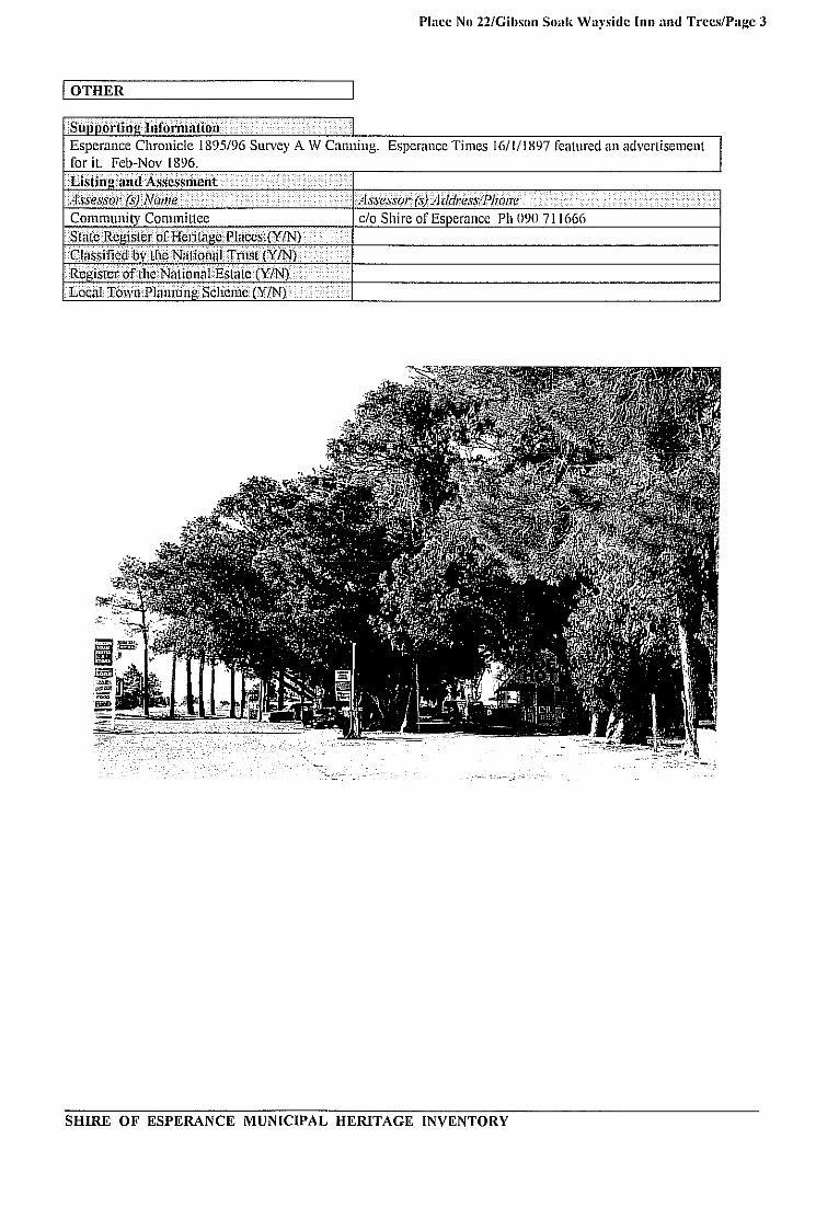
LGA Place No: 23 Gilmore's Tempemnce Hotel - Scaddan
Photograph of the place
I LOCATION
HCW A Reference Number ....
Other Reference Number . . ...
Name of Place •..• ..... · Gilmore's Temperance Hotel - Scaddan Store Other. Name (lJ . . . .
Other Name(2) . . .
Location/Address .... ·
Street Number and Name South West Cnr Cooigardie-Esperance Highway ..............
. . . and Raszvk Road Suburb/Town .. . .... Scaddan Other Locational Descrilltor ... Local Government Authority Shire of Esperance Map References .. ...... .... . ..
·
SHIRE OF ESPERANCE MUNICIPAL HERITAGE INVENTORY
Place No 23/Gilmore's Temllerancc Hotel ScaddanlPagc 2
I OWNERSHIP & LAND DESCRIPTION
I P J Hourn PO Box 43.
I Lots 36. 37, 38 I
I DESCRIPTION
some
.6447 I
·(1
I
I L
I
to Esperance Advertiser 3.9.71, Esperance Express 5.6.75, Archives
Museum. Lands
roof, bull nosed verandah, some walls
The building was originally timber framed, and was clad and roofed with galvauised iron. Later a bullnosed galvauised iron verandah was added. The living quarters were in a lean-to at the rear. The original dining room became the bedroom of Mrs Annie Gilmore. A shed, store and poultry run were added.
SHIRE OF ESPERANCE MUNICIPAL HERITAGE INVENTORY
I
I
Place No 23/Gilmorc's Temperance Hotel ScaddanlPage 3
I SIGNIFICANCE
In about 1896 the building was originally erected by Fred Gilmore as a wayside inn at Jocks condenser, 34 miles south of Norseman. In 1913 F Gilmore moved to Esperance and farmed location 3919 CR location 397 and also son Gordon's blocks H location 605 and CP location 505. He was granted a special business area and wayside inn license. He dismantled the Lakeview building and transported it to Scaddan. Jim Anderson commenced re-erection. The liquor license was revoked, and the building was completed as the Temperance Hotel, serving as a wayside inn in the coaching days of 1915-1925. Later it was used as a post office and store, F Gilmore and Son, for the farming community of Scaddan. They were agents for Ford and State Machinery, Scaddan and for the branch at Salmon Gums from approximately 1925-1935. Later Mr and Mrs Ted McCarthy ran the Post Office and Store, followed by Daniels and then Le Mercier who bnilt new premises opposite. The bnilding was typical of a tavern, store, post office and agency that was the main focus ofisolated communities in the first half of the century.
IOTIIER
SHIRE OF ESPERANCE MUNICIPAL HERITAGE INVENTORY

Place No 2..f./Grass Patch Homesteau/Page 1
SHIRE OF ESPERANCE
MUNICIPAL HERITAGE INVENTORY PLACE RECORD FORM
LGA Place No: 24 Grass Patch Homestead
Photogl-aph of the place
The Grass Patch Farm Homestead· before renovations in 1982_
I LOCATION
HCW A Reference Number . Other. Reference Number .. .
Name of Place ....• Grass Patch Homestead Other Name(l) .... .
OtilerName(2) .
Location/Address Street Number and Name . Tom Starcevich V C Road Suburbrrown . Grass Patch Other Locational Desen,)t"r Local Government Authority .. Shire of Esperance Map References . Fitz Loc 23
SHIRE OF ESPERANCE MUNICIPAL HERITAGE INVENTORY

Place No 24/GraNs Patch HomesteadlPage 2
I OWNERSHIP & LAND DESCRIPTION
I DESCRIPTION
Mason AlfHamdorfand 12 year old
The original building was constructed of granite. It was renovated in 1982, but the character and essence were retained. The building consists of nine rooms around a central court yard (originally unroofed, now roofed in a manner which allows light into the centre). Some original furniture and one original fire surround has been retained.
This is the only remaiuing dwelling from c.1904 in the Western Australia mallee region. It is the location of a condenser site and of a Cobb & Co horse changing station. It is a good example of Alf Hamdorfs workmanship, demonstrating the use oflocally available building materials. The farm itself was mentioned many times in the government enquiry into mallee lands 1915. Travelling dignatories were always accommodated here.
SHIRE OF ESPERANCE MUNICIPAL HERITAGE INVENTORY
Place No 24/Grass Patch HomesteadlPagc 3
I OTHER
SHIRE OF ESPERANCE MUNICIPAL HERITAGE INVENTORY
Place No 2SIGra" Patch Ccmeter)'lPage 1
SHIRE OF ESPERANCE
MUNICIPAL HERITAGE INVENTORY PLACE RECORD FORM
LGA Place No: 25 Gmss Patch Cemetery
Photograph of the place
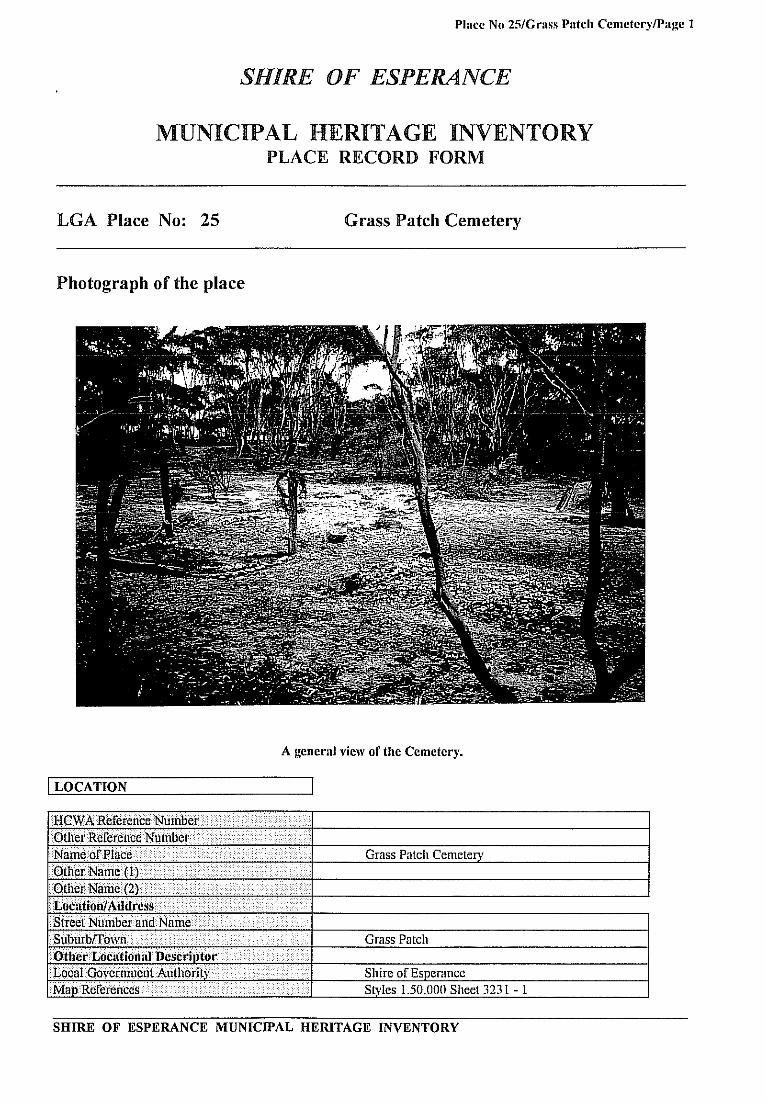
A general view of the Cemetery.
I LOCATION
HcWARetefellceNtiinber····/ ... ···· •...................•. Ot!lefRcfeiettccNlltnber·· .....> ......................•......... NatlleofPlilce .•.....• >\ i.·· .•....••..••.....••. Grass Patch Cemetery
.. OthprNan'" { IT« ·.i ....... >< •..• .... .. ••..•.• ....••. . • ••......•. O(herName{2}i< .•...•...•••.•....••.... < .••.•....••...•••.•••••.•.•..•
SubllrblTO\vll ....... .. .•...•....••.....•..••........... ....•.......... . ..•... . ..> Grass Patch Other Loc,(tionllrDescrlJltor .•..•. < .•.•.•.••..•......•..... t6calG()vefrimetitAllthofjty ...•.......•... <.. ....•. . ..... . Shire of Esperance M:apReferellces .. <. ... ........••.•.....• < ...... . Styles l.50,OOO Sheet 3231 - 1
SHIRE OF ESPERANCE MUNrCfPAL HERITAGE INVENTORY
Place No 25/Grass Patch CemeterylPage 2
I OWNERSHIP & LAND DESCRIPTION
I DESCRIPTION
The cemetery is in a cleared area. surrounded by trees and scrub. Stones mark some of the graves. and a memorial plaque has been set in a tree stnmp close to some of the visible graves.
Five people were buried in this cemetery Four otbers who died in the area are buried. generally near to where they died. Kayleen Freeman has further details of those buried.
SHIRE OF ESPERANCE MUNICIPAL HERITAGE INVENTORY

Place No 25/Grass Patch ('cmctery/Pa~c 3
I OTHER
Stipportillulnformiltloo> .......••.• ••.•• •.. .. • •...••.•.
Li.1:iligariiIAsscs!1Iit~i1t .····i·· > ••.• >... •.•• • ....••.•..••.••••••••.
;)ss~#Q((s)Nallle .............................................. .. ·.··.···.·Ai.fess()I'(.I')Atidressij>I,ol1e ........ . ... ...... .... . ..... ..... ..... . i
Community Committee c/o Shire of Esperance Ph 09() 711666
· .. ClassjJ1edbylheNiltioriaITrust(Y/l\I)···
Il:iOTHOF'\ .n.NN HA''''R'l'.eIr::JN 1:1,,:0 ,!IT I1,:CO::MnlO" ,,,.1' ..... .: ,,, ...... ""t> ..JOHN r .. :n::Ie!OR"" HAI=lFUt'!lON
011:1:1 .. Til \'I:D!OUA"T .,,;> ....... "- !\:I ... 0:"''''' "umIANO ot 1':".1<1:1> .... '"
CAl-1E13 I"'OctlT£!:A I)n:o LN Honr.t:MAlj'I:!:II'\:'II""C1! COAC'~
ON l~iT ... .I .. t. 11>0'1 .. ct: UO ,,':"'"1' l"u::u"U"'FI"1" Oc.:cJ'rr .<.RKALClY 011:;0 ";e':;,,, MIIl.ell """ ACt. ,,:\ ... 1:,,"5
"'EOr-iOIS: !V1AI"lTIN ()Ito '(lTil 001 ...... ,,,;>7 lI<.t 4r .... CAIIS
..... 0 ""~ utH(NOWN n ... n ....
A memoriallJlaque commemorating some of the graves in the cemetery.
SHIRE OF ESPERANCE MUNICIPAL HERITAGE INVENTORY

Place No 25/Gra" Patch CcmeterylPage.j
One of the graves in the Grass Patch Cemetery
SHIRE OF ESPERANCE MUNICIPAL HERITAGE INVENTORY

Place No 26/Grass Patch Hotel/Page 1
SHIRE OF ESPERANCE
MUNICIPAL HERITAGE INVENTORY PLACE RECORD FORM
LGA Place No: 26 Grass Patch Hotel
Photograph of the place
I LOCATION
SHIRE OF ESPERANCE MUNICIPAL HERITAGE INVENTORY

Place No 26/Grass Patch HotellPage 2
I OWNERSHIP & LAND DESCRIPTION
I DESCRIPTION
one extra doorway made. Trouble
The character of the building has mostly been retained. The outside remains unchanged from 1927. The kitchen is particularly significant.
The hotel was built for Kevin Heenan who had earlier purchased the original Grass Patch Wayside Inn (Hotel). Ivan Starcevich, a long time Grass Patch resident, worked as a gardener at the Grass Patch Tavern before starting his farm.
For settlers living in sheds and bush shacks the "Billiard Room" and the promise of company was an essenti3I ingredient in their lives. It was their source of outside information and meeting place for anything from raising money for the Miss Australia Quest to an all in war to obtain a school in the town. It was the cultural hub in the 1920s and essentially so again in 1960s. It was also used as a post office for a time and as a shop today.
SHIRE OF ESPERANCE MUNICIPAL HERITAGE INVENTORY

Place No 261Grass Patch HotellPage 3
I OTHER
$upp(}rtinglnformation .. ... ... . ··1
l.isfiniiliiJ.I!Assess!l1cnt . .. . ... . ••• .•. ...•. . ... Assessor MA.tI<iressIPhOl!e . .. .. ..... . ... . .....
Community Committee cia Shire of Esperance Ph 090 7 I I GGG StateRewsterofHeritagel'Iaces;cYtN) ••. . ....•. CJiJ~si£jedbylhIlN:itiollal Trust (YiN) ........... . ..
Building the Grass Patch Hotell92G-27
SHIRE OF ESPERANCE MUNICIPAL HERITAGE INVENTORY

Placc No 27/Grass Patch StOl"clPage 1
SHIRE OF ESPERANCE
MUNICIPAL HERITAGE INVENTORY PLACE RECORD FORM
LGA Place No: 27 Grass Patch Store
Photograph of the place
I LOCATION
SHIRE OF ESPERANCE MUNICIPAL HERITAGE INVENTORY

Place No 27/Grass Patch StorelPage 2
I OWNERSHIP & LAND DESCRIPTION
I DESCRIPTION
Passimini from Cararra Marble
but
Half the building was the original shop. The other half was the living quarters, consisting of a drawing room (with fireplace), main bed room (with fireplace), back verandah (enclosed), kitchen and maids room. North of the shop room a corrugated iron section was used as a store and at times as extra bedrooms. A bull nosed verandah with curved wooden support timbers runs along the eastern side of building.
The shop was originally run by Mary Therese (Totty) Thompson and her elderly sick husband George. The Thompsons were the first private owners of The Grass Patch Farm (Ist farm in the WA MalIee). The shop carried not only the basic necessities of life, but every other commodity needed on a farm eg swingle trees, chains and harness for the horses.
The Thompsons (like their relatives the Daws) carried many of the MalIee Settlers through the Depression to the tune of many thousands of dollars. It was to this Post Office that the telegram announcing "The MalIee's First V C" Tom Starcevich came. It was also the Post Master's duty to deliver the unpleasant news of POW's and the Sruith boys' demise.
SHIRE OF ESPERANCE MUNICIPAL HERITAGE INVENTORY

Place No 27/G,'ass Patch Stol'eiPage 3
I OTHER I
SIlI)I)()liill~I,ifor'nllti()o •..•.. .... .•... .•...• . .. • .·1
[';;.1:inlr II.II<1A~~es&mcnt . ..•..... . ........ . )Jssessol'(s)Nmlle .......... .... .............. . .. Asse,,,\'ol'(.v) Address!Pho~e . ... . ...•..
Community Commillce clo Shire of Esperance Ph 090 711666 StaieRegisterOfHeriUll!.eP!aces:(YIN) •• · ..... .
1.0caiTown PlllnnilJIlScliemc (Y!Nj .... • .•
The Grass Patch Shop 1927
SHIRE OF ESPERANCE MUNICIPAL HERITAGE INVENTORY

Place No 28lRcadmastcr's House/Page 1
SHIRE OF ESPERANCE
MUNICIPAL HERITAGE INVENTORY PLACE RECORD FORM
LGA Place No: 28 Headmaster's House
Photograph of the place
I LOCATION
and Dempster Street now
SHIRE OF ESPERANCE MUNICIPAL HERITAGE INVENTORY
Place No 28lHeadmaster's House!Page 2
I OWNERSHIP & LAND DESCRIPTION
I DESCRIPTION
100 years
of
but
This is a small four roomed house, with an asbestos roof, and a wooden board exterior. It still retains some original windows of the period. It was originally on the corner of Hicks and Dempster Streets. It has been transported twice from its original site, the first move to JameslDempster Streets when purchased by the Esperance Shire 1963-1976. It was later moved to the Museum Village in 1983. It probably had a tin roof in the 1930s. Asbestos was used more in the 1960s so when the building was moved, an asbestos roof replaced the tiu roof.
The building is a good example of 1930s domestic architecture. It was necessary to have a resident Headmaster's House, as the position changed rapidly. Five principals were housed there - Rintoul, Bainbridge, Kidby, Eastwood and Jecks. (Jecks was the last headmaster to occupy the house). It was later used for Shire employees eg Clerk. Health Surveyors. In 1983 the Shire gave the house to Museum Park.
SHIRE OF ESPERANCE MUNICIPAL HERITAGE INVENTORY
Place No 28lHeadmaster's House/Page 3
/OTHER
SHIRE OF ESPERANCE MUNICIPAL HERITAGE INVENTORY

Place No 2WHili Sllrings/Pagc 1
SHIRE OF ESPERANCE
MUNICIPAL HERITAGE INVENTORY PLACE RECORD FORM
LGA Place No: 29
Photograph of the place
I LOCATION
HCWNReferenceNunitler ..•..•....•....•.•.....••....•..•.••.... OtherReferel1ceNulllbet· ..\ .•... \ .•.......•••.•.•.•. . NarijerifPla"" ii/··.<>·· .•.....•.
· ..•...• (i/ .. · .•. i.
StrcetNumber arid Na\ne ..\ ......•. \ ..••...••.•.•.••.....•.•.•.•.. bDi. ...i/ii) ..... .. i ................. i··· .. .
L()cafObvernmentAilthprity .• ·· ..• ··· ... ·•. . ............•......•..•.•. / .....•... ·JI.1apR"ferellces .•.•.•...••....•..•...•...•........ i··· •• . \.. • ..•...•. • .....•.•.....•..
Hill Springs
Hill Springs
Location 8 Neridup Cape Arid
Shire of Esperance
SHIRE OF ESPERANCE MUNICIPAL HERITAGE INVENTORY

Place No 29ffim Spring!ilPage 2
I OWNERSHIP & LAND DESCRIPTION
I DESCRIPTION
Located in a beautiful setting in a fold in the hills of Mount Arid, the homestead was situated between the runoff from two creeks, so water was not a problem. The views from the front verandah and hiII behind the house are of bays and islands. The house overlooked the road in and the cropping areas. A large iron and timber shed was built down near the paddocks.
The station was founded by the son-in-law of one of the Ponton Brothers in 1903 who was the first to settle at Point Malcolm, east of Cape Arid. After discovering and establishing Balladouia and after the death of his only brother, he started a new farm at Arid called Gabtoobich. It was established together with Hill Springs. The late Amy Crocker, (Balladonia painter and historian) is Jack Baesjou's daughter who spent her childhood there before moving to inland Deralinya in 1910.
SHIRE OF ESPERANCE MUNICIPAL HERITAGE INVENTORY

Place No 29fHiII Springs/Page 3
iOTHER
SHIRE OF ESPERANCE MUNICIPAL HERITAGE INVENTORY
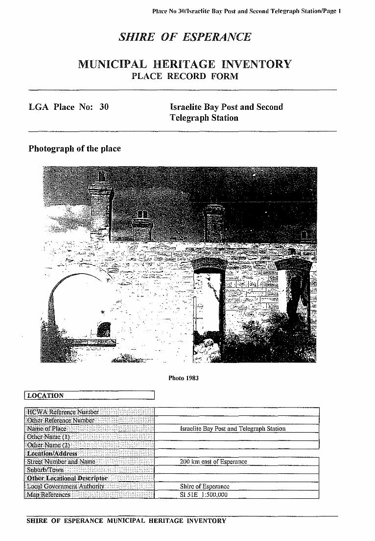
Plan' No 31111<l":Iolit(' Bay Post and Second Tclcgl":lJlh Station/Page 1
SHIRE OF ESPERANCE
MUNICIPAL HERITAGE INVENTORY PLACE RECORD FORM
LGA Place No: 30 Israelite Bay Post and Second Telegraph Station
Photograph of the place
. ','-.:.,... .' <, •• -:
Photo 1983
I LOCATION
SHIRE OF ESPERANCE MUNICIPAL HERITAGE INVENTORY

Pillre No 30tI-mrlite Ba)' Po,t and "erond Telegraph StlltionlPagc 2
I OWNERSHIP & LAND DESCRIPTION
6MieJ'ii···· ...•......... > .. .. Address·· .. .....•....... . ...•...•.............• Phonejax ..... SlaI1l." .....•... ~ .....•. No
The Crown Vested in the National Trust of Australia (WA) and CALM .·tahl!DeScih",;nn< ...................•..... .. ·.··.i· .. ·i.·.·····.! lkserveNo.< . .............. .La//LOcl1/iOnNo. .•.......•. ' ..... i· ....• ···.IPldn/DioRrmn·· .. , ." . <!J:o/!]"olio ..... ··.···lNo; C 36002 Mardarbilla 7
I DESCRIPTION
UBIe!I}/·.·.··.··.····.· •. ··.·,·· .........•.•..•.....
: (2}· •• ·.·<··<··········· •.••.. ····./··.·i ...... ·.·.······.·.·.···.·.·.····· ... · .. ·• . ....... . .....<
...................... ......... \ ..
.· .... ·..i
I D82706 I
August 1895 . April 1896
·16 An 1895 ('
. station line from West to East
1··iLi.ii? ............ A L Payne, Locke
).............. t .. •••·•·•·•·•··•·····•·••·.····
!
"; ( ) ..... ·.·.·•·· •. ·.i~+l---"S""-'!..cottt W=3S;=, alsol!!.:; al b=uild"",er·..:.:. i'n "",' th""e:= area'--___ ---i .....••..• ).<~';"I/'---------------j
•• Local stone r{"i:ij,\ CGI
'i.······ . Tin Jer ig Ii .. <,;·.·.i·.· ......... ;; .... ? .... "77. . ..... ' ~~r
The walls of the ruins are solid.
.
···)i ...•.•...•..
• The telegraph station was founded in approximately 1877 when the Overland Telegraph Line was constructed. The early timber bUildings were replaced with new and larger buildings in 1896 using the design of George Temple Poole. renowned government architect. under the supervision of builders Payne and Locke at a cost of £2,572. The building had 12-foot walls and four tall chimneys. The rooms were spacious and well proportioned. the public and mail room being 20 feet by 16 feet, with three tall windows along one wall. Housed under the one roof were the Telegraph master's residential quarters, and separate similar accommodation for the single men's quarters.
The station remained in use until 1917 and although it was stripped of timber and iron which was sold and removed circa 1927, the stonework is in excellent condition.
In the area are the graves of Postmasters John Healey 1898. John Francis c.1920. Thomas Brass 13.1.1916, John Cook 14.10.1912. and John Charles Lecount 18.12.1922 (aged 52 years)
SHIRE OF ESPERANCE MUNICIPAL HERITAGE INVENTORY

Place No 30/Israelite Bay Post and Second Telegraph Station/Page 3
I SIGNIFICANCE I
Historic Ihenic (s) Transport and........................ Communications
....... .......Sub1hciic (s) • . Telecommunications........................................niSt*tecnt or Significance
Apart from the Telegraph Station staff, others lived in the area too. Cook's cottage is still present. althoughis partly ruined. Dimer bought the Telegraph Station building in 1927. He took the roofing for the shearersquarters on his property in 1928. The Brooks house ruins., a cemetery with five graves and the ruins of thehouse occupied by Cook can be seen.
The telegraph line from west to east was a major achievement for the time. The station has historicsignificance as a link in the Albany to Eucla and overseas commmunication system which played animportant role in the development of Australia. The operation of the place had great scientific significance,but there is not much left to demonstrate that now. The remains of the building are a landmark in the remotelocation and demonstrate how well it was designed to suit its purposes and location. The social value of theplace lies in its capacity to remind present and future generations of the ability of people to build and operateessential services in extremely difficult circumstances.
The area is visited today only by occasional fishermen or people interested in local history. It is surroundedby Coastal Reserve No A 27632. commonly known as the Nuytsland Nature Reserve. The area containingthe Telegraph Staion and the nuns of the surrounding settlement have been classified by the National Trustof Australia (W Australia), and have been entered on the National Estate Register. It was also entered on theWestern Australian Register of Heritage Places in 1993. The National Trust ha ys produced a conservationplan for the Telegraph Station Building.
•men(latkm/Conservation Str4iteg
I OTHER I- .......... ............ - ............................... ......................
Supporting Information.............
.......................................................................................... I............National Trust (WA Heritage) -Registered National TrustGovernment Gazette 16.8. 1895. Esperance Chronicle January - March 1896, March 1897.
- ..................... -...... .Listing andAssessrnent................................
lcssEw (is.) v(Wle . ' i,;iie.c.Sor (srn) j(,1(/tc.cs P/)OflC.................... ......... .. ..... .......Community Committee do Shire ofEsperance Ph 090 711666Stale Register of Heritage Places:Y/N. Y----Classilied by the National Trust (YIN) ........... .......
.... ........................Register ofthc National Estate (Y/N).. .......................
. ........................Local Town Planning Scheme (YIN)..
SHIRE OF ESPERANCE MUNICIPAL HERITAGE INVENTORY

Place No Ofhraelite 13:is Post and SCCOfl(J Telegraph StationfPage 4
r!T'p
t.3 -ip-- mIr
:•
L
--: •
4P44 i#. - 1
b I tt :
:\ JJ' ;*!
. :AL
Cook's Cottage, Israelite Bay
SHIRE OF ESPERANCE MUNICIPAL HERITAGE INVENTORY

-
Place No 31/Kangawarrie Tank/Page 1
SHIRE OF ESP!ERANCE
MUNICIPAL HERITAGE INVENTORYPLACE RECORD FORM
LGA Place No: 31 Kangawarrie Tank
Photograph of the place
Al 1K.
., .
- t w ! j;k?1p
:ba %b
(
i'i
41 r t! j I1?#b
Lei,
o^w
: , ''ci
.:;
• • , :.
, - . .
L:
;: 1i4 s? '' *'
't' A '
Kangawarrie Tank
I LOCATION I
SHIRE OF ESPERANCE MUNICIPAL HERITAGE INVENTORY

Place No 31lKangawarrie Tank/Page 2
I OWNERSHIP & LAND DESCRIPTION
............ ....... . . ..... . ....
----
1 kIdl( S I PIwfl( /a I (antsPt Vacant Crown LandPt Reserve 41934 vested in theNational Parks and NatureConservation AuthorityLand Descripilon ............................. I/?ecer'e;\?() LOtL()COtiO!1 A'o. I PIanI)iagrain , I o/. ioIio: ....
DESCRIPTION I
............... ... . ... ....ConstructIon Date ( I ) 1880sConstruction Date (2)Source/Details
... .. .................Site Type , , . . Tank and dwelling
se S) of Place()r4'in9l .. . . Station outcamp...Preseiit Abandoned
. . ... .Other . . Unusual camel padArchitect/Designer ( I ) J P Brooks of BalbinyaArchitect/Designer (2)OtherAssociated Persons ( I.).Other A'ssociated Persons (2)Construction Materials:
.......... ..... .. .... . ..... . ...
.. .Jfalls. Limestone
...... ....... ... . ... .. ................... *
. ...... .. .......... ......ROOf...the . . Iron watering trough.. ... .... . . ....... ...
ModifictIons . None....
Condition ............................... .. . GoodIntegrity (how much of the original fabric is Allintact?):Description .
Kangawarrie tank is a large rectangular stone structure sunk below ground level. The walls areapproximately 3m high. In the vicinity. situated in the larger of two grass plains near the Russel Range. arethe stone remains of a building which was never completed. The ruins of the cottage are set amongst thetrees.
SIGNIFICANCE I.. . ..... ....... ... .... . ... .. ..
Historic theme (5)
OccupationsSubtheine (s)
Grazin g. nastoralism. dairvinStatement of Signiticance
The area was used to shepherd sheep. being only 15 kilometres from the main homestead on a well wateredand grassed road. J P Brooks started to build a house there. which was never completed. Piles of buildingstone and sand can still be seen.
RccomnwndationlConservation Strategy ....
SHIRE OF ESPERANCE MUNICIPAL HERITAGE INVENTORY

Place No 31/Kangawarrie Tank/Page 3
OTHER I............ ........................ ......... ... .... . ..Sunnortin InformationDOLA File 2348/99 1: Pt Reserve 41934, "Conservation of Flora and Fauna" vested in the National Parksand Nature Conservation Authority.Listing and Assessment;lssessor (s) V(L!1l(
communitV CommitteeState Register ofJ-leritage Places:(Y/N)Classified b the National Trust (Y/N)Register 6f the National Esfate (Y/N)Local Town Planning Scheme (YIN)
:1sse.ssor (s) ; I ss PIfl)II(
c/o Shire of Esperance Ph 090 711666
t W//1
i? #
4
or
of
i:w t5$=* : j t? W:& acc 44M1 / I ' '
?:¼ 4_•%
\
Si IJ .' ____.-
''. . 2 1 " yl
! ) JhI(3$
E:4w
t'e2 + 4 i '\ 'r CIL
The stone remains of the unfinished building.
SHIRE OF ESPERANCE MUNICIPAL HERITAGE INVENTORY

Place No 31/Kangawarrie Tank/Page 4
:
The view looking from the ruin to the tank at Kangawarrie.
SHIRE OF ESPERANCE MUNICIPAL HERITAGE INVENTORY
PIice No 37/I ynburn Station, Thomas River/Page 1
SHIRE OF ESPERANCE
MUNICIPAL HERITAGE INVENTORYPLACE RECORD FORM
LGA Place No: 32
Lynburn Station, Thomas River
Photograph of the place
;a,
il^i l '
:t-'. 7--
%:70 1-
. .
I LOCATION
HCWA Reference Number........... .. .
Other Reference Number .................... - ....... .............. I ......Name of Place ................ ......................... ........ - .............
. ......... ..... .... .......Other Name (1)
......... . . ........ .... .. ................. .............................. ** ..... .
OthcrNaiue(2)
... .ao
Street Number and Name...... .. ................................ ....................... ...1.111-1- . .... ................ .Suburb/Town....................... .. ..... ........... . . ............. I ......Other LA)CatiOflal UcscrII)torLocal Government AuihoritMap References
Thomas River StationLynburn Station (Lyndburn Station
Thomas River. East mail runEsoerance
Shire of Esperance3304515 123000'E
SHIRE OF ESPERANCE MUNICIPAL HERITAGE INVENTORY
Place No 32/1 vnburn Station, Thomas River/Page 2
F OWNERSHIP & LAND DESCRIPTION I
........... ... I I NO()wner - 1(14IF(?SS PhG & P Grewar Box 154, Esperance 711865.... ...... .......... ....... .. ...... .................. __ ......LandDescriptIon: I,. .. ....... ... ...... ..... .......Reserve No. LolLocalion l'lan.Diagrani......
Neridup Loc No 5 P1 Jedacorrudup & Pt CapeArid
I DESCRIPTION I
I .'Vo.
Construction Date ( I)Construction Date (2).. ................. ................ ... ..... ............................................ . .----- -------SourcefDetais............... ............ .....Site .peUse(s) of Place...... .......()riçinal
Other
Architeci/Desipicr (1).'Arc liiLclIDesiner (2).Other Associated Persons:.(1)......... ......Oilier Associated Persons (2) ,
....... .Coustruction MatcriaIsii aiIs Local river sandstone,.... . .... . .. .. ... .
I .............. ......... ... ................limestone rock with mudmortar
ROOf Thatch of river rushes....... ........ ......... ...... ... -now CGI
er Local Yate wood beams. .... .... .. .... . .. ... .-------... ... **"* ...... ..... .Modiiicalions
Conditioii...... ... ........... . ............. I ... ... I .......... . . .... . ....... .... .... . . .... ............ . . .......
Integrity (how much of the original fabric is. .inlact?):...........
Descrintion . ..........
(1)1872 (2) 1889
( 1) Settlers Cottage (2) Shearing Shed
( 1) Homestead (2) Shearing ShedUnliveable
(1) Not known probably Campbell-Taylor and helpers(2) H Dimer
Roof (thatching burned now iron). No verandah now.Fair - redeemableFloors and verand6,h. windows and doors all gone.Cellar virtually gone. Shearing Shed re-roofed and halfre-floored.
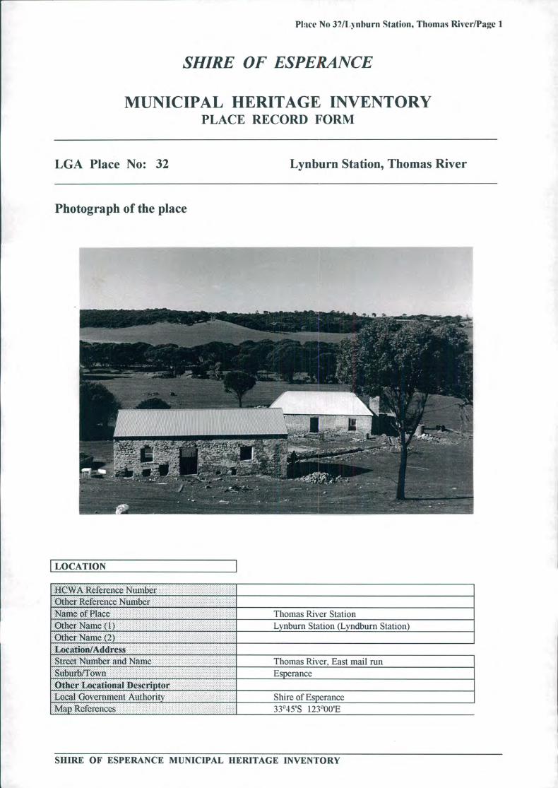
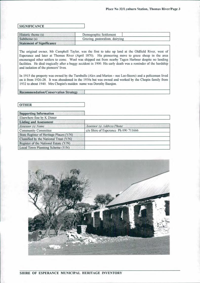
This simple settlers cottage was located on very fertile soil in a very pretty setting. Situated in a valley sixkilometres from sea, it was on the original telegraph line track to Israelite. The old doorways were tiny, andthe house consisted of a vestibule, kitchen, sitting room, four bedrooms and a verandah. A substantial stoneshearing shed is located nearby. Nearby is the grave of Dennis Dunn who died in 1890 when he was10 months old. His father was Andrew. the Station Master.
SHIRE OF ESPERANCE MUNICIPAL HERITAGE INVENTORY
Place No 32/I vnburn Station, Thomas River/Page 3
SIGNIFICANCE
HistorIc Ilicifle (s) Demographic SettlementSubtheme (s) Grazing, pastoralism. dairy].. . .. ............ .... ..Statement of Si2nificance.............
The original owner, Mr Campbell Taylor, was the first to take up land at the Oldfield River, west ofEsperance and later at Thomas River (April 1870). His pioneering move to graze sheep in the areaencouraged other settlers to come. Wool was shipped out from nearby Tagen Harbour despite no landingfacilities. He died tragically after a buggy accident in 1900. His early death was a reminder of the hardshipand isolation of the pioneers' lives.
In 1915 the property was owned by the Turnbulls (Alex and Marion - nee Lee-Steere) and a policeman livedon it from 1926-28. It was abandoned in the 1930s but was owned and worked by the Chopin family from1932 to about 1940. Mrs Chopin's maiden name was Dorothy Baesjon.
Recon)mendatm/Consenation Strategy
I OTHER
!!rII1ation .. .. .. ..... ..... .... .IElsewhere fine by K DinierListing and Assessnient ..:.1.sw Jssor (s) .\aJ)Ie ._1,SXeS,W)r (SI 1 ddress.Phone
Community Committee do Shire of Esperance Ph ()9( ' 711666State Register of Heitage PIaccs:(Y/N Classified by the Natioiial Trust (YIN)Register of the National Estate (YIN) Local iiTo Planning Scheme (Y /N)
. ,. .. .1 .,
./ ,..
:.
.4
VO
& ..tV:..1?. *: . ( I
.:v' 'é'AIP
14
.. .-'.
V
Air
,pip V
. .
SHIRE OF ESPERANCE MUNICIPAL HERITAGE INVENTORY
- I
Place No 33/McCarthy's Residence/Page 1
SHIRE OF ESPERANCE
MUNICIPAL HERITAGE INVENTORYPLACE RECORD FORM
LGA Place No: 33
McCarthy's Residence
Photograph of the place
I LOCATION I
I-ICWA Reference NumberOther Rcferciicc Number.. .................... .. .... ............
Nanie of Place........ ...... ......
....... . ....................
Other Name ( I )Other Name (2)Location/AthiressSired Nutt: and Nam.......Suburb/TownOther Locational DescriptorLocal Government AuthorityMap References
McCarthy's ResidenceBaseden Residence
16 The EsplanadeEsnerance
Shire of Esperance
SHIRE OF ESPERANCE MUNICIPAL HERITAGE INVENTORY

Place No 33/McCarth y's Residence/Page 2
OWNERSHIP & LAND DESCRIPTION I
(')wner . I th1r.cs PhOfl(?JaX Statit...... ...... s'.................. AW........... .---- ----F J WelkeP0 Box 483 Darwin. NT 0801............................ ........... ........ ..... ...Land Description : I .. ..................
. ............... .............Reserve !Vo. I oi Lücaliüii .\ o. Plan J)iagram I 'o/Foliu No........... .......
92 1526-972
I DESCRIPTION I
nstruction Date (1) 1919nslrtiction Dale (2) •urce/Details Niece of builder/ownerC p9 Dwelling(s) of Place'iiwl Dwelling
ru Dwelling
... ........ .. .....Cr E McCarthy (Jnr). J Orr., T Orr, R DouglascUDesigner (2)
Associated Persons ( 1)h r Associated Persons (2)
: ctruction Materials:. Iron Wooden weatherboard
Iron
difications Have been carried out to carts of the residence.. .iditIon Good
n" , egrity (how much of the original fabric is 75 percentAft?.:
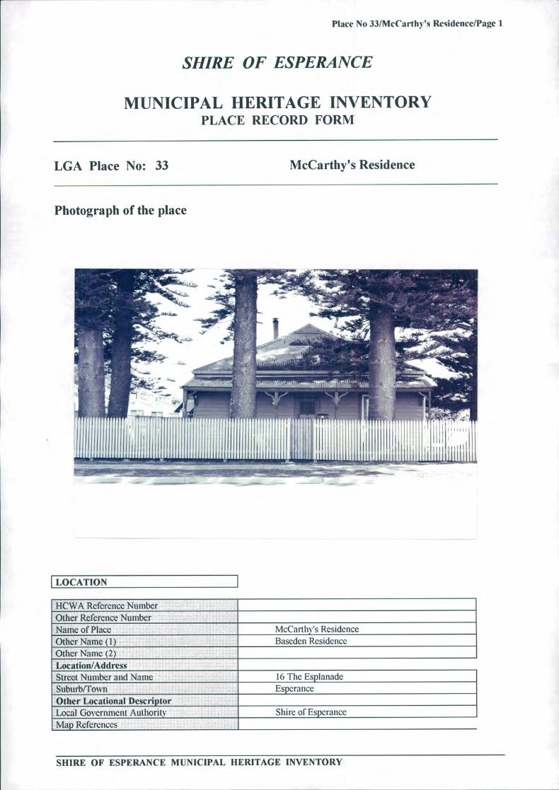
The neat weatherboard house has a verandah supported by wooden posts running the length of the front. Thedoor is central and is flanked by symmetrical windows on either side. The main roof is pitched and theverandah roof is flat. In the front yard are a number of very large Norfolk pine trees. planted in 1919.Some existing features of the residence are remaining from the original construction. with french doors. ironwindow/shade and ornate cornices.
SIGNIFICANCE
Historic theme (s) PeopleSubthcnic (s)Statement of Sficance
The residence was constructed by an early pioneer of the area. McCarthy had considerable input into theearly development of central area of Esperance and the salt works at Middle Island and Pink Lake.
Recommendation/Conservation Strategy.
SHIRE OF ESPERANCE MUNICIPAL HERITAGE INVENTORY

Place No 33/McCarthy's Residence/Page 3
OTHER I
SHIRE OF ESPERANCE MUNICIPAL HERITAGE INVENTORY
Place No 34/Middle Island/Page 1
SHIRE OF ESPERANCE
MUNICIPAL HERITAGE INVENTORYPLACE RECORD FORM
LGA Place No: 34
Middle Island
Photograph of the place
\ •L\
Z^t44t;
Ae
7-- jri# - <fr& I a
-
:d';::
I "%41L•'d
-
I 1! - mot
\j Wvp4
IT,'
OF
,, : •0 ' . j4 :: _Im
.001
1:- '4 r_-•_:_ -:-
I LOCATION I
HCWA R eference Number ........ . . ...........
.................. .. . .........Oilier Reference Number -,-" "' " ' "' ""' ,...... . ......
.......... .. - I .... ..................... ... .......... ...... . ........................ L ....................
N uu. ol P1 iu Middle Island....... . r , , ^. .... ... .... ... ........ ...... . ... .. .OtIcr N mR.
.... ......................... r ........................ ( I ) Isle Dc Milieu
her Name (2Ot
--"-::'4. . .
• tv
,
g-r:
SHIRE OF ESPERANCE MUNICIPAL HERITAGE INVENTORY

Place No 34/Middle Island/Page 2
Locatioti/AthiressStreet Number and Nanic .11 ......
ONM. .... . . ....... . ..
Other Locational DescriptorLocal Government AuthorityMap References
Recherche Archipelago Nature Reserve9 kms south of Cape AridEsoerance
Shire of Esperance35°06'S 123 0 1 P
I OWNERSHIP & LAND DESCRIPTION I
()wner... . . . . . . . ... . . . . . . ... . . . . . . ... . . . . . . . . .
; I cit/revs............. . . . . . . . . . . . . . . . . .
Status
Dept of Conservation and Land 92 Dempster Street. Esperance 713733ManagementLand Description : I .I?fse?1'e \'o. IA)I .LOC(ZtlO/1 .\o. f'Iaii /)Iagiaiii JO1i')I1() /W).
22796 428/8()
F-DESCRIPTION I
.. ...Construction Date......................... ( I ) , , , 1835. ...........
Construction Date (2)SourcclDetails A Court Declaration (Albany Court)............... . . ............ ... .. ......- --------- Site T PC • • Stone Well, 3 Stone Fireplace and rusting remains of. .........
. . . . wrecked steamer "Penguin" 1920Use010 Place .Original Dwelling camp for seal hunters.Pre.seni CALM Reserve.. ..... . ...... ....... .................. ..... .......other
........ .. .......Salt farming. . ........ ..... .....
ArchitectJDcsiiicr (1) John Anderson (alias Black Jack)Architect/Designer (2....... ..Other Associated Persons ( I ) ,Oth Associated Personers (2)
Construction Materials:Drvstoiic
()ilwr
Modifications Sheets of corrugated iron on top to protect.Condition . Well - fair. Fireplaces - poor. Wreck - very poor.Integrity (how niuch of the cnigiiml fabrIc is Well - all. Fireplaces - only part,iit1rt) l)tiOfl
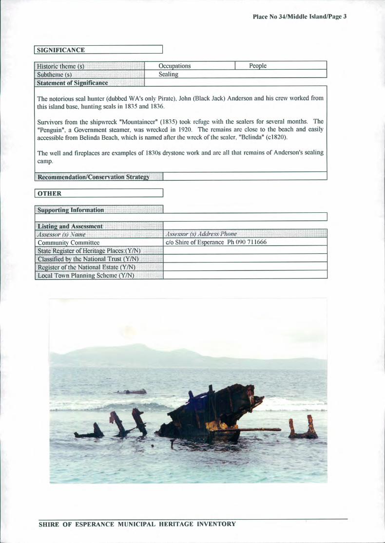
Middle Island is a large (1080 ha) picturesque island nine kilometres south of Cape Arid and 130 kilometreseast from Esperance. It is a CALM nature reserve (Class A). From 1937 to 1958 a pastoral lease was heldover the island by Alexander Chisholm of Kalgoorlie.
The south coast has high cliffs while there is a long beach on the north coast. At the western end is FlindersPeak (174 metres), a large granite hill. Behind the beach is a pink saline lake approximately one kilometreacross.
SHIRE OF ESPERANCE MUNICIPAL HERITAGE INVENTORY
U:
Place No 34/Middle Island/Page 3
I SIGNIFICANCE I... ... . ..... . .....Historic th eme (s) Occupations
le
Subtliciuc (s) SealingStatement of Significance
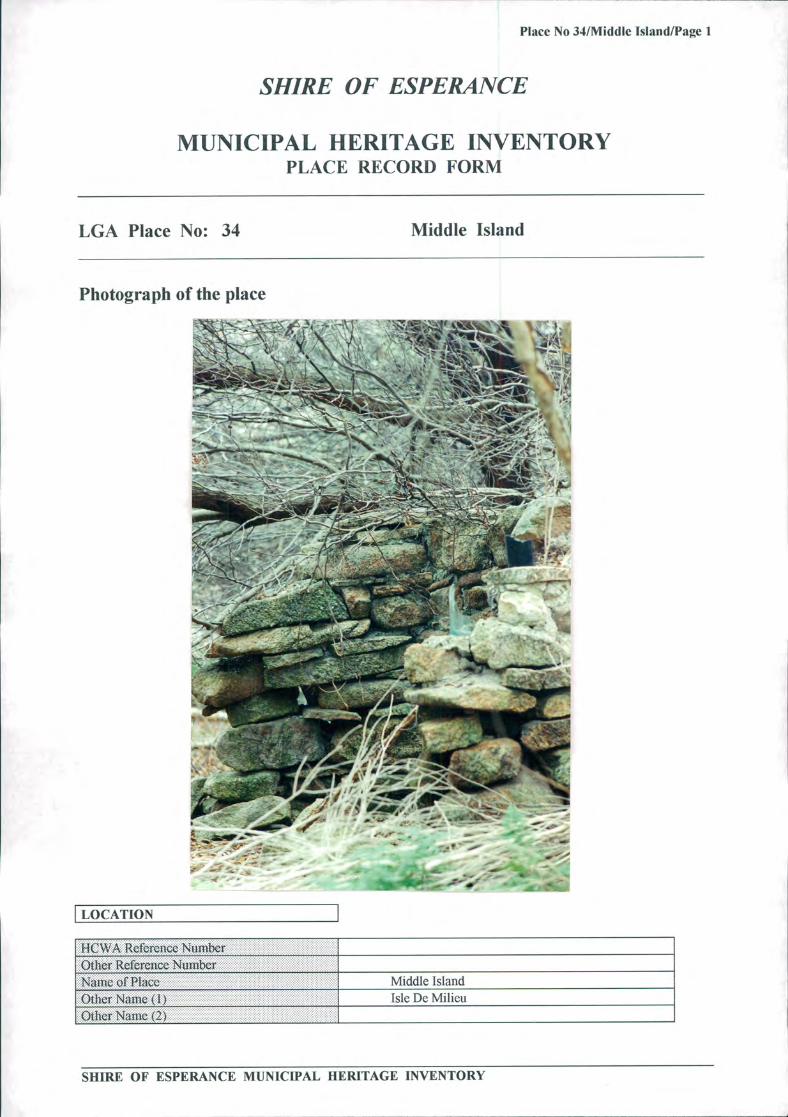
The notorious seal hunter (dubbed WA's only Pirate). John (Black Jack) Anderson and his crew worked fromthis island base., hunting seals in 1835 and 1836.
Survivors from the shipwreck "Mountaineer" (1835) took refuge with the sealers for several months. The"Penguin". a Government steamer. was wrecked in 1920. The remains are close to the beach and easilyaccessible from Belinda Beach, which is named after the wreck of the sealer. "Belinda" (0820).
The well and fireplaces are examples of 1830s dry stone work and are all that remains of Anderson's sealingcamp.
nendan/Conservation Stio trate
I OTHER Iorting Information
Listing and _______
A,SSe.cSO/ f's) \cwie ._l.s.ws.cor (c) . lddre. P/nne
Community Committee do Shire ofEsperance Ph 090 711666Rcis1er of Ueritae Placcs:(YIN)
Classified by the National Trust (YIN)
Register of the National Estate (Y/N)Local Town Planning Scheme
---.
SHIRE OF ESPERANCE MUNICIPAL HERITAGE INVENTORY
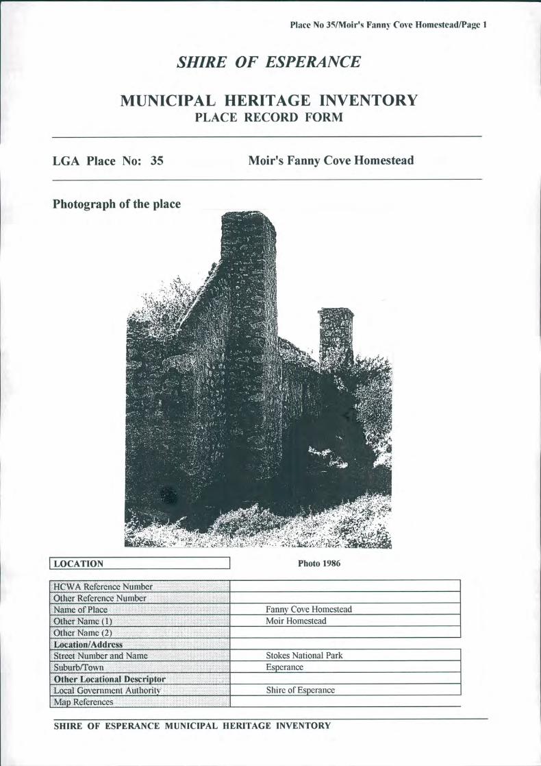
Place No 35/Moir's Fanny Cove Homestead/Page 1
SHIRE OF ESPERANCE
MUNICIPAL HERITAGE INVENTORYPLACE RECORD FORM
LGA Place No: 35
Moir's Fanny Cove Homestead
Photograph of the place
44;
E ? .
' .
LOCATION I Photo 1986
HCWA Rcfcrciice Number
Other Reference Number .... .. . .... . .... .....
Name of PlaceOther Naiie ( I)Other Name (2) ....... ... ..... ..... .
Location/AthIrcssStreet Nwither and N' Suburb/TownOther Locational DescriptorLocal Go'crimicnt Authority........Map References
Fanny Cove HomesteadMoir Homestead
Stokes National ParkEsoerance
Shire of Esperance
SHIRE OF ESPERANCE MUNICIPAL HERITAGE INVENTORY
Place No 35/Moir's Fann y Cove Homestead/Page 241
I OWNERSHIP & LAND DESCRIPTION I
(')snrkldi< s P/1()/1( /a 1a1ii. . . . . ............. ....CALM 92 Dempster Street. Esperance. (090)713733
WA 6450L and Dc scription... ....... I .............. .................
. ................ .......I?: SCI L\ ü I ol I ocatlon \ 0 Plan I)iagi am I ol fo1io \ o.......32601 Esnerance 1961
I DESCRIPTION I
Construction Date ( 1)
1873-1888 .. .. ... ...... ............ ...................................Construction Date (2).. .. ...... ..........................................
..................... .......... .... .... .... ......... . ......... .... ....... ............... .............Source/Details Family history Esperance Municipal Museum...........Site Type Dwelling and farm buildings.. .... ....... ..... . ...... . ........ .........Use(s) 01? PlaceOriina/ . Station homestead.................. * ...... 1 ................ ............... .....................P1c til Deserted....................... .................................. ...... ........!!!!!!!! ... ..... .. ... .... ..... .......... * ...... * ... *...... ...................... .. ... ............................. ........................... ....... ..................................... ......... .................... ............ ............................ ......... .... ..........
... . .......................... ............ ........................* ... ........ ....... ...
......................... ........................................... * * ..........
........... .................. ............ * ....................... * ............................................... ................................... ......... -
............... .... .............................. ................ ........... ... ,Architect/Designer (1) Stage 1: John and Alexander Moir and ticket-of-leave.................... ........ ...... ........
.......... . .. ......
............... ... . .convict masons............. ......... .
ArchitecilDesigner (2) Stage 2: William & George (Geordie) Moir with farm......... ...... .................
. labourers.• Ql • iA pciateçl Persons (I)...Other Assodated Persons (2) .................... ................ - ....... .......Construction Materials:......... . . . . . . ........................
.............. ...... . .......................... ............................ ........... - ...... ................................ ........folk Limestone............. .......... .......... ^ I - ^ - 1.ROOf Galvonized Iron Yate timber rafters.... ...................Other Foundation & floor
......... ................................... ....... .................... ......... ........... ........ .................. ................................. ...... . - ___ limestone............... ........ ..... -............. .. ... ................... ... ....... ........... ... ..... . .................... . .
Modifications Original verandah removed from homestead........................... ... . ....... . . ... . .............................. ................. . ........ .. ^ ...... - ......... I ...... * * ...... ..........Condition Homestead - Smithy Shearing Shed....... ......... - .................... W ............ I ....... .............. .................................. .......... ................. ...................... ... .........
Cottage - quite sound
Integrity (Iio much of the original fabric is Main building: walls, cottage walls, rafters roof,......intact?): drystone well - excellent condition.
...... .. ... ..... ........... ... ...... ....D scrIPti!fl.
The Moir Fanny Cove Homestead and farm buildings were erected approximately two kilometres from FannyCove anchorage and about a half kilometre east of Fanny Cove. The limestone skeleton of the buildings,although in urgent need of stabilization, effectively reflect the atmosphere of such pioneer establishments.
According to a National Trust report (1971) there were 5 structures: a house (similar in design to the oldDempster Homestead), woolshed, hut, forge and cast shed and remains of stock yards. Most roofs, floors,door and window frames had been removed.
The kitchen range and adjacent bread oven, reflect the need for self sufficiency in the 'early days'.
The smithy (forge) with its tool racks and outside wheel tyring slab was an important part of station activity.Despite poor condition the woolshed remains an interesting feature and the location of the horseworks andstockyards are clearly defined. There were remains of the wool press in the woolshed and remains of largebellows in the forge in 1971. At that time most of the buildings were occupied by bees, making detailedinvestigation difficult.
The large 100 year old Moreton Bay fig tree and the tall palms growing up through it are impressive.
SHIRE OF ESPERANCE MUNICIPAL HERITAGE INVENTORY
Place No 35lMoir's Fanny Cove Homestead/Page 3
I SIGNIFICANCE 1................... 1.11 ........... ...... . ....... ... .Historic theme (s).........Subihenie (s)Statement of Significance
Demographic SettlementPastoral Land Use
Nineteenth century pastoralists used the relatively small freehold homestead location as the hub of theirextensive pastoral leases. Security of ownership of premises was assured and the sites selected were judgedthe best available. The Moirs of Fanny Cove cut the first track to Dundas in 1888 and later sold stores andequipment to miners landed from ships at Fanny Cove or trekking overland from Broomehill. It was also thebase of their flour cartage contract to Coolgardie. The Fanny Cove Homestead saw the genesis of thebranches of a family still making significant contributions to life in Esperance. Ravensthorpe and theGoldfields.
comrnen(Iation/Consen'ation Strategy
I OTHER
Supporting Information IPhotographs - Western Mail Annual D N Ford, Esperance Yesterday and Today J Rintoul:The Denipsiers - Rica Erickson, Big Weekend 1993?
......... ... .. ......... .. ........Lsting and Assessment _________________________________________________........ ....... ..... 1 SSeS.SO/ (s) Vaiiie -__1SSCS.W)1 (s) . 1 k/re s PJfl)J1e.......
..... .... ...Comniunitv Committee do Shire of Esperance Ph 090 711666Sthte Register of Heritage Ptaccs:(Y/N)Classified by the NatIonal Trust (YIN)
Register ofthc National Estate (YIN) Local Town Planning Scheme (Y1N)
SHIRE OF ESPERANCE MUNICIPAL HERITAGE INVENTORY

Place No 36/Moreton Bay Fig Tree/Page I
SHIRE OF ESPERANCE
MUNICIPAL HERITAGE INVENTORYPLACE RECORD FORM
LGA Place No: 36
Moreton Bay Fig Tree
Photograph of the place
:
'
' N*qN IT
Ark.,A"t
•: .
.-\
LOCATION
.....A Reference Number ............
...... .....O .......................ther Reference ........erName of Place........ ... ................. ............. ... ... ....... ...... ..........
..................... . ......... . . - ................. ---- ........Other Name (1) ....... * ..............
................. ........ ................. I ........... ................... .................... - ................
........... ................ ....... ................. ..........OtheUN 1P ........ ...........................
.................... f ...... ............................ ............................. -- ...... .......
Location/Address............... ........ ..............
Street Number and Nanie........... .......... .......
................ .. ....... ....... ........................... ... ..... ..... ............... .............
u....... . ............ ................... .....
... .Other Locational Dcsciiptor....................................... .............
Local Government.
ritMap References .............
Moreton Bay Fig TreePart of McCarthy's double storey home/shop(However, one source doubts that McCarthy livedin the 2-storey building. His home was a separatecottacie).
Shire of Esnerance
SHIRE OF ESPERANCE MUNICIPAL HERITAGE INVENTORY

Place No 36/Moreton Bay Fig Tree/Page 2
I OWNERSHIP & LAND DESCRIPTION
I DESCRIPTION I
Construction Dale (1 ) Planted 1897...
Construction Dale (2)....................................
............ ... ....Source/DetailsSiteType Tree................!(kf?!Icc.... ............. --- ............. I ... I .................................................. ................ .......... ..........
... ...... .nal........ ....... .........Pre,se,if ..................... -- ............ ................... --........... ..
()ther
.......ription
This very large Moreton Bay fig tree is situated in William Street, approximately 70m west of DempsterStreet on the property where some sources indicate that McCarthy had a double storey home/shop. It is saidit was planted in 1897.
Historic theme (s) People............._Subthciue(s).Statement Of S ignificance................................................ -- ...
The fig tree has survived for almost a century, and it is a magnificent specimen of great size.
Conservation Steatey
I OTHER I
SHIRE OF ESPERANCE MUNICIPAL HERITAGE INVENTORY

- 7
Place No 37lMurtadinia Dam/Page 1
SHIRE OF ESPEJUNCE
MUNICIPAL HERITAGE INVENTORYPLACE RECORD FORM
LGA Place No: 37 Murtadinia Dam
Photograph of the place
::F4r 4•%7'
4 IhF4- '4 I 1 '---- %'_ ç
4
,
. - 4w jr • '. - -- '
+ : ' - -. : ' "k•
-
;:L4IiI;;Lç '$
-- - -!: J _ *
i ' p-- * ( 1L
4*-C-;
" 4
I LOCATION I
Place No 37/Murtadinia Dam/Page 2
I OWNERSHIP & LAND DESCRIPTION
............ ....... ... ........ I ........Id PhOfl(? /iV I S(aIusVCLDept of Lands and SurveysLand Description II?esert'e Vc). I Lot LOCatiOfl ;vo I /'Iai•i Didgiain J I
I DESCRIPTION I........... ..................... .......... ............ .................. ...................Construction Date ( I ) 1 880sConstruction Dale (2)
.... ... .. . .................. ........... . .............. --% ......... .... .... .. ............. ......Source/Details
....... ..... . ......... Local knowledgeSite Type Man made water holeUse (s) of Place ....()riinaI .. . Used for watering stock by shepherdsPres'nt Disused. ...... ...... ......
............ .. ... .
...Other . . .
...... .... . ... .. ...
.... - I .......... ................................... ......,9,!JpsiI (1).J P Brooks
..........Architect/Designer (2)Other Associated Persons ( I)OIlier Associated Persons (2)Construction Materials:!UaJfv EarthROOfOther ,. Dry stone work
.......... ........ModificatIons None...........
..... . I .................
Condition GoodIntegrity (ho much of the original fabrLc is All of the original fabric is intact.intact?):
DeSCflhIti()fl
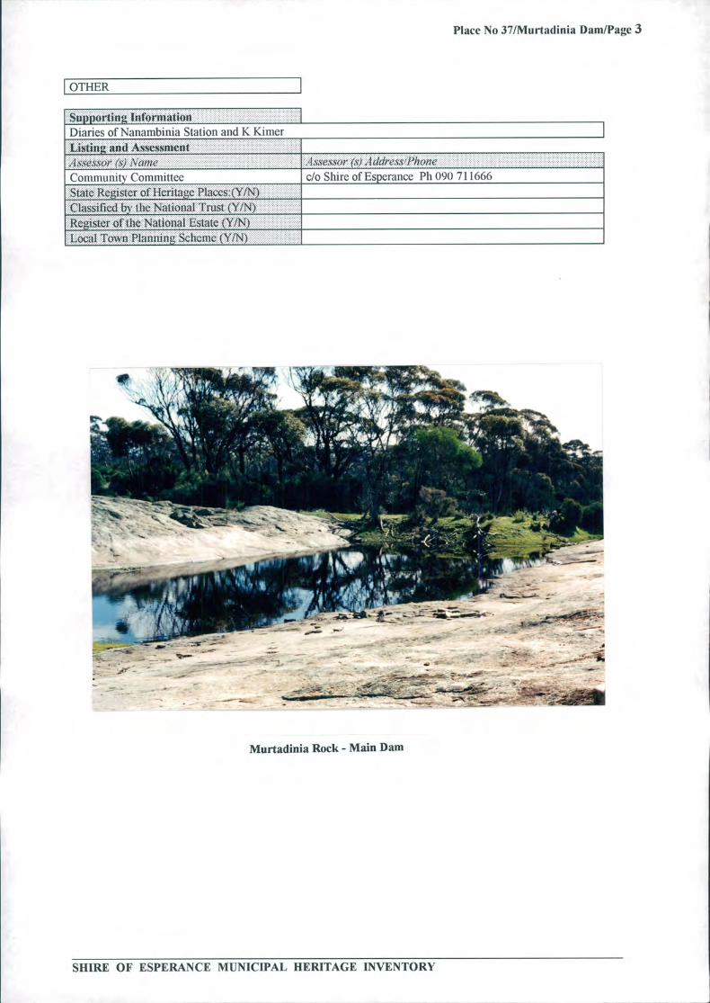
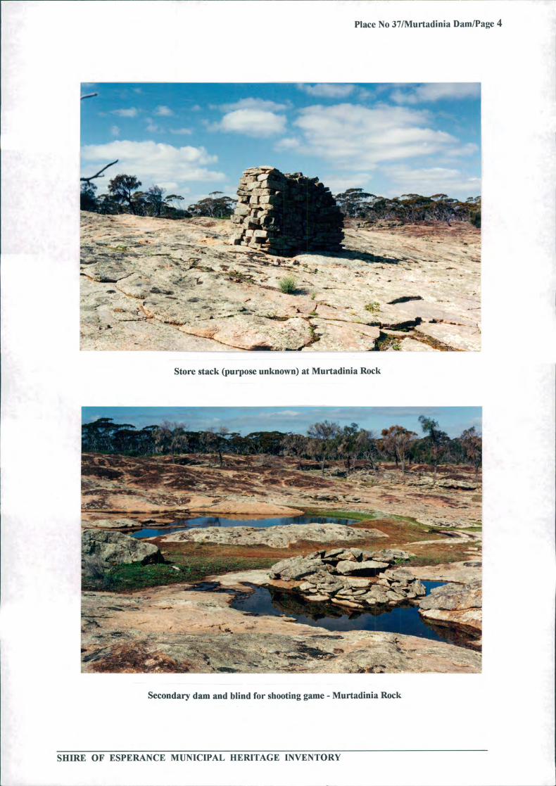
There is a large granite rock used as a catchment for one main dam and several smaller dams. There aresome div stone blinds for shooting animals for meat. The purpose of another small complete construction ofdry stone is unknown. No clearing has been done so the area is still natural bushland.
[SIGNIFICANCE I..... ..... ... . .... . .. ......Historic theme (s) Occupations-----Subthenic (s) Grazing. pastoralism. dairyinStatement of Significance .... .......
..................
This was the main watering hole to the north of Balbinya station, and it would have been essential to thesurvival of the station. Generally this is a place that remains as it would have been used. a good example ofbush craftmanship and ingenuity.
cconiment1ation/Conscrvation Strategy
SHIRE OF ESPERANCE MUNICIPAL HERITAGE INVENTORY
Place No 37/Murtadinia Dam/Page 3
[OTHER I
Supporting Information. . .. . . . . . . . . . . ..... ...Diaries of Naiiambinia Station and K KinierListing and Assessment . ..... ........ .. .. ....
..........................
;1ssessi# (s) .iConiniunilv Committee........ I
State Register of Heritage Placcs:(Y/N)ClassUied by the National Trust (YIN)
..............
Register Nationalof the Estate (YIN) •........
............
... ...... .Local Town Plaminimig Scheme (YIN)
......... .. 0 ..........
.. . ..... .. .... .. ....
..... .... .. . ...."As ' * (Si 1 (/d,?.cSPhC)flC ...................................................
do Shire ofEsperance Ph 090 711666
:
I41
__
:
- '---- -S
- S
- - S5
S:
Murtadinia Rock - Main Dam
SHIRE OF ESPERANCE MUNICIPAL HERITAGE INVENTORY
MAC
r4I - :
...- -
Place No 37/Murtadinia Dam/Page 4
1k. AT
_ • i - .' . é- .. - ;.-• ---- .- 4
:4'--A;,, •T. -: I
40,,- ,"Wr
: -
:- -.---..---
------- ..Sao
: -
Store stack (purpose unknown) at Murtadinia Rock
ir
:c
-::----- U•I-L-- * - - . •4_I :: . :
4i*rWOW
' w _
won
41 1
T -: ' T ? 'r"Vol_
*rr::
- -- ;;
Secondary dam and blind for shooting game - Murtadinia Rock
SHIRE OF ESPERANCE MUNICIPAL HERITAGE INVENTORY

Place No 38lNewtown Jetty/Page 1
SHIRE OF ESPERANCE
MUNICIPAL HERITAGE INVENTORYPLACE RECORD FORM
LGA Place No: 38 Newtown Jetty
Photograph of the place
idl
ikliz
_ - ..
•, 1'1J _
ETIETEJ1::
I LOCATION I.................... ........... I .................... ........ .. ..... . ...... .........I-.14 Reference Number . . ....... ......
Other Reference NuniberName of Place Newtown JettyOther Nairic ( I ,, Esperance Land Co JettyOther Name (2) . Hampton (Plains) town jetty.. .
Location/Address ............ ......................... .......... .. .................. ..... ..... .......... ........... ....... *.-'.-* '' *'.'... ........ ........
Street Number and Name Castletown QuaysSuburb/TownOther Locational DeSCriI)torLocal Go crnment AuthorityShire of EsperanceMap R' fi
SHIRE OF ESPERANCE MUNICIPAL HERITAGE INVENTORY

Place No 38/Newtown Jetty/Page 2
I OWNERSHIP & LAND DESCRIPTION I
OwnerI
Idress
J ihoiwJax
.................. Siaius......................
Land Description................................................................................................................................I........ .. . .... .... . ..................
Rt'seri'e .Vo. LOtLOC'aIlO/1 .\(). J/aii I.)iagram 0/ JO/iO
Originally off Loc 18 Survey1881
I DESCRIPTION I.'-- .............. ... ..... ..Con$tniction Date ( I ) 1894C` us ructim Date (2)Source/DetailsSite Type . JettyUse(s) of PlaceOr1i•wI . Used for loading and unloading vesselsPreseni Some piles remainOther ,
ArciiitecI/Dcsiiier (1) Esperance Propnetry CoArchitectJDesiner (2) . Mr A B Wright (extensions)Other Associated Persons ( I)Other Associated PersonsConstruction Materials:JUalls
ROOf
other Timber and bolts _____________________________________________________________________Modifications . Extended in 1896 by Mr A B Wright.... ........Condition............................................................................ Very poorIntegrity (how much of the original fabric is Very little1 ____________ :::Desen Won-
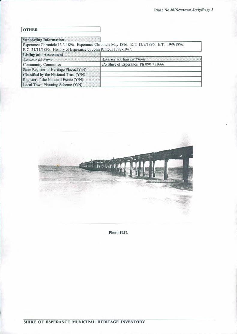
The Newtown Jetty was situated in Esperance Bay along Castletown Quays and Eastern end of ChaplinStreet. Approximately 29 piles remain from the original structure, with some seven cross top beams.
[SIGNIFICANCE I
Uistori theme (5)
......... ... .. ....... Transport &.. .. .......... ........... .........Communication
Subthenie (5). . Sea TransportStatement o.
This was an early sea loading and unloading facilit y in Esperance, thus the remaining structure has historicvalue and is considered an important Esperance landmark. Prior to the jetty being built. provisions wereferried to shore by small boats. Over the years it has disappeared - some naturally and some with humanhelp.
Recommendation/Conservation StrategI I
SHIRE OF ESPERANCE MUNICIPAL HERITAGE INVENTORY
- !
Place No 38/Newtown Jetty/Page 3
I OTHER
Supyortin IflfOrillatiOfl IEsperancc Chronicle 13.3.1896. Esperance Chronicle May 1896. E.T. 12/9/1896. E.T. 19/9/1896.E. 21/11/1896. History of Esperancc by John Rintoul 1792-1947.Listing AO.d. Assessment .
...I s.ses.s'or (s) \/?1( - 'lsse.ss(Ir (st) - I d(IreX.s'PJio!lC ... ................Comniiinitv Committee c/o Shire of Esperance Ph 090 711666.. ... .......St 'ate' of Heritage Ptaces:(Y/N) ..........
Classified b the National Trust (Y/N) ,R.eister oftlic National Estate (YIN)Local TownPlanning Scheme (YIN)
Photo 1937.
SHIRE OF ESPERANCE MUNICIPAL HERITAGE INVENTORY

Place No 39/Norfolk Pine Trees/Page 1
SHIRE OF ESPERANCE
MUNICIPAL HERITAGE INVENTORYPLACE RECORD FORM
LGA Place No: 39
Norfolk Pine Trees
Photograph of the place
Al
•:
', I494s ' ,-
j}4 '-
)wt * +w ;;
L
\1:s4 Al
44: 1!. r* T ;: ow a;r
OF
*4Zv, :?
'4 $#•
1
,M
S
1s
dav -1
—---
LOCATION I
SHIRE OF ESPERANCE MUNICIPAL HERITAGE INVENTORY
Place No 39/Norfolk Pine Trees/Page 2
I OWNERSHIP & LAND DESCRIPTION
....... . ...... ....()wnerjd(1re.:s PIioiieJt2x S (a/tic . .....-0 ...
Esperance ShireHasla illsLand Description.i
........Reser'e iV(). . I .LOI.L()(atiOfl /T() j P10/I i)iagrain. J:/ ,........ .............
DESCRIPTION
Coflstrtictioll Date (1) Planted in 1896. 1897Construction Date (2)Source/Details. Photographs....... ......... .... ..........
..... .. ... ...................................... Site Type ,,, , ,, Norfolk Pines........................................................... ......................
..................... ..........
.......... ......................................................... ....Use ()I? PlaceOriina/ .. ..Present .......... ..
OtherCondition Good............. ...................... ................ ........... ......Integrity (how much of the original Fabric is All......... .............illtact4!):Description
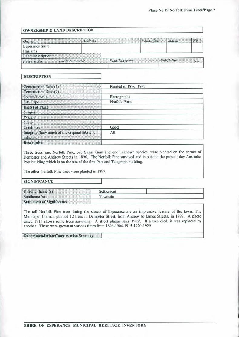
Three trees, one Norfolk Pine. one Sugar Gum and one unknown species, were planted on the corner ofDempster and Andrew Streets in 1896. The Norfolk Pine survived and is outside the present day AustraliaPost building which is on the site of the first Post and Telegraph building.
The other Norfolk Pine trees were planted in 1897.
SIGNIFICANCE I........... 11 ................ ...... 11 ..................... ..... -- .......1-lisiorIc II1CJ1IC (s)
.. .. .. . .... .. ...... Settlement
Subiheme (s) . . Townsite..Statement if Significance.......... .....
The tall Norfolk Pine trees lining the streets of Esperance are an impressive feature of the town. TheMunicipal Council planted 12 trees in Dempster Street. from Andrew to James Streets. in 1897. A photodated 1915 shows some trees surviving. A street plaque says '1902'. If a tree died, it was replaced byanother. These were grown at various times from 1896-1904-1915-1920-1929.
Reconirnendation/Conservation Str
SHIRE OF ESPERANCE MUNICIPAL HERITAGE INVENTORY

Place No 39/Norfolk Pine Trees/Page 3
[ÔTHER
.......... ...... ..................... ......Supporting Information
...... .............I
C J Daw"s 24 Dec 1896, March 1 898. L Daw 1904 May. Esperance Chronicle.
ting and Assessment .......................1SS?SOV (s) Nae .1swwo (st) I (k/leSS Phc)fle . . .Community Committee c/o Shire of Esperance Ph 090 7 1 1666
... . ............ State Risler of Heritage Placcs:(YIN) .Classilied by thç National Trust (YIN)..........Register of 1- h. (YiN).Local Towit Planniiig Scheme (YIN)
SHIRE OF ESPERANCE MUNICIPAL HERITAGE INVENTORY

Place No 40/01d Camping Ground/Page 1
SHIRE OF ESPERANCE.4
MUNICIPAL HERITAGE INVENTORYPLACE RECORD FORM
LGA Place No: 40 Old Camping Ground
Photograph of the place
LaskinA vi40;*w
1;:jZ#*p Yt I "r t:v#t 4
t '
44
W
fc$ : 4;)44
, ,#( ' * !b *
Vol
!7.1 &The treed area in the middle of the photograph was the old camping grounds.
I LOCATION I
HCWA Reference NumberOther 'Reference NuiiiberName of Place Port Authority ParkOther Name (1) Camping Ground..... ......Other Name (2)LocationIAddrcw4Street Number and Name The Esplanade (opposite Esperance Bay Ca ravan.......... . .... ............. ...... ............. Park).... ............. ......... I .......... ....... ........ ^ I ...... 1.Suburb/Town Esperance
. Other Locational DescriptorLocal Government Aiiihorilv Shire of EsperanceMap References
in
SHIRE OF ESPERANCE MUNICIPAL HERITAGE INVENTORY
Place No 40/Old Camping Ground/Page 2
OWNERSHIP & LAND DESCRIPTION
(')flflj l(I(11( ss PI!()I1( Ia\ (aIzis... ........... N6
... .. .... . .. ..... ..... .
Esperance Port Authority Esplanade. Esperaiicc .. .. ................... ...... ... .................... .. ....................... .................... .LaiidDcscriflhØfl
...............
................... . . ............ .......I........... ........ ........ .. ........... .. . .......... ..... .Lo -Lo(LOC(1llOI1 \ o. Plan J)iagnnn I o/ J()iiO . .. .\ 0.
28207
I DESCRIPTION I
Construction Date (1)1893 - used 1920s, 1930s
... ........ ....... .......... ..........Construction Date (2) First usage probably when miners going to Goldfields............ . . .............. . ....... ................... .. ....... ......allowed to camp.
.. .. .. ..... . ................Source/Details.Town plan 1893
..
Site Type ., Camping site
Use(s) 01?
. Camping, Recreation
...... .iJ . Lessees: Mini Golf: Miniature Train.... .Architect/Designer ( I)
ArchitectJDesiner (2) .
Other Associated Persons ( 1). Other Associated Persons (2).... .Construction Materials:Waifs Galvanised Iron
Roof ,. Galvanised Iron
(:)ilier Tent poles on hire
Modifications1930s Kitchen and ablutions provided........... .çondiiioii Very good
Integrity hìow( much of the original fabric is Nil - now lawns/landscaped garden. .intact?):
.n CSCi!tiOfl.
The camping site was a low lying grassed flat area between Dempsters' woolshed and the coasthills. LaterTuart gum trees were planted (1930s) and a kitchen and ablution block of galvanised iron provided basicfacilities. Dempsters' shepherds and stockmen camped here. The Dempster's woolshed was on the westernside of the camping ground. A narrow guage tramway linked the woolshed to the Dempsters' Jetty. Thiscrossed the camping ground. Low sand dunes covered with low scrub. rushes and marrum grass protectedthe site from the easterly winds. On occasion the heavy winter seas broached this bulwark and flooded thecamping ground. In the 1920s-50s overflow from the railway dam exacerbated the problem. The high watertable made the provision of soaks and a well an easy task.
SIGNIFICANCE I..................... ........ ................ I ........ - ........ I ... .......... --Historic theme (s) Occupations
. ... ... . ... .........Subtheinc ( 5) Community Utilities
SHIRE OF ESPERANCE MUNICIPAL HERITAGE INVENTORY
Place No 40/Old Camping Ground/Page 3
of Significance .
There is no record of Aboriginal usage although it is likely that short term occupation occurred. Places likeBukenrup and Monjinup where kangaroos etc abounded appeared more popular. The Dempsters probablycamped here. John Forrest camped on this site while awaiting the arrival of his storeship "Adur" (1870) andwhile surveying the Dempster homestead location. Dempster shepherds used this camping ground duringshearing circa 1870-1898.
During World War I troops protecting the wireless station camped here. From the late 1920s to 1950sholiday makers from the Mallee and goldfields spent their summer holidays here. This site became the firsthome in Esperance for such families as the McCrackens. McKenzies Smiths and others.
. Recommendation/Conservation Strateg
I OTHER
Supporting !:!!I!thj0t.ISue Max. Esperance's Man of the Sea. Museum Archives.John Forrest Journals. The Dcnipsters - Rica Erickson and Bushman Barn.......... -Listing aml Assessment ..........
.lsses;cor (S') .\ante , , , , lXSe.c.SOP () I'IIOflC ..........
Comnuinhlv Committee do Shire ofEsperance Ph 090 71166677
-
.t.:tW LW1SWJ Ut r-içt iuigt. I I LN I
Classified by (lie National Trust (YIN)Register of the National Estate (Y/N)Local Town Planning Scheme (Y/N).......
SHIRE OF ESPERANCE MUNICIPAL HERITAGE INVENTORY