Embed Size (px)
Citation preview
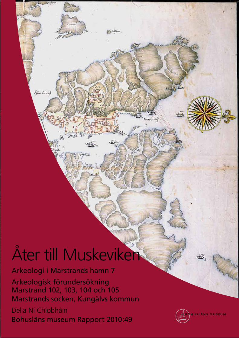
Åter till MuskevikenArkeologi i Marstrands hamn 7
Arkeologisk förundersökningMarstrand 102, 103, 104 och 105Marstrands socken, Kungälvs kommun
Delia Ní ChíobháinBohusläns museum Rapport 2010:49
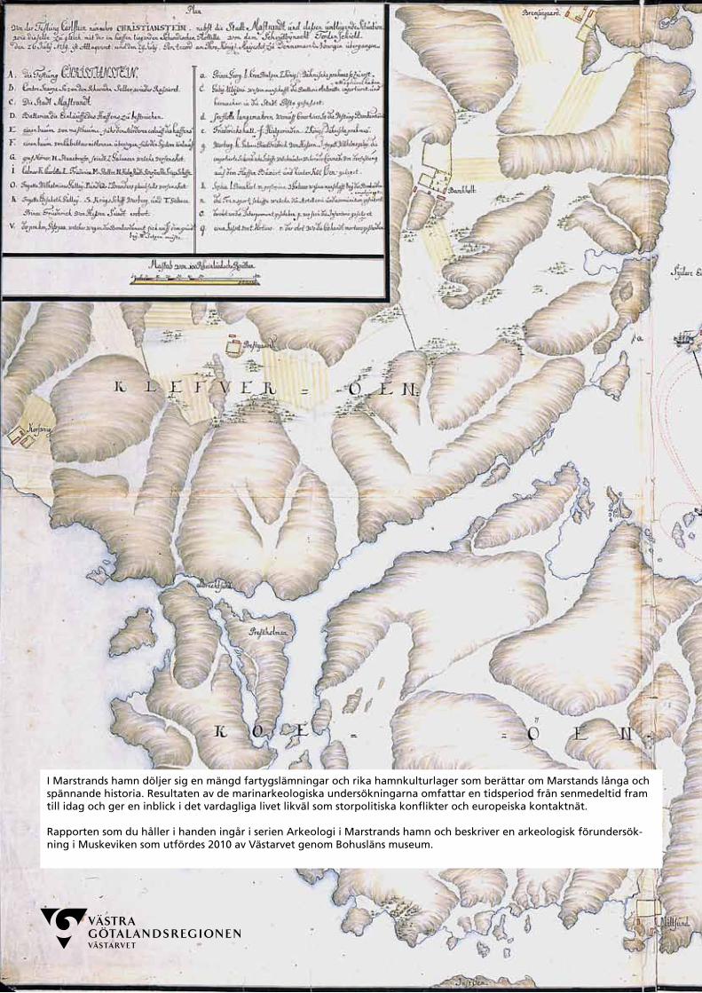
I Marstrands hamn döljer sig en mängd fartygslämningar och rika hamnkulturlager som berättar om Marstands långa och spännande historia. Resultaten av de marinarkeologiska undersökningarna omfattar en tidsperiod från senmedeltid fram till idag och ger en inblick i det vardagliga livet likväl som storpolitiska konflikter och europeiska kontaktnät.
Rapporten som du håller i handen ingår i serien Arkeologi i Marstrands hamn och beskriver en arkeologisk förundersök-ning i Muskeviken som utfördes 2010 av Västarvet genom Bohusläns museum.


Åter till MuskevikenArkeologi i Marstrands hamn 7
Arkeologisk förundersökning Marstrand 102, 103, 104 och 105,Marstrands socken, Kungälvs kommun
Bohusläns museum Rapport 2010:49
ISSN 1650-3368
Författare Delia Ní Chíobháin
Layout, grafisk form och teknisk redigering Gabriella Kalmar
Omslagsbild Utsnitt från ett danskt situationskort som visar den danska flottans angrepp på Marstrand och
Carlstens fästning i juli 1719. Upphovsrätt: Det Kgl Biblioteket Köpenhamn, Danmark. Nr XVIII 4.1 Marstrand C
Illustration Författaren om inget annat anges
Tryck IT Grafiska AB, Uddevalla 2010
Kartor ur allmänt kartmaterial, © Lantmäteriverket medgivande 90.8012
Kartor godkända från sekretessynpunkt för spridning Lantmäteriet 2008-11-25. Dnr 601-2008/3017.
Bohusläns museum
Museigatan 1
Box 403
451 19 Uddevalla
tel 0522-65 65 00, fax 0522-126 73
www.vastarvet.se, www.bohuslansmuseum.se
InnehållSvensk sammanfattning ..........................................................................................................5
Background .....................................................................................................................................................5
Landscape ..........................................................................................................................................................7Natural landscape ..................................................................................................................................7Cultural environment .......................................................................................................................8Historical source material ............................................................................................................9Previous investigations .................................................................................................................11
Methods ............................................................................................................................................................ 13
Results ................................................................................................................................................................... 13Marstrand 103 (cultural layers) ...................................................................................... 14Marstrand 105 (Muskeviken 6) ...................................................................................... 15Marstrand 104 (Muskeviken 7) ...................................................................................... 15Marstrand 102 (Muskeviken 8) ......................................................................................16
Conclusions and proposals for action ........................................................16
References ..................................................................................................................................................... 17Literature ....................................................................................................................................................... 17Unpublished sources .....................................................................................................................18
Technical and administrative data ..................................................................... 19
Appendices ..................................................................................................................................................20
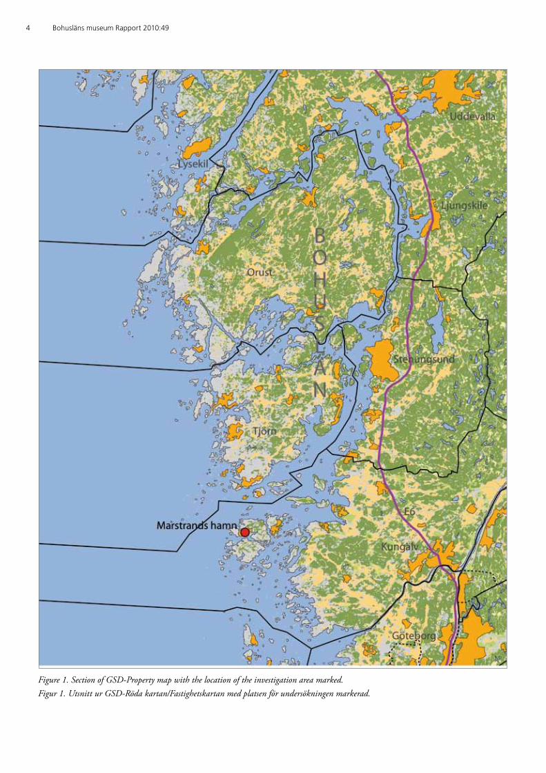
4 Bohusläns museum Rapport 2010:49
Figure 1. Section of GSD-Property map with the location of the investigation area marked. Figur 1. Utsnitt ur GSD-Röda kartan/Fastighetskartan med platsen för undersökningen markerad.
Åter till Muskeviken 5
Svensk sammanfattningMed anledning av planerad muddring har Västarvet genom Bohusläns museum utfört en marinarkeologisk förundersökning inom en del av Muskeviken, Marstrand, Kungälvs kommun. Inom Marstrands hamn fanns sedan tidigare omfattande kulturlagerförekomster samt ett stort antal fartygslämningar med datering från 1500-talet och framåt registre-rade. Förundersökningen omfattade dykande besiktning, sticksondering samt provgropsgrävning. Inom förundersökningsområdet påträffades kulturlager (Marstrand 103) och två tidigare okända fartygslämningar (Marstrand 102 och 104). Utanför området, något väster om detsamma, påträffades ytterligare en fartygslämning (Marstrand 105). Eftersom det planerade arbetsföretaget riskerar att komma i konflikt med de nyupp-täckta fornlämningarna Marstrand 102, 103 och 104 anser Bohusläns museum att tillstånd till muddring ej bör medges. Skulle Länsstyrelsen finna att muddring trots allt kan tillåtas bör en slutundersökning av Marstrand 104 först utföras. Likaså bör åtgärder vidtas för att säkerställa att Marstrand 102 inte kommer till skada.
BackgroundIn April of 2010 Bohusläns museum carried out a preliminary under-water archaeological investigation in an area in the south-east of Muskeviken harbour, Marstrand parish, in Kungälv kommun (figures 1–4). Following an application by the client for permission to dredge the area, Länsstyrelsen Västra Götalands Län decided that an archaeo-logical investigation was required.
Previous investigations of the cultural layers around the quay on the island of Marstrand have revealed cultural layers of up to three meters thick from the city and harbour areas. These layers extend chronologi-cally from the late medieval period until today. Following recent archaeo-logical work in Marstrand harbour it is possible to identify how these layers are arranged and also to recognise their various compositions. In addition to the presence of harbour cultural layers there is also exten-sive evidence of shipwreck remains within the area.
In Muskeviken alone there are five confirmed shipwrecks which date from the 1600 and 1700s. Prior to the survey it was also likely that there may also be remains of earlier pier systems and similar structures, and the presence of additional vessel remains was also highly probable. The purpose of the investigation was to determine the possibility of additio-nal archaeological sites or remains within the survey area and to provide planning and decision support based on any findings.
6 Bohusläns museum Rapport 2010:49
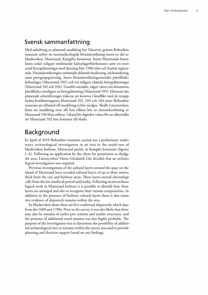
Figure 2. Section of GSD-Property map with the location of the investigation area marked. Scale 1:20 000. Permission for distribution approved by the Security Officer. Lantmäteriet 2008-11-25. Dnr 601-2008/3017. Figur 2. Utsnitt ur GSD-Fastighetskartan med platsen för undersökningen markerad. Skala 1:20 000. Godkänd ur sekretessynpunkt för spridning. Lantmäteriet 2008-11-25. Dnr 601-2008/3017.
Åter till Muskeviken 7
LandscapeNatural landscape
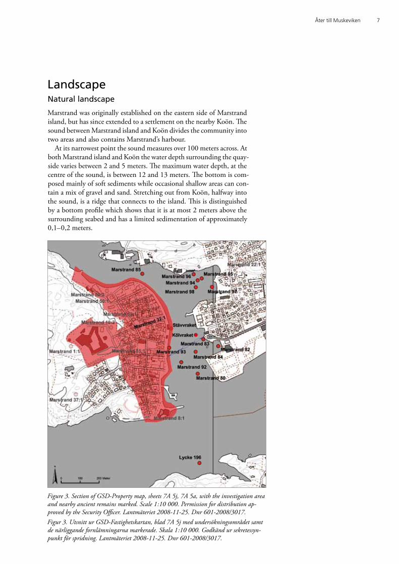
Marstrand was originally established on the eastern side of Marstrand island, but has since extended to a settlement on the nearby Koön. The sound between Marstrand island and Koön divides the community into two areas and also contains Marstrand’s harbour.
At its narrowest point the sound measures over 100 meters across. At both Marstrand island and Koön the water depth surrounding the quay-side varies between 2 and 5 meters. The maximum water depth, at the centre of the sound, is between 12 and 13 meters. The bottom is com-posed mainly of soft sediments while occasional shallow areas can con-tain a mix of gravel and sand. Stretching out from Koön, halfway into the sound, is a ridge that connects to the island. This is distinguished by a bottom profile which shows that it is at most 2 meters above the surrounding seabed and has a limited sedimentation of approximately 0,1–0,2 meters.
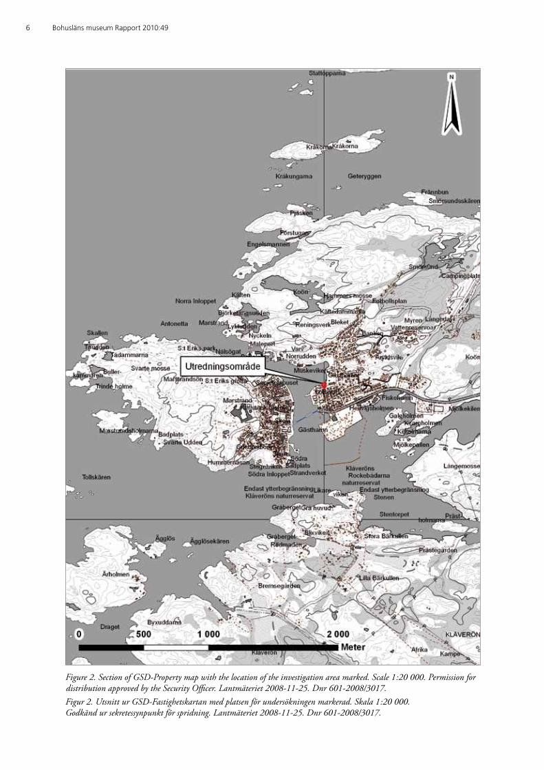
Figure 3. Section of GSD-Property map, sheets 7A 5j, 7A 5a, with the investigation area and nearby ancient remains marked. Scale 1:10 000. Permission for distribution ap-proved by the Security Officer. Lantmäteriet 2008-11-25. Dnr 601-2008/3017.Figur 3. Utsnitt ur GSD-Fastighetskartan, blad 7A 5j med undersökningsområdet samt de närliggande fornlämningarna markerade. Skala 1:10 000. Godkänd ur sekretessyn-punkt för spridning. Lantmäteriet 2008-11-25. Dnr 601-2008/3017.
8 Bohusläns museum Rapport 2010:49
Muskeviken is located on the western face of Koön and contains an area of water approximately 200 × 200 meters (40 000 square meters). The northern shoreline consists of a high outcrop of bedrock while the eastern and southern areas accommodate urban and port activities. Re-cent coastal deposition has transformed the area and reduced it in size. The water in the central area of the bay is from 2 to 2,5 meters deep. The substrate is relatively uniform over the whole survey area with the upper half meter of test trenches consisting of muddy sediments. There were also occurrences of shell and gravel concentrations in the shallow areas excavated.
Cultural environment
Marstrand port has the highest concentration of underwater archaeo-logical remains in relation to area on the west coast of Sweden. Aside from the national monument Carlstens fortress (Carlstens fästning), a large area of ancient Marstrand (Marstrand 32) can be identified by harbour and city cultural layers. Archaeological research conducted over the past decade has revealed that Marstrand 32 also includes large parts of the port itself, however the extent of which is as yet unknown. Excavations focusing on the cultural layers have covered an area of ten meters cubed and have yielded over 1 500 artefacts. The most common find categories were bones, ceramics, glass and clay pipes along with a smaller amount of wood, metal, leather, other organic material and rocks. The oldest parts of the layers have been dated to the 1600s whi-le the later layers have been dated to the 1700s, 1800s and the 1900s (Bergstrand 2009 a).
In addition to the extensive cultural layers in the port, there are four-teen well-known historic shipwreck remains which date from the late 1500s until at least the 1700s (figure 3). All of these sites are designa-ted ancient monuments and five of the wreck sites are located within Muskeviken. Three of them – Halmstad, Stettin and Kalmar – were Swedish Navy frigates, which sank in 1719 (Marstrand, 80, 92, 85). Another frigate, Fredricus, was investigated in 1998 by Bohusläns mu-seum (Marstrand 93). The preserved section of the hull today lies under a mound of stones to the north of the ferry landing on Marstrand island.
The other wreck remains have working titles; Kölvraket (lacking regist-ration), Färjevraket (Marstrand 83), Brännaren (Lycke 196), Stävvraket (lacking registration but probably identical to Marstrand 84), and the Muskeviken wrecks (Marstrand 94, 95, 96, 97, 98). Kölvraket is dendro-chronologically dated to approximately 1500; Färjevraket wreck is dated to the 1600s, while the Brännaren and Stävvraket wrecks are undated. Additionally, the remains of another vessel were destroyed by dredging in 1981 (Marstrand 82). Only limited documentation was conducted of the remains in order to conserve construction time (Lisberg Jensen 1981). Information for the Muskeviken wrecks has been provided for a
Åter till Muskeviken 9
number of years mainly by the Marinarkeologiska sällskapet Götheborgs-kretsen (MASG), whose documentation gave a better understanding of the remains. An inventory of Coast Guard divers in the late 1990s also acknowledged the existence of ship remains and/or timber structures.
Historical source material
The earliest written source material on Marstrand is from the 1200s (Unger & Huitfeldt 1864: DN 6, 57), indicating that some settlements grew around the natural harbour. From the year 1291 there is a reference to “minoriternas kyrka i Marstrand” i.e. an abbey, which confirms the existence of the settlement but also gives an indication of its importance. As a general rule Franciscan abbeys were established in relatively large settlements. From the 1300s onwards Marstrand is mentioned in ad-ministrative and political contexts, suggesting that the city developed into an independent administrative unit (Svenskt diplomatarium: DS 8, 6819; Lange & Unger 1855: DN 3, 806).
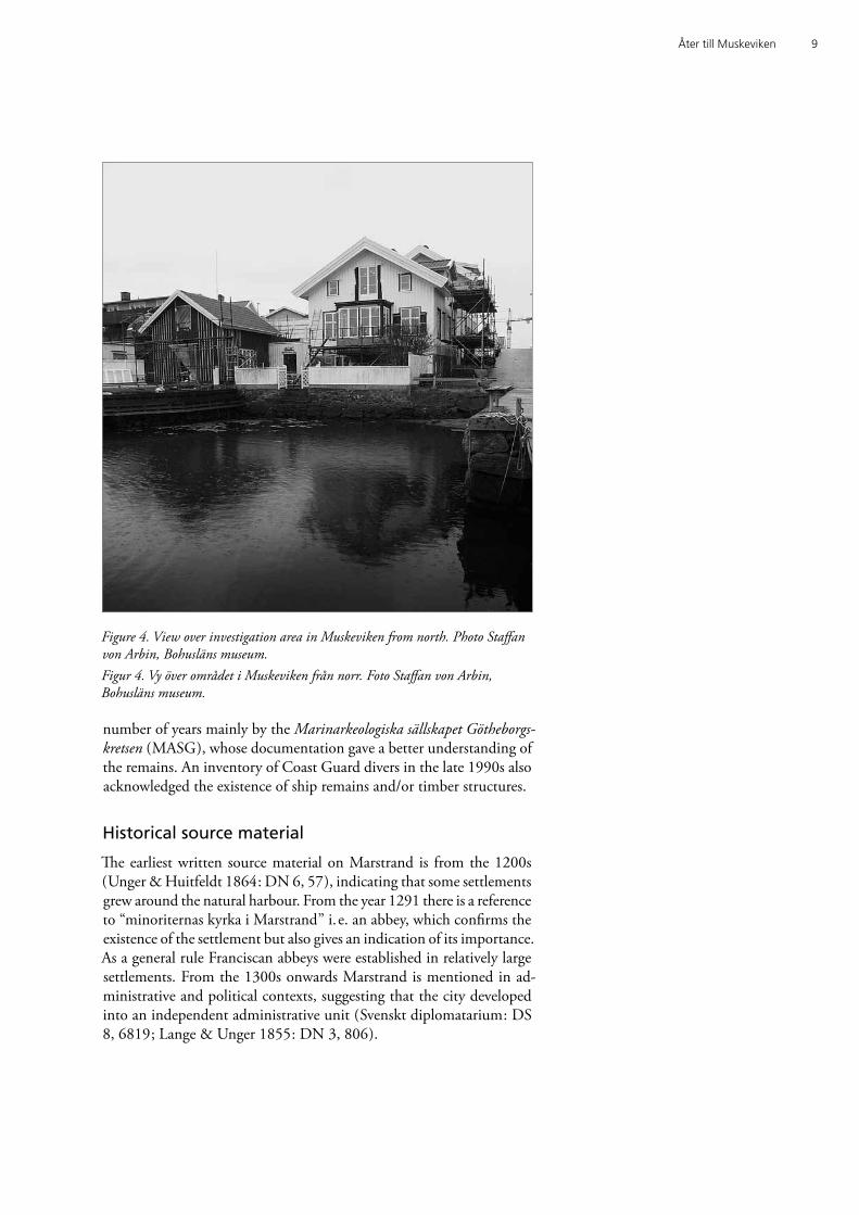
Figure 4. View over investigation area in Muskeviken from north. Photo Staffan von Arbin, Bohusläns museum. Figur 4. Vy över området i Muskeviken från norr. Foto Staffan von Arbin, Bohusläns museum.
10 Bohusläns museum Rapport 2010:49
The founding of Marstrand has been associated with changes in shipping and trade which took place during the late 1100s and 1200s. Marstrand’s location within Bohusläns outer islands and skerries, along with a suitable natural harbour, established it as an important transit harbour for regional shipping. It was during one of the better documen-ted herring periods, which occurred in the late 1500s, that Marstrand reached a prominent position in Bohuslän as a trade and transit port for foreign shipping. This dominance was also evident during the herring fishing season of the 1700s when it remained Sweden’s only free port in the later part of that century (Holmberg 1963:149 ff.). The town’s importance remained high during the early modern period, including when Carlstens fortress was constructed. Marstrand harbour was perio-dically used as a base for part of the Swedish west coast squadron.
A consequence of its central role as a transit port and a military foothold resulted in the city being repeatedly embroiled in conflict. Among the most notable conflicts include two Danish attacks, one
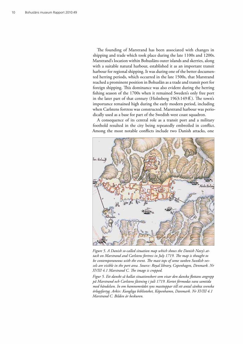
Figure 5. A Danish so-called situation map which shows the Danish Navy’s at-tack on Marstrand and Carlstens fortress in July 1719. The map is thought to be contemporaneous with the event. The mast tops of some sunken Swedish ves-sels are visible in the port area. Source: Royal library, Copenhagen, Denmark. Nr XVIII 4.1 Marstrand C. The image is cropped. Figur 5. Ett danskt så kallat situationskort som visar den danska flottans angrepp på Marstrand och Carlstens fästning i juli 1719. Kortet förmodas vara samtida med händelsen. In om hamnområdet syns masttoppar till ett antal sänkta svenska örlogsfartyg. Arkiv: Kungliga biblioteket, Köpenhamn, Danmark. Nr XVIII 4.1 Marstrand C. Bilden är beskuren.

Åter till Muskeviken 11
in Gyldenlöwe fejden in 1677 and another in 1719 when the Danish fleet besieged the city until the fortress garrison finally capitulated (Holmberg 1963:235; 262). The latter event has been attributed to one of Denmark’s greatest naval heroes, Peder Wessel Thordenskiold, who, in addition to the siege of Marstrand in 1719, was also responsible for several attacks against Sweden’s western interests in the Great Northern War (1700–1721).
It was also in connection with the siege of Marstrand in 1719 that large parts of the Swedish west coast squadron were lost. Since the vessels were enclosed within the harbour and most likely at a disad-vantage, it was decided on the basis of a tactical stance to order the sinking of Swedish ships rather than risk them being captured by the enemy (Ribbing 1949:151). A contemporary Danish situationskort of the city and harbour (figure 5) state clearly what vessels were scuttled, and where: frigates Halmstad (46), Stettin (46), Kalmar (46), Fredricus (36) and Charlotta (30); galleys Stå Bra (9) and Greve Mörner (9); the yacht Diana (4) and two fireships (Ribbing 1949:151). The numbers after each name indicates the number of guns the ships are believed to have been armed with. One of the sunken fireships is allocated a loca-tion on the situationskort where today a known wreck site lies, north of Klåverön (Lycke 196). The second fire ship on the situationskort is lo-cated directly north of Hedvigsholmen. This area was most likely filled in during modern times when large areas of Arvidsvik were reclaimed. However, it cannot be completely ruled out that the remains of a ves-sel dredged up in 1981 (Marstrand 82) is the aforementioned fireship. Ship remains from four of the large sunken frigates Halmstad, Stettin, Kalmar and Fredricus (Marstrand 80, 92, 85, 93) have been located in modern times to form an almost unique resource of information on the events which took place in Marstrand 1719.
Previous investigations
The archaeological investigations on Marstrand island are relatively few, which is due largely to the low level of exploitation in the older wooden city. Apart from some minor excavations, Kristina Carlsson’s excavation of Drottninggatan in 1981 is noteworthy (Carlsson 1984). Mention should also be given to Margaret Hasselmo’s report on Marstrand in the series Medeltidsstaden (Hasselmo 1980).
On the other side of the port of Marstrand, marine archaeological investigations have been relatively widespread during the last decade (appendix 2). As early as 1958, during dredging work in connection with the Koön ferry berth, archaeological remains of a wooden vessel were found, which are possibly identical to the so called Färjevraket (Marstrand 83). The question is not entirely resolved however, as it re-mains to be seen whether the remains of one or two vessels are located there. Items located include a fragment of a keel, a rudder and a breech
12 Bohusläns museum Rapport 2010:49
loading cannon. Dredging operations in Arvidsvik on Koön in 1981 for a gas filling station revealed the presence of a larger vessel which was later examined by the Sjöfartsmuseet in Göteborg (Marstrand 82). However, the documentation results are relatively rudimentary and do not provide enough direct evidence to indicate the ships characteristics or age (Lisberg Jensen 1981).
During the 1970s and ‘80s sport diving activities led to the redisco-very of several sunken warships. It was not until 1997 that an accurate archaeological investigation was carried out in the port. The investiga-tions arose from plans to construct two large submerged levees outside the quay on Marstrand island. The development resulted in a prelimi-nary investigation of the harbour cultural layers and two wreck sites (Bergstrand 2007 a, 2007 b). In 1998 an excavation of one of the two large wrecks was carried out on the Fredricus (Marstrand 93), along with a partial survey of the harbour cultural layers, and a preliminary investi-gation of harbour cultural layers associated with the quay (Marstrand 32) where a boat stem and other vessel remains were located (Bergstrand 2008). Also during the same year an in situ preservation project was car-ried out on the wreck with a working title of Färjevraket (report forth-coming). The following year, 1999, an investigation was conducted in Arvidsvik in connection with Hedvigsholmen on Koön (Bergstrand 2009 b). It was not until 2008 before new developments would result
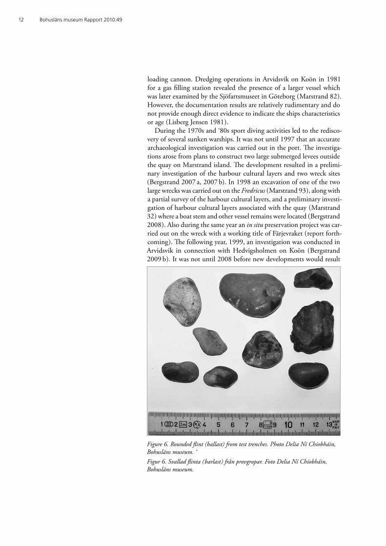
Figure 6. Rounded flint (ballast) from test trenches. Photo Delia Ní Chíobháin, Bohusläns museum. ‘Figur 6. Svallad flinta (barlast) från provgropar. Foto Delia Ní Chíobháin, Bohusläns museum.
Åter till Muskeviken 13
in further archaeological efforts. In addition to harbour developments in Muskeviken, further investigations have also been carried out in the area induced by the laying of a fibre optic cable through the northern inlet of Marstrand and further into Muskeviken (Gainsford 2009).
MethodsThe field investigation methods consisted of two parts. The first invol-ved a visual inspection of the entire survey area combined with probing down to about one meter deep in the soft bottom. The results of the completed survey served as the basis for the assessment of particular areas of interest. The second stage involved a total of six test trenches in these areas to assess the presence of archaeological remains and cul-tural layers. The trenches were excavated with the assistance of a water dredge; the material dredged up was then sieved and inspected for ar-chaeological remains.
ResultsVisual inspection led to the discovery of Marstrand 105, the remains of a clinker-built oak vessel to the west of the proposed dredging area. Probing and dredging actions revealed the presence of a further two vessel remains Marstrand 102 and 104 within the survey area, as well
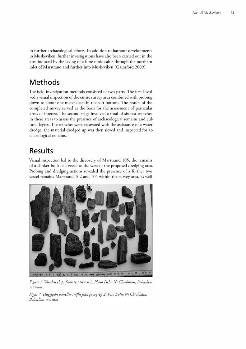
Figure 7. Wooden chips from test trench 2. Photo Delia Ní Chíobháin, Bohusläns museum .
Figur 7. Huggspån och/eller träflis från provgrop 2. Foto Delia Ní Chíobháin. Bohusläns museum
14 Bohusläns museum Rapport 2010:49
as cultural layers previously known from the area (Marstrand 103). As a result of the cultural layers present, the vessel constructional features and dendrochronological results from Marstrand 104, all three wreck remains are deemed to be over 100 years old and therefore are to be re-garded as ancient monuments.
Marstrand 103 (cultural layers)
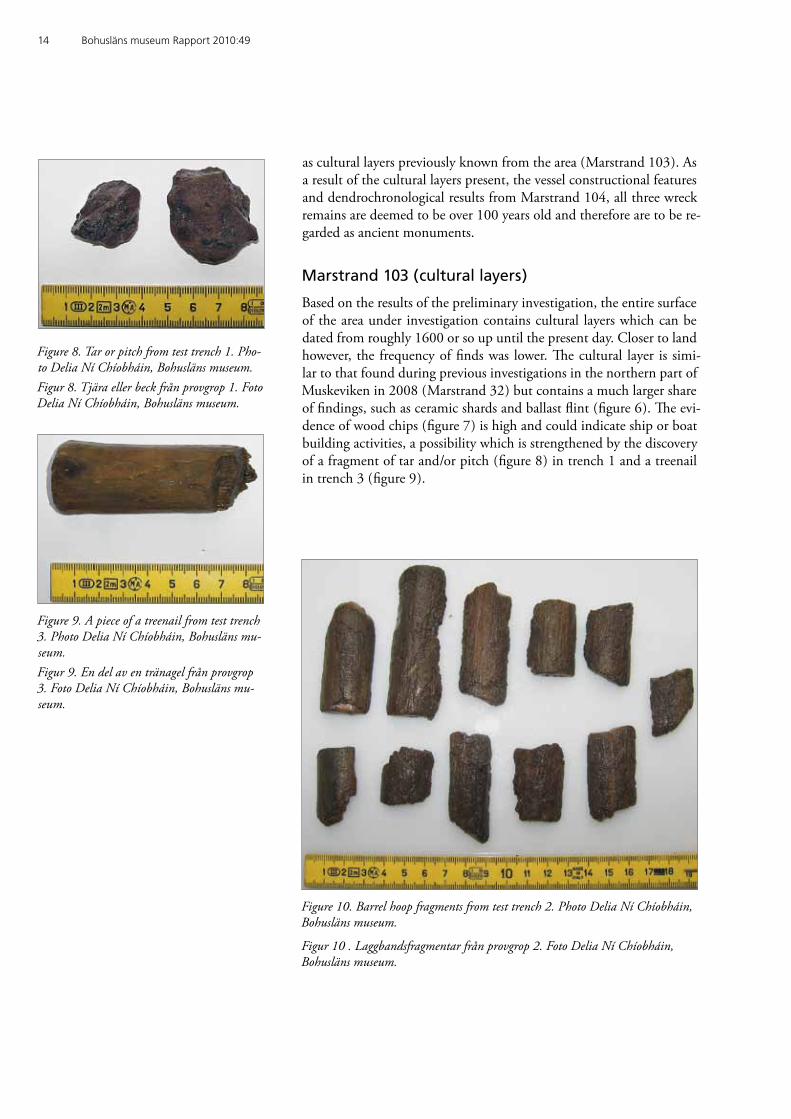
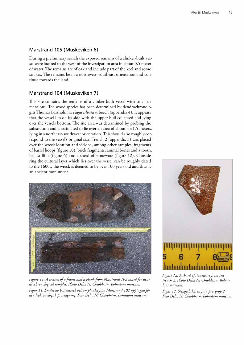
Based on the results of the preliminary investigation, the entire surface of the area under investigation contains cultural layers which can be dated from roughly 1600 or so up until the present day. Closer to land however, the frequency of finds was lower. The cultural layer is simi-lar to that found during previous investigations in the northern part of Muskeviken in 2008 (Marstrand 32) but contains a much larger share of findings, such as ceramic shards and ballast flint (figure 6). The evi-dence of wood chips (figure 7) is high and could indicate ship or boat building activities, a possibility which is strengthened by the discovery of a fragment of tar and/or pitch (figure 8) in trench 1 and a treenail in trench 3 (figure 9).
Figure 9. A piece of a treenail from test trench 3. Photo Delia Ní Chíobháin, Bohusläns mu-seum. Figur 9. En del av en tränagel från provgrop 3. Foto Delia Ní Chíobháin, Bohusläns mu-seum.
Figure 8. Tar or pitch from test trench 1. Pho-to Delia Ní Chíobháin, Bohusläns museum.Figur 8. Tjära eller beck från provgrop 1. Foto Delia Ní Chíobháin, Bohusläns museum.
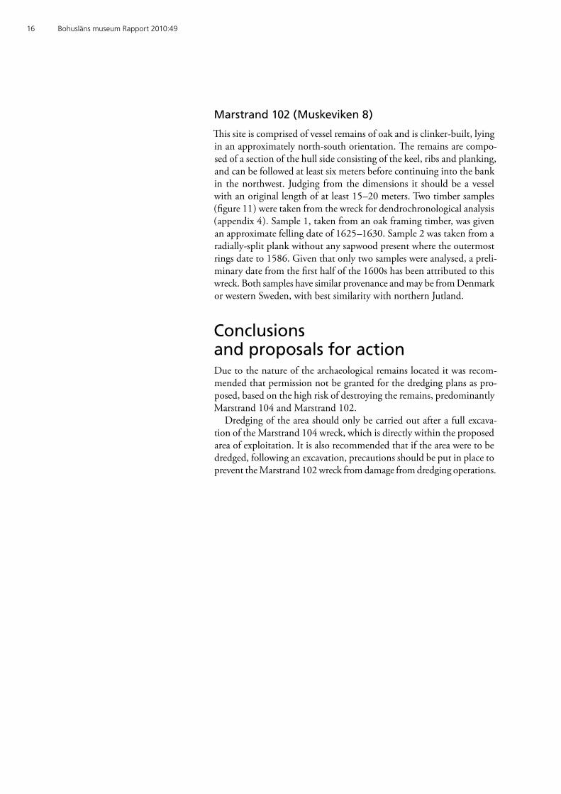
Figure 10. Barrel hoop fragments from test trench 2. Photo Delia Ní Chíobháin, Bohusläns museum.
Figur 10 . Laggbandsfragmentar från provgrop 2. Foto Delia Ní Chíobháin, Bohusläns museum.
Åter till Muskeviken 15
Marstrand 105 (Muskeviken 6)
During a preliminary search the exposed remains of a clinker-built ves-sel were located to the west of the investigation area in about 0,5 meter of water. The remains are of oak and include part of the keel and some strakes. The remains lie in a northwest–southeast orientation and con-tinue towards the land.
Marstrand 104 (Muskeviken 7)
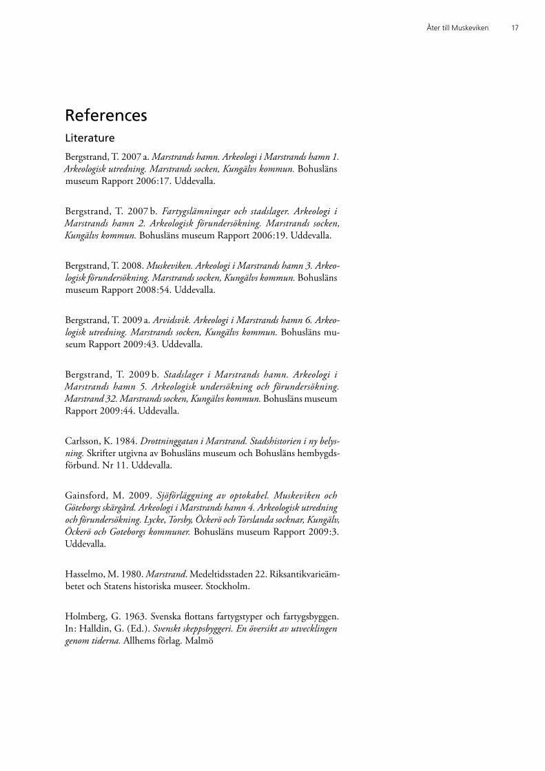
This site contains the remains of a clinker-built vessel with small di-mensions. The wood species has been determined by dendrochronolo-gist Thomas Bartholin as Fagus silvatica, beech (appendix 4). It appears that the vessel lies on its side with the upper hull collapsed and lying over the vessels bottom. The site area was determined by probing the substratum and is estimated to lie over an area of about 4 × 1.5 meters, lying in a northeast-southwest orientation. This should also roughly cor-respond to the vessel’s original size. Trench 2 (appendix 3) was placed over the wreck location and yielded, among other samples, fragments of barrel hoops (figure 10), brick fragments, animal bones and a tooth, ballast flint (figure 6) and a sherd of stoneware (figure 12). Conside-ring the cultural layer which lies over the vessel can be roughly dated to the 1600s, the wreck is deemed to be over 100 years old and thus is an ancient monument.
Figure 12. A shard of stoneware from test trench 2. Photo Delia Ní Chíobháin, Bohus-läns museum. Figur 12. Stengodsskärva från provgrop 2. Foto Delia Ní Chíobháin, Bohusläns museum.
Figure 11. A section of a frame and a plank from Marstrand 102 raised for den-drochronological samples. Photo Delia Ní Chíobháin, Bohusläns museum. Figur 11. En del av bottenstock och en planka från Marstrand 102 upptagna för dendrokronologisk provtagning. Foto Delia Ní Chíobháin, Bohusläns museum.
16 Bohusläns museum Rapport 2010:49
Marstrand 102 (Muskeviken 8)
This site is comprised of vessel remains of oak and is clinker-built, lying in an approximately north-south orientation. The remains are compo-sed of a section of the hull side consisting of the keel, ribs and planking, and can be followed at least six meters before continuing into the bank in the northwest. Judging from the dimensions it should be a vessel with an original length of at least 15–20 meters. Two timber samples (figure 11) were taken from the wreck for dendrochronological analysis (appendix 4). Sample 1, taken from an oak framing timber, was given an approximate felling date of 1625–1630. Sample 2 was taken from a radially-split plank without any sapwood present where the outermost rings date to 1586. Given that only two samples were analysed, a preli-minary date from the first half of the 1600s has been attributed to this wreck. Both samples have similar provenance and may be from Denmark or western Sweden, with best similarity with northern Jutland.
Conclusions and proposals for actionDue to the nature of the archaeological remains located it was recom-mended that permission not be granted for the dredging plans as pro-posed, based on the high risk of destroying the remains, predominantly Marstrand 104 and Marstrand 102.
Dredging of the area should only be carried out after a full excava-tion of the Marstrand 104 wreck, which is directly within the proposed area of exploitation. It is also recommended that if the area were to be dredged, following an excavation, precautions should be put in place to prevent the Marstrand 102 wreck from damage from dredging operations.
Åter till Muskeviken 17
ReferencesLiterature
Bergstrand, T. 2007 a. Marstrands hamn. Arkeologi i Marstrands hamn 1. Arkeologisk utredning. Marstrands socken, Kungälvs kommun. Bohusläns museum Rapport 2006:17. Uddevalla.
Bergstrand, T. 2007 b. Fartygslämningar och stadslager. Arkeologi i Marstrands hamn 2. Arkeologisk förundersökning. Marstrands socken, Kungälvs kommun. Bohusläns museum Rapport 2006:19. Uddevalla.
Bergstrand, T. 2008. Muskeviken. Arkeologi i Marstrands hamn 3. Arkeo-logisk förundersökning. Marstrands socken, Kungälvs kommun. Bohusläns museum Rapport 2008:54. Uddevalla.
Bergstrand, T. 2009 a. Arvidsvik. Arkeologi i Marstrands hamn 6. Arkeo-logisk utredning. Marstrands socken, Kungälvs kommun. Bohusläns mu-seum Rapport 2009:43. Uddevalla.
Bergstrand, T. 2009 b. Stadslager i Marstrands hamn. Arkeologi i Marstrands hamn 5. Arkeologisk undersökning och förundersökning. Marstrand 32. Marstrands socken, Kungälvs kommun. Bohusläns museum Rapport 2009:44. Uddevalla.
Carlsson, K. 1984. Drottninggatan i Marstrand. Stadshistorien i ny belys-ning. Skrifter utgivna av Bohusläns museum och Bohusläns hembygds-förbund. Nr 11. Uddevalla.
Gainsford, M. 2009. Sjöförläggning av optokabel. Muskeviken och Göteborgs skärgård. Arkeologi i Marstrands hamn 4. Arkeologisk utredning och förundersökning. Lycke, Torsby, Öckerö och Torslanda socknar, Kungälv, Öckerö och Goteborgs kommuner. Bohusläns museum Rapport 2009:3. Uddevalla.
Hasselmo, M. 1980. Marstrand. Medeltidsstaden 22. Riksantikvarieäm-betet och Statens historiska museer. Stockholm.
Holmberg, G. 1963. Svenska flottans fartygstyper och fartygsbyggen. In: Halldin, G. (Ed.). Svenskt skeppsbyggeri. En översikt av utvecklingen genom tiderna. Allhems förlag. Malmö
18 Bohusläns museum Rapport 2010:49
Lange, Chr. C.A. & Unger, Carl R. (Eds) 1855. Diplomatarium Norvegicum: Oldbreve til kundskab om Norgesindre og ydre forhold, sprog, slaegter, saeder, lovgivning og rettergang i middelalderen. Samling 3. Oslo.
Ribbing, O. (Ed.) 1949. Göteborgs eskader och örlogsstation 1523–1870. Historik utarbetad och utgiven av Försvarsstabens krigshistoriska avdel-ning. Göteborg.
Unger, C.R. & Huitfeldt, H.J. (Eds) 1864. Diplomatarium Norvegicum: Oldbreve til kundskab om Norges indre og ydre forhold, sprog, slaegter, saeder, lovgivning og rettergang i middelalderen. Samling 6. Oslo.
Svenskt diplomatarium. Bd 8. H. 2, 1363–1364. Utg. av Kungl. Vitter-hets historie och antikvitetsakademien och Riksarkivet. Stockholm, 1964.
Unpublished sources
Lisberg Jensen, O. 1981. Dokumentation av uppmuddrad fartygsläm-ning i Arvidsvik, Marstrand. Fornlämning Marstrand 82. Handlingar hämtade från [http://www.fmis.raa.se/cocoon/fornsok/search.html] 25 May 2010.
Åter till Muskeviken 19
Technical and administrative dataLst dnr: 431-5331-2010Västarvet dnr: NOK 309-2010Västarvet pnr: E199Fornlämningsnr: Marstrand 102, 103, 104 och 105
Län: Västra Götalands länKommun: Kungälvs kommunSocken: Marstrands sockenFastighet: Muskeviken, vattenområde i Marstrands hamn
Ek. karta: 7A 5j, 7A 5aLäge: X 6426100, Y 1249900 Meter över havet: -0,5 till -2 mKoordinatsystem: RT 90, 2,5g V
Uppdragsgivare: Per HultengrenAnsvarig institution: Bohusläns museumProjektledare: Staffan von ArbinFältpersonal: Staffan von Arbin, Matthew Gainsford, Delia Ní Chíobháin
Fältarbetstid: 28 april 2010Arkeologtimmar: 24Dyktid: 5Undersökt yta: 38 m2
Arkiv: Bohusläns museums arkivFynd: Inga fynd omhändertogs
20 Bohusläns museum Rapport 2010:49
AppendicesAppendix 1. Plan over the investigation area with test trenches and wrecks marked. Scale 1:500. Permission for distribution approved by the Security Offi-cer. Lantmäteriet 2008-11-25. Dnr 601-2008/3017.Plan över förundersökningsområdet med provgropar och vrak markerade. Skala 1:500. Godkänd ur sekretessynpunkt för spridning. Lantmäteriet 2008-11-25. Dnr 601-2008/3017.
Appendix 2. Ortophoto over Marstrands harbour area with known an-cient remains marked. Lycke 196 is outside the image. Permission for distribu-tion approved by the Security Officer. Lantmäteriet 2008-11-25. Dnr 601-2008/3017.Ortofoto över Marstrands hamnområde med kända fornlämningar markerade. Lycke 196 utanför bild. Godkänd ur sekretessynpunkt för spridning. Lantmäteri-et 2009-04-01. Dnr 601-2009/1030.
Appendix 3. Test trenches with descriptions and finds.Provgropar med beskrivning och fynd.
Appendix 4. Rapport on dendrochronological and wood anatomy analysis of the wrecks Marstrand 104 and 102. Consultant Thomas Bartholin.Rapport över dendrokronologiska och vedanatomiska analyser av fartygslämnin-garna Marstrand 104 och 102. Konsult Thomas Bartholin.
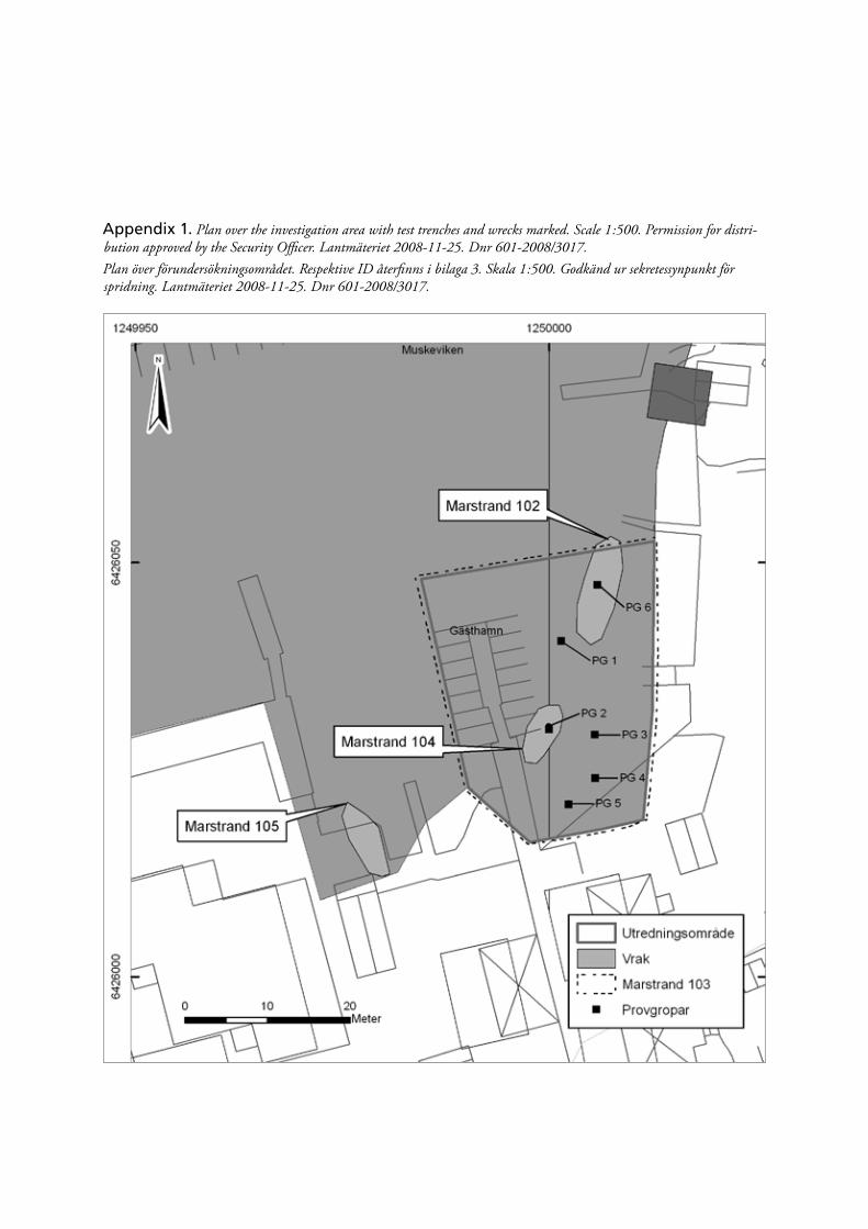
Appendix 1. Plan over the investigation area with test trenches and wrecks marked. Scale 1:500. Permission for distri-bution approved by the Security Officer. Lantmäteriet 2008-11-25. Dnr 601-2008/3017.Plan över förundersökningsområdet. Respektive ID återfinns i bilaga 3. Skala 1:500. Godkänd ur sekretessynpunkt för spridning. Lantmäteriet 2008-11-25. Dnr 601-2008/3017.
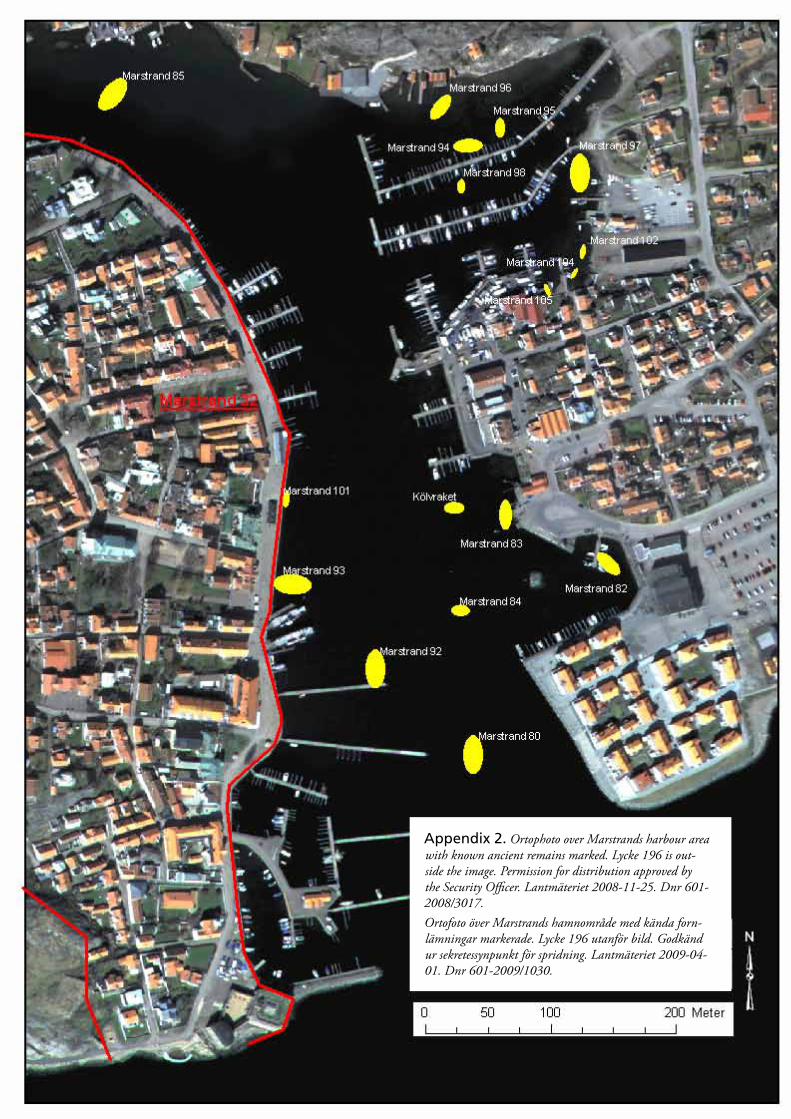
Appendix 2. Ortophoto over Marstrands harbour area with known ancient remains marked. Lycke 196 is out-side the image. Permission for distribution approved by the Security Officer. Lantmäteriet 2008-11-25. Dnr 601-2008/3017.Ortofoto över Marstrands hamnområde med kända forn-lämningar markerade. Lycke 196 utanför bild. Godkänd ur sekretessynpunkt för spridning. Lantmäteriet 2009-04-01. Dnr 601-2009/1030.
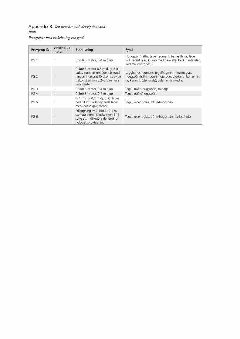
Provgrop IDVattendjup, meter
Beskrivning Fynd
PG 1 1 0,5×0,5 m stor, 0,4 m djup.Huggspån/träflis, tegelfragment, barlastflinta, läder, kol, recent glas, klump med tjära eller beck, flintavslag, keramik (flintgods).
PG 2 1
0,5×0,5 m stor 0,5 m djup. För-lades inom ett område där sond-ningen indikerat förekomst av en träkonstruktion 0,2–0,5 m ner i sedimenten.
Laggbandsfragment, tegelfragment, recent glas, huggspån/träflis, porslin, djurben, djurtand, barlastflin-ta, keramik (stengods), delar av järnkedja.
PG 3 1 0,5×0,5 m stor, 0,4 m djup. Tegel, träflis/huggspån, tränagel.
PG 4 1 0,5×0,5 m stor, 0,4 m djup. Tegel, träflis/huggspån.
PG 5 11×1 m stor 0,2 m djup. Grävdes ned till ett underliggande lager med (naturliga?) stenar.
Tegel, recent glas, träflis/huggspån.
PG 6 1
Friläggning av 0,5×0,3×0,1 m stor yta inom ”Muskeviken 8” i syfte att möjliggöra dendrokro-nologisk provtagning.
Tegel, recent glas, träflis/huggspån, barlastflinta.
Appendix 3. Test trenches with descriptions and finds.Provgropar med beskrivning och fynd.
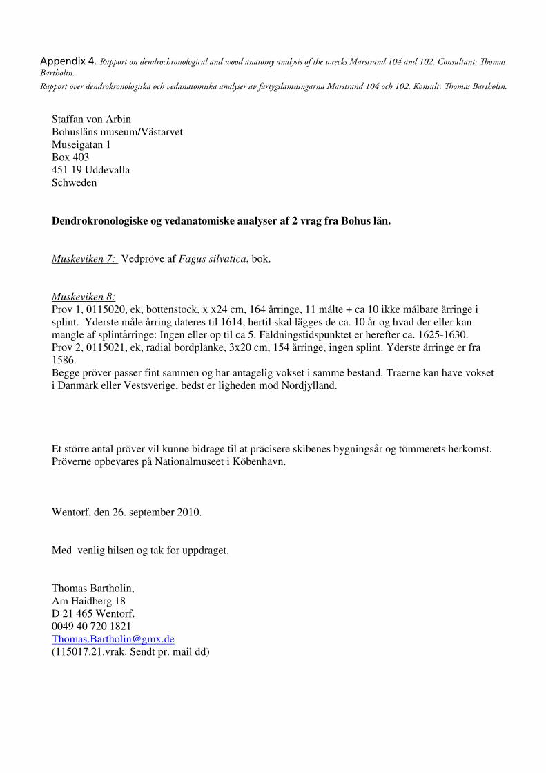
Bilaga 4. Rapport över dendrokronologiska och vedanatomiska analyser av fartygslämningarna Marstrand
104 och 102. Konsult: Thomas Bartholin.
Staffan von Arbin Bohusläns museum/Västarvet Museigatan 1 Box 403 451 19 Uddevalla Schweden Dendrokronologiske og vedanatomiske analyser af 2 vrag fra Bohus län.
Muskeviken 7: Vedpröve af Fagus silvatica, bok. Muskeviken 8:
Prov 1, 0115020, ek, bottenstock, x x24 cm, 164 årringe, 11 målte + ca 10 ikke målbare årringe i splint. Yderste måle årring dateres til 1614, hertil skal lägges de ca. 10 år og hvad der eller kan mangle af splintårringe: Ingen eller op til ca 5. Fäldningstidspunktet er herefter ca. 1625-1630. Prov 2, 0115021, ek, radial bordplanke, 3x20 cm, 154 årringe, ingen splint. Yderste årringe er fra 1586. Begge pröver passer fint sammen og har antagelig vokset i samme bestand. Träerne kan have vokset i Danmark eller Vestsverige, bedst er ligheden mod Nordjylland. Et större antal pröver vil kunne bidrage til at präcisere skibenes bygningsår og tömmerets herkomst. Pröverne opbevares på Nationalmuseet i Köbenhavn. Wentorf, den 26. september 2010. Med venlig hilsen og tak for uppdraget. Thomas Bartholin, Am Haidberg 18 D 21 465 Wentorf. 0049 40 720 1821 [email protected] (115017.21.vrak. Sendt pr. mail dd)
Appendix 4. Rapport on dendrochronological and wood anatomy analysis of the wrecks Marstrand 104 and 102. Consultant: Thomas Bartholin.Rapport över dendrokronologiska och vedanatomiska analyser av fartygslämningarna Marstrand 104 och 102. Konsult: Thomas Bartholin.
Åter till MuskevikenArkeologi i Marstrands hamn 7
Arkeologisk förundersökningMarstrand 102, 103, 104 och 105Marstrands socken, Kungälvs kommun
Delia Ní ChíobháinBohusläns museum Rapport 2010:49
I Marstrands hamn döljer sig en mängd fartygslämningar och rika hamnkulturlager som berättar om Marstands långa och spännande historia. Resultaten av de marinarkeologiska undersökningarna omfattar en tidsperiod från senmedeltid fram till idag och ger en inblick i det vardagliga livet likväl som storpolitiska konflikter och europeiska kontaktnät.
Rapporten som du håller i handen ingår i serien Arkeologi i Marstrands hamn och beskriver en arkeologisk förundersök-ning i Muskeviken som utfördes 2010 av Västarvet genom Bohusläns museum.