Embed Size (px)
Citation preview

Data IntegrityIs there a need for an Accuracy & Currency Standard for Private Heliports & Airports
2/16/2017 USHST 2017 Infrastructure Summit 1
Rex AlexanderHeliExperts International [email protected]
?

FAA Identifier: TN60 (Heliport)
• FAA 5010 Information:• WSMV-TV Heliport
• Nashville, Tennessee, USA
• Lat/Long: 6-08-28.2100N / 087-51-43.0980W
• Heliport use: Private use. Permission required prior to landing
• Activation date: 05/1979
• Address• 5700 KNOB ROAD
• NASHVILLE, TN 37209
2/16/2017 USHST 2017 Infrastructure Summit 2
*Data pulled on 2/23/2017
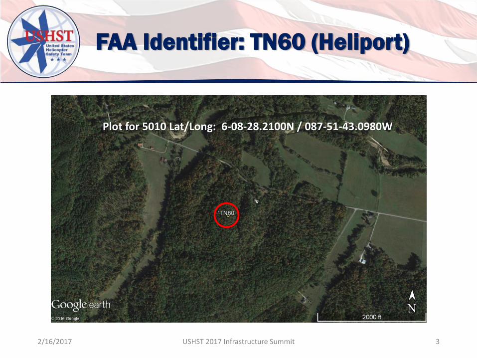
FAA Identifier: TN60 (Heliport)
Plot for 5010 Lat/Long: 6-08-28.2100N / 087-51-43.0980W
2/16/2017 USHST 2017 Infrastructure Summit 3

FAA Identifier: TN60 (Heliport)
Plot for Address: 5700 KNOB ROAD NASHVILLE, TN 37209
2/16/2017 USHST 2017 Infrastructure Summit 4

FAA Identifier: TN60 (Heliport)
5010 Plot Actual
Difference between 5010 and Actual Location: 55.95 statute miles
2/16/2017 USHST 2017 Infrastructure Summit 5
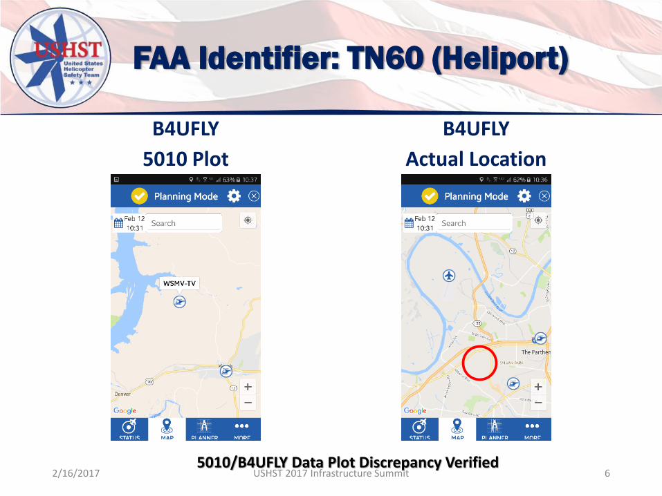
FAA Identifier: TN60 (Heliport)
B4UFLY
5010 Plot
B4UFLY
Actual Location
5010/B4UFLY Data Plot Discrepancy Verified2/16/2017 USHST 2017 Infrastructure Summit 6

FAA Identifier: 6OI8 (Heliport)
• FAA 5010 Information:• Cleveland Clinic Foundation Heliport
• Cleveland, Ohio, USA
• Lat/Long: 41-30-06.5000N / 081-38-19.2600W
• Heliport use: Private use. Permission required prior to landing
• Activation date: 02/1982
• Address• CLEVELAND CLINIC FOUNDATION
• 9500 EUCLID AVENUE
2/16/2017 USHST 2017 Infrastructure Summit 7
*Data pulled on 2/23/2017
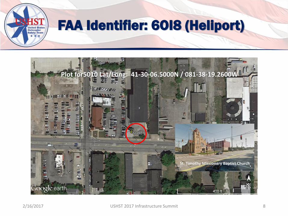
FAA Identifier: 6OI8 (Heliport)
Plot for5010 Lat/Long: 41-30-06.5000N / 081-38-19.2600W
St. Timothy Missionary Baptist Church
2/16/2017 USHST 2017 Infrastructure Summit 8
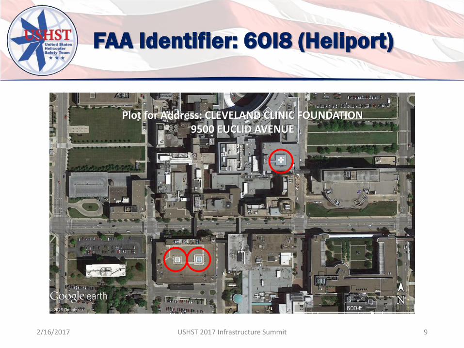
FAA Identifier: 6OI8 (Heliport)
Plot for Address: CLEVELAND CLINIC FOUNDATION9500 EUCLID AVENUE
2/16/2017 USHST 2017 Infrastructure Summit 9

FAA Identifier: 6OI8 (Heliport)
5010 Plot Actual
Difference between 5010 and Actual Location: 0.9 statute miles
2/16/2017 USHST 2017 Infrastructure Summit 10
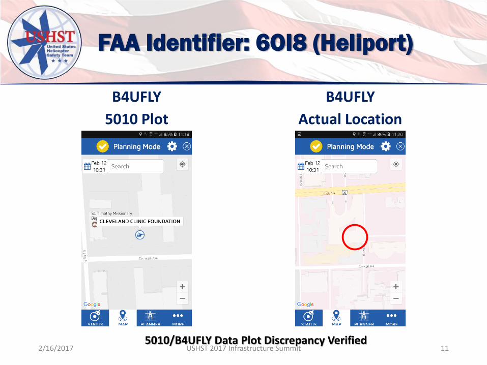
FAA Identifier: 6OI8 (Heliport)
B4UFLY
5010 Plot
B4UFLY
Actual Location
5010/B4UFLY Data Plot Discrepancy Verified2/16/2017 USHST 2017 Infrastructure Summit 11

ICAO Standard
2/16/2017 USHST 2017 Infrastructure Summit 12
• ICAO, Annex 14, Aerodromes, Volume II, Heliports (July 2013), Chapter 1 General, 1.1 Definitions
• Integrity (aeronautical data). A degree of assurance that an aeronautical data and its value has not been lost nor altered since the data originated or authorized amendment.

ICAO Standard
• INTEGRITY CLASSIFICATION• Routine Data: There is a very low probability when
using corrupted routine data that the continued safe flight and landing of an aircraft would be severely at risk with the potential for catastrophe;
• Essential Data: There is a low probability when using corrupted essential data that the continued safe flight and landing of an aircraft would be severely at risk with the potential for catastrophe; and
• Critical Data: There is a high probability when using corrupted critical data that the continued safe flight and landing of an aircraft would be severely at risk with the potential for catastrophe.
2/16/2017 USHST 2017 Infrastructure Summit 13

Potential Standards
•Currency • How old is the data and when was the
last time it was updated.
•Accuracy• How accurate is the data.
2/16/2017 USHST 2017 Infrastructure Summit 14
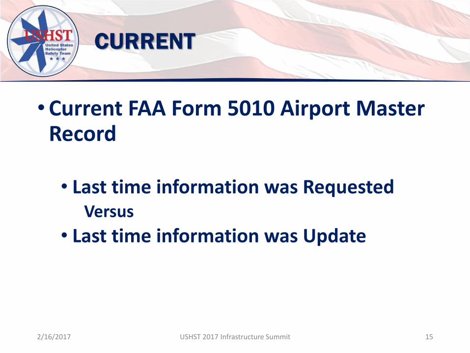
CURRENT
•Current FAA Form 5010 Airport Master Record
• Last time information was Requested Versus
• Last time information was Update
2/16/2017 USHST 2017 Infrastructure Summit 15

CURRENT: FAA Form 5010
2/16/2017 USHST 2017 Infrastructure Summit 16
Activation Date: 1979Last Info Requested Date: 2007Date Last Update: UnknownData Accuracy: Zero
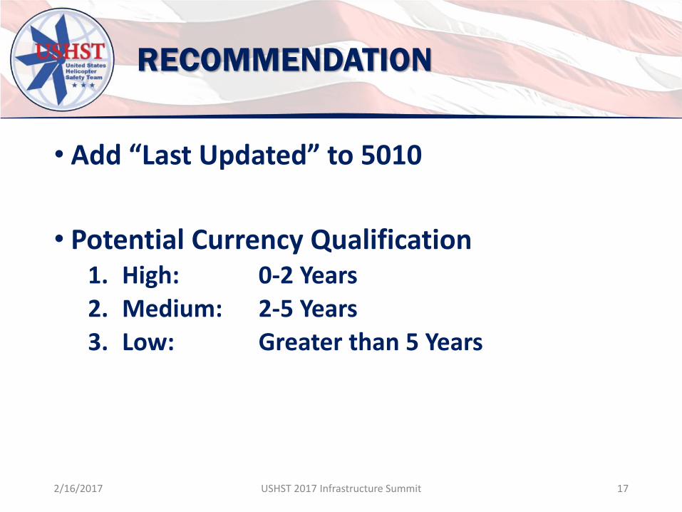
RECOMMENDATION
• Add “Last Updated” to 5010
• Potential Currency Qualification1. High: 0-2 Years
2. Medium: 2-5 Years
3. Low: Greater than 5 Years
2/16/2017 USHST 2017 Infrastructure Summit 17
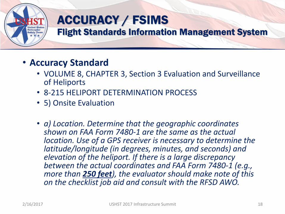
ACCURACY / FSIMSFlight Standards Information Management System
• Accuracy Standard• VOLUME 8, CHAPTER 3, Section 3 Evaluation and Surveillance
of Heliports• 8-215 HELIPORT DETERMINATION PROCESS• 5) Onsite Evaluation
• a) Location. Determine that the geographic coordinates shown on FAA Form 7480-1 are the same as the actual location. Use of a GPS receiver is necessary to determine the latitude/longitude (in degrees, minutes, and seconds) and elevation of the heliport. If there is a large discrepancy between the actual coordinates and FAA Form 7480-1 (e.g., more than 250 feet), the evaluator should make note of this on the checklist job aid and consult with the RFSD AWO.
2/16/2017 USHST 2017 Infrastructure Summit 18
2/16/2017 USHST 2017 Infrastructure Summit 19
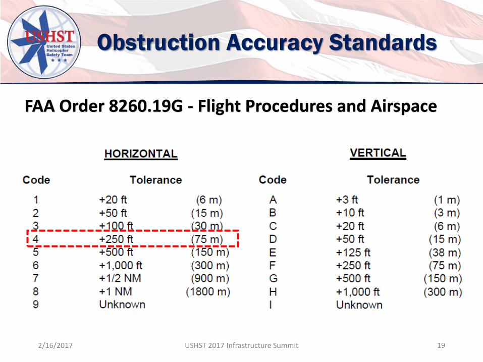
Obstruction Accuracy Standards
FAA Order 8260.19G - Flight Procedures and Airspace

DISCUSSIONIs There a Need for a Currency and Accuracy Standard?
2/16/2017 USHST 2017 Infrastructure Summit 20

QUESTIONSRex J Alexander
HeliExperts International LLC
260-494-0891
2/16/2017 USHST 2017 Infrastructure Summit 21