Embed Size (px)
Citation preview

論文撰寫必避條件
審稿經驗分享與Publons使用
盧光輝中國文化大學地學研究所教授兼理學院院長
內容大綱
1. Publons使用
2. 審稿經驗分享
3. 論文撰寫必避條件
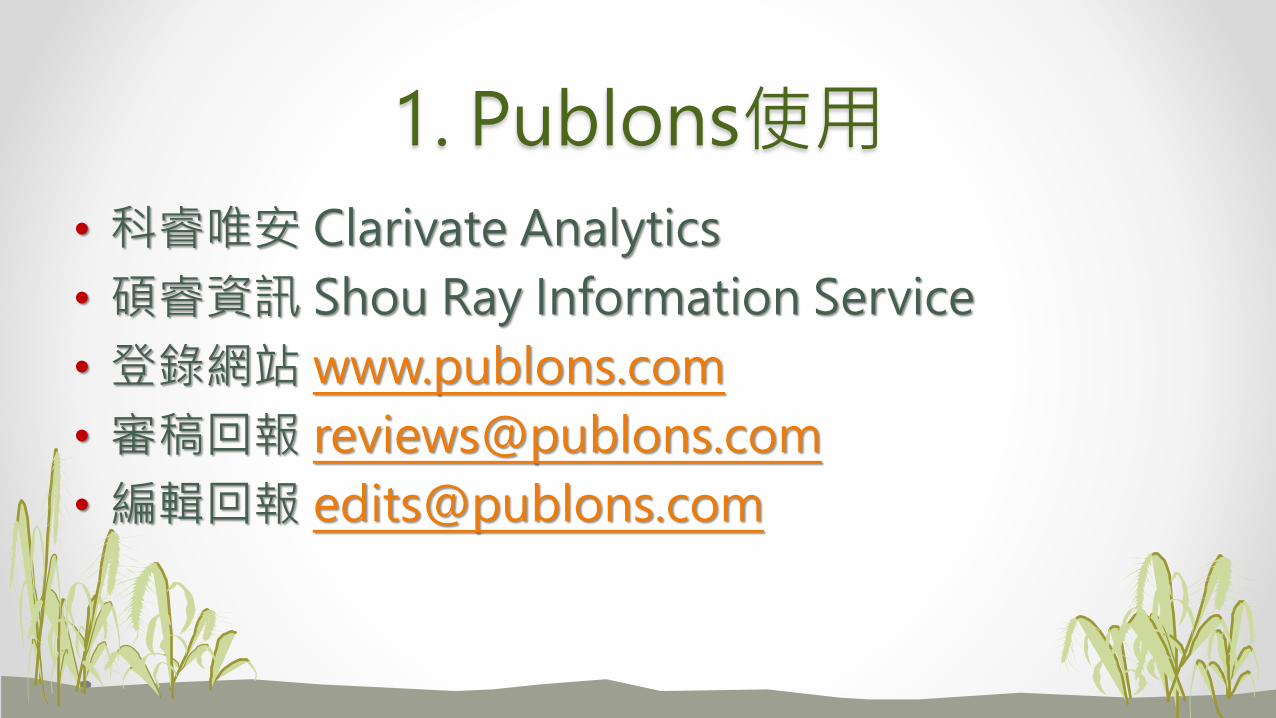
1. Publons使用
• 科睿唯安 Clarivate Analytics
• 碩睿資訊 Shou Ray Information Service
• 登錄網站 www.publons.com
• 審稿回報 [email protected]
• 編輯回報 [email protected]

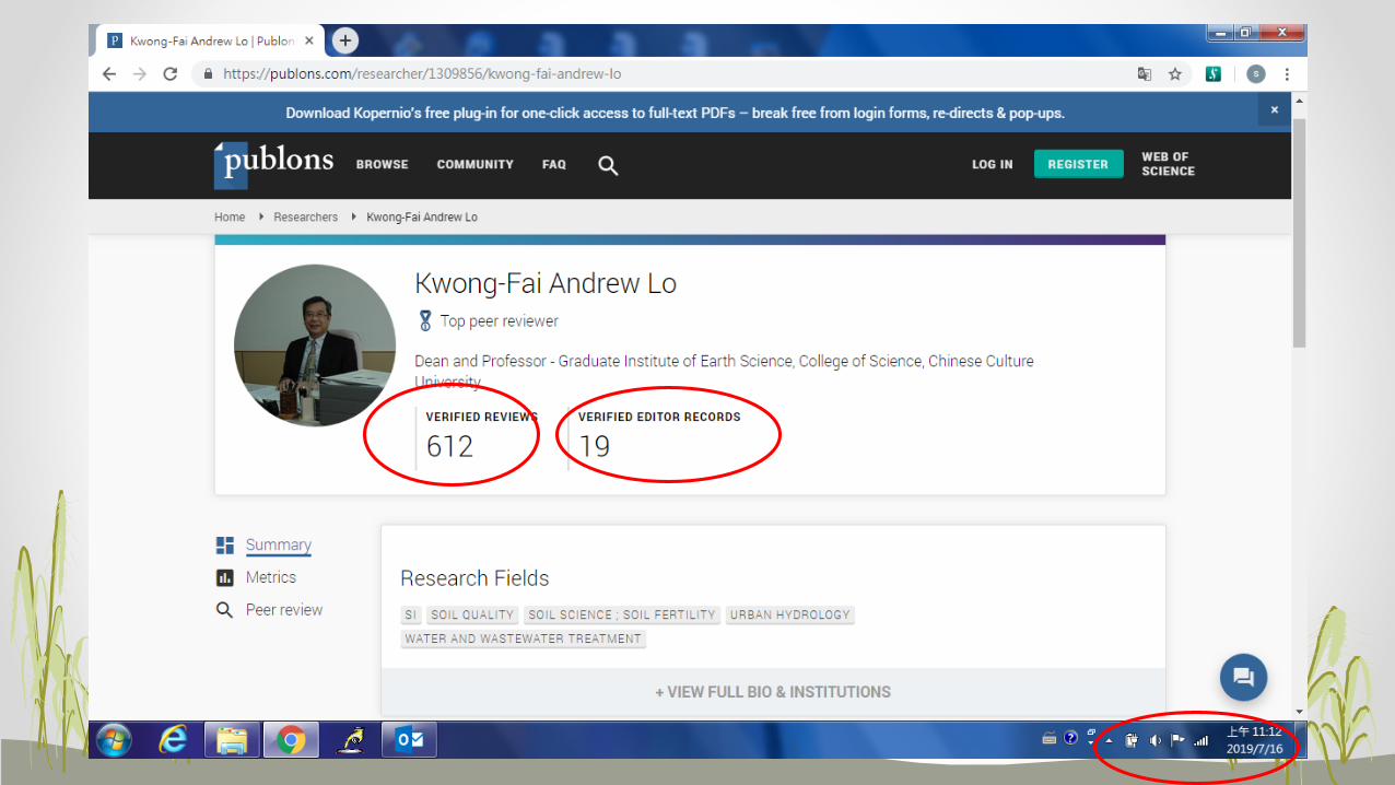
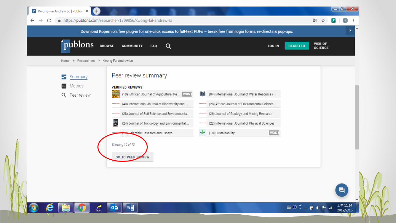


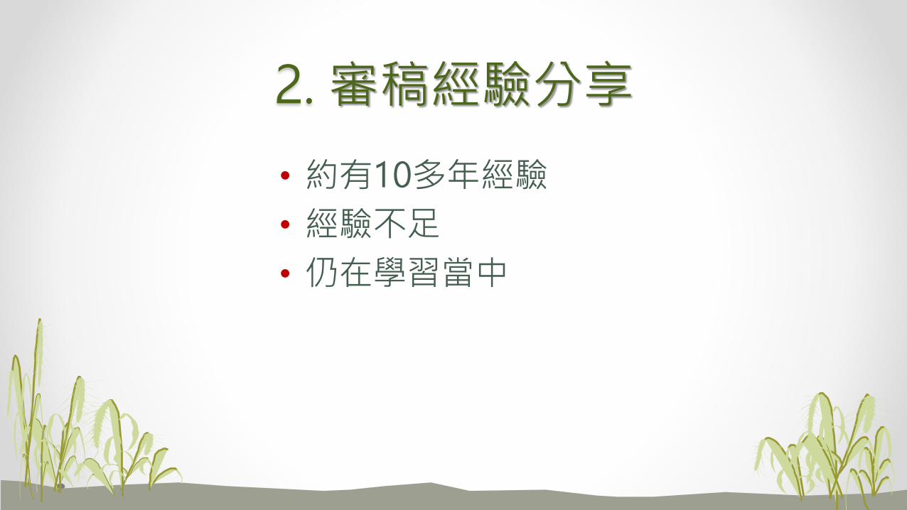
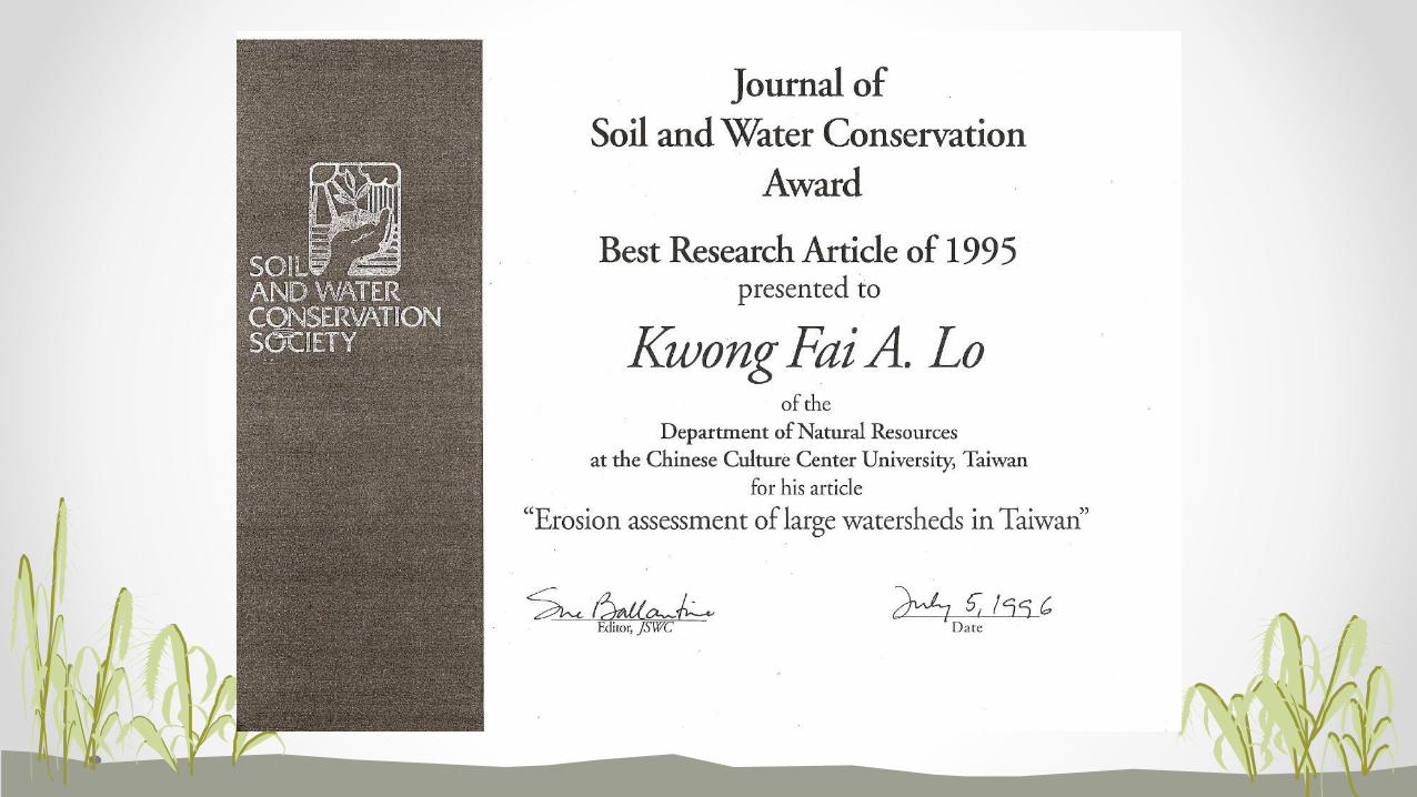
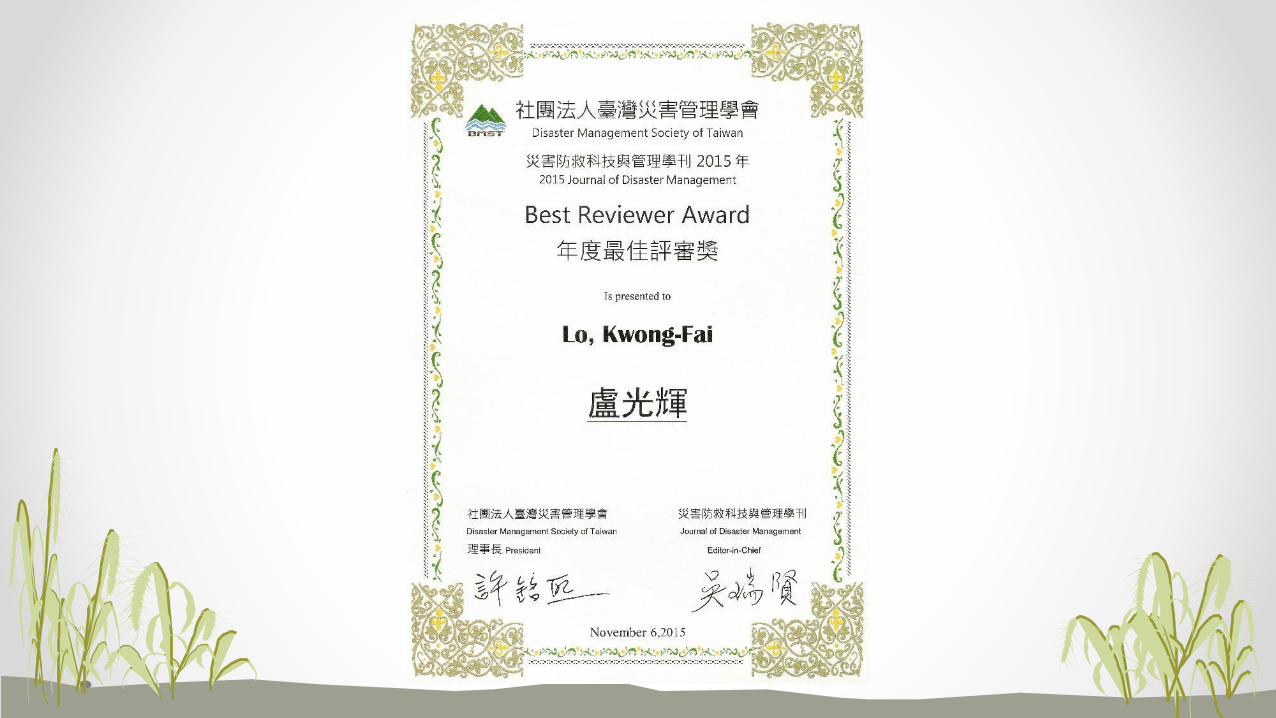
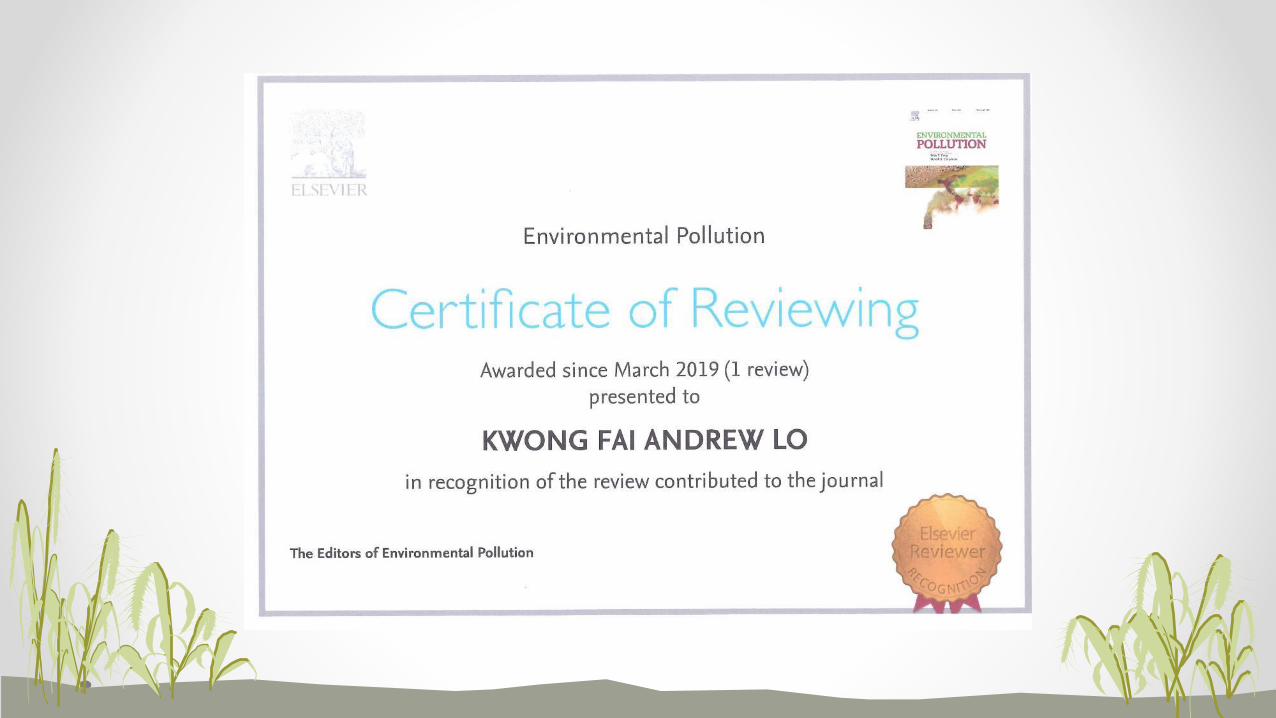
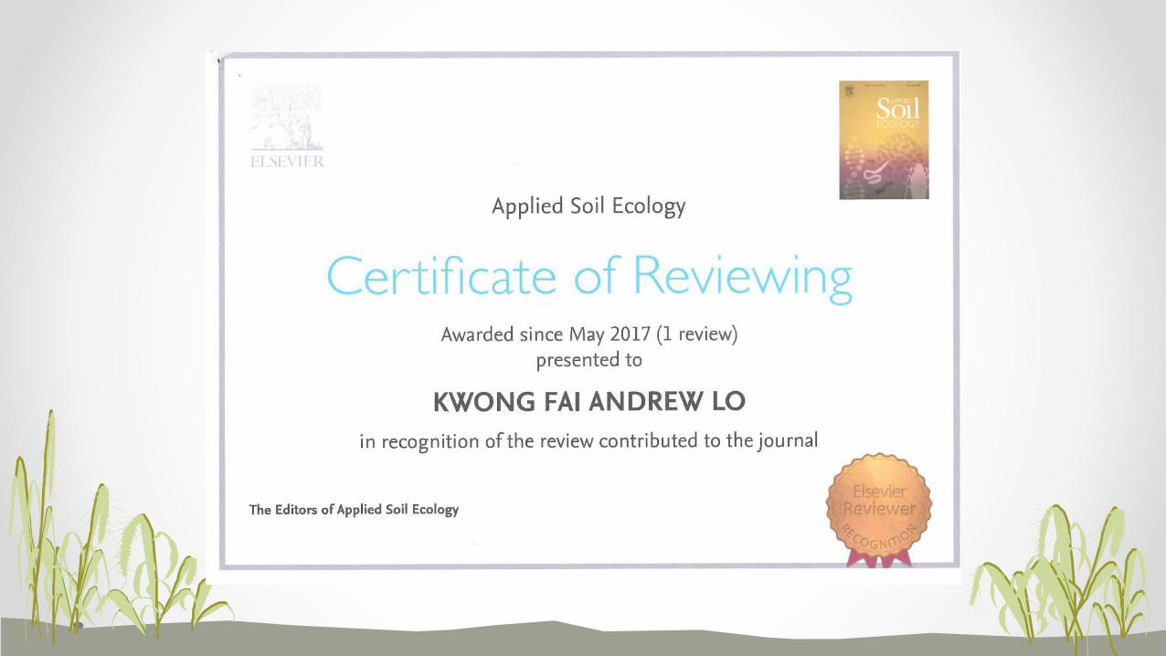
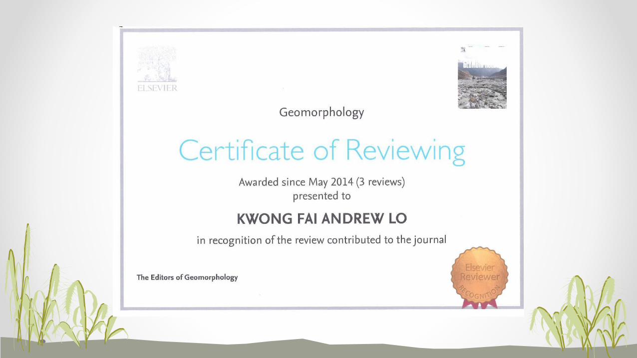
2. 審稿經驗分享
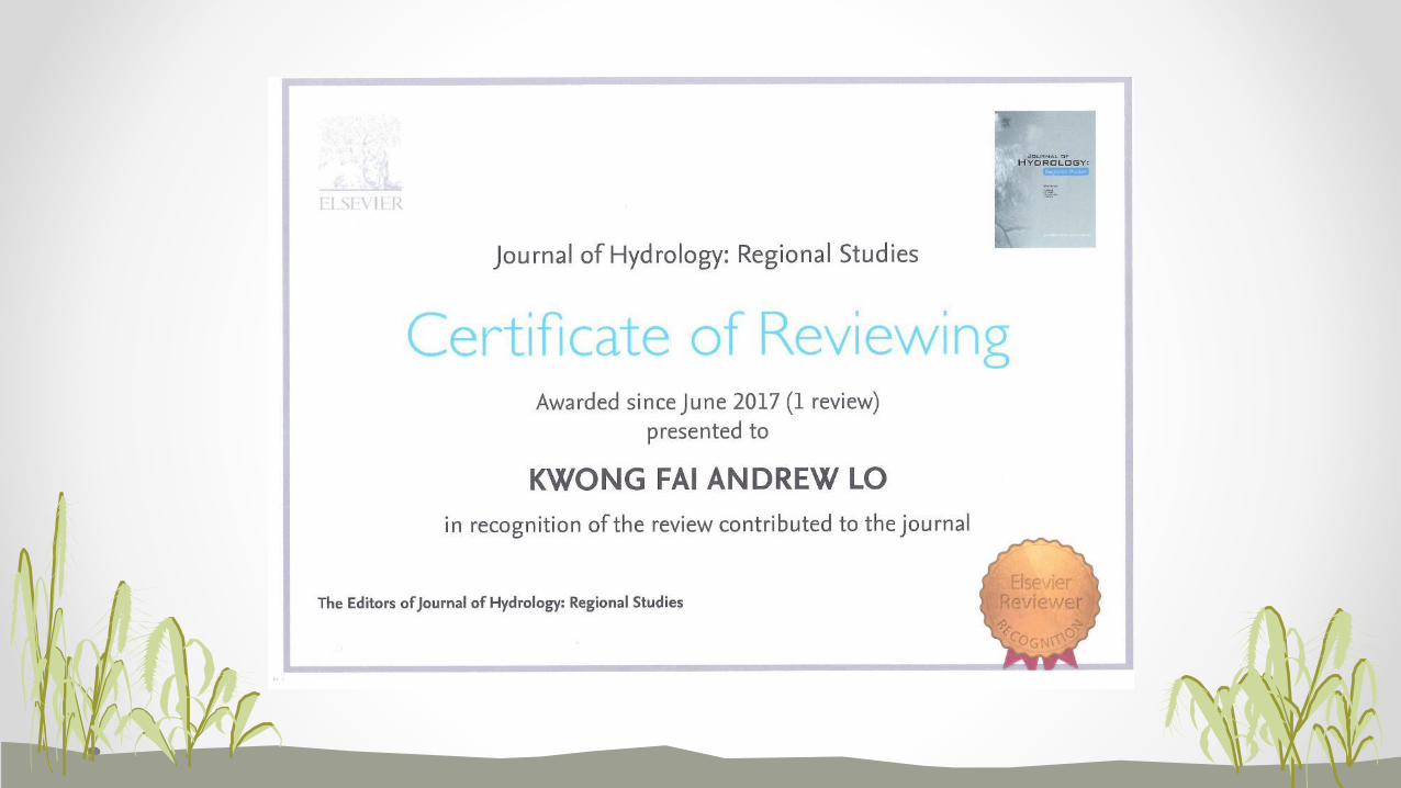
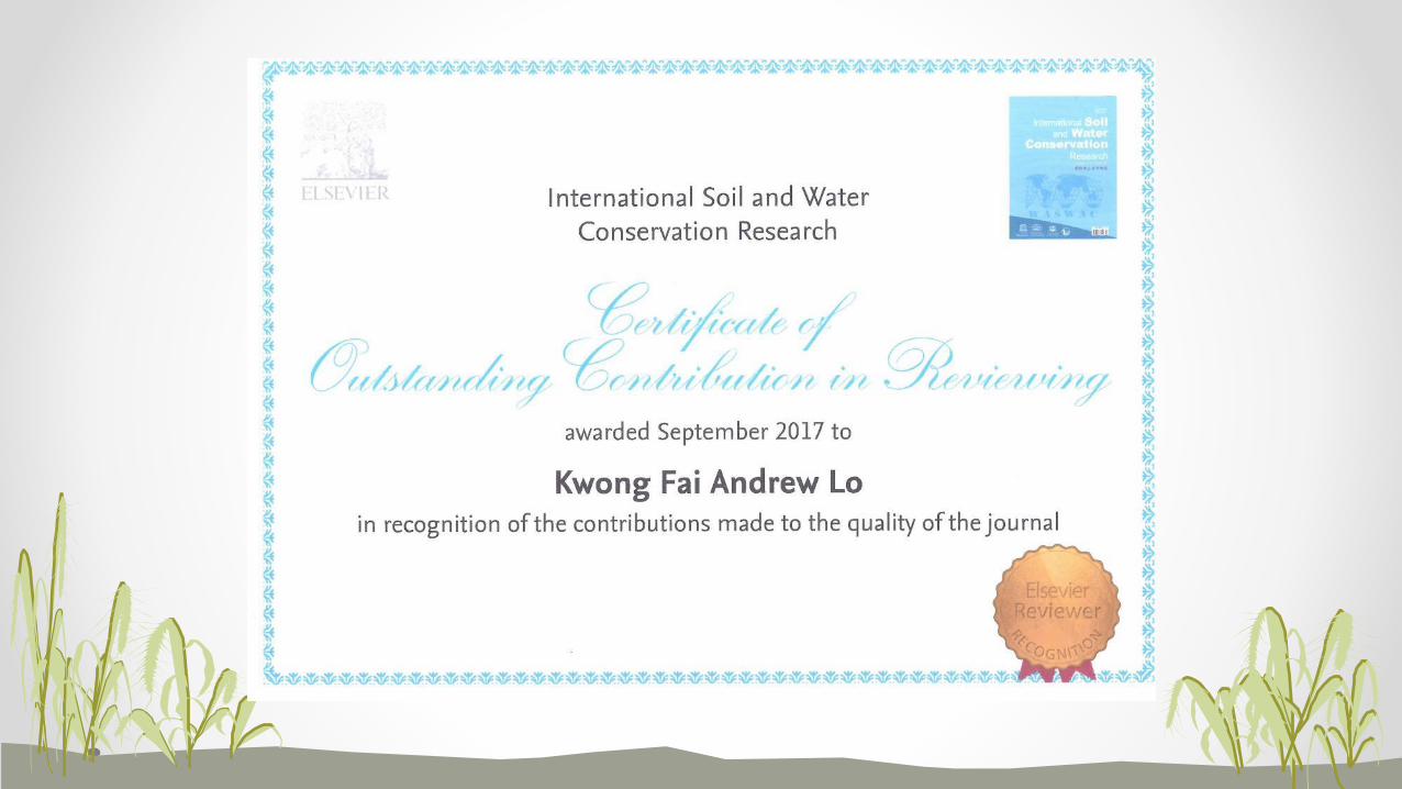
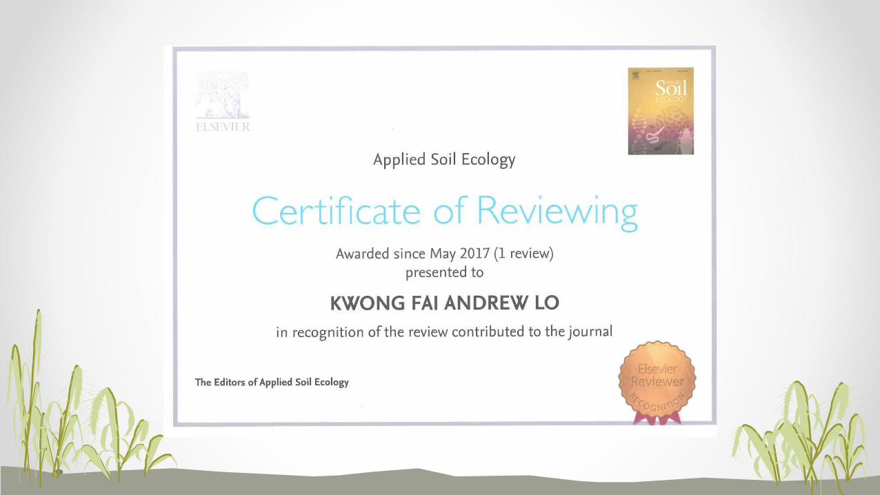
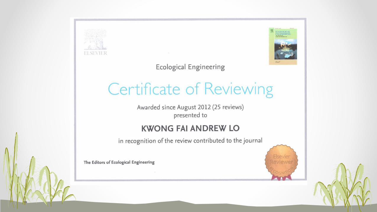
• 約有10多年經驗
• 經驗不足
• 仍在學習當中
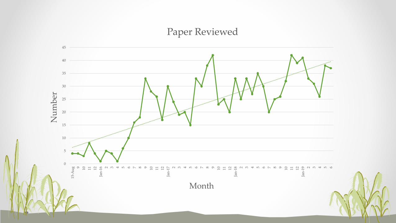
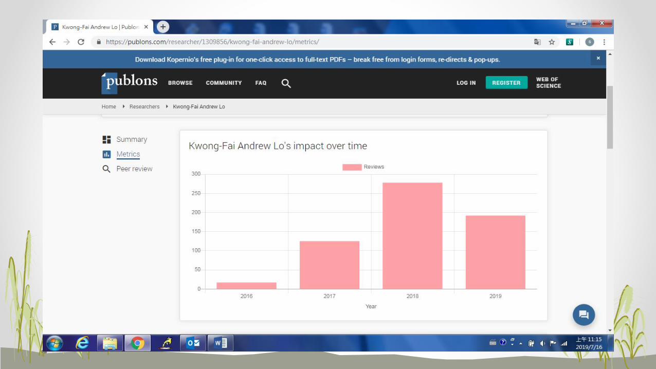
0
5
10
15
20
25
30
35
40
45
15-A
ug 9 10 11 12
Jan
-16 2 3 4 5 6 7 8 9 10 11 12
Jan
-17 2 3 4 5 6 7 8 9 10 11 12
Jan
-18 2 3 4 5 6 7 8 9 10 11 12
Jan
-19 2 3 4 5 6
Nu
mb
er
Month
Paper Reviewed
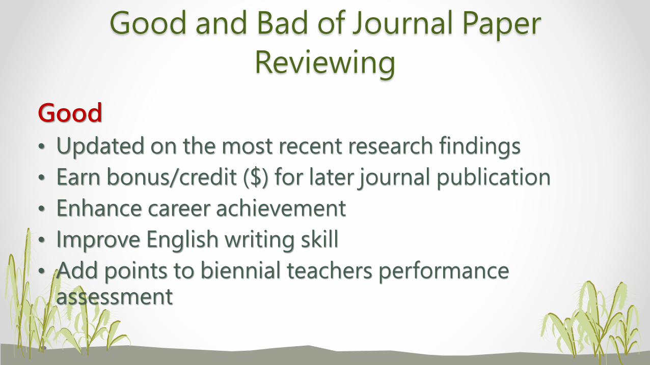
Good and Bad of Journal Paper
Reviewing
Good
• Updated on the most recent research findings
• Earn bonus/credit ($) for later journal publication
• Enhance career achievement
• Improve English writing skill
• Add points to biennial teachers performance assessment
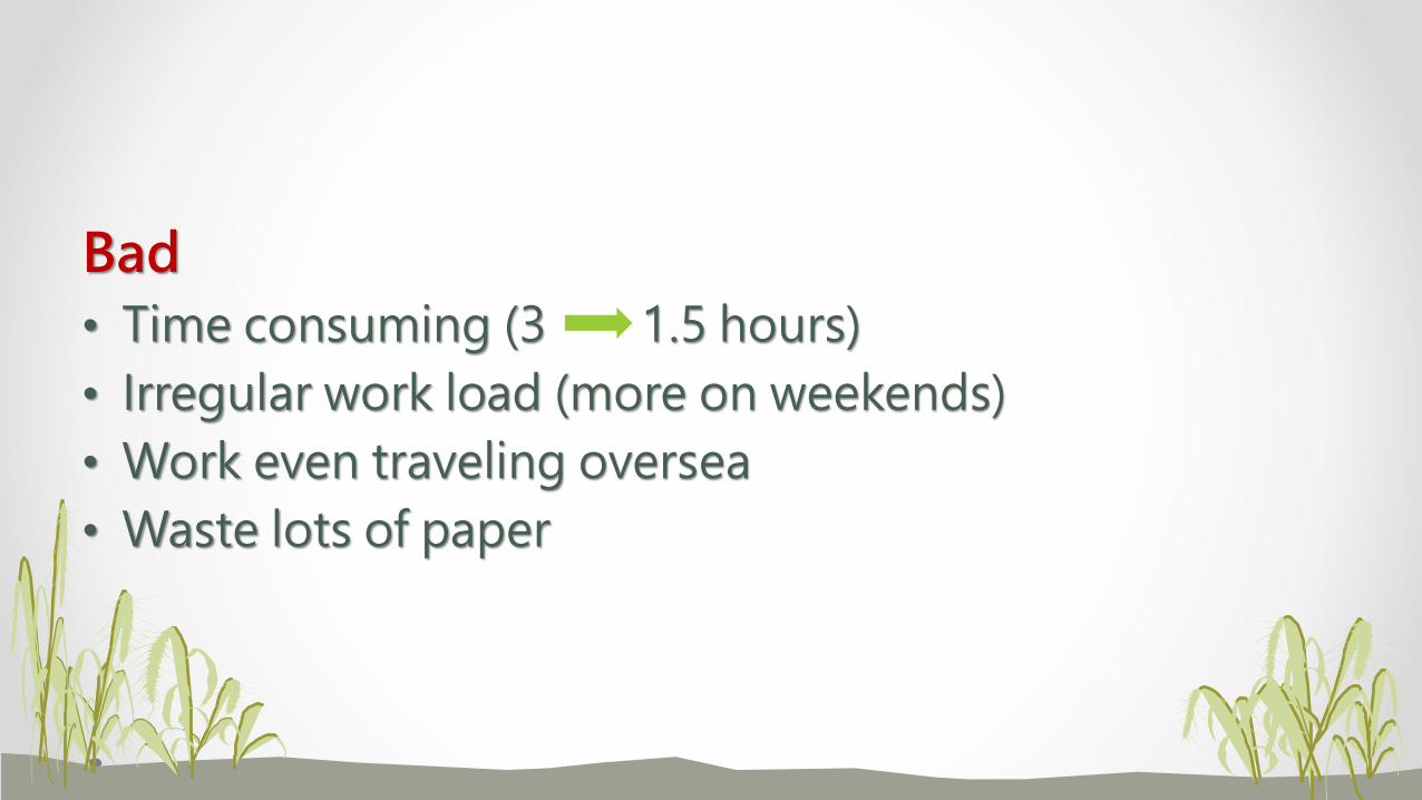
Bad
• Time consuming (3 1.5 hours)
• Irregular work load (more on weekends)
• Work even traveling oversea
• Waste lots of paper

3. 論文撰寫必避條件
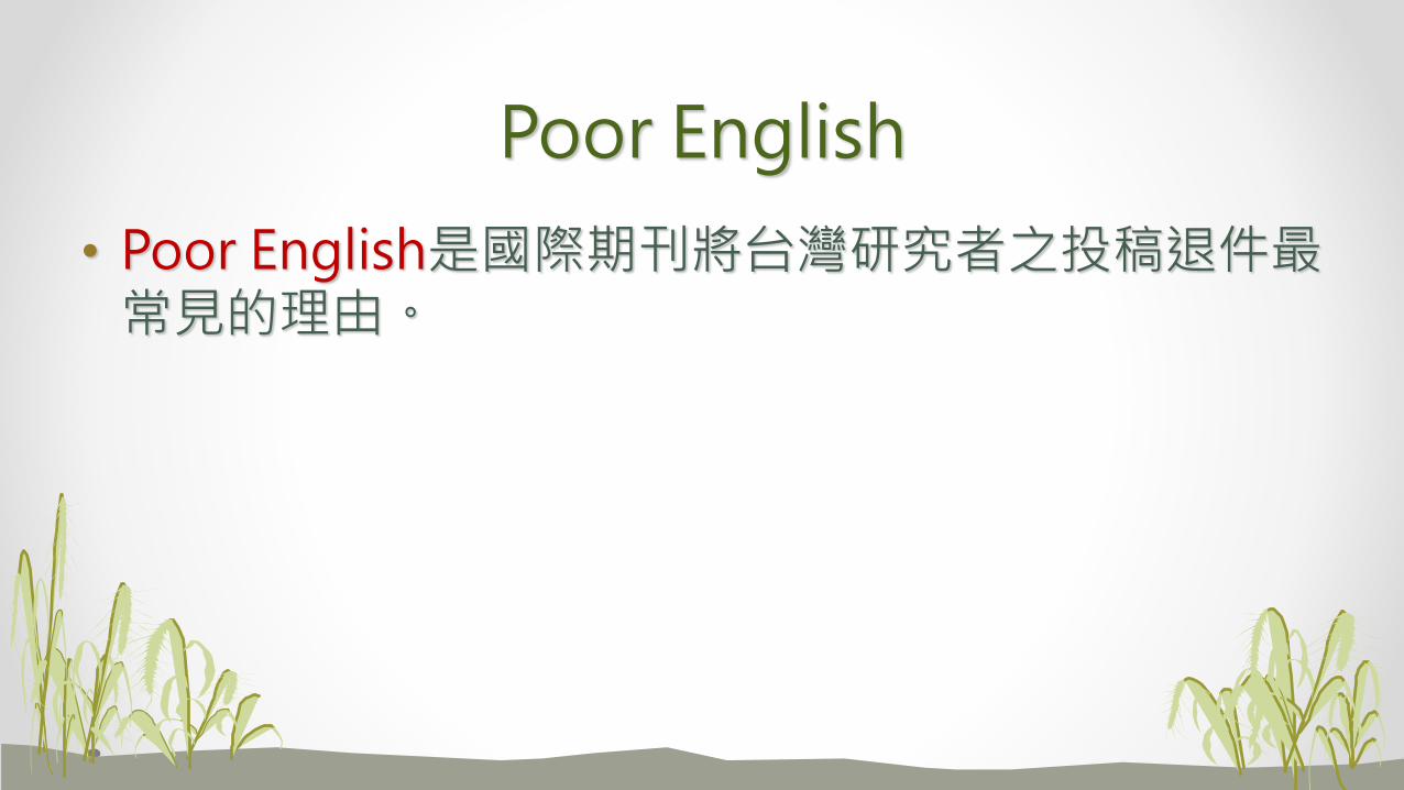
Poor English
• Poor English是國際期刊將台灣研究者之投稿退件最常見的理由。
一些審查委員針對英文不佳之評語:
• The author needs to focus on making his English more readable.
• His ideas may be worth publishing but until he can communicate in an understandable and systematic format, his ideas are not publishable.
• Please work on the English. It shouldn’t be the reviewer’s job to rewrite your paper in understandable English. We are busy people. In its current form the paper is unsuitable for this journal.
• Also, grammar, syntax and style all need improvement. The author writes like a non-native. I hope that he can improve his English to the level where his ideas can be appreciated.
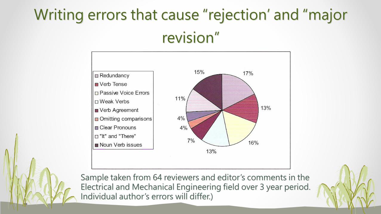
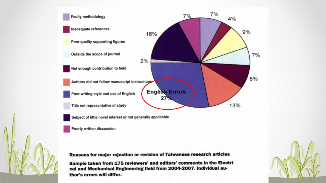
Writing errors that cause “rejection’ and “major
revision”
Sample taken from 64 reviewers and editor’s comments in the Electrical and Mechanical Engineering field over 3 year period. Individual author’s errors will differ.)
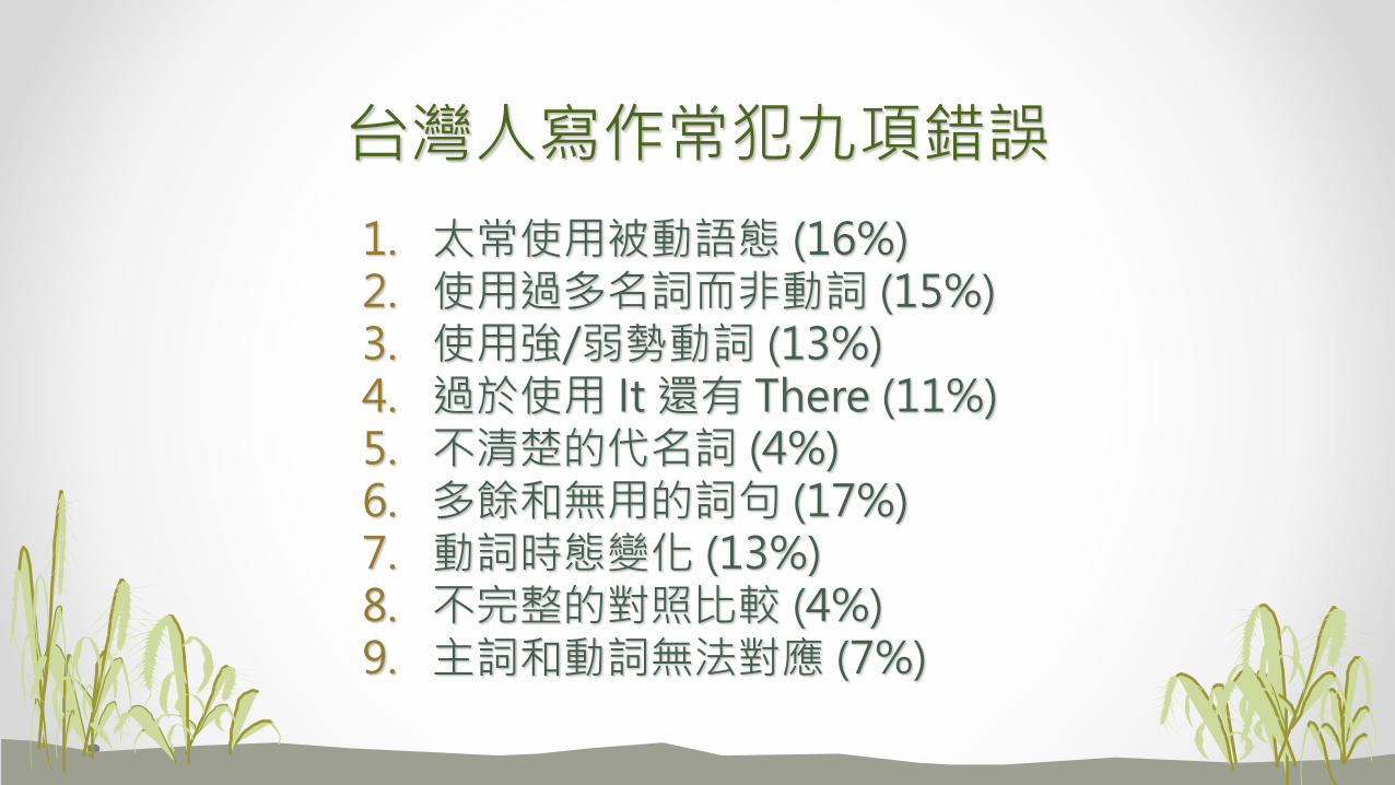
台灣人寫作常犯九項錯誤
1. 太常使用被動語態 (16%)2. 使用過多名詞而非動詞 (15%)3. 使用強/弱勢動詞 (13%)4. 過於使用 It 還有 There (11%)5. 不清楚的代名詞 (4%)6. 多餘和無用的詞句 (17%)7. 動詞時態變化 (13%)8. 不完整的對照比較 (4%)9. 主詞和動詞無法對應 (7%)
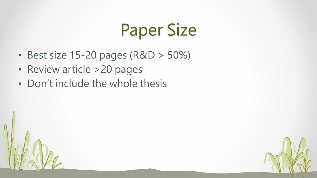
Paper Size
• Best size 15-20 pages (R&D > 50%)
• Review article >20 pages
• Don’t include the whole thesis
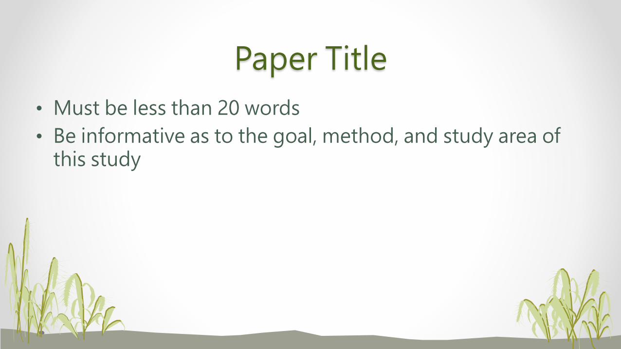
Paper Title
• Must be less than 20 words
• Be informative as to the goal, method, and study area of this study
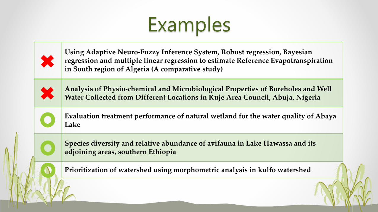
ExamplesUsing Adaptive Neuro-Fuzzy Inference System, Robust regression, Bayesian regression and multiple linear regression to estimate Reference Evapotranspiration in South region of Algeria (A comparative study)
Analysis of Physio-chemical and Microbiological Properties of Boreholes and Well Water Collected from Different Locations in Kuje Area Council, Abuja, Nigeria
Evaluation treatment performance of natural wetland for the water quality of Abaya Lake
Species diversity and relative abundance of avifauna in Lake Hawassa and its adjoining areas, southern Ethiopia
Prioritization of watershed using morphometric analysis in kulfo watershed
Abstract
• About 200 – 300 words (depends on Journals)
• Consists of objective, methodology, significant results and implications
• No reference citations, too many quantitative results
• Vivid, attractive and easy to understand
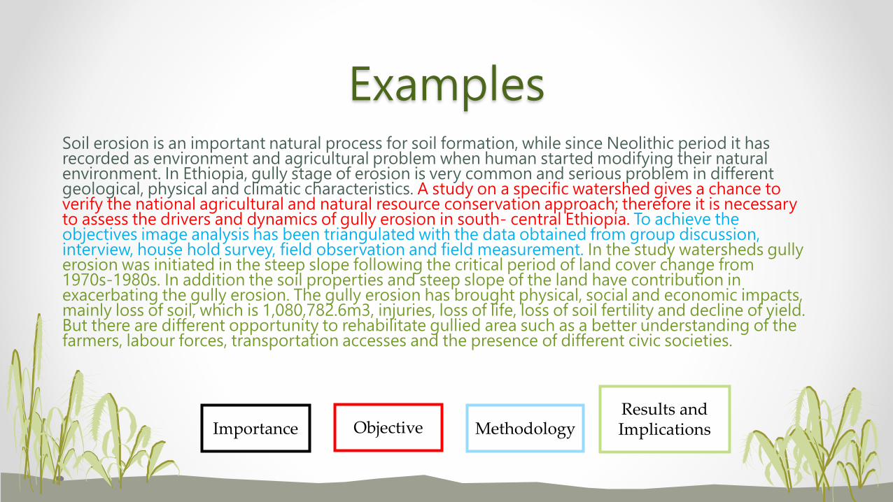
ExamplesSoil erosion is an important natural process for soil formation, while since Neolithic period it has recorded as environment and agricultural problem when human started modifying their natural environment. In Ethiopia, gully stage of erosion is very common and serious problem in different geological, physical and climatic characteristics. A study on a specific watershed gives a chance to verify the national agricultural and natural resource conservation approach; therefore it is necessary to assess the drivers and dynamics of gully erosion in south- central Ethiopia. To achieve the objectives image analysis has been triangulated with the data obtained from group discussion, interview, house hold survey, field observation and field measurement. In the study watersheds gully erosion was initiated in the steep slope following the critical period of land cover change from 1970s-1980s. In addition the soil properties and steep slope of the land have contribution in exacerbating the gully erosion. The gully erosion has brought physical, social and economic impacts, mainly loss of soil, which is 1,080,782.6m3, injuries, loss of life, loss of soil fertility and decline of yield. But there are different opportunity to rehabilitate gullied area such as a better understanding of the farmers, labour forces, transportation accesses and the presence of different civic societies.
ObjectiveImportance MethodologyResults and Implications
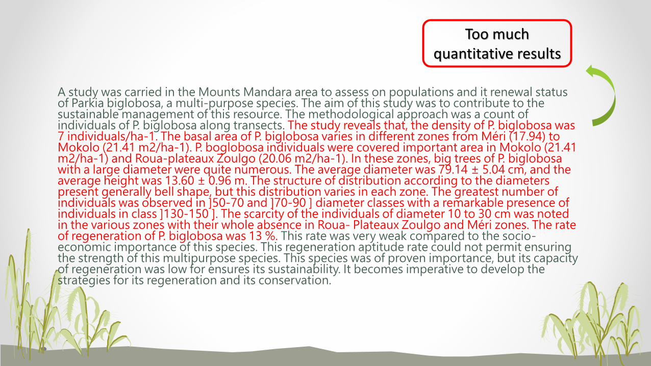
A study was carried in the Mounts Mandara area to assess on populations and it renewal status of Parkia biglobosa, a multi-purpose species. The aim of this study was to contribute to the sustainable management of this resource. The methodological approach was a count of individuals of P. biglobosa along transects. The study reveals that, the density of P. biglobosa was 7 individuals/ha-1. The basal area of P. biglobosa varies in different zones from Méri (17.94) to Mokolo (21.41 m2/ha-1). P. boglobosa individuals were covered important area in Mokolo (21.41 m2/ha-1) and Roua-plateaux Zoulgo (20.06 m2/ha-1). In these zones, big trees of P. biglobosawith a large diameter were quite numerous. The average diameter was 79.14 ± 5.04 cm, and the average height was 13.60 ± 0.96 m. The structure of distribution according to the diameters present generally bell shape, but this distribution varies in each zone. The greatest number of individuals was observed in ]50-70 and ]70-90 ] diameter classes with a remarkable presence of individuals in class ]130-150 ]. The scarcity of the individuals of diameter 10 to 30 cm was noted in the various zones with their whole absence in Roua- Plateaux Zoulgo and Méri zones. The rate of regeneration of P. biglobosa was 13 %. This rate was very weak compared to the socio-economic importance of this species. This regeneration aptitude rate could not permit ensuring the strength of this multipurpose species. This species was of proven importance, but its capacity of regeneration was low for ensures its sustainability. It becomes imperative to develop the strategies for its regeneration and its conservation.
Too much quantitative results
Keywords
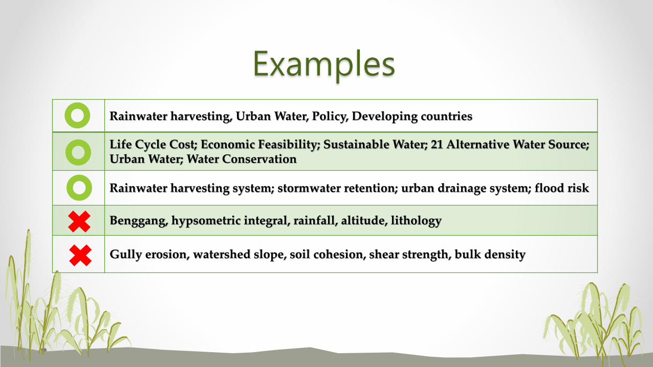
• 4 - 6 in numbers (according to the Journals)
• Do not repeat the same as in the paper title
• Specific terms related to the importance of the journal paper
Examples
Rainwater harvesting, Urban Water, Policy, Developing countries
Life Cycle Cost; Economic Feasibility; Sustainable Water; 21 Alternative Water Source; Urban Water; Water Conservation
Rainwater harvesting system; stormwater retention; urban drainage system; flood risk
Benggang, hypsometric integral, rainfall, altitude, lithology
Gully erosion, watershed slope, soil cohesion, shear strength, bulk density
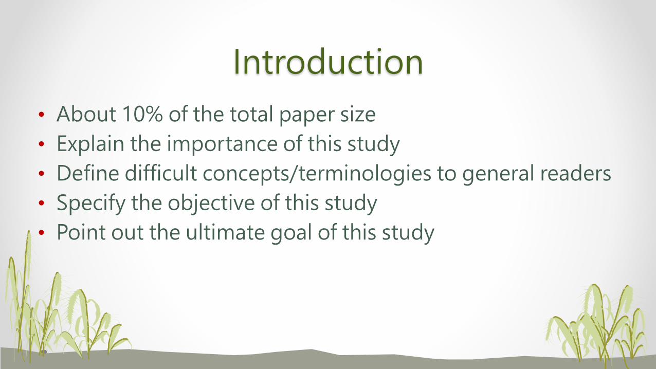
Introduction
• About 10% of the total paper size
• Explain the importance of this study
• Define difficult concepts/terminologies to general readers
• Specify the objective of this study
• Point out the ultimate goal of this study
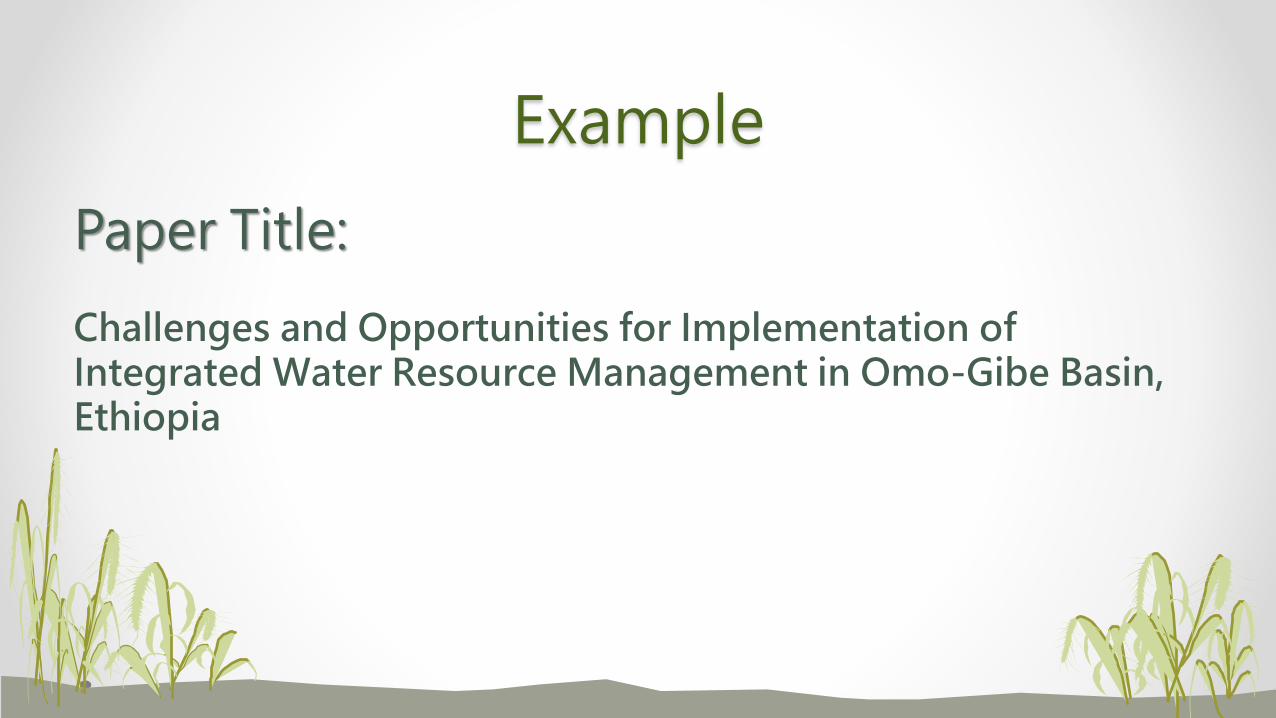
Example
Paper Title:
Challenges and Opportunities for Implementation of Integrated Water Resource Management in Omo-Gibe Basin, Ethiopia
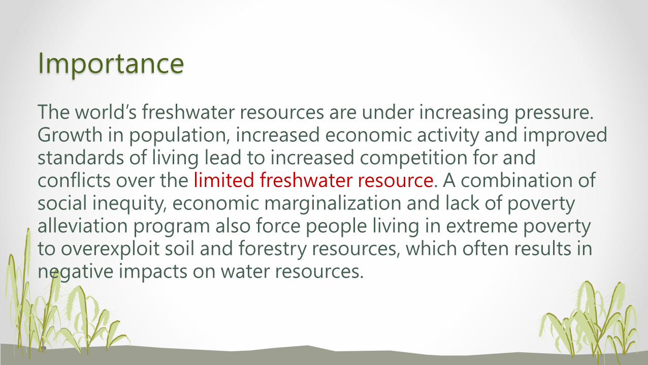
Importance
The world’s freshwater resources are under increasing pressure. Growth in population, increased economic activity and improved standards of living lead to increased competition for and conflicts over the limited freshwater resource. A combination of social inequity, economic marginalization and lack of poverty alleviation program also force people living in extreme poverty to overexploit soil and forestry resources, which often results in negative impacts on water resources.
Concept Explanation
The concept of Integrated Water Resources Management – in contrast to “traditional”, fragmented water resources management – at its most fundamental level is as concerned with the management of water demand as with its supply. Thus, integration can be considered two basic categories: the natural system and the human system.
Objective
Therefore, this study is designed to identify the major challenges and opportunities for implementation of IWRM in Omo Gibe basin in Ethiopia, and provided base line information and the fact to make management strategies for successful implementation of IWRM.
Ultimate Goal
The recent (2006) flood damage of Omo- Gibe river basin and Dire-dawa town are the indicators for ineffective implementation of IWRM. Moreover, uncoordinated and competitive uses of water resources are causing the water sources to face a situation approaching the “tragedy of the commons” (Yohannes 2012). To solve such problems, integrated water resource management has great contribution. Hence, the role of effective implementation of IWRM in to practice is indispensable.
Methodology
• About 20% of the total paper size
• Tells what materials and methods to conduct this study
• Explains data types, procedures and steps, analytical methods
• Details for new methods and supporting references for well-known methods.
• Need to number all equations/formula
• Defines all acronym names (m.a.s.l. [?])
• If error is involved, includes statistical analysis (don’t use ANOVA every time)
• Pay attention to logical thinking (geology data in urbanization study)
Results
• Together with Discussions about 50% of the entire text
• Should combine with Discussions for not too many Results
• Results are obtained from proper analysis of data information
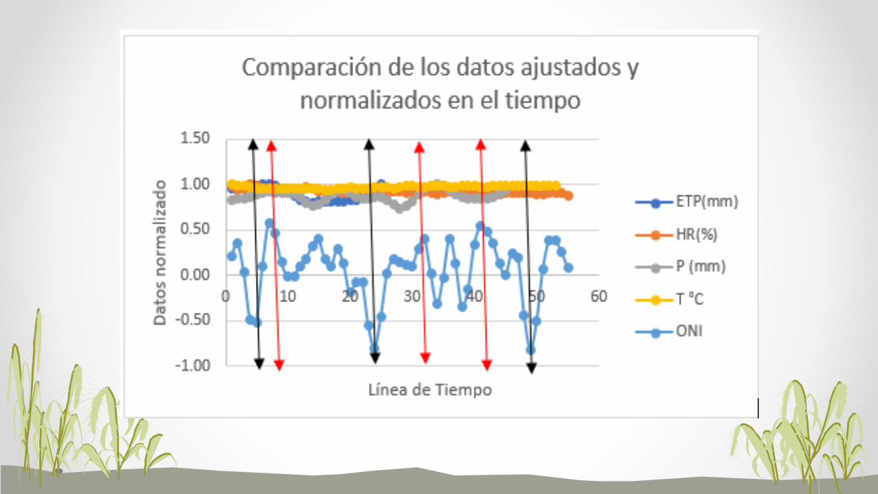
• Good illustration techniques are useful to bring out good results
• Tables and figures should be self-explanatory
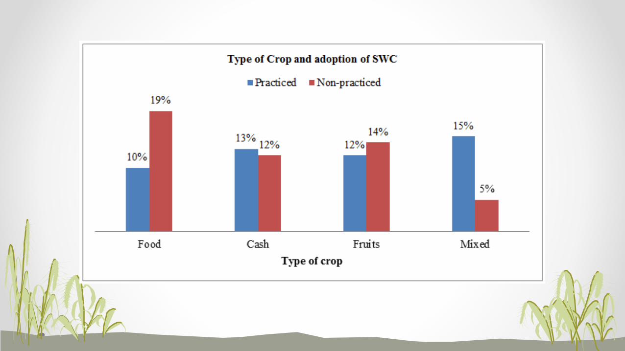
• Don’t use more than one techniques (table and figure) to display the same dataset
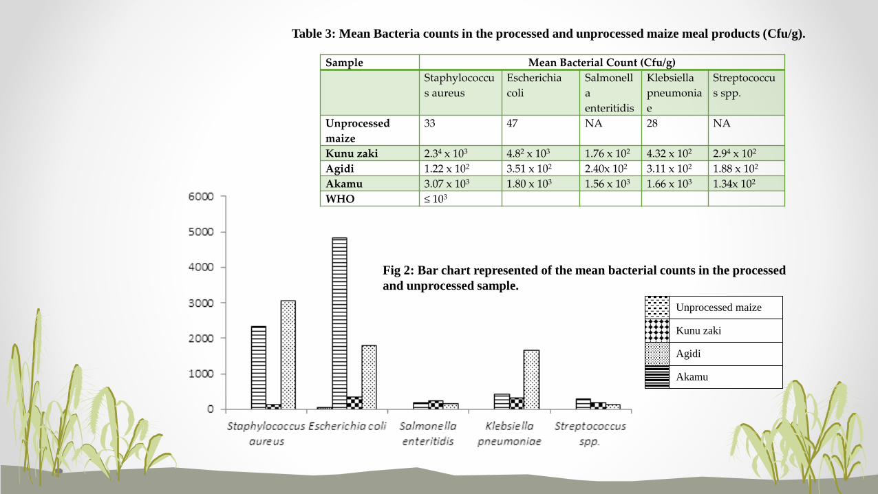
Sample Mean Bacterial Count (Cfu/g)
Staphylococcu
s aureus
Escherichia
coli
Salmonell
a
enteritidis
Klebsiella
pneumonia
e
Streptococcu
s spp.
Unprocessed
maize
33 47 NA 28 NA
Kunu zaki 2.34 x 10³ 4.82 x 10³ 1.76 x 10² 4.32 x 10² 2.94 x 10²
Agidi 1.22 x 10² 3.51 x 10² 2.40x 10² 3.11 x 10² 1.88 x 10²
Akamu 3.07 x 10³ 1.80 x 10³ 1.56 x 10³ 1.66 x 10³ 1.34x 10²
WHO ≤ 103
Unprocessed maize
Kunu zaki
Agidi
Akamu
Table 3: Mean Bacteria counts in the processed and unprocessed maize meal products (Cfu/g).
Fig 2: Bar chart represented of the mean bacterial counts in the processed
and unprocessed sample.
• Avoid large tables and complicated figures
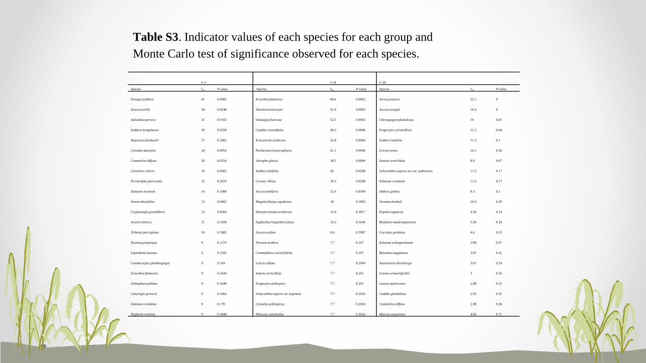
C-I C-II C-III
Species IVI P-value Species IVI P-value Species IVI P-value
Prosopi juliflora 61 0.0002 Eriochloa fatmensis 84.6 0.0002 Aerva javanica 25.1 0
Acacia tortilis 34 0.0248 Abutilon fruticosum 61.9 0.0002 Acacia senegal 16.4 0
Salvadora persica 31 0.0102 Otostegia fruticosa 52.5 0.0002 Chrysopogon plumulosus 10 0.01
Seddera bongshawei 29 0.0358 Cadaba rotundifolia 48.3 0.0008 Eragrostis cylindriflora 13.3 0.04
Hypoestes forskaolii 27 0.2865 Erucastrum arabicum 42.8 0.0004 Seddera latifolia 11.5 0.1
Cynodon dactylon 24 0.0916 Parthenium hysterophorus 41.1 0.0044 Grewia tenax 16.1 0.36
Commelina diffusa 20 0.0254 Jatropha glauca 38.5 0.0004 Setaria verticillata 8.9 0.07
Cenchrus ciliaris 19 0.0662 Seddera latifolia 36 0.0268 Achyranthes aspera var var. pubeseens 11.5 0.17
Peristrophe paniculata 15 0.2919 Grewia villosa 30.3 0.0208 Solanum cordatum 11.6 0.17
Solanum incanum 14 0.1008 Acacia mellifera 23.4 0.0304 Dobera glabra 9.3 0.1
Senna obtusifolia 13 0.0462 Megalochlamys ogadensis 18 0.1892 Ocimum forskoli 10.6 0.29
Cryptostegia grandiflora 13 0.0564 Dactyloctenium scindicum 14.4 0.2817 Pupalia lappacea 4.36 0.24
Acacia nilotica 11 0.1418 Euphorbia longituberculosa 14.3 0.1044 Blepharis maderaspatensis 3.94 0.18
Tribulus parvispinus 10 0.1882 Acacia oerfota 8.6 0.2987 Cocculus pendulus 4.6 0.55
Pavonia propinqua 9 0.1574 Pavonia arabica 7.7 0.197 Solanum schimperianum 3.89 0.47
Leptadenia hastata 9 0.1592 Commiphora coronillifolia 7.7 0.197 Balanites aegyptiaca 3.87 0.41
Commicarpus plumbagingus 9 0.164 Leucas inflata 7.7 0.2004 Sansevieria ehrenbergii 3.01 0.34
Eriochloa fatmensis 9 0.1644 Setaria verticillata 7.7 0.201 Grewia schweinfurthii 3 0.35
Orthophon pallidus 9 0.1648 Eragrostis aethiopica 7.7 0.201 Leucas marticensis 2.88 0.35
Calotropis procera 9 0.1664 Achyranthes aspera var argentea 7.7 0.2024 Cadaba glandulosa 2.95 0.35
Solanum cordatum 9 0.178 Cynodon aethiopicus 7.7 0.2024 Commelina diffusa 2.98 0.36
Digitaria velutina 9 0.1848 Hibiscus calyphyllus 7.7 0.2024 Maerua angolensis 4.06 0.71
Table S3. Indicator values of each species for each group and
Monte Carlo test of significance observed for each species.
• Bad results (if accounted for) are better than wrong results
• Simple, straight-forward results are much preferred and convincing
Discussions
• Discuss all study results and don’t skip any
• Provide personal views/opinions along with others (with references) on result findings
• Should gear towards the fulfillment of the objective statements
• Should integrate different result findings to satisfy the ultimate goal of this study
• Use supporting illustrations to convince results validity/accuracy
• Avoid too many comparisons with other, previous study results (different experimental design and conditions)
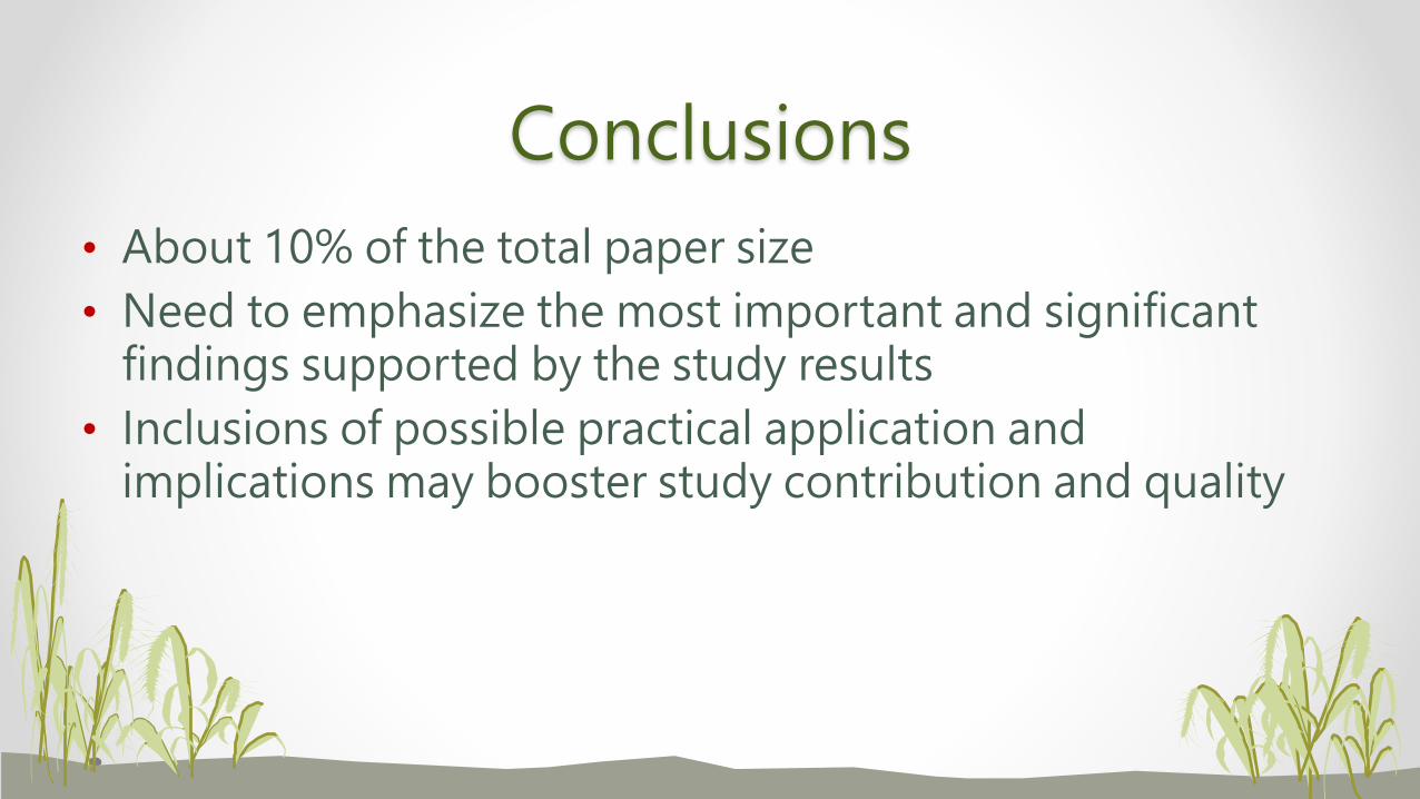
Conclusions
• About 10% of the total paper size
• Need to emphasize the most important and significant findings supported by the study results
• Inclusions of possible practical application and implications may booster study contribution and quality
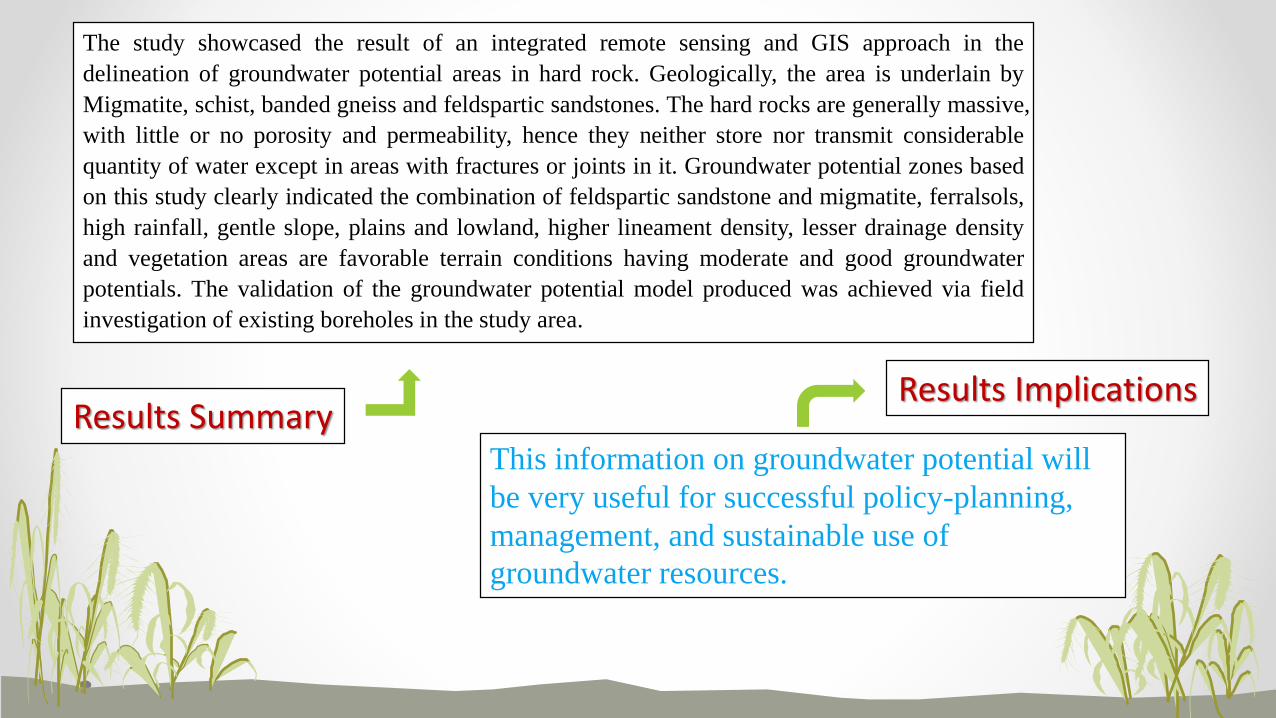
The study showcased the result of an integrated remote sensing and GIS approach in the
delineation of groundwater potential areas in hard rock. Geologically, the area is underlain by
Migmatite, schist, banded gneiss and feldspartic sandstones. The hard rocks are generally massive,
with little or no porosity and permeability, hence they neither store nor transmit considerable
quantity of water except in areas with fractures or joints in it. Groundwater potential zones based
on this study clearly indicated the combination of feldspartic sandstone and migmatite, ferralsols,
high rainfall, gentle slope, plains and lowland, higher lineament density, lesser drainage density
and vegetation areas are favorable terrain conditions having moderate and good groundwater
potentials. The validation of the groundwater potential model produced was achieved via field
investigation of existing boreholes in the study area.
This information on groundwater potential will
be very useful for successful policy-planning,
management, and sustainable use of
groundwater resources.
Results SummaryResults Implications
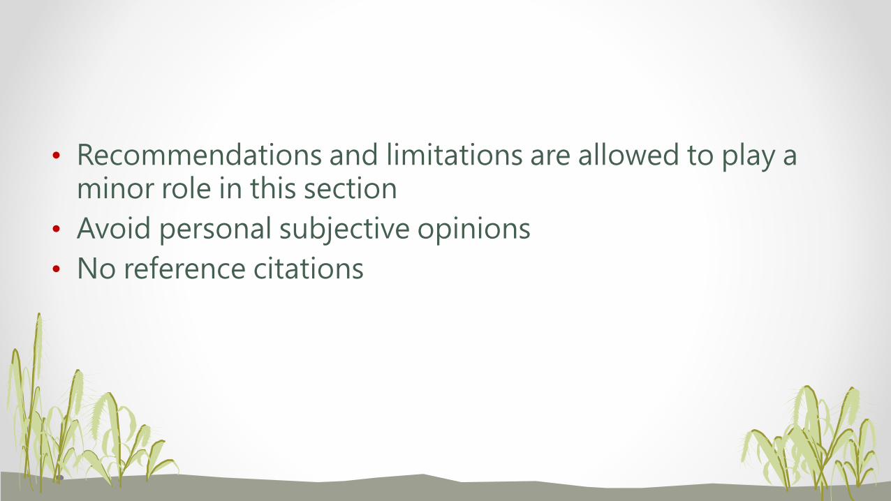
• Recommendations and limitations are allowed to play a minor role in this section
• Avoid personal subjective opinions
• No reference citations
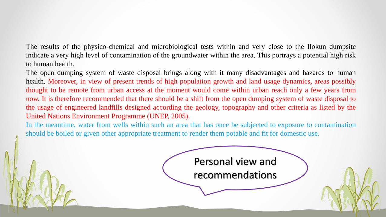
The results of the physico-chemical and microbiological tests within and very close to the Ilokun dumpsite
indicate a very high level of contamination of the groundwater within the area. This portrays a potential high risk
to human health.
The open dumping system of waste disposal brings along with it many disadvantages and hazards to human
health. Moreover, in view of present trends of high population growth and land usage dynamics, areas possibly
thought to be remote from urban access at the moment would come within urban reach only a few years from
now. It is therefore recommended that there should be a shift from the open dumping system of waste disposal to
the usage of engineered landfills designed according the geology, topography and other criteria as listed by the
United Nations Environment Programme (UNEP, 2005).
In the meantime, water from wells within such an area that has once be subjected to exposure to contamination
should be boiled or given other appropriate treatment to render them potable and fit for domestic use.
Personal view and recommendations

References
• Always follow the format prescribed by the journal
• Don’t over-reference ( < 30 for regular papers; > 50 for review papers)
• Use initials for authors’ first names
• Use authors’ last name to alphabetize reference list
• Each listing must to complete and must be cited in the text
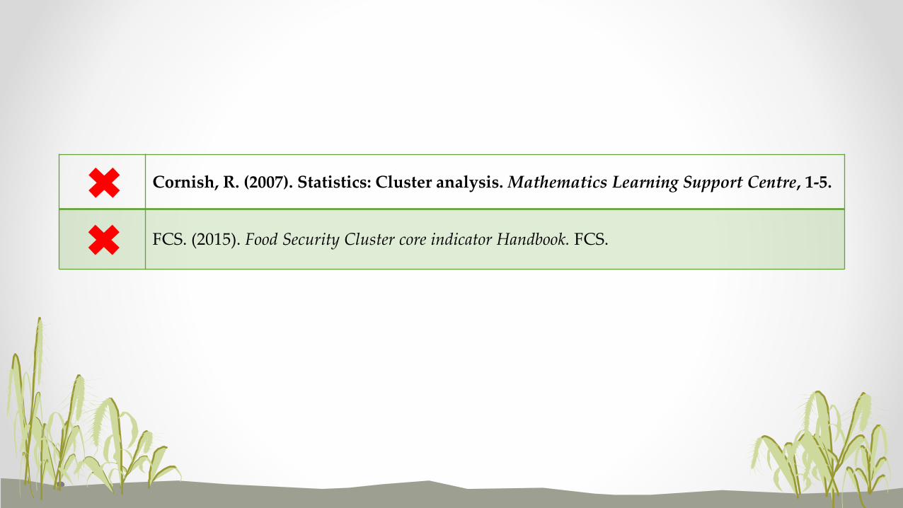
Cornish, R. (2007). Statistics: Cluster analysis. Mathematics Learning Support Centre, 1-5.
FCS. (2015). Food Security Cluster core indicator Handbook. FCS.
Miscellaneous
• Proper spacing is “5 cm”, not “5cm”
• Unify use of “Fig.” and “Figure”; “Tab.” and “Table”
• Use “km2” instead of “sq. km”
• It is “et al.”, not “et al” or “et. al.” or “et. al”
謝謝聆聽HAPPY WRITING